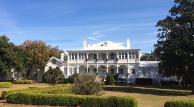
The Apalachicola Arsenal, originally known as the Mt. Vernon Arsenal, was built by the United States Army and served as an arms depot during the Second Seminole Indian War. Construction began in 1832, and was completed in 1839. The original compound . . . — — Map (db m79625) HM
The Apalachicola Arsenal, originally known as the Mt. Vernon Arsenal, was built by the United States Army and served as an arms depot during the Second Seminole Indian War. Construction began in 1832, and was completed in 1839. The original compound . . . — — Map (db m79626) HM
This prehistoric mound is the largest of seven that once stood here at River Landing Park. Believed to date from the Fort Walton time period (A.D. 900-A.D. 1500), its original appearance was that of a flat-topped pyramid. Archaeologists believe that . . . — — Map (db m110893) HM
The 1795 Treaty of San Lorenzo defined the international border dividing Spanish Florida from the newly formed United States.
No one who signed the treaty had ever seen it, but the point of land formed by the confluence of the Chattahoochee and . . . — — Map (db m230733) HM
The wooden wrecks visible along the shoreline here are all that remain of once luxurious paddlewheel steamboats that plied the Apalachicola River from 1820s to the 1930s.
Marine archaeologists documented a large number of these vessels between . . . — — Map (db m303449) HM
Chattahoochee River Landing Park-An Apalachicola River Heritage Destination
This restored mound helps you visualize the original appearance of the seven prehistoric mounds that archaeologists believe stood here. Native Americans started . . . — — Map (db m216211) HM
British troops arrived here in June 1814 as the War of 1812 entered its closing months. Initially, they worked to recruit and train Native American (Red Stick Creek, Seminole, Miccosukee, and Yuchi) warriors as auxiliaries.
The Apalachicola River . . . — — Map (db m231607) HM
Atop this large prehistoric mound stood Nicolls' Outpost, a British fort of the War of 1812. Built in the fall of 1814, it was a rectangular earthen redoubt with a surrounding stockade and was armed with two small cannons. Garrisoned by 180 white . . . — — Map (db m79455) HM
River Landing Road follows the approximate route of the "Old Spanish Trail" or "Mission Road," a colonial era path that led west across Florida from St. Augustine.
Spanish friars and soldiers used the road to reach a chain of missions or religious . . . — — Map (db m230673) HM
At the end of the American Revolutionary War in 1783, Florida was returned to Spain after twenty years of British control. Controversy soon arose over the exact location of the boundary between Spanish Florida and the state of Georgia. In 1795, . . . — — Map (db m79444) HM
The Apalachicola River flows 107 miles from its source at the Jim Woodruff Dam to its mouth at Apalachicola Bay.
A vital ecological and water resource, it has a long history as a waterway for commercial, military, and recreational use. It is . . . — — Map (db m231584) HM
River Landing Park is sacred ground. A major culture flourished here more than 1,000 years ago, building a complex of at least seven platform mounds. The largest of these earthworks stands before you.
Construction of the mounds began nearly 2,000 . . . — — Map (db m231609) HM
The First Seminole War erupted when U.S. soldiers attacked the Lower Creek village of Fowltown near today's Bainbridge, Georgia, on November 21-23, 1817.
Native American and Maroon (escaped slave or Black Seminole) warriors retaliated by . . . — — Map (db m230902) HM
A bloody battle fought on this site more than 200 years ago helped assure that Florida would become part of the United States.
Angered over an attack by American soldiers on the Lower Creek village of Fowltown near today's Bainbridge, Georgia, . . . — — Map (db m231593) HM
The first U.S. defeat of the Seminole Wars took place here on November 30, 1817. Several hundred Seminole, Creek and maroon (Black Seminole) warriors came to this site following raids by U.S. troops on the Creek Indian village of Fowltown near . . . — — Map (db m113147) HM
One-half mile to the north are the remains of the United States Arsenal erected by the United States Army Ordnance under an Act of Congress passed in 1832. The arsenal proper consisted of various buildings erected so that their exterior walls formed . . . — — Map (db m79447) HM
Victory Bridge is a monument to early 20th century engineering. Completed in 1922 at a cost of roughly $1 million, the bridge was built by Masters and Mullen Construction Company of Cleveland, Ohio.
Its name honors the Allied victory in World War . . . — — Map (db m230656) HM
The Apalachicola Northern Railroad (ANRR) opened to rail traffic in 1907, serving as the first north – south rail line connecting existing railroads at River Junction (Chattahoochee) and the port at Apalachicola. In 1910, the railroad was extended . . . — — Map (db m239556) HM
The Dezell House was built in 1912 by James A. and Margaret Leila "Maggie" Shepard Dezell. This house, with its Prairie Style architecture and Arts and Crafts features, was their family home for 46 years. James A. Dezell (1867-1937) was born in . . . — — Map (db m79479) HM
In the late 1800’s the railroad pushed further west into Gadsden County. In 1897, the Humphrey Company established a settlement. The company, owned by W.P. Humphrey, dealt in land, timber, and general merchant services of the time. When Gretna was . . . — — Map (db m79468) HM
Located just north of this point is the Dr. Malcolm Nicholson Plantation Home. Built in the 1820's, it is one of the oldest remaining structures in Gadsden County. It is a one-story Gulf coast Cottage, with end-gables and a built-in porch. It rests . . . — — Map (db m157927) HM
“A teacher takes a hand, opens a mind, and touches a heart” Dedicated to the Havana High School Faculty and Staff by HHS Alumni and Friends. This memorial is on the site of Havana High School. Circa 1910-1971 — — Map (db m299689) HM
The town of Havana was incorporated in 1906. Havana came into existence as a result of the construction of the Georgia, Florida and Alabama Railroad. The advent of the automobile demanded an expansion and improvement of roads… …and the Old . . . — — Map (db m188556) HM
[east side] Prisoners of War Havana remembers those who were forced to endure the adversities and indignities of enemy captivity. Prisoners of Japan Apr 1942 to Sep 1945 US Army Air Force Walter H. (Bubba) . . . — — Map (db m299496) HM WM
[north side] Havana remembers those who paid the ultimate price in defense of America, its values, and interestsWorld War II US Army Sylvester P. Hamilton • Guy Jones, Jr. • Sam Ray Jones • Ralph Overstreet • . . . — — Map (db m299396) WM
The Statue The 6-foot tall bronze statue perched atop the 5½ foot high concrete pedestal is entitled, “The Price of Freedom.” It was sculpted by L’Deane Trueblood of St. George, Utah and cast by Metal Arts Foundry of Lehi, Utah. It . . . — — Map (db m299399) HM WM
This site was the home of Sam Z. Fletcher. It was his surrounding land on which the town was established after the Georgia-Florida railroad was laid from Cuthbert, Georgia, to Tallahassee, Florida, bypassing by a mile the community of Salem. Town . . . — — Map (db m257796) HM
The earliest families in this private cemetery are those of Joshua and Martha Vickers and Bryant and Frances Vickers. It is believed that the first burial was in 1845. The oldest remaining marker is that of Rite Sanders, who died in 1866.
The . . . — — Map (db m110894) HM
In the 1820's, settlers from Georgia, South Carolina and other states came to the new United States Territory of Florida in search of land to homestead. One such frontiersman was Thomas Dawsey, who by 1824 was residing in the Gadsden County area. . . . — — Map (db m79449) HM
The Arnett Chapel African Methodist Episcopal (AME) Church, affectionately known as "The Nett," was established in 1866 but can trace its beginnings to 1865. This historical church is the oldest surviving African American congregation in Quincy and . . . — — Map (db m268548) HM
This historic bell, manufactured by the William Buckley Co., New York, New York / circa 1830, was installed in the steeple of Centenary Methodist Church in 1839. In addition to ringing in weekly services, during the 19th and early 20th century the . . . — — Map (db m228475) HM
The light of freedom still burns brightly in our world today because
of the service and sacrifice of America’s men and women in uniform.
Our Nation’s servicemen and women have fought the forces of tyranny and
won victories for . . . — — Map (db m154555) WM
Gadsden, Florida's fifth county, was formed in 1823. It once ran from Georgia to the Gulf of Mexico, from the Suwannee River to the Apalachicola River. Quincy, the county seat, was incorporated in 1828. Previously known as Middle Florida, the new . . . — — Map (db m29677) HM
South Side
Sacred to
the
memory of the
Confederate Soldiers
from Gadsden Co. Florida
who died in the defense
of their country.
—
"On fame's eternal camping ground their silent tents are spread and glory . . . — — Map (db m79722) WM
Presbyterians came to this area from Georgia and the Carolinas as early as 1822. These worshippers built Philadelphia, a log meeting house, in 1828. It was served by itinerant ministers until 1832, when the Reverend Leander Kerr arrived. The log . . . — — Map (db m79515) HM
Settlers in the new U.S. territory of Florida (created in 1821) who were members of the Masonic order soon established lodges in their new communities. Washington Lodge No. 2, Free and Accepted Masons, created in 1828 was among the first Florida . . . — — Map (db m79484) HM
Mark Welch "Mr. Pat" Munroe built the Pat Munroe House for his first wife, Edith Adelaide Walker, in 1893. The couple had 10 children before her death in 1896. Mr. Pat later married Mary Frances Gray in 1912. Eight children were born from this . . . — — Map (db m79622) HM
This antebellum home is related in style to the early Louisiana plantation houses of the lower Mississippi Valley. Designed to cope with the heat and dampness of the climate, its main living quarters were on the second floor. It rests on land once . . . — — Map (db m72799) HM
Gadsden County and the town of Quincy served the war effort of the Confederate States of America in many ways. Quincy served as a crossroads and a military center of activity through the four years of conflict. As a military center and commissary, . . . — — Map (db m79489) HM
The earliest Episcopal Services were performed in Quincy in 1834 and Jackson Kemper was the first bishop to visit in 1838. St. Paul's Parish was organized and the first Vestry was elected in the same year. In 1839, the parish joined the Diocese of . . . — — Map (db m79485) HM
The Quincy Academy was incorporated in 1832 and was probably established as early as 1830. Private educational institutions were common in newly settled frontier areas. Education was provided at reasonable rates by the "Male Academy" and the "Female . . . — — Map (db m79486) HM
Pioneer commercial banking house in Gadsden County, E.P. Dismukes, President, opened 20 August 1889, under State Charter No. 1, issued twelve days earlier under the Act creating a State Banking System; original capital, $60,000. Became strong . . . — — Map (db m79488) HM
Side 1
The White House
This house was constructed during the early 1840's for Joseph Leonard Smallwood. At that time, it was a one and one-half story structure. In 1849, Pleasants Woodson White married Smallwood's niece, Emily, and . . . — — Map (db m79487) HM
In memory of
Gadsden County Veterans who gave
their lives during the Korean Conflict, Vietnam
Era, Grenada, Lebanon, Panama, Persian Gulf
Our Fallen Heroes
on renown eternal camping grounds,
their silent graves are spread, . . . — — Map (db m79719) WM
This excellent example of a "Carpenter Classic" style farmhouse was probably built c. 1836 for Burwell McBride shortly after he moved to Jefferson County from South Carolina. He was the grandfather of Margaret McBride who married Asa May, a wealthy . . . — — Map (db m126389) HM
Livingston Place, a former Antebellum cotton plantation, is located in the heart of the Red Hills, a distinct American landscape of large wild quail hunting preserves rich in natural and cultural resources. From 1926 to 1994, this land was the . . . — — Map (db m264338) HM
Lamont began existence in 1848 when a U.S. post office was established at Beasley's Store which also served as a horse changing station on the stagecoach line between Tallahassee and St. Augustine. After the Civil War, the small settlement that had . . . — — Map (db m127036) HM
In honor of the Confederate
Soldiers of Jefferson County
and the south land who
who served the South and the
Confederate States of
America from 1861-1865.
Donated by the Sons of the
Confederate Veterans, Major . . . — — Map (db m239653) WM
It’s October 3, 1539…
Hernando de Soto’s army has crossed a large swamp to the east of here and is attacked by Apalachee warriors –
Our cavalry proved useless against this attack, as the trails are too narrow. We were forced to . . . — — Map (db m126590) HM
Archaeologists have many types of tools for unearthing the story of human cultures. Between 2002 and 2005, archaeologists conducted several digs at Letchworth-Love Mounds Archaeological State Park. They used a variety of methods to learn about the . . . — — Map (db m153300) HM
The Elizabeth School, a three-room, vernacular shingle-clad building, was a school for Black students on Groover Road in 1938 and was funded by parents and the Works Progress Administration (WPA). Miles Edward Groover (1887-1966) and his wife, Daisy . . . — — Map (db m67601) HM
In recognition of Platoon Sergeant Ernest I. Thomas U.S.M.C.R. who, on February 23, 1945, led his platoon to raise the first flag on Iwo Jima, the first Japanese territory taken in World War II. On March 3rd, eight days after the first flag . . . — — Map (db m62109) WM
The light of freedom still burns brightly in our world today because
of the service and sacrifice of America’s men and women in uniform.
Our Nation’s servicemen and women have fought the forces of tyranny and
won victories for liberty, . . . — — Map (db m154514) WM
The light of freedom still burns brightly in our world today because
of the service and sacrifice of America’s men and women in uniform.
Our Nation’s servicemen and women have fought the forces of tyranny and won victories for liberty, . . . — — Map (db m154516) WM
This historic marker recognizes Howard Academy Elementary/Junior High School, which eventually became Howard Academy High School. In 1957, the first phase of Howard Academy Elementary and Junior High School was constructed on Second Street. The . . . — — Map (db m67639) HM
Howard Academy High School's Building 1 opened on Chestnut Street in 1936 with one structure containing several classrooms. In 1940, a similar, second building was constructed and financed by the county, parents and The Julius Rosenwald Fund. . . . — — Map (db m67656) HM
(front/north side)
Erected 1899 by the Ladies’ Memorial
Association of Jefferson County Fla.
Our Fallen Heros
(west side)
Let this testimonial of Woman’s deathless fidelity to Man’s imperishable valor speak to the sons . . . — — Map (db m126495) WM
Jefferson County High School
Erected 1852
Charter Granted in 1852 by Legislative Council
First brick school building constructed in state
Bricks made on George Taylor Plantation
Building constructed by Samuel Carroll with slave . . . — — Map (db m239585) HM
When Florida’s Territorial Legislative Council established Jefferson County in January, 1827, settlers from the seaboard states already had begun to develop cotton plantations in this area. In December, 1827, the county seat received the name . . . — — Map (db m126297) HM
If you were able to travel back in time over 1,100 years to the peak period of the Weeden Island civilization, you would witness the construction of one of the greatest feats of American Indian architecture in the region now known as Florida. You . . . — — Map (db m153298) HM
Cultures throughout history left their mark through art. Come and explore the art of architecture from an earlier time and culture here at Letchworth-Love Mounds Archaeological State Park. Constructed between 1,800 and 1,100 years ago by the Weeden . . . — — Map (db m153296) HM
Named for President Thomas Jefferson, Jefferson County is home to the Monticello courthouse and opera house. Monticello's 1909 courthouse remains Florida's last historic courthouse square model still in active use. Surrounded by antebellum homes, . . . — — Map (db m293070) HM
This church was on the Leon Circuit, Tallahassee District, South Carolina Conference of the Methodist Episcopal Church in 1828.
Adam Wirick, a minister on the Leon Circuit, from 1828 to 1832, “located” in Monticello and his name heads the . . . — — Map (db m239560) HM
The Olive Baptist Church was begun in 1831, and at that time the property was in the state of Georgia. In 1872 the U.S. Congress designated this land to be a part of Florida. On Tuesday, November 22, 1853, in the Eleventh Annual Session of the . . . — — Map (db m110980) HM
A Landmark of American Music
Perkins Opera House
Erected in 1890 by John H. Perkins, a Monticello merchant and patron of the theatre. Touring theatrical, musical and community performances were presented until 1928. The upstairs auditorium . . . — — Map (db m126298) HM
Built in 1890, John Howard Girardeau and his wife, Agnes, constructed this Folk Victorian style house for their large family on 11 children. It faces north toward Dogwood Street. Girardeau planted 46 oaks along the street, which provided a grand . . . — — Map (db m200398) HM
Believe it or not, the discovery of the Great Mound was like finding a needle in a haystack. Although archaeologists began searching for the mound as early as the 1930s, and some even found the site, it was not officially recorded until 1975. The . . . — — Map (db m153299) HM
Imagine standing in this spot over 1,100 years ago. Surrounding you would be a large architectural complex, complete with ten small mounds, two cleared plazas and the Great Mound, with its platforms, earthen ramp and pyramid-like peak. While form . . . — — Map (db m153297) HM
Jefferson County became Territorial Florida's 13th county in January, 1827. In December of that year, the town of Monticello, named in honor of Thomas Jefferson's famous Virginia home, was laid out and lots began to be sold. During the 1830s and . . . — — Map (db m126300) HM
175th Anniversary of the Waukeenah
United Methodist Church
In the year 1837, the Waukeenah United Methodist Church was
established. It began as the Waukeenah Methodist Episcopal
Church. The story of the Waukeenah United Methodist Church . . . — — Map (db m136051) HM
Fort Braden was established in 1839 as a military outpost during the Second Seminole War (1835-1842). At the end of the war the fort was abandoned, but the small farming community that had developed nearby continued. A school in the Fort Braden area . . . — — Map (db m79475) HM
Miccosukee United Methodist Church has been placed on the National Register of Historic Places by the United States Department of the Interior Est. 1828 — Built 1876 — — Map (db m172646) HM
In 1778 the British mapped this once thriving community, originally called Mikasuki, with sixty houses, a square, 28 families and 70 gunmen. The village was first settled by Native Americans of Creek descent who were often in armed conflict with . . . — — Map (db m167466) HM
Throughout the 1950s-1970s, large-scale, nonviolent demonstrations by audacious students attending Florida Agricultural and Mechanical University (FAMU), Florida State University, and the University of Florida, as well as local high school . . . — — Map (db m135553) HM
The Moore Family Trust presents this plaque to the Florida State University to honor the achievements of the 1993 National Championship Football Team FSU 42 — Kansas 0 FSU 45 — Duke 7 FSU 57 — Clemson 0 FSU 33 — N. Carolina 7 FSU 51 — Georgia Tech 0 . . . — — Map (db m269997) HM
The Moore Family Trust presents this plaque to the Florida State University to honor the achievements of the 1999 National Championship Football Team FSU 41 — Louisiana Tech 7 FSU 41 — Georgia Tech 35 FSU 42 — NC State 11 FSU 42 — N. Carolina 10 FSU . . . — — Map (db m269998) HM
The Coyle Moore Family Trust honors the Florida State University and the achievements of the 2013 Atlantic Coast Conference Championship and National Championship Football Team FSU 41 — Pittsburgh 13 FSU 62 — Nevada 7 FSU 54 — Bethune-Cookman 6 FSU . . . — — Map (db m269999) HM
Daily life for Spaniards at San Luis was not unlike that in other Hispanic communities. Shoemakers and tailors plied their trades. Off-duty soldiers drank wine, played at cards or dice, and stringed guitars or similar stringed instruments known as . . . — — Map (db m239318) HM
The Apalachee ball game was an integral part of native life. The game was dedicated to the native gods of rain and thunder and was played to ensure rain for crops.
The game involved 50 or more players and was quite violent, sometimes . . . — — Map (db m239526) HM
Defeating segregation took years of sustained struggle. A federal court ordered the integration of Leon County's public schools in 1967 more than 10 years after the local civil rights movement began. The legacy of those who fought for justice . . . — — Map (db m230698) HM
In 1656, the Spaniards chose this hilltop because of its clear view of the countryside. A powerful Apalachee chief offered to build a blockhouse for the Spanish military garrison and moved his village to San Luis. The blockhouse added a formal . . . — — Map (db m239259) HM
Julian Edwin "Cannonball" Adderley (1928-1975)
Nathaniel Carlyle "Nat" Adderley (1931-2000)
Brothers Cannonball Adderley (alto saxophone) and Nat Adderley (cornet) were two of the most important jazz musicians in history. Born . . . — — Map (db m230644) HM
The Apalachee were a matrilineal society. Inheritance and authority were passed down through the mother's family. Related groups were also combined into clans with each member belonging to the mother's clan. After marriage, the husband relocated to . . . — — Map (db m239379) HM
The dwelling frame to your right represents the shape and size of a typical Apalachee home. Although the Apalachee were skilled carpenters, their own dwellings were relatively simple. Most activities were conducted outside, with homes reserved for . . . — — Map (db m239388) HM
Living on the hilltop where the plaza and public buildings were located was an honor most likely reserved for the village's leaders. They attended daily meetings in a council house where community affairs were discussed and planned.
By . . . — — Map (db m239272) HM
Apalachee militias provided the bulk of the province's military power. Apalachee received training in the use of firearms from Spaniards. They served as sentries, some held military titles, and they always outnumbered Spanish soldiers on raids. . . . — — Map (db m239355) HM
Site of decisive repulse of Federal forces by Confederate Militia in joint U.S. Army and Navy Operation to take St. Marks. The Army landing at lighthouse was prevented from getting to rear of St. Marks by Confederate opposition at Newport and . . . — — Map (db m13721) HM
In the early 1800s, wealthy Tallahasseans traveled to the mountains of
Tennessee, the Carolinas, and Georgia during the summer. When the Panic
of 1837 caused a national economic depression that resulted in the decline
of Tallahassee's Union . . . — — Map (db m270488) HM
Bernard F. Sliger President 1977-1991 Bernard F. “Bernie” Sliger served as FSU president from 1977 to 1991. In 1993 he returned to the helm as interim president and served in that capacity until 1994. During Sliger’s tenure, student . . . — — Map (db m187599) HM
In 1947, an American "Friendship Train" traveled around the United States collecting large amounts of food and supplies from donors for transport to the people of France and Italy. These countries were hit the hardest during WWII and in desperate . . . — — Map (db m211149) HM WM
Built in 1908 with funds donated by industrialist and philanthropist Andrew Carnegie, this was the first Carnegie Library built on a Black Land-Grant college campus. Nathan Young, President of the State Normal College for Colored Students, with . . . — — Map (db m207495) HM
This waterfall celebrates the location of the Florida State Capital in October 1823 by Dr. William H. Simmons of St. Augustine and John Lee Williams of Pensacola. These men were commissioned by Governor William P. Duval to find a compromise location . . . — — Map (db m230632) HM
In 1915, construction began on the Dixie Highway system that linked Florida with the Midwest via highways running from Michigan through Tallahassee along Old St. Augustine Road toward Miami. In the 1920s, the number of auto tourists visiting Florida . . . — — Map (db m100888) HM
The introduction of Catholicism to the Apalachee at San Luis brought fundamental changes. From marriage to funeral practices, holidays to education, the church influenced nearly every aspect of daily life.
Throughout the day, the church bells . . . — — Map (db m239520) HM
“Colonel Scott proceeded to place the troops in line… In the early dawn the enemy advanced in force across the pass, firing rapidly, but after a short contest were driven back by a mingled fire of musketry and canister.” ”During . . . — — Map (db m157202) HM
(south)In Loving Memory 1861-1865 Defenders of Natural Bridge Lest We Forget (east) This monument erected under authority of an act of the legislature of Florida of 1921 as a just tribute of the people of Florida to commemorate the . . . — — Map (db m157200) HM WM
397 entries matched your criteria. The first 100 are listed above. Next 100 ⊳