On Oct. 10, 1871 the Buffalo County seat was by vote located at Gibbon.
On this site was built the first Buffalo County Courthouse in 1873. Hand made brick in base, made from local clay is from this courthouse razed in 1909.
On Oct. 13, 1874 the . . . — — Map (db m79715) HM
Gibbon, on the old Mormon Trail, was the site of a unique experiment in homestead colonization. Originally conceived as a financial venture by Colonel John Thorp of Ohio, the Soldier's Free Homestead Colony was responsible for bringing the first . . . — — Map (db m79880) HM
Gibbon, near here, was the site of a unique experiment in homestead colonization. The Soldiers' Free Homestead Temperance Colony was responsible for bringing the earliest settlers, mostly Union veterans, to this locality. Traveling via the Union . . . — — Map (db m79716) HM
James E. Boyd settled near here in 1858 and by 1860 operated a trail ranche supplying travelers on the Platte Valley Overland Route (Mormon Trail). The ranche included 2200 acres of corn and barley. Nebraska Centre Post Office was here until it was . . . — — Map (db m45425) HM
Erected by the descendants of the Soldiers Free Homestead Colony, to honor and perpetuate their names, for their courage and self sacrifice in their pioneering. They arrived in Gibbon, Nebraska, April 7, 1871, by Union Pacific Railroad, seeking . . . — — Map (db m79721) HM
Baldwin Built engine 481 in 1903. The original number was 1902, but was later renumbered 841 in 1915. It was used on the main line branch lines of the Union Pacific Railroad in Kansas until the winter of 1954-55, when it was brought to Kearney . . . — — Map (db m45428) HM
The Boyd House, first frame house in Buffalo County, was built just west of present-day Gibbon in 1864 by brothers James E. and Joseph Boyd. It was the family home of James and Ann Boyd and their children. The two brothers came to the area in the . . . — — Map (db m45468) HM
The Lincoln Highway Association was founded in 1913 to promote a transcontinental automobile route from new York City to San Francisco. Dedicated on October 31, 1913, the route was marked by the letter “L” within red, white, and blue . . . — — Map (db m45520) HM
This garden was planted in memory of Dr. Paul Ambrose who died on American Airlines Flight 77 on September 11, 2001.
"Paul dedicated his career to changing the health care system with an emphasis on physician leadership and prevention. Paul . . . — — Map (db m58905) HM
This property
has been placed on the
National Register
of Historic Places
by the United States
Department of the Interior
Destroyed by fire
Rebuilt 1940 as
Fort Theatre — — Map (db m58904) HM
In the period of westward expansion, the presence of the U.S. Army on the frontier was necessary to protect emigrants and settlers from Indians who were less than enthusiastic about the white intrusion on their lands. Forts were set up as key . . . — — Map (db m294265) HM
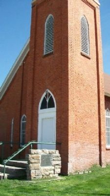
This building was constructed in 1898 by the German Baptist Church of the Brethren to serve as a house of worship. It was originally located on the southwest corner of ? Street and Avenue A in Kearney. This congregation used this building until . . . — — Map (db m45467) HM
This gazebo is dedicated to the
memory of the
Good Samaritan Air Crew.
On December 20, 1985, they gave
their lives attempting to save others.
Nancy Brandon
Joan Brown
Craig Budden — — Map (db m58938) HM
In 1847 Brigham Young led the first migration over the Mormon Trail along the north bank of the Platte River, and in 1866 the Union Pacific Railroad pushed its main line westward to this valley, bringing pioneer settlers. However, it was not . . . — — Map (db m45427) HM
Dedicated in honor and memory
Judge Bruno O. Hostetler
1861 - 1954
Leadership in establishing
college in Kearney
1903
A gift from his daughter
Mrs. Florence H. Raymond
June 19, 1980 — — Map (db m58962) HM
Long before early French explorers named it the Platte River, or "flat waters," this heartland oasis was a crossroads. Migratory birds, abundant wildlife and Native Americans had been in residence for centuries when the confluence of the Oregon and . . . — — Map (db m58888) HM
In the late 1880's, Kearney business leaders envisioned the city as a major manufacturing center. The Kearney Cotton Mill was among the many enterprises launched as part of this venture, which included paper, woolen, and oatmeal mills; plow and . . . — — Map (db m101852) HM
In honor of
George and Venetia Peterson
and
Elias and Mary Yanney
The carillon tower reflects the early history of Kearney State College and the Administration Building located adjacent to this site.
The four columns of the . . . — — Map (db m58961) HM
For the next fifty miles east-bound travelers will be passing from the semi-arid Great Plains into the prairie country of eastern Nebraska. Near here are located the city of Kearney and Fort Kearny, for which it was named. The fort was . . . — — Map (db m288804) HM
Loup River Freighters Hotel was built in 1884 by Jerome Lalone, a house painter and wallpaper hanger from Kearney. Mr. Lolone purchased land in the northwestern corner of Buffalo County along the South Loup river in 1883. he built the house along a . . . — — Map (db m45429) HM
This depot was built in 1898 next to the Union Pacific tracks in Shelton. It was moved to this site in September 1975 and was the first building on the grounds of the Trails and Rails Museum of the Buffalo County Historical Society. It was donated . . . — — Map (db m45471) HM
and
Bauer Sundries & Veterinary Supplies
January 1959 - October 1969
Proprietor, Frances R. Bauer
Home of Kearney's last soda fountain
In honor of
George J. and Frances R. Bauer
for their civic mindedness and years of . . . — — Map (db m58857) HM
West-bound travelers will leave the prairie regions of eastern Nebraska and
enter the Great Plains the next within fifty miles. This semi-arid region stretching from Canada to Mexico and westward toward the Rockies was long known
as the Great . . . — — Map (db m228360) HM
The Mormon Pioneer Trail. Fleeing heated religious and political hostility and persecution, many members of The Church of Jesus Christ of Latter-day Saints (widely known as Mormons) abruptly fled their homes in Nauvoo, Illinois, in February . . . — — Map (db m275913) HM
In 1888, H. D. Watson established the historic Watson Ranch, at one time containing 8,000 acres, reaching from the fertile Platte Valley on the south to the rolling hills on the north and from downtown Kearney to a point five miles west.
. . . — — Map (db m101853) HM
In 1903 the legislature appropriated $50,000 to establish a state normal school in central or western Nebraska. After 111 ballots, the State Board of Education chose Kearney as the site. The city donated twenty acres on the west edge of town for . . . — — Map (db m45500) HM
From 1934 to 1939, Companies 2741 and 2732 of the Civilian Conservation Corps occupied a camp near this site. Barracks housed about 200 men, ages 18 to 25, who built soil conservation dams and planted shelterbelts on nearby farms. The camp moved to . . . — — Map (db m181771) HM
In memoriam John Pesek Ravenna, Nebraska 1894-1978 World Champion Wrestler Recognized September 13, 1937 This statue made possible by grant from Nebraska Arts Council citizen donations and Ravenna Chamber of Commerce Dedicated May . . . — — Map (db m236861) HM
The ill-fated Pleasanton Nebraska branch extended southwestward along the South Loup Valley from Boelus to Pleasanton, a distance of 22.42 miles. Construction from Boelus to Nantasket was completed in 1887 and reached Pleasanton in 1890. The line . . . — — Map (db m181793) HM
On the South Loup River southwest of here was the site of the U.S. Army’s Post South Loup Fork. This small outpost of Fort Kearney was established in May 1865 by Company “E”, Seventh Iowa Cavalry, under the command of Capt. James B. David and . . . — — Map (db m181699) HM
This boulder is dedicated to the early pioneers of the community of Shelton, in recognition of their heroic services in establishing and protecting this town and in risking their lives that Shelton might be secure.
[Lower plaque] . . . — — Map (db m45283) HM
In April 1860 Joseph E. Johnson, a Mormon, established a road ranche at Wood River Center, today’s Shelton, and began publishing The Huntsman’s Echo, the first newspaper in Nebraska west of Omaha. He had earlier edited papers in Council Bluffs, . . . — — Map (db m45423) HM
Here in Dawson county, much of the early history is concerned with the pioneer trails to the west. The Mormon Trail to Utah and the first transcontinental railroad passed through here on the north side of the Platte River; the Oregon Trail and the . . . — — Map (db m68060) HM
Here in Dawson County, much of the early history is concerned with the pioneer trails to the west. The Mormon Trail to Utah and the first transcontinental railroad passed through here on the north side of the Platte River; the Oregon Trail and the . . . — — Map (db m228354) HM
The 100th longitudinal line west of Greenwich was the major goal set by Congress in building the first transcontinental railroad.
Construction of the Union Pacific track reached the Meridian on October 5, 1866.
To celebrate this record-breaking . . . — — Map (db m123869) HM
This cabin was built about 1849 on the south bank of the Platte River south of
Darr. First used as a post to trade with the Indians. Later known as Willow Island Station and used as a stage & Pony Express station. Moved to present site, rebuilt . . . — — Map (db m253059) HM
The Pony Express
This building, when on its original site was a Pony Express Relay Station. Billy Campbell and Melville Baughn both were riders on this portion of the trail. The station was also used by the Central Overland California and . . . — — Map (db m253058) HM
has been designated a --------------------------- National Natural Landmark --------------------------- This site possesses exceptional value as an illustration of the nation’s natural heritage and contributes to a better understanding of man’s . . . — — Map (db m86774) HM
Gothenburg Nebraska
Early settlement
In late 1882, Swedish businessman Olof Bergstrom was working for Union Pacific Railroad in the American frontier when he conceived the idea that a town was
needed where Gothenburg now stands.
. . . — — Map (db m253053) HM
Erected on the Oregon Trail, four miles east of Fort McPherson, Lincoln County, Nebraska, and used as fur trading post and ranch house. 1860 – 61 Used as Pony Express Station. 1862 – 1931 Used as Overland Trail Stage Station, dwelling, . . . — — Map (db m86773) HM
One of the many Swedish settlements in Nebraska during the late nineteenth century was north of Gothenburg in northwestern Dawson County. An enduring symbol of this settlement is Swedish Crosses Cemetery, where three children of Mr. and Mrs. Berg . . . — — Map (db m299047) HM
This old station once stood on the upper 96 Ranch west of here and south of the Platte River, on the original Pony Express route. It was moved and restored by Gothenburg Post No. 64, American Legion. Erected by the Gothenburg Chamber of . . . — — Map (db m86775) HM
From the late 1840s through the 1860s, an exodus of more than 70,000 Mormons passed by here on their way to their “New Zion” in Utah. Starting from Nauvoo, Illinois in February 1846, the first group of at least 13,000 Mormons crossed into Iowa to . . . — — Map (db m275786) HM
This vehicle, not a true tank, is built by FMC Corporation. Named after General Omar Bradley, it first appeared in 1978. It is powered by a Cummins 500 hp, V-8, Diesel engine with a supercharger. The transmission is built by General Electric. The . . . — — Map (db m92688) HM
This tank weighs 53 tons with crew and equipment. The armament is one 105 mm main gun, a 7.62, co-axial machine gun and a .50 caliber m85 machine gun on the commanders cupola. The hull and turret are homogeneous steel castings.
The tank is . . . — — Map (db m92690) WM
Here, on August 7, 1867, a band of Southern Cheyennes, led by Chief Turkey Leg, wrecked a west-bound Union Pacific freight train and handcar which preceded it.
The engineer and fireman were killed and the boxcars looted and burned.
One of the . . . — — Map (db m120893) HM
Railroads played an important role in the settlement of the Great Plains. Their construction was particularly damaging to the Indian way of life, since railroads helped the military to patrol rapidly along their lines, and villages and farming . . . — — Map (db m101854) HM
Solon H. Borglum (1868-1922), son of Danish Mormon emigrants, was a world-famous sculptor. From 1885 until 1893, Solon ran his father’s cattle ranch located in the South Loup Valley just east of this marker. The Borglums moved from Utah to Omaha . . . — — Map (db m183294) HM
Nathaniel Martin, age 15, and Robert O. Martin, age 12, while fleeing from a war party of Sioux Indians were struck by two Indian arrows, one of which pinned the two boys together. They fell from their horse and were left for dead, but survived. . . . — — Map (db m30408) HM
On July 24, 1867 Mrs. Thurston Warren was murdered by Sioux Indians as she stood in the doorway of her log cabin home located one-half mile north of this spot.
When found her baby Thomas was still clasped in his mother's arms. Another son was . . . — — Map (db m288855) HM
The men and women of the 6th Bomb Group Association thank the people of Grand Island for their warm hospitality when we trained here in 1944/1945 before leaving for the Pacific Theatre of War to fly 1,750 World War II B-29 combat missions over . . . — — Map (db m59854) HM
In memory of the
Heroes of 1861-65
who lie in unknown graves
on Southern battle fields.
Sleep on brave boys though
your graves are unmarked
You are not forgotten
Dedicated May 30, 1908 — — Map (db m53256) HM
On February 25, 1944, a B-17G bomber from the Grand Island Army Air Field crashed half a mile east of here on the Langenheder farm, killing nine aboard. The Grand Island base served as a training location for aircrews prior to their leaving for . . . — — Map (db m181684) HM WM
B-29 Superfortress Purpose: Very Heavy Bomber (increased speed, range, and bomb load) Features included pressurized cabin, electronic fire control system, remote-controlled gun turrets. Manufacturer: Boeing First Flown: September . . . — — Map (db m181656) HM
The first Grand Island airport, a grass field, was located approximately 1½ miles south of the present terminal building on land owned by H. O. “Doc” Woodward. It was used by the Grand Island Aero Company, organized in 1919 by former World War I . . . — — Map (db m181602) HM
In memory of the
defenders of our country
1861-1865 — 1898-1900
Committee of Lyon Post No. 11
Nebr. G.A.R.
G. C. Humphrey
C. B. Norris
G. F. Ryan — — Map (db m53249) HM
Beneath the earthen exterior is an intricate structure of Cottonwood tree trunks and Willow branches. This is a moderate-sized earth lodge—thirty eight feet in diameter and eighteen feet high at the central fire hole.
Responsible for the . . . — — Map (db m45188) HM
Originally designed as a U.S. Post Office and Court House, the Grand Island Federal Building opened on November 26, 1910. It was designed by James Knox Taylor and cost $108,000. The 1935 west-wing addition was designed by local architect, Charles . . . — — Map (db m53250) HM
You are near the Platte River's famous Grand Island. It is approximately forty miles in length and two miles at its widest. Providing abundant wood and water, it often served as a campsite for Pawnee Indians. Journalists for the expeditions of . . . — — Map (db m228357) HM
You are near the Platte River's famous Grand Island. It is approximately forty miles in length and two miles at its widest. Providing abundant wood and water, it often served as a campsite for Pawnee Indians. Journalists for the expeditions of . . . — — Map (db m79694) HM
Grand Island Public School. Erected 1878.
I proclaim unceasing warfare against
ignorance, fanaticism and intolerance.
School Board, 1879
O A Abbott, Moderator
W H Platt, Director
H A Koenig, Treasurer
T J Hurford · C E Lykke · R C . . . — — Map (db m155063) HM
First known as the Nebraska Soldiers and Sailors Home, the Grand Island Veterans Home was opened in 1887. The first home was a four-story Victorian building situated on 640 acres. The building soon became inadequate to house the veterans. Between . . . — — Map (db m181697) HM
Designed by Omaha architect Thomas Rogers Kimball (1862-1934), the Hall County Courthouse is an exceptional example of Beaux-Arts classicism and borrows on Germanic design sources. Constructed of brick accented with limestone, the building features . . . — — Map (db m53239) HM
In 1879 Hall County purchased 160 acres at this location where the county’s paupers could live and work in exchange for shelter, clothing, food, and medical care. In March 1881 part of the Poor Farm property was set aside as a cemetery for those who . . . — — Map (db m181695) HM
Grand Island, in the Platte River, has given its name to the city of Grand Island. The island was formed by a narrow channel branching off the Platte River approximately 28 miles upstream from the present city of Grand Island and rejoining the main . . . — — Map (db m53258) HM
The Martin building was designed for J.D. Martin by local architect, Oscar Kirschke. The building was completed in 1914 for approximately $55,000. One of the first occupants was the funeral chapel and morgue of the Buchheit-O'Loughlin Furniture and . . . — — Map (db m53255) HM
Religious freedom, An American ideal, has on occasion been denied certain sects because of prejudice. Mormons were once persecuted and forced from their homes. The north bank of the Platte River served as the exodus route for thousands of members . . . — — Map (db m45171) HM
Old Dodge School served as one of two branch camps in Hall County housing German prisoners of war. On July 9, 1944, Leo B. Stuhr, president of the county Non-Stock Labor Association, announced plans to use the school for this purpose. About one . . . — — Map (db m53254) HM
This building is the authorized public school house built in District No1 Hall County Nebr. Authorized & constructed in 1869 - 1870. — — Map (db m53263) HM
Wilhelm Stolley
April 6, 1831 - May 17, 1911
Wilhelmine F. Hagge Stolley
April 21, 1837 - Jan. 31, 1923
Born in Schleswig Holstein, Germany
Friederich, March 26, 1857 - Sept. 25, 1938
Anna H., June 123, 1859 - Apr. 15, 1929
Born in . . . — — Map (db m53264) HM
Pioneer Park, site of the first Hall County courthouse, honors the courageous settlers who peacefully inhabited this area in 1857 when only Pawnee lived here. In 1866 the Union Pacific reached Grad Island and in 1868 the railroad donated Block 19 . . . — — Map (db m45189) HM
This horse drawn tank wagon was used by Sinclair Oil beginning in 1917. The tank had an amazing 300 gallons of fuel or gasoline that was delivered to farmers and homesteads for numerous uses. In comparison, today's transport trucks hold 7,000 to . . . — — Map (db m53267) HM
The following settlers arrived here July 4, 1857
R.C. Barnard
Lorenz Barnard
Joshua Smith
David P. Morgan
William Seymour
Heinrich Schoel & Wife
Heinrich Joehnck & Wife
Wilhelm Stier & Wife
Friedrich Doll & Wife
Christian . . . — — Map (db m190217) HM
The Lincoln Highway association, formed in 1913 to build a New York to San Francisco highway, sold “highway memberships” to raise funds for the project. In Nebraska the road, which traversed twelve states, extended westward from Iowa . . . — — Map (db m45203) HM
From 1847 to the 1860s, the Mormon migration along the Great Platte River Road marked a distinctive chapter in the history of westward expansion. In contrast to the random migrations of individual families or companies that characterized much of . . . — — Map (db m79695) HM
The Pawnee: Prairie Town Builders, Pawnee History
The Pawnee migrated from the Southwest and lived in the Platte and Loup Village areas for more than seven centuries.
The Pawnee were the most influential and populous of the native peoples of . . . — — Map (db m45187) HM
The Purple Heart medal was originated by General George Washington on August 7, 1782 for distinguished valor and is now awarded only to members of the armed forces of the United States who have been wounded in combat against an armed . . . — — Map (db m79693) HM WM
Here is a section of an original Seedling Mile on the Lincoln Highway. It was completed November 3, 1915. Grand Island was the second city in the United States to build such an example of concrete roadway. The original Seedling Mile extended from . . . — — Map (db m53234) HM
This building has been placed on the National Register of Historic Places of the United States Department of the Interior. Orginally constructed to be part of the American Hotel chain for the Bankers Realty Investment Company of Omaha, the . . . — — Map (db m53251) HM
On August 17, 1943, a B-17F bomber from Kearney, Nebraska, Army Air Field crashed 300 yards south, killing all aboard. The plane was on a routine training flight before going overseas. Losing their lives were 2nd Lt. Sylvester J. Diebold, Benton, . . . — — Map (db m182051) HM
Commonly known as the Cornhusker Ordnance Plant, the facility opened in 1942 and covered nearly 20 square miles. During World War II it produced artillery shells and various bombs weighing up to 2,000 pounds apiece. An explosion on May 26, 1945, . . . — — Map (db m181700) HM
Between 1844 and 1866 thousands of emigrants, gold seekers, and Mormons moved west through the Platte Valley. The first settlers along Wood River 1858-60 operated road ranches to serve travelers. They included Patrick, Richard, and Anthony Moore; . . . — — Map (db m45282) HM
This memorial is presented in honor of the men and women, past, present and future, of the Armed Forces of the United States of America in remembrance of their efforts and sacrifices to preserve our freedom.
We thank, also, our many friends and . . . — — Map (db m45204) HM
The first homestead claim in Howard County was filed on March 11, 1871. St. Paul was appointed the county seat in May, and retained that title over Dannebrog in a close 1874 election. A wooden courthouse was built in St. Paul in 1877. By June 1912, . . . — — Map (db m181691) HM
The cemetery was established in 1876, one year after the first settlers of the Czech club “Slovania” arrived in the Warsaw vicinity. The plot was donated by Martin Slobodny. Initially, Sunday worship was held around a large wooden cross in the . . . — — Map (db m181795) HM
Mayor 14 years
Expanded the water supply system.
Purchased the power and light plant.
Established the city library.
In 1936, on this site, a fire destroyed the Fleming Lumber and Coal Company and Carpenter Scarbourgh's Tools.
We . . . — — Map (db m76947) HM
Grover Cleveland Alexander, the third winningest pitcher in major league baseball history, was born near Elba, Nebraska, on February 26, 1887. After pitching for local and minor league teams, Alexander signed with the Philadelphia Phillies. In 1911, . . . — — Map (db m104682) HM
200 entries matched your criteria. The first 100 are listed above. Next 100 ⊳