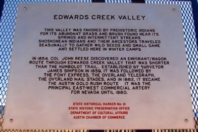
Replacement Marker
Abundant grass and brush found near springs and intermittent streams in Edwards Creek Valley were important ecological areas for Native Americans. Shoshone Indians wandered seasonally to gather wild seeds and small . . . — — Map (db m67146) HM
In 1861, the rocks composing the walls of this stage station and freighter stop were in neat rows and roofed with bundles of willow. It was one part of "Stagecoach King" John Butterfield's Overland Mail & Stage Company Road Systems, which at the . . . — — Map (db m67145) HM
On the mountain slopes in the distance, you can see a series of horizontal lines or terraces etched into the side of the range. These beach lines are left by waves of ancient Lake Lahontan. Over 12,000 years ago, the lake reached a maximum depth . . . — — Map (db m165833) HM
"We continued on following the river. The main road leaving the river for 12 miles. Over a strip of desert without grass or water the road along the river being a pack route and impracticable for wagons" - Calvin Taylor, Sep 17, 1850 — — Map (db m159073) HM
"Ragtown...is a collection of tents and canvass shanties, where a tolerable meal can be had at one dollar a head. Whiskey is sold, cards are played, gambling pretty extensively carried on and hay sold" - Henry Sheldon Anable, Sep 1, 1852 — — Map (db m159072) HM
"Passing out of the canyon we went up [Edwards Creek] Valley between two ranges of mountains ... to Cold Springs where we ... prepared for crossing the sixty mile desert by cutting grass and fillings our kegs with water" - Lumin A. Scott, Aug 29, . . . — — Map (db m159358) HM
"Sand Springs is a station on...the overland stage road...a few rough poles stuck in the sand and covered with the cloth...several holes have been shoveled out of the sand These are the springs....warm and unwholesome" - William C. Moss, Aug . . . — — Map (db m261790) HM
Churchill County was created by the Territorial Legislature in 1861 but attached to Lyon County for judicial and revenue purposes. Churchill County was organized in 1864 and La Plata served as county seat. In 1868, it was moved to Stillwater, . . . — — Map (db m69686) HM
In 1903, Senator Warren Williams introduced a bill allowing the county seat to be moved from Stillwater to Fallon. The courthouse was constructed at its present location that same year. The wooden-framed structure of Neo-Classical design was . . . — — Map (db m70512) HM
According to anthropologists, many hunter-gatherer societies, such as those who lived here, had a spiritual leader called a shaman. During the hunt, the shaman was called on to perform rituals to ensure success. One theory is that some of the . . . — — Map (db m165835) HM
Fairview was part of the renewed interest in mining. Triggered by the strikes in Tonopah and Goldfield. Discoveries in 1905 of a rich silver float led to a boom that lasted through 1906 and 1907. A substantial town that boasted 27 saloons, . . . — — Map (db m67147) HM
When the energy from pressure built up underneath the Earth's thin crust is suddenly released, an earthquake occurs. At first the crust may just bend. But if the stress is great enough, the rocks will break and "snap" to a new position. This . . . — — Map (db m62121) HM
Grimes Point, one of the largest and most accessible petroglyph sites in northern Nevada, contains about 150 basalt boulders covered with petroglyphs. Nevada petroglyphs were of magico-religious significance in insuring the success of large game . . . — — Map (db m127115) HM
[side 1] The Cattail-Eater People (Toidikadi) Stillwater Marsh is located in the basin northwest of Grimes Point. When the first non-native explorers entered the area, it was the home of the Northern Paiute people, known as the . . . — — Map (db m165830) HM
On this site, while participating in a training exercise, five U.S. Navy men from Helantisubron Four N.A.S. North Island, California were killed when their SH-3 Sea King helicopter crashed at 1245 on 22 March 1978
HS-4 Black Knights LT C.O. . . . — — Map (db m192607) HM
Lahontan Dam, completed in 1915, is the key feature of the Newlands Irrigation Project which has turned Lahontan Valley into one of Nevada's most productive farming and ranching areas. With completion of the dam's powerhouse, the electrical energy . . . — — Map (db m89515) HM
The crater-like depressions and elongated grooves, seen on the boulder before you, possibly date back 7,000 years or more. This "Pit and Groove" petroglyph style is believed to be the oldest at Grimes Point. Depressions were made by striking the . . . — — Map (db m165831) HM
Scientists measure the force of an earthquake in several ways. The Richter Scale and the Modified Mercalli Scale are the two methods most often used to gauge an earthquake's strength and magnitude.
The Richter Scale provides an . . . — — Map (db m62122) HM
The Oats Park School was designed in 1914 by Frederick J. DeLongchamps, Nevada's pre-eminent architect of the period. He was also responsible for the 1921 north and south wing additions. This building is one of his earliest, and perhaps, first, . . . — — Map (db m69683) HM
In 1929, this building was deemed a magnificent improvement to the city. Built to U.S. Postal Service standards, this brick structure features massive single doors on either end of a vestibule that protects the inside from the elements. Carved . . . — — Map (db m142625) HM
One hundred and fifty years ago, the Pony Express was founded by W. H. Russell, Alexander Majors and William B. Waddell, operators of the Overland Stage Line of Leavenworth, Kansas. During a visit to Washington, Mr. Russell was urged by California . . . — — Map (db m69681) HM
Ragtown was never a town, but the name of a most welcome oasis and hamlet. This mecca on the banks of nearby Carson River received its name from the appearance of pioneer laundry spread on every handy bush around.
The Forty-Mile Desert, . . . — — Map (db m180202) HM
Rock art in the Great Basin has often been linked to prehistoric game trails. While this seems strange for this barren scene, consider what this area was like thousands of years ago. Grimes Point would have been a peninsula surrounded by water, and . . . — — Map (db m165834) HM
Replacement Marker
Rock Creek was an important stagecoach stop on the Overland Mail Stage Company's historic line along the Simpson route between Salt Lake City and Genoa, Nevada, which was operated by John Butterfield (1861-1866) and . . . — — Map (db m67144) HM
Sand Mountain, dominating the Salt Wells Basin, is a prominent landmark in Nevada's early history. The Northern Piute know it as Kwazi, the name of the snake that inhabits the dune, its backbone forming the crest of the mountain. Captain James . . . — — Map (db m69653) HM
Two small rooms at the southwest end of the station were originally one large room and shared a common wood floor. The wall which now separates the two rooms was built on top of the floor some time later. The center room was probably used for . . . — — Map (db m127117) HM
Built in March 1860, this station was used by the Pony Express
until it was driven out of business by the first Transcontinental
Telegraph in November 1861. The telegraph and the Overland
Stage Company continued to make use of the station . . . — — Map (db m261815) HM
While petroglyphs were etched or scratched into the rock surface, pictographs were painted, using natural materials as pigments. One of the oldest petroglyph styles can be seen as circular and wavy lines and may be almost 3000 years old. The . . . — — Map (db m165832) HM
"The Mail Must Go Through"
From April 3, 1860 to November 21, 1861, mail was delivered by the Pony Express between St. Joseph, Missouri and Sacramento, California. It was a relay system between 190 stations along the route. A fresh horse was . . . — — Map (db m142572) HM
This room and the room you just walked through were the living areas for the Pony Express employees. Here they ate, slept, and passed the time when they were not working. Life at the station was not only hard, it was wretched. Sir Richard Burton, a . . . — — Map (db m261818) HM
Want it known that in the State of Nevada....
This site is dedicated not for it’s historical significance, but for the significance of the genuine gold diggers of Western history… the working girls who made a man forget the back . . . — — Map (db m90814) HM
Competing with time, distance, harsh climate, and hostile Indians, the Pony Express carried important communications from the East and the West across 2,000 miles in only 10 days.
The "Pony," as it was called, is an outstanding . . . — — Map (db m67142) HM
Middlegate station closed in the early 1900s. It was an overland stage stop, Pony Express station and freight station. The building was stripped of useful material for mines, shacks, until only the foundation of zeolite blocks remained.
In . . . — — Map (db m261679) HM
"Long before sunrise our teams were on the trail marching forward on the desert. Very little to note save the dust & brightness of the glittering sand. Now & then a grave, little donage & dead stock." - John Clark of Virginia, Aug 21, 1852 — — Map (db m149414) HM
The ten foot wide flat at the base of the cliff is the site of Wagon Jack Shelter. The name comes from the Shoshone Indian, Wagon Jack, who camped here about 1900, while working on an Eastgate Ranch. He was a leader of Indian rabbit drives in Smith . . . — — Map (db m69650) HM
Sand Springs Deserved its Name The rocks you see in front of you were once Sand Springs Pony Express Station. The Pony Express ended in November 1861, but this Station was used as a stopover for freight wagons until the late 1800s. It laid . . . — — Map (db m142573) HM
Little known at the time, except as a stage stop, Williams Station was destined to be remembered in Nevada history as the incident that ignited the Pyramid Lake War of 1860.
Williams Station was named for three brothers, James O., Oscar, and . . . — — Map (db m168508) HM
Located 13 miles to the north is the camp of Wonder, a major mining center in the early years of the twentieth century. Thomas J. Stroud and several others made the first locations in March 1906, and in June of that year the Wonder Mining . . . — — Map (db m251578) HM
Hazen was named for William Babcock Hazen, who served under General Sherman in his "March to the Sea." The town, established in 1903 to house laborers working on the Newlands Irrigation Project south of here, included hotels, saloons, brothels, . . . — — Map (db m42328) HM
Stretching before you are two vast sinks, terminal areas of the Humboldt and Carson River drainage systems. The marshey remnant of Lake Lahontan, between you and the distant Humboldt Range, served as a life sustaining resource of wildlife for . . . — — Map (db m263929) HM
Whichever direction your travels take you, you're going to have a similar experience to what the California-bound emigrants had. You're going to see the same country, except for the towns and the ranch meadows. The big difference, though, is that . . . — — Map (db m67359) HM
The 40 Mile Desert, beginning here, is a barren stretch of waterless alkali wasteland. It was the most dreaded section of the California Emigrant Trail. If possible, it was traveled by night because of the great heat.
The route was first . . . — — Map (db m67348) HM
Look at the barren country south of here just beyond this Rest Stop. This is the Forty-Mile Desert--a barren stretch of waterless alkali wasteland. It was the single-most dreaded section of the entire California Trail from the banks of the Missouri . . . — — Map (db m67357) HM
Truckee Trail - Forks of the Trail
"Continued along a slue to the foot of a small hill. Here
the roads fork, the left hand being the Carson Route, the
right the Truckee...Bidding adieu to the Humboldt & sink passed up the hill to the . . . — — Map (db m264210) HM
"We left camp at 6 this morning passed through Middle and West Gate This kanyon that these passes or gates are in is the most beautiful one we passed through yet we have not traveled only 15 miles to day." - Elizabeth Duncan Oct 4, 1867 . . . — — Map (db m155193) HM
Middlegate was named in 1850 by James Simson as he mapped the route for the Overland Stage Company. In his journal he writes that he thought the cuts in the mountains looked like 'gates' so he named each cut Westgate, Middlegate, and Eastgate to . . . — — Map (db m89452) HM
Nevada lies within the Great Basin where rivers drain into lakebeds and sinks, never reaching an ocean. The broad valley around this location contains two of these terminal lake basins or "sinks" one
for the Humboldt River arising in northeastern . . . — — Map (db m263928) HM
The numerous valleys of Nevada have supported a vigorous cattle industry since the 1850's. Beginning in the western part of the state, cattlemen ranged their herds throughout northern Nevada by the 1870's. The completion of the transcontinental . . . — — Map (db m149718) HM
You have arrived at this place by driving east on Interstate Highway 80. Did you know that since entering Nevada you have been traveling along the route of the historic California Trail? From 1843 to 1869, an estimated 250,000 people made the trek . . . — — Map (db m67441) HM
Whichever direction your travels take you, you're going to have a similar experience to what the California-bound emigrants had. You're going to see the same country, except for the towns and the ranch meadows. The big difference, though, is that . . . — — Map (db m67440) HM
In 1868, the town of Argenta was founded as the first Central Pacific Railroad station in Lander County. The town, 10 miles west of this marker, was named by Judge E.B. Crocker. A post office opened and the railroad established an eating station, . . . — — Map (db m81182) HM
From this vantage point one can see the steam rising from the geysers located near the base of the far hill across the valley.
The U.S. Geological Survey has designated an area south of Beowawe a Known Geothermal Resource Area (KGRA). The . . . — — Map (db m240318) HM
7 miles southeast of here was a favorite pioneer crossing of the Humboldt River, Gravely Ford. Campsite of the Donner Party, here occurred the Snyder-Reed fight, as Snyder lashed at Reed he missed and hit Reed's wife. Reed then killed Snyder. Reed . . . — — Map (db m67443) HM
Looking at the broad valley of the Humboldt River before you, close your eyes and imagine how it would have been in the mid-1800s. Instead of the sounds of traffic on I-80, you can almost hear the creak of wagon wheels. You might hear the sounds of . . . — — Map (db m81206) HM
Located in the tank-like depths of Palisade (12-mile) Canyon, Palisade first named Palisades - surveyed and laid out by the Central Pacific Railroad in February, 1870. During the 1870's it rivaled Elko and Carlin as a departure point on the C.P. for . . . — — Map (db m135385) HM
Silver ore was discovered at Mount Tango in 1862 by a group of Mexican prospectors. They took the ore to Austin, Nevada. It was assayed. They were paid, and they were never heard from again.
In May of 1863 Simeon Wenban led a group to the Mount . . . — — Map (db m138451) HM
This historic five-hole outhouse was built for prominent Eureka businessman, Frederick Bartine (1888-1964).
A native of Finland, Bartine immigrated here in 1901. Soon after, he prospered as owner of the Ruby Hill Water Works, the Bartine . . . — — Map (db m51694) HM
Giovanni Pedroni Marcellus Locatelli Teodoro Zesta Pompeo Pattini Antonio Canonica
Charcoal Burners Massacred Aug. 18, 1879 By A Sheriff's Posse Southwest Of The Fish Creek Ranch — — Map (db m89510) HM
The first known explorer of Diamond Valley was Colonel John C. Fremont, who mapped the area to aid western migration in 1845. Before Fremont, tribes of Shoshone and Paiute Indians long had gathered nature's bounty here.
Colonel J.H. Simpson . . . — — Map (db m69606) HM
“Eureka!” a miner is said to have exclaimed in September, 1864, when the discovery of rich ore was made here—and thus the town was named. Eureka soon developed the first important lead-silver deposits in the nation and during the . . . — — Map (db m14690) HM
In 1873 separate stage coach owners Gilbert and Salsbury along with Hotel owner J.P. Withington organized the E&P to supply the Eureka Mining District. With the first train reaching Eureka on October 22 1875. This 87-mile-long narrow gauge train . . . — — Map (db m183755) HM
Built in 1879-80, of locally-fired brick and of sandstone quarried nearby, the Eureka County Courthouse remains a fine example of boom town Victorian opulence. This relic, scene of many famous trials, lives on in reflected glory of the days when . . . — — Map (db m14616) HM
The opera house was constructed by Richard Ryland, Joseph Winzell, and M.D. Foley in October through December of 1880. They used the foundation of the Odd Fellows Hall. The building had been destroyed earlier in the year during a disastrous fire. . . . — — Map (db m69601) HM
Constructed in 1879 at a cost of $10,000, the Sentinel Building was designed by architect C.M. Bennett. The Eureka Sentinel was published in this building from 1879 to 1960. Three generations of the Skillman family, Archibald, Edward and Willis, . . . — — Map (db m14686) HM
When A. Skillman closed the Shermantown Reporter at Hamilton he moved is printing press to Eureka. Together with Dr. L.C. McKenny they started the Sentinel as a weekly paper in July 1870. It became a daily in June 1871 reporting local and . . . — — Map (db m14687) HM
The Tannehill brothers built this cabin for a residence in 1864 and lived here about a year before selling their mining interest to a New York company in 1866. The cabin subsequently went through a number of owners, including the firm of Nathan & . . . — — Map (db m14688) HM
"Mining is an art...one of the most ancient, the most necessary and the most profitable to mankind."
Agricola, De Re Metallica, 1556
In 1864, a group of prospectors from Austin, Nevada discovered rock containing a silver-lead . . . — — Map (db m69607) HM
Golconda is a one time Utah Territory mining town whose hot springs, a landmark on the California Emigrant Trail, were of more enduring fame than its gold and silver boom.
In 1868, Golconda became an ore shipping station on the new Central . . . — — Map (db m67432) HM
Established in 1865, Fort McDermitt was originally called Quinn River Camp #33 on the East Fork, then renamed in honor of Lt. Col. Charles McDermitt who died while fighting American Indians. The fort consisted of several adobe, stone, and frame . . . — — Map (db m207501) HM
The Northern Paiute name Thocmetony (Shell-flower) was bestowed on this valiant daughter of Chief Winnemucca, and grandchild of the redoubtable Captain Truckee -- a friend and supporter of General John C. Fremont. Sarah sought understanding between . . . — — Map (db m59257) HM
Overlooking the Old California Emigrant Trail, Valmy was named after the Battle of Valmy in France. Established in 1910 by the Southern Pacific Railroad Company as a section point, Valmy served during the steam era as a water and fuel stop for . . . — — Map (db m10090) HM
Whichever direction your travels take you, you're going to have a similar experience to what the California-bound emigrants had. You're going to see the same country, except for the towns and the ranch meadows. The big difference, though, is that . . . — — Map (db m67431) HM
A few houses, a ferry across the Humboldt River, and Bridge Street paved with sagebrush stubs comprised the town of Winnemucca in 1873 when Frank Button and his uncle I.V. Button drove cattle into the area to begin ranching operations in the rich, . . . — — Map (db m67427) HM
"The water is warm and tastes but little better than soap suds. We use acid in all the water we drink, by that means we manage to get along, although we are all anxious to get off this river" - Ephriam Brandiff, Aug. 16, 1852 — — Map (db m70354) HM
"The road still continues on the south side of the river, there is also one on the north side and I believe it is the old one. The one on the south side is said to be the best." - Joseph Middleton, Sep 18, 1849
Guidebook available
Trails . . . — — Map (db m138455) HM
"Saw in this distance a flag flying denoting a trading post, rode over to it but found the most they had to sell was very poor whiskey. ... These traders get a great price for everything they sell." - Henry S. Anable, Aug. 25, 1852 — — Map (db m70355) HM
The abundance of beaver in the Humboldt River drew the first non-native people, trappers (mountain men), to this area in the early 1800s. The popularity of felt hats was partially responsible for an increased demand for beaver pelts, but there . . . — — Map (db m141452) HM
The oldest known masonic document, the Halliwell Manuscript (or Regius Poem), dates to around 1390 and hints at the craft's ancient roots. freemasonry stands as the world's oldest and largest fraternal order. On june 24, 1717, the Grand Lodge of . . . — — Map (db m283954) HM
Dedicated on the Pilgrimage to ‘Mucca on 3 Rabia I, 1380 A.H. (Mohammedan Calendar). Brought by caravan from the sea at Crescent City, California, to dedicate the opening of the new trade route from Winnemucca to the sea and to affirm the . . . — — Map (db m170925) HM
On October 31, 1864, the United States declared Nevada a State of the Union. The first county seat was located in Unionville, Nevada. Officials did not build a permanent courthouse. Nevada officials moved the seat of Humboldt County to the city . . . — — Map (db m269760) HM
First discovered November 9, 1828 by Peter Skene Ogden on his fifth Snake Country Expedition. Entering Nevada near present Denio, Ogden came southward along Quinn River and the Little Humboldt River, emerging on the Humboldt main stem near this . . . — — Map (db m67428) HM
Before nearly quarter of a million California-bound emigrants followed the path of the Humboldt River from 1841 to 1869, someone had to have first explored the Humboldt and figured out where it went. That someone was Peter Skene Ogden, who traveled . . . — — Map (db m67429) HM
Josie is reported to have sold her first mine by the age of thirteen. She went to Creede, CO where she married mining engineer Lane Pearl. They traveled the west to places such as Goldfield. Lane went to work at Ward, near Ely where he succumbed . . . — — Map (db m245368) HM
This spot was part of the Pioneer Cemetery where rests Frank Baud and other of the pioneers who founded Winnemucca, earlier known as French Ford. Baud arrived in 1863 and is one of the men credited with naming the town Winnemucca after the famous . . . — — Map (db m67394) HM
In 1868 the Central Pacific Railroad (CPR) was completed from Sacramento to Winnemucca and the first locomotive, the Champion, traveled to Winnemucca. On May 10, 1869 the CPR and the Union Pacific Railroad (UPR) were joined at Promontory, Utah. On . . . — — Map (db m141451) HM
Between 1841 and 1869, up to 250,000 emigrants followed the California Trail along the Humboldt River to California. in 1846, the Donner Party traveled along this trail and Donner Party teamster, John Snyder was killed in a dispute with wagon . . . — — Map (db m141453) HM
The Humboldt Canal, sometimes termed the Old French Canal, coursed southwestward from Preble, near Golconda, toward Mill City. The present highway crossed it at this point, from whence it ran southerly toward the Humboldt County Courthouse on Bridge . . . — — Map (db m67393) HM
The Humboldt River is the only natural east-west water corridor across the Great Basin. It has been a conduit for travel, trade and communication from prehistoric times to the present. From its headwaters near Wells, Nevada, the river slowly . . . — — Map (db m141454) HM
The growth of the American auto industry in the early 20th century transformed America. Americans embraced their new freedom to explore, leading to a demand for transcontinental auto routes. In 1921, the Federal Highway Act was passed and the . . . — — Map (db m141450) HM
The informational plaques located at the military equipment in Veterans Memorial Park were dedicated on Veterans Day, November 11, 2017.
Our sincerest thanks to all who have served our country.
Sponsored by:
Barrick - Turquoise Ridge
SSR - . . . — — Map (db m131834) HM WM
Despite being remote, Winnemucca's location along the Humboldt River travel corridor has connected it to the rest of the country and made it a welcome resting place for travelers and a center for trade and commerce through the present day. . . . — — Map (db m141447) HM
This log is a portion of a redwood tree which contained 45,000 board feet of lumber. This tree drifted onto the Crescent City, California, beach during the 1964 flood. This log is 1477 years old and was cut from the largest piece of driftwood ever . . . — — Map (db m67388) HM
Our Men
Who Made the
Supreme Sacrifice
Vernon Crossen • Marine
William Kent Lamb • Navy
Chester Arthur Lillie • Field Hospital
Ole Admundsen Littleton • Infantry
Harold Martin • Ammunition Train
Frank Emanuel Olsen • Engineer . . . — — Map (db m98174) WM
Austin, mother town of mining camps, sprang into being after William Talcott discovered silver at this spot on May 2, 1862. Talcott came from Jacobsville, a stage stop six miles to the west on the Reese River, the first Lander County seat. He was . . . — — Map (db m14435) HM
160 entries matched your criteria. The first 100 are listed above. The final 60 ⊳