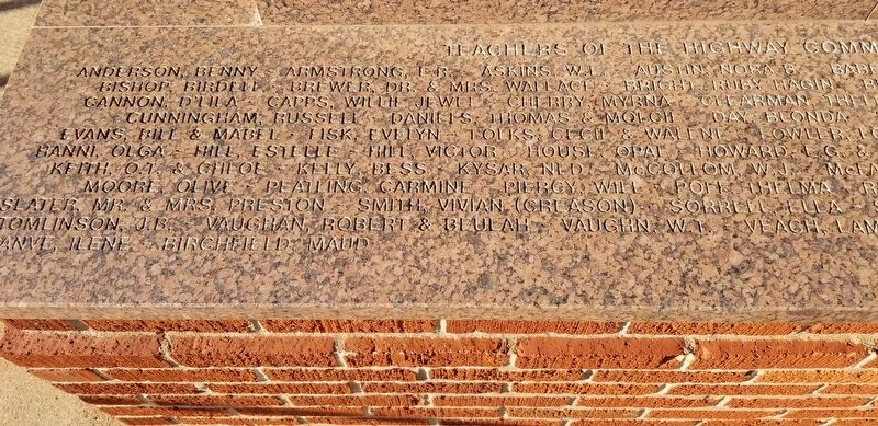
In honor of the people who lived here from 1892 to 1957, and built this community.
Life in the community, which at one time included 2 general stores, a barber shop, blacksmith shop, grain grinding mills, church and family residences, centered . . . — — Map (db m209528) HM
More than 6 million cattle went up this trail from Texas to Kansas between 1874 and 1888.
The trail crossed this area approximately 10 miles east of this location. — — Map (db m162452) HM
His hot brand number was 018
But he was called Ole Cowtown,
Many a bullrider put a rope on him
And most every time they hit the ground.
Over 350 times they nodded their heads
But only 5 made the judges book,
Ole Cowtown not only would . . . — — Map (db m162455) HM
Built & displayed by
Dr. Dennis Friesen
Dedicated 2001
"The railroad is the reason why Elk City exists and I want people to know what the railroad has really meant to Elk City. I share this for people to . . . — — Map (db m255418) HM
Entrepreneurs, pioneering a new industry - a new way to receive a broadcast television signal. Inventing the first cable television system west of the Mississippi river, here in Elk City, Oklahoma. — — Map (db m162454) HM
Beutler and Son PRCA Bareback Bucking Horse of the Year 1998, 1999, and 2000 NFR Bareback Horse of the Year 1997.
Commotion had ten straight trips to the NFR in Las Vegas, Nevada before retiring in 2006.
The 1-1/3 life-sized bronze by . . . — — Map (db m162468) HM
This is dedicated in loving memory of Elmer "Red” and Elsie G. Cruze,
early day settlers of the Indian Creek area, north of Carter, Oklahoma.
Elsie moved to the Indian Creek area at the age of 3, with her parents
Pearl J. and Kate King, . . . — — Map (db m162457) HM
Ernest Martin of Leedey purchased this gas pump at public auction in 1946 to use on his farm. When ill health forced him to sell the farm in 1974, his daughter and son-in-law, Hellen & Derrel Weaver, bought the pump and donated it to the museum. — — Map (db m187259) HM
Established in 1998, the National Route 66 and Old Town Museum Complex preserves the history of Route 66 in Western Oklahoma.
Recognized by Hampton Hotels Save-A-Landmark program as a site worth seeing — — Map (db m183510) HM
Sold to the city of Elk City
by C.H. Nesser for $10.00 in 1931.
This grader was used to help build
Route 66 in 1926.
C.H. Nesser was grandfather to Norman, Harold and Herman Nesser,
(sons of Ernie Nesser) and Neil, Ray and Ron Nesser . . . — — Map (db m162451) HM
Jaycee project 1976
Rock Bluff School
Est. 1894-1926
Donated by Trigg Music Family
Cornerstone:
Rock Bluff School
1894 - 1976
Building donated by
The Trigg Music Family
Ron Savage Jr. Chairman
Western Oklahoma . . . — — Map (db m162462) HM
The deep Anadarko Basin of Western Oklahoma is one of the most prolific gas provinces of North America. Wells drilled here have been among the world's deepest. The Bertha-Rogers No. 1 in Washita County, drilled in 1971 to 31,441 feet, was then . . . — — Map (db m162463) HM
Formerly the City Meat Market, this is known as the oldest brick building in Erick. It is now the home of Harley and Annabelle, "The Mediocre Music Makers."
Recognized by Hampton Hotels Save-A-Landmark program as a site worth . . . — — Map (db m183509) HM
Beckham county was created at statehood from portions of territorial Greer and Roger Mills counties. It was named for J.C. Beckham, former governor of Kentucky. Sayre, a town founded in 1891 and named for a railroad promoter, won the title of . . . — — Map (db m160832) HM
In honor of veterans of all wars
who sacrificed for democracy, peace
and justice.
Sponsored by Mildred Lee Chapter No. 1822
United Daughters of Confederacy
MCMLXXI — — Map (db m160833) WM
In 1888 Thomas and Millie Price were one of the first families to settle in this portion of old Greer Co, now Beckham Co. Price built a cotton gin ½ mi. east of Delhi in 1903. The one-roomed Delhi Academy was established in 1921. The Academy . . . — — Map (db m54903) HM
This underpass was a 1939 WPA Works Project. In 1939 the Sayre Grade School was located one block east of this location the underpass was built to provide safe passage for children and pedestrians crossing under the very busy Route 66. It is still a . . . — — Map (db m187260) HM
June 26, 1952, on this location, Route 66 was rededicated as the Will Rogers Highway. This was one of the many ceremonies that took place on the state lines of Illinois, Missouri, Kansas, Texas, New Mexico, Arizona, California as well as Oklahoma, . . . — — Map (db m100328) HM
Most decorated Indian soldier in United States history who was honored by receiving forty-two awards and medals from the U.S. Armed Forces including five Bronze Stars, four Silver Stars, three Purple Hearts and one Air Medal.
The brave combat . . . — — Map (db m182082) HM
B. 1852 - D. 1935 Educator, Humanitarian, Interpreter
Donors Mr. & Mrs. Tom Garrard & Mrs. William S. Key Willard Stone: Sculptor — — Map (db m187719) HM
The present location of the Anadarko Community Library was previously an auto garage then car dealership that was built in 1902 and remodeled in 1916. In 1925, it became an Auto Electric and Battery Shop.
In the mid 1980's, the library board . . . — — Map (db m181825) HM
The Windhollow at 132 East Broadway is a resale outlet, selling both used and new items. It is housed in one of the few stuccoed buildings in the historic district. The three story building was renovated in 1983-84. The Sanborn and APP map have its . . . — — Map (db m181834) HM
Chief Cochise was a great leader of his people. He was accused falsely of a kidnapping and members of his tribe were killed by soldiers. He became a bitter enemy of the White man. Sculptor: Betty Butts — — Map (db m182527) HM
Brave Wiinnebago hero whose courage and self-sacrifice reflects the traditional spirit of bravery inherited from Great Indian Warriors. He gave his life for his country. Saved his comrades in battle and was awarded the Congressional Medal of Honor. . . . — — Map (db m182108) HM
S.M. Singer was the owner and manager of Singer's clothing store from 1913 to 1947.
George's Department Store is Anadarko's oldest clothing and shoe store. It was opened in 1948 by George Salamy. For over 65 years, George made a tremendous . . . — — Map (db m181822) HM
Vigilant, stubborn, fierce and relentless war leader who became a legendary fighting hero.
He led his followers in revolt against cruelties and injustices that changed the brave Apache's way of life. Sculptor: Leonard McMurry Donor: Mrs. . . . — — Map (db m182545) HM
Mohawk Indian Chief who lived during the late 1500's. Social reformer, interested in ending war and promoting universal peace. Co-founder of the Iroquois Confederacy, an influence on the U.S. Constitution. Sculptor: Kenneth F. Campbell
Donor: . . . — — Map (db m182558) HM
U.S. Post Office (1947). The historic Anadarko post office building was previously the site of the Kiowa Indian Agency until 1947. The former name is still on the east side of the building.
The post office is listed on the National Historic . . . — — Map (db m166736) HM
Hosteen Klah was a noted medicine man and an unsurpassed weaver. His sand paintings were seen by President F.D. Roosevelt in 1934. He was a singer and a chanter of the many Navajo ceremonial chants. Sculptor: Allan Houser — — Map (db m182529) HM
The location of the Youngheim Clothing Co. for the better part of a century. In 1901, Herman Youngheim arrived at Ellis Island from Bad Wildengen, Germany.
Shortly after arriving in New York City, his family put him on a train to meet his . . . — — Map (db m181806) HM
Most notable chief of the Cherokees. Served as leader and statesman for a half century during the most dynamic period of Cherokee history. His love and attachment to the sacred home lands matched that of the full blood Cherokees, whom he led when . . . — — Map (db m182084) HM
José Maria Was Principal Chief of All Caddo Tribes and Led Them From the Brazos River, Texas in 1859, to the Site Now Called Anadarko, Oklahoma
Sculptor: Leonard McMurry
Donors: the Caddo Tribe and Citizens of Anadarko . . . — — Map (db m182078) HM
A Hopi tribal antelope, he received a silver medal in the 1912 Stockholm Olympics. He lived most of his life on Second Mesa, Hopi Reservation, Arizona. He won more than 25 track records during his school years. In 1967 he was inducted into the . . . — — Map (db m182526) HM
Chief of the Southern Arapaho, Brave in War, a tribal religious leader who always stood for peace with the with the United States. — — Map (db m182519) HM
Martinez 1911 is embossed atop the store front. Andres Martinez, known as Andele, was an Apache captive. One day he and his nephew were taken by a band of Mescalaro Apache Indians. Andele's nephew, Pedro, didn't survive. Andele remained a slave for . . . — — Map (db m181819) HM
Wright was a teacher and researcher. She worked for the Oklahoma Historical Society researching and writing the history and language of the Cherokee, Choctaw, Chickasaw, Creek and Seminole. She wrote "A Guide to Oklahoma Indians" in 1951 and many . . . — — Map (db m182127) HM
Powhatan --- 1595 to 1617
Noted as the Angel of Mercy who saved
the starving colonists of Jamestown, Virginia
Sculptor: Kenneth F. Campbell
Donor: National Society of the Colonial Dames XVII Century — — Map (db m7619) HM
Wise, and eloquent leader, educator and warrior of great distinction. Friend of President Andrew Jackson and leader of Choctaw warriors in the War of 1812.
Sculptor: Leonard McMurry
Donated by: Frances Billingsley — — Map (db m182109) HM
Redskin Theatre at 221 West Broadway. The Redskin Theater's formal opening was held on Wednesday February 12, 1947. It was designed by architect Jack Corgan of Dallas, Texas, and constructed by Cowan Construction of Shawnee, Oklahoma.
Arrows . . . — — Map (db m181831) HM
This school opened at the Indian agency on Sugar Creek with 8 pupils. A new building was erected as a boarding school in 1872, for Wichita and Caddo children. Fire in 1878 destroyed the school. It soon reopened in a new building here on the Washita . . . — — Map (db m166713) HM
"Orator of the Plains" One of the most illustrious and colorful Indian leaders of the southwest region. Signer of the Medicine Lodge treaties which benefit the Nation's Indian tribes today.
Satanta's (Set-Tainte) Children . . . — — Map (db m182604) HM
Beloved Southern Cherokee Chief
who served during Civil War as
brave Brigadier General. Last
Confederate leader to surrender.
Donors Frances Billingsley
Plains Indian Arts and Crafts — — Map (db m7719) HM
Kiowa Chief 1832 - 1903
Stumbling Bear became a chieftain for his leadership in battle at the age of 22. He led war parties against the Navajos in 1856-57. Against the Utes in 1859-59 and Kit Carson at Adobe Walls, Texas in 1865. He was a . . . — — Map (db m182514) HM
Born and raised in southwest Oklahoma, Cannon permanently resided in Santa Fe, N.M. at the time of his death. Following his studies at the Institute of American Indian Arts in Santa Fe, Cannon quickly became internationally recognized as a leading . . . — — Map (db m182531) HM
A noted warrior / statesman who conceived a confederation of Indian Tribes to stem the flow of white emigration, revitalize tribal culture and preserve tribal lands along the Mississippi Valley. Killed in the Battle of Thames River, 1813 — — Map (db m275412) HM
The Anadarko Heritage Museum is housed in the old Rock Island Depot (1912). The museum was established in 1936 by the Philomathic clubwomen, and was previously located at the old City Hall then the Fire station and Police Department.
Through . . . — — Map (db m181858) HM
The building that houses the Soda Fountain Eatery was built in 1901. This building has only housed pharmacies until it was converted into a restaurant in 2012, and had only three owners over the past century or more.
The current establishment . . . — — Map (db m181814) HM
Noted as the "War Chief" of the Chickasaws, advisor and leader in the Treaty of Pontotoc (1832) and final removal of the tribe to the west. — — Map (db m182128) HM
"Old Man Wagon" Kiowa Principal Chief From 1833-1866
A courageous warrior, peacemaker, skilled diplomat and a member of Koitsenko "Real dogs", the elite Kiowa military society consisting of the 10 bravest men in the Kiowa tribe.
He . . . — — Map (db m182501) HM
This building has been the location of a number of businesses over the years. It was WN Lankford Grocery before 1935 when it became Hagemeier Grocery, then a year later it was Toma's Grocery.
Bill's Club was here in 1938, followed by Broadway . . . — — Map (db m181824) HM
(Warm Springs Apache-Band of Chil-ehn-deh) ca 1809 - 1879
Victorio was known for his skills in warfare tactics. He lived up to his name, "The Triumphant One". Despite the hardships and abuses imposed on his people, he tried to keep peace. He . . . — — Map (db m182469) HM
Honor Roll of All Cement Area Men Who Died While Our Country. 2nd LT. William A. Simms • 2nd LT. V. Leslie Dixon • Clyde Walker, S. SGT. • Samuel Lawrence Estes, PVT. • Sidney Ezzell, PVT. • Lester Logston, SA • Loftin McGinnis, CPL. • John David . . . — — Map (db m192435) WM
Established Oct. 1. 1859 by 1st Cavalry, U.S.A. under Major Wm. H. Emory. Post evacuated by Federal troops, May 1861, and occupied by Confederate garrison 1862. Hq. for Gen. W.B. Hazen, special Indian Agent, 1868. Gen. Phil H. Sheridan based here . . . — — Map (db m181533) HM
This bridge spans the South Canadian River, which at this point is the boundary between Canadian and Caddo Counties Oklahoma. It is 3,944.33 feet in length and was built jointly by the state and federal governments. Contract for its construction was . . . — — Map (db m171053) HM
Established in 1911 and known as Science Hill. The school house was located one half mile east of this memorial. Later the name was changed to Britton School in honor of the pioneer family. The church located at the same site served as a Grade . . . — — Map (db m142497) HM
This rural Rt. 66 filling station with an over the drive design was built by Carl Ditmore in 1929.
W.O. Waldrop bought the business/home in 1934 and renamed the place, the Provine Station. A small tourist court was added for overnight stays. . . . — — Map (db m174530) HM
An encomium of honor to
Senator Don Baldwin
Born Feb. 2, 1912 Anadarko
Caddo County Oklahoma
Member House of
Representatives 1944-1948
Majority Floor Leader
State Senate 1955
President Pro Tempore
State Senate . . . — — Map (db m171056) HM
The original Lucille's station was built in 1927. Lucille and Carl Hamons purchased the station and motor courts on Route 66 near Hydro, Oklahoma in 1941. The station was truly a family business. The living quarters and
the business were in the . . . — — Map (db m267045) HM
The Civilian Conservation Corps was organized by President Franklin Roosevelt during the Great Depression. The program provided useful employment for nearly three million young men ages 17 to 26 and served to enhance and preserve our nation’s . . . — — Map (db m108855) HM
C-22, an M109, self-propelled 155mm Howitzer, was built by Allison Division of General Motors in 1967. It entered the U.S. Army inventory on 6 Jan 1968 and was received at Letterkenny Army Depot 16 Feb 1968. C-22 was shipped to Vietnam 1 May 1968 . . . — — Map (db m216511) HM
Soldiers From C Battery 8/6 FA Killed in Action Assigned to This Gun SP4 Lester C. Williams, SSG James R. Norris, SGT Wendell C. McBurrows
Soldiers From C Battery 8/6 FA Killed in Action SP4 Thurl G. Carter, SP4 Charles G. Costin, SP4 Ronnie . . . — — Map (db m216494) WM
The Schneider was the most heavily used howitzer by American artillery units in World War I. Prior to World War I, the U.S. Army's dissatisfaction with the American-designed 6-inch howitzer, Model of 1908, led to the adoption of the French 155mm . . . — — Map (db m193262) HM
The 155mm Howitzer, M109, is an armored tracklaying vehicle and a highly mobile combat support weapon. It is air transportable in support of airborne operations and has an amphibious capability when equipped with a flotation kit.
The M109 was . . . — — Map (db m216487) HM
This was an American built copy of the outstanding French Schneider 240mm Howitzer. Although nearly the same size as the British 9.2 inch howitzer and the 8 inch howitzer, the 240mm was by far more powerful than either. The former had ranges of . . . — — Map (db m193166) HM
(left plaque)
At 8:31 a.m. on 25 May 1953 this gun fired the world's first atomic artillery round, at Camp Desert Rock, Nevada. 19 seconds later and 7¾ miles distant, the shell that could wipe out an enemy division exploded on target with . . . — — Map (db m60886) HM
The roll call of chiefs, warriors, army scouts and families buried here include the most famous names in Apache history: Geronimo, whose daring band performed deeds unmatched since the days of Captain Kidd; Chief Loco of the Warm Springs who stood . . . — — Map (db m62167) HM
Here beneath Oklahoma skies far from their native haunts in Arizona, New Mexico and northern Mexico is the resting place for more than 300 Apaches of the Chiricahua, Warm Springs, and Nedni tribes. During and after the Geronimo campaign of 1886 . . . — — Map (db m62166) HM
The Austrian GHN-45 was first produced in 1983 and has design similarities to the South African G-5 155mm Field Gun, also in the Artillery Park. The GHN-45 features a similarly long range of 30,300m (18.8 miles) with "Extended Range Full Bore" . . . — — Map (db m217052) HM
At the beginning of World War I this howitzer was one of the standard field artillery pieces of Germany's ally, the Austro-Hungarian Empire. Shortly after the beginning of World War I, the Austro-Hungarian Empire introduced a new 10cm field . . . — — Map (db m193135) HM
The Leichte Feld Haubitze M14/17 was originally produced at Skoda Works at Pilsen for the armies of the Austro-Hungarian Empire. It was basically the 100mm tube of the Skoda Model 16/17 Mountain Howitzer mounted on the standard 191 carriage. . . . — — Map (db m193134) HM
This small mountain gun saw service on both sides in two world wars. It was designed and built by the famous Skoda Works in the city of Pilsen, in present day Czech Republic. Skoda was one of the finest and largest arms manufacturers in Europe. A . . . — — Map (db m193212) HM
This excellent Austro-Hungarian howitzer entered service in 1917 and remained in service during World War II with the German Army. Prior to the First World War, the 7.65cm and the 8.35cm Field Guns were designed at the famous Skoda Works at Pilsen. . . . — — Map (db m193133) HM
This building was erected in 1870 to serve as housing for the post band, with a capacity of 20 men. By 1905, it had been converted to a Non-Commissioned Officer's quarters for two families.
The Tenth Cavalry Regimental Band was organized at . . . — — Map (db m190952) HM
The 25-pounder was the principal field artillery weapon of the British Army in World War II. Developed during the 1930's to replace both the 18-pounder (84 mm) gun and the 4.5-inch (114mm) howitzer, the 25-pounder was the first British artillery . . . — — Map (db m193209) HM
The "Five Five" entered service in the summer of 1941 and saw heavy use with British and Commonwealth Armies in World War II, the Korean War and other conflicts into the 1970s. Developed during the 1930's, the gun was designed to replace the 6-inch . . . — — Map (db m216438) HM
The Ordnance Quick Firing 18-pounder Gun was the principal field artillery for British and Commonwealth forces during World War I. It was a composite design consisting of an Armstrong gun, a Vickers recoil system, a Royal Ordnance Factory sights and . . . — — Map (db m193171) HM
In June 1917, on the prairie west and south of here, one of the great training grounds of the first World War was established. Named in honor of Missouri's Colonel Alexander W. Doniphan of Mexican War fame, the huge national army cantonment . . . — — Map (db m82364) HM
Three cavalry barracks were constructed in 1870 on the west side of the Post Quadrangle, each barracks housing two companies of cavalry. The wings extending from the west side of the buildings served as kitchens and mess halls. The basement area . . . — — Map (db m190855) HM
Combining mobility with concentrated fire power, this weapon was valued for its ability to deliver rapid barrages and relocate quickly. The Type 63 Multiple Rocket Launcher (MRL) began production in 1963. It carried 19 tubes and 38 rockets mounted . . . — — Map (db m216957) HM
The Type 83 gun was developed as a longer-range version of the Chinese Type 66 152mm Field Howitzer, which in turn had been developed almost identically to the Soviet D-20 152mm Field Howitzer. The Type 83 here could accept a larger powder charge . . . — — Map (db m216955) HM
Colonel Jack L. Treadwell epitomized the Army Value of Personal Courage perhaps as no other soldier in the history of the nation. During his 33 years of service, he earned every medal of valor possible for a member of the United States Army. For . . . — — Map (db m82374) HM
This building was originally constructed in 1870 to serve as the post commissary storehouse. It was filled with sacks, barrels, and boxes containing the foodstuffs necessary to feed a frontier garrison. The commissariat supplied all the food, . . . — — Map (db m190955) HM
This his building was constructed in the early 1870's to serve as the post commissary storehouse. The commissary function was originally assigned to another facility on the southwest corner of the quadrangle, but the need for Infantry barracks by . . . — — Map (db m191005) HM
320 entries matched your criteria. The first 100 are listed above. Next 100 ⊳