By cmh2315fl via Flickr (CC BY-NC 2.0), July 30, 2017
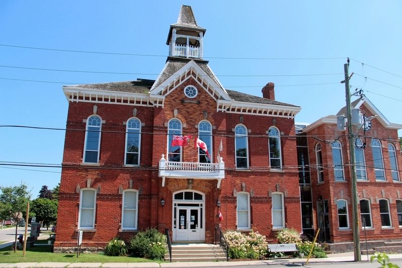
Acton Town Hall Marker
| On Willow Street North at Bower Street, on the right when traveling north on Willow Street North. |
| On Fairview Street, 0.4 kilometers east of Maple Avenue, on the right when traveling west. |
| Near Guelph Line, 0.2 kilometers north of Pinemeadow Drive. |
| On Lakeshore Road, 0.4 kilometers west of Brant Street, on the right when traveling west. |
| On Lakeshore Road at Burlington Avenue, on the right when traveling east on Lakeshore Road. |
| On Lakeshore Road, 0.1 kilometers east of Maple Avenue, on the right when traveling east. |
| On Lakeshore Road at North Shore Boulevard East, on the right when traveling south on Lakeshore Road. |
| On Lakeshore Road, 0.1 kilometers east of Maple Avenue, on the right when traveling east. |
| On Brant Street at Ontario Street, on the right when traveling south on Brant Street. |
| On Brant Street at Elgin Street, on the right when traveling north on Brant Street. |
| On Tuck Drive, 0.1 kilometers north of Spruve Avenue, on the right when traveling north. |
| On Plains Road East at Waterdown Road, on the right when traveling west on Plains Road East. |
| Near North Shore Boulevard at Las Salle Park Boulevard. |
| On North Shore Boulevard West, 0.1 kilometers east of La Salle Park Road, on the right when traveling east. |
| On Plains Road West, 0.4 kilometers east of Botanic Drive, on the right when traveling east. |
| On Main Street East at Charles Street, on the right when traveling west on Main Street East. |
| On Brown Street just west of King Street, on the right when traveling west. |
| On Trafalgar Road at Sumner Street, on the right when traveling north on Trafalgar Road. |
| On Lakeshore Road East at George Street, on the right when traveling east on Lakeshore Road East. |
| On Trafalgar Road at Sumner Avenue, on the right when traveling north on Trafalgar Road. |
| On Navy Street, 0.1 kilometers south of King Street, on the left when traveling south. |
| On Navy Street at William Street, on the right when traveling south on Navy Street. |
| On Randall Street at Thomas Street, on the right when traveling west on Randall Street. |
| On Navy Street at William Street, on the right when traveling south on Navy Street. |
| On Cornwall Road, 0.2 kilometers west of Trafalgar Road, on the right when traveling east. |
| On Walker Street, 0.1 kilometers east of Chisholm Street, on the right when traveling east. |
| On Trafalgar Road at Sumner Avenue, on the right when traveling north on Trafalgar Road. |
| On Walker Street, 0.2 kilometers east of Chisholm Street, on the right when traveling east. |
| On Randall Street at Thomas Street, on the right when traveling west on Randall Street. |
| On Cornwall Road, 0.2 kilometers west of Trafalgar Road, on the right when traveling east. |
| On Lakeshore Road East near George Street, on the right when traveling east. |
| On Front Street at Thomas Street, on the right when traveling east on Front Street. |
| On Lakeshore Road East near George Street, on the right when traveling east. |
| On Walker Street, 0.1 kilometers east of Chisholm Street, on the left when traveling west. |
| On Trafalgar Road at Sumner Avenue, on the right when traveling north on Trafalgar Road. |
| On Cornwall Road, 0.2 kilometers west of Trafalgar Road, on the right when traveling east. |
| On Navy Street at Church Street, on the left when traveling north on Navy Street. |
| On Navy Street at William Street, on the right when traveling south on Navy Street. |
| On Navy Street at William Street, on the right when traveling south on Navy Street. |
| On Randall Street near Thomas Street, on the right when traveling west. |
| On Navy Street at William Street, on the right when traveling south on Navy Street. |
| On Reynolds Street at Palmer Avenue, on the left when traveling north on Reynolds Street. |
| On Cornwall Road, 0.2 kilometers west of Trafalgar Road, on the right when traveling east. |
| On Trafalgar Road at Sumner Avenue, on the right when traveling north on Trafalgar Road. |
| On Walker Street, 0.1 kilometers east of Chisholm Street, on the left when traveling west. |
| On Walker Street, 0.1 kilometers east of Chisholm Street, on the right when traveling east. |
| On Randall Street at Thomas Street, on the right when traveling west on Randall Street. |
| On Trafalgar Road at Sumner Avenue, on the right when traveling north on Trafalgar Road. |
| On Lakeshore Road East at George Street, on the right on Lakeshore Road East. |
| On Navy Street at William Street, on the right when traveling south on Navy Street. |
| On Walker Street, 0.1 kilometers east of Chisholm Street, on the right when traveling east. |