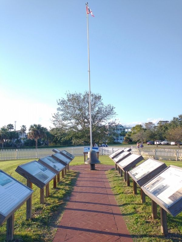
The 1st Tybee Island Day Mark
When James Oglethorpe established the British colony in 1733, he recognized the need for a lighthouse on Georgia's coast, and and ordered that one be built on Tybee Island. When the wooden tower was completed in . . . — — Map (db m210677) HM
Orange Crush made its formal debut in 1988 as a beach bash for Savannah State University students celebrating the end of the school year. Kenneth Flowe, one of the original organizers of Orange Crush, described how the intention of the event was to . . . — — Map (db m251838) HM
Following the War Between the States, the United States Lighthouse Service decided to rebuild the Tybee Island Lighthouse in 1866. Due to increased shipping activity in the South during Reconstruction, the Lighthouse Service reclassified the . . . — — Map (db m210680) HM
The second Tybee School remained open until 1988 when it closed due to not meeting local intergration requirements that were the result of Tybee's demographics and Chatham County refusing to bus students from Savannah to Tybee Island. The old school . . . — — Map (db m252164) HM
The reclassification of the Tybee Lighthouse as a "First Order light required significant changes to the light station. It now required 3 Light Keepers, so housing had to be constructed for them and their families. The light station was located on . . . — — Map (db m210686) HM
In 2019, Tybee Island was designated a UNESCO Site of Memory as a documented trans-Atlantic location where kidnapped African men, women, and children who survived the Middle Passage arrived. Fifty-three ports line the coast of the continental . . . — — Map (db m253751) HM
In 2019, Tybee Island was designated a UNESCO Site of Memory as a documented trans-Atlantic location where kidnapped African men, women, and children who survived the Middle Passage arrived. Fifty-three ports line the coast of the continental . . . — — Map (db m253754) HM
Tybee Island was named by the Indians who came from the interior to hunt and fish. Settled since the beginning of the colony of Georgia, it was the scene in 1775 of the first capture by the first Provincial vessel commissioned by any Congress in . . . — — Map (db m44320) HM
A Black fish camp once thrived at the location of what is today, A.J. 's Dockside restaurant. In the 1930s, several Black families lived along the Back River in a village of shanty homes known as a "fish camp." Navigating the coastal waterways was . . . — — Map (db m251910) HM
The Tybrisa Pavilion II
The Tybrisa Pavilion stood for three-quarters of a century as a landmark on the South Atlantic Ocean. Built in 1891 by the Central of Georgia Railroad, it became a well known destination for day-trippers and seasonal . . . — — Map (db m13778) HM
"But is not the slave trade entirely a war with the heart of man? And surely that which is begun by breaking down the barriers of virtue involves in its continuance destruction to every principle, and buries all sentiments in ruin"! - Olaudah . . . — — Map (db m253772) HM
In the early 1960s, Savannah Beach, now Tybee Island, GA, was the site of Civil Rights protests called wade-ins, akin to the sit-in demonstrations of the time.
These protests, planned and conducted by the NAACP Savannah Youth Council, sought to . . . — — Map (db m200228) HM
General George C. Marshall and his wife Katherine played an important role in the formation of the Girl Scout Troops on Tybee Island. General Marshall, who was the commander of Fort Screven 1932-1933, served as a reference for two of the captains . . . — — Map (db m252303) HM
The 3rd Tybee Island Day Mark/Lighthouse 1773 - 1861
A third lighthouse was begun in 1768 and completed in early 1773. To prevent future loss to the fury of the Atlantic, the third light was constructed well inland, away from wave action, . . . — — Map (db m210678) HM
The Middle Passage is a scar on the history of humanity. It is not a single race, religion or country's responsibility to bear; it belongs to the world. The enslavement of Africans was a global system that lasted more than 300 years. The Middle . . . — — Map (db m253753) HM
(top)
In October 2006, the founding members conceived the idea of a lifelong monument for Tybee Island residents and visitors to commemorate veterans from all branches of all wars, conflicts and hostilities.
Founding Committee . . . — — Map (db m252483) WM
Between February 21 and April 9, 1862, Federal troops under Gen. Quincy A. Gillmore erected 36 guns in 11 batteries, extending eastwardly on Tybee Island from Lazeretto Creek opposite Fort Pulaski. Two of the Federal batteries consisted of rifled . . . — — Map (db m7545) HM
One of the most prosperous businesses on Tybee Island, with a 40-year tenure, was Walter "Contractor" Brown's Cement Plant. Mr. Brown, who was born in 1917 on Daufuskie Island, South Carolina and moved to Tybee as a teenager, having completed his . . . — — Map (db m251848) HM
Joseph "Thomas" Gilyard's Hutment sat at this location from 1975 to 2007. Gilyard used the building as a guest cottage and a place to spend time with friends. It was never used as a primary residence. The hutment was donated to the Tybee Island . . . — — Map (db m251853) HM
1933 marked the end of prohibition and the beginning of a new era for music on Tybee Island. Famous Black musicians of National and International renown preformed jazz and swing with Big Bands on Tybrisa, a trend that would last until the late . . . — — Map (db m251828) HM
James Adams had an oyster house on Chatham Avenue that he rented from Amy and Jeff Dickey. His partner in the oyster business was Jack Munjon from Daufuskie Island, South Carolina. In the fall, James and Jack would go out to harvest oysters. In . . . — — Map (db m251905) HM
The Alger Avenue neighborhood was a small community of Tybee Black residents. The buildings were simple and efficient cinder block homes with hipped roofs. Some, but not all of Alger's residents and places have been documented. Most of this . . . — — Map (db m251842) HM
Walter Brown Sr., owner of the Brown Cement Factory moved to Tybee from Daufuskie Island, South Carolina when he was a teenager. Over the years, Brown built up a successful cement business and eventually constructed a home for his growing family on . . . — — Map (db m251855) HM
The Tybee Island Lighthouse was originally built and controlled by the British Crown. After the Revolutionary war, ownership was transferred to the new colony of Georgia. In 1790, Georgia transferred ownership to the new federal government and the . . . — — Map (db m210684) HM
Louis Green and Joseph Sanders
WWI Veterans, Employees of Hotel Tybee, 1910s
Louis Green and Joseph Sanders both listed their residence as Tybee on their draft registration and were reported in the newspaper as men from Chatham County who . . . — — Map (db m252414) HM
Brutus
Waterman, 1860s
Brutus was an enslaved man who later escaped slavery in 1861. He expertly traversed Tybee Island's waterways, impressing Union military officers with his navigational skills and his knowledge of the local . . . — — Map (db m252454) HM
The destruction of the lighthouse was a disappointment to Olmstead and the Confederate
forces. Olmstead stated that "although the fire entirely destroyed all the wood work of the interior, the solid brick shaft was left standing like a chimney and . . . — — Map (db m210679) HM
Journal of the Light-House Stationat at Tybee Island, Ga.
August 7, 1878
Early on the evening of the unit. An incident occurred which aroused the station to such a degree of excitement that had a stranger come suddenly upon the . . . — — Map (db m210688) HM
Troop 16, the first Tybee Island based troop, had its initial meeting on May 28, 1934. "Army Wives" were the initial lead-ers. The army sponsored the troop and meetings were held from 1935 on at a Scout Hut specially built at the Fort for the Girl . . . — — Map (db m252279) HM
Lighthouses were designed to have different paint schemes or "day marks” on their exteriors. This made the Lighthouse recognizable during the daytime when the light could not be seen. Once established, it was rare for a day mark to change. However, . . . — — Map (db m210683) HM
Until recently 1000 watt bulbs were used in most first-order Fresnel lenses. The light produced by the 1000 watt bulb combined with the magnification power of the Fresnel lens, can be seen for over 20 miles at sea and can be measured in hundreds of . . . — — Map (db m210682) HM
Savannah River Light
Name: Cockspur Lighthouse
Location: entrance of the south channel of the Savannah River
Date Built: 1849
Date Deactivated: 1909
Height: 45 feet
Light: Fourth-Order Fresnel Lens
Savannah River Light
Name: Tybee . . . — — Map (db m210690) HM
Dorothy Jackson (top), older daughter of Tybee Head Keeper George Jackson, was an original member of Troop 16 at Fort Screven. Her younger sister Grace was a member of Troop 16 and then Troop 15. They both served as scribes for their troops, writing . . . — — Map (db m252286) HM
Fort Screven - 1911
(located on the left)
The Fort Screwen Fire Station was built in 1911 for a sum on $2,860, which would amount to $84,000 in 2022. In 1912 the electric light system was installed for a sum of $63. Prior to . . . — — Map (db m252236) HM
An article in the Savannah Evening Press on October 13, 1937 stated, "The troop having no hall of its own had to hold meetings in first one place and then another. In 1935 through the efforts of General Van Horn Moseley a beautiful rustic hut was . . . — — Map (db m252275) HM
The City of Tybee Island, by comparison to our neighbor Savannah, is a relatively young city. The city was chartered in 1887 as Ocean City, and a year later the name was changed to Town of Tybee. Tybee Island was developed as a seaside resort town . . . — — Map (db m252028) HM
The Cockspur Island Lighthouse, located in front of you was built in 1856. Six years later it was a silent witness to the Battle of Fort Pulaski. On April 10-11, 1862, the lighthouse was located midway between Union forces here on Tybee Island and . . . — — Map (db m292061) HM
In March of 2010, the Tybee Island Historical Society moved the Fogarty-Hosti Cottage to the property adjacent to the Tybee Island Light Station, and the cottages restoration was completed in 2011. This move from Butler Avenue to the Tybee Island . . . — — Map (db m252437) HM
There were four Enlisted Men's Barracks located on Fort Screven but only one remains. The remaining Enlisted Men's Barrack building was built in 1910 and could sleep 109 men It was built at a cost of $24,523 which would amount to $720,000 in 2022. . . . — — Map (db m252005) HM
This island became the "platform" on which
the Union Army mounted 36 pieces of heavy
artillery in early 1862. The bombardment that
began on April 10 led to the surrender of
Fort Pulaski 30 hours later. The placement of
these batteries can be . . . — — Map (db m292062) HM
Tybee Lighthouse was re-classified as a major aid to navigation in 1866 and a First-Order Fresnel lens was installed in 1867. The lens, with a height of 9 feet and a 6-foot diameter, has 320 glass prisms. Lard was used to keep the light lit in 1867, . . . — — Map (db m210681) HM
Fort Screven Bakery - 1914
(Located on the left)
The Fort Screven Bakery was built in 1914 for a sum of $6,911.00, which. would amount to $193,000 in 2022.
In 1940 the new bakery equipment was installed at a cost of $5,400 . . . — — Map (db m252120) HM
In military terms, a hutment is a group of huts on an Army campsite; however, on Tybee the word refers to a singular structure. Initially located at the north end of Hosti Avenue, the Gilyard hutment was given free of charge to Joseph Thomas Gilyard . . . — — Map (db m252349) HM
The Immortal 600 were a group of Confederate officers held prisoners of war at Fort Pulaski during the bitterly cold winter of 1864-1865. They were moved here from Charleston where they had been placed in the line of artillery fire in retaliation . . . — — Map (db m5076) HM
The Fort Screven District is a nationally recognized Historic District. The first buildings to be built for Fort Screven were the six Endicott Period Batteries, that would be used for coastal defense. All of which were constructed between the years . . . — — Map (db m200251) HM
Annie Dickerson
Lodging House Owner, early 1900s
Annie Dickerson opened Brown's Cottage in 1913 to provide lodging and catering services for Black visitors to the island. Brown's Cottage served as both a lodging place and catering . . . — — Map (db m252418) HM
The Tybrisa pier and pavilion has a long history on Tybee Island. The original Tybrisa pier and pavilion was built around the turn of the 20th century as a segregated event venue for the Georgia of Central Railroad. It included a bandstand, a dance . . . — — Map (db m252015) HM
Veterans Day
11 November 1987
The citizens of Tybee Island an members of American Legion Post 154 dedicate this plaque to honor Tybee Island residents who served with distinction in the Armed Forces of the United States during the Korean War and . . . — — Map (db m253834) WM
Please enjoy our garden, but do not pick the fruits of our labor, these are for our current keepers. Thank you.
The keepers of the Tybee Island Light Station were required to have a garden by the United States Lighthouse Service. In the 1927 . . . — — Map (db m210700) HM
With the creation of the Tybee Road in 1923, the automobile came to Tybee Island. This meant that the keepers could have a vehicle to help them work and move around the island more freely than before. With the addition of the automobile came the . . . — — Map (db m210710) HM
Albertha “Bertha” Lucas Tattnall and Edward “Bones” Tattnall
Fishing Industry Workers, mid-1900s
Edward Tattnall was born in the 1890s on Wilmington Island, Georgia. As an adult he lived on Tybee Island with his wife Alberta "Bertha" . . . — — Map (db m252405) HM
T.J. Carter
Builder and Businessman, 1880s-early 1900s
T.J. Carter was a prolific contractor and builder who worked in and around Savannah. According to a 1914 article in The Savannah Tribune, Carter was a native of the city. He . . . — — Map (db m252448) HM
Type of Light: Texas Tower
Location: at the mouth of the Savannah River
Date Built: 1922 Date Lit:1964 Date Deactivated: 1996
Height: unknown Light: DCB 24
This front range light was hit by the container ship from Singapore called Neptune . . . — — Map (db m210694) HM
This recreated gun battery marks the center of the Union lines. Between February and April 1862, eleven gun batteries were erected on Tybee Island. A battery was not located on this site, but the cannon on the left is an original from the battle. . . . — — Map (db m292060) HM
Named for General Casimir Pulaski, the Polish hero who was mortally wounded at the siege of Savannah, 1779, Fort Pulaski was built in accordance with plans by General Simon Bernard, formerly chief engineer under Napoleon. Begun in 1829 and . . . — — Map (db m5037) HM
The City of Tybee Island was incorporated in 1887, and a small year round population had developed creating a need for local services including a school. The first Tybee School was in an old wooden structure at the turn of the century, and a new . . . — — Map (db m252133) HM
Prelude to Disaster
On September 19, 1918, 574 Coastal Artillery Corps (CAC) officers and troops from the surrounding Georgia counties, including Chatham, set out by train from Tybee Island to New York under the command of 2nd Lt. Sam Levy. . . . — — Map (db m200243) HM
Sacred to the Memory of Veterans of World Wars
Chatham Post No. 36
Savannah Post No. 135
American Legion
They served for God and
Country to promote peace
and good will on Earth. — — Map (db m210674) WM
The Fuel Storage Building was completed in 1890. It's red roof marked that there were flammable substances inside. This is where the keepers would have kept the fuel for the light. Note the metal roof, brick walls, and a brick floor, which was an . . . — — Map (db m210696) HM
On September 19, 1918, 574 US Army officers and enlisted men departed Fort Screven under the command of 2nd Lt Samuel E. Levy to board the British troopship H.M.S. Otranto. The ship departed New York carrying more than 1025 U.S. soldiers and . . . — — Map (db m200247) HM
The Head Keeper's Cottage was built in 1881 after the previous dwelling had suffered extreme damage during a tropical cyclone that hit in 1871. The house was built for a sum of $6,000 which would be $160,500 in 2021.
The restoration was . . . — — Map (db m210699) HM
On August 17, 1960, eleven African-American students were arrested six blocks north of here at Georgia's first wade-in protesting the Whites-only public beaches. During the era of segregation, Savannah's African Americans were forced to travel . . . — — Map (db m251770) HM
The Second Assistant Keeper's Cottage was believed to have been built from the remains of an 1861 barracks building which housed soldiers during the Civil War. In 1867, the 2nd Assistant Keeper was assigned to live in the cottage.
The . . . — — Map (db m210698) HM
The Summer Kitchen is the second oldest building on the property. All of the cooking for the site was done in this building until 1910. Cooking away from the main homes reduced the likelihood of fire in the houses and kept them cooler in the hot . . . — — Map (db m210709) HM
A lighthouse on Tybee was one of the first public structures in Georgia. Completed in 1736 by William Blithman of cedar piles and brickwork, its 90 foot height made it the loftiest in America. Destroyed
in a storm, it was replaced by another . . . — — Map (db m7423) HM
Erected To
The Memory And Honor Of
The Men Who Served Their
Country During World War II
From Savannah Beach
1946
★ Bordley, George
★ Bryan, Clifford Jennings
★ Manning, O.D.
★ Waszkiewicz, Lawrence . . . — — Map (db m253791) WM
The Legislature of Georgia in 1786 passed a law providing for a fort on Cockspur or Tybee Island to be named in honor of General James Screven, Revolutionary War hero. It was never built by the state. In 1808 the Federal government obtained . . . — — Map (db m210473) HM
" The result of this bombardment must
cause, I am convinced, a change in the
construction of fortification as radical
as that foreshadowed in naval architecture
by the conflict between the Monitor and
Merrimac. No works of stone or brick
can . . . — — Map (db m13224) HM
(Top)
This is the only cemetery on Tybee Island and much of its history remains shrouded in mystery. It is believed that the township established a small plot of land in the 1870s to provide victims of shipwrecks (and other drowning . . . — — Map (db m252231) HM
Designed and built in 1848 by renowned architect John S. Norris to mark the entrance to the South Channel of the Savannah River, the Cockspur Island Lighthouse was destroyed by a hurricane in 1854. A larger replacement was built on the same . . . — — Map (db m47201) HM
Thirty-six big guns on Tybee Island, 1 to 1½ miles away, converged their fire on the fort. The bombardment proved that rifled cannon could destroy masonry forts. — — Map (db m67816) HM
April 10, 1862: The Confederates refused a formal demand to surrender because enemy guns were a mile away—more than twice the effective range of heavy artillery of the day. When Union troops opened fire, their new rifled cannons fired . . . — — Map (db m134110) HM
After the repeal of the anti-slavery provision in the Charter of the Colony of Georgia on 1749, an act permitting the importation of slaves ordered the erection of a Lazaretto (Quarantine Station) on Tybee Island. Not until 1767 were 104 acres . . . — — Map (db m12953) HM
Activated just prior to the Spanish-American War and inactivated at the close of World War II, Fort Screven served as a military post for almost 50 years. During that time, Fort Screven was a coast artillery installation, an infantry post, District . . . — — Map (db m13076) HM
Acting Brigadier General Quincy Adams Gillmore led the Union artillery attack on Fort Pulaski. Because the US Army originally built the fort, he knew its strengths and weaknesses and targeted the angle in front of you. Within range of Tybee . . . — — Map (db m134112) HM
On January 5, 1914, the Rotary Club of Savannah met for the first time at the DeSoto Hotel. Founded by John S. Banks and a group of local businessmen, this was the second Rotary club established in Georgia. The nation’s first service club, Rotary . . . — — Map (db m108958) HM
A pioneer in women’s education, Nina Anderson Pape completed her studies at Columbia University. She founded the Froebel Circle, which educated the poor children of Savannah’s Yamacraw Village; and Tybee Island’s Fresh Air Home for disadvantaged . . . — — Map (db m8659) HM
After the war broke out, wooden frame barracks were built by North and South at permanent installations such as forts, arsenals, coastal installations, and training camps. In winter, smaller barracks were constructed with available materials and man . . . — — Map (db m129426) HM
This fountain was donated to the City of Tybee Island by Nicholas Charles Alexander in loving memory of his wife Voncyle. Nickie, as he was known to his many friends, was a Tybee icon, a City Council member, business owner and shrewd entrepreneur. . . . — — Map (db m252171) HM
On September 25, 1918, the British troopship H.M.S. Otranto left New York carrying more than 1,025 U.S. soldiers and crewmen as part of a convoy headed to fight in Europe during World War I. Most of the soldiers onboard had trained at Fort . . . — — Map (db m159278) HM
To honor the memory of two gallant gentleman
of South Carolina. Thomas Fenwick Drayton;
Brigadier-General, C.S.A. and his brother
Commodore Percival Drayton, U.S.N., Captain
of U.S.S. Hartford, and later the first Chief
of Naval Operations. . . . — — Map (db m16499) HM
End of U.S. 80
Tybee Island
Korean War Veterans
Memorial Highway
Dedicated 4/7/08 by the
Republic of Korea
and a grateful nation — — Map (db m252503) WM
With devastating accuracy, Union rifled artillery breached the southeast angle of Fort Pulaski in less than 30 hours. It took Federal troops six weeks to repair the battle damage. For the remainder of the war, Fort Pulaski was a Union outpost in the . . . — — Map (db m134098) HM
Fish Hall Plantation This plantation was part of a 1717 Proprietary landgrant of 500 acres to Col. John Barnwell. Later owners included members of the Green, Ellis, and Pope families. Nearby tabby ruins are remains of fire places of slave . . . — — Map (db m6625) HM
Georgia's coast stretches for approximately 100 miles from the Savannah River in the north to the St. Marys River in the south.
Separating the mainland from the Atlantic Ocean is a series of barrier islands. These islands are several miles . . . — — Map (db m301252) HM
Anchor
circa 1849
Salvaged from the sunken
wreck of an old wooden sailing
ship discovered several miles off
the north shore of Tybee Island.
This anchor, ballast rock and
and some iron debris were all that . . . — — Map (db m251821) HM
This is the historic cupola that topped the Cockspur Island Lighthouse. The cupola protected the powerful Fresnel lens at the top of the lighthouse tower. In 1995, preservation staff discovered several structural cracks in the cupola and removed it . . . — — Map (db m134077) HM
The election of Abraham Lincoln in 1860 brought years of festering political differences between Southern and Northern states to a head. In mid-January 1861 Georgia delegates voted to secede from the Union. The April 1861 bombardment and surrender . . . — — Map (db m19676) HM
The armed schooner "Liberty", the first American Naval vessel officially commissioned early in July 1775 by a Provincial Congress, sailed from this port. She was commanded by Oliver Bowen and Joseph Habersham and carried ten carriage guns and fifty . . . — — Map (db m20314) HM
"The Soldier above all other people prays for peace for he must suffer and bear the deepest wounds and scars of war." General Douglas MacArthur
Georgia remembers its citizen/soldier
Participation and sacrifices for duty, . . . — — Map (db m215905) WM
To the memory of
our fellow citizens
who died
in defense of the government. 1861 – 65
Erected 1873
Antietam • Gettysburg • Vicksburg • Fort Fisher • Appomattox • Atlanta • New Berne • Roanoke Island . . . — — Map (db m27336) WM