58 entries match your criteria.
El Camino Real de los Tejas National Historic Trail Historical Markers
National Park Service designated El Camino Real de los Tejas a National Historic Trail in 2004. During the Spanish colonial period in America royal roads tied far-flung regions with Mexico City. One of these, El Camino Real de los Tejas, was overland route from what is now Mexico, across the Río Grande through Texas, to the Red River Valley in what is now Louisiana. Routes used by Spanish explorers followed established Indian trails and trade routes dating to prehistoric times.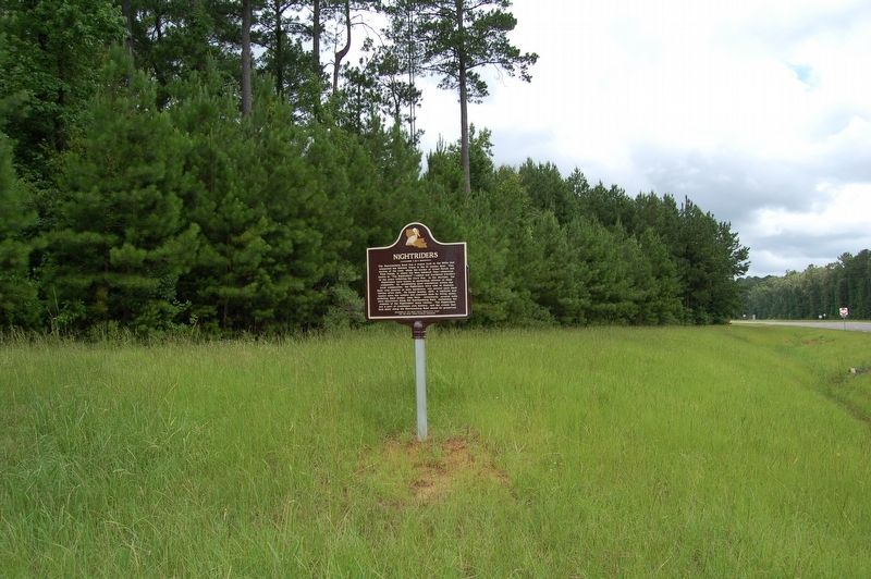
By Cajun Scrambler, June 28, 2019
Nightriders Marker
| 1 ► Louisiana, Grant Parish, Georgetown — Nightriders — |
| On U.S. 167 at State Highway 500, on the right when traveling south on U.S. 167. | |||
| 2 ► Louisiana, Natchitoches Parish, Grand Ecore — U.S. Military Road #11 — |
| Near Par Road 429 west of Natchitoches-Winnfield Highway (State Highway 6), on the right when traveling west. | |||
| 3 ► Louisiana, Natchitoches Parish, Natchitoches — El Camino Real — King's Highway — Old San Antonio Trace — |
| On Washington Street (State Highway 6) at Lafayette Street, on the right when traveling north on Washington Street. | |||
| 4 ► Louisiana, Natchitoches Parish, Robeline — El Camino Real — Kings Highway — Old San Antonio Road — |
| On Natchitoches Highway (State Highway 6) at State Highway 485, on the left when traveling east on Natchitoches Highway. | |||
| 5 ► Louisiana, Natchitoches Parish, Robeline — El Camino Real de los Tejas — (Royal Road of the Tejas Indians) — |
| On State Highway 485, 1 mile north of Natchitoches Hwy. (Route 6), on the left when traveling north. | |||
| 6 ► Louisiana, Natchitoches Parish, Robeline — Los Adaes — |
| On State Highway 485 at Natchitoches Highway (Route 6), on the right when traveling north on State Highway 485. | |||
| 7 ► Louisiana, Sabine Parish, Many — El Camino Real — King's Highway — San Antonio Trace — |
| On Texas Highway (State Highway 6), on the right when traveling east. | |||
| 8 ► Louisiana, Sabine Parish, Many — El Camino Real — Kings Highway — Old San Antonio Road — |
| On Old Louisiana 6 (State Highway 485) at Geoghangan Road, on the right when traveling north on Old Louisiana 6. | |||
| 9 ► Texas, Atascosa County, Jourdanton — 223 — Atascosa County — |
| On Campbell Avenue at Circle Drive, on the left when traveling north on Campbell Avenue. | |||
| 10 ► Texas, Austin County, San Felipe — 11707 — Early Roads To San Felipe — |
| On Farm to Market 1458, 0.2 miles north of 2nd Street, on the left when traveling north. | |||
| 11 ► Texas, Bastrop County, Bastrop — 9151 — Early History of the City of Bastrop — |
| On Loop State Highway 150 at Park Road 1, on the right when traveling west on State Highway 150. | |||
| 12 ► Texas, Bastrop County, Smithville — 9231 — Smithville — |
| On Main Street. | |||
| 13 ► Texas, Bexar County, San Antonio, Alamo Plaza — Acequia (Irrigation Ditch) — |
| 14 ► Texas, Bexar County, San Antonio, Alamo Plaza — Founding of the Mission and Origin of Name — |
| Near Alamo Plaza. | |||
| 15 ► Texas, Bexar County, San Antonio, Alamo Plaza — The Mission Period — 1716 - 1793 — |
| Near Alamo Plaza at East Houston Street. | |||
| 16 ► Texas, Bexar County, San Antonio, Harlandale — Mission San José / La Misión de San José — |
| 17 ► Texas, Bexar County, San Antonio, Harlandale — The Mission Road / El Camino de las Misiones — |
| 18 ► Texas, Bexar County, San Antonio, Main/Military Plaza — 748 — The Casas Reales — |
| On Market Street at West Main Plaza, on the left when traveling east on Market Street. | |||
| 19 ► Texas, Bexar County, San Antonio, Uptown — Comanche Lookout — |
| Near Nacogdoches Road (Farm to Market Road 2252) at Toepperwein Road, on the right when traveling west. | |||
| 20 ► Texas, Bexar County, San Antonio, Uptown — 1409 — Route of El Camino Real — |
| On Nacogdoches Road at Loop Interstate 410, on the right when traveling south on Nacogdoches Road. | |||
| 21 ► Texas, Brazos County, Bryan — 8706 — Route of El Camino Real — (Also known as Old San Antonio Road and Old Spanish Road) — |
| On Old San Antonio Road, 0.2 miles north of Texas Highway 21, on the right when traveling west. | |||
| 22 ► Texas, Burleson County, Caldwell — 50 — Kings Highway — Camino Real — Old San Antonio Road — |
| On Presidential Corridor E (State Highway 21) at County Road 216, on the right when traveling west on Presidential Corridor E. | |||
| 23 ► Texas, Caldwell County, San Marcos — 73 — Kings Highway — Camino Real — Old San Antonio Road — |
| On State Highway 21, 0.9 miles east of Airport Drive, on the right when traveling east. | |||
| 24 ► Texas, Cherokee County, Alto — 6971 — Mound Prairie |
| On State Highway 21, 6.2 miles west of Marcus Street (U.S. 69), on the right when traveling east. Reported missing. | |||
| 25 ► Texas, Goliad County, Goliad — 4119 — Presidio de Nuestra Señora de Loreto de la Bahía — (Fort of Our Lady of Loreto of the Bay) — |
| On Camino de Bexar east of Calle Cinco de Mayo. | |||
| 26 ► Texas, Goliad County, Goliad — 3409 — Site of the Mission Nuestra Señora del Espiritu Santo de Zúñiga — |
| On Park Road 6, 0.2 miles west of South Jefferson Street (U.S. 183), on the right when traveling west. | |||
| 27 ► Texas, Hays County, San Marcos — Col. Ignacio Elizondo’s 1813 Campaign — |
| On Old Bastrop Road, 0.8 miles south of San Marcos Highway (Texas Highway 80), on the left when traveling south. | |||
| 28 ► Texas, Hays County, San Marcos — 10256 — Don Felipe Roque de la Portilla — |
| On North Old Bastrop Highway (County Route 266) 1.2 miles south of San Marcos Highway (Texas Highway 80), on the right when traveling south. | |||
| 29 ► Texas, Hays County, San Marcos — El Camino De Nacogdoches |
| On Old Bastrop Highway, on the right when traveling east. Reported missing. | |||
| 30 ► Texas, Hays County, San Marcos — 74 — Kings Highway — Camino Real — Old San Antonio Road — |
| On South Old Bastrop Highway (County Road 266) at Staples Road (Farm to Market Road 621), on the right when traveling east on South Old Bastrop Highway. | |||
| 31 ► Texas, Hays County, San Marcos — 75 — Kings Highway — Camino Real — Old San Antonio Road — |
| On South Old Bastrop Highway (County Road 266) at Center Point Road (County Road 234), on the right when traveling west on South Old Bastrop Highway. | |||
| 32 ► Texas, Hays County, San Marcos — 10293 — McGehee Crossing — |
| On San Marcos Highway (State Highway 80) at Old Bastrop Road (County Route 266), on the right when traveling west on San Marcos Highway. | |||
| 33 ► Texas, Hays County, San Marcos — 10311 — Post San Marcos — |
| Near Aquarena Springs Drive south of West Laurel Street, on the right when traveling south. | |||
| 34 ► Texas, Hays County, San Marcos — 10325 — San Marcos Springs — |
| On Spring Lake at West Laurel Street, on the right when traveling west on Spring Lake. | |||
| 35 ► Texas, Hays County, San Marcos — 10319 — Site of the First Town of San Marcos — |
| On North Old Bastrop Highway (County Route 266) 1.2 miles south of San Marcos Highway (Texas Highway 80), on the right when traveling south. | |||
| 36 ► Texas, Hays County, San Marcos — 10338 — Wonder Cave — |
| Near Prospect Street at Allen Street, on the right when traveling north. | |||
| 37 ► Texas, Houston County, Weches — 7013 — Mission San Francisco de Los Tejas — |
| 38 ► Texas, Kinney County, Brackettville — 17807 — Las Moras Spring — |
| Near Swim Park Lane west of Fort Clark Road, on the right when traveling north. | |||
| 39 ► Texas, La Salle County, Cotulla — 112 — Kings Highway — Camino Real — Old San Antonio Road — |
| On Tilden Street (State Highway 97) at North Front Street, on the right when traveling east on Tilden Street. | |||
| 40 ► Texas, Madison County, Normangee — 9621 — El Camino Real — The Old San Antonio Road — |
| On Old San Antonio Road at Texas Highway 39, on the left when traveling west on Old San Antonio Road. | |||
| 41 ► Texas, Milam County, Rockdale — 17269 — Apache Pass River Crossing — |
| Near Farm to Market Road 908 at County Road 428, on the right when traveling west. | |||
| 42 ► Texas, Milam County, Rockdale — 14050 — Site of Mission San Francisco Xavier de Los Dolores — |
| On Farm to Market Road 908, 0.5 miles east of County Road 432, on the right when traveling west. | |||
| 43 ► Texas, Milam County, Rockdale — 7988 — Site of the Mission Nuestra Señora de la Candelaria — |
| On County Road 432, 0.2 miles south of Farm to Market Road 908, on the left when traveling south. | |||
| 44 ► Texas, Milam County, Rockdale — 7990 — Site of the Mission San Ildefonso — |
| On County Road 429, 0.3 miles south of Farm to Market Road 908, on the left when traveling south. | |||
| 45 ► Texas, Nacogdoches County, Chireno — 9276 — Halfway Inn — (Flournoy - Granberry House) — |
| On State Highway 21, 0.5 miles west of Farm to Market Road 95, on the left when traveling east. | |||
| 46 ► Texas, Nacogdoches County, Nacogdoches — 9243 — Ancient Mound — |
| On North Mound Street, on the right when traveling north. | |||
| 47 ► Texas, Nacogdoches County, Nacogdoches — 9400 — Texas Stagecoaches, C.S.A. — |
| On East Main Street at North Fredonia Street, on the right when traveling west on East Main Street. | |||
| 48 ► Texas, Robertson County, Benchley — 10908 — El Camino Real — Also known as Old San Antonio Road and Old Spanish Trail — |
| On State Highway OSR, 0.7 miles east of State Highway 6, on the right when traveling west. | |||
| 49 ► Texas, Sabine County, Milam — 2 — Kings Highway — Camino Real — Old San Antonio Road — |
| On State Highway 21, 0.7 miles east of County Highway 3121, on the left when traveling east. | |||
| 50 ► Texas, Sabine County, Milam — 3 — Kings Highway — Camino Real — Old San Antonio Road — |
| On State Highway 21, on the right when traveling west. | |||
| 51 ► Texas, Sabine County, Toledo Bend — 1 — Texas Louisiana Boundary — Kings Highway — Camino Real — |
| On State Highway 21, on the left when traveling east. | |||
| 52 ► Texas, Travis County, Austin — 15083 — Santiago del Valle Grant — |
| Near McKinney Falls Parkway south of Burleson Road, on the right when traveling west. | |||
| 53 ► Texas, Travis County, Austin, Barton Hills — 14883 — Approximate Location of the Missions — |
| Near Barton Hills Drive west of Azie Morton Road, on the right when traveling west. | |||
| 54 ► Texas, Travis County, Austin, Greater South River City — 14903 — Approximate Site Reached by the Espinosa-Olivares-Aguirre Expedition — |
| On South Congress Avenue at University Circle, on the right when traveling north on South Congress Avenue. | |||
| 55 ► Texas, Travis County, Austin, Prominent Point — 12689 — Balcones Fault Aids Colonization of Texas — |
| On North Capital of Texas Highway (State Highway 360) west of Spicewood Springs Road, on the right when traveling south. | |||
| 56 ► Texas, Victoria County, Victoria — 6572 — Tonkawa Bank — Visita of Mission Espiritu Santo — |
| On McCright Drive, 0.2 miles west of North Vine Street, on the left when traveling west. | |||
| 57 ► Texas, Washington County, Brenham — 8361 — La Bahia Road — |
| On State Highway 36 at State Highway FM 390, on the right when traveling north on State Highway 36. | |||
| 58 ► Texas, Wilson County, Floresville — 4866 — Site of Old Town: Lodi — |
| On Trail Street (Farm to Market Road 536) at Goliad Road, on the right when traveling south on Trail Street. | |||