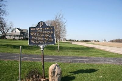
By Dale K. Benington, April 6, 2010
The Wayne Trace Marker
GEOGRAPHIC SORT Title Sort Marker Number Sort Marker Number Sort N Marker Number Sort T Publication Order Sort Publication Order Sort A Erected Year Sort Most Viewed Sort Most Recent-Interest Sort Most Recently Changed Sort SEE FAQ #33 FOR DESCRIPTIONS
On North 400 East, 0.1 miles East North (U.S. 224), on the left when traveling north.
On E. Line St at High St, on the right when traveling west on E. Line St.
On Center Street at Huron Street, on the left when traveling south on Center Street.
On West Main Street at Growth Avenue, on the right when traveling west on West Main Street.
On St. Joseph Blvd at E. State Blvd, on the right when traveling south on St. Joseph Blvd.
On Van Buren Street at Michaels Avenue, on the right when traveling north on Van Buren Street.
On Carroll Road near Madden Road. Reported permanently removed.
On U.S. 24 at Harper Road, on the right when traveling east on U.S. 24.
On Middle Rd at Grissom Ave, on the left when traveling north on Middle Rd.
On Washington Street south of 3rd Street, on the right when traveling south.
On Jackson Street just south of 7th Street, on the right when traveling south.
On County Road 325W at Lowell Rd, on the right when traveling north on County Road 325W.
On 17th St at Orinoco Ave, on the right when traveling west on 17th St.
On Reed St at 9th St, on the right on Reed St. Reported missing.
On 2nd Street at Railroad Rd, in the median on 2nd Street.
Paid Advertisement
On E. Harrison St (State Road 46) at N. Jackson St, on the right when traveling west on E. Harrison St.
On E. Harrison St (State Road 46) at N. Washington St, on the right when traveling west on E. Harrison St.
On East 6th Street west of South Grant Avenue, on the right when traveling west.
On State Road 18 west of County Road N200W, on the right when traveling east.
On South Michigan Street (State Road 352) south of East McConnell Street (State Road 55), on the left when traveling south.
On West Washington Street (State Road 26).
On North Richmond Street at West Van Cleve Street, on the left when traveling north on North Richmond Street.
On E. Huntington St (State Road 18) at S. Main St, on the right when traveling east on E. Huntington St.
On West Main Street (U.S. 136) west of North High Street, on the right when traveling west.
On West Main Street just east of North Lebanon Street (Indiana Route 39), on the right when traveling west.
On State Road 47 west of Evans Road, on the left when traveling east.
On Michigan Road (U.S. 421) at Valley Meadow Drive, on the left when traveling north on Michigan Road.
On W. Hawthorne Street at S. 2nd Street, on the left when traveling west on W. Hawthorne Street.
On State Road 46 at T C Steele Road, on the right when traveling east on State Road 46. Reported missing.
On Indiana Route 29 south of County Road E400N, on the right when traveling south.
Paid Advertisement
On West Monroe Street (State Road 39) near West S Road, on the left when traveling west.
On Bicycle Bridge Road just west of West Monroe Street (Indiana Route 18), on the left when traveling west.
On State Road 29 north of County Road E400N, on the left when traveling north. Reported permanently removed.
On North 5th Street at North Street, on the left when traveling north on North 5th Street.
On West Street north of Summit Street, on the right when traveling north.
On Jersey Avenue east of Ohio River Scenic Byway (Indiana Road 62), on the left when traveling east.
On Market Street (State Road 3) 0.2 miles south of Clark Road, on the right when traveling south.
On Tunnel Mill Road, on the right when traveling south.
On Main Street at Short Street, on the left when traveling east on Main Street.
Near Harrison Avenue west of Bailey Avenue, on the left when traveling west.
On State Road 160 east of Interstate 65, on the right when traveling east. Reported missing.
On Winding Road, 0.1 miles west of U.S. 31, on the left when traveling west.
On East Park Place east of Crestview Court, on the right when traveling east.
On Riverside Drive at Pearl Street, on the right when traveling east on Riverside Drive.
On East National Avenue west of South Harrison Street, on the left when traveling west.
Paid Advertisement
On Forest Avenue (Indiana Route 59) at East National Avenue (U.S. 40), on the right when traveling north on Forest Avenue.
On South Maish Road north of East Wabash Street (U.S. 421), on the right when traveling north.
On South Wyandotte Cave Road (County Road 81) north of Ohio River Scenic Byway (State Road 62), on the left when traveling north.
On Ohio River Scenic Byway (State Road 62) near North 1st Street, on the right when traveling west.
On State Road 58 west of State Road 57, on the right when traveling east.
On E. State Road (State Road 58) west of N. John Street, on the right when traveling west.
On South Meridian Street at Depot Street, on the left when traveling south on South Meridian Street.
On East Main Street west of SE 2nd Street, on the left when traveling west.
On Road W660N at Road 150W, on the left when traveling west on Road W660N.
On NW 1st Street at West Maple Street, on the left when traveling south on NW 1st Street.
On County Road S 300W, 0.1 miles north of U.S. 50, on the right when traveling north.
Near Cumberland Drive, 0.2 miles east of State Road 57.
On S. State Street at Campbell Road, on the right when traveling south on S. State Street.
On East Main Street (State Road 46) west of North Lathrop Street, on the right when traveling west.
On East Main Street (U.S. 421) west of North Franklin Street, on the right when traveling east.
On East Washington Street east of North Broadway Street, on the right when traveling east.
Paid Advertisement
On County Road N80NE at Road E280N, on the right when traveling south on County Road N80NE.
On Wayne Street at Gordon M. Buehrig Place, on the left when traveling south on Wayne Street.
On Jackson Street north of West Eleventh Street, on the left when traveling north.
On Cowen Street, 0.1 miles north of West Keyser Street, on the left when traveling south.
On County Route 56 at Indiana Route 1, on the right when traveling west on County Route 56.
On County Road 68 west of County Road 57, on the right when traveling west.
On South Wayne Street at East Maple Street, on the right when traveling north on South Wayne Street.
On E. Harris St, 0.1 miles east of N. Meridian St, on the left when traveling east.
On County Road 650N, 0.1 miles east of County Line Rd, on the right when traveling east.
On East Memorial Drive west of South Macedonia Avenue, on the left when traveling west. Reported missing.
On West University Avenue west of North McKinley Avenue, on the right when traveling west.
On Macedonia Avenue, on the right when traveling north.
On East Highland Avenue at North Wolfe Street, on the right when traveling east on East Highland Avenue.
On North Newton Street (U.S. 231) just north of West Schuetter Road, on the left when traveling north.
On State Road 120 at State Road 15, on the right when traveling east on State Road 120.
On W. Franklin Street, 0 miles west of S. 5th Street, on the right when traveling west.
Paid Advertisement
On East Jackson Boulevard at Elkhart Avenue, on the left when traveling east on East Jackson Boulevard.
On South 2nd Street at West High Street, on the right when traveling north on South 2nd Street.
On W. Franklin Street at S. 4th Street, on the left when traveling west on W. Franklin Street.
On South 2nd Street at West High Street, on the left when traveling north on South 2nd Street.
On U.S. 33 at County Road 28, on the right when traveling south on U.S. 33.
On Main Street (U.S. 33) at Lincoln Avenue (State Road 4) on Main Street.
On S. 5th Street at Washington Street, on the right when traveling north on S. 5th Street.
On South 5th Street at East Jefferson Street, on the left when traveling north on South 5th Street.
On U.S. 33, 0.3 miles north of County Road 17, on the right when traveling south.
On Bristol Avenue at Railroad Street, on the right when traveling north on Bristol Avenue.
On North Main Street (State Road 19) at Walnut Street, on the right when traveling north on North Main Street.
On E. Market Street (U.S. 6) at S. Summit St, on the right when traveling east on E. Market Street.
On South Grand Avenue (State Road 121) at South Eastern Avenue, on the left when traveling south on South Grand Avenue.
On Main Street (State Road 64) at Fuzzy Way, on the right when traveling west on Main Street.
On East Main Street at East 3rd Street, on the right when traveling east on East Main Street.
On State Street, 0.2 miles south of West Daisy Lane, on the right when traveling south.
Paid Advertisement
On East Oak Street at East 13th Street, on the right when traveling east on East Oak Street.
On Grant Line Road south of Southern Drive, on the right when traveling south.
On East Main Street (Indiana Route 111) east of East 9th Street, on the right when traveling east.
On East Main Street (Indiana Route 111) at East 7th Street, on the right when traveling east on East Main Street.
On Division Street at East 18th Street, on the right when traveling east on Division Street.
587 entries matched your criteria. The first 100 are listed above.
Next 100 ⊳