522 entries match your criteria. Entries 101 through 200 are listed.⊲ Previous 100 — Next 100 ⊳
Civilian Conservation Corps (CCC) Historical Markers
Markers relating to the Great Depression-era New Deal federal work relief program that operated from 1933 to 1942 in the United States for unemployed, unmarried young men from relief families.
By Craig Doda, July 29, 2023
Civilian Conservation Corps Camp Shiloh Encampment Site Marker
On South Lincoln Highway, on the right when traveling east.
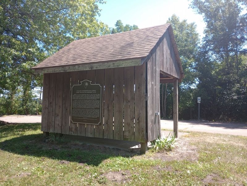
Members of Civilian Conservation Corps Co. V-2657 SP-52 built their barracks on this site in August 1935. The WWI veterans who comprised this CCC encampment named it Camp Shiloh after the burial place of Thomas and Sarah Lincoln. Like all CCC camps . . . — — Map (db m229793) HM
The Ben Fuller House is one of, if not the oldest surviving buildings in DuPage County. The farmhouse was built sometime between 1835 and 1842 by Benjamin Fuller, one of DuPage County’s earliest settlers. Mr. Fuller reportedly arrived to the area . . . — — Map (db m48058) HM
On Lodge Boulevard, on the right when traveling west.
Over the years, about 165,000 individuals were employed in at least 50 Illinois Civilian Conservation Corps camps in Illinois. Many of these worked on projects in Illinois' state parks.
One of the most successful programs to aid Americans . . . — — Map (db m142758) HM
Over the years, about 165,000 individuals were employed in at least 50 Illinois Civilian Conservation Corps camps in Illinois. Many of these worked on projects in Illinois' state parks.
One of the most successful programs to aid Americans . . . — — Map (db m225080) HM
In 1933 the Civilian Conservation Corps (CCC) built the core of Starved Rock Lodge — the lobby, dining room, kitchen and cabins for a cost of $200,000. Also they constructed many of the structures - bridges, shelters, and the trails you see today. . . . — — Map (db m185000) HM
On Illinois Route 123 at Illinois Route 97 on State Route 123.
To the south stands a mature red hawthorne tree, planted around 1930 under the direction of the Garden Clubs of Illinois to beautify the highways leading to Lincoln's New Salem. Several organizations, including the Civilian Conservation Corps, . . . — — Map (db m57346) HM
On State Road 7 at Muscatatuck Park Entrance Road, on the left when traveling north on State Road 7.
Side one:
Opened 1921 as Indiana's fourth state park for its natural beauty and recreation potential. Named Vinegar Mills State Park after stone-cutting mill in park. Renamed Muscatatuck State Park 1922. Stone shelters and stairways, . . . — — Map (db m45877) HM
Near Indiana Route 60, 0.3 miles County Road 950E, on the right when traveling west.
"Created in early 1933, the CCC was an effort by President Franklin Roosevelt to combine the national need for employment with the preservation of natural and historical resources. From May, 1933 until 1942, CCC boys restored village cabins, built . . . — — Map (db m163025) HM
Near Indiana Route 60, 0.3 miles west of County Road 950E, on the right when traveling west.
…our parks and preserves are not mere picnicking
places. They are rich storehouses of memories and
reveries. They are a solace to the aged and an
inspiration to the young.
Richard Lieber, Founder
Indiana State . . . — — Map (db m163028) HM
On Mounds Road (Indiana Route 232) 1 mile north of Donnelly Road (Local Road E100S), on the right when traveling south.
…our parks and preserves are not mere picnicking
places. They are rich storehouses of memories and
reveries. They are a solace to the aged and an
inspiration to the young.
Richard Lieber, Founder
Indiana State . . . — — Map (db m163059) HM
In 1926 the Studebaker Corporation purchased 850 acres from area farmers to develop an automobile proving ground. This same year, the Clubhouse was built for employee lodging, including a caretaker's apartment. The Clubhouse transformed over the . . . — — Map (db m64814) HM
Near Indiana Route 727 just west of Lane 105 Lake James, on the left when traveling west.
The administration building housed the camp offices, army offices, dispensary (medical clinic), supply room and, later, the infirmary (hospital).
[Caption:]
Administration building in the foreground, 1938. — — Map (db m236156) HM
Near Indiana Route 727 south of Lane 100 Lake James, on the left when traveling west.
Most of the six barracks are in areas that later became overgrown with vegetation. Which two are in what is now open picnic area? — — Map (db m236161) HM
Near Route 727 south of Lane 105 Lake James, on the left when traveling west.
The 18 × 26 bath house was shared by at least 180 men in camp.
Company 556 received its training at Ft. Knox, Kentucky. The company was first assigned to Indiana Dunes State Park before moving to Pokagon. — — Map (db m238392) HM
On Indiana Route 727 south of Lane 105 Lake James, on the left when traveling west.
You are standing next to the flagpole site. Looking to the north, toward the current picnic grounds, stood Barrack #1. Notice the trees in the photo. Many of them still stand today. Can you find them? — — Map (db m236157) HM
Near Indiana Route 727 south of Lane 105 Lake James, on the left when traveling west.
The latrine was the outhouse for the camp. It was at four different locations during the lifespan of the camp. Can you find the four different depressions in the ground?
Latrine in background. Background image is CCC sewer . . . — — Map (db m238394) HM
Near Indiana Route 727 south of Lane 105 Lake James, on the left when traveling west.
Look for the concrete slab that was at the kitchen entrance. Large tubs of water for cleaning dishes and utensils were set on this slab. The mess hall, where the boys would eat, was connected to the kitchen. On the south side of the mess hall was . . . — — Map (db m236158) HM
The recreation hall was later named Weaver Hall after the well-liked commanding officer, Captain Weaver. With WWII pending, Captain Weaver left Company 556 to return to active army duty.
Weaver Hall provided:
Bleak Times, Bright Promise
The 1929 stock market crash was the catalyst for the Great Depression. Almost 18 million people were unemployed and two million Americans were homeless. Newly elected President Franklin D. Roosevelt . . . — — Map (db m227722) HM
On 1st Avenue north of Court Avenue, on the left when traveling north.
T.S. Mardis constructed this building and most of the brick structures facing the square. Dry goods and boots and shoes were sold here in the 1880's. By the 1890's the first floor was a hardware store with a tin shop in the back. For the next 60 . . . — — Map (db m72803) HM
People have always been attracted to the loess Hills, with their rich natural resources and beautiful landscape. Native peoples, explorers, early settlers, and modern man have gathered across, settled upon, and enjoyed these lush lands.
. . . — — Map (db m136493) HM
History
Company 788, CCC, was formed at Camp Whiteside, Fort Riley, Kansas, May 19, 1933. The company was made up of Kansas boys, the largest percentage coming from the eastern part of the state.
After conditioning at Fort Riley, the . . . — — Map (db m50189) HM
We dedicate this monument to the 3.5 million men of the Civilian Conservation Corps. We celebrate their legacy of accomplishments they left for the future to enjoy.
This is the home of Camp Farlington, Co. 788th "Fire Devils" SCS-10-L, who built . . . — — Map (db m50187) HM
Another advantage the Civilian Conservation Corps offered to its enrollees was the chance to further their education. In their spare time, they could enroll in classes, such as radio operator and maintenance, surveying, photography, leather works, . . . — — Map (db m50207) HM
By 1936, the progress of building the dam was greatly accelerated with the arrival of new heavy equipment. The men now had excavators, dump trucks, caterpillar tractors, box sleds, and a pull-type grader.
The CCC camp had storage sheds for . . . — — Map (db m50234) HM
Proof of how hard times were during the Great Depression, this CCC recruiting poster depicts a young man wearing a clean, pressed uniform with a plate of food. Another incentive to enroll into the CCC was a $30.00 a month salary with $25.00 . . . — — Map (db m50192) HM
"We used mules and dump wagons before we got dump trucks," said Stanley Dolinar.
Prior to 1935, the majority of earth was moved by mule teams pulling slip buckets and wagons.
On display here is a pair of slip buckets actually used to . . . — — Map (db m50235) HM
This lake constructed
by the
United States
Department of Agriculture
Soil Conservation Service
Civilian Conservation Corps
cooperating with Kansas State
Forestry-Fish-Game Commission — — Map (db m50236) HM
The story of the Civilian Conservation Corps cannot be told without knowing the tale of the times from which it was created. The stock market crash of 1929, which led to the Great Depression coupled with the lack of soil conservation enabled the . . . — — Map (db m50186) HM
You Are Here! The Water Tower. Rumor had it that whoever had the job of testing and chlorinating the drinking water in the tower received more than his share of ribbing from the men. The only recorded time of discontent was over the sulfur . . . — — Map (db m50233) HM
The 788th Co. was nicknamed the Fire Devils because of its reputation for putting out prairie fires while stationed at Camp Ruteledge in Minnesota. The nickname remained with the company throughout service. The men were proud of their reputation . . . — — Map (db m50210) HM
The Farlington project started with a creek bed surrounded by trees and brush that had to be cut and hauled away. In fact, 90 percent of the work to build Crawford State Lake was done by hand. As one volunteer claimed, "You worked, and you worked . . . — — Map (db m50190) HM
This area encompasses a portion of the National Rifle Range.
The idea for such a site originated with Congressional legislation in 1904. The Army's growing emphasis on marksmanship and the idea that Fort Riley was the geographical center of . . . — — Map (db m74298) HM
On Lakeshore Drive, on the left when traveling west.
From 1933 to 1942 the Civilian Conservation Corps had more than 3.5 million enrollees, including 38,163 Kansas youth and veterans. The CCC left a legacy of improvements in our natural resources and infrastructure. This statue honors them for . . . — — Map (db m60995) HM
On Lakeshore Drive, on the left when traveling west.
Election held Nov. 6. 1934 - Camp moved in Feb. 3. 1936 - Plan approved Aug. 9. 1936 - Gate closed June 17. 1937 - First state fish Mar. 1938 - First county fish Apr. 20. 1938 - Lake level high elv. 133.3 June 24. 1938 - Gate opened Elev 127.3 Nov. . . . — — Map (db m60997) HM
On Lakeshore Drive, on the left when traveling west.
Marion County Park & Lake is the result of two FDR New Deal programs that were born during the 1930s depression. The Civilian Conservation Corps and Works Progress Administration's goals were to put men to work and conserve our natural resources. . . . — — Map (db m60994) HM
1821 • The Santa Fe Trail is first used by travelers throughout this area.
1827 • Big John Spring, now buried beneath the highway berm 100 ft. south, is discovered and named by George Sibley survey party.
1844 • John C. Fremont's party, . . . — — Map (db m192211) HM
On Main Street east of Highland Avenue, on the left when traveling west.
When settlers came to the prairie in the 1870s, they learned from the land that grasses grew better than any other crop here. In 1874, Russian Mennonite immigrants brought seeds of Turkey Red winter wheat from the Russian steppes. Well . . . — — Map (db m64254) HM
1903 • Pelican Island established in Florida
1905 • Congress establishes the Wichita Mountains Forest and Game Preserve
1908 • National Bison Range established in Montana
1912 • National Elk Refuge established in Wyoming
1918 • . . . — — Map (db m64274) HM
Near Chained Rock Road, 4 miles east of 382, on the right when traveling east.
Chained Rock is a boulder formation of Pine Mountain, 2,200 feet above sea level. The Chain, 101 feet long with seen pound links, was carried here by a four-mule team in two trips. It is anchored to the rock with pegs 1½ × 24 inches concreted into . . . — — Map (db m181126) HM
On School Road at Alta Vista Drive, on the right when traveling south on School Road.
Civilian Conservation Corps (CCC) company
3541 began here in July 1935 on a former ball
park site owned by John L. Vest. Known as
Camp Bean Ridge to the 200 men stationed
here, it was 1 of 44 CCC camps in Kentucky
In all, more than 89,000 . . . — — Map (db m133269) HM
This Model 1829 Cannon # 209 was affectionately called a "32-pounder". This simply means it shot a 32-pound, round iron shot. Most of the large cannons used at Forts DeRussy, Henry, Donelson, Pillow, and Island #10 were this size. Cast in 1839 at . . . — — Map (db m37300) HM
Settlement and Early Growth The French explorers Marquette and Joliet first explored the area around Columbus in 1673. The French gave Columbus the name "Iron Banks," believing the color of the banks indicated the presence of iron. In 1783, . . . — — Map (db m37014) HM
On Kentucky Route 90, on the right when traveling west on State Route 90.
(side one) Some 80,000 Kentuckians served in Civilian Conservation Corps. Three camps located in area (Companies 509, 563, and 1578). All helped develop Cumberland Falls State Park, blazing foot trails, drawing maps, and erecting cabins. Men . . . — — Map (db m9811) HM
On Twin Bridges Road (State Highway 488) at Messina Road, on the left when traveling south on Twin Bridges Road.
On June 28, 1933, Company 1446 of the Civilian Conservation Corps (CCC) occupied Camp Packard (F-3) one mile south of this location near Castor Plunge. Camp Packard was the center of operations for tree planting, fire-fighting, road and bridge . . . — — Map (db m136382) HM
On Pitkin Highway (Highway 10) 1 mile east of Lookout Road, on the left when traveling east.
CCC planted these slash pine
in 1939 in Kisatchie National
Forest. CCC reforestation and
construction of dams, roads,
fire towers and recreation
areas (1933-42) contributed
to a rebirth in Vernon
Parish's forest industry. — — Map (db m125536) HM
One of Franklin Delano Roosevelt's New Deal programs, the Civilian Conservation Corps hired unemployed young men during the Great Depression. The CCC provided training to men between the ages of 18 and 25 for work on conservation projects including . . . — — Map (db m25390) HM
This plaque was dedicated by Chapter 111 Alumni by former members of the Civilian Conservation Corps in memory of Franklin Delano Roosevelt and the members, who served at this post and other C.C.C. camps in Maine and throughout the United States . . . — — Map (db m50361) HM
This plaque was dedicated by Chapter 111 Alumni by former members of the Civilian Conservation Corps in memory of Franklin Delano Roosevelt and the members, who served at this post and other C.C.C. camps in Maine and throughout the United States . . . — — Map (db m55601) HM
Built as a ranger residence in 1934, the Thunder Hole ranger station later housed the first interpretive displays in the park. Rangers were stationed here to answer visitor questions and present programs about the park.
The Civilian Conservation . . . — — Map (db m54414) HM
In honor of the young men of the Civilian Conservation Corps who, from 1933 to 1942, changed the face of Maine by building parks, roads, trails, forests and citizenship, leaving a lasting legacy to the conservation of natural resources for which all . . . — — Map (db m111015) HM
On Main Street (U.S. 1) at Depot Street, on the left when traveling south on Main Street.
This plaque was dedicated by Chapter 111 Alumni by former members members of the Civilian Conservation Corps in memory of Franklin Delano Roosevelt and members,
who served at C.C.C. camps in Maine and throughout the United States between the . . . — — Map (db m125224) HM
Near Washington Boulevard (U.S. 1) at South Street.
"There is much to be discovered [indistinguishable] way of beautiful scenery inaccessible on account of lack of trails and [indistinquishable] time this park will be one of the nicest in this part of the county." - Tell W. . . . — — Map (db m8845) HM
Near Catoctin Mountain Highway (U.S. 15) 0.5 miles south of Welty Road, on the right when traveling south.
Beginning in the 1730's, German and Swiss immigrants would traverse this area, coming from the eastern Pennsylvania en-route to the Shenandoah Valley. Many would settle on, and beside, Catoctin Mountain.
Family farms were quick to sprout up . . . — — Map (db m159915) HM
Many organizations and individuals have played a part in cultivating Catoctin Mountain Park’s legacy of conservation and education. Since the 1930’s thousands of adults and school children have participated in learning-by-doing programs. They have . . . — — Map (db m61237) HM
Long before 1930, thirteen acres of low-lying land in the village of New Germany was flooded and dammed. An earthen dam was constructed, largely through the efforts of John Swauger, to hold back the waters of Poplar Lick Run for the operation of . . . — — Map (db m61167) HM
In 1850, this land was the site of a three-story gristmill, which processed wheat, buckwheat and cornmeal for the people who lived in the village of New Germany. John Swauger built the gristmill piece by piece, using hardwood from his own property, . . . — — Map (db m61169) HM
On Maple Glade Road east of Tolliver Camp Road, on the right when traveling north.
A nationwide program established by President Franklin D. Roosevelt to perform emergency natural resource conservation work on public lands. The C C C employed millions during the depression and set the standards for the development of our State and . . . — — Map (db m206732) HM
Near Clara Barton Parkway, 1.5 miles Capital Beltway Inner Loop (Interstate 495), on the right when traveling east.
After being neglected for nearly a decade, the Chesapeake and Ohio Canal received new life with the New Deal programs in the late 1930s. Two African American Civilian Conservation Corps camps were setup at nearby Cabin John and Carderock to . . . — — Map (db m105328) HM
Near Carderock, 0.3 miles south of Clara Barton Parkway, on the left when traveling west.
Has a job ever rewarded you with more than a paycheck? This was the case for many young African-American men who reported for duty each morning at Camp NP-2, where you are now standing. They lived a military lifestyle as Civilian . . . — — Map (db m160754) HM
On Macarthur Boulevard, 0.3 miles south of Clara Barton Parkway, on the left when traveling west.
Have you ever had difficulty finding a job? During the Great Depression of the 1930s, 15 million Americans—a quarter of the nation's workforce—were unemployed. Many people lived in poverty. African-American unemployment rates were two to three . . . — — Map (db m160747) HM
Near Glenallan Avenue east of Heurich Road, on the right when traveling east.
Over a hundred years ago an acorn sprouted in this spot. During its long life, the oak provided food and shelter for animals. Tree rings tell the story of a tree's life. Wide rings mean years of good growth; narrow rings may mean drought when the . . . — — Map (db m113949) HM
On Washington Monument Road, 0.3 miles north of Zittlestown Road, on the right when traveling north.
Background Overshadowed by the Battle of Antietam (near Sharpsburg), which took place three days later and resulted in a loss of 23,000 men, the Battle of South Mountain nevertheless played a crucial role in determining the outcome of . . . — — Map (db m129047) HM
Volunteer villagers of nearby Boonesboro celebrated their Independence Day July 4, 1827, by building and dedicating this first monument to the memory of George Washington.
Repaired and altered many times over a hundred years by patriotic . . . — — Map (db m1908) HM
The Civilian Conservation Corps (CCC) was created by president Franklin Roosevelt during the Great Depression to provide employment opportunities and to improve the country’s forest and recreation resources.
Administration and logistics were the . . . — — Map (db m106408) HM
On Huron Road, 0.2 miles east of Fort Street, on the left when traveling east.
Scout BarracksIn 1929, Park Commissioner Roger Andrews invited eight Eagle Scouts, including future President Gerald Ford, to serve as the “Governor’s Honor Guard” and tour guides at Fort Mackinac. Scouts raised and lowered the colors . . . — — Map (db m107087) HM
Near North State Street (Business Interstate 75) at Central Hill, on the right when traveling north.
By the 1930's, most of the Eastern Upper Peninsula's virgin forest had fallen under the axe and saw of the early loggers. Fires further ravaged the cut-over areas, leaving a barren landscape. Timber production plummeted just as the whole country . . . — — Map (db m139675) HM
On County Route 612 at Fish Lab Road, on the left when traveling east on County Route 612.
In June 1933 two hundred unmarried, able-bodied men between the ages of seventeen and twenty-three, members of the Civilian Conservation Corps, set up camp on Hunt Creek. Soon after, they relocated to this site, which they named Camp Lunden. In 1936 . . . — — Map (db m33293) HM
On North Higgins Lake Drive at Conservation Drive on North Higgins Lake Drive.
Under the leadership of President Franklin Delano Roosevelt, Civilian Conservation Corps camps were established during the early thirties. FDR recruited thousands of unemployed youth and sent them into battle against the destruction and erosion of . . . — — Map (db m213553) HM
Near North Higgins Lake Drive at Conservation Drive.
This museum tells real stories of the more than 100,000 young men
who lived and worked in 125 Civilian Conservation Corps (CCC)
camps in Michigan. The CCC was one of many nation-wide
programs that gave work to the unemployed during the . . . — — Map (db m213554) HM
Near North Higgins Lake Drive at Conservation Drive.
Forest fires are a CALAMITY and rank properly with flood,
pestilence, famine, earthquakes.... [it is] estimated that by
1912, forest fire had destroyed more timber than was logged.
-Annual Forestry Report of the Game, Fish, and Forestry . . . — — Map (db m213541) HM
On North Higgins Lake Drive near Conservation Drive, on the right when traveling west.
In 1903 this site, like much of Northern Michigan, was barren. During the logging era (1850 - 1900) Michigan's forests had been almost entirely cut down. Fires ravaged what was left.
Professor Filibert Roth opened Michigan's first state nursery . . . — — Map (db m213538) HM
No hostile shots have ever been fired from this star-shaped fort built in the 1840s to guard against a British invasion from Canada which never came. This third bastion to protect the river approach to the city was named for General "Mad" Anthony . . . — — Map (db m14292) HM
This is the site of the Civilian Conservation Corps (CCC) Biological Survey Camp 3. Serving as the home of Company 2705 from 1939 to 1941, as many as 23 buildings were once located here to house and support 200 men.
[Captions:] Crew . . . — — Map (db m210895) HM
On 363rd Lane at Minnesota Route 65, on the right when traveling west on 363rd Lane.
The Civilian Conservation Corps (CCC), what began as a Depression era work program, became an important building block to the U.S. Fish and Wildlife Service's National Wildlife Refuge System. In 1939, seven thousand Corps participants worked at 35 . . . — — Map (db m210281) HM
On U.S. 169 at Central Street, on the left when traveling south on U.S. 169.
Names from the fur traders' phrase "The Thousand Lakes Region." This lake is 1250 feet above sea level and covers about 200 square miles. It formerly included much low ground and several adjacent lakes. When visited by Du Luth in 1679, Sioux . . . — — Map (db m78405) HM
Near County Road 11, 0.3 miles east of State Highway 371, on the left when traveling east.
"Plant Some Trees, Then Plant Some More" Art Savage worked as a Forest Ranger from 1939 to 1971. He was District Forester for the Department of Conservation, the agency that later became the Minnesota Department of Natural Resources. . . . — — Map (db m237499) HM
Near County Road 11, 0.3 miles east of State Highway 371, on the left when traveling east.
Welcome to Paul M. Thiede Fire Tower Park. The main feature of the park is the historic Pequot Fire Lookout Tower. The 100-foot tower, which is listed on the National Register of Historic Places, sits atop a tall hill, providing up to a 20-mile . . . — — Map (db m237392) HM
Near County Road 11, 0.3 miles east of State Highway 371, on the left when traveling east.
The hillcrest where you are standing is 1,378 feet above sea level, 70 feet higher than County Road 11 at the entrance to the park. Add another 100 feet to the floor of the tower cab, and you get a commanding view of the area. This site was . . . — — Map (db m237500) HM
Near Minnesota Route 38 north of Little Ranier Road, on the right when traveling north.
The Civilian Conservation Corp [sic] was started on April 5th, 1933 by President Roosevelt. Also known as the "Tree Army" they would be mainly made up of unemployed men from rural settings during the Great Depression. The CCC was operated under the . . . — — Map (db m225693) HM
Near Edge of the Wilderness Scenic Byway (State Highway 38 at milepost 19), on the left when traveling north.
An important chapter of American history took place here. First, the Day Lake CCC camp provided jobs. Later, it held prisoners of war.
American's First Major Conservation Program
At the height of the Great Depression, President . . . — — Map (db m232032) HM
Honoring The Dedication And Spirit Of Over 3 Million Young Men Across The United States And 86,000 Young Men In Minnesota Who Helped Create A Legacy For The Conservation Of Natural Resources And Inspired Future Generations. The Civilian Conservation . . . — — Map (db m204404) HM
One of the park's most impressive features is the highway concourse that was designed after a castle. It is over 300 feet long, 15-25 feet high and 12 feet wide at the base!
photographs:
Plans for the parking concourse. Dept. of . . . — — Map (db m204420) HM
This wall was built between 1936 and 1940 by the Civilian Conservation Corps enrollees as a retaining wall for the parking concourse.
It is 300 feet long, 15-25 feet high, 12 feet wide at the base, and was designed after a castle. . . . — — Map (db m204512) HM
Notice the area behind the waterfalls? This is where the CCC Boys lived.
Young Men...
As many as 200 young men at a time were living here. There was a hustle and bustle of activity as they built over 80 stone and log structures, buildings . . . — — Map (db m204410) HM
Cooperation Helps Build a Park
In 1910, residents were promoting government involvement in recreational facilities. By 1925, four Two Harbors men brought state officials to waterfalls and urged that the state purchase the land for future . . . — — Map (db m204430) HM
Take a Walk: Discover a Legacy
Wander through the park and see the skills used by the CCC boys to create these structures. Marvel at the detailed stonework of the Castle. Then, walk across the bridge to see the Falls View Shelter.
Boys . . . — — Map (db m204397) HM
Having Fun on the North Shore
In the late 1800s, the North Shore was becoming a popular recreational destination. Guidebooks from 1872 promoted the "recreational splendors of Lake Superior." By 1895, the North Shore recreation industry was . . . — — Map (db m204433) HM
On Lindbergh Drive South, on the left when traveling south.
After Charles Lindbergh took off on his motorcycle in 1920, headed for the University of Wisconsin, he rarely came back to Little Falls. He made one visit by airplane in 1923, landing his "Jenny" - the first plane he owned - in a field near here. . . . — — Map (db m78196) HM
Near County Highway 30, 0.7 miles west of State Highway 4, on the right when traveling west.
President Franklin D. Roosevelt Creates the CCC
During the early 1930s close to 40% of America's youth (16 to 24 years old) were unemployed and not in school. Twenty-five percent of adult men were unemployed. Out of this great economic . . . — — Map (db m71893) HM
Near County Highway 30, 0.7 miles west of State Highway 4, on the right when traveling west.
"Life in a CCC camp is a different kind of life than most boys have known. An enrollee, as a CCC man is called, does not have his own private room. There is no one to pamper him. He lives with 200 other men of . . . — — Map (db m71888) HM
Near County Highway 30, 0.7 miles west of State Highway 4, on the right when traveling west.
The legacy of the hard work by the young men of the CCC and veterans of the VCC during the five years the camp was here lives on in the structures we still use and enjoy today.
"The CCC has . . . — — Map (db m71918) HM
Near County Highway 30, 0.7 miles west of State Highway 4, on the right when traveling west.
Although Fort Ridgely had been a state park since 1911, little development for recreation had occurred. Under the direction of the Department of Interior, the National Park Service (NPS) planned, designed, and supervised the . . . — — Map (db m71881) HM
Near Phalen Drive north of Wheelock Parkway, on the right when traveling north.
"I will turn their mourning into joy and will comfort them and make them rejoice from their sorrow..." Jeremiah 31:13
With native stone and rock gathered from Civilian Conservation Corps camps in all states of the union, with stones from the . . . — — Map (db m156422) HM
On Xenwood Avenue at South Frontage Road, on the left when traveling south on Xenwood Avenue.
During World War II, some 5,000-6,000 Japanese American soldiers, members of the U.S. Army's Military Intelligence Service, were given intensive and accelerated classes in the Japanese language at Camp Savage.
Their subsequent work translating . . . — — Map (db m41673) HM
On Legion State Park Drive, 1 mile north of North Columbus Avenue, on the left when traveling north.
Built between 1934 and 1937 by the Civilian Conservation Corps, Legion Lodge is the oldest structure within a Mississippi State Park. Constructed of stone and hand-hewn timbers, the lodge is a prime example of rustic architecture. Legion Lodge was . . . — — Map (db m140793) HM
Near Katy Road, 0.9 miles north of Oilwell Road, on the right when traveling north.
From the time of the Louisiana Purchase and the expedition of Lewis and Clark, the 19th century saw Missouri and the nation journey from a rural frontier to an urban industrialized society. The dawn of the 20th century saw the recognition of a . . . — — Map (db m169403) HM
522 entries matched your criteria. Entries 101 through 200 are listed above. ⊲ Previous 100 — Next 100 ⊳