523 entries match your criteria. Entries 101 through 200 are listed.⊲ Previous 100 — Next 100 ⊳
Civilian Conservation Corps (CCC) Historical Markers
Markers relating to the Great Depression-era New Deal federal work relief program that operated from 1933 to 1942 in the United States for unemployed, unmarried young men from relief families.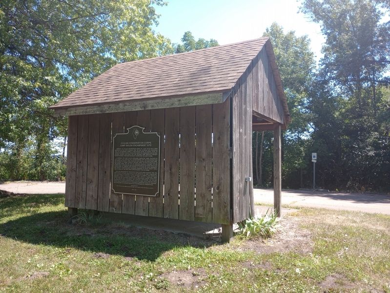
By Craig Doda, July 29, 2023
Civilian Conservation Corps Camp Shiloh Encampment Site Marker
| 101 ► Illinois, Coles County, Lerna, Pleasant Grove Township — Civilian Conservation Corps Camp Shiloh Encampment Site — |
| On South Lincoln Highway, on the right when traveling east. | |||
| 102 ► Illinois, DuPage County, Oak Brook — Ben Fuller House — Graue Gristmill — |
| Near York Road at Spring Road. | |||
| 103 ► Illinois, Jersey County, Grafton — The CCC — |
| On Lodge Boulevard, on the right when traveling west. | |||
| 104 ► Illinois, Jersey County, Grafton, Quarry Township — The CCC — |
| Near Scenic Drive near Illinois Route 100. | |||
| 105 ► Illinois, LaSalle County, Oglesby — Building Starved Rock Lodge — |
| On Lodge Lane, on the right when traveling west. | |||
| 106 ► Illinois, Menard County, Tallula — Historic Tree — |
| On Illinois Route 123 at Illinois Route 97 on State Route 123. | |||
| 107 ► Indiana, Jennings County, North Vernon — 40.1999.1 — Muscatatuck Park — |
| On State Road 7 at Muscatatuck Park Entrance Road, on the left when traveling north on State Road 7. | |||
| 108 ► Indiana, Lawrence County, Spring Mill Village — Civilian Conservation Corp — This area is dedicated to the committed services of the Civilian Conservation Corps — Co. 1536, Co. 539 — |
| Near Indiana Route 60, 0.3 miles County Road 950E, on the right when traveling west. | |||
| 109 ► Indiana, Lawrence County, Spring Mill Village — Indiana State Parks — The First 100 Years — Spring Mill State Park — |
| Near Indiana Route 60, 0.3 miles west of County Road 950E, on the right when traveling west. | |||
| 110 ► Indiana, Madison County, Chesterfield — Indiana State Parks: the First 100 Years — 1916 - 2016 — |
| On Mounds Road (Indiana Route 232) 1 mile north of Donnelly Road (Local Road E100S), on the right when traveling south. | |||
| 111 ► Indiana, Owen County, Spencer — Company #589, Camp SP 4 — The Civilian Conservation Corps at McCormick's Creek — |
| Near McCormick Creek Park Road, on the right when traveling west. | |||
| 112 ► Indiana, St. Joseph County, New Carlisle — Rooted in Studebaker History — |
| Near Timothy Rd, 0.4 miles south of State Road 2. | |||
| 113 ► Indiana, Steuben County, Angola, Pokagon State Park — Administration Building — [Civilian Conservation Corps Camp] — |
| Near Indiana Route 727 just west of Lane 105 Lake James, on the left when traveling west. | |||
| 114 ► Indiana, Steuben County, Angola, Pokagon State Park — Barracks #1 — Civilian Conservation Corps Camp — |
| Near Indiana Route 727 south of Lane 100 Lake James, on the left when traveling west. | |||
| 115 ► Indiana, Steuben County, Angola, Pokagon State Park — Bath House — [Civilian Conservation Corps Camp] — |
| Near Route 727 south of Lane 105 Lake James, on the left when traveling west. | |||
| 116 ► Indiana, Steuben County, Angola, Pokagon State Park — Flag Pole — [Civilian Conservation Corps Camp] — |
| On Indiana Route 727 south of Lane 105 Lake James, on the left when traveling west. | |||
| 117 ► Indiana, Steuben County, Angola, Pokagon State Park — Latrine — [Civilian Conservation Corps Camp] — |
| Near Indiana Route 727 south of Lane 105 Lake James, on the left when traveling west. | |||
| 118 ► Indiana, Steuben County, Angola, Pokagon State Park — Mess Hall — [Civilian Conservation Corps Camp] — |
| Near Indiana Route 727 south of Lane 105 Lake James, on the left when traveling west. | |||
| 119 ► Indiana, Steuben County, Angola, Pokagon State Park — Recreation Hall — Civilian Conservation Corps Camp — |
| 120 ► Indiana, Steuben County, Angola, Pokagon State Park — The Civilian Conservation Corps Camp — |
| 121 ► Iowa, Madison County, Winterset — 112 North 1st Avenue — circa 1874 — |
| On 1st Avenue north of Court Avenue, on the left when traveling north. | |||
| 122 ► Iowa, Woodbury County, Sioux City — From Settlement to State Park — Stone State Park — |
| On Stone State Park Dr. | |||
| 123 ► Kansas, Crawford County, Crawford State Park — A Brief History of the 788th Company [CCC] — Who were these men who built Crawford State Lake? — |
| 124 ► Kansas, Crawford County, Crawford State Park — C.C.C. Volunteer — |
| 125 ► Kansas, Crawford County, Crawford State Park — Education — |
| 126 ► Kansas, Crawford County, Crawford State Park — Equipment — |
| 127 ► Kansas, Crawford County, Crawford State Park — Hard Times — |
| 128 ► Kansas, Crawford County, Crawford State Park — Hard Work — |
| 129 ► Kansas, Crawford County, Crawford State Park — Lake Crawford — |
| 130 ► Kansas, Crawford County, Crawford State Park — The Beginning — |
| 131 ► Kansas, Crawford County, Crawford State Park — The Camp of Co. 788 of the Civilian Conservation Corps — |
| 132 ► Kansas, Crawford County, Crawford State Park — The Fire Devils — |
| 133 ► Kansas, Crawford County, Crawford State Park — Work Done By Hand — |
| 134 ► Kansas, Geary County, Fort Riley, Camp Forsyth — National Rifle Range — 1900-1992 — |
| Near Lookout Drive -or- Thunder Road. | |||
| 135 ► Kansas, Marion County, Marion — C.C.C. Worker — |
| On Lakeshore Drive, on the left when traveling west. | |||
| 136 ► Kansas, Marion County, Marion — Marion County Lake — Earthen Dam Completed June 21, 1937 — By Civilian Conservation Corp. — |
| On Lakeshore Drive, on the left when traveling west. | |||
| 137 ► Kansas, Marion County, Marion — Marion County Park & Lake — |
| On Lakeshore Drive, on the left when traveling west. | |||
| 138 ► Kansas, Morris County, Council Grove — Morris County 4-H Fairgrounds Circle of History — |
| On U.S. 56, on the left when traveling east. | |||
| 139 ► Kansas, Stafford County, Hudson — Cultivating America’s Bread Basket — Agriculture on the Prairie — |
| On Main Street east of Highland Avenue, on the left when traveling west. | |||
| 140 ► Kansas, Stafford County, Quivira National Wildlife Refuge — A Brief History of the Growth of the National Wildlife Refuge System — |
| 141 ► Kentucky, Bell County, Pineville — Chained Rock — |
| Near Chained Rock Road, 4 miles east of 382, on the right when traveling east. | |||
| 142 ► Kentucky, Boone County, Walton — 2510 — Walton CCC Camp Bean Ridge — |
| On School Road at Alta Vista Drive, on the right when traveling south on School Road. | |||
| 143 ► Kentucky, Hickman County, Columbus — Polk's Firepower — |
| 144 ► Kentucky, Hickman County, Columbus — The History of Columbus, Kentucky — |
| 145 ► Kentucky, Whitley County, Honeybee — 2002 — CCC at Cumberland Falls / Civilian Conservation Corps — |
| On Kentucky Route 90, on the right when traveling west on State Route 90. | |||
| 146 ► Louisiana, Rapides Parish, Castor Plunge — Camp Packard - Company 1446 — |
| On Twin Bridges Road (State Highway 488) at Messina Road, on the left when traveling south on Twin Bridges Road. | |||
| 147 ► Louisiana, Vernon Parish, Sandy Hill — Civilian Conservation Corps — |
| On Pitkin Highway (Highway 10) 1 mile east of Lookout Road, on the left when traveling east. | |||
| 148 ► Maine, Cumberland County, Cape Elizabeth — CCC Headquarters — |
| 149 ► Maine, Cumberland County, Cape Elizabeth — Civilian Conservation Corps — |
| 150 ► Maine, Cumberland County, South Portland — Civilian Conservation Corps — |
| 151 ► Maine, Hancock County, Bar Harbor — Thunder Hole Ranger Station — |
| 152 ► Maine, Kennebec County, Augusta — Civilian Conservation Corps — |
| 153 ► Maine, Washington County, Princeton — Civilian Conservation Corps — |
| On Main Street (U.S. 1) at Depot Street, on the left when traveling south on Main Street. | |||
| 154 ► Maryland, Baltimore County, Avalon — The C.C.C. Builds Our Park — The Civilian Conservation Corps Legacy — |
| Near Washington Boulevard (U.S. 1) at South Street. | |||
| 155 ► Maryland, Frederick County, Emmitsburg — Thurmont — Gateway to the Mountain — Catoctin Mountain Towns & Communities — |
| Near Catoctin Mountain Highway (U.S. 15) 0.5 miles south of Welty Road, on the right when traveling south. | |||
| 156 ► Maryland, Frederick County, Thurmont — A Tradition of Conservation — Catoctin Mountain Park — National Park Service, U.S. Department of the Interior — |
| On Park Central Road. | |||
| 157 ► Maryland, Garrett County, Grantsville — New Germany Lake — New Germany State Park — Friends of New Germany — |
| On McAndrews Hill Road. | |||
| 158 ► Maryland, Garrett County, Grantsville — Swauger Mill — New Germany State Park — Friends of New Germany — |
| On McAndrews Hill Road. | |||
| 159 ► Maryland, Garrett County, McHenry — Civilian Conservation Corps — 1933 - 1942 — |
| On Maple Glade Road east of Tolliver Camp Road, on the right when traveling north. | |||
| 160 ► Maryland, Montgomery County, Cabin John — Lockhouse 10 — Chesapeake and Ohio Canal National Historical Park — National Park Service, U.S. Department of the Interior — |
| Near Clara Barton Parkway, 1.5 miles Capital Beltway Inner Loop (Interstate 495), on the right when traveling east. | |||
| 161 ► Maryland, Montgomery County, Potomac, Carderock — Unexpected Benefits in the CCC — Chesapeake & Ohio National Historical Park — |
| Near Carderock, 0.3 miles south of Clara Barton Parkway, on the left when traveling west. | |||
| 162 ► Maryland, Montgomery County, Potomac, Carderock — Working Hard To Survive — CCC Creates Jobs for America's Unemployed — Chesapeake & Ohio Canal National Historical Park — |
| On Macarthur Boulevard, 0.3 miles south of Clara Barton Parkway, on the left when traveling west. | |||
| 163 ► Maryland, Montgomery County, Silver Spring, Wheaton — One Tree's Life — |
| Near Glenallan Avenue east of Heurich Road, on the right when traveling east. | |||
| 164 ► Maryland, Washington County, Boonsboro — Washington Monument State Park — Home of First Completed Monument to Honor George Washington — |
| On Washington Monument Road, 0.3 miles north of Zittlestown Road, on the right when traveling north. | |||
| 165 ► Maryland, Washington County, Middletown — Washington Monument — |
| Near Washington Monument Road. | |||
| 166 ► Massachusetts, Hampden County, Brimfield — Civilian Conservation Corps (1933-1941) — |
| Near Dean Pond Road. | |||
| 167 ► Michigan, Mackinac County, Mackinac Island — L2266 — Scout Barracks / Parade Ground — Registered Michigan Historic Site — |
| On Huron Road, 0.2 miles east of Fort Street, on the left when traveling east. | |||
| 168 ► Michigan, Mackinac County, St. Ignace — Civilian Conservation Corps — |
| Near North State Street (Business Interstate 75) at Central Hill, on the right when traveling north. | |||
| 169 ► Michigan, Montmorency County, Lewiston — L647 — Camp Lunden — |
| On County Route 612 at Fish Lab Road, on the left when traveling east on County Route 612. | |||
| 170 ► Michigan, Roscommon County, Higgins Lake — Civilian Conservation Corps — |
| On North Higgins Lake Drive at Conservation Drive on North Higgins Lake Drive. | |||
| 171 ► Michigan, Roscommon County, Higgins Lake — Civilian Conservation Corps Museum — Higgins Lake Nursery Trail — |
| Near North Higgins Lake Drive at Conservation Drive. | |||
| 172 ► Michigan, Roscommon County, Higgins Lake — Michigan's First Fire Tower — Higgins Lake Nursery Trail — |
| Near North Higgins Lake Drive at Conservation Drive. | |||
| 173 ► Michigan, Roscommon County, Higgins Lake — Welcome to the Higgins Lake Nursery and CCC Museum — |
| On North Higgins Lake Drive near Conservation Drive, on the right when traveling west. | |||
| 174 ► Michigan, Wayne County, Detroit, Delray — S0182 — Fort Wayne — |
| On Fort Wayne Drive near Livernois. | |||
| 175 ► Minnesota, Aitkin County, East Lake — CCC Camp 2705 — Rice Lake National Wildlife Refuge — |
| Near 363rd Lane, on the left when traveling west. | |||
| 176 ► Minnesota, Aitkin County, East Lake — From Railroad Tracks to Refuge Road — |
| On 363rd Lane at Minnesota Route 65, on the right when traveling west on 363rd Lane. | |||
| 177 ► Minnesota, Clearwater County, Park Rapids — From a Day When Trees Were Trees — |
| Near Douglas Lodge Drive. | |||
| 178 ► Minnesota, Crow Wing County, Garrison — Mille Lacs Lake — |
| On U.S. 169 at Central Street, on the left when traveling south on U.S. 169. | |||
| 179 ► Minnesota, Crow Wing County, Pequot Lakes — Art Savage, Fire Tower Ranger — |
| Near County Road 11, 0.3 miles east of State Highway 371, on the left when traveling east. | |||
| 180 ► Minnesota, Crow Wing County, Pequot Lakes — Paul M. Thiede Fire Tower Park — |
| Near County Road 11, 0.3 miles east of State Highway 371, on the left when traveling east. | |||
| 181 ► Minnesota, Crow Wing County, Pequot Lakes — The Pequot Fire Lookout Tower — |
| Near County Road 11, 0.3 miles east of State Highway 371, on the left when traveling east. | |||
| 182 ► Minnesota, Itasca County, Marcell — Civilian Conservation Corp — |
| Near Minnesota Route 38 north of Little Ranier Road, on the right when traveling north. | |||
| 183 ► Minnesota, Itasca County, Suomi — Day Lake CCC Camp — Building a Better America — Edge of the Wilderness National Scenic Byway — |
| Near Edge of the Wilderness Scenic Byway (State Highway 38 at milepost 19), on the left when traveling north. | |||
| 184 ► Minnesota, Kandiyohi County, Willmar — 37 — C.C.C. Worker — 1933 - 1942 — |
| Near Business U.S. 71, 0.5 miles north of 10th Street Northeast, on the left when traveling north. | |||
| 185 ► Minnesota, Lake County, Two Harbors — "C.C.C. Worker" — Civilian Conservation Corps — 1933-1942 — |
| 186 ► Minnesota, Lake County, Two Harbors — A Castle in the Park — |
| 187 ► Minnesota, Lake County, Two Harbors — Building the Wall — |
| 188 ► Minnesota, Lake County, Two Harbors — CCC Camp Site — Civilian Conservation Corps Legacy Self-guided Tour — |
| 189 ► Minnesota, Lake County, Two Harbors — Cooperation Helps Build a Park / We Built this Park. — |
| 190 ► Minnesota, Lake County, Two Harbors — Gooseberry Falls CCC Historic District — Civilian Conservation Corps Legacy Self-guided Tour — |
| 191 ► Minnesota, Lake County, Two Harbors — Having Fun on the North Shore / Cruisin' on the Shore — |
| 192 ► Minnesota, Morrison County, Little Falls — Lindbergh State Park — |
| On Lindbergh Drive South, on the left when traveling south. | |||
| 193 ► Minnesota, Nicollet County, Fairfax — A New Deal for Fort Ridgely State Park — The New Deal and Fort Ridgely State Park — United States Civilian Conservation Corps — |
| Near County Highway 30, 0.7 miles west of State Highway 4, on the right when traveling west. | |||
| 194 ► Minnesota, Nicollet County, Fairfax — CCC Camp Life is a Healthful One — The New Deal and Fort Ridgely State Park — United States Civilian Conservation Corps — |
| Near County Highway 30, 0.7 miles west of State Highway 4, on the right when traveling west. | |||
| 195 ► Minnesota, Nicollet County, Fairfax — Fort Ridgely State Park's Buildings Today — The New Deal and Fort Ridgely State Park — United States Civilian Conservation Corps — |
| Near County Highway 30, 0.7 miles west of State Highway 4, on the right when traveling west. | |||
| 196 ► Minnesota, Nicollet County, Fairfax — Working Year-Round to Develop the Park — The New Deal and Fort Ridgely State Park — United States Civilian Conservation Corps — |
| Near County Highway 30, 0.7 miles west of State Highway 4, on the right when traveling west. | |||
| 197 ► Minnesota, Ramsey County, Saint Paul, Payne - Phalen — In Memory of Civilian Conservation Corps Personnel — |
| Near Phalen Drive north of Wheelock Parkway, on the right when traveling north. | |||
| 198 ► Minnesota, Scott County, Savage — Camp Savage — |
| On Xenwood Avenue at South Frontage Road, on the left when traveling south on Xenwood Avenue. | |||
| 199 ► Mississippi, Winston County, Louisville — Legion Lodge — |
| On Legion State Park Drive, 1 mile north of North Columbus Avenue, on the left when traveling north. | |||
| 200 ► Missouri, Callaway County, Jefferson City — Missouri State Parks — |
| Near Katy Road, 0.9 miles north of Oilwell Road, on the right when traveling north. | |||
523 entries matched your criteria. Entries 101 through 200 are listed above. ⊲ Previous 100 — Next 100 ⊳