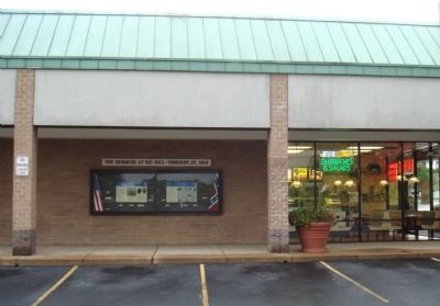
Near Woodbrook Drive west of Seminole Trail (U.S. 29).
Civil War relic collectors found Stuart’s winter camp and skirmish site (shaded area of map) long before the Rio Hill Shopping Center opened in 1989.
Metal detectors were used to search the area and artifacts—bullets, buttons, belt and . . . — — Map (db m7692) HM
Near Woodbrook Drive west of Seminole Trail (U.S. 29).
In December 1863, Confederate troops established winter quarters here. The approximately 200 soldiers, under the command of Capt. Marcellus N. Moorman, were from Stuart’s Horse Artillery Battalion and were equipped with 16 cannons. The men built . . . — — Map (db m7690) HM
On East Main Street (Virginia Route 6) just east of Valley Street ( Route 20), on the right when traveling east.
At 3 p.m. on Monday, March 6, 1865, the first of Union Gen. Philip H. Sheridan’s 10,000 cavalrymen under Gens. Wesley Merritt, Thomas Devin, and George A. Custer entered Scottsville unopposed. To accomplish their mission—destroy the
James . . . — — Map (db m17844) HM
Near West Braddock Road, on the right when traveling west. Reported permanently removed.
This stairway leads up the west wall of Fort Ward between the Northwest Bastion (to the left) and the Southwest Bastion (to the right). Fort Ward had 14 cannon emplacements along this area of the wall that created overlapping fields of fire. . . . — — Map (db m7709) HM
On Callahan Drive at King Street ( Route 7), on the right when traveling north on Callahan Drive. Reported permanently removed.
“Alexandria is ours,” declared Col. Orlando Wilcox of the 1st Michigan Vol. Inf. as his regiment captured the city on the morning of May 24, 1861. When Virginia's vote of secession became effective, Union forces immediately crossed the . . . — — Map (db m159) HM
Near Callahan Drive at King Street ( Route 7), on the right when traveling north.
“Alexandria is ours,” declared Col. Orlando Wilcox of the 1st Michigan Infantry as his regiment captured the city on the morning of May 24, 1861, one day after Virginia officially left the Union. Due to its strategic location on the . . . — — Map (db m152570) HM
On Mall Road 0.2 miles east of Horse Mountain View ( Route 648), on the left when traveling east.
In December 1863, Union Gen. William W. Averell’s 2,500 cavalrymen raided Salem, Virginia, to disrupt the Virginia and Tennessee Railroad supply line to Confederate Gen. James Longstreet, who was besieging Knoxville, Tennessee. After the raid, . . . — — Map (db m107979) HM
On Longdale Furnace Road (Virginia Route 269) at Collierstown Road ( Route 770), on the right when traveling west on Longdale Furnace Road.
Australia Furnace, located just east of here, produced pig iron for the Tredegar Iron Works—“Ironmaker to the Confederacy”—during the Civil War. Ira and Edwin Jordan had begun constructing Australia Furnace in 1852; two years later, they put it in . . . — — Map (db m107981) HM
On Longdale Furnace Road (Virginia Route 269) at Collierstown Road ( Route 770), on the right when traveling west on Longdale Furnace Road.
You are standing near the site of the Lucy Selina Furnace, which supplied the Confederacy with pig iron for the production of cannons, munitions, and rails during the Civil War. In 1827, two Scots-Irishmen, Col. John Jordan and John Irvine, built . . . — — Map (db m107982) HM
On Selma Low Moor Road (Virginia Route 696) 0.2 miles west of Oakland Drive, on the right when traveling west.
During the Civil War, the Jackson River Depot was located here. It marked the western terminus of the Virginia Central Railroad, which extended 200 miles from Hanover Junction north of Richmond. Located just east of the Kanawha Pass of the . . . — — Map (db m107980) HM
On Virginia Street at Court Street ( Route 38/1007), on the right when traveling north on Virginia Street.
Confederate Gen. Robert E. Lee ordered all of the Army of Northern Virginia's columns retreating west from Richmond and Petersburg to rendezvous at this courthouse village on April 4-5, 1865. Lee hoped that Richmond & Danville Railroad trains . . . — — Map (db m180224) HM
On East Sayler's Creek Road (Virginia Route 617) west of South Genito Road ( Route 616), on the right when traveling west.
Through early morning showers on April 6, 1865. Gen. Robert E. Lee's weary men and creaking wagons slogged west toward Farmville and expected rations. They passed through Deatonville, “a cluster of half-a-dozen brick farmhouses,” and . . . — — Map (db m117558) HM
On Amelia Springs Road (Virginia Route 642) 0.2 miles south of St. James Road, on the right when traveling north.
Union cavalry under Gen. Henry E. Davies, Jr. left Gen. Philip H. Sheridan’s column near Jetersville on April 5, 1865, on a reconnaissance mission against the Army of Northern Virginia. Davies swept by here, rode through Paineville, and four Miles . . . — — Map (db m28834) HM
Near Saylers Creek Road (Virginia Route 617), on the left when traveling south. Reported permanently removed.
Union forces assembled along this ridge while Confederate troops prepared on the opposite slope. Federal forces crossed Little Sailor’s Creek for a fierce battle which compelled many Southerners to surrender. The house served as a hospital for both . . . — — Map (db m293004) HM
On Sayler's Creek Road (Virginia Route 617) at James Town Road ( Route 618), on the left when traveling west on Sayler's Creek Road.
Shortly before noon on April 6, 1865, elements of Union Gen. George Crook's cavalry division attacked Confederate Gen. Richard H. Anderson's infantry corps as it marched through this intersection. While most of the Army of Northern Virginia . . . — — Map (db m256599) HM
On Saylers Creek Road (Virginia Route 617) 0.9 miles west of James Town Road, on the left when traveling west.
The building in front of you was a witness to war, a battlefield hospital, and the birthplace of one of the nation's foremost Black educators.
Built in the 1780s by Moses Overton, the farmhouse was occupied by James Hillsman and his wife, Lucy, . . . — — Map (db m271588) HM
Near Saylers Creek Road (County Route 617) 1 mile west of James Town Road (County Route 618), on the left when traveling west. Reported permanently removed.
As night began to fall here on, April 6, 1865, the hard fought battles of Little Sailor's Creek and the crossroads near the Marshall Farm draw to a close. Federal surgeons work by the little natural light that's still available. They are inside . . . — — Map (db m271590) HM
On Mill Quarter Road (County Route 622) at Namozine Road (Route 708), on the left when traveling north on Mill Quarter Road.
When Gen. Robert E. Lee evacuated the Army of Northern Virginia from Petersburg and Richmond on April 2-3, 1865, he ordered the army’s wings to unite at Amelia Court House, where trains would meet them with food and other supplies. The army would . . . — — Map (db m6049) HM
On Jamerson Lane at Jones Street, on the left when traveling east on Jamerson Lane.
At this location, Confederate Gen. R. Lindsay Walker formed a crescent of artillery that repulsed three charges of Union Gen. George Custer's cavalry division. Around 8 p.m. on April 8, 1865, Custer's fourth charge broke through, blocking the . . . — — Map (db m290464) HM
On Main Street (Virginia Route 131), on the right.
You are standing near the site of Appomattox Station Depot on the South Side Railroad. Here, on the afternoon of April 8, 1865, Union cavalrymen under Gen. George A. Custer dealt the Army of Northern Virginia a final blow. First, they captured . . . — — Map (db m156545) HM
Near Jamerson Lane (Virginia Route 1014) at Jones Street (Route 1012).
Confederate Gen. Robert E. Lee’s Army of Norther Virginia began the retreat west from Richmond and Petersburg on April 3, 1865, with about 250 cannon. Two days later, at Amelia Court House, about a hundred of the least effective pieces were culled . . . — — Map (db m272145) HM
Near Jamerson Lane (Virginia Route 1014) at Jones Street ( Route 1012). Reported permanently removed.
Union Col. Henry Capehart commanded Gen. George A. Custer’s Third Cavalry Brigade on Custer’s left flank. On April 8, 1865, Capehart had only the 1st New York (Lincoln) an 1st and 2nd West Virginia regiments on hand, the 3rd West Virginia . . . — — Map (db m272139) HM
Near Horseshoe Road north of Old Courthouse Road ( Route 24), on the left when traveling north.
You are facing the historic Richmond-Lynchburg Stage Road. On the afternoon of April 8, 1865, hundreds of Confederate vehicles, including baggage wagons, ambulances and artillery pieces, were parked in a long column in front of you. The soldiers . . . — — Map (db m290102) HM
Near Oakville Road (Virginia Route 26) north of Richmond Highway (U.S. 460), on the right when traveling south.
In the last clash at Appomattox, some of the men who fought here at the Robertson House on April 9, 1865, were unfortunate enough to be among the last soldiers killed, wounded, or captured in combat. A few were later cited for bravery in the . . . — — Map (db m169288) HM
Near Oakville Road (Virginia Route 26) north of Richmond Highway (U.S. 460), on the right when traveling south.
(preface)
After Union Gen. Ulysses S. Grant's forces broke through Confederate Gen. Robert E. Lee's lines at Petersburg on April 2, 1865, Lee ordered the evacuation of Petersburg and Richmond. The Army of Northern Virginia retreated west on . . . — — Map (db m169292) HM
Near Jamerson Lane (Virginia Route 1014) at Jones Street ( Route 1012).
One of the last battles of the Civil War in Virginia took place here early in the evening of April 8, 1865. Confederate Gen. Reuben L. Walker, who commanded 100 guns of Gen. Robert E. Lee’s reserve artillery, made camp here late in the afternoon. . . . — — Map (db m272035) HM
On Howe Flood Highway (State Highway 24), on the left when traveling south.
You are standing where Gen. James Longstreet’s corps entrenched early in the morning of April 9, 1865, to protect the rear of the Army of Northern Virginia. Gen. Robert E. Lee and most of the army bivouacked about four miles south, just short of . . . — — Map (db m6051) HM
On Columbia Pike (Virginia Route 244) east of South Dinwiddie STreet, on the left when traveling east.
On the night of June 1, 1861, a scouting party of Virginia militia attacked U.S. troops at Arlington Mill, which stood to your right. Co. E 1st. Michigan Volunteer Infantry Regiment was on picket duty at the mill guarding the Columbia Turnpike and . . . — — Map (db m250360) HM
On South Oak Street at Southgate Road, on the right when traveling north on South Oak Street.
During the Civil War, many escaped and freed slaves traveled north seeking refuge in Union camps. Thousands crowded into the Federal City. The number of refugees quickly overwhelmed the area’s resources. Overcrowding and disease became prevalent. . . . — — Map (db m5293) HM
On North Old Glebe Road north of North Stafford Street, on the right when traveling north.
Fort Ethan Allen witnessed the dramatic social change brought on by the war. In late 1865, the 107th United States Colored Troops (USCT) garrisoned Fort Ethan Allen. Two companies, C and H, roughly 200 men, drilled on the parade ground and manned . . . — — Map (db m283749) HM
On Old Glebe Road, on the right when traveling north. Reported permanently removed.
Fort Ethan Allen was constructed during the Civil War to provide one of the last lines of defense against possible Confederate attacks aimed at Washington. The fort commanded approaches to Chain Bridge (over the Potomac River) from the south of . . . — — Map (db m2318) HM
Near North Old Glebe Road south of North Stafford Street, on the right when traveling north.
Fort Ethan Allen was constructed during the Civil War to provide one of the last lines of defense against possible Confederate attacks aimed at Washington. The fort commanded approaches to Chain Bridge (over the Potomac River) from south of . . . — — Map (db m213839) HM
Near 24th Street North. Reported permanently removed.
Fort C.F. Smith was constructed in early 1863 as part of the expansion and strengthening of the capital’s defenses that continued throughout the Civil War. With Forts Strong, Morton and Woodbury, Fort C.F. Smith formed the outer perimeter of the . . . — — Map (db m5099) HM
Near 24th Street North. Reported permanently removed.
Fort C.F. Smith was constructed in 1863 on farmland appropriated from William Jewell. The fort was named in honor of Gen. Charles Ferguson Smith, who was instrumental in the Union victory at Fort Donelson, Tennessee in 1862. The fortification was . . . — — Map (db m5101) HM
Near 24th Street North. Reported permanently removed.
The ramps in front of you, now covered with grass, led to wooden platforms on which the various cannons were placed. When built in 1863, Fort C.F. Smith had platforms for twenty-two artillery pieces and four siege mortars. However, only sixteen . . . — — Map (db m5102) HM
Near 24th Street North 0.1 miles east of 23rd Road North, on the left when traveling east.
Fort C.F. Smith was constructed early in 1863 as part of the expansion and strengthening of the capital's defenses that continued throughout the war. With Forts Strong, Morton, and Woodbury, Fort C.F. Smith formed the outer perimeter of . . . — — Map (db m284561) HM
On 24th Street North 0.1 miles west of 23rd Road North, on the right when traveling west.
The ramps in front of you, now covered with grass, led to wooden platforms on which the various cannons were placed. When Fort C.F. Smith was built in 1863, it had platforms for twenty-two artillery pieces and four siege mortars. Only the mortars . . . — — Map (db m295406) HM
On 24th Street North 0.1 miles west of 23rd Road North, on the right when traveling west.
Fort C.F. Smith was constructed in 1863 on farmland appropriated from William Jewell. The fort was named in honor of Gen. Charles F. Smith, who was instrumental in the Union victory at Fort Donelson, Tennessee, in 1862. Fort Smith extended the . . . — — Map (db m295407) HM
On Grand Cavern Road 0.2 miles west of South River Road, on the right when traveling west.
Up the hill to your left is the entrance to Grand Caverns, known as Weyers Cave during the Civil War. Discovered in 1804, it soon became a tourist attraction. During the Shenandoah Valley campaigns of 1862 and 1864, numerous Union and Confederate . . . — — Map (db m308014) HM
On Battlefield Road (County Route 608), on the left when traveling south. Reported permanently removed.
The Battle of Piedmont, fought on June 5, 1864 between Union Gen. David Hunter and Confederate Gen. William E. "Grumble" Jones, ended here. It began more than a mile northeast when the 12,000-man strong Federal army, whose mission was to scour the . . . — — Map (db m155471) HM
On Battlefield Road (Virginia Route 608) 0.3 miles north of Dam Town Road ( Route 616), on the right when traveling north.
The Battle of Piedmont, fought on June 5, 1864 between Union Gen. David Hunter and Confederate Gen. William E. "Grumble" Jones, ended here. It began more than a mile northeast when the 12,000-man strong Federal army, whose mission was to scour . . . — — Map (db m279922) HM
On Parkersburg Turnpike (Virginia Route 254) east of Charlbrooke Lane, on the right.
On March 19, 1862, a weary column shuffled by the road in front of you. They were not soldiers marching to a battle, but dozens of pacifist conscientious objectors who were being herded to Staunton, and then prison.
Desperate for recruits, . . . — — Map (db m308002) HM
On Parkersburg Turnpike (Route 254), on the right when traveling west.
In 1862, West View was a village of about 15 buildings including a flour mill, post office, store, wagon shop and saw mills. About 3,000 soldiers camped in the surrounding fields from April 20 to May 6. Confederates under Gen. Edward . . . — — Map (db m15788) HM
On Shenandoah Mountain Drive (U.S. 250) at Ramsey's Draft North, on the right when traveling west on Shenandoah Mountain Drive.
The Battle of McDowell began three miles to the southeast (near the intersection of Routes 629 and 716) when Confederates were fired upon by Union cavalry on May 7, 1862. After skirmishing, Federals rushed to the base camp here, sounding the . . . — — Map (db m62920) HM
Near Avenel Avenue north of Burwell Way, on the right when traveling south.
On May 26, 1864, Union Gen. David Hunter marched south from Cedar Creek near Winchester to drive out Confederate forces, lay waste to the Shenandoah Valley, and destroy transportation facilities at Lynchburg. His raid was part of Gen. . . . — — Map (db m256761) HM
On South Bridge Street at West Main Street (U.S. 221), on the left when traveling north on South Bridge Street.
On the evening of June 15, 1864, the lead element of Union Gen. David Hunter’s 18,000-man army arrived here and cam near Avenel. The main force arrived the following morning and started destroying the Virginia and Tennessee Railroad tracks, burning . . . — — Map (db m41408) HM
On Blue Ridge Parkway near Peaks Road ( Route 43).
(preface)
On May 26, 1864, Union Gen. David Hunter marched south from Cedar Creek near Winchester to drive out Confederate forces, lay waste to the Shenandoah Valley, and destroy transportation facilities at Lynchburg. His raid was part of . . . — — Map (db m55780) HM
On East Lynchburg Salem Turnpike (U.S. 460) at Thomas Jefferson Road ( Route 811), on the right when traveling west on East Lynchburg Salem Turnpike.
(preface)
On May 26, 1864, Union Gen. David Hunter marched south from Cedar Creek near Winchester to drive out Confederate forces, lay waste to the Shenandoah Valley, and destroy transportation facilities at Lynchburg. His raid was part of . . . — — Map (db m55782) HM
Near Lowe Street (County Road T-1305) west of Main Street (U.S. 11), on the right when traveling west.
(preface)
On May 26, 1864, Union Gen. David Hunter marched south from Cedar Creek near Winchester to drive out Confederate forces, lay waste to the Shenandoah Valley, and destroy transportation facilities at Lynchburg. His raid was part of . . . — — Map (db m55777) HM
On Main Street (U.S. 11) at 15th Street (County Road T-1313), on the right when traveling south on Main Street.
(preface) On May 26, 1864, Union Gen. David Hunter marched south from Cedar Creek near Winchester to drive out Confederate forces, lay waste to the Shenandoah Valley, and destroy transportation facilities at Lynchburg. His raid was . . . — — Map (db m256765) HM
On Lowe Street (County Road T-1305) at Washington Street, on the right when traveling south on Lowe Street.
(preface) On May 26, 1864, Union Gen. David Hunter marched south from Cedar Creek near Winchester to drive out Confederate forces, lay waste to the Shenandoah Valley, and destroy transportation facilities at Lynchburg. His raid was . . . — — Map (db m256753) HM
On Christanna Highway (Virginia Route 46) at New Hope Road, on the right when traveling north on Christanna Highway.
In June 1864, to deny Gen. Robert E. Lee the use of the South Side R.R. and the Richmond and Danville R.R., Gen. Ulysses S Grant sent Gen. James H. Wilson and Gen. August V. Kautz south of Petersburg on a cavalry raid to destroy track and rolling . . . — — Map (db m20168) HM
On Liberty Road at Old Stage Road, on the left when traveling east on Liberty Road. Reported permanently removed.
In June 1864, to deny Gen. Robert E. Lee the use of the South Side R.R. and the Richmond and Danville R.R., Gen. Ulysses S. Grant sent Gen. James H. Wilson and Gen. August V. Kautz south of Petersburg on a cavalry raid to destroy track and rolling . . . — — Map (db m289877) HM
On Liberty Road (County Road 634) north of Old Stage Road (County Road 712), on the left when traveling north.
Over two days, June 27-28, 1864, dusty columns of approximately 5,000 exhausted Union cavalrymen, with artillery, wagons, and ambulances, passed this spot near Smoky Ordinary. Gen. James H. Wilson's division led the way, with Gen. August V. . . . — — Map (db m310188) HM
On North Main Street (Business U.S. 58) south of Bank Street, on the left when traveling south.
Late in the afternoon of May 15, 1864, Union Gen. August V. Kautz and his cavalry division rode into Lawrenceville, the Brunswick County seat. They were on the second leg of a two-part, two-week-long expedition to destroy railroad bridges and depots . . . — — Map (db m62400) HM
On Francisco Road (Virginia Route 636) at New Store Road ( Route 609), on the right when traveling north on Francisco Road. Reported damaged.
New Store, located a short distance to your left, was a stop on the stage road from Richmond to Lynchburg. In 1865 it consisted of Louis D. Jones's house, three offices, a cobbler's shop, and a store. On April 8 virtually the entire Army of Northern . . . — — Map (db m290958) HM
On Francisco Road (Virginia Route 636) west of James Madison Highway (U.S. 15), on the right when traveling west.
Clifton was the home of Joseph Crute and his family in 1865. Early on April 8, part of the Confederate Army of Northern Virginia marched by the house, followed soon by a pursuing Union army corps. Gen. Ulysses S. Grant spent that night in the house, . . . — — Map (db m271223) HM
Near Avoca Lane west of Main Street (Business U.S. 29), on the right when traveling west.
This cemetery was the first burial place of Gen. James Dearing (1840-1865), the last Confederate general officer to die of battle wounds during the Civil War.
Dearing hailed from nearby Otterbourne plantation, about one mile northeast. In . . . — — Map (db m299483) HM
On North Main Street (State Highway 2) at Courthouse Lane (Local Route 1204), on the right when traveling north on North Main Street.
Built approximately 1820, the Star Hotel was one of two taverns serving Bowling Green. During the Civil War, it was operated by the Henry Gouldman family, and became a notorious Confederate spy headquarters and safe haven to those who aided . . . — — Map (db m207706) HM
Near Stonewall Jackson Road (Virginia Route 606) near Guinea Station Road ( Route 634).
General Winfield Hancock’s Union Second corps left Spotsylvania Court House after sunset on May 290, 1864. It trudged south along dark roads, headed toward Milford Station on the Richmond, Fredericksburg, and Potomac Railroad. Grant had ordered . . . — — Map (db m3308) HM
On Colonial Road at Antioch Road, on the right when traveling south on Colonial Road.
Unable to crack Confederate Gen. Robert E. Lee’s strongly fortified lines at Spotsylvania Court House, Union Gen. Grant ordered Gen. Winfield Hancock’s Second Corps to cross the Mattaponi River here at Milford Station and threaten the Confederate . . . — — Map (db m116534) HM
On King Street north of Water Street, on the right when traveling north.
Port Royal possessed the finest harbor on the middle reaches of the Rappahannock River. Although the town's permanent wharf had been destroyed by Union gunboats before the Battle of Fredericksburg, the excellent harbor made Port Royal an obvious . . . — — Map (db m57537) HM
On Jericho Road (Virginia Route 207) at U.S. 1, on the left when traveling south on Jericho Road.
The scattered corps of the Union army reunited here at Carmel Church (known during the war as Mount Carmel Church) on May 23 before attacking Confederate Gen. Robert E. Lee across the North Anna River, approximately three miles ahead. Gen. Winfield . . . — — Map (db m3693) HM
On South River Road (Virginia Route 638) at Paige Road ( Route 605), on the right when traveling south on South River Road.
"At the church…the 9th Corps was marching past, and Burnside was sitting, like a comfortable abbot, in one of the pews, surrounded by his buckish staff whose appearance is the reverse of clerical.” – Theodore Lyman, aide-de-camp . . . — — Map (db m294969) HM
Near Weyanoke Road 2 miles south of John Tyler Memorial Highway ( Route 5), on the left when traveling south.
Part of Gen. Ulysses S. Grant's Army of the Potomac occupied North Bend on June 14, 1864, en route to Weyanoke Point. Two days earlier, Union forces had disengaged from the Cold Harbor battlefield so stealthily that it escaped Gen. Robert E. Lee's . . . — — Map (db m267268) HM
Near The Glebe Lane (Virginia Route 615) at Southall Plantation Lane, on the right when traveling west.
In Virginia, the “Home Front” and the “Front Line” were often just miles apart during the Civil War. In places such as Charles City County families provided their men for troops and also lost the income from their plantations and other businesses . . . — — Map (db m18589) HM
On Adkins Road (Virginia Route 618) at Church Lane, on the right when traveling south on Adkins Road.
In May 1862, Union Gen. George B. McClellan led the Army of the Potomac up the Peninsula to the gates of Richmond. Confederate Gen. Robert E. Lee assumed command of the Army of Northern Virginia in June and began planning a counterattack. On June . . . — — Map (db m61881) HM
Near John Tyler Memorial Highway (Virginia Route 5) 0.2 miles east of Herring Creek Road ( Route 640), on the right when traveling east.
In May 1862, Union Gen. George B. McClellan led the Army of the Potomac up the Peninsula to the gates of Richmond. Confederate Gen. Robert E. Lee assumed command of the Army of Northern Virginia in June and began planning a counterattack. On June . . . — — Map (db m61882) HM
Near Westover Road (Virginia Route 633) 2.1 miles east of Harrison Landing Road.
Following the last of the Seven Days' Battles on July 1, 1862, at Malvern Hill, Gen. George B. McClellan's Union Army of the Potomac continued its retreat to the James River. McClellan had earlier decided to "change his base" from the Pamunkey . . . — — Map (db m30227) HM
On Wilcox Wharf Road 0.2 miles south of Dalmation Drive, on the left when traveling south.
With the Federal armies stalled at Cold Harbor, Gen. U.S. Grant made the fateful decision to move on Petersburg. The march began under cover of darkness on the evening of June 12, 1864, and covered some 20 miles before reaching the James River . . . — — Map (db m17507) HM
On David Bruce Avenue (Virginia Route 40) at Legrande Avenue ( Route 47), on the right when traveling east on David Bruce Avenue. Reported permanently removed.
In June 1864, to deny Gen. Robert E. Lee the use of the South Side R.R. and the Richmond and Danville R.R., Gen. Ulysses S. Grant sent Gen. James H. Wilson and Gen. August V. Kautz south of Petersburg on a cavalry raid to destroy track and . . . — — Map (db m262877) HM
On David Bruce Avenue (Virginia Route 40) east of Legrande Avenue ( Route 47), on the right when traveling east.
When mounted Union raiders clattered into town here late on the blisteringly hot morning of June 25, 1864, residents waited anxiously to see what destruction the invaders would bring.
The raiders were part of a Union cavalry force under Gen. . . . — — Map (db m262878) HM
On Depot Street at Drakes Main Street ( Route 47), on the right when traveling south on Depot Street.
In June 1864, to deny Gen. Robert E. Lee the use of the South Side R.R. and the Richmond and Danville R.R., Gen. Ulysses S. Grant sent Gen. James H. Wilson and Gen. August V. Kautz south of Petersburg on a cavalry raid to destroy track and . . . — — Map (db m31006) HM
On King Street (Virginia Route 40) at J Street, on the left when traveling east on King Street.
In June 1864, to deny Gen. Robert E. Lee the use of the South Side R.R. and the Richmond and Danville R.R., Gen. Ulysses S. Grant sent Gen. James H. Wilson and Gen. August V. Kautz south of Petersburg on a cavalry raid to destroy track and rolling . . . — — Map (db m66003) HM
On River Road (County Route 607) at Mulberry Hill Road (County Route 641), on the right when traveling west on River Road.
In late June 1864, Confederate Gen. Robert E. Lee and the Army of Northern Virginia were engaged in a desperate defense of the city of Petersburg. Victory for Lee depended on a steady flow of supplies, brought in by rail. To force Lee from . . . — — Map (db m107472) HM
Near Hailey Road (County Route 759) at Sylvan Hill Road (County Route 612).
In June 1864, to deny Gen. Robert E. Lee the use of the South Side R.R. and the Richmond and Danville R.R., Gen. Ulysses S. Grant sent Gen. James H. Wilson and Gen. August V. Kautz south of Petersburg on a cavalry raid to destroy track and rolling . . . — — Map (db m31004) HM
On Mulberry Hill Road 1.1 miles north of Roanoke Station Road, on the right when traveling north.
Union cavalrymen swarmed over this ground on the afternoon of June 25, 1864, as mounted soldiers advanced on the wagon road that ran behind you and Union Gen. James Wilson established his headquarters in front of you at "Mulberry Hill," the wartime . . . — — Map (db m286157) HM
On Jackson-Vaughan Road (County Route 607) at Moody Circle Road, on the left when traveling west on Jackson-Vaughan Road.
In June 1864, to deny General Robert E. Lee the use of the South Side Railroad and the Richmond and Danville Railroad, General Ulysses S. Grant sent General James H. Wilson and General August V. Kautz south of Petersburg on a cavalry raid to destroy . . . — — Map (db m40791) HM
On West Market Street at First Street, on the right when traveling west on West Market Street. Reported permanently removed.
Lee and Jackson Parks contain two of Charlottesville's fine examples of public sculpture, gifts of benefactor Paul Goodloe McIntire (1860-1952). The Thomas Jonathan "Stonewall" Jackson statue was dedicated in 1921,the Robert E. Lee statue in 1924. . . . — — Map (db m497) HM
On Dismal Swamp Canal Trail near Ballahack Road, on the left when traveling north.
You are in Walllaceton, a community named for the Wallace family home, with the Dismal Swamp Canal and Great Dismal Swamp in front of you. Before the war, runaway slaves found refuge in the swamp. Confederate guerrillas later hid there, while the . . . — — Map (db m260163) HM
Before you is the Deep Creek Lock of the Great Dismal Swamp Canal. The canal was an important thoroughfare, connecting the North Carolina Sounds with Hampton Roads and the Chesapeake Bay. The Dismal Swamp Canal is the oldest operating artificial . . . — — Map (db m4773) HM
On Luray Street 0.3 miles north of George Washington Highway North (Business U.S. 17), on the right when traveling north.
This is the Deep Creek Lock of the Dismal Swamp Canal, the northern end of the waterway linking the North Carolina sounds with Hampton Roads and the Chesapeake Bay. Deep Creek village evolved on the canal to serve workers, boatmen, and the . . . — — Map (db m165286) HM
On Locks Road 0.3 miles west of North Battlefield Boulevard ( Route 168), on the left when traveling west. Reported permanently removed.
The village of Great Bridge was located at a strategic crossing of the Albemarle and Chesapeake Canal. This canal, along with the Dismal Swamp Canal, was recognized as being a strategically important corridor by both the Union and Confederate . . . — — Map (db m48919) HM
On Locks Road 0.3 miles west of North Battlefield Boulevard ( Route 168), on the left when traveling west.
The Great Bridge village evolved to your left, where a bridge spanned the Elizabeth River. An early battle of the Revolution occurred around the bridge on December 9, 1775. The village grew with the completion of the Albemarle & Chesapeake Canal. . . . — — Map (db m211246) HM WM
On Long Ridge Road at Cuffee Road, on the left when traveling north on Long Ridge Road.
Thirteen African American veterans of the Civil War are interred nearby at the Cuffeytown Historic Cemetery. They served in the 5th, 10th, and 36th United States Colored Troops infantry regiments organized in 1863 and 1864, after the Emancipation . . . — — Map (db m48917) HM
Near Douglas Road (Old U.S. 17) at George Washington Highway (Old U.S. 17), on the right when traveling south.
Before you is the Dismal Swamp Canal, a much sought after prize of war during the Civil War. The Confederates made good use of the canal facilities during the initial stages of the conflict. A large volume of supplies passed through in both . . . — — Map (db m282378) HM
On South George Washington Highway (U.S. 17), on the left when traveling north. Reported permanently removed.
“Glencoe,” the plantation home of Capt. William Wallace of the Jackson Grays, was located approximately one-half mile northeast of this site.
William C. Wallace was born at Wallaceton, Norfolk County, Virginia, on March 23, 1842, and . . . — — Map (db m282377) HM
On St. Brides Road 0.3 miles south of Benefit Road, on the left when traveling south.
This is the former site of the Pleasant Grove Baptist Church. The monument to the "Jackson Greys" honors the regiment that was formed on the grounds of Pleasant Grove Baptist Church by Capt. (later Lieutenant Colonel) William H. Stewart who lived . . . — — Map (db m211238) HM
Near Relay Road at Ballahack Road, on the left when traveling south.
Nearby were the homes of three Afro-Virginians who served in the United States Colored Troops (USCT) during the Civil War. Sgt. March Corprew, Co. I, 2nd USCT Cavalry, and his brother Pvt. Daniel Corprew, Co. D, 1st USCT Cavalry, lived on a . . . — — Map (db m282379) HM
On Battery Dantzler Road 0.2 miles east of Old Stage Road, on the left when traveling east.
In 1862, Confederate authorities considered locating the main defensive James River battery here to block the Union navy’s approach to Richmond. They chose Drewry’s Bluff instead because they feared that Union forces would bypass this position by . . . — — Map (db m16058) HM
On West Hundred Road (Virginia Route 10) east of Parker Lane, on the right when traveling east. Reported missing.
On May 5, 1864, Gen. Benjamin F. Butler’s Union Army of the James landed at Bermuda Hundred to sever direct communication between Richmond and Petersburg. Five days later, desperate to keep the connection open, 2,000 Confederates under Gen. Robert . . . — — Map (db m235891) HM
On West Hundred Road (Virginia Route 10) near Parker Lane, on the right when traveling east.
On May 5, 1864 Union Gen. Benjamin F. Butler's Army of the James landed at Bermuda Hundred to sever Confederate communication lines between Richmond and Petersburg. Five days later to keep the connection open, 2,000 Confederates under . . . — — Map (db m245750) HM
On Bermuda Hundred Road 1.4 miles east of Allied Road, on the right when traveling east. Reported permanently removed.
Union Gen. Benjamin Butler’s 30,000-man Army of the James landed here without opposition on May 5, 1864. Despite his surprise arrival, Butler proved unable to take advantage of the unprepared Confederate defenders below Richmond.
He pushed west . . . — — Map (db m17108) HM
On Bermuda Hundred Road 1.4 miles east of Allied Road, on the right when traveling east.
In the spring of 1864, Union Gen. Ulysses S. Grant, commander of all Federal armies, ordered advances throughout the Confederacy. On May 5, Union Gen. Benjamin F. Butler landed his Army of the James here on Bermuda Hundred to operate against . . . — — Map (db m291775) HM
Near Henricus Park Road 1.3 miles east of Coxendale Road (County Route 615).
With the opposing armies locked in a protracted struggle around Petersburg and Bermuda Hundred, the James and Appomattox Rivers assumed added importance. In August 1864, Union Gen. Benjamin Butler began excavations at Dutch Gap. When completed, . . . — — Map (db m16150) HM
On U.S. 1 at Wonderview Drive, on the right when traveling north on U.S. 1.
As Grant grappled with Lee in the Wilderness and near Spotsylvania Court House in May 1864, Union Gen. Benjamin Butler landed with 30,000 troops at Bermuda Hundred, eight miles east of here. Butler’s objective was to open another front and to . . . — — Map (db m16041) HM
On Tobacco Bay Place south of Greyledge Boulevard, on the left when traveling south.
(Preface) Early 1864, Gen. Ulysses S. Grant, commander of all Federal armies, ordered advances throughout the Confederacy in the spring. On May 5, General Benjamin F. Butler's Army of the James landed Bermuda Hundred to begin . . . — — Map (db m184714) HM
Near Henricus Park Road 1.3 miles east of Coxendale Road.
(preface) Early in 1864, Union Gen. Ulysses S. Grant, commander of all Federal armies, ordered advances throughout the Confederacy in the spring. On May 5, Union Gen. Benjamin F. Butler landed his Army of the James on Bermuda Hundred . . . — — Map (db m164324) HM
Near Iron Bridge Road (Virginia Route 10) at Wagners Way. Reported permanently removed.
Late on the morning of Monday, April 3, 1865, part of Confederate General Robert E. Lee’s Army of Northern Virginia briefly halted here at the Chesterfield County seat. The day before, a series of Federal attacks had broken through Lee’s lines at . . . — — Map (db m19518) HM
Near Iron Bridge Road (Virginia Route 10) 0.1 miles west of Wagners Way, on the right when traveling west.
On the morning of Monday, April 3, 1865, part of Confederate General Robert E. Lee's Army of Northern Virginia briefly halted here. The day before, a series of Federal attacks had broken through Lee's lines at Petersburg and ended the siege there. . . . — — Map (db m311949) HM
893 entries matched your criteria. The first 100 are listed above. Next 100 ⊳