175 entries match your criteria. The first 100 are listed. The final 75 ⊳
The Colonial Dames XVII Century, National Society Historical Markers
Markers placed or sponsored by any Chapter of The National Society Colonial Dames Seventeenth Century, whose membership is devoted to preserving the memory of those that settled in the United States of America prior to 1701.
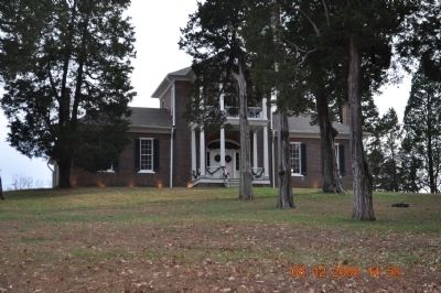
Built between 1828 and 1832, Belle Mont is a foremost example of Jeffersonian Palladian Architecture in the deep south and one of Alabama's first great plantation houses.
It was build for Dr. Alexander W. Mitchell, a native of Virginia, and a . . . — — Map (db m29561) HM
On State Road 22 at County Route 9, on the right when traveling west on State Road 22. Reported missing.
Site of Alabama's first permanent capital 1820-26. County seat Dallas County, 1820-66. Prison for Union soldiers during the War Between the States 1863-65. Indians were the first inhabitants over 4000 years ago. Their large fortified village could . . . — — Map (db m75779) HM
On 5th Avenue Northeast (U.S. 431) at Cleveland Avenue, on the right when traveling south on 5th Avenue Northeast.
For thousands of years, two important Indian trade routes ran across what was to become Etowah County. The “High Town Path” ran from Charlestown, S.C. west to the Mississippi River, near Memphis, TN. The “Creek Path” begins . . . — — Map (db m39226) HM
On Rainbow Drive (U.S. 411) east of Peteet Street, on the right when traveling east.
The lone survivor being Edmond Jones, 5 year old son of William and Hannah Humphries Jones, who later gave the land for the cemetery. — — Map (db m156398) HM
On Eastern Valley Road south of Elrie Boulevard, on the right when traveling south.
A cotton plantation house
circa 1840, with about 2,000 acres.
Built by Thomas McAdory, Jr.,
the pioneer architecture was the
dog-trot style built of numbered
hand-hewn logs and wooden pegs.
Born here: Robert McAdory,
first mayor of Bessemer . . . — — Map (db m215904) HM
On Eastern Valley Road (County Road 18) 0.1 miles north of Rosser Loop Drive, on the left when traveling north.
Thomas Hennington Owen,
grandson of Methodist
minister, David Owen and
Lucy McCraw, moved into
the 2 room rear wing with his
bride Malissa Rose Sadler in
1833. Second wife was Mary
Elizabeth Tarrant. The 2 story
addition in 1838 was . . . — — Map (db m215730) HM
On Allison-Bonnett Memorial Drive at Tin Mill Road, on the right when traveling west on Allison-Bonnett Memorial Drive.
Established in 1818, is one of the oldest church parishes in Jefferson County. About 1814 James Rutledge settled here to be near the Rutledge Springs and donated land for the church building and the cemetery. The first church building was completed . . . — — Map (db m215908) HM
On Eastern Valley Road (County Road 18) at Vintage Lane, on the left when traveling west on Eastern Valley Road.
“Single pen” log house built by John Loveless in 1817 in an old Indian field. Additions, which enclosed the log house, were by Isaac Wellington Sadler and wife, Martha Prude, starting in 1835. Isaac, the son of William Rose Sadler, was a planter, . . . — — Map (db m215728) HM
On Williams Avenue SE at Greene Street SE, on the right when traveling east on Williams Avenue SE.
Thomas Bibb, first president of the Alabama Senate and second governor of Alabama, completed this early high-style Greek revival house in 1836, having occupied the land since 1821. This was his town residence, his plantation home being Belmina, in . . . — — Map (db m160635) HM
On U.S. 43, 0.2 miles north of Richie Road, on the right when traveling north.
(English)
Site of
Old Mobile
Fort Louis de la Louisiane
Founded 1702 by
Pierre Le Moyne d’Iberville
Under orders of Louis XIV
First Capital of French Louisiana
1702-1711
(French)
Site de
Vieux Mobile
Fort . . . — — Map (db m70588) HM
On Bienville Boulevard at Lackland Street, on the right when traveling east on Bienville Boulevard.
This island, rich in history and legend, was
known to Europeans by 1502. Pineda visited in
1519, Narvaes and deVaca in 1528, the fleet of
deSoto in 1540, and the deLuna colonists in 1559.
In 1699, d'Iberville and Bienville arrived under
orders . . . — — Map (db m226727) HM
On North Royal Street at St Michael Street, on the right when traveling north on North Royal Street.
When Mobile was laid out, this was the city's north-east boundary point.
Royal Street ran along a bluff overlooking the Mobile River. There were no streets between Royal and the river, only marshland. — — Map (db m86347) HM
On North Conception Street, 0.1 miles north of St Michael Street, on the right when traveling north.
At this point the northwest limits of French Mobile faded into the dense forest which surrounded the city in 1711 and many years thereafter. An 1815 map shows the forest reaching Joachim Street, one block west. — — Map (db m86348) HM
On Government Street (U.S. 98) at South Jackson Street, on the right when traveling west on Government Street.
This site marks the southwestern limit of the city of Mobile in 1711. Known then as Fort Louis de la Mobile, it had been founded by the French at 27-Mile Bluff in 1702 and moved to its present site in 1711.
Mobile has been a city under six . . . — — Map (db m131883) HM
On Walden Road north of White Drive (Arkansas Route 25), on the left when traveling north.
David Hogan brought his family to Walnut
Grove from North Carolina in 1830. He was
buried in 1840 in this cemetery. Three of
his children are buried here; Charlotte,
wife of J.N. Churchill, for whom the
town of Charlotte is named, lies . . . — — Map (db m221078) HM
Near State Highway 362, 1.8 miles east of U.S. 49.
The stone marker behind you marks the 'Initial Point' for the survey of the Louisiana Purchase Territory. The east-west Baseline and the north-south line, the Fifth Principal Meridian, are fundamental in land transactions throughout the western . . . — — Map (db m155199) HM
On Graham Avenue at Spring Street, on the right when traveling west on Graham Avenue.
Est. 1887.
Presented by
Valley of the Mist Chapter, National Society Colonial Dames XVII Century,
2010.
The Crescent Bath House
has been placed on the
National Register
of Historic Places
by the United States
Department of the . . . — — Map (db m178935) HM
On Mill Street at Santa Barbara Street, on the right when traveling south on Mill Street.
Glen Tavern Inn, built 1911.
Presented by
Aquila Chase chapter,
National Society Colonial Dames XVII Century,
12 October 2014.
The Glen Tavern Inn, built in 1911,
has been placed on the
National Register
of Historic Places
by . . . — — Map (db m175684) HM
Near Southeast 15th Street (Camp Ranch Road), 0.4 miles south of Southeast 41st Avenue when traveling south.
The Alachua Sink, a named likely derived from the Potano word meaning “jug,” is the deepest of Paynes Prairie’s sinkholes and acts as a conduit for water entering the Floridan aquifer at a rate of up to 6 million gallons per day. . . . — — Map (db m126294) HM
Construction began 1856, was lit 1859 and is still in use at the present time.
This lighthouse replaced the original lighthouse built 1824, the first lighthouse on the Gulf Coast. — — Map (db m50405) HM
On June 14, 1898, Lt. Col. Theodore Roosevelt
and the First United States Volunteer Cavalry,
known as the Rough Riders, embarked from Port
Tampa for victory in the Spanish-American War.
The Tampa Bay Hotel was used as headquarters
for . . . — — Map (db m20160) HM
Near Mango Road at State Road A1A, on the left when traveling east.
The 1st house of refuge on Florida's east coast was constructed on this site which later became part of the U.S. Lifesaving Service. Houses of Refuge were built about 20 miles apart and provided a safe haven for those shipwrecked along the desolate . . . — — Map (db m112157) HM
On First Street (State Road 80) south of Jackson Street, on the left when traveling south.
Fort Myers, like many South Florida communities, developed during the last half of the 19th century. First Street (once called Front Street) became the heart of the new town, In 1866, Manuel A, Gonzalez and Joseph Vivas took up residence at the . . . — — Map (db m131368) HM
Near Periwinkle Way, 1.7 miles east of Causeway Boulevard.
The first permanent English-speaking settlers on Sanibel Island arrived from New York in 1833 as part of a colony planned by land investors. Although that settlement was short-lived, the initial colonists petitioned the U.S. government for the . . . — — Map (db m80475) HM
Mission San Luis de Talimali was among the largest and most important missions in Spanish Florida. Its parishioners were Apalachee Indians who were descendents of those people whose village Hernando de Soto appropriated during the winter of . . . — — Map (db m79564) HM
On West Call Street, 0.1 miles east of North Macomb Street, on the left when traveling east.
Prince Achille Murat was the nephew of Napoleon Bonaparte and the son of General Jochaim Murat, King of Naples. He settled in Florida in 1825, and as attorney, county judge, and director of Tallahassee's Union Bank, he played an active role in . . . — — Map (db m79577) HM
Near Manatee Avenue East (State Road 64) at 14th Street East.
The Manatee Village Historical Park was created as a gift to the people of Manatee County by the Historical Commission and the HOME Committee in remembrance of our Nation's Two Hundredth Birthday in the year 1976. Two historical buildings, Manatee . . . — — Map (db m43100) HM
On SE Ocean Boulevard (State Road A1A) at SE Denver Avenue, on the right when traveling east on SE Ocean Boulevard.
The Peter Montague & Lord Baltimore
Chapters of the National Society Colonial Dames XVII Century mark this Martin County Court House to commemorate the historical significance of this site to Martin County, Florida and its people. Built in . . . — — Map (db m193667) HM
On Overseas Highway (at milepost 79), on the right when traveling south.
1. North East end Lower Matecumbe Key - Ancient Water Wells - only fresh water on Upper Keys - Used by Indians, Sailors and Traders in XVII Century. Huge Indian Midden (Kitchen) near Wells.
2. Indian Key - Spanish Trading Post - established by . . . — — Map (db m83862) HM
On Dixie Avenue, 0.1 miles north of North Booth Street, on the left when traveling north.
The Callahan Train Depot was built by the Savannah, Florida and Western Railroad in 1881 along their Waycross GA to Jacksonville FL line that was the first major rail connection between Florida and the northern states. The original 32-foot square . . . — — Map (db m239180) HM
On Centre Street near North 4th Street, on the right when traveling west.
Dedicated in 1912, this Italian Renaissance Revival building was designed under the direction of Treasury Department architect James Knox Taylor. The interior was custom built to accommodate the building’s three original functions as a United . . . — — Map (db m144847) HM
On County Road 44A, 0.6 miles west of State Road 44, on the right when traveling west.
Baker House was the home to Senator David Hume Baker and his wife Mary. They moved from Kentucky where he served as a State Senator. He also served as a Florida Senator for Marion and Sumter Counties. He was a bank investor, county commissioner and . . . — — Map (db m134360) HM
On North Main Street (U.S. 301) at East Wonders Street, on the right when traveling south on North Main Street.
This modest Greek Revival building opened its doors for business in October 1908 and is believed to be the oldest surviving commercial building in downtown Wildwood. — — Map (db m208613) HM
On Cemetery Avenue, 0.2 miles east of East Campus Drive, on the right when traveling east.
Oconee Hill Cemetery was purchased in 1855 by the City of Athens when further burials were prohibited in the old town cemetery on land owned by The University of Georgia. In 1856, the City formed a self-perpetuating Board of Trustees to hold and . . . — — Map (db m38875) HM
On South Jackson Street, 0.1 miles north of Baldwin Street, on the right when traveling north.
This site is the original burial ground for Athens and contains the remains of its earliest citizens. It is a part of the original tract of land purchased for The University of Georgia by Governor John Milledge in 1801. All people in Athens were . . . — — Map (db m19707) HM
On North Wayne St. near West Thomas St. when traveling north.
Jarrett Springs formerly known as Commissioners Springs,
flows in an enclosed structure about 40 yards on adjacent land.
In 1803, because of the abundant and clear water supply,
this site was selected by the Georgia Legislature as the . . . — — Map (db m43164) HM
On Mulberry Street (Georgia Route 49) at 2nd Street Lane, on the right when traveling east on Mulberry Street.
Built in 1859 for Dr. George Emerson, the building is a prominent example of Italianate architecture. The 23 foot wide Brownstone was designed by New York architects, T. Thomas & Sons, who are also renowned for the Hay House. Listed on the National . . . — — Map (db m186752) HM
On Habersham Street at East Broughton Street, on the right when traveling south on Habersham Street.
Major John Berrien (1760-1815) was a Revolutionary War officer who served at Valley Forge and fought at the Battle of Monmouth. Berrien, a New Jersey native who moved to Georgia in 1775, was an original member of the Society of the Cincinnati in . . . — — Map (db m133218) HM
On West Mimosa Drive at Jonesboro Road (Georgia Route 54), on the right when traveling west on West Mimosa Drive.
Built in 1840 by Guy L. Warren, this Federal style family home became Confederate headquarters and hospital in 1864 during the Battle of Jonesboro. When Jonesboro fell, Union forces commandeered the house as Union headquarters and hospital to serve . . . — — Map (db m187123) HM
The Native Americans bent saplings to grow into living “signposts” for traveling Indians. These living markers pointed the way to a water source, a suitable river crossing or a main trail. — — Map (db m50200) HM
Near North Marietta Parkway Northwest (Georgia Route 5) at Polk Street Northwest, on the right when traveling north.
Originally located on Macland Road in Marietta, Georgia, this
c. 1830 log cabin was the home of the Manning family during
the Civil War. In 1990 the cabin was slated for demolition as part of
a road-widening project, so the Manning descendants . . . — — Map (db m227641) HM
On Highway 92 (Georgia Route 92) at New Hope Road, on the right when traveling north on Highway 92.
Hopeful Primitive Baptist Church Est. 1825 The oldest church in Fayette County. The cemetery is the final resting place of veterans from the Revolutionary War, War of 1812, Civil War, WWI & WWII. Placed by Thomas Wingfield Chapter National . . . — — Map (db m120067) HM
On Paces Ferry Road at Mount Paran Road, on the right when traveling east on Paces Ferry Road.
On 29 September 1877 William Brown donated one acre of land at the intersection of Paces Ferry and Mount Paran Roads for the purpose of establishing and building a church. Pleasant Hill Methodist Church was first served by circuit rider ministers, . . . — — Map (db m41951) HM
On North Broad Street (Georgia Route 93) just south of 3rd Avenue Northeast, on the right when traveling south.
The Oldest of Three Single Screen Movie Theaters In Georgia Marked by John Lee of Nansemond Chapter Colonial Dames XVII Century 15 April 2020 — — Map (db m172570) HM
On Etheridge Road just south of Carruth Road (Johnson Mill Road), on the left when traveling south.
This Piedmont Homestead, originally settled by brothers James and Patrick Shields in 1798, contains a collection of intact historical buildings on a total of 152 acres set aside for preservation. This is one of the most diverse collections of farm . . . — — Map (db m184289) HM
On South Broad Street just north of Smith Avenue (Business U.S. 84), on the right when traveling north.
Established 1916 Thomasville, Georgia Oldest continuously operating restaurant in Georgia Marked by John Lee of Nansemond Chapter Colonial Dames XVII Century December 2020 — — Map (db m172444) HM
On South Main Street north of Birger Street, on the right when traveling west.
The Yanda Log Cabin was built in 1853 by Austrian immigrant William Yanda, a blacksmith. The family owned the property for at least three generations, including Frank Yanda, Jr., an early mayor.
This cabin was restored in 1992 by Glen Carbon . . . — — Map (db m163555) HM
Near North 3100 East Road south of County Route 850N.
This park is the location of the major village of the Kickapoo Indians in central Illinois. The French first recorded a well established Kickapoo presence here in 1752. The 1818 surveyor's map for the new state of Illinois showed the grand village . . . — — Map (db m157173) HM
On North Main Street north of Madison Street, on the left when traveling north.
1906 - ∮ - ∮ - ∮ - 1946
Built in 1906
First and only Hospital in Johnson County
until after World War II
(Second Plaque)
To Honor the lineage of Family Physicians
who have served here . . . — — Map (db m69390) HM
On Liberty Trail at E. 8th Street, on the right when traveling north on Liberty Trail.
In the aftermath of George Rogers Clark’s conquest, skirmishers from Cahokia led by Capt. B. Hamelin and Lt. T. Brady, who had raided Fort St. Joseph, were defeated and captured near here by fur-trader Etienne Champion and Potawatomi allies of the . . . — — Map (db m72908) HM
On Lincoln Avenue west of U.S. 41, on the left when traveling west.
Neo-Classical Revival Mansion 1912. Architect Clifford Shopbell.
Boehne (1856-1946) was Evansville Councilman, Mayor and US Congressman. Under his administration the Water Works and Filtration Plant were built. Boehne Camp Hospital was named . . . — — Map (db m227006) HM
On Local Road N800W close to State Route 16, on the right when traveling north.
Built 1857
Owned by
James M. Deck Family
Since 1881
Dedicated by
Hon. Peter Tilton Chapter
National Society Colonial Dames XVII Century
As an historic site - Sept. 20, 1992 — — Map (db m163119) HM
On Waterfall Road, on the right when traveling east.
On this site in 1854 Timothy Thistlethwaite and his brother-in-law Joseph Ratliff dammed the water of the river with the use of farm teams, placing large boulders at the bottom of an earth and stone fill in the river channel; this changing the . . . — — Map (db m138711) HM
Near Oxford Avenue, 0.1 miles south of East Parker Boulevard, on the left when traveling south.
Oldest surviving cemetery in Baton Rouge. Dedicated by George Garig as a burial ground in 1813 and deeded to St. Joseph Roman Catholic Parish in 1819. This cemetery holds the remains of American Revolutionary War soldiers Armand Duplantier and . . . — — Map (db m92878) HM
On North Oak Hills Parkway, 0.1 miles west of Bluebonnet Boulevard, on the right when traveling east.
The area around the swamp was settled over 200 years ago. This 101 acre Louisiana swamp and surrounding highland terrace escarpment is preserved for education and recreation. — — Map (db m97685) HM
On Sycamore Street at Bank Street, on the right when traveling west on Sycamore Street.
Host to Mississippi Conference in 1854. The Gothic building with a Revival basilica, slave gallery, windows depicting cross and crown of thorns, has served its congregation 140 years. — — Map (db m85820) HM
On High Street at College Street (Louisiana Highway 952), on the left when traveling west on High Street.
And used for that purpose until the division of the Parish into East and West Feliciana in 1824.
This building has been owned by the Jackson Assembly since 1969. — — Map (db m93350) HM
On 2nd Street north of Bossier Street, on the right when traveling north.
Originally this was the site of the relocated Fort St. Jean Baptiste and the first formal burial ground at the Natchitoches Post. Graves date from the middle eighteenth century and represent the following French, Spanish and American founders. . . . — — Map (db m106116) HM
Near Highway 1052 north of Camp Moore Road, on the left when traveling north.
Established May 15, 1861. Dedicated on Confederate Decoration Day June 3, 1905.
Marked by Louisiana Society Colonial Dames XVII Century February 6, 2020 — — Map (db m196989) HM WM
Site of
First Quaker Regional Gathering
In Maryland
By George Fox in 1672
Ann of Arundell Chapter, MD.
National Society of Colonial
Dames XVII Century
1999 — — Map (db m65888) HM
Near Bayside Beach Road, 2.3 miles east of Fort Smallwood Road (Maryland Route 173).
Recorded on the
National Register
of
Historic Places
1975.
Second Marker (inside the facility):
Hancock's Resolution
Unusual for its stone construction, this house was built c1785 by Stephen & Belinda Ridgely Hancock, a . . . — — Map (db m9064) HM
On Greenway Drive at Abacco Lane, on the right when traveling east on Greenway Drive.
Once a focal point of a large farm as LaGrange, Meredith House is is one of the few remaining Georgian houses in Cambridge. Purchased by the Dorchester County Historical Society in 1959, the house is furnished with antiques reflecting the heritage . . . — — Map (db m3967) HM
On Old Frederick Road (Maryland Route 99), on the right when traveling west.
Home of the Browns of Howard County, descendants of the original settler Thomas Browne (the Patuxent Ranger) who was commissioned in 1692 to survey this area of then Anne Arundel County. — — Map (db m168880) HM
On West Nepessing Street at North Court Street, on the right when traveling east on West Nepessing Street.
One of the 10 oldest in the United States
1846
Court sessions have been held in this
building each year since its first
owner, Lapeer pioneer judge
Alvin N. Hart, held court here in
April 1847
Presented by
the Michigan State Society . . . — — Map (db m198366) HM
On College Street near Chinquepin Street, on the right when traveling north.
Methodists assumed ownership and the Academy was chartered as Port Gibson Collegiate Academy in 1854, becoming Port Gibson Female College in 1881. The school closed in 1928.
On December 21, 1933 deeds were filed in the courthouse . . . — — Map (db m139047) HM
On Delaware Avenue at South 6th Street, on the left when traveling west on Delaware Avenue.
McComb Neoclassical Revival landmark built by Hilborn B.
Holmes in 1912. Home of Julius H. & Elizabeth Brent in 1940. The
Brents served God and country through their humanitarian
spirit, buildings they erected & service in the MS . . . — — Map (db m243289) HM
Waters of Crosswicks Creek and the Delaware River join below. 22 vessels at Bordentown and 4 at White Hill were among the 44 that were destroyed in a British raid on May 8, 1778. All were trapped in the Upper Delaware when the British took . . . — — Map (db m5336) HM
On High Street south of West Pearl Street, on the right when traveling south.
Built by master bricklayer John Hoskins, Jr., the Federal-Style House is constructed of Flemish Bond brick. The facade focal point is the broken pediment entry with paneled pilasters, and round arched fanlight. Restored in 1983, it typifies 18th . . . — — Map (db m160102) HM
Oldest center portion c. 1738, with later additions 1760’s, the Smith Mansion and 160 acre farm, which hosted Lafayette during the American Revolution, was also raided by Hessian troops. Presented 19 October 2000 The Rancocas Valley Chapter . . . — — Map (db m35879) HM
On N Central Avenue at E 1st Avenue, on the right when traveling north on N Central Avenue.
This plaque was presented on June 3, 2006 by the New Jersey Sarah Soper Chapter of the National Society Colonial Dames XVII Century to recognize the unique architecture of the building and its importance as an aid to navigation. — — Map (db m46294) HM
On Merrick Road at Cedar Shore Drive, on the right when traveling east on Merrick Road.
( Left Plaque : ) National Society Colonial Dames XVII Century Long Island Chapter Commends the preservation of Old Grace Church Historic Complex Burial site of first colonial settlers Major Thomas Jones (d. 1713) and wife Freelove . . . — — Map (db m65154) HM
This marker is placed in grateful recognition of the gifts of food, friendship, and assistance with which the native inhabitants greeted the first Europeans to Roanoke Island in 1584.
Presented by
North Carolina Society
National . . . — — Map (db m206285) HM
On East Lexington Avenue at Terrell Drive, on the left when traveling east on East Lexington Avenue.
Ancient Indian Warrior / Trading Path. A branch passed through Guilford Co. here, ran from the Great Lakes to Georgia. Used by Colonists in Indian Treaty br 1744 but traveled after 1745 at their own risk. Most heavily traveled Early American Road. . . . — — Map (db m34925) HM