By J. J. Prats, September 29, 2018
The Bryan Family Marker
GEOGRAPHIC SORT Title Sort Marker Number Sort Marker Number Sort N Marker Number Sort T Publication Order Sort Publication Order Sort A Erected Year Sort Most Viewed Sort Most Recent-Interest Sort Most Recently Changed Sort SEE FAQ #33 FOR DESCRIPTIONS
On Midland Trail (U.S. 60) just east of Sherry Lane, on the right when traveling west.
Near Roach Road (County Route 45) 0.6 miles north of West Virginia Route 10, on the left when traveling north.
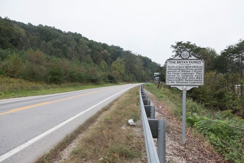
On U.S. 33 at Arnoldsburg-Rocksdale Road, on the left when traveling east on U.S. 33.
On U.S. 33 west of Arnoldsburg-Rocksdale Road (Local Route 18).
On U.S. 33 west of Arnoldsburg-Rocksdale Road (Local Route 18), on the right when traveling west.
On Little Kanawha Parkway (West Virginia Route 5) 1.3 miles west of the Big Bend Post Office, on the right when traveling east.
On Calhoun Highway (West Virginia Route 16) at Milo Road (Local Route 13), on the right when traveling south on Calhoun Highway.
On West Virginia Route 16 just south of Jess Reedy Road, on the left when traveling south.
On Main Street (West Virginia Route 16) east of Locust Street, on the right when traveling east.
On Main Street (West Virginia Route 16) east of Locust Street, on the left when traveling east.
On Main Street (West Virginia Route 4) at Main Street (West Virginia Route 16), on the left when traveling east on Main Street.
On West Virginia Route 16 at Elkhurst Road, on the right when traveling south on State Route 16.
On Procious Maysel Road (West Virginia Route 4) east of Maysel Clay Road (Local Route 26), on the right when traveling east.
On Big Otter Highway (West Virginia Route 16) 1 mile north of Nebo Walker Road (Local Route 16/1), on the right when traveling south.
Paid Advertisement
Near West Virginia Route 23 at Pike Fork (Local Route 10), on the right when traveling south.
On Stone Valley Road near Arnold Creek Road, on the right when traveling east.
On West Virginia Route 18 at Carter Camp Run Road, on the right when traveling north on State Route 18.
On West Virginia Route 18 at Porto Rico Road, on the right when traveling south on State Route 18.
On Greenbrier Road (County Route 17) 0.9 miles west of Patterson Fork Road (County Route 29), on the right when traveling west.
On Smithton Road at East Main Street, on the right when traveling north on Smithton Road.
On Davis Street (West Virginia Route 18) 0.1 miles north of Howell Street, on the right when traveling south.
On Davis Street / Old U.S. 50 (West Virginia Route 18) just north of Main Street (West Virginia Route 18), on the left when traveling north. Reported missing.
On West Main Street (U.S. 60).
On James River and Kanawha Turnpike East (County Route 60/33) at Tyree Street, on the right when traveling east on James River and Kanawha Turnpike East. Reported missing.
On U.S. 60, 1.7 miles west of Fox Avenue, on the right when traveling east.
On Midland Trail (U.S. 60), on the left when traveling west.
Near Midland Trail (U.S. 60) 0.4 miles west of Short Street.
On East Main Street (U.S. 60) at Cemetery Street, on the left when traveling west on East Main Street.
Near West Main Street (U.S. 60) near Orchard Street.
On Dixie Highway (West Virginia Route 16) just north of Twenty Mile Creek Road (Route 16/3), on the left when traveling south.
Paid Advertisement
On U.S. 60, 0.4 miles east of Park Road.
On Camp Carver Road (Local Route 11/3) 1.2 miles west of Clifftop Road (County Route 11), on the right when traveling north.
On North Court Street (Route 16) at Keller Avenue (County Route 82), on the right when traveling north on North Court Street.
On North Court Street (West Virginia Route 16), on the left when traveling west.
On Academy Court (County Road 8) at Park Drive, on the right when traveling east on Academy Court.
On Nickelville Road (County Route 19/1) north of Talbert Road, on the left when traveling south.
On Fayette Station Road (State Road 82) near the Tunney Hunsaker Bridge.
On High Street north of West Wiseman Avenue, on the left when traveling west.
On Midland Trail (U.S. 60) 9.7 miles west of West Virginia Route 16, on the right when traveling west.
On U.S. 60, 0.1 miles east of West Virginia Route 16, on the right when traveling east.
On U.S. 60, on the right when traveling east.
On U.S. 60 at West Virginia Route 41, on the right when traveling east on U.S. 60.
On Stanaford Road (West Virginia Route 41) 3.8 miles Meadow Bridge Road (County Route 41), on the left when traveling south.
On U.S. 60 at Spy Rock Loop, on the right when traveling east on U.S. 60.
On 2nd Avenue (West Virginia Route 61) 0.1 miles east of College Street, on the right when traveling west.
On Fayette Pike West (West Virginia Route 61) 0.1 miles east of Jackson Street, on the left when traveling east.
Paid Advertisement
On 4th Avenue east of Washington Street, on the right when traveling east.
Near Deepwater Mountain Road (West Virginia Route 61) at the Montgomery Bridge (West Virginia Route 6), on the right when traveling east.
On Fayette Pike West (West Virginia Route 61) 0.3 miles east of Jackson Street, on the right when traveling east.
On West Virginia Route 16 north of Virginia Street, on the right when traveling south.
On Robert C. Byrd Drive (West Virginia Route 16) at Price Hill Road, on the right when traveling north on Robert C. Byrd Drive.
On West Virginia Route 41, 0.4 miles south of Nallen Road, on the left when traveling south.
On Central Avenue at Virginia Street, on the right when traveling south on Central Avenue.
On West Virginia Route 612 at Torrey Fork Road (County Route 15/2), on the right when traveling west on State Route 612.
On Stanaford Road (West Virginia Route 41) at Prince Army Camp Road (Local Route 41/39), on the right when traveling east on Stanaford Road.
On Midland Trail (U.S. 60) at Cavendish Road (Local Route 60/17), on the left when traveling east on Midland Trail.
On Midland Trail, 3.7 miles west of Rainelle, on the left when traveling west.
On Midland Trail (U.S. 60) at Stonehouse Road (County Route 10), on the right when traveling east on Midland Trail.
On West Virginia Route 5, 0.1 miles west of Spruce Run (County Route 30), on the left when traveling west.
On Pioneer Way (County Route 5/3) 0.2 miles east of North Court Street, on the right when traveling east.
On North Lewis Street (U.S. 33) east of Main Street, on the left when traveling east. Reported missing.
On East Main Street west of Court Street, on the left when traveling west.
Paid Advertisement
On North Lewis Street (U.S. 33) at Factory Road (West Virginia Route 5), on the right when traveling east on North Lewis Street.
On Patterson Creek Road (County Route 5) 0.4 miles north of Williamsport-Twin Mountain Road (Local Road 5/2), on the left when traveling north.
On George Washington Highway (U.S. 50) at Mavis Avenue, on the right when traveling west on George Washington Highway.
On Laurel Dale Road (West Virginia Route 93) at Presbyterian Church Road (County Route 1), on the right when traveling south on Laurel Dale Road.
On George Washington Highway (U.S. 50) west of Cherry Ridge Road, on the left when traveling west.
On George Washington Highway (U.S. 50) west of Cherry Ridge Road, on the left when traveling west.
On U.S. 220 just south of the city line, on the right when traveling south.
On U.S. 220, on the right when traveling south.
On U.S. 220, 0.2 miles west of Rig Road (County Road 10), on the left when traveling west.
On Virginia Avenue (West Virginia Route 55) east of Main Street (U.S. 220), on the right when traveling east. Reported missing.
On Riverview Avenue (West Virginia Route 12) at Monroe Street, on the right when traveling east on Riverview Avenue.
On North Monroe Street north of Walnut Avenue, on the right when traveling north.
On West Virginia Route 3, 0.2 miles east of Big Branch Road (County Road 3/11), on the right when traveling east.
On Midland Trail West (U.S. 60) at Alta Mountain Road (Old West Virginia Route 12) on Midland Trail West.
Paid Advertisement
On Midland Trail W (U.S. 60) at Old State 12/Alta Mountain Road (County Route 60/38) on Midland Trail W. Reported missing.
On Midland Trail (U.S. 60) at Raders Valley Road, on the left when traveling south on Midland Trail.
On Midland Trail (West Virginia Route 60) at Delta Road 7 (Local Route 60/70), on the right when traveling east on Midland Trail.
On Alta Dr (West Virginia Route 12).
On Midland Trail (U.S. 60) 1.2 miles west of Harts Run Road (County Road 60/14), on the right when traveling west.
On Seneca Trail (U.S. 219) north of Red Oaks Farm Lane, on the right when traveling north.
On U.S. 219, 0.2 miles north of Anthony Road (County Route 21), on the right when traveling north.
On Midland Trail East (U.S. 60) 0.2 miles west of Battle Hill Drive, on the left when traveling west.
On U.S. 60, on the right when traveling west.
On Church St., on the right when traveling south.
On North Jefferson Street (U.S. 219) north of Lee Street, on the left when traveling south.
On Courtney Drive east of Washington Street (U.S. 60).
On E. Washington St. near Near Lee St..
On Church Street at West Foster Street, on the right when traveling south on Church Street.
On Court Street at Randolph Street on Court Street.
On U.S. 60, on the right when traveling west.
Paid Advertisement
On U.S. 219 at Greenbrier Ave., on the right when traveling north on U.S. 219.
On Courtney Drive at Washington Street (U.S. 60) on Courtney Drive.
On U.S. 60, on the left when traveling west.
On Houfnaggle Road (County Route 35) 1.8 miles south of Midland Trails Road (U.S. 60), on the left when traveling north.
On North Court Street at Preston Boulevard, on the right when traveling north on North Court Street.
980 entries matched your criteria. Entries 101 through 200 are listed above.
⊲ Previous 100 —
Next 100 ⊳