On 265th Street (County Road 60) west of 373rd Avenue, on the right when traveling west.
On Nov. 11, 1935, Explorer II, released in Black Hills, bearing Captains Orville A. Anderson and Albert W. Stevens, after a record ascent to 72,395 feet landed here, instruments intact and with a wealth of new scientific knowledge. — — Map (db m180701) HM
On 3rd Street Southwest west of Livestock Avenue, on the right when traveling east.
Camp SCS-4 (Huron): located on SE corner of State Fair Grounds. Companies: 2770--10/31/35-10/7/37; 4725V--10/7/37-8/15/41.
The Civilian Conservation Corps was a federal work - relief program during the Great Depression. From 1933 to 1942, . . . — — Map (db m179885) HM
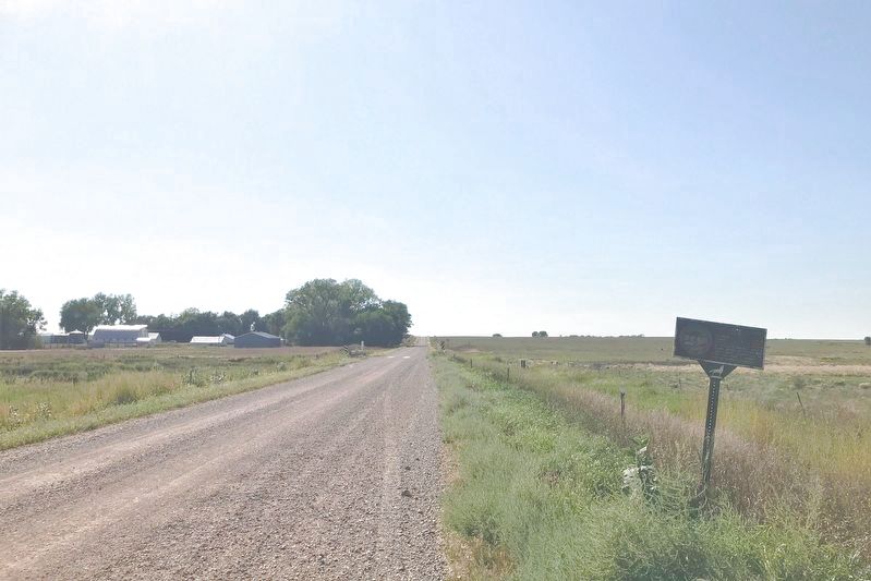
On 4th Street NE (U.S. 14) at Jersey Avenue NE, on the right when traveling east on 4th Street NE.
While with the Bureau of Reclamation, Glenn Sloan saw the possibility of using mountain water from the Missouri River to develop irrigation in the James River Valley.
His vision and determination made possible the broadened multi-purpose . . . — — Map (db m123908) HM
On 3rd Street Southwest west of Livestock Avenue, on the left when traveling east.
Where Does the West Begin?
Traditionally the American West has begun at the edge of the settled areas, always advancing with the sun. The Delaware River was the West of 1700; the Mississippi of 1820. Then the settlement of the Pacific . . . — — Map (db m179726) HM
On Commercial Avenue (U.S. 14) south of Cardinal Street, on the left when traveling south.
Wolsey: A Crossroad of the Heartland
Wolsey has been a crossroad of the heartland of South Dakota from its beginnings. In 1880 the Dakota Central Railway, a subsidiary of the Chicago & North Western, laid track following a wagon trail called . . . — — Map (db m123906) HM
On U.S. 18 at 230th Avenue (State Highway 73), on the right when traveling west on U.S. 18.
Camp BF-3: located 1 mile E, 4 miles S, 1 mile W & 5 miles S
Company: 4723 May 1937-Fall 1939
The Civilian Conservation Corps was a federal relief program during 1933-1942 that gave jobless men work renovating abused lands. The Army . . . — — Map (db m137082) HM
On 311th Street at Bon Homme Road, on the right when traveling west on 311th Street.
South side:
First Teacher
Emma J. Bradford
Pupils
John Bradford ·
Geo. McDaniels ·
Leanna Bradford ·
Ira Brown ·
Mary McDaniels ·
Melissa Brown ·
Geo. G. Rounds ·
Delia Rounds
East side:
In 1860 near . . . — — Map (db m213909) HM
On South Dakota Route 50, 0.1 miles south of South Dakota Route 52, on the right when traveling south.
Tabor named for a Bohemian town of that name can well be called “The Mother City of Dakota Czechs”. Frank Bem advertised for Czechs who wanted to take up new land and a large contingent came in 1869 and by April 14, 1872, at a meeting, it was . . . — — Map (db m180970) HM
On 471st Avenue at 220th Street, on the right when traveling north on 471st Avenue.
Home of roving Indians until 1862. The exploring party of Nicollet, scientist, and Fremont,
‘Pathfinder of the West,’ visited Oakwood Lakes July 1838, leaving the first reliable record.
The region East of the Big Sioux was ceded by the Santee . . . — — Map (db m181268) HM
Near 6th Street (U.S. 14) at 17th Avenue, on the right when traveling east.
Brookings: The county seat of Brookings County was platted October 3-4, 1879, when the Northwestern Railroad reached here. Some of the early store buildings were moved overland from Fountain and Medary, which soon became ghost towns. In November . . . — — Map (db m179949) HM
On 471st Avenue at 219th Street, on the right when traveling south on 471st Avenue.
Created 1862; Organized 1871; Convention 1877
The County, created on paper in 1862, was organized July 3, 1871 and by 1877, there were communities at Lake Hendricks, Oakwood, Lake Village and Medary, and all had delegates to the nominating . . . — — Map (db m179959) HM
On 471st Avenue at 219th Street, on the right when traveling south on 471st Avenue.
The Dakota Land Company of St. Paul, hoping to make this site the capital of a proposed
Dakota Territory, started a town here, naming it for Samuel Medary, Governor of Minnesota
Territory. Towns were also begun at Flandreau and Sioux Falls, the . . . — — Map (db m179957) HM
On County Road 6, 0.5 miles west of 163rd Avenue, on the right when traveling west.
Oakwood, called Tetonkaha, Lakes, when visited in 1838 by Nicollet & Fremont, was site of a small Fort, N of Little Round Lake in 1857 and again occupied in 1863-64. The township was surveyed by Richard F. Pettigrew in September 1871 and James . . . — — Map (db m179799) HM
The mounds found in Oakwood Lakes are typical of numerous such mounds in eastern South Dakota. Ten mounds have been located at Oakwood lakes and have been dated about A. D. 300 to A.D. 1400. Probably the remanents of late Woodland or Middle Missouri . . . — — Map (db m179695) HM
Breastworks
Probably built by two companies of the 2nd Infantry, under command of Capt. D. Davidson, in June-July, 1859. Parapets were then about 5 ft. high. A log house once stood in the center, but was razed long ago for firewood. Cannon . . . — — Map (db m179795) HM
On 202nd Street, 1.2 miles west of 462nd Avenue, on the right when traveling west.
This log cabin stands on the original site where it was constructed in 1869 by Samuel "Ol Spot" Mortimer.
Mortimer, a shoemaker from New York, came to Dakota Territory after hearing stories of the rich fur trade in the Big Sioux Valley. In . . . — — Map (db m179782) HM
On 220th Street east of 481st Avenue (State Route 13), on the left when traveling east.
You are about to enter
Brookings County
home of roving Indians until 1862. The exploring party of Nicollet, scientist, and Fremont, "Pathfinder of the West," visited Oakwood Lakes, July 1838, leaving the first reliable record.
The . . . — — Map (db m181265) HM
On Highway 14, 0.5 miles east of 487th Ave, on the right when traveling west.
All early maps (1838-1879) showed the Hole-in-The-Mountain or Mountain Pass where Coteau Perce creek drained SW from Lake Benton to the Big Sioux. It is 8 miles SE. Nicollet & Fremont, first explorers, visited the "Hole" on July 6, 1838 and . . . — — Map (db m177443) HM
On 215th Street (U.S. 14) 0.5 miles east of 487th Avenue, on the right when traveling west.
Created with its Twin North Dakota, 2 November 1889. Its 77,047 square miles ranks 15th in size. Those square miles include: exceptional corn land in the SE, grass land in the W, wheat land in the N and productive land all over. Its lowest . . . — — Map (db m179809) HM
On 219th Street, 1.1 miles east of Caspian Avenue, on the right when traveling west.
The Lake Campbell Lutheran Church was originally the Medary Norwegian Evangelical Lutheran Congregation, Brookings County, Dakota Territory. The congregation was organized June 13, 1870 at the John Thompson home in Sverdrup Township Minnehaha . . . — — Map (db m179962) HM
On 211th Street (U.S. 81) 1.1 miles west of Caspian Avenue, on the right when traveling west.
Oakwood Lakes, called by the Sioux, Te-tonka-ha, meaning the place of the Great Summer Lodge, lie in a scenic state park 7 miles N and 3 W. First visitors of record were Nicollet & Fremont. July 8, 1838.
During the Indian Disturbances of . . . — — Map (db m179802) HM
On 197th Street, 15 miles east of U.S. 29, on the right when traveling west.
Lake Hendricks Norwegian Colony of 1873
The first settlers at Lake Hendricks were 31 Norwegians, arriving July 14, 1873, with 11 covered wagons and 30 cattle. On May 14, 1873 they left Houston County, Minn., and Allamakee and Winneshiek . . . — — Map (db m179811) HM
On Unnamed Road, 0.7 miles north of 201st Street, on the right when traveling north.
Lake Hendricks State Park
This lake was named for Thomas A. Hendricks (1819-1885), Commissioner of the General Land Office, 1855-59, at which time the state boundary was surveyed and the lake named. Hendricks was a Member of Congress, 1851-55; . . . — — Map (db m184234) HM
On 6th Avenue Southeast (U.S. 12) east of South Harrison Street, on the left when traveling west.
(northwest section, side 1)
Day is done. Gone the sun.
From the lake. From the hills. From the sky:
All is well. Safely rest: God is nigh.
Fading light. Dims the sight.
And a star gems the sky. Gleaming bright.
From afar . . . — — Map (db m112664) HM
On East Melgaard Road, 0.1 miles west of South Lloyd Street, on the right when traveling west.
Two German-language newspapers, Dakota Freie Press (DFP) and Neue Deutsche Presse (NDP), were located a short distance from here at 524 South Main St. Owner and editor, Friedrich Wilheim Sallet, emigrated from East Prussia and published DFP for . . . — — Map (db m90571) HM
Located at the mouth of Elm River, Columbia has a notable history.
Here was the wintering place of Waneta "Cuthead Band"of Yanctonaise Sioux.
Here was the site of the scout's camp from which in 1866, Sam J. Brown
started his famous "ride in . . . — — Map (db m179946) HM
On 401st Avenue (County Road 18) at 120th Street (County Road 9), on the right when traveling north on 401st Avenue.
In 1880, John Daly and his four sons - George, John Charles ("JC"), Edward and Austin arrived at this location from Michigan.
It was here that "Daly Corners" started. On the northwest corner was J.C. Daly's tree claim and his homestead was on . . . — — Map (db m206716) HM
On Hamlin Garland Highway (123rd Street) (County Road 11) 0.5 miles west of 391st Avenue (County Road 14), on the right when traveling west.
who rose to distinction in
American Letters
resided on this spot 1881-1884
Here stood the
Garland Homestead
where he began his first book
"Main Travelled Roads" — — Map (db m206717) HM
On 391st Avenue (County Road 14) 0.5 miles north of 112th Street (State Highway 10), on the left when traveling north.
(east side)
History
The united Norwegion Luthern church.
In memory of the pioneer members of the Aurland congregation, organized in 1885. Rev Rogne was the first Pastor. The services wer held in homes & school houses until when in . . . — — Map (db m206714) HM
On 391st Avenue (County Road 14) at 104th Street (County Road 3), on the right when traveling north on 391st Avenue.
This monument was created to forever make available the story of those Finnish people who early came to Brown and Dickey Counties, and settled there.
Erected by the Savo Finnish Historical Society under the direction of John G. Peterson, the . . . — — Map (db m206703) HM
On U.S. 281, 0.2 miles south of 102nd St Southeast, on the right when traveling south.
Created with its twin, North Dakota, 2 November 1889, its 77,047 square miles ranks 15th in size. Those square miles include; exceptional corn land in the SE, grass land in the W, wheat land in the N and Productive land all over. Its lowest point, . . . — — Map (db m177397) HM
On 112th Street (State Highway 10) 1.3 miles west of 400th Ave., on the right when traveling east.
Camp BF-2 (Sand Lake): 2 1/2 miles W and 2 1/2 miles S at headquarters. Company: 2749--6/28/35 - 7/31/39.
The Civilian Conservation Corps was a federal work-relief program during the Great Depression. From 1933 to 1942, the CCC provided work . . . — — Map (db m100979) HM
On 112th Street (State Highway 10) at 3rd Street, on the right when traveling east on 112th Street.
Ralph Herseth, 1909 - 1969, was born on a ranch near Houghten and grew to manhood here. He graduated from Columbia High School and attended North Dakota State College. As a farmer - rancher, he raised wheat, corn, and Aberdeen Angus cattle and . . . — — Map (db m180972) HM
On North Main Street (State Highway 50) at Rodeo Avenue, on the left when traveling north on North Main Street.
Named for Selah Chamberlain, a Milwaukee RR official, the site was scene of an encounter between Jean Baptiste Trudeau and the Teton Sioux in 1794 and when Samuel H. Morrow surveyed the area, in November of 1868, he found a ranch on American Creek . . . — — Map (db m184645) HM
On 344th Avenue, 0.2 miles north of 251st Street, on the left when traveling north.
The Fort Ridgely and South Pass Federal Wagon Road, surveyed and mounded in 1857 crossed here from NE to SW. First public road in the South Dakota area. — — Map (db m242461) HM
Dedicated July 7, 1974 by Governor Richard F. Kneip
Meriwether Lewis and William Clark with their party camped at several points
near this crossing. In September 1804, continuous rain had soaked their gear.
They stopped near Ocoma, above . . . — — Map (db m180987) HM
On U.S. 83 at 102nd St. SE, on the right when traveling south on U.S. 83.
You are about to enter South Dakota Created with its twin, North Dakota, 2 November 1889, its 77,047 square miles ranks 15th in size. Those square miles include: exceptional corn land in the SE, grass land in the W, wheat land in the N. and . . . — — Map (db m44710) HM
On 296th Ave at State Highway 10, on the right when traveling north on 296th Ave.
Side A The Flint store and post office was built on this site in 1895. It was named after Moses E. Flint, and early homesteader. Mr. Flint served as a teamster with General Custer on the 1876 campaign against the Sioux which ended with the . . . — — Map (db m112082) HM
On State Highway 1804 at 294th Ave, on the right when traveling west on State Highway 1804.
Old Pollock
In 1901 Pollock was founded as the end point of the Soo Line rail service from Wishek, ND. Soo Line officials requested the town be named Pollock in honor of R.Y. Pollock, a pioneer lay minister and respected citizen of the . . . — — Map (db m112084) HM
On 303rd Street east of 388th Avenue, on the right when traveling east.
Martin Marty
1834-1896
First Abbot of St. Meinrad Archabbey, First Bishop of the Dakota Territory, began to visit the Indians in this territory in 1877. He established the first Indian Mission called St. Ann’s Mission of Wheeler, . . . — — Map (db m177442) HM
On 390th Avenue, 0.2 miles north of County Road 2, on the right when traveling north.
In memory of the Yankton Chiefs, who made the Treaty of 1858.
Struck by the Ree ·
Black Bear ·
Medicine Cow ·
White Swan ·
Pretty Boy ·
Feather in the Ear ·
Crazy Bull ·
Frank Deloria
Sioux
Delegates who signed the . . . — — Map (db m217464) HM
On 1st Ave. W at Commercial St., on the right when traveling east on 1st Ave. W.
This Memorial dedicated to all veterans of Clark County and to those who will come after us for their service to God and Country. They gave the supreme sacrifice
Sponsored by American Legion and Veterans of Foreign Wars Posts and . . . — — Map (db m183482) WM
On 1st Avenue East at South Commercial Street, on the left when traveling west on 1st Avenue East.
Samuel H. Elrod was born near Coatesville, Indiana, May 1, 1856. Having worked his way through Asbury College, now Depauw University, graduating in 1882, he passed the Indiana Bar Examinations and headed for Dakota Territory. Arriving in Watertown . . . — — Map (db m183480) HM
On U.S. 212, 0.2 miles west of 433rd Avenue, on the right when traveling east.
In 1931 an economic depression spread across South Dakota and the nation. A drouth ravished crops and unemployment was widespread.
In an effort to raise the morale of the people and to give amateur baseball players an opportunity to compete, . . . — — Map (db m183478) HM
On University Road, 3 miles east of State Highway 19, on the right when traveling north.
The Southeast South Dakota Experiment Farm was organized on April 5th 1956, for the purpose of conducting a research demonstration farm in Southeast South Dakota. It was through the efforts of the Norgren family, farmers, and other interested people . . . — — Map (db m182240) HM
On State Highway 50 east of 469th Avenue, on the right when traveling west.
On November 25, 1935, 17 farmers from Clay and Union counties held an historic meeting at the Manning/O'Connor store in Burbank, three miles south of this spot. Their purpose was to form a consumer-owned corporation which would allow the rural . . . — — Map (db m221237) HM
On Main Street south of State Route 50, on the left when traveling east.
Named for a grading contractor on the Dakota Southern Railway, built in 1872. George W. Gilbert became the first postmaster on 29 April 1873. Prior to that Lincoln Post Office, Charles M. Taylor, Postmaster, 27 July 1864 was nearby to the south. In . . . — — Map (db m179347) HM
On South Dakota Route 50, 3 miles west of Interstate 29, on the right when traveling west.
August Bruyer, his wife, Josephine (Simon) and their sons, John and Julius, were born in France, coming to America about the middle of the nineteenth century. By 1858, they had settled in Fairview Township, 4 miles east of what was to be Vermillion. . . . — — Map (db m179897) HM
On State Highway 50 west of 469th Avenue, on the right when traveling east.
On November 25, 1935, 17 farmers from Clay and Union counties held an historic meeting at the Manning/O'Connor store in Burbank, three miles south of this spot. Their purpose was to form a consumer-owned corporation which would allow the rural . . . — — Map (db m179899) HM
On West Main Street west of South Market Street, on the right when traveling east.
Andrew E. Lee was born near Bergen, Norway, on March 18, 1847. When Lee was four, he and his family moved to Wisconsin. After receiving a general school education, Lee arrived in Vermillion, Dakota Territory, in 1867.
Lee and Charles E. . . . — — Map (db m221599) HM
On South Dakota Street at West Chestnut Street, on the right when traveling south on South Dakota Street.
This stone marks the place where, on the twenty first day of July A.D. 1875, A.L. 5875, the Most Worshipful Grand Lodge, Ancient Free and Accepted Masons of Dakota, was constituted and the officers installed.
Grand Officers
Thos. H. . . . — — Map (db m179206) HM
On West Cherry Street, 0.5 miles south of State Route 50, on the left when traveling west.
Vermillion
August 24, 1804, Lewis & Clark camped near the White Stone (Vermillion) River and next day visited Spirit Mound 8 miles north. The military road, Sioux City - Ft. Randall after 1855 provided access, as did steamboats. A. C. Van Meter . . . — — Map (db m179392) HM
On South Dakota Route 20, 1 mile east of 462nd Avenue, on the right when traveling east.
During the Moon of the Harvest (August) in 1773 a band of Sioux were camped on the shore of this lake. We-Wa-Ke, fairest maiden in the camp had given her heart to a brave young warrior, Big Eagle, whose courage on the hunt and in battle far . . . — — Map (db m180984) HM
On 1st Avenue Southeast west of Maple Street Southeast, on the right when traveling east.
East side:
In Memory of Codington County Veterans who Gave their Lives
World War I
1917 — 1918
Ernest G. Aderhold ·
Daniel W. Bannister ·
Donald M. Bannister ·
Clifford O. Bates ·
George Coombes ·
Fred W. Domes · . . . — — Map (db m244155) WM
On 1st Avenue Southeast east of Broadway Street South, on the right when traveling east.
All Gave Some
Some Gave All
Gearhart, Michael E. Marine 16 May 66
Stoltenburg, Mark E. Marine 21 July 66
Langenfeld, Charles T. Navy 17 Apr. 66
Bolhouse, Dean F. Army 2 Jan. 69
Noeldner, Daniel M. Army 6 Mar. 69 . . . — — Map (db m244156) WM
On 1st Avenue Southeast west of Maple Street Southeast, on the right when traveling east.
West side:
Allen, Ephraim J. ·
Ashton, Perry J. ·
Amy, Oren H. ·
Amshein, Jos. ·
Best, Frederick D. ·
Beardsley, Geo. W. ·
Brenswoltz, Orlando P. ·
Bigelow, Orson T. ·
Bartlett, Geo. E. ·
Butler, Harris O. ·
Brown, . . . — — Map (db m244154) WM
On 5th Avenue Northwest at Skyline Drive, on the right when traveling west on 5th Avenue Northwest.
Arthur C. Mellette was elected first Governor of the State of South Dakota in 1889. Although Watertown lost in its bid to obtain the State Capital, which was established in Pierre, the Mellettes maintained their home in Watertown.
While the . . . — — Map (db m181946) HM
On North Broadway Street, 0.1 miles north of 1st Avenue North, on the right when traveling north.
This depot, originally the Rock Island Lines New Passenger Station and Division Office Building, was erected as a joint venture of
the Rock Island, and the Minneapolis and St. Louis Railroads in
1912 for $50,000.00.
Over the years, it has . . . — — Map (db m90413) HM
On 9th Avenue Southeast (U.S. 212) 0.2 miles west of 5th Street Southeast (U.S. 81), on the right when traveling east.
This tower was constructed in 1987 to house the old town clock. The city purchased the clock from Dakota Loan and Trust Co in 1887 for $1,000. The clock was moved to a tower on top of city hall in 1889. The old City Hall was demolished in 1965 . . . — — Map (db m169947) HM
On 9th Ave. SW at 3rd St. SW, on the right when traveling west on 9th Ave. SW.
1835 Joseph LaFramboise had trade post at Two Woods Lake (Chanopa.
1838 Nicollet & Fremont , explorers, visited SE Codington County.
1840 Rev. Stephen Return Riggs enroute, Lac Qui Parle to Ft. Pierre, traversed the area.
1856 Capt. Alfred . . . — — Map (db m177449) HM
Near State Highway 1806, 4 miles south of U.S. 12.
Sakakawea won her place in history as the indomitable guide of Lewis and Clark on their trip to the Pacific in 1805. She was a member of the Shoshoni tribe dwelling near the Big Horn mountains in Montana. In one of the frequent tribal conflicts she . . . — — Map (db m190173) HM
On Highway 12, 0.2 miles west of 222nd Ave, on the right when traveling west.
At this point the Bismarck-Deadwood Stage Trail passed in a line extending about 240 miles from northeast to southwest. In 1877, the Dakota Territorial Legislature commissioned the survey of the trail, which transported passengers and freight . . . — — Map (db m190174) HM
On U.S. 79 near County Route 101, on the right when traveling north.
First white man in the Black Hills, this courageous and brawny beaver trapper in 1823 led a dozen Mountain Men from Fort Kiowa to the Yellowstone. His party entered the Black Hills via the old bison trail through Buffalo Gap near here.
Born in . . . — — Map (db m89396) HM
On Badger Clark Road at Badger Hole, on the right when traveling south on Badger Clark Road.
Home of Charles Badger Clark (1883-1957)
Poet-Laureate
Author,
Lecturer and one of
South
Dakota's best known and beloved citizens.
For
approximately
thirty
years Badger
lived
alone
and wrote in
the cabin built with his own . . . — — Map (db m203436) HM
On Lower French Creek Road, 0.2 miles south of Stockade Lake Drive (U.S. 16A), on the left when traveling south.
In Memory of
Anna Donna Tallent
Teacher and Author.
Born in New York State
April 12, 1827.
Died in Sturgis, S. Dakota
February 13, 1901.
The first white woman
to enter the Black Hills.
Arriving in Custer City
in December . . . — — Map (db m185226) HM
On Stockade Lake Road (U.S. 16) close to County Route 346.
This picturesque valley was the site of the permanent camp of the Black Hills Expedition of 1874 under the command of General George A. Custer of the 7th Cavalry. Their 5 day stay was the longest stop made during the entire expedition and General . . . — — Map (db m180983) HM
On State Highway 87, 0.5 miles north of Lame Johnny Road, on the left when traveling north.
Camp SP-3 (DSP-1 in 1934): NE 2 miles, end of CSP road on French Creek. Company: 2757 - 7/28/34-10/1/41.
The Civilian Conservation Corps was a federal work-relief program during the Great Depression. From 1933 to 1942, the CCC provided work for . . . — — Map (db m124589) HM
Near South Playhouse Road east of Needles Highway (State Highway 87).
Camp SP-4 (DSP-2):
Lodge: located in the buildings seen here.
Companies:
2755–7/16/34 - 10/21/35 795–10/29/35 - 1/13/36 1793–4/27/36 - 7/30/42
The Civilian Conservation Corps was a federal relief program during
1933 - 1942 gave jobless . . . — — Map (db m203658) HM
On Mt. Rushmore Road (U.S. 16) at Lightning Creek Road (Forest Road 288), on the right when traveling west on Mt. Rushmore Road.
Camp F-14 Lightning Creek: located 0.7 mile NW on road 288. Companies: 1783V--10/17/33-Spring 34 791--4/30/34-Fall 41
The Civilian Conservation Corps was a federal relief program during 1933-1942 that gave jobless men work renovating abused . . . — — Map (db m185227) HM
On Hearst Memorial Highway (U.S. 385) at Avenue of the Chiefs, on the right when traveling north on Hearst Memorial Highway.
George Hearst (1820-1891) United States Senator, mining engineer, sportsman, speculator. Starting with nothing, he developed three of the fabled mines in the American West -- The Ophir, the Anaconda, and the Homestake -- and founded one of the . . . — — Map (db m180982) HM
On U.S. 385, 1.9 miles north of 7-11 Road (County Road 101), on the right when traveling north.
Camp NP-1 (DNP-1): located southeast of the cave entrance
in Wind Cave Canyon.
Companies: 2754 -- 7/16/34 - 11/1/39
2757 detachment -- 4/18/40 - 8/1/40
The Civilian Conservation Corps was a federal relief program during 1933-1942 that . . . — — Map (db m134564) HM
On Iron Mountain Road (U.S. 16A) near South Dakota Highway 244.
In 1932, Cecil Clyde Gideon, forged ahead with the design of the Pigtail Bridges when many felt it couldn’t be done. C.C., as he was called, was a pioneer in the Black Hills, making his mark as a master builder, architect, craftsman, lawman, highway . . . — — Map (db m89460) HM
On North Main Street at East 7th Avenue on North Main Street.
Carl Gunderson was born June 20, 1864 on his family's homestead near Vermillion. He graduated from the University of South Dakota in 1890. Gunderson farmed in Clay and Aurora counties and was a leader of the Wheat Growers Association. He was also a . . . — — Map (db m179896) HM
Near West University Avenue, 0.1 miles south of McCabe Street, on the right when traveling north.
This tree, regarded as "medicine" by the Indians, a scrawny hackberry, growing out of a rock, near Bois Cache Creek, soon to be lost to rising waters of Oahe Lake, on April 12, 1863 was rescued in a joint enterprise of the S. D. Dept. of History and . . . — — Map (db m180131) HM
On East 1st Avenue at Bartscher Road, on the right when traveling east on East 1st Avenue.
The site of the junction of two old trails—the "Jimtown" Trail first mail route of the James River Valley and the Fort Thompson Trail much used in the Black Hills Gold Rush.
Close to this junction was Firesteel the pioneer settlement and trading . . . — — Map (db m180135) HM
On South Gamble Street at East Hanson Avenue, on the right when traveling north on South Gamble Street.
Used for many years in White's mill on "Jim" River, 4 miles east of Mitchell, to grind flour for the homesteaders and farmers who hauled their wheat to the "grist" mill
In memory of my father
John R. White
and other pioneers of 1879 . . . — — Map (db m180133) HM
During the early 1880's, a small group of Swedish settlers left their homeland to come to Dakota Territory where they took up homesteads in this vicinity. On September 15, 1883, after holding services and meetings in their homes, they organized "The . . . — — Map (db m180277) HM
On 134th Street at 412th Avenue (County Highway 43), on the right when traveling west on 134th Street.
You are entering
Brown County
South Dakota
Colin Campbell had an early trade post on Elm River for Waneta's Cuthead Band of Yanctonaise Sioux. Leblanc's wintering post of 1835 was burnt and in 1836 he built a new one at the Talles Chenes . . . — — Map (db m206641) HM
On Railroad Avenue East just east of Main Street, on the left when traveling east.
Indians from the Lake Region now Northeastern South Dakota visited this area frequently in the early 1800's and white traders also traveled this way while buying furs. The government survey party of Horace J. Austin arrived June 21, 1879, and began . . . — — Map (db m197685) HM
On South Dakota Route 27 at 130th Street, on the right when traveling south on State Route 27.
Born at Johnson, Vermont, Sept. 12, 1840. His father died when he was 4 and at 6 he was bound out to work on a farm. He had 3 months schooling per year until 14 when, to get better educational opportunity, he got a store job for room and board and . . . — — Map (db m179944) HM
On South Dakota Route 25 at 133rd Street, on the right when traveling south on State Route 25.
Pioneering was never easy. In Dakota, drought, and grasshoppers, blizzards, and prairie fires were all occupational hazards. In sparse timbered areas, the settlers lived in dugouts and sod houses, enduring the hardships common to all . . . — — Map (db m185035) HM
On U.S. 12, 0.2 miles west of West 7th Street, on the right when traveling west.
The farmers and farm organizations of Day County herewith seek to perpetuate the memory of and appreciation for one of Day County's farmers, agronomist and plant pathologist:
Edgar S. McFadden
The son of humble Christian parents was born . . . — — Map (db m91410) HM
On Federal Route 12, 0.2 miles W. 7th Street, on the right when traveling west.
Born at Arendal, Norway, January 22, 1904, and came to the United States when three years old, settling in Lincoln County near Canton. Taught history and speech at Webster High School, 1932 to 1935. Completed law course at University of South Dakota . . . — — Map (db m179945) HM
On U.S. 12, 0.2 miles W. 7th Street, on the right when traveling west.
Following the 1862 Minnesota Indian Uprising where nearly 600 men, women, and children were killed, the United States Army at Fort Wadsworth recruited friendly Indians as scouts to restrict the hostile Indians from white settlements. A half-breed, . . . — — Map (db m179955) HM
On U.S. 12, 0.2 miles W. 7th Street, on the right when traveling west.
Founded in 1881 and named for J.P. Webster who homesteaded the townsite. Railroad supply point for Fort Sisseton (Fort Wadsworth) frontier outpost established 20 miles north in 1864. Gateway to
Northeastern South Dakota Lake Region whose abundance . . . — — Map (db m179947) HM
On U.S. 12, 0.2 miles west of West 7th Street, on the right when traveling west.
On October 25th, 1944 at 3:50 p.m. an A26-B two engine medium bomber from the Watertown Army Airbase crashed and burned in a field on the northwest quarter of section 12 of Butler township, which is two miles south and one mile west of this site. . . . — — Map (db m91404) HM
On County Road 22 at 496th Avenue, on the left when traveling east on County Road 22.
This marker commemorates the courage, sacrifice, and faithful devotion of the pioneer families of the Evangelical faith who settled in this vicinity of Duel County, South Dakota. In the early days of settlement, services were held in the homes or . . . — — Map (db m179948) HM
On South Dakota Route 20, 0.3 miles south of County Road 3, on the right when traveling south.
The town of Firesteel takes its name from nearby Firesteel Creek. First known as “Firesteel Station”, it started in May of 1910 with an influx of settlers drawn by rumors an entire section (square mile) to become a government townsite. Many who had . . . — — Map (db m161846) HM
On 276th Street (U.S. 281) 0.4 miles west of 392nd Avenue, on the right when traveling west.
A great town while it lasted, Grand View became Douglas County's third county seat when it won out over Huston, the second and Douglas City by 11 votes in 1882. Brownsdale the first, a phantom city, had been a brief but expensive luxury. Grand View . . . — — Map (db m180686) HM
On U.S. 12 at 8th Street, on the right when traveling east on U.S. 12.
Plaque South Post East Side.
This pillar of the Memorial Arch of Ipswich is erected in honor of the valiant men of the Community of Ipswich who answered our country's call to arms in the World War 1917-1918 and as an everlasting monument to . . . — — Map (db m182239) HM WM
On Main Street, 0.1 miles south of 2nd Avenue, on the right when traveling north.
Found near Mobridge, the impression was tediously incised by some old Indian intent on building himself up as a medicine man. Once formed it was a symbol of great power and was venerated by the Indians who believed it the work of the "Wakan" or . . . — — Map (db m179940) HM
On South Dakota Route 45 at 145th Street, on the right when traveling south on State Route 45.
On March 22, 1883 the 300 Members of a Welsh colony arrives by train at Aberdeen, South Dakota. Thirty families led by William E. Powell arrived here on the 29th and built the "Big Shanty or Shanty Mawr" on the Hugh Griffin claim on Section 9, 1 . . . — — Map (db m177873) HM
On U.S. 18, 0.2 miles east of Red Canyon Road, on the right when traveling east.
Camp at the Mouth of the Red Canyon, sometimes called Camp Collier, was established at this site in mid-June 1876 to protect travelers over the 150-mile Cheyenne-Black Hills stage road. It came into being after the Sioux, resentful of the white . . . — — Map (db m184460) HM
On U.S. 18, 0.5 miles west of Cemetery Road (County Highway 185), on the right when traveling west.
The Cheyenne to Deadwood Stage Line changed routes several times during its history.
In 1876 and 1877, the Cheyenne to Deadwood stagecoaches came through what would become present day Edgemont over what was known as Pollock’s Cutoff Route. The . . . — — Map (db m119900) HM
349 entries matched your criteria. The first 100 are listed above. Next 100 ⊳