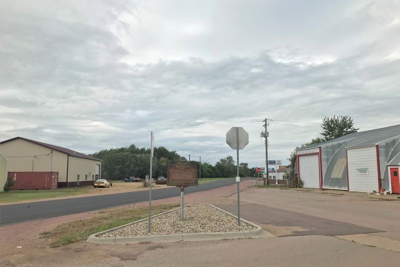
The Milwaukee, building from Marion to the Missouri, in 1880 soon reached Nation, platted in 1879 by Robert and J. B. Nation, with Orlan K. Bullard its postmaster on 5 January 1880 and when changed to Bridgewater on November 20th he continued to . . . — — Map (db m180129) HM
Farmer’s Union Local No. 253 was organized Dec. 15, 1917. Charter Members were J.C. Heinrich, John Noordsy, Henry Preshun, Robert Kaster, Elmer Goodyear, John Reecy, Leo Wingert, Henry Dykstra, Alfred Waechter, John Witkop, and G. H.Kirchner. The . . . — — Map (db m179883) HM
South Dakota's rich western heritage has been remembered along the Interstate highway system at safety rest areas and tourist information centers.
The eight pillars which thrust skyward here merge in the framework of a tipi, the Plains . . . — — Map (db m179882) HM
Born in Dane County, Wisconsin, October 20th, 1857, he graduated from Galesville College and in 1882 from the Law School of the University of Wisconsin and came to Leola, McPherson County, Dakota. He was elected Register of Deeds and County Clerk at . . . — — Map (db m182238) HM
Where Highways US 212 and SD 73 meet, at the end of the Cheyenne Branch of the Milwaukee Road, we live, a half mile above sea level of the Fox Ridge Divide, our souls nourished by the picture sunsets.
Our Grass is unsurpassed anywhere, . . . — — Map (db m185219) HM
Small Town
By Badger Clark
The circling cones of bison hide
that made the village of the Sioux
Rose near as high, spread near as wide,
O little Western town, as you.
But small-town skylines all are great
And . . . — — Map (db m185220) HM
On this parade ground in 1892 "The Star Spangled Banner" got its impetus to become the National Anthem. Colonel Caleb Carlton of the Eighth Cavalry was Post Commander and with his wife discussed the need for a National Air. At her suggestion he . . . — — Map (db m185221) HM
The trail blazers
here on December 26, 1875
Ben Ash, S.C. Dodge,
Russ Marsh, Ed Donahue,
and Stimmy Stimson
on their trip from Bismarck
through the Indian country
first sighted the Black Hills. — — Map (db m185222) HM
This 4,422 foot high volcanic bubble rises 1,200 feet above the plains, a guide for centuries to Indians, fur traders, soldiers, cowboys, and travelers. It was visited or passed by Verendrye, 1743; Lt. G. K. Warren, 1855; Hayden, the scientist and . . . — — Map (db m177396) HM
This area, extending along Bear Butte Creek, was for centuries a select camp site for the Plains Indians, who found here mountain spring water, wood, protection from the bitter north winds, together with much game and wild fruit in season. Here, or . . . — — Map (db m184003) HM
Camp J.G. Sturgis
Named for Lt. J.G. Sturgis, killed June 25, 1876 at Battle of Little Big Horn. Established July 1, 1878 in this area by Cos. G.F.I.K., 1st US Infantry; D.G. 11th US Infantry; Hq. & Trs. A.C.D.E.G.I.K.M. 7th US Cavalry; Col. . . . — — Map (db m177387) HM
This youthful pony mail carrier on the Sidney-Deadwood Gold Trail was ambushed, killed, and scalped in what is now south Sturgis on August 19, 1876. He was buried, next morning, by passing pioneers. On June 7, 1889, local citizens re-interred him . . . — — Map (db m183999) HM
Charles "Red" Nolin, pony mail carrier on the Sidney-Deadwood trail, was ambushed, killed, and scalped here by Indians on August 19, 1876.
On this evening, Nolin stopped by Alkali Creek, where the National Cemetery is now located. Here a . . . — — Map (db m184002) HM
Camps D-Army-1 & SCS-6 (Fechner): 1/2 mile S on W edge of Ft. Meade D-Army-1 company: 2758--7/20/34-10/31/35. SCS-6 companies: 2765--10/15/36-5/27/42; 4725V--5/28/42-7/27/42. The Civilian Conservation Corps was a federal work-relief program during . . . — — Map (db m184004) HM
Born in Ohio in 1876, he came to South Dakota in 1907. With scant education, he achieved college degrees, taught for 25 years, his last school at 86, to afford him time for summer research.
He wrote "Mato Paha", the story of Bear Butte, a . . . — — Map (db m180977) HM
On this spot, where the eroded ruts of the Bismarck-Deadwood Trail are still plain to see took place on July 17, 1877 the massacre of the Wagnus family by Indians, who from Bear Butte watched with envy the passing of their lands to the whites. Two . . . — — Map (db m184171) HM
Around 1895 the first Fedora village school was the Root School located in section 9 later moved to section 10. In 1905 a new two story wood school was built and used for grades one through ten located two blocks south of this marker on the west . . . — — Map (db m124601) HM
(side 1)
The Howard Public Library was the first public library chartered in Dakota Territory. Charter No. 1 was issued to the Ladies Library Association of Howard on January 8, 1886, by M.L. McCormick, Territorial Secretary. In 1889, the . . . — — Map (db m124599) HM
John Thompson, Pioneer
(1841-1913)
John Thompson arrived in America in 1854. He was a 13-year-old orphan who had lost his parents and sister to cholera during the long journey from Meraker, Norway. He was raised by an aunt in . . . — — Map (db m181288) HM
In 1881 Frank and Justin Pettigrew began construction of the power dam and flour mill at this site where portions of the foundation remain. The mill and the railroad were the nucleus of the town which was first called St. Olaf, later called Keyes, . . . — — Map (db m222277) HM
In May of 1857, land speculators from the Dakota Land Company, of St. Paul, Minnesota Territory, surveyed and located the town site of Eminija in this immediate area. Eminija was the Santee Sioux Indian name for the Split Rock River . . . — — Map (db m198935) HM
For hundreds of years, the land on which Brandon is situated was the home and hunting grounds of Native Americans. A prehistoric village site and numerous burial mounds are located nearby. Many early Brandon area settlers were of Norwegian descent; . . . — — Map (db m181916) HM
The Eminija Mounds, the largest and most numerous burial mound group in South Dakota, were built by Native Americans of the Late Woodland Period and may date from 500 to 1000 A.D. The original group consisted of at least 38 dome-shaped burial . . . — — Map (db m198936) HM
In 1908 the Western Bridge and Construction Co. of Omaha, Nebraska, built this Pratt-Through Truss Bridge. Workers fastened beams together with diagonal bracing to create a strong rigid framework. Each beam of a truss bridge shares a portion of the . . . — — Map (db m184708) HM
In 1878 when Hartford was first settled, it was called Oaksville after pioneer I.E. Oaks. The next year, the Worthington & Sioux Falls Railroad extended its line to Salem, South Dakota, and established a station at Oaksville. By 1881, the town, . . . — — Map (db m224417) HM
Townsite of Hartman was homesteaded in 1878 by John Hartmann, Sr. Town started in January 1899. Hans J. Johnson, Postmaster & General Store; Charles F. Bartling, Creamery; Jarvis W. Phelps, Blacksmith; John and Carl Johnson, Farm Implements; John . . . — — Map (db m183490) HM
On plains where Native Americans once hunted vast herds of buffalo, a country general store called Wellington Corner sprang up at this location in 1921. The first building, which became the ice house, was constructed by Luther and Anna Gage. The . . . — — Map (db m183487) HM
Lindbergh Landing
Col. Charles A. Lindbergh was the first to fly non-stop from New York to Paris. The 33½-hour solo flight on May 20-21, 1927, in a single engine monoplane, was a phenomenal aeronautical achievement which fascinated the . . . — — Map (db m181301) HM
Leonard Renner, a German immigrant and a Union Army Civil War veteran, came to Dakota Territory in 1878. He acquired farm land in Mapleton Township. Years later, the Chicago, Milwaukee, St. Paul and Pacific Railroad built a track . . . — — Map (db m181296) HM
Ole B. Iverson, his father Iver, brother Peter and brother-in-law Andy had no established roads to follow when they came to Dakota Territory in 1868. They had to wade or ford rivers and streams as best they could. These men, from near Decorah, Iowa, . . . — — Map (db m181919) HM
On July 27, 1888, Thomas Ryan of Dubuque, Iowa, purchased land for the Rowena townsite in the SE¼, Section 26, Split Rock Township from Nelson Webster. On October 10, 1888, Ryan platted the town into 43 city blocks and named the streets after . . . — — Map (db m181618) HM
In June of 1894, inspired by tales of marvelous progress in medicine at the 1893 Chicago Columbian Exposition, a small group of Lutheran clergy and laymen banded together to form a hospital association. They organized Sioux Falls Hospital . . . — — Map (db m238362) HM
Enraged over the broken promises of the white man, the Santee Sioux, led by Chief Little Crow, launched the "War of the Outbreak" - or "Dakota War" - in August, 1862, along the Minnesota River. Little Crow ordered White . . . — — Map (db m184699) HM
Memorial to
the Pioneers
of
Minnehaha County
1856 – 1889
Erected by the
Minnehaha County
Historical Society
- 1949 -
The Pioneer Memorial
Honors the early settlers who faced the harsh and lonely . . . — — Map (db m184705) HM
In late 1873, the young frontier town of Sioux Falls, Dakota Territory, population 150, established its first cemetery organization, Mount Pleasant Cemetery. Initially, twenty acres of land were purchased at a location east of town presumed to be . . . — — Map (db m181920) HM
In these mounds were buried the physical remains of Indians who lived in eastern South Dakota 1600 years ago. Radiocarbon testing established the time of the burials. Known to archaeologists as the Woodland Indians, they moved westward from the . . . — — Map (db m179951) HM
Following the advent of powered flight at Kitty Hawk, North Carolina in 1903, the dawning air age slowly arrived in Sioux Falls. In June 1912, a Curtis Pusher biplane was the first airplane to enter the skies over the city. It was delivered . . . — — Map (db m182227) HM
The 1862 Sioux Uprising, a result of unjust government treatment, claimed many Indian and non-Indian lives. Near this place on August 25, 1862, two of its victims, Judge Joseph B. Amidon and his son, William, were killed while making hay on their . . . — — Map (db m184710) HM
From 1887 to about 1913, this area, bordering the Big Sioux River, was the thriving community of East Sioux Falls. The city boasted a hotel, several boarding houses, saloons and retail stores, a town hall, a cricket team, at least three . . . — — Map (db m181620) HM
All Saints School was founded in 1884 by Bishop William Hobart Hare as an Episcopalian
boarding school for daughters of missionary clergy men and other young women in Dakota Territory. In memory of his late wife and in tribute to all women, he . . . — — Map (db m184709) HM
Richard Franklin Pettigrew was 20 years old in the spring of 1869 when he first came to Dakota Territory from Wisconsin as a member of a government surveying party. Pettigrew decided to settle in Sioux Falls, and join in the building of a city. . . . — — Map (db m184712) HM
A frontier town such as Sioux Falls, Dakota Territory, built almost entirely of wood and surrounded by highly flammable prairie grass could be swiftly consumed by uncontrolled fire. Without protection, farms and towns were vulnerable . . . — — Map (db m184701) HM
Arriving in Sioux Falls, Dakota Territory in 1878, Eliza Tupper Wilkes quickly became one of the community leaders of the small prairie town. She was born Eliza Smith Tupper on October 8, 1844 in Houlton, Maine. As a young woman she . . . — — Map (db m184707) HM
In the fall of 1856, speculators from the Western Town Company of Dubuque, Iowa, claimed a town site at the Falls of the Big Sioux River. The next spring, men joined them from the Dakota Land Company of St. Paul. Together, they founded Sioux Falls . . . — — Map (db m184704) HM
Nils A. Boe was born on September 10, 1913 in Baltic. The son of a Norwegian Lutheran minister, he came to Sioux Falls as a child and graduated from Washington High School. Boe earned his bachelor's and law degrees from the University of Wisconsin, . . . — — Map (db m184706) HM
Originally part of Minnesota Territory, Sioux Falls City was founded during a time of widespread townsite speculation on the frontier. In 1856 members of the Western Town Company of Dubuque, Iowa, arrived at the Falls of the Big . . . — — Map (db m184703) HM
On September 11, 1900, Theodore Roosevelt spoke from a platform at this intersection of Ninth Street and Minnesota Avenue. Thousands turned out for "Roosevelt Day" to see and hear the 41-year-old governor of New York, who was running . . . — — Map (db m184700) HM
(side 1)
In 1891, the Unites States Government purchased the southeast corner lot on Phillips Avenue and 12th Street for $8,000 for the construction of a government building. While everyone agreed that the fledgling city of Sioux Falls . . . — — Map (db m124096) HM
Early day justice in Minnehaha County, Dakota Territory, overlooked innocence when gallows were erected near this site for the hanging of Thomas Egan, a pioneer immigrant farmer from County Tipperary in Ireland. Egan settled in Dakota . . . — — Map (db m227957) HM
The Dubuque House, Sioux Falls’ first hotel, was built about 350 yards due west of this spot by Wilmot W. Brookings and members of the Western Town Company of Dubuque, Iowa, in September 1857. In the previous year, they had staked out a 320 acre . . . — — Map (db m184711) HM
The Sioux Quartzite, deposited more than a billion years ago, is among the oldest rock exposed in South Dakota. The quartzite and associated pipestone deposits were known to white men as early as 1822, but the American Indian used pipestone . . . — — Map (db m124602) HM
Soon after this area was platted in 1889, the city of Sioux Falls installed a community well which was located at this spot. It was a source of water for livestock and household use. Local residents referred to it as the "town pump." Here they hand . . . — — Map (db m184689) HM
In March 1889, several months before South Dakota achieved statehood, Evan B. Meredith, first president of the University of Sioux Falls, platted a future residential community within the northwest boundary of early Sioux Falls. His purpose . . . — — Map (db m184687) HM
In March 1889, several months before South Dakota achieved statehood, Evan B. Meredith, first president of the University of Sioux Falls, platted a future residential community within the northwest boundary of early Sioux Falls. His purpose . . . — — Map (db m184688) HM
No one knows when the first people came to live on the land that now comprises Minnehaha County, but native Woodland and Oneota peoples were here over 1000 years ago. The Big Sioux River which flows south through the county, appears on maps in . . . — — Map (db m179043) HM
Pasque-crowned, green-kirtled Spring with a promise
Met our people that April day
As their oxen stopped their weary plodding
At a stream they could trace on their claim's survey.
-Adeline M. Jenney
Adeline Jenney, Second Poet . . . — — Map (db m181352) HM
1859
Set at the junction of the states of Minnesota, Iowa and Dakota Territory by the Federal Land Office survey of Minnesota 's western boundary.
Early 1900's
Removed after partial destruction by vandals.
1938
Repaired . . . — — Map (db m184713) HM
Indian and frontier legends mix with the space age as you enter South Dakota here. Just one and one-half miles south, Valley Springs typifies early South Dakota settlements. Established in 1873, the town got its name from the many springs found by . . . — — Map (db m179040) HM
domain of the Dakota (Sioux) Indians, with a trading post, traditionally, at the Great Bend as
early as 1763 and Joseph LaFramboise in 1822 and Philander Prescott, 1832-33, certainly had
posts there. That portion east of the Big Sioux was ceded by . . . — — Map (db m181270) HM
You are about to enter
Lake County
so named because of its beautiful lakes. It had been the realm of the Dacotah (Sioux) Indians with few white intruders until ceded by the Yankton tribe in 1858. In 1857 the Noble's Trail was built across . . . — — Map (db m208335) HM
Here on the Highway, in front of this marker, stood the "Lone Tree" for more than two generations. It was planted, a mere cottonwood seedling, in the hole left by pulling out the original survey stake (surveyed in September 1869 by Levi P. . . . — — Map (db m181287) HM
For a quarter of a century before 1862 and its War of the Indian Outbreak in Minnesota, Santee Sioux had been accepting Christianity. With the killing of over 500 whites by a truculent minority. The government hung 38, imprisoned over 300 at . . . — — Map (db m177447) HM
One hundred years ago Flandreau Indian School had its inception when the federal government appropriated $1,000 for the mission school set up in 1872 by Presbyterian missionaries for Santee Sioux who had homesteaded near Flandreau.
The first . . . — — Map (db m181272) HM
William John "Bill" Janklow was born in Chicago in 1939. He grew up in Flandreau. After serving in the US Marine Corps, he married Flandreau native Mary Dean Thom. They raised three children: Russell, Pam, and Shonna. After graduating from the . . . — — Map (db m181274) HM
One of the captives of the Spirit Lake Massacre, who was drowned while crossing the Big Sioux River, in April 1857, about 300 yards east of this point. — — Map (db m181285) HM
In 1915, Mr. and Mrs. Bill Hagensick purchased 14 acres of land here that, in 1917, became Hagensick's Resort. As the automobile gained popularity, thousands of summer fun-seekers sought out the resort. In 1920, it was expanded west of the bridge . . . — — Map (db m181260) HM
Camp F-2 (DF-2) Horse Creek: Located 2 miles W on Horse Creek. Companies: 791--5/22/33-4/30/34 2752--7/30/34-10/21/35 2761--10/25/35-01/36 2748--01/36-5/25/36
The Civilian Conservation Corps was a federal relief program during 1933-1942 that . . . — — Map (db m184419) HM
Camp F-15 Tigerville: Located 1/4 mile S of here.
Companies: 765--10/26/33-Spring 1934 757--4/21/34-10/20/34
2748--10/21/34-1/36 793--5/25/36-6/13/39
The Civilian Conservation Corps was a federal relief program during 1933-1942 that . . . — — Map (db m184461) HM
First laid out as a gold camp in February 1876 by Thomas Harvey, John Miller and Hugh McCullough, the rich strikes in the Northern Hills made it a deserted village by May 1876. Its deserted cabins had many transient occupants and the cabin that . . . — — Map (db m177389) HM
Sheridan, located 1/2 mile NE, now 30 feet under water, was named for General Philip Sheridan and founded in 1875 on Cheyenne-Deadwood Trail, as Golden, in the belief that fabulous placer gold existed here. Still Indian Country and everybody a . . . — — Map (db m184420) HM
Camp F-4: Pactola Campsite inundated by Lake Pactola. Companies: 1789--6/8/33-10/35 2748--5/25/36-1940
The Civilian Conservation Corps was a federal relief program during 1933-1942 that gave jobless men work renovating abused lands. The Army . . . — — Map (db m184423) HM
His birthplace was Idaho. California first taught him art. Then France, who first gave him fame. England welcomed him. America called him home. His genius for the exquisite as for the colossal gave permanence on canvas, in bronze, in marble, to . . . — — Map (db m134568) HM
Doane Robinson (1856-1946) was the South Dakota state historian from 1901 to 1926. Speaking to the Black and Yellow Trail Association in January 1924, Robinson proposed his idea to carve legendary figures of the American West into the Black Hills . . . — — Map (db m184424) HM
Camp F-1 Mystic: Located at this spot
Companies: 760--6/29/33-10/20/34 2753--10/20/34-10/30/35
2763--10/30/35-1/20/36 1790--1/20/36-1/6/38
The Civilian Conservation Corps was a federal relief program during 1933-1942 that gave jobless . . . — — Map (db m184462) HM
Walter Dale Miller was born October 5, 1925 near Viewfield. He graduated from New Underwood High School and spent his life ranching in Meade County.
Miller served in the State House of Representatives from 1967 to 1987. He is the only person in . . . — — Map (db m183905) HM
Near a perpendicular sandstone cliff a short distance North of here and across Rapid Creek (a marker denotes the site) was the first camp of those hardy pioneers who founded Rapid City. Here John R. Brennan, Martin Persinger, Thomas Ferguson, W. P. . . . — — Map (db m184409) HM
South Dakota's rich western heritage has been remembered along the Interstate highway system at safety rest areas and tourist information centers.
The eight pillars which thrust skyward here merge in the framework of a tipi, the Plains Indian . . . — — Map (db m184631) HM
South Dakota's rich western heritage has been remembered along the Interstate highway system at safety rest areas and tourist information centers.
The eight pillars which thrust skyward here merge in the framework of a tipi, the Plains . . . — — Map (db m192323) HM
At this point the Bismarck-Deadwood Stage Trail passed in a line extending about 240 miles from northeast to southwest. In 1877, the Dakota Territorial Legislature commissioned the survey of the trail, which transported passengers and freight . . . — — Map (db m190172) HM
Hugh Glass, a member of the Ashley Fur Party under Major Henry, going up the Grand River in August 1823, a habitual "loner", while hunting, was attacked by a grizzly bear near the Forks of Grand River. Horribly mauled he could not be moved, a . . . — — Map (db m178664) HM
Originally located near mouth of Little Cheyenne River 15 miles west it was to be inundated by the Oahe Dam and so moved here.
White men, ascending the Missouri, observed this huge rock on a hillside and were told by the Indians it was a Sacred . . . — — Map (db m246332) HM
Don't look now. Because that site is normally under 50 feet of
water. 125 feet from the shore at a point 1.15 miles northeast along a meandering shore line, from the point this road finally runs into the Oahe Reservoir. It was a landmark in . . . — — Map (db m184292) HM
has been designated a
Registered
Natural Landmark
Under the provisions of the Historic Sites Act of August 21, 1935 this site possesses exceptional value in illustrating the natural history of the United States
U. S. Department of . . . — — Map (db m185215) HM
Until 1883, Grant County extended N to the S end of Lake Traverse and out to the Sisseton Reservation line. With the creation of Roberts County, Governor Ordway appointed Major Crissey, Sisseton Agent, Frederick Dittes and Reuben E. Hall to organize . . . — — Map (db m185214) HM
You are entering
Roberts County
South Dakota
Long the home of Sisseton, Wahpeton & Cuthead Yanktonaise Sioux, it became part of Deuel & Cheyenne Counties in 1862; Deuel extending N to 46th parallel (4 miles N) in 1872. The Reservation . . . — — Map (db m185177) HM
You are entering
Roberts County
South Dakota
Long the home of Sisseton, Wahpeton & Cuthead Yanktonaise Sioux, it became part of Deuel & Cheyenne Counties in 1862; Deuel extending N to 46th parallel (4 miles N) in 1872. The Reservation . . . — — Map (db m197544) HM
Roberts County Long the home of Sisseton, Wahpeton & Cuthead Yanktonaise Sioux, it became part of Deuel & Cheyenne Counties in 1862; Deuel extending N to 46th parallel (4 miles N) in 1872. The Reservation extending S to Lake Kampeska in a . . . — — Map (db m185165) HM
Born at Swan Lake, Minnesota, and converted to Christianity by Protestant Missionaries. In 1857, he led in rescue of Abbie Gardner, from Hostile Indians, on James River (near Redfield) and in 1862 rendered heroic service protecting the whites during . . . — — Map (db m197538) HM
Noted Indian orator, born at Lac Qui Parle. After conversion to Christianity, he was President of the Hazelwood Republic. He participated in rescue of Abbie Gardner in 1857 from hostiles on James River (near Redfield). During War of Outbreak in . . . — — Map (db m185158) HM
A grove of tall, stately pine trees two miles north of this marker whisper the tale of two Dakota Indian brothers, Clarence and Joseph Grey, who died in an early winter snowstorm in November 1958, while trapping along the coteau. Their bodies were . . . — — Map (db m185162) HM
The Dakota winter of 1937 stretched out too long for farm boys Charles Almos and Clayton Week. They lived with their parents on the Coteau des Prairies eight and ten miles west of Sisseton. During their high school years, the boys shared room and . . . — — Map (db m185164) HM
On a pleasant winter day, January 6, 1903, Knut Throndson, an 1892 homesteader from Hellingdal, Norway, decided to visit his closest neighbors, Tobias and Bertha Herigstad, who lived less than a quarter mile east of this spot. Knut's wife, Caroline, . . . — — Map (db m185163) HM
You are entering
Roberts County
South Dakota
Long the home of Sisseton, Wahpeton & Cuthead Yanktonaise Sioux, it became part of Deuel & Cheyenne Counties in 1862; Deuel extending N to 46th parallel (4 miles N) in 1872. The Reservation . . . — — Map (db m185183) HM
Long before the white man, an Indian Trail from the sanctuary at Pipestone Quarry to the "Three Rivers of the Sioux" near Ft. Thompson passed closely by. The whiteman's first road in Dakota, the Ft. Ridgely & South Pass Wagon Road, forded the James . . . — — Map (db m177446) HM
Ruskin Park was synonymous with excitement, entertainment and romance from its inception.
The area's first pioneers settled along the James River near here in 1873. The Santee and Rodee families homesteaded south of here near a large grove . . . — — Map (db m179938) HM
Before white settlers came, this vicinity was inhabited by the Yankton tribe of the Sioux nation and numerous reminders of these people can still be seen in the burial mounds, storage cellars and artifacts that have been found.
Fisher Grove . . . — — Map (db m180980) HM