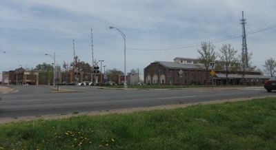
On North Main Street at Webb Avenue (North Carolina Highway 87) on North Main Street.
At this site on 1 June 1861 soldiers of the 6th NC State Troops, commanded by Col. Charles Fisher president of the NC Railroad, drilled before departing for the war front. In July 1861, they became the first troops ever carried by rail into battle. . . . — — Map (db m29626) HM
(Preface) The Carolinas Campaign began on February 1, 1865, when Union Gen. William T. Sherman led his army north from Savannah, Georgia, after the March to the Sea. Sherman’s objective was to join Gen. Ulysses S. Grant in Virginia to crush . . . — — Map (db m222825) HM
When North Carolina passed laws in 1833 to restrict the rights of free blacks; they also limited the rights of Indians. In old Orange (later Alamance) County, many Occaneechi Indians including Dixon Corn, Jesse Jeffries, Enoch Jones, and Andrew . . . — — Map (db m168278) HM
(Preface): The Carolinas Campaign began of February 1, 1865, when Union Gen. William T. Sherman led his army north from Savannah, Georgia, after the March to the Sea. Sherman's objective was to join Gen. Ulysses S. Grant in Virginia to crush . . . — — Map (db m42335) HM
On North Carolina 62 (State Highway 62), on the left when traveling south.
(Preface): The Carolinas Campaign began of February 1, 1865, when Union Gen. William T. Sherman led his army north from Savannah, Georgia, after the March to the Sea. Sherman's objective was to join Gen. Ulysses S. Grant in Virginia to . . . — — Map (db m222726) HM
To Commemorate With Grateful Love the Patriotism, Valor, and Devotion to Duty, of the Brave Soldiers of Alamance County.
(Back): "On Fame's Eternal Camping Ground, Their Silent Tents are Spread, and Glory Guards, with Solemn Round, . . . — — Map (db m28269) WM
The Memorial Is Dedicated To The Honor Of All The Brave Men And Women Of Alamance County Who Fought In Service To Their Country And In Memory Of Those Inscribed Here Who Died In Defense Of Our Freedom.
Civil War
Jacob Adams, W.B. . . . — — Map (db m31485) WM
(Preface) The Carolinas Campaign began on February 1, 1865, when Union Gen. William T. Sherman led his army north from Savannah, Georgia, after the March to the Sea. Sherman’s objective was to join Gen. Ulysses S. Grant in Virginia to crush . . . — — Map (db m46022) HM
On East Main Street (State Highway 49), on the left when traveling west.
Nathaniel Polk DeShong descended from Huguenot immigrants who settled near the Haw River about a mile and a half north of here. He enlisted on June 21, 1861, at 17 years of age under Capt. James W. Lea “for the War” in the 6th North Carolina State . . . — — Map (db m222823) HM
On State Highway 119 at Jim Minor Road, on the right when traveling south on State Highway 119. Reported missing.
(Preface): The Carolinas Campaign began on February 1, 1865, when Union Gen. William T. Sherman led his army north from Savannah, Georgia, after the March to the Sea. Sherman’s objective was to join Gen. Ulysses S. Grant in Virginia to crush . . . — — Map (db m211213) HM
The Quakers (Society of Friends) were early anti-slavery supporters of the Underground Railroad. Once the war erupted and Alamance County residents chose sides, supporters of the Confederacy regarded the Friends as Unionists. Never attacked directly . . . — — Map (db m45538) HM
A mile south of here is the site of Freedom Hill Wesleyan Methodist Church, a simple frame building that measured 27 by 36 feet and was dedicated in March 1848. When local residents sent a plea for a minister to the Wesleyans in Ohio in 1847, the . . . — — Map (db m46020) HM
Micajah McPherson, a trustee of Freedom Hill Wesleyan Methodist Church and abolitionist, was lynched about a mile and a half southeast of here. Although there are different stories about his lynching, they agree that he was an innocent man lynched . . . — — Map (db m46021) HM
On West Main Avenue (State Highway 90) at South Center Street (County Highway 1605), on the left when traveling west on West Main Avenue.
From 1861-65 the heroic sons and daughters of The Old South, under the greatest generals of all times, Robert E. Lee and Stonewall Jackson, fought with gallantry unequaled in all the annals of history. Not for the preservation of slavery, but for . . . — — Map (db m156819) WM
On West Main Avenue (State Highway 90) at South Center Street (County Highway 1605), on the left when traveling west on West Main Avenue.
At 2:00 o'clock p.m. the belch and roar of this Jones six-pounder ceased and out of the grove on Seminary Ridge, Gettysburg, marched the bravest body of infantry that ever careered the fields of battle, to hurl itself against the Union batteries on . . . — — Map (db m156818) WM
On North Main Street (U.S. 21) just north of East Whitehead Street (State Highway 18), on the right when traveling north.
[southwest side]Coast Guard • Army • Air Force • Navy • Marine Corps ☆ Dedicated to the honor and sacrifice of our Men and Women who served our Country in War and Peace ☆[northeast . . . — — Map (db m227326) WM
On North Carolina Route 742 at Deep Creek Road, on the right when traveling south on State Route 742.
At present NC 742, Gen. Wm. T. Sherman's Left Wing (14th & 20th Corps or Army of Georgia), under command of Union Maj. Gen. Henry Slocum and Union Cav. Gen. Judson Kilpatrick, converged with approx. 31,000 Union soldiers of Union Left Wing Army . . . — — Map (db m226582) HM
On East Caswell Street (U.S. 74) at North Park Drive, on the right when traveling west on East Caswell Street.
Associate Justice, State Supreme Court, 1878-1887; Member of Congress, 1873-1877; Member of Confederate Congress; legislator. Home is one mile west. — — Map (db m42320) HM
On Hickory Nut Gap Road (County Route 1342) west of North Carolina Highway 184, on the left when traveling west.
In 1860 Banner Elk was a small community in the mountains of Watauga County (present-day Avery County). Then called Banner’s Elk, it was named for the local Banner family and the Elk River. During the last years of the Civil War, an organized system . . . — — Map (db m77533) HM
Near Elk Park Highway (State Highway 194) at U.S. 19E, on the right when traveling east.
During the Civil War, natural resources such as salt, lead, and iron were highly prized commodities in the Confederacy. The government relied especially on small rural ironworks to manufacture cannons, swords, and firearms. Ruben White first mined . . . — — Map (db m77479) HM
On Hospital Drive, 0.5 miles south of Newland Highway (North Carolina Highway 181), on the left when traveling south.
Sarah Malinda Blalock and her husband, William McKesson “Keith” Blalock, lived in Coffey’s Gap on the Watauga and Caldwell County line in 1860. Keith Blalock was an avowed Unionist, but with the passage of the first Confederate . . . — — Map (db m77492) HM
On State Highway 33 at Windmill Road (County Road 1124) on State Highway 33.
Site of Confederate batteries on Pamlico River which enabled General D. H. Hill's forces to besiege Washington in spring of 1863. Five miles east. — — Map (db m52837) HM
On West Main Street at Gladden Street, on the left when traveling east on West Main Street.
Prior to formation of 1st N.C. Colored Volunteers, about 100 black men were armed to aid Union forces during the siege of Washington in 1863. — — Map (db m114466) HM
On West Main Street near South Respess Street, on the right when traveling south.
Governor, 1889-91, state Adjutant General, 1863, Confederate officer, superior court judge, state legislator. His home was here. — — Map (db m65862) HM
On North Market Street (County Route 1516) at East 15th Street, on the right when traveling north on North Market Street.
After the Civil War, women’s associations throughout the South sought to gather the Confederate dead from battlefield burial sites and reinter the remains in proper cemeteries, while Confederate monuments were erected in courthouse squares and other . . . — — Map (db m76917) HM
On East Water Street at South Bonner Street, on the right when traveling east on East Water Street.
To protect Confederate supply lines and to gather much-need provisions in eastern North Carolina, Gen. Daniel H. Hill planned demonstrations against Union-occupied New Bern and Washington in March 1863. He acted under orders from Gen. James . . . — — Map (db m70502) HM
Near Pactolus Highway (U.S. 264) 0.1 miles west of Voa Road, on the left when traveling west. Reported permanently removed.
After Union Gen. Ambrose E. Burnside’s army captured Roanoke Island in February 1862, Federal troops occupied New Bern the next month and then secured the undefended town of Washington on March 20. Although several weeks passed with only a few . . . — — Map (db m211803) HM
On West Stewart Parkway near West Main Street, on the right when traveling south.
During the summer of 1862, Union
forces firmly controlled eastern
North Carolina, with garrisons
stationed at Plymouth, Washington,
New Bern and elsewhere. Federal
detachments raided the countryside
at will, while Confederate . . . — — Map (db m64899) HM
On South Queen Street south of East Water Street (U.S. 17) when traveling south. Reported missing.
To disrupt Confederate recruiting efforts here in Windsor, the Bertie County seat, three Federal transports steamed from Plymouth on the night of January 29, 1864, under U.S. Navy Lt. Cmdr. Charles W Flusser. USS Whitehead and USS . . . — — Map (db m60627) HM
On South Queen Street south of West Water Street when traveling south.
Windsor's residents slept peacefully the night of January 29-30, 1864, unaware of what the morning would bring, as U.S. Navy Lt. Cmdr. Charles W. Flusser led three gunboats their way to disrupt Confederate recruiting efforts. USS Massasoit . . . — — Map (db m226118) HM
On State Highway 45 at Batchelor Bay Drive, on the left when traveling north on State Highway 45.
The Confederate ironclad ram Albemarle, led by Capt. J.W. Cooke, crossed Batchelor's Bay, May 5, 1864, and fought seven Union warships 15 mi. E. — — Map (db m56990) HM
On South King Street (State Highway 308) at East Water Street (U.S. 17), on the right when traveling north on South King Street.
Acting on orders from General Robert E. Lee in the winter of 1863-64, Confederate forces under the command of Major General George E. Pickett were deployed throughout eastern North Carolina preparatory to as an attempt at clearing the enemy from the . . . — — Map (db m60628) HM
On South Bald Head Wynd, 0.1 miles south of Salt Meadow Trail, on the right when traveling south.
Union ships chased the blockade runner Ella ashore on Bald Head Island as she tried to enter Old Inlet on December 3, 1864. Over the following two days, Confederate soldiers from Fort Holmes salvaged goods from the derelict vessel before she . . . — — Map (db m165876) HM
On West Bald Head Wynd at Cape Fear Trail, on the left when traveling south on West Bald Head Wynd.
A rectangular sand bastion, Battery No. 2 mounted a 100-pounder Brooke Cannon and was located about 200 yards east. The site of circular-shaped Battery No. 1 with its 10-inch Columbiad cannon is about 100 yards to the west. It sat upon the south end . . . — — Map (db m165878) HM
On West Bald Head Wynd at Sea Gull Trail, on the right when traveling south on West Bald Head Wynd.
Fort Holmes’s largest earthen battery was built on the southwestern elbow of Bald Head Island to guard Old Inlet for blockade running ships. Its seacoast cannon provided cross-fire with Fort Caswell on Oak Island. Erosion claimed Battery Holmes by . . . — — Map (db m115743) HM
On Light House Wynd at North Bald Head Wynd, on the left when traveling north on Light House Wynd.
Battery No. 4 highlights what remains of Fort Holmes. This crescent-shaped sand bastion mounted two 24-pounder and two 32-pounder cannon to guard against an enemy attack from the direction of East Beach and Bald Head Creek. The battery and a large . . . — — Map (db m115759) HM
On Ballast Stone Ally east of North Bald Head Wynd, on the right when traveling east.
In this area stood the main base camp for Fort Holmes’s garrison troops, and the headquarters of Colonel John J. Hedrick, 40th Regiment NC Troops. The barracks and storehouses were made largely of red cedar lumber and shingles, hewed from Bald Head . . . — — Map (db m115745) HM
On Light House Wynd north of North Bald Head Wynd, on the left when traveling north.
Wilmington, North Carolina was the Confederacy's most important Seaport during the Civil War. By 1864, it was the last Atlantic Port open to trade with the outside world. General Robert E. Lee said: “If Wilmington falls, I cannot maintain . . . — — Map (db m165877) HM
On Station House Way north of Chicamacomico Way, on the left when traveling south.
U.S.S. Peterhoff served on the Union blockade of the Cape Fear until it was accidentally run into and sunk by the U.S.S. Monticello on March 7, 1864 off bald Head Island’s East Beach. The Peterhoff’s remains are located about . . . — — Map (db m115693) HM
On River Road SE (U.S. 133) south of Route 17, on the right when traveling south.
Large Confederate fort stands 13 mi. S. After a strong Union attack it was evacuated Feb. 18, 1865, resulting in the fall of Wilmington. — — Map (db m6437) HM
On Country Club Road (State Highway 133) at Yaupon Drive, on the right when traveling south on Country Club Road.
Seized by N.C. Militia three months before firing on Fort Sumter. Governor Ellis ordered its return to Federal Authority; three miles east. — — Map (db m5834) HM
On Southport-Supply Road (State Highway 211) at Long Beach Road (State Highway 133), on the left when traveling east on Southport-Supply Road. Reported missing.
Named for Gov. Caswell. Begun by U.S. in 1826; seized by N.C. troops, 1861; abandoned by Confederates, 1865. Stands five miles southeast. — — Map (db m16331) HM
On East Bay Street east of South Davis Street, on the left when traveling east.
Confederate Lifeline. On January 9, 1861, as secession fever swept the South, an armed body of civilians overwhelmed Fort Johnston’s lone occupant, Ordinance Sgt. James Reilly, and demanded the keys. Reilly quickly surrendered them and received . . . — — Map (db m168569) HM
Begun 1861. Named in honor of General Joseph R. Anderson, then commanding military district.
The Fort, under command of Brig. Gen. Johnson Hagood, suffered a severe bombardment by a Federal fleet and attack by Federal army under Maj. Gen. J. M. . . . — — Map (db m6494) HM
In 1861–1862, Col. William Lamb and Maj. John Hedrick
constructed Fort Anderson, one of several Confederate
strongholds that protected Wilmington, a major blockade-running port. They enlarged Fort St. Philip (for St. Philip’s Anglican Church . . . — — Map (db m6515) HM
On River Road SE (State Highway 133) at Plantation Road (Local Road 1529), on the left when traveling south on River Road SE.
Large Confederate fort stands 2 mi. E. After a strong Union attack it was evacuated Feb. 18, 1865, resulting in the fall of Wilmington. — — Map (db m6438) HM
On Broadway at Mt. Clare Avenue, on the right when traveling north on Broadway.
Gen. Davis Tillson raised 1,700-man 1st U.S. Colored Heavy Artillery in Tennessee and North Carolina in 1864. The unit encamped nearby while garrisoned in Asheville in 1865. Assigned to Tillson's 2nd brigade, the men participated in operations in . . . — — Map (db m55571) HM
Near Eagle Street at Davidson Drive, on the right when traveling east.
When the war began, more than 15 percent of Buncombe County’s residents were enslaved people. James Patton housed slaves behind his Eagle Hotel (straight ahead), where they worked as waiter, maids, grooms, cooks, and trail guides. Three blocks to . . . — — Map (db m75507) HM
On O Henry Avenue at Battle Square, on the right when traveling north on O Henry Avenue.
Near the end of the Civil War in 1865, Confederate Battery Porter was positioned uphill to your right on Stony Hill, at that time the highest point in Asheville. The battery included four 12-pounder field pieces known as Napoleons, a model 1857 . . . — — Map (db m75505) HM
On Campus Drive at Field Drive, on the right when traveling north on Campus Drive.
On April 3, 1865, Union Col. Isaac M. Kirby left Tennessee with 900 men including his own 101st Ohio Infantry for “a scout in the direction of Asheville.” Three days later, local resident Nicholas Woodfin spotted the Federals on the Buncombe . . . — — Map (db m209953) HM
On Broadway (State Highway 1781), on the right when traveling north.
On April 3, 1865, Union Col. Isaac M. Kirby left East Tenn. with 1100 men on a raid against Asheville. On April 6, Kirby's force was defeated by local militia under Col. G. W. Clayton. Earthworks remain 100 yds. N. — — Map (db m55543) HM
On Overlook Road south of Springside Road (County Route 3506), on the left when traveling south.
Early in 1861, Buncombe County farmer William Riley Powers joined the Rough and Ready Guards (Co. F, 14th North Carolina Infantry). The regiment was assigned to southeastern Virginia. There, Confederate Gen. Benjamin Huger discharged Pvts. Powers . . . — — Map (db m75532) HM
Near Dalton Street, 0.3 miles north of Wyoming Road, on the right when traveling north.
George Avery, a 19-year-old enslaved blacksmith, joined Co. D, 40th United States Colored Troops, in Greeneville, Tennessee, in 1865. According to local tradition, his master, Confederate Maj. William W. McDowell, sent Avery to enlist for a post-war . . . — — Map (db m75527) HM
Near Birch Street west of Pearson Drive when traveling west.
Two notable Buncombe County brothers are buried here. Zebulon B. Vance (1830-1894) was North Carolina's Civil War governor and served as a U.S. senator from 1879 to 1894. His elder brother, Robert B. Vince (1828-1899), led the 29th North Carolina . . . — — Map (db m209950) HM
On Broadway Street at Ocala Street, on the left when traveling north on Broadway Street.
Graves of Thomas Wolfe & "O. Henry," authors; Zebulon B. Vance, governor; Thomas L. Clingman and Robert R. Reynolds, U.S. senators. One-half mile W. — — Map (db m97532) HM
On Biltmore Avenue (U.S. 25) near Patton Avenue (U.S. 74E), on the right when traveling north. Reported permanently removed.
Erected and Dedicated by the
United Daughters of the Confederacy
and Friends
In loving memory of
Robert E. Lee
and to mark the route of the
Dixie Highway
“The shaft memorial and highway straight
attest his worth — he . . . — — Map (db m31578) HM
Near Victoria Road, 0.1 miles south of Oakland Road, on the right when traveling south.
After John Brown’s raid on Harpers Ferry, Virginia, in 1859, new militia companies were formed in the South. Businessman William W. McDowell, whose wife acquired this house from her father’s and brother’s estates, raised a company called the . . . — — Map (db m75524) HM
Near Montford Avenue at Hill Street, on the right when traveling south.
During the war, many large buildings such as schools, warehouses, and churches became temporary prisons in Southern cities. After Asheville's jail on Pack Square overflowed with Confederate draft evaders, deserters, Union prisoners of war, and . . . — — Map (db m59170) HM
On Charlotte Highway (Alternate U.S. 74) south of Clarke Lane, on the left when traveling south.
(preface)
On March 24, 1865, Union Gen. George Stoneman led 6,000 cavalrymen from Tennessee into southwestern Virginia and western North Carolina to disrupt the Confederate supply line by destroying sections of the Virginia and Tennessee . . . — — Map (db m209727) HM
On Old U.S. 70 E, on the right when traveling west.
Southern troops turned back Stoneman's U.S. cavalry, raiding through western North Carolina, at Swannanoa Gap, near here, April 20, 1865. — — Map (db m55830) HM
On Yates Avenue near Old U.S. 70, on the left when traveling north.
Stoneman's Raid
On March 24, 1865, Union Gen. George Stoneman led 6,000 cavalrymen from Tennessee into southwestern Virginia and western North Carolina to disrupt the Confederate supply line by destroying sections of the Virginia and Tennessee . . . — — Map (db m55971) HM
On Reems Creek Road (State Highway 1003), on the right when traveling north.
Here were born two notable Buncombe County brothers, Zebulon Baird Vance (1830-1894) and Robert Brank Vance (1828-1899).
Zebulon Vance was a Whig and supporter of the Union who opposed secession until the last moment. At the outbreak of war in . . . — — Map (db m225431) HM
Built of local cut stone, ca. 1835, by James Binnie. August terms of State Supreme Court held here, 1847-61. Raided by Union force 1865. Remodeled 1901. — — Map (db m99610) HM
On U.S. 70 at Summers Road, on the right when traveling east on U.S. 70.
Training camp for state troops, 1861-64, named for Col. Zebulon Vance, war governor, was here. The camp was raided by federal troops in 1864. — — Map (db m99612) HM
(Preface): On March 24, 1865, Union Gen. George Stoneman led 6,000 cavalrymen from Tennessee into southwestern Virginia and western North Carolina to disrupt the Confederate supply line by destroying sections of the Virginia and Tennessee . . . — — Map (db m20348) HM
On Sterling Street at Union Street on Sterling Street.
On March 24, 1865, Union Gen. George Stoneman led 6,000 cavalrymen from Tennessee into southwestern Virginia and western North Carolina to disrupt the Confederate supply line by destroying sections of the Virginia and Tennessee Railroad, the . . . — — Map (db m99609) HM
On Lenoir Road (State Highway 16) 0.2 miles north of Sanford Drive (County Route 64), in the median.
On their raid through western North Carolina Gen. Stoneman's U.S. cavalry skirmished with Confederates near here on April 17, 1865. — — Map (db m20346) HM
On Union Street South at Means Avenue Southeast, on the right when traveling north on Union Street South.
This monument erected to the memory of the Confederate dead of Cabarrus County N.C.
With granite and marble and branch of the cypress the emblems of peace shall thy slumbers enshrine then take this memento. 'Tis all we can offer. Oh grave . . . — — Map (db m175747) WM
On St Johns Church Road at Mt Olive Road (County Route 2416), on the right when traveling north on St Johns Church Road.
During the Civil War, about two hundred members of St. John’s Lutheran Church served in at least eight Confederate army units. The units included companies in the 8th, 20th, 33rd, 52nd, and 57th North Carolina Infantry regiments, as well as a . . . — — Map (db m77374) HM
On Yadkin River Road (County Route 1560) 0.3 miles north of North Carolina Highway 268, on the right when traveling north.
(preface)
On March 24, 1865, Union Gen. George Stoneman led 6,000 cavalrymen from Tennessee into southwestern Virginia and western North Carolina to disrupt the Confederate supply line by destroying sections of the Virginia and Tennessee . . . — — Map (db m168406) HM
On Harper Avenue Northwest at Main Street Northwest, on the right when traveling east on Harper Avenue Northwest.
(preface)
On March 24, 1865, Union Gen. George Stoneman led 6,000 cavalrymen from Tennessee into southwestern Virginia and western North Carolina to disrupt the Confederate supply line by destroying sections of the Virginia and Tennessee . . . — — Map (db m208798) HM
On Norwood Street Southwest at Pennton Avenue Southwest, on the right when traveling south on Norwood Street Southwest.
On a raid through western North Carolina Gen. Stoneman's U.S. Cavalry passed through Lenoir, Mar. 28, and there again, Apr. 15-17, 1865. — — Map (db m20388) HM
On McPherson Road (State Highway 1231) 0.1 miles south of U.S. 17, on the right when traveling south.
North Carolina's Civil War stories are as diverse as its landscape. Northeastern North Carolina, including Camden County, the Outer Banks, and the coastal rivers, saw action early in the war as Union forces occupied it. Stories abound of naval . . . — — Map (db m165188) HM
On Canal Drive, 0.3 miles south of Main Street (U.S. 17), on the left when traveling south.
Early in 1862, Union Gen. Ambrose E. Burnside led an expedition to secure the coast of North Carolina and occupy strategically important sites such as New Bern and Elizabeth City. After Burnside learned of the March 9 clash between USS . . . — — Map (db m56761) HM
Near East Fort Macon Road (County Route 1190) 3.6 miles east of Atlantic Beach Causeway (County Route 1182).
This cannon is a replica of a 30-pounder Parrott Rifle, one of the most widely used siege cannons in the War Between the States. Invented by Robert P. Parrott in 1861, the 30-pounder Parrott Rifle quickly became one of the Union Army’s standard . . . — — Map (db m77064) HM
Near East Fort Macon Road (County Route 1190) 3.6 miles east of Atlantic Beach Causeway (County Route 1182).
In order to promote safe navigation of shipping through Beaufort Inlet past numerous shoals and sand bars, the US Lighthouse Board established the Bogue Banks Lighthouse and a navigational beacon on the eastern end of Bogue Banks near Fort Macon . . . — — Map (db m77086) HM
Near East Fort Macon Road, 1.3 miles Picnic Park Drive, on the left when traveling east.
Early in the War Between the States, Confederate soldiers at Fort Macon obtained a large number of cannons from the Gosport Navy yard at Norfolk, Virginia, in 1861 to defend the fort. Among these were six 32-pounder carronades, which were stubby . . . — — Map (db m225891) HM
On Fort Macon Road, on the right when traveling east.
This fort, guarding the entrance to Beaufort Harbor, was built between 1826 and 1834 as one of a series of seacoast fortifications for national defense. Local secessionist militia forces seized the fort on April 14, 1861, at the outbreak of the . . . — — Map (db m31451) HM
Built by U.S. Corps of Engineers, 1826-34. Good example of brick fort. Seized by Confederates, April 14, 1861. Scene of battle, April 25, 1862. — — Map (db m31278) HM
Near West Fort Macon Road at Atlantic Station Shopping Center, on the right when traveling west.
In March 1862, Union Gen. John G. Parke’s brigade of Gen. Ambrose E. Burnside’ Coastal Division advanced from New Bern to capture Beaufort Harbor and Fort Macon. During March 22-26, Parke’s forces took possession of Carolina City, Morehead City . . . — — Map (db m77046) HM
804 entries matched your criteria. The first 100 are listed above. Next 100 ⊳