By Dale K. Benington, April 6, 2010
The Wayne Trace Marker
| On North 400 East, 0.1 miles East North (U.S. 224), on the left when traveling north. |
| On Lindenwood Avenue, 0 miles north of West Jefferson Boulevard, on the right when traveling north. |
| On North Wells Street, on the right when traveling north. |
| On East Main Street at Clay Street, on the right when traveling west on East Main Street. |
| On Clay Street at East Berry Street, on the left when traveling north on Clay Street. |
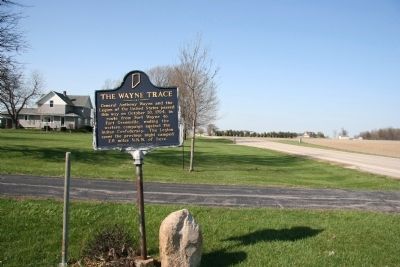
| On Wayne Trace at New Haven Avenue, on the left when traveling south on Wayne Trace. |
| On Edgewater Avenue, 0.5 miles west of Lafort Street, on the left. |
| On Edgewater Avenue at Dearborn Street, on the left when traveling west on Edgewater Avenue. |
| On Edgewater Avenue at Dearborn Street, on the left when traveling west on Edgewater Avenue. |
| On Lawton Place, 0.1 miles east of Spy Run Avenue, on the right when traveling east. |
| On South Clinton Street (U.S. 27) south of East 4th Street, on the left when traveling south. |
| On Lawton Place, 0.1 miles east of Spy Run Avenue, on the right when traveling east. |
| Near Rivergreenway, 0.1 miles east of Spy Run Avenue (U.S. 27), on the left when traveling east. |
| On Tennessee Avenue at Griswold Drive, on the right when traveling west on Tennessee Avenue. |
| On Clinton Street, on the right when traveling north. |
| On Michaels Avenue at Van Buren Street, on the left when traveling west on Michaels Avenue. |
| On South Calhoun Street north of East Lewis Street, on the right when traveling north. |
| On Hoagland Road just east of Poplar Drive, on the right when traveling east. |
| On Carroll Road near Madden Road. Reported permanently removed. |
| On 3000 County Road 300 E (State Road 55) at County Road E 300 N, on the right when traveling north on 3000 County Road 300 E. |
| On State Road 18 west of County Road N200W, on the right when traveling east. |
| On E. Huntington St (State Road 18) at S. Main St, on the right when traveling east on E. Huntington St. |
| On State Road 47 west of Evans Road, on the left when traveling east. |
| On Michigan Street (a.k.a.: St Rd 29) at East 7th Street, on the right when traveling north on Michigan Street (a.k.a.: St Rd 29). |
| Near West North Washington Street at North Charles Street, on the right when traveling east. |
| On West Monroe Street (State Road 39) near West S Road, on the left when traveling west. |
| On West Towpath Road west of North Meridian Road, on the left when traveling west. |
| On County Road N 800 W at County Road W 550 N, on the right when traveling south on County Road N 800 W. |
| On South 800 West at West 550 South on South 800 West. |
| On Indiana Route 29 near County Road 400, on the right when traveling south. |
| On County Road E250N, 0.4 miles County Road 725E, on the right when traveling east. |
| On County Road E250N, 0.8 miles east of County Road N600E, on the right when traveling east. |
| On Michigan Avenue (a.k.a. - St Rd 25) at Fulton Street, on the right when traveling south on Michigan Avenue (a.k.a. - St Rd 25). |
| Near Patrol Road, 0.7 miles north of Collector Wells Road, on the right when traveling north. |
| Near Riverview Drive south of East Laughery Creek Road, on the right when traveling south. |
| Near Riverview Drive south of East Laughery Creek Road, on the right when traveling south. |
| Near Riverview Drive south of East Laughery Creek Road, on the right when traveling south. |
| On South Burlington Drive, 0.2 miles north of County Road 500, on the left when traveling north. |
| Near Cardinal Greenway Trail at Wheeling Avenue, on the right when traveling south. |
| Near West Minnestrista Boulevard south of North Minnetrista Parkway, on the left when traveling south. |
| On Burlington Drive, on the right when traveling south. |
| On South Walnut Street at West Seymour Street, on the right when traveling south on South Walnut Street. |
| On Courthouse Square (Main Street) at East 6th Street, on the left when traveling north on Courthouse Square (Main Street). |
| Near East Jackson Boulevard east of Marine Avenue, on the right when traveling east. |
| Near Pacific Street west of N. Elkhart Avenue. |
| On Lincolnway East (U.S. 33) at Reynolds Street, on the right when traveling south on Lincolnway East. |
| On County Road 142, 0 miles east of County Road 29, on the left when traveling east. |
| On West 4th Street at Market Street, on the left when traveling east on West 4th Street. |
| On State Road 44 at South Gabbard Road, on the right when traveling east on State Road 44. |
| On State Street, 0.2 miles south of West Daisy Lane, on the right when traveling south. |
| On Ravine Park Boulevard near East Jackson Street, on the right when traveling north. |
| On St. Mary's Road at Castle Road, on the left when traveling west on St. Mary's Road. |
| On US Rt 52 (U.S. 52), on the left when traveling west. |
| On U.S. 31 south of County Road W 375 N, on the right when traveling south. |
| On Main Street south of West 8th Street, on the right when traveling south. |
| On North Old US Highway 31 north of County Road E 350 N, on the right when traveling north. |
| On Main Street north of East 9th Street, on the right when traveling north. |
| On North Old US Highway 31 north of County Road E 350 N, on the right when traveling north. |
| On State Road 25 south of County Road E 400 S, on the right when traveling south. |
| On U.S. 31 south of County Road W 375 N, on the right when traveling south. |
| On Old U.S. 31 north of County Road 350N, on the right when traveling north. |
| On West Broadway Street (Indiana Route 65) at North West Street, on the left when traveling east on West Broadway Street. |
| On West Broadway Street (Indiana Route 65) at North West Street, on the left when traveling east on West Broadway Street. |
| On West Broadway Street (Indiana Route 65) at North West Street, on the left when traveling east on West Broadway Street. |
| On West 600 North (County Road 600N) 0.1 miles County Road 300W. |
| On County Road 380 West, 0.8 miles south of County Road W600N, on the left when traveling south. |
| On County Road 600 N, 1.1 miles west of State Road 15. |
| On State Road 15 at County Road 600 N on State Road 15. Reported permanently removed. |
| Near County Road 308W, 0.7 miles south of County Road W600N, on the right when traveling south. |
| On South Washington Street at East 3rd Street (State Road 18), on the left when traveling south on South Washington Street. |
| On North River Drive just south of West Buckingham Drive, on the left when traveling south. |
| On Strawtown Avenue, 0.3 miles west of Essig Avenue, on the right when traveling west. |
| On Strawtown Avenue, 0.3 miles west of Essig Avenue, on the right when traveling west. |
| On Strawtown Avenue, 0.3 miles west of Essig Avenue, on the right when traveling west. |
| On Strawtown Avenue west of Essig Avenue, on the right when traveling west. |
| Near Strawtown Avenue west of Essig Avenue, on the right when traveling west. |
| Near Strawtown Avenue west of Essig Avenue, on the right when traveling west. |
| Near Strawtown Avenue west of Essig Avenue, on the right when traveling west. |
| Near Strawtown Avenue west of Essig Avenue, on the right when traveling west. |
| Near Strawtown Avenue west of Essig Avenue, on the right when traveling west. |
| Near County Road E100S east of State Route 213, on the right when traveling east. |
| Near West Superior Street east of South Indiana Avenue, on the right when traveling east. |
| On East Sycamore Street at North Apperson Way, on the right when traveling west on East Sycamore Street. |
| On South Purdum Street, 0.1 miles East Superior Street when traveling south. |
| Near County Road W 500N at State Road 5. |
| On West Park Drive at SR 9, on the right when traveling east on West Park Drive. |
| On Wabash Road (U.S. 24) at N Marion Road (State Road 9) on Wabash Road. |
| On Jefferson St., 0.1 miles north of Riverside Dr., on the right when traveling south. |
| On N Marion Road (State Road 9) at Wabash Road (U.S. 24), on the right when traveling south on N Marion Road. |
| On E. Wilt Street at S. Miller Street, on the right when traveling east on E. Wilt Street. |
| On U.S. 50 west of Schleter Road (County Road E410N), on the right when traveling west. |
| On U.S. 50 west of Schleter Road (County Road E410N), on the right when traveling west. |
| On State Road 135 at South Main Street (County Road S310W), on the right when traveling south on State Road 135. |
| On West Washington Street (U.S. 231), on the right when traveling west. |
| On South College Avenue (U.S. 231) at East Drexel Parkway on South College Avenue. |
247 entries matched your criteria. The first 100 are listed above.
Next 100 ⊳