In January of 1776, San Gabriel Mission was host to trailblazer Colonel Juan Bautista De Anza and over 200 colonists and soldiers, enroute from Sonora, Mexico, to become the first residents of San Francisco. This was the first overland immigration . . . — — Map (db m67294) HM
The 72 foot mural depicts life in early California with scenes of Native Americans, Francisan Padres and Senoritas. It was painted over a period of three months. Images projected against the wall at night provided the basic outline necessary to . . . — — Map (db m67295) HM
Grapevine Park
Beyond
these walls
stands the old
Grapevine,
planted in 1861.
This famed Vine
stands today as
a Heritage and
a monument to
the early pioneers
of San Gabriel.
"The Old Mother Grapevine",
planted . . . — — Map (db m197094) HM
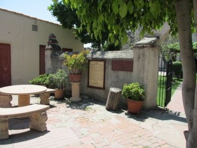
Erected during the mission days 1792-1806. In 1849 it became the property of Don Juan Lopez. On October 9, 1937 a record of it was made and deposited for permanent reference in the Library of Congress. — — Map (db m175953) HM
Founded September 8, 1771, by Franciscan Friars on Rio Temblores - due to flooding, the expedition moved to this 2nd site in 1774, where the Old Mission of stone and red brick was built with the help of Gabrieleno Indians.
The exterior has . . . — — Map (db m66721) HM
San Gabriel Mission was founded by Fr. Pedro Benito Cambon (statue above right) and Fr. Angel Fernandez de la Somera (statue above left) on Sept. 8, 1771 in nearby Montebello by the Rio Hondo River, and moved to this location in 1775. This . . . — — Map (db m139099) HM
This property has been placed on the National Register of Historic Places by the United States Department of the Interior.
Sierra Madre Historical Landmark,
Church of the Ascension - Episcopal,
1888,
Ernest A. Coxhead - architect. . . . — — Map (db m241932) HM
panel 1:
Under this oak — the legend runs — the first Easter Services in California
were held by Father Crespi in 1770.
panel 2:
Near this spot the Cathedral Oak stood. Time destroyed its roots. This monument is . . . — — Map (db m134912) HM
Built by volunteers with donated materials, this church was first consecrated June 20, 1894. It was the only house of worship in the region for half a century. Services were discontinued in the early 1950's. The community rallied to save the church . . . — — Map (db m34934) HM
Calvary Presbyterian Church
was built on Gospel Flat in 1877.
In 1898 it was cut in half
and moved closer to town using horses and wooden rollers. — — Map (db m190253) HM
After Novato was incorporated in 1960, city officials found a ready-made City Hall in the former Presbyterian Church, built in 1896. The City purchased it in 1962; it was repainted dark red with white trim and in 1963, it reopened as Novato's City . . . — — Map (db m102618) HM
Originally built in 1896, this was the site of Novato's first Presbyterian Church. The church was built in the Victorian Gothic style of architecture. The building served as Novato City Hall from 1963 until it was closed for safety reasons in 2005. . . . — — Map (db m64860) HM
In Commemoration of
the landing of Francis Drake
upon these shores June 17, 1579
This cross is erected by
The Sir Francis Drake Association
June 1906 — — Map (db m221787) HM
Theodore A. Gill (1920-2005) embraced the Christian calling to rejoice in God and creation, and to love God’s people. With his wife Katherine Gill, he welcomed world-class teachers, learners, story-teller, dramatists, musicians, and other artists to . . . — — Map (db m213738) HM
La Misión de Gloriosísimo Principe, the twentieth in the California chain of missions. Founded by Fray Vicente de Sarría, December 14, 1817. It was named for the Archangel Raphael – “God’s healing messenger.”
Weekday Masses 6:30am & 8:30am . . . — — Map (db m204390) HM
Founded in 1817 by Padre Vincente Sarria as an “asistencia” or adjunct to Mission Dolores. Mission San Rafael was originally designated a sanitarium for native converts suffering from San Francisco’s generally damper climate. Here, under sunnier . . . — — Map (db m64864) HM
In 1853, Timothy Murphy, Irish born pioneer of Marin County, gave 317 acres of land to Archbishop Alemany for educational purposes. Here the Sister of Charity in 1855 founded a school now called St. Vincent's School for Boys. It has been maintained . . . — — Map (db m143404) HM
In 1976
the Cultural Affairs Commission
designated this building,
by virtue of its Gothic window,
historically & culturally
of major significance.
In 1913 St. Matthew's
German Evangelical Church
built this structure
at a cost . . . — — Map (db m63858) HM
Constructed 1876
This building served as a place of worship and a school for the post’s children. The modest one-story building is a good example of vernacular church architecture from the 1870’s — — Map (db m203670) HM
This chapel ministered to soldiers of all faiths. Built in 1942, in a style similar to other military chapels, it featured a vaulted ceiling and fiber board walls to enhance acoustics. Chapel services included “...Catholic, Protestant, Jewish, . . . — — Map (db m69298) HM
Old St. Hilary's Outhouse is the only "sanitary
privy” known to survive on the Tiburon Peninsula. It was constructed on an unknown date for the convenience of
churchgoers and used until circa 1940.
Early photographs and an oral history confirm . . . — — Map (db m193335) HM
Marker One:
St. Hilary’s Mission Church was built in 1888 as a place of worship for Tiburon’s Catholic railroad and dairy workers. This iconic hillside structure is one of the few remaining Carpenter Gothic churches in its original setting. . . . — — Map (db m222922) HM
Old St. Hilary’s Landmark is one of the few surviving examples of Carpenter Gothic in original condition and setting. Built in 1886 as a Roman Catholic Church, it was deconsecrated in 1954, and acquired by the Belvedere-Tiburon Landmarks Society in . . . — — Map (db m223554) HM
Marker One:
Roman Catholic Church from October 1888 to January 1954
Dedicated as a historical monument October 1960.
Belvedere-Tiburon Landmarks Society
Marker Two:
St. Hilary’s Mission Church
1888 . . . — — Map (db m222910) HM
St. Catherine Church was built during the 1860’s probably in 1865. Before the church was built, priests came from Stockton to say Mass for the people of Hornitos. Priests from Sonora and Mariposa came for Mass after the church was built. In the . . . — — Map (db m183735) HM
Built in 1862 by the people of Mariposa under the direction of Father Auger the church was dedicated and the first mass was said on January 18, 1863 by Archbishop Alemany — — Map (db m46444) HM
Built in 1862 by the people of Mariposa under the direction of Father Auger. The church was dedicated, Confirmation was conferred and the first Mass was said by Archbishop Alameny on Jan. 18, 1863. The church has been repaired many times through the . . . — — Map (db m46599) HM
Cast in England and brought around the Horn. First bell in Fort Bragg. It
hung in the steeple from 1890-1952. It summoned worshipers to church, sounded
fire alarms and curfew. — — Map (db m152830) HM
Since time immemorial, this monolith has been revered by Pomo
people as the home of Frog Woman, the consort of coyote, and a
special being in her own right. For native people it is a place of sacred
power and a reminder of the connection we . . . — — Map (db m221628) HM
Left panel:
The Pinches Stable was located here during the late eighteen-hundreds. During that time horses were the key element for travel and people passing through town boarded them here.
Right panel:
Laytonville's . . . — — Map (db m91801) HM
This is one of the oldest Protestant churches in continuous use in California. Organized as the Presbyterian Church on November 6, 1859, the building, constructed of redwood, was dedicated on July 5, 1868. — — Map (db m10600) HM
California State Landmark #927
C.A. 1854
[California Registered Historical Landmark description states: One of the oldest of California's Chinese houses of worship in continuous use, the temple may date back as far as 1854, though its . . . — — Map (db m143483) HM
Begun 1883
Completed 1910
Designated a National Historic Place by the United States Department of the Interior
in the Pontificate of Pope John Paul II
in the Episcopate of Bishop Francis Quinn
in the Pastorate of Reverend James Streets . . . — — Map (db m87844) HM
The Esselen, the native people of Big Sur, were one of the smallest tribes in California. Due to their small population and proximity to three Spanish missions they were severely impacted by European contact and domination. For many decades, the . . . — — Map (db m197531) HM
Located in the valley of the San Antonio River within the Santa Lucia Range, Misión San Antonio de Padua, established on July 14, 1771, was the third in a series of missions founded in Alta California by Father Junípero Serra. Its picturesque . . . — — Map (db m79130) HM
Honoring
Four Early Americans in California
They came to this coast as seamen and remained as settlers
Baptized in this Mission
George Mayo, of Plymouth, Mass., on 3 August, 1816
Thomas W. Doak, of Boston, Mass., on 22 November, 1816 . . . — — Map (db m63684) HM
Junípero Serra
Serra played a decisive role in the European settlement of the New World. He was born Miquel José Serra in Petra on the Mediterranean island of Mallorca on November 24, 1713. Though not an assuming figure and plagued by ill . . . — — Map (db m143467) HM
Founded by Father Junipero Serra July 14, 1774. Most picturesque setting. First mass was celebrated in presence of one Indian. Later congregation grew to a thousand neophytes. Famous for its fine horses and expert vaqueros. — — Map (db m154381) HM
This hall started in 1847, completed in 1848, was named after its builder
Chaplain Walter Colton, U.S.N., 1787-1851
Congregational Minister, historian, author, and editor, who served as alcalde at Monterey from 28 July 1846 to 1 October . . . — — Map (db m63328) HM
Here June 3, 1770, landed Very Rev. Father Junipero Serra, O.S.F. and founded the following missions; San Diego, July 16, 1769, San Carlos Monterey, June 3, 1770, San Antonio de Padua, July 14, 1771, San Gabriel, Sept. 8, 1771, San Luis Obispo, . . . — — Map (db m63109) HM
Formerly first Protestant church built in Monterey. Built in 1876
Monterey Art & History Assn.
Courtesy of Thomson J. Hudson
Memorial Fund — — Map (db m63092) HM
The Royal Chapel of San Carlos de Borromeo, founded June 3, 1770, is the only remaining Presidio chapel in California.
Madariaga Adobe * Follow Church St. to Abrego
Cell Phone Tour (831) 718-9123 enter 710 — — Map (db m143524) HM
This mission, founded October 9, 1791 by Father Fermín Francisco de Lasuén, ministered to the Indians of the Salinas Valley. Governor José Joaquín de Arrillaga died here July 24, 1814 and was buried in the chapel. Prosperous in its early years, . . . — — Map (db m27217) HM
As the only resident padre, he devotedly served at Mission Soledad for 15 years until his death November 26, 1818. He is the only priest buried at this mission. — — Map (db m64315) HM
Designed by pioneer architects R.H. Daly and Theodore Eisen, this church is an outstanding example of late Victorian Gothic architectural styling. It is the best surviving example in this region of early works associated with Eisen, who later became . . . — — Map (db m18781) HM
This bell cast in 1848, hung from 1854 until 1896 in the Pioneer Christian Church (Disciples of Christ). On demolition of the church, the bell was rescued by Senator C.L. LaRue. Presented by the Ellis McLanahan family, In the interest of local . . . — — Map (db m49553) HM
Built in 1926 on land donated to the Catholic archbishop by the DeBenadetti Family. The hall opened April 17, 1926 and soon became the focal point of social life throughout the Valley.
In 1956 use of the hall was restricted to church functions . . . — — Map (db m192054) HM
Oldest Episcopal Edifice in California
First services Sunday April 23, 1854 by Rt. Rev. William I. Kip, Bishop of Calif.
This building opened for worship Aug. 1858. — — Map (db m10827) HM
Built by the Reverend Thomas J. Dalton and dedicated May 2, 1865 by Bishop Eugene O’Connell as Sacred Heart Convent and Holy Angels Orphanage. Under the Sisters of Mercy it served from 1866 to 1932 as the first orphanage of the Northern Mines. It . . . — — Map (db m12898) HM
Historic
Old Brick Gothic Building constructed as a congregational church in 1857. Restored by First Baptist Church.
Dedicated by Laurel Parlor No. 6
Native Daughters of the Golden West
April 13, 1987 — — Map (db m37148) HM
Built in 1855 as the edifice of the Baptist Church, it was here that famed soprano Emma Nevada (Emma Wixom Palmer) made her debut at the age of three. In 1886 the church was remodeled as the residence of the E.T.R. Powell family — — Map (db m14824) HM
Historic Saint Canice Catholic Church was built and first services held during 1864 under the guidance of Father John Grifin
Plaque placed October 6, 1965 by Laurel Parlor No. 6 and Hydraulic Parlor No. 56 Native Daughters and Sons of the . . . — — Map (db m37122) HM
Trinity Episcopal Church, founded as a parish in 1855, opened for divine service in this building on November 2, 1873. Previously on this site was “Caldwell’s Upper Store”, built in 1849 for the miners of Upper Deer Creek Dry Diggings, . . . — — Map (db m40294) HM
St. Columncille’s Catholic Church, formerly the Bridgeport Union Guard Hall, was used in 1860 to train men for the Civil War under Capt. Frank Coffey of French Corral.
In 1880 it was purchased as a house of worship for the Catholics of the . . . — — Map (db m43666) HM
One of the oldest of this faith in continuous operation in California. Escaped three major fires which destroyed the town. The Rev. H.B. Sheldon first assigned Pastor. Rode circuit from Brandy City to French Corral on horseback. — — Map (db m39823) HM
The walls of this House of God are hallowed by the prayers of countless worshippers. For nearly a century the mellow tones of its bell have called the faithful to prayer, announced weddings with joy, and tolled in grief for those who have passed . . . — — Map (db m49995) HM
Since 1920, the American Legion has had an active presence in Brea. Post #181 dedicated a structure on this site on November 8, 1924 followed by a transformation to this Mission Style building in 1931.
It housed the Brea Women's Club during . . . — — Map (db m199553) HM
In 1906 guidepost bells were placed along the El Camino Real to guide early travelers and to preserve this historic route which linked California's missions beginning in 1769. — — Map (db m204334) HM
This adobe building was constructed about 1820 as part of an outlying mission stock headquarters to shelter the herdsmen who cared for the cattle from Mission San Juan Capistrano. After secularization, the property continued as a cattle ranch . . . — — Map (db m79043) HM
Around the turn of the 20th Century, Tom Talbert donated land and 40% toward erecting the "Country Church of Talbert". The land was later deeded to the Methodist Church. — — Map (db m59490) HM
Built in 1935 and dedicated in 1936. First Buddhist Church in Orange County. In 1954 the Church was moved to Stanton then moved to present location in Anaheim in 1965. — — Map (db m146156) HM
Established in 1923 with six streets on lots sized 50 by 300. A complete community with stores, recreation facilities, and churches. (Holy Family Mission still exists). — — Map (db m59056) HM
When the Spanish army and missionaries came to California in 1769, they made a route, El Camino Real, for travel between missions they established, stretching from San Diego to Sonoma. In the early 1900s, a group of women's clubs, among others . . . — — Map (db m189668) HM
St. George's is part of the worldwide Anglican family of churches (70 million members) and celebrates the diversity of congregations in 150 churches in the Diocese of Los Angeles. Originally built in 1891 in El Toro, the mission church was served by . . . — — Map (db m188546) HM
The Angel of Hope was introduced to the world in the book, The Christmas Box, By Richard Paul Evans. It is a tale about a woman who mourns the loss of her child at the base of an
angel monument. Though mostly fictional, the angel monument once . . . — — Map (db m210733) HM
Arriving from Boston in 1884, Dwight Whiting began buying the foreclosed upon acreage of Rancho Cañada de los Alisos. He augmented the crops with dry- farmed orchards of olives and apricots and subdivided the land. Intent on establishing an English . . . — — Map (db m194216) HM
The St. Isidore Catholic Parish was established in 1921. Parishioners met for services at the local Felts Market or the Harmona Hotel, whichever could accommodate them. In 1922, the parishioners asked the Bixby Land Company for a piece of the land . . . — — Map (db m89835) HM
Dedicated to the valiant members of the historic Mormon Battalion who stopped here on March 20, 1847, as they marched from San Diego to Los Angeles. A division of the U.S. Army of the West, these brave soldiers, trusting in God, overcame incredible . . . — — Map (db m50351) HM
St. John’s Lutheran School,
the first parochial school
in the city of Orange, began in 1882 with the first
building being dedicated on February 11, 1883. This
building was located on a site five blocks to the west
on the corner of Almond . . . — — Map (db m241285) HM
Two miles inland from this point, in Los Cristianitos Valley, the first Christian baptism in Alta California was performed by Padre Francisco Gómez, a member of the Portolá Expedition, in 1769. — — Map (db m145307) HM
Forster bought Mission San Juan Capistrano at public auction in 1844 and later owned 260,000 acres in Orange and San Diego Counties. — — Map (db m199169) HM
While reading this plaque, you are facing the historic El Camino Real, also known as "the King's Highway or "The Royal Road".
Originating in 1769, the trail got its name from the Spanish monarch who directed the establishment of a chain of . . . — — Map (db m188641) HM
For Many years the Mission has been the focal point of Capistrano Valley. During the 1800's the Mission was active in it's religious and agricultural endeavors; it also maintained large herds of cattle and developed an industry of hide-curing. The . . . — — Map (db m197258) HM
This valley of San Juan Capistrano is the home of the First People known as Acjachemen (Ah-hah-sha-men). The Acjachemen language has been classified by linguists as a member of the Taki branch of the Uto-Aztecan family of languages. Many autonomous . . . — — Map (db m197234) HM
In the Tradition of the bells first brought to the Mission Basilica and the Valley of San Juan Capistrano in 1775; these eight bells were cast in 1984 (across the Sea) at the Petit and Fristen Foundry in Holland.
Donated by
ARTHUR AND GAYE . . . — — Map (db m195063) HM
"Jewel of the Missions" founded on November 1, 1776 by father Junipero Serra, most renown and most beautiful of the California Missions, Quaint little Serra Chapel is California's oldest building still in use. The magnificent ruins of the Great . . . — — Map (db m149788) HM
Mission San Juan Capistrano was founded in 1776 by Saint
Serra. As the seventh of the 21 California missions, and the
only mission in Orange County, it hosts the State's most
historically significant chapel, Serra Chapel (1782) and the
ruins of . . . — — Map (db m148351) HM
The site before you and the surrounding areas have been utilized by the Juaneno Indians (Original inhabitants of the Capistrano Valley). Mission San Juan Capistrano, and residents of this community in a variety of capacities over the years. . . . — — Map (db m188549) HM
Situated on this hill, located between the two rivers of the Capistrano Valley, is this sacred and consecrated ground. From this hilltop, the ocean, Mission, and town can be seen. It is a perfect resting place for San Juan Capistrano's historic . . . — — Map (db m199141) HM
Founded in 1776 by Padre Junipero Serra. The seventeenth in the chain of twenty-one missions established in Alta California to Christianize and civilize the Indians. Stone church destroyed in 1812 earthquake. Expropriated during Mexican rule. . . . — — Map (db m50226) HM
Va. Jhs Ma. Jph
The Mission of San Juan Capistrano which is about to be established in the valley of the same name or in its vicinity between the Missions of San Diego & San Gabriel of the Earthquakes, about twenty leagues from both & too from . . . — — Map (db m148353) HM
The California Mission Bell commemorates the route of El Camino Real. This bell sits near the crossroads of the summer and winter route from Mission San Juan Capistrano to Mission San Gabriel Archangel. — — Map (db m188551) HM
Santa Ana's oldest assembly on its original site was completed on 1888 and dedicated Easter 1889. Consecrated by Bishop Joseph Johnson October 31, 1887, with Rev. W.B. Burrows, Rector. The building was designed of redwood by Ernest Coxhead with . . . — — Map (db m49983) HM
This church is the oldest in Tustin, having been in continuous service since 1881. The original sanctuary contains pews which came around the Horn from the East Coast by sailing ship. — — Map (db m50010) HM
This 14-room Victorian mansion was built by prominent California pioneer David Hewes (1822-1915). Known as the "Maker of San Francisco," he donated golden spike at Promontory Point and contributed greatly to local civic, church, and agricultural . . . — — Map (db m148782) HM
Central Square:
After the Central Pacific Railroad built a Train Depot, over a mile away and up the hill from Old Auburn, civic leaders looked for a way to connect the two areas. The city planners took a map and located a halfway point . . . — — Map (db m52312) HM
567 entries matched your criteria. Entries 201 through 300 are listed above. ⊲ Previous 100 — Next 100 ⊳