3466 entries match your criteria. The first 100 are listed. ⊳
Man-Made Features Topic
By Joseph Alvarado, October 28, 2023
Palm Event Center Marker
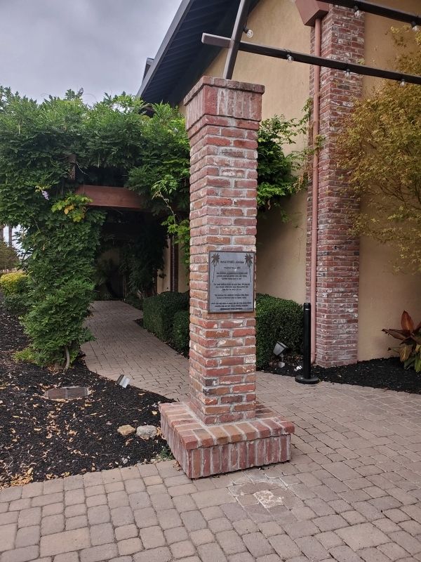
| 1 ► California, Alameda County, Pleasanton — Palm Event Center — Completed May 1, 2004 — |
| Near Vineyard Avenue east of Machado Place, on the right when traveling east. | |||
| 2 ► California, Inyo County, Independence — Hydroelectric Power From Bishop Creek — |
| Near North Grant Street. | |||
| 3 ► California, Kern County, Tehachapi — Tehachapi Pass Railroad Line — Constructed 1874 – 1876 — Commemorated October 1998 — |
| On Woodford-Tehachapi Road, 3.2 mi E of Keene exit, on the left when traveling east. | |||
| 4 ► California, Los Angeles County, Angeles National Forest — The 100-Inch Hooker Telescope — Mount Wilson Observatory — |
| Near Mt Wilson Red Box Road, 4.7 miles south of Angeles Crest Highway (California Route 2). | |||
| 5 ► California, Los Angeles County, Los Angeles, Downtown Los Angeles — Sylmar Tunnel Disaster — Honoring The Lives — |
| Near Alameda Street just north of U.S. 101, on the right when traveling north. | |||
| 6 ► California, Los Angeles County, Los Angeles, Elysian Park — 48 — Chavez Ravine Arboretum — Elysian Park Arboretum — |
| On Stadium Way, 0.8 miles south of Riverside Drive (Interstate 5), on the right when traveling south. | |||
| 7 ► California, Los Angeles County, Los Angeles, Hancock Park — 94 — Highland Avenue Medians — City of Los Angeles — |
| On Highland Avenue at Melrose Avenue, in the median on Highland Avenue. | |||
| 8 ► California, Los Angeles County, Los Angeles, Hancock Park — 94 — Highland Avenue Medians — City of Los Angeles — |
| On Highland Avenue just north of Wilshire Boulevard, in the median. | |||
| 9 ► California, Los Angeles County, Los Angeles, Northridge — Lauretta Wasserstein Sculpture Garden — “Post-Tension” — Earthquake Garden — |
| Near Nordhoff Street west of Lindley Avenue. | |||
| 10 ► California, Los Angeles County, Los Angeles, San Pedro — 187 — Korean Friendship Bell — |
| On Gaffey Street south of Leavenworth Drive, on the right when traveling south. | |||
| 11 ► California, Los Angeles County, Los Angeles, Sylmar — 1006 — Beale's Cut |
| On Sierra Highway, 0.7 miles north of Foothill Boulevard, on the right when traveling north. Reported missing. | |||
| 12 ► California, Los Angeles County, Los Angeles, Van Nuys — Van Nuys Airport — In Honor of Pioneer Aviators — |
| On Waterman Drive, 0.3 miles west of Woodley Ave, on the left when traveling west. | |||
| 13 ► California, Los Angeles County, Los Angeles, Woodland Hills — 939 — Old Trapper's Lodge — |
| On El Rancho Drive, 0.3 miles east of De Soto Avenue. | |||
| 14 ► California, Los Angeles County, Marina del Rey — The Helmsman — |
| Near Mindanao Way, 1 mile west of Lincoln Boulevard. | |||
| 15 ► California, Los Angeles County, Santa Clarita, Angeles National Forest — Power Plant No. 1 — First Los Angeles Aqueduct — |
| Near Pelton Street, 0.5 miles east of San Francisquito Canyon Road. | |||
| 16 ► California, Los Angeles County, Santa Clarita, Angeles National Forest — St. Francis Dam — |
| Near San Francisquito Canyon Road, 9 miles north of Copper Hill Road, on the right when traveling north. | |||
| 17 ► California, Los Angeles County, Santa Clarita, Angeles National Forest — St. Francis Dam Disaster Site |
| Near San Francisquito Canyon Road, 0.3 miles south of San Francisquito Motorway. Reported missing. | |||
| 18 ► California, Los Angeles County, Santa Clarita, Angeles National Forest — 919 — St. Francis Dam Disaster Site — |
| On San Francisquito Canyon Road, 9 miles north of Copper Hill Road, on the right when traveling north. | |||
| 19 ► California, Los Angeles County, Santa Clarita, Stevenson Ranch — 516 — First Commercial Oil Well In California — Pico #4 — |
| Near Pico Canyon Road, 4.5 miles west of Interstate 5. | |||
| 20 ► California, Riverside County, Mountain Center — 122 — Historic Lake Hemet Dam — |
| On Pines to Palms Highway (California Route 74), on the right when traveling south. | |||
| 21 ► California, Riverside County, Riverside, Downtown Riverside — The Nanjing Bell — |
| Near Mission Inn Avenue. | |||
| 22 ► California, Sacramento County, Sacramento, "Old Sacramento" — Sacramento Water Works — Historic Civil Engineering Landmark — |
| On I street at Front Street, on the right when traveling west on I street. | |||
| 23 ► California, Sacramento County, Sacramento, Old Sacramento — 780 — First Transcontinental Railroad Groundbreaking Site |
| On Front Street at K Street, on the left when traveling north on Front Street. Reported permanently removed. | |||
| 24 ► California, Solano County, Vallejo — An Island Built of Mud — |
| Near Dump Road at Lawes Street. | |||
| 25 ► California, Solano County, Vallejo — Mare Island - A Place of "Firsts" — |
| Near Dump Road at Lawes Street. | |||
| 26 ► California, Solano County, Vallejo — The Carquinez Strait: Gateway to California's Riches — |
| Near Dump Road at Lawes Street. | |||
| 27 ► California, Solano County, Vallejo — The Western Magazine — |
| Near Dump Road. | |||
| 28 ► Connecticut, Hartford County, Farmington, Unionville — An Industrial History of Unionville, 1780-1880 — |
| Near New Road (Connecticut Route 4). | |||
| 29 ► Connecticut, Hartford County, Farmington, Unionville — The Water Fountain — |
| Near Farmington Avenue (Connecticut Route 4) 0.3 miles north of Park Pond Place, on the left when traveling east. | |||
| 30 ► District of Columbia, Washington, Northeast Washington, Kingman and Heritage Islands — Welcome to Kingman & Heritage Islands |
| On Kingman Island Trail Northeast south of Benning Road Northeast, on the left when traveling north. Reported damaged. | |||
| 31 ► District of Columbia, Washington, Northeast Washington, Kingman and Heritage Islands — Welcome to Kingman & Heritage Islands — |
| On Heritage Island Trail Northeast east of Anacostia Riverwalk Trail, on the right when traveling east. | |||
| 32 ► District of Columbia, Washington, Northwest Washington, 16th Street Heights — 4 — Crossroads Create Community — Battleground to Community — Brightwood Heritage Trail — |
| On Georgia Avenue Northwest (U.S. 29) at Missouri Avenue Northwest, on the right when traveling south on Georgia Avenue Northwest. | |||
| 33 ► District of Columbia, Washington, Northwest Washington, The Ellipse — The National Christmas Tree — President's Park — National Park Service, U.S. Department of the Interior |
| On E Street Northwest west of 15th Street Northwest, on the left when traveling west. Reported permanently removed. | |||
| 34 ► Florida, Manatee County, Anna Maria — Historic Anna Maria City Pier — |
| Near South Bay Boulevard at Pine Avenue, on the left when traveling south. | |||
| 35 ► Florida, Osceola County, Kissimmee — Tree Firemark — |
| On County Road 532 (County Route CR552) at East Monument Avenue, on the right when traveling south on County Road 532. | |||
| 36 ► Florida, Palm Beach County, Jupiter — Jupiter Inlet Lighthouse began protecting ships at sea on July 10, 1860 — |
| Near Captain Armours Way. | |||
| 37 ► Florida, St. Johns County, St. Augustine, Historic District — Invincible? / ¿Invencible? — Castillo de San Marcos National Monument — |
| Near South Castillo Drive (Business State Highway A1A) east of Orange Street, on the right when traveling north. | |||
| 38 ► Georgia, Glynn County, Jekyll Island — Preserving the Legacy — |
| On Old Plantation Road north of Schoolhouse Lane, on the right when traveling north. | |||
| 39 ► Georgia, Glynn County, Jekyll Island — Taking Care of Family |
| On Riverview Drive, 0.2 miles south of Stable Road, on the left when traveling south. Reported permanently removed. | |||
| 40 ► Georgia, Glynn County, Jekyll Island — The Clubhouse — Evolution of Elegance — |
| On Pier Road at Riverview Drive, on the right when traveling west on Pier Road. | |||
| 41 ► Georgia, Union County, Blairsville — Original Clock & Bell Mechanism — From the Historic 1899 Courthouse — |
| On Town Square at Candler Drive, on the left when traveling north on Town Square. | |||
| 42 ► Illinois, Hancock County, Warsaw — This Antique Fire Hydrant — |
| On North 5th Street east of Main Street, on the right when traveling south. | |||
| 43 ► Illinois, Madison County, Collinsville — Cahokia — City of the Sun — |
| Near Collins Lane, 0.1 miles north of Collinsville Road. | |||
| 44 ► Illinois, Massac County, Metropolis — Superman Statue Facts — |
| On Market Street north of West 5th Street, on the left when traveling west. | |||
| 45 ► Illinois, Peoria County, Peoria — The Easton Fountain — |
| On West High Street south of Main Street, on the left when traveling south. | |||
| 46 ► Indiana, Cass County, Logansport — Little Turtle Waterway Plaza — |
| On 4th Street, on the right when traveling south. | |||
| 47 ► Indiana, Franklin County, Metamora, Metamora Township — Building the Whitewater Canal — an 1840s Engineering Feat — |
| On 75 Main Street, on the right when traveling east. | |||
| 48 ► Indiana, Franklin County, Metamora, Metamora Township — Locking Thru Lock No. 24 — Welcome to Whitewater Canal State Historic Site — Metamora — |
| On U.S. 52, on the right when traveling east. | |||
| 49 ► Indiana, Harrison County, Corydon — Flags Over Corydon — |
| On South Capitol Avenue west of West Poplar Street, on the right when traveling south. | |||
| 50 ► Indiana, Ripley County, Versailles — Hitching Post — |
| On South Main Street at Water Street, on the right when traveling south on South Main Street. | |||
| 51 ► Indiana, White County, Monticello — Courthouse Cast Iron Drinking Fountain — |
| On North Bluff Street at East Broadway Street, on the left when traveling north on North Bluff Street. | |||
| 52 ► Indiana, White County, Monticello — The Black Light Poles — |
| On North Bluff Street at East Broadway Street, on the left when traveling north on North Bluff Street. | |||
| 53 ► Maryland, Cecil County, Chesapeake City — From Creek to Canal — |
| On George Street. | |||
| 54 ► Maryland, Cecil County, Conowingo — The Proprietors of the Susquehanna Canal — |
| On Susquehanna River Road (Maryland Route 222) 2 miles south of Conowingo Road (U.S. 1), on the right when traveling south. | |||
| 55 ► Maryland, Montgomery County, Bethesda, Brookmont — Original Federal Boundary Stone, District of Columbia, Northwest 4 — |
| On Capital Cresent Trail, on the right when traveling north. | |||
| 56 ► Maryland, Montgomery County, Silver Spring, Wheaton — Azalea Garden — 1970 — Brookside Gardens: 40 years (1969-2009) — |
| Near Glenallan Avenue east of Heurich Road, on the right when traveling east. | |||
| 57 ► Maryland, Montgomery County, Silver Spring, Wheaton — Conservatory — 1969 — Brookside Gardens: 40 years (1969-2009) — |
| Near Glenallan Avenue east of Heurich Road, on the right when traveling east. | |||
| 58 ► Maryland, Montgomery County, Silver Spring, Wheaton — Formal Gardens — 1969 — Brookside Gardens: 40 years (1969-2009) — |
| Near Glenallan Avenue east of Heurich Road, on the right when traveling east. | |||
| 59 ► Maryland, Montgomery County, Silver Spring, Wheaton — Trial Garden — 1974 — Brookside Gardens: 40 years (1969-2009) — |
| Near Glenallan Avenue east of Heurich Road, on the right when traveling east. | |||
| 60 ► Maryland, Prince George's County, Brentwood — Original Federal Boundary Stone, District of Columbia, Northeast 7 — |
| 61 ► Massachusetts, Suffolk County, Boston, East Boston — Islands - Volkan Alkanoglu, 2019 — |
| On Father Jacobbe Road at Lisbon Street, on the right when traveling east on Father Jacobbe Road. | |||
| 62 ► Massachusetts, Suffolk County, Boston, East Boston — View of Boston in 1848. — East Boston — Harborwalk Boston — |
| On Lewis Street at East Pier Drive, on the right when traveling south on Lewis Street. | |||
| 63 ► Michigan, Antrim County, Elk Rapids — 548 — The Island House — |
| On River Street at Pine Street, on the right when traveling west on River Street. | |||
| 64 ► Michigan, Chippewa County, Sault Ste. Marie — Construction of the Power Canal — |
| On Ashmun Street (Business Interstate 75) at Dawson Street, on the right when traveling south on Ashmun Street. | |||
| 65 ► Michigan, Chippewa County, Sault Ste. Marie — Historic Water Tower — Sault Ste. Marie — |
| On West Easterday Avenue at Ryan Avenue, on the right when traveling east on West Easterday Avenue. | |||
| 66 ► Michigan, Chippewa County, Sault Ste. Marie — Making a Grand Entrance — |
| On West Portage Avenue at Osborn Boulevard, on the right when traveling west on West Portage Avenue. | |||
| 67 ► Michigan, Ingham County, Lansing — The Woman's Christian Temperance Union Fountain — |
| On East North Street near James Street, on the right when traveling east. | |||
| 68 ► Michigan, St. Clair County, Fort Gratiot — What Lies Beneath — |
| On the park road, in the median. | |||
| 69 ► Michigan, Wayne County, Dearborn — The Path of the Setting Sun — |
| Near Fair Lane Drive, 0.3 miles west of Evergreen Road. | |||
| 70 ► Minnesota, Chisago County, Almelund, Wild River State Park — Nevers Dam — 1889–1954 — |
| 71 ► Minnesota, Hennepin County, Minneapolis, Loring Park — 501 — Wesley United Methodist Church — Established in 1852 — United Methodist Church Registered Historic Site No. 501 — |
| On Grant Street at Marquette Avenue / 1st Avenue, on the right when traveling east on Grant Street. | |||
| 72 ► Mississippi, Grenada County, Grenada — Grenada Dam — |
| On Scenic Mississippi Route 333, 0.1 miles north of Grenada Lake Visitor's Center, on the right when traveling north. | |||
| 73 ► Montana, Big Horn County, Decker — The Land Speaks — (Rosebud Battlefield/Where the Girl Saved Her Brother) — |
| On Rosebud Road, 1.5 miles west of State Highway 314. | |||
| 74 ► Montana, Pondera County, Valier — Signs of Home — Lewis & Clark National Historic Trail — National Park Service, U.S. Department of the Interior — |
| On Valier Road (State Highway 358 at milepost 17) near TriGood Road, on the right when traveling south. | |||
| 75 ► Montana, Pondera County, Valier — The 546th Missile Squadron — |
| On U.S. 89 near Robare Lane, on the right when traveling north. | |||
| 76 ► Montana, Powell County, Deer Lodge — Beaverslide Haystacker — |
| Near North Main Street (Business Interstate 90) near Warren Lane, on the left when traveling north. | |||
| 77 ► Montana, Powell County, Deer Lodge — Good Fences Make Bad Neighbors? — Grant-Kohrs Ranch National Historic Site — |
| Near North Main Street (Business Interstate 90) near Warren Street, on the left when traveling north. | |||
| 78 ► Montana, Sanders County, Thompson Falls — Thompson Falls Hydroelectric Dam District — St. Luke's Hospital — |
| On Maiden Lane near Pond Street, on the right when traveling west. | |||
| 79 ► Montana, Silver Bow County, Butte — Butte Mining Through the Years — |
| Near Continental Drive near Madison Street, on the left when traveling south. | |||
| 80 ► Montana, Silver Bow County, Butte — Mining The Berkeley Pit 1955-1982 — |
| On Continental Drive near Madison Street, on the left when traveling south. | |||
| 81 ► Montana, Silver Bow County, Butte — The Berkeley Pit Threatens the Water — |
| Near Continental Drive near Madison Street, on the left when traveling south. | |||
| 82 ► Montana, Silver Bow County, Butte — The Berkeley Pit: The Water Returns — |
| Near Continental Drive near Madison Street, on the left when traveling south. | |||
| 83 ► Nebraska, Dawson County, Cozad — 17 — The 100th Meridian — |
| On U.S. 30 at North Meridian Avenue, on the right when traveling east on U.S. 30. | |||
| 84 ► Nevada, Esmeralda County, Goldfield — 242 — Southern Nevada Consolidated Telephone-Telegraph Company Building |
| On Ramsey Street east of Columbia Avenus, on the right when traveling east. Reported permanently removed. | |||
| 85 ► New Hampshire, Grafton County, Bath — 121 — Bath, New Hampshire — |
| On Rum Hill Road (U.S. 302), on the right when traveling south. | |||
| 86 ► New Hampshire, Sullivan County, Washington — Compass Rock — |
| 87 ► New Jersey, Cape May County, Cape May, Lower Township — All Shapes, Sizes and Materials — Aids to Navigation — Maritime History |
| On Light House Avenue, on the left when traveling south. Reported permanently removed. | |||
| 88 ► New Jersey, Cape May County, Cape May, Lower Township — The Construction of Fort Miles — |
| On Sunset Blvd. (County Route 606), on the left when traveling west. | |||
| 89 ► New York, Albany County, Albany — 1816 Dwelling House — |
| Near Meeting House Rd east of Heritage Ln (Local Route 151). | |||
| 90 ► New York, Albany County, Albany — Brethren's Workshop (1822) — |
| On Meeting House Road, on the left when traveling north. | |||
| 91 ► New York, Albany County, Albany — Creamery (1856) — |
| 92 ► New York, Albany County, Albany — Ministry Shop (1825) — |
| 93 ► New York, Albany County, Albany — Shaker Garage (1920) — |
| 94 ► New York, Albany County, Albany — Shaker Meeting House — |
| On Meeting House Road, on the right when traveling north. | |||
| 95 ► New York, Albany County, Albany — Wash House & Cannery (c.1858) — |
| On Meeting House Road, on the left when traveling east. | |||
| 96 ► New York, Albany County, Albany, Downtown — Academy Park — |
| On Washington Avenue at Eagle Street on Washington Avenue. | |||
| 97 ► New York, Albany County, Albany, Downtown — City Hall Carillon — Albany 300 - 1686-1986 — Still Making History — |
| On Eagle Street at Corning Place, on the right when traveling east on Eagle Street. | |||
| 98 ► New York, Albany County, Albany, Mansion Area — Bleecker Park — |
| On Eagle Street at Madison Avenue, on the right when traveling east on Eagle Street. | |||
| 99 ► New York, Albany County, Albany, Washington Park — Boats and Music — |
| Near Madison Avenue (U.S. 20) at New Scotland Avenue. | |||
| 100 ► New York, Albany County, Albany, Washington Park — Washington Park — Albany 300 — 1686-1986 • Still Making History — |
| On New Scotland Avenue (Washington Park Road) at Madison Avenue (U.S. 20), on the right when traveling north on New Scotland Avenue (Washington Park Road). | |||
3466 entries matched your criteria. The first 100 are listed above. Next 100 ⊳