With the discovery of gold on January 24, 1848, Coloma Road became one of the primary routes to the gold fields of El Dorado County. The road started at Sutter’s Fort (New Helvitia), then proceeded to Willow Springs (near Folsom), Mormon Island, . . . — — Map (db m11282) HM
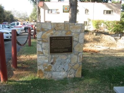
Past this point on the Old Coloma Road, running between Sutter’s Fort and his sawmill on the American River, James W. Marshall rode with the first gold discovered at Coloma on Jan. 24, 1848. Traveled by thousands to and from the diggings, this road . . . — — Map (db m11268) HM
"It took fifty men of us and all the oxen we could hitch to the wagons to take thirteen wagons up in two days. It takes all the men...and four yoke oxen to move an empty wagon...It is just like climbing a tree only worse." - William Gobin, Oct 1852 — — Map (db m212031) HM
"Started at 2 P.M. down through [Lake] valley for 6 miles and campt near a small stream here we saw 2 men just commencing to mine gold just found here...Road very good this afternoon" - William Wirt Gilbert, Sep 26, 1853 — — Map (db m212407) HM
"After passing over this summit [Luther Pass] we enter Lake Valley [Lake Tahoe Basin]. Here we are camped, grass scarce. We had the roughest road down the mountain I ever saw." - John W. Powell, Sep 3, 1859 — — Map (db m212026) HM
"We now prepared for the ascent of the mountain, we put all the oxen to one wagon, and started....The road is very steep in places, and runs up and along and around the side of the mountain" - J. Robert Brown, Sep 27, 1856 — — Map (db m212028) HM
Oldest Standing Structure at Lake Tahoe
In 1859, silver was discovered in Nevada and the road past Lake Tahoe became a busy highway for treasure seekers and for the goods they needed to survive. To keep roads in repair, stations were set up . . . — — Map (db m113203) HM
Imagine what an adventure it must have been for Tahoe’s early motorists. Traveling in open-air Model Ts and Oldsmobiles, vacationers began driving as roads connected the Lake’s recreation spots. Completed in 1913, a rough road around Emerald Bay . . . — — Map (db m35112) HM
Henry Van Sickle, 1822-1894
Henry Van Sickle arrived in the Carson Valley in 1852, settling near Genoa. Before Nevada became a state in 1864, and when the area was still part of the Utah Territory, Van Sickle began welcoming weary travelers – . . . — — Map (db m223617) HM
In 1988, Jack Van Sickle (1916 – 2003) donated 542 acres of land to the Nevada Division of State Parks to honor his grandfather, Henry Van Sickle. 20 years later, Van Sickle Bi-State Park was born.
”He was a cowboy. That was one of . . . — — Map (db m223616) HM
This popular resort and stopping place for stages and teams of the Comstock, established by Swift and Watson in 1856, became a remount station of the Central Overland Pony Express on April 4, 1860. Here on that date division superintendent Bolivar . . . — — Map (db m436) HM
One Quarter mile NW of here in a grove of oak tress on the south bank of Dog Creek was established "The Academy" in 1872. It was the first secondary school in Fresno County. J.D. Collins, later Sheriff was the first teacher. Just easterly of The . . . — — Map (db m28014) HM
Headquarters of notorious bandit Joaquin Murieta. Killed here July 25, 1853 by posse of state rangers led by Captain Harry Love. Terrorized mining camps and stage operations during his career. — — Map (db m151585) HM
Headquarters of notorious bandit, Joaquin Murieta. Killed here July 25, 1853, by posse of State Rangers, led by Captain Harry Love. Terrorized mining camps and stage operations during his career. — — Map (db m229467) HM
Mr. Robert “Bob” Schatt purchased a lot at this location in 1938. The lot was bought from a Mr. Tom Glenchur for the purpose of building a “Union Oil” service station. Bob opened the station in 1939. During World War II, Bob . . . — — Map (db m64161) HM
Vince Motte was born at home in Coalinga on the 6th of August, 1913. He is the youngest son of Westside pioneers Baptiste and Josephine Motte. Baptiste homesteaded, what is now Motte Canyon in the Jacalitos Hills south of Coalinga. Later he . . . — — Map (db m64022) HM
R.C. Baker
Memorial Museum
Richfield
Service Station
Built in Coalinga
On the corner of
Fifth and Glenn St.
1934
Restored in 2003
Moved to this location 2004
Restored by
Wayne James
and
The R.C. Baker Museum . . . — — Map (db m63890) HM
Arriving in Fresno County in 1870, Sands Baker purchased a quarter section of land at the base of what became Baker's Mountain. Baker continually added to this tract until he had about 2000 acres.
Baker was prominent in the mountain community. . . . — — Map (db m147608) HM
Andrew Davidson Firebaugh was born in Virginia in 1823. He served with the Texas Mounted Riflemen in the Mexican War. Coming to California in 1849, he fought in the Mariposa Indian War under Major James D. Savage on the expedition that discovered . . . — — Map (db m229464) HM
This Monument is dedicated May 30, 1956, by the citizens of Fresno to the memory of Fresno's own Billy Vukovich, who met his death while leading the Indianapolis 500 Mile race May 30, 1955.
Billy Vukovich, who lived all his life in Fresno, won . . . — — Map (db m47249) HM
This site was originally called Mechanicsville, gradually changing to Humphrey Station after Miles Humphreys' store. Miles Humphreys came to California to join his brother John after the Civil War and saw an opportunity by opening his store at this . . . — — Map (db m28272) HM
Side A - North
Poole's Ferry
Most important of Kings River's earliest crossings, it was operated from 1851 - 1857 by William Campbell and John Poole 3 miles above this point. The ferry and its trading post served travelers and . . . — — Map (db m28844) HM
In the early 1850's, before it became a town, Reedley was in Mariposa County. The only way to cross the Kings River was doing so at your own risk or to find a ferry and pay a fee to cross. The Reedley area could claim two operating ferries. . . . — — Map (db m77752) HM
In the early 60's Elijah Sarvers, a solitary goatherd, was the first non-Indian here. In 1866 the Woods Bros. began making shakes on Pine Ridge, hiring Indians to carry them down the mountain. In 1867 the county granted them a franchise to build a . . . — — Map (db m28016) HM
This site, 645 10th Street, has long been a travel
hub beginning with a Stage Depot that served those
traveling by horse and buggy through the
introduction of the automobile. The Arcata Bus
Depot building replaced the Stage Depot and . . . — — Map (db m208622) HM
Hal, a native of San Diego, was graduated from San Diego State College with a degree in Civil Engineering, and subsequently started work with the California Division of Highways in that area.
As a person dedicated to serving the needs of . . . — — Map (db m1556) HM
Californians were among the first in the world to build a lifestyle around the automobile. In the early 20th century, mass-produced cars became affordable for almost everyone. In 1907 there were just 300 autos registers in the state. By 1920, more . . . — — Map (db m139844) HM
Your journey along the Newton B. Drury Scenic Parkway follows the historic Redwood Highway. When the highway reached this area in the early 1920s, a new era of automobile-based tourism was booming. Then, just as today, iconic Big Tree was an . . . — — Map (db m176816) HM
First conceived in 1909, the Redwood Highway
extends from San Francisco's Golden Gate to
Grants Pass, Oregon. The original route passed
through nearly two million acres of the world's
tallest forests, ancestral Indian lands, and dozens . . . — — Map (db m182941) HM
A native of Plunkett, Saskatchewan, Canada. Graduated from Stanford University with a degree in Civil Engineering, began work with the Division of Highways in 1936. He worked in many positions and locations throughout his career, becoming State . . . — — Map (db m1509) HM
Sam Helwer, the son of German-Russian immigrants, began his life on a small dairy farm in Russell, Kansas. In 1936 he began his career with the California Division of Highways as an Engineering Aide. By the 1940's he was Project Engineer for the . . . — — Map (db m1558) HM
Bert Vaughn of Jacumba built the stone tower in 1922-23 to commemorate the pioneers and road and railroad builders who opened the area. In the 1930s W.T. Ratcliffe carved the stone animal figures which lurk in the rocks surrounding the tower, . . . — — Map (db m149171) HM
From 1862-70, Peter Larkin and Joe Stancliff used a stone house about a mile north of here as a store from which ox teams pulled wagons up a 30% grade. The San Diego and Fort Yuma Turnpike Co. used the site as a toll road station until 1876. The . . . — — Map (db m50232) HM
When Jim Taylor acquired his ferry in 1922, he had just completed his connecting, hand-made highway on both sides of the Colorado River. His plan to attract the Los Angeles to Phoenix traffic had faded with the continued success of the . . . — — Map (db m138179) HM
This highway parallels the old Indian trail, still visible from here, connecting the Imperial and Palo Verde Valleys.
The grateful people of Imperial County honor the memory of our beloved Senator Ben Hulse, who worked untiringly for the people . . . — — Map (db m57702) HM
(Panel 1)
In the beginning
1915 - 1926
The story of the Plank Road began with the era of automobile transportation and a spirit of competition between the cities of San Diego and Los Angeles. San Diego was determined to become . . . — — Map (db m185972) HM
This unique plank road seven miles long was the only means early motorists had for crossing the treacherous Imperial Sand Dunes. The eight by twelve foot sections were moved with a team of horses whenever the shifting sands covered portions of the . . . — — Map (db m50682) HM
The Plank Road once provided the only means of crossing the treacherous Imperial Sand Dunes. This historic road spurred settlement of Imperial County and development of San Diego at the start of the automobile age. — — Map (db m50618) HM
Camp Independence soldiers needed a road to Waucoba-Deep Springs. In 1873 J. S. "Scott" Broder completed this road and collected tolls until 1900. In 1913 A. L. Westgaard led an American Automobile Assn. tour across here, seeking a new . . . — — Map (db m54425) HM
Behind this plaque is the original road that went to the Bishop Creek Drainage. Built at the turn of the 20th Century, this road brought miners and supplies to the Wilshire Mine, known today as the Cardinal Mine.
Seven miles up this road was . . . — — Map (db m189377) HM
In June 1873 Colonel Sherman Stevens built a sawmill and flume on Cottonwood Creek high in the Sierra’s directly west of this spot. The flume connected with the Los Angeles Bullion Road. The lumber from the flume was used for timbering in the . . . — — Map (db m52104) HM
Through this natural gateway the Death Valley Forty-Niners, more than one hundred emigrants from the middle west, seeking a shortcut to gold fields of central California, entered Death Valley in
December, 1849. All suffered from thirst and . . . — — Map (db m167508) HM
Herman William “Bob” Eichbaum long dreamed of
building a resort hotel in Death Valley, convinced that
its “beauty, mystery, and history” would attract tourists.
Beginning in 1915, motion pictures, automobile companies,
and writers created . . . — — Map (db m195619) HM
In 1926 H.W. Eichbaum obtained a franchise for a toll road from Darwin Falls to Stovepipe Wells, the first maintained road into the valley from the west. It changed the area from mining to tourism and brought about the creation of Death Valley . . . — — Map (db m149164) HM
From the very early days of tourism in Death Valley, visitors wanted to explore the geologic treasures found in Golden Canyon. Once a road travelled up the canyon, but now only remnants of asphalt remain and the route is now Death
Valley's most . . . — — Map (db m195617) HM
For more than a century, the 20 Mule Team has been the symbol of the Borax industry — on product labels, in history books, and on television. The status is well-earned; mule teams help solve the most difficult task that faced death Valley Borax . . . — — Map (db m194275) HM
Traces of civilization remain for a long time on the face of Death Valley. Here, on both sides of the paved highway, you can see tracks of wagons that rolled between the mining boom towns of Rhyolite, Nevada and Skidoo, California. — — Map (db m159209) HM
Used in hauling borax from Death Valley to
Mojave, 165 miles - 10 days. The borax weighed
24 tons. The entire weight totaled 36½ tons. — — Map (db m159870) HM
Steam tractor and ore wagons introduced
at Old Borate to replace the twenty mule
teams and replaced in turn by the Borate
and Daggett Railroad. The tractor was later
used and abandoned on the Beatty-Keane
Wonder Mine Road in Death Valley. — — Map (db m159872) HM
On Names and Routes
The numbering of the current State and Federal highways reflects the piecemeal manner in which
these highway systems were conceived, constructed and signed. Most highways replicate or replace
older local routes, . . . — — Map (db m195706) HM
The pageant weekend in 1937 was created by Father Crowley and locals to celebrate the opening of the much needed new paved road section connecting Owens Valley to Death Valley and points east.
Friday morning a special gourd of water was . . . — — Map (db m77727) HM
During the 1880s, this wagon was used by a cook as a portable kitchen to prepare meals for field hands employed by the Kern County Land Company.
The wagon is equipped with a pantry for storing vegetables and bread, a sink, a work space . . . — — Map (db m26973) HM
In the 1930’s, more than half of a million Americans fled the Southwestern part of the United States due to the prolonged drought called the “Dust Bowl.”
Traveling in old cars with just basic necessities, the migrants came primarily from . . . — — Map (db m167100) HM
Gordon’s Ferry was an overhead cable type of ferry operated during the 1850’s by Major Gordon. An adobe station house was located on the south bank of Kern River, just a few yards to the west of this marker. It was also a station on the Butterfield . . . — — Map (db m25149) HM
Just south of this point stood the Butterfield Overland Stage site known as Kern River Slough. Operating through present Kern County during 1858 – 1861. This famous line ran from St. Louis, Missouri to San Francisco until the outbreak of the . . . — — Map (db m24946) HM
Two and one half miles east of this point, on a small flat south of Poso Creek, is the site of one of six stagecoach stations in Kern County belonging to the Butterfield Overland Mail Company. The Butterfield Company operated along a southern route . . . — — Map (db m168620) HM
In the 1880s, the famous twenty-mule
teams hauled borax from mines in Death
Valley to the railroad junction in Mojave. The
wagon route passed just north of here.
In 1925, a huge deposit of borax ores was
discovered near Boron. By the . . . — — Map (db m155972) HM
This is one of the original twenty mule team wagon sets, used to carry borax out of Death Valley, through 165 miles of desolate mountains and blistering deserts, to the closest railroad spur in Mojave, California. It took 20 days for the 20 Mule . . . — — Map (db m123897) HM
A lone tree landmark on an old trans-valley trail. It was an ancient Yokuts Indian meeting place, later a location for white stock rodeos. Miller and Lux established their headquarters and store here about 1885. The town of Buttonwillow takes its . . . — — Map (db m50251) HM
From 1883 to 1889, wagons hauled borax along this road 165 miles from Death Valley to Mohave. The route was laid out by J.W.S. Perry. He and a muleskinner named Ed Stiles designed the wagons to carry the heavy loads to the rail depot.
The wagon . . . — — Map (db m123893) HM
The Randsburg Mojave Road was built by Rice & Shippee of Mojave to speed stage transportation from the Southern Pacific railroad station at Mojave, to the rich gold mines in the Randsburg area; service commenced on November 22, 1898. The stage left . . . — — Map (db m143407) HM
About February 1, 1827, Jedediah Strong Smith, first American to reach Mexican California overland, passed near this spot with his party of fur trappers. From San Gabriel Mission, the group was en route north to a land reported teeming with 'plenty . . . — — Map (db m51855) HM
This vehicle served much of its life at the
NASA Dryden Flight Research Center
at Edwards AFB in support of
the Space Shuttle Program.
On Loan from the National Museum of the United States Air Force. — — Map (db m223302) HM
El Camino Viejo (The Old Highway) began as an inland trail prior to 1800. It was originally a refugee route running between present day San Pedro in Southern California to the East Oakland area in the north. It was used by Indians, trappers, . . . — — Map (db m116500) HM
William Lynn completed his Bull Road past this site from Linn’s Valley across Greenhorn Mountain to Keyesville in 1856. This freight route was used until the opening of the McFarlane Toll Road through Glennville en route to the Kern River Mines in . . . — — Map (db m25196) HM
The last stage coach robbery in Kern County occurred near here on August 26, 1896. The Kernville stage to Caliente was held-up by a lone gunman on horseback who got $1,700 in coin and gold bullion from the Wells Fargo strong box. He did not molest . . . — — Map (db m83415) HM
In 1834 explorer Joseph R. Walker passed this junction of Indian trails after discovering nearby Walker Pass. Death Valley 49er parties here diverged west and south after their escape from Death Valley enroute to the California gold fields. Later . . . — — Map (db m207791) HM
Jefferson Davis, “Father of National Highways,” as Secretary of War 1853-57 sponsored the importation of 33 camels for transporting military supplies to the west coast. The camel trail survey ran from San Antonio, Texas to Fort Tejon which marks the . . . — — Map (db m32823) HM
The California Outstanding Civil Engineering Achievement - 1980, Interstate Highway 5, designated by the California State Council, ASCE. — — Map (db m192222) HM
Six miles east of this point was the site of the Butterfield Stage Line station Sinks of Tejón. Operating through present Kern County during 1858-61, this famous line ran from St. Louis, Missouri to San Francisco until the outbreak of the Civil War. — — Map (db m144943) HM
"Josie" was born on June 18, 1875 in Silver City, New Mexico to Harvey and Harriet Whitehall. At 19 years old, she taught school in Pinos Altos, New Mexico. She married Herbert Hall Bishop on March 4, 1896, bearing him seven children. The Bishops . . . — — Map (db m78560) HM
Just west of this point was the Southern Pacific terminus for the Twenty-Mule-Team Borax wagons that operated between Death Valley and Mojave from 1884 to 1889. The route ran from the Harmony Borax Mining Company works, later acquired by the . . . — — Map (db m123891) HM
Discovered by Joseph R. Walker, American trail-blazer who left the San Joaquin Valley through this pass in 1834. This area was traversed by topographer Edward M. Kern, after whom the Kern River was named, while accompanying the Fremont expedition of . . . — — Map (db m159834) HM
Came to territory by
covered wagon in 1865
Settled here in 1876
Owned and operated
Gwynne Gold Mine, store
hotel and stage station
cattle rancher, Indian agent
Postmistress — — Map (db m83310) HM
A Monument to
Determination and Perserverance
William Henry "Burro" Schmidt
Took thirty eight years to hand dig this
half-mile long tunnel--Completed in 1936
Born in Rhode Island, January 30, 1871
Died in Ridgecrest, Calif., January . . . — — Map (db m114470) HM
Visited by Padre Garces (1776) while following Old Horse Thief Trace later known as Joe Walker Trail. Fremont stopped here (1844). The famished Jayhawk Party (1850) found water here while struggling from Death Valley to Los Angeles. Still later was . . . — — Map (db m156684) HM
Willow Springs was a stage station on the Los Angeles-Havilah Stage Lines, 1864-1874. From here light traffic went through Oak Creek Pass via Tehachapi to Havilah and Kernville; heavy traffic went northwest to the Inyo mines, or via Jawbone Canyon . . . — — Map (db m156685) HM
In the early days of the Tehachapi Valley traveling was arduous as there were only trails and wagon tracks, a few toll roads and the stage routes. The road to Bakersfield from Tehachapi followed the current Woodford – Tehachapi Road, curving and . . . — — Map (db m135039) HM
Father Francisco Garces used the Oak Creek Pass in 1776 to return to the Mojave after exploring the San Joaquin Valley, as did Fremont in 1844-45. Until the building of the railroad through the Tehachapi Pass in 1876, Oak Creek Pass was the only . . . — — Map (db m50250) HM
Golden Hills, Bear Valley Springs, Stallion Springs, Alpine Forest Park, Mountain Meadows, Sand Canyon.
Golden Hills – In early 1960s, the purchase of four ranches in the Old Town area by the Murchison Brothers of Dallas, Texas, became the . . . — — Map (db m135041) HM
One and one-half miles north of this point stood the Mountain House Station on the route of the Butterfield Stage. Operating through present Kern County during 1858-1861, this famous line ran from St. Louis, Missouri to San Francisco until the . . . — — Map (db m168616) HM
Founded in 1856 by L.A. Whitmore who operated first Kings River ferry crossing. After 1858 town became stopping place for Butterfield stages. Toll bridge superseded ferry in 1873. On December 26, 1873, Tiburcio Vasquez and bandit gang made bold raid . . . — — Map (db m158224) HM
The Old Bull Trail Road ran from Napa Valley to Middletown. It was built by volunteers in the 1850’s. A number of grades were 35 percent. It was an official road in 1861 and abandoned in 1868. St. Helena Toll Road also ran from same points. Was . . . — — Map (db m171749) HM
This was one of three livery stables in Upper Lake in the 1880's. As far back as 1870, Upper Lake was the terminus of both the Cloverdale and Clearlake stage lines, bringing tourists to the famous mineral waters of Witter Springs, Saratoga Springs . . . — — Map (db m48989) HM
"We descended in to the head of a beautiful valley here we found things requisite for camping ... our road led immediately down the valley from camp ... with a good level road all the way." - John C. Thorniley, Aug 16-17, 1852 — — Map (db m148331) HM
This route was first used in 1852 by emigrants to Northern California seeking to avoid the hardships of the Lassen Trail. It crossed the desert from the Humbolt River in Nevada, passed this point, and proceeded over the mountains to the town of . . . — — Map (db m10269) HM
Many hundreds of Overland Trail emigrants died while crossing the continent during the great westward expansion of the mid-Nineteenth Century. Most of these emigrants were buried in unmarked graves beside the trails, and have been lost to history. . . . — — Map (db m148181) HM
"Day pleasant. Road has been excellent ... Has led us through beautiful glades and plains ... Tonight we camped at 'Butte Creek' a fine little stream with abundance." Benjamin Franklin Ruggles, Aug 15, 1859 — — Map (db m148737) HM
"Thence northwest winding westward through some timber into a dry valley, some grass near the west end of the valley ... here we camped some grass wood plenty but no water, having water in our keg." J. D. Randall, Aug 24, 1852 — — Map (db m148185) HM
“Peter Lassen was born on October 31, 1800 in Farum, Denmark. At the time Farum was a small village about 15 miles northwest of Copenhagen. Peter was a son of humble parents. His mother was Johanne Sophie Westergaard and his father was Lars . . . — — Map (db m14179) HM
Named for John "Coyote Jack" Wright who left here in 1869. By 1880, five wagon roads converged here which resulted in various establishments over the years including a stage station, saloon, sawmill, dance hall, logging camp, and agricultural . . . — — Map (db m87820) HM
“We do not know the exact date on which Peter Lassen arrived in America. Let us suppose that he landed in the early spring of 1831. Most reports say that Lassen arrived in Boston, Massachusetts. Also his passport had Boston written as the . . . — — Map (db m31741) HM
This meadow, now a city park, was a welcome stopping place on the Noble Emigrant Trail, pioneered by William H. Nobles in 1851 and first used in 1852. Here, emigrants en route to the Northern California mines were able to rest, refresh their stocks, . . . — — Map (db m10268) HM
"10 ms. from the...head (of) Susan Valley you will find an excellent spring 150 yds. south of the road; but little grass here; grass is scarce on this ridge." J. D. Randall, Aug 23, 1852 — — Map (db m148177) HM
"This is a fine valley and has the purest and coldest water a man ever drank ... I think this is the most pleasant camping place we have had, fine pine timbers ... Found the grave of Nancy Allen today." Gorham Gates Kimball, Jun 23, 1865 — — Map (db m148179) HM
"We have risen to a considerable heighth [sic] today, though our road has been up and down. We are now crossing the Sierra Nevada Mountains by 'Nobles Pass' said to be the easiest pass of three" Benjamin Franklin Ruggles, Aug 13, 1859 — — Map (db m148178) HM
"We commenced the ascent directly on leaving the city...The greater portion of the company took the road to Marysville while the remaining portion & ourselves included have taken the Red Bluff Road." Mary C. Fish, Sep 12, 1860 — — Map (db m148037) HM
"This is a village of about 20 houses nearly all of which were built this summer. (It) is situated at the head of the valley... there is a hotel, store, blacksmith shop and... a saw-mill not far away." - Allen J. Tyrrell, Sep 8, 1860 . . . — — Map (db m87785) HM
Through this draw passed many covered wagons and gold seekers enroute to California over the Lassen Trail during 1848-1851. Approaching this location from the north, the trail passed what is now Bogard Ranger Station. Proceeding southward to Big . . . — — Map (db m22027) HM
775 entries matched your criteria. Entries 101 through 200 are listed above. ⊲ Previous 100 — Next 100 ⊳