After filtering for Texas, 579 entries match your criteria. The first 100 are listed. ⊳
Roads & Vehicles Topic
By James Hulse, September 3, 2023
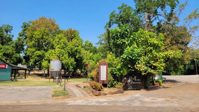
The view of the Old Town Marker from the street
| 1 ► Texas, Anderson County, Palestine — Old Town — 1836 — |
| 2 ► Texas, Angelina County, Huntington — 7003 — Joseph Herrington — |
| 3 ► Texas, Angelina County, Lufkin — 8713 — Site of Martin Wagon Company — |
| 4 ► Texas, Angelina County, Lufkin — 12821 — W.C. Trout and the Counter-Balanced Pumping Unit — |
| 5 ► Texas, Aransas County, Rockport — 1 — The Old Beach Road — |
| 6 ► Texas, Armstrong County, Claude — 4284 — Hamblen Drive — |
| 7 ► Texas, Atascosa County, Charlotte — 96 — Kings Highway Camino Real — Old San Antonio Road — Marker #96 — El Camino Real de los Tejas National Historic Trail — |
| 8 ► Texas, Atascosa County, Charlotte — 97 — Kings Highway Camino Real — Old San Antonio Road — Marker #97 — El Camino Real de los Tejas National Historic Trail — |
| 9 ► Texas, Atascosa County, Jourdanton — 16705 — Jourdan Campbell — |
| 10 ► Texas, Atascosa County, Jourdanton — 93 — Kings Highway Camino Real — Old San Antonio Road — Marker #93 — El Camino Real de los Tejas National Historic Trail — |
| 11 ► Texas, Atascosa County, Jourdanton — 94 — Kings Highway Camino Real — Old San Antonio Road — Marker #94 — El Camino Real de los Tejas National Historic Trail — |
| 12 ► Texas, Atascosa County, Leming — 90 — Kings Highway Camino Real — Old San Antonio Road — Marker #90 — El Camino Real de los Tejas National Historic Trail — |
| 13 ► Texas, Atascosa County, Leming — 91 — Kings Highway Camino Real — Old San Antonio Road — Marker #91 — El Camino Real de los Tejas National Historic Trail — |
| 14 ► Texas, Austin County, Industry — 17941 — Fisches Park — |
| 15 ► Texas, Austin County, San Felipe — 11707 — Early Roads To San Felipe — |
| 16 ► Texas, Austin County, San Felipe — Rio Brazos — Commerce Square — |
| 17 ► Texas, Bailey County, Enochs — 14640 — La Pista de Vida Agua — |
| 18 ► Texas, Bandera County, Bandera — 293 — Bandera Pass — |
| 19 ► Texas, Bandera County, Bandera — Great Western Cattle Trail — |
| 20 ► Texas, Bandera County, Bandera — 17843 — Great Western Cattle Trail — |
| 21 ► Texas, Bandera County, Bandera — 3823 — Old Texas Ranger Trail — |
| 22 ► Texas, Bastrop County, Bastrop — 9151 — Early History of the City of Bastrop — |
| 23 ► Texas, Bastrop County, Bastrop — 63 — Kings Highway Camino Real — Old San Antonio Road — Marker #63 — El Camino Real de los Tejas National Historic Trail — |
| 24 ► Texas, Bastrop County, Bastrop — 64 — Kings Highway Camino Real — Old San Antonio Road — Marker #64 — El Camino Real de los Tejas National Historic Trail — |
| 25 ► Texas, Bastrop County, Bastrop — 65 — Kings Highway Camino Real — Old San Antonio Road — Marker #65 — El Camino Real de los Tejas National Historic Trail — |
| 26 ► Texas, Bastrop County, Bastrop — 66 — Kings Highway Camino Real — Old San Antonio Road — Marker #66 — El Camino Real de los Tejas National Historic Trail — |
| 27 ► Texas, Bastrop County, Bastrop — 9190 — The Gotier Trace — |
| 28 ► Texas, Bastrop County, Bastrop — 13114 — Thomas H. Mays — |
| 29 ► Texas, Bastrop County, Bastrop — Wilbarger's Bend — |
| 30 ► Texas, Bastrop County, Cedar Creek — 67 — Kings Highway Camino Real — Old San Antonio Road — Marker #67 — El Camino Real de los Tejas National Historic Trail — |
| 31 ► Texas, Bastrop County, McDade — 9209 — McDade — |
| 32 ► Texas, Bastrop County, Paige — 60 — Kings Highway Camino Real — Old San Antonio Road — Marker #60 — El Camino Real de los Tejas National Historic Trail — |
| 33 ► Texas, Bastrop County, Paige — 61 — Kings Highway Camino Real — Old San Antonio Road — Marker #61 — El Camino Real de los Tejas National Historic Trail — |
| 34 ► Texas, Bastrop County, Paige — 62 — Kings Highway Camino Real — Old San Antonio Road — Marker #62 — El Camino Real de los Tejas National Historic Trail — |
| 35 ► Texas, Baylor County, Seymour — 5766 — Near Route of The Western Trail — |
| 36 ► Texas, Bee County, Beeville — 3315 — Medio Creek — Significant natural landmark — |
| 37 ► Texas, Bexar County, Fort Sam Houston, Government Hill — M-48 Medium Tank 90mm "Patton" — |
| 38 ► Texas, Bexar County, Fort Sam Houston, Government Hill — M-59 Armored Personnel Carrier — |
| 39 ► Texas, Bexar County, Leon Valley, Northwest Side — 14818 — Huebner-Onion Homestead and Stagecoach Stop — |
| 40 ► Texas, Bexar County, San Antonio — 89 — Kings Highway Camino Real — Old San Antonio Road — Marker #89 — El Camino Real de los Tejas National Historic Trail — |
| 41 ► Texas, Bexar County, San Antonio, Auditorium Circle — Navarro Street Bridge — |
| 42 ► Texas, Bexar County, San Antonio, Downtown — Commerce Street — |
| 43 ► Texas, Bexar County, San Antonio, Downtown — Goad Motor Company Building — |
| 44 ► Texas, Bexar County, San Antonio, Downtown — Historic Engineering on the Creek — |
| 45 ► Texas, Bexar County, San Antonio, Downtown — Houston Street — |
| 46 ► Texas, Bexar County, San Antonio, Downtown — Travis Street Crossing — |
| 47 ► Texas, Bexar County, San Antonio, Far North Central — 17579 — Scenic Loop - Boerne Stage - Toutant-Beauregard — Historic Corridor — |
| 48 ► Texas, Bexar County, San Antonio, Harlandale — The Mission Road / El Camino de las Misiones — |
| 49 ► Texas, Bexar County, San Antonio, Main/Military Plaza — American Legion Memorial Highway — |
| 50 ► Texas, Bexar County, San Antonio, Main/Military Plaza — Commerce Street — |
| 51 ► Texas, Bexar County, San Antonio, Main/Military Plaza — Houston Street — |
| 52 ► Texas, Bexar County, San Antonio, Main/Military Plaza — 31 — Laredito and the Tale of Two San Antonios — |
| 53 ► Texas, Bexar County, San Antonio, Main/Military Plaza — Zero Milestone Old Spanish Trail — |
| 54 ► Texas, Bexar County, San Antonio, Midtown — 18014 — Belknap Place — |
| 55 ► Texas, Bexar County, San Antonio, Midtown — 84 — Kings Highway Camino Real — Old San Antonio Road — Marker #84 — El Camino Real de los Tejas National Historic Trail — |
| 56 ► Texas, Bexar County, San Antonio, Northeast Side — 81 — Kings Highway Camino Real — Old San Antonio Road — Marker #81 — El Camino Real de los Tejas National Historic Trail — |
| 57 ► Texas, Bexar County, San Antonio, Southside — 86 — Kings Highway Camino Real — Old San Antonio Road — Marker #86 — El Camino Real de los Tejas National Historic Trail — |
| 58 ► Texas, Bexar County, San Antonio, Southside — 87 — Kings Highway Camino Real — Old San Antonio Road — Marker #87 — El Camino Real de los Tejas National Historic Trail — |
| 59 ► Texas, Bexar County, San Antonio, Southside — 88 — Kings Highway Camino Real — Old San Antonio Road — El Camino Real de los Tejas National Historic Trail — |
| 60 ► Texas, Bexar County, San Antonio, Thelka — 85 — Kings Highway Camino Real — Old San Antonio Road — Marker #85 — El Camino Real de los Tejas National Historic Trail — |
| 61 ► Texas, Bexar County, San Antonio, Uptown — Comanche Lookout — |
| 62 ► Texas, Bexar County, San Antonio, Uptown — 83 — Kings Highway Camino Real — Old San Antonio Road — Marker #83 — El Camino Real de los Tejas National Historic Trail — |
| 63 ► Texas, Bexar County, San Antonio, Uptown — 1409 — Route of El Camino Real — |
| 64 ► Texas, Bexar County, San Antonio, Windsor Square Crimewatch — 82 — Kings Highway Camino Real — Old San Antonio Road — Marker #82 — El Camino Real de los Tejas National Historic Trail — |
| 65 ► Texas, Bexar County, Selma, Northeast Side — Harrison and McCulloch Stage Lines — Circa 1850s-1860s — |
| 66 ► Texas, Bexar County, Selma, Northeast Side — 17273 — Harrison and McCulloch Stage Stop — |
| 67 ► Texas, Bexar County, Selma, Northeast Side — Historic Evans Road Trail — |
| 68 ► Texas, Bexar County, Selma, Northeast Side — Historic Evans Road Trail — |
| 69 ► Texas, Bexar County, Selma, Northeast Side — Selma Stage Stop & Post Office — John S. Harrison Historic Site & Home — |
| 70 ► Texas, Bexar County, Selma, Northeast Side — The Harrison House — Historic Site Overview — |
| 71 ► Texas, Blanco County, Johnson City — 5550 — Blanco County Trail Drives — |
| 72 ► Texas, Blanco County, Johnson City — 1641 — First Baptist Church — of Johnson City — |
| 73 ► Texas, Brazos County, Benchley — 46 — Kings Highway Camino Real — Old San Antonio Road — Marker #46 — El Camino Real de los Tejas National Historic Trail — |
| 74 ► Texas, Brazos County, Bryan — 47 — Kings Highway Camino Real — Old San Antonio Road — Marker #47 — El Camino Real de los Tejas National Historic Trail — |
| 75 ► Texas, Brazos County, Bryan — 12943 — Martin's Place — |
| 76 ► Texas, Brazos County, Bryan — 8706 — Route of El Camino Real — (Also known as Old San Antonio Road and Old Spanish Road) — |
| 77 ► Texas, Brazos County, Bryan — Stagecoach Travel — Boonville — |
| 78 ► Texas, Brewster County, Alpine — 570 — Burgess' Water Hole — |
| 79 ► Texas, Brewster County, Study Butte-Terlingua — Ranching in the Big Bend — Big Bend Snapshot History — |
| 80 ► Texas, Brooks County, Encino — 1414 — El Encino del Poso — (The Oak in the Hole) — |
| 81 ► Texas, Brown County, Brownwood — Ben Lednicky Park — |
| 82 ► Texas, Burleson County, Caldwell — 7562 — Chisholm Cattle Trail — An Arm of the — |
| 83 ► Texas, Burleson County, Caldwell — 7566 — Cooks Point — |
| 84 ► Texas, Burleson County, Caldwell — 50 — Kings Highway — Camino Real — Old San Antonio Road — |
| 85 ► Texas, Burleson County, Caldwell — 48 — Kings Highway - Camino Real — Old San Antonio Road — Marker #48 — El Camino Real de los Tejas National Historic Trail — |
| 86 ► Texas, Burleson County, Caldwell — 51 — Kings Highway Camino Real — Old San Antonio Road — El Camino Real de los Tejas National Historic Trail — |
| 87 ► Texas, Burleson County, Caldwell — 52 — Kings Highway Camino Real — Old San Antonio Road — Marker #52 — El Camino Real de los Tejas National Historic Trail — |
| 88 ► Texas, Burleson County, Caldwell — 53 — Kings Highway Camino Real — Old San Antonio Road — Marker #53 — El Camino Real de los Tejas National Historic Trail — |
| 89 ► Texas, Burleson County, Caldwell — 8645 — Moseley's Ferry — |
| 90 ► Texas, Burleson County, Deanville — 54 — Kings Highway Camino Real — Old San Antonio Road — Marker #54 — El Camino Real de los Tejas National Historic Trail — |
| 91 ► Texas, Burleson County, Dime Box — 7570 — Site of El Camino Real — (The Old San Antonio Road) — |
| 92 ► Texas, Burleson County, Lyons — 8641 — Lyons — |
| 93 ► Texas, Caldwell County, Niederwald — 70 — Kings Highway Camino Real — Old San Antonio Road — Marker #70 — El Camino Real de los Tejas National Historic Trail — |
| 94 ► Texas, Caldwell County, Niederwald — 71 — Kings Highway Camino Real — Old San Antonio Road — Marker #71 — El Camino Real de los Tejas National Historic Trail — |
| 95 ► Texas, Caldwell County, San Marcos — 73 — Kings Highway — Camino Real — Old San Antonio Road — |
| 96 ► Texas, Calhoun County, Indianola — 17226 — The Chihuahua Road — |
| 97 ► Texas, Calhoun County, Indianola — 19 — The German Emigration Company — Indian Point — |
| 98 ► Texas, Calhoun County, Indianola — 23 — The Merchants of Indian Point — Indian Point — |
| 99 ► Texas, Calhoun County, Indianola — 24 — The Trade Routes — Indian Point — |
| 100 ► Texas, Callahan County, Baird — 634 — Callahan County — |
579 entries matched your criteria. The first 100 are listed above. Next 100 ⊳