At the heart of the San Francisco waterfront are the maritime workers - the ferryboat deckhands, longshore workers, deep-sea sailors, cooks, cleaners, and engineers who move
goods and people across the bay and around the world.
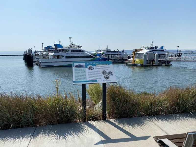
Deckhands, . . . — — Map (db m157581) HM
Five Decades of Operation
From the Second World War through the Korean and Vietnam wars, Naval Air Station (NAS) Alameda supported the Department of the Navy's defense mission, until operational closure in 1997. During this period numerous . . . — — Map (db m232568) HM
Historically Alameda was a peninsula, rich in
natural resources. Native peoples gathered food
and materials from bay salt marshes, abundant
oak forests, and nearby shorelines. From the
early 1800's the western tip of the peninsula
now known as . . . — — Map (db m157046) HM
Patrol, Rescue, and Transport Missions
The construction of the Seaplane Lagoon and two of the eventual five seaplane hangars prior to building landplane hangars and the airfield, confirms the high importance of seaplanes and flying boats to . . . — — Map (db m232538) HM
NAS Alameda
Encouraged by Alameda's trio of existing aviation facilities, Congress appropriated funding to build Naval Air Station (NAS) Alameda in 1937, after decades of urging for an air station by the Navy and local supporters. The air . . . — — Map (db m232301) HM
This plaque marks the location of an 1890 seawall on the Alameda shoreline. Behind you are the stairs where bathers went down to the beach. The wall was built by architect Joseph A. Leonard, who constructed many homes here during the 1890s. . . . — — Map (db m62215) HM
Berkeley's original shoreline was about where Second Street and the eastern side of Aquatic Park are located today. In 1853 a private wharf was built at the foot of what is now Delaware Street, and a working waterfront with factories and piers . . . — — Map (db m155983) HM
(Rehabilitated and Partially Reconstructed in 1986. William Coburn, Historic Architectural Consultant)
In the 1850s, Gold Rush-era farmers and merchants began settling in this rural bayside area. Delaware Street connected Jacob’s . . . — — Map (db m52299) HM
Site of flour mill, Niles. Built 1853 by Don Jose De Vallejo, brother of General Vallejo, on his Rancho Arroyo De La Alameda.
Niles was once called "Vallejo Mills". Stone aqueduct carrying water for mill parallels Niles Canyon Road. — — Map (db m154369) HM
The former Salt Evaporation Ponds in front of you have been divided into sections with different levels of saltiness. By studying water conditions, bird use, and prey abundance here, researchers will learn how to create the most opportunities for . . . — — Map (db m206505) HM
The Don Castro lagoon and adjacent lake were created in 1964 when the Alameda Flood Control and Water Conservation District dammed San Lorenzo Creek. Today the lagoon is supplied with water from EBMUD. A large shallow area is roped off for children. . . . — — Map (db m198391) HM
”The plague of long-billed mosquitos…bite us and pursued us all the way to the place where we camped”
- Padre Pedro Font
Padre Font was not happy. Setting up camp that March 31, 1776, he had come over a thousand miles from his home in . . . — — Map (db m208140) HM
Marker Once:
Once plentiful on California beaches, western snowy plovers now face extinction due to habitat loss from coastal development and beach recreation. Fortunately, dry salt ponds offer these sparrow-sized shorebirds an . . . — — Map (db m207071) HM
In the late 1870’s, inventive Andrew Oliver studied the drawings of Archimedes (287-212 B.C.E) and built these wind driven screw pumps based on the ancient designs.
The wooden blades rotate in the wind, which turns the screw shaft visible under . . . — — Map (db m207726) HM
Dramatic reductions in tidal wetlands over the past 200 years, due to urban development, agriculture, and salt production, resulted in significant declines in marsh-dependent wildlife. In addition to providing critically important habitat for fish, . . . — — Map (db m207017) HM
Marker One:
Balancing the needs of people and wildlife has long challenged Californians. Gold Rush-era settlers believed the best value of Baylands came from converting them to salt ponds, housing, or other human uses. Today we recognize . . . — — Map (db m207078) HM
Regional Historic
Mechanical Engineering Landmark
Wind-Powered Archimedes Screw-Pump
ca. 1890
Newark, California
This late example of the wind-driven Archimedes screw-pump shifted brine from on salt concentrating pond to one . . . — — Map (db m71365) HM
The ship’s mast in front of you is salvaged from the USS Oakland, an anti-aircraft cruiser – typical of many ships that received supplies sent from the Oakland Naval Supply Depot during World War II. The Oakland was assigned to the . . . — — Map (db m72102) WM
Imagine crossing the Bay before there
were bridges and trains. Boats were once
the only option.
In 1869, a ferry from a terminal near here finished the journey West for transcontinental railroad passengers.
In 1869, a ferry from a . . . — — Map (db m160324) HM
Moving Shoreline
Oakland's 19-mile shoreline underwent continual change after the Gold Rush, as marsh and tideland was reclaimed for development. The natural shoreline now lies buried under dredged bay sediments and landfill. Here, by the . . . — — Map (db m92753) HM
Until at least 1851, Redwood trees on this site were used as landmarks to avoid striking the treacherous submerged Blossom Rock in San Francisco Bay west of Yerba Buena Island. Although by 1855 the original stems had been logged, today's trees are . . . — — Map (db m100564) HM
This stone wall you see before you is a partial replica of the north training wall, one of two historic jetties called “training walls” because they were designed to direct the forces of the ebb tide to scour Oakland’s shipping channel . . . — — Map (db m72206) HM
Commanding Officers
Captain William K. Phillips, USN • Captain Kendall S. Reed, USN • Captain Allen P. Calvert, USN • Captain Thomas J. Casey, USN • Captain John N. Opie III, USN • Captain Hugh J. Martin, USN • Commander E.B. Ellsworth, USN . . . — — Map (db m72101) WM
Oakland Canneries
By the early 20th century, harbor improvements, expanded port facilities, and transcontinental rail service had made Oakland one of the state's leading exporters of processed food of all kinds: canned, dried, bottled, . . . — — Map (db m92788) HM
Oakland built the 9th Avenue Terminal to load and unload
break-bulk cargo – goods packed in individual crates,
barrels, and bags, rather than in standardized containers.
It's a method of shipping that requires a lot of manpower, and for . . . — — Map (db m163098) HM
The opening of the Panama Canal in 1914 made way for new
trade routes that led to a shipping boom in the post-war
world of the 1920s. By 1925, Oakland was ready to capitalize
on growing international commerce. On November 10, the
people of . . . — — Map (db m163097) HM
The idea for the Chinese junk (boat) came
from the voyage of the real junk "Free
China” from Taiwan to San Francisco in
1955. The idea originally involved the purchase
of an actual junk for the playground, but
eventually developed into a . . . — — Map (db m157313) HM
Chinese Explore the World in Junks
Before Christopher Columbus there was
Zheng He. From 1405 to 1433 Zheng He
led seven treasure fleets halfway around
the world. From the eastern coast of China, the
explorers sailed south through the . . . — — Map (db m157288) HM
Creating the Cove
The transformation of the estuary from industrial harbor to recreational waterway is a major trend in Oakland’s history. The change began at this spot. The Oakland Municipal Yacht Harbor – the city’s first public marina – . . . — — Map (db m71420) HM
There are two plaques, mounted back-to-back, on the same support for this marker.
Water & Rails
Rancho Heritage
Under Spanish and Mexican rule, much of the East Bay, including all of present-day Oakland, lay within the . . . — — Map (db m71422) HM
In operation on the Oakland waterfront from 1907 to 1989, Cryer was one of the best-known builders of small boats in the Bay Area. Founded in San Francisco in the 1890s by English-born William Cryer, the yard was later taken over by his son William . . . — — Map (db m71421) HM
Originally known as San Antonio Creek – a shallow, marsh-fringed inlet that ended near present-day Coast Guard Island – the Oakland Estuary was transformed into a working harbor under the direction of the Army Corps of Engineers. The harbor plan, . . . — — Map (db m218625) HM
Creating a Harbor
Spreading before you is the Oakland Estuary. This sheltered inlet of San Francisco Bay was once fringed by broad marshes and shallow tidelands which became mud flats at low tide. A rich wildlife habitat, the estuary was a . . . — — Map (db m72098) HM
Looking up Broadway from the wharf, 1854
The waterfront at the foot of Broadway was the site of the first rents and small wooden buildings that became the ciy of Oakland. Settlers began
arriving in 1850 during the Gold Rush. When Oakland . . . — — Map (db m185869) HM
The marine terminal you are facing is the easternmost of the Port of Oakland’s container shipping facilities. Howard Terminal is operated as a joint venture of SSA Terminals and Matson Navigation Company, the principal carrier of containerized . . . — — Map (db m71327) HM
Railroads & Industries
Railroads and shipping set the stage for Oakland's industrial development. Transcontinental trains have been rumbling down the Embarcadero (old First Street) since 1869, and oceangoing vessels have been calling at . . . — — Map (db m92790) HM
Oakland’s waterfront has been rebuilt many times in response to changes in marine technology. In 1900 coal-laden schooners discharged their cargo into bunkers on Howard Terminal’s pier. Dockside warehouses, known as transit sheds, held break-bulk . . . — — Map (db m71328) HM
Ferry service between Oakland and San Francisco has played a vital role over 145 years. The earliest licensed operator was Captain Thomas Gray who started his stern-wheeler river boat, the “General Sutter”, from a landing at the foot of . . . — — Map (db m71255) HM
This is the approximate site of the first wharf authorized by the town of Oakland and constructed by Horace W. Carpenter at the foot of Main Street (now Broadway) in 1852. The wharf was used for shipping lumber and supplies. — — Map (db m71235) HM
The Port of Oakland was formed on November 10, 1925 when citizen passed bonds for the development of port facilities. On February 12, 1927, the first permanent Board of Port Commissioners was sworn in by Mayor John L. Davie, The Port’s headquarters . . . — — Map (db m71270) HM
Completed in 1934, the Coast Guard Cutter Electra was converted to the presidential yacht and commissioned as a U.S. Navy Vessel, USS Potomac, in 1936. The 165-foot ship, which weighs 376 gross tons and has a cruising speed of . . . — — Map (db m19056) HM
Spine of West Oakland
The elevated BART tracks are the latest link in Seventh Street's long history as the transportation spine of West Oakland. The street once led to the long Wharf and Mole on the western waterfront where the . . . — — Map (db m92787) HM
The first recorded visitor to the sulphur springs grotto is Isaac Holmes, a retired U.S. Senator from South Carolina, who reportedly installed a bathtub in Bushy Dell canyon in the early 1860s in order to take alfresco baths for his rheumatism. . . . — — Map (db m72378) HM
Since the operation of Chabot reservoir in 1876, four different water companies have managed the lake. Their staff led colorful lives on this hill as they kept an eye on this valuable resource.
In 1904, William Dingee, then head of CCWC, . . . — — Map (db m71707) HM
Chabot Dam, originally called San Leandro Dam, was built by Anthony Chabot who started Contra Coast Water Company in 1868. When artesian wells and Temescal and Sausal Creeks failed to bring Oakland and surrounding cities enough water he decided . . . — — Map (db m71714) HM
Public outcry led Oakland councilman George Pardee, who later became Governor of California, to campaign Contra Costa Water Company for a clean reliable water system. The Hyatt filters were installed, along with pump houses and filtration basins, . . . — — Map (db m113822) HM
“Aha!” exclaimed Anthony Chabot It was spring of 1866 when he saw the raging waters of San Leandro Creek collide with Grass Valley Creek. He studied the vast surrounding watershed and determined it could nourish a reservoir year-round. He had . . . — — Map (db m71712) HM
Underneath the lake lies evidence of the dam’s construction. The steps on this panel and the next one show how hands and hooves toiled to complete this engineering feat in 1892.
The rest of this marker consists of three illustrations . . . — — Map (db m71734) HM
Hydraulicing:
Hydraulics were used to widen and strengthen the dam. In this sketch drawn by John Muir in 1888, look for the metal-lined wooden flume into which workmen shoveled and sprayed earth from nearby hills that gravity would move . . . — — Map (db m71733) HM
The stone structure before you is a 157 foot vertical control shaft. It joins to Tunnel No. 1 to open and close the flow of water running through the tunnel pipes. Two known accidents took place at this site. Tunnel No. 1 collapsed on two Chinese . . . — — Map (db m71908) HM
The giant drums in front of you were designed and built in 1888 as part of the filtration plant that processed water from Lake Chabot. Water was forced through these sand filters to remove impurities. Named after the engineer who designed them, . . . — — Map (db m71649) HM
In February 1874 a large Chinese work force entered this woodland setting to begin construction of San Leandro Reservoir. Later renamed Lake Chabot after its French-Canadian originator Anthony Chabot, the dam was built using techniques Chabot . . . — — Map (db m71648) HM
The Alameda County Historical Society dedicates this panel to:
Ah Bing – 41, Kim Yuen – 29, Toy Sing – 31, and Lock Sing – 33, who died outside this tunnel. This panel is also dedicated to the countless unnamed and unsung Chinese laborers . . . — — Map (db m71651) HM
Three monuments honor the submarines and their crews lost during the Second World War:
U.S. Navy Submarines paid heavily for their success in World War II. A total of 374 officers and 3121 men are on board these 52 U.S. Submarines . . . — — Map (db m94812) WM
Main marker:
California Historic Civil Engineering Landmark.
Alameda Creek Water System, 1888.
San Francisco Section A802, 1975.
Second marker:
Restoration of the Sunol Water Temple.
Started May 27, 1997. . . . — — Map (db m24499) HM
Associate of Leland Stanford, Pioneer, Miner, Legislator, Businessman. Sailed around Cape Horn on clipper ship Tahamaroo in 1849. Established the first deep quartz mine, The Union, with E.B. McIntyre, S. Hanford & N. Drew in 1851. Became . . . — — Map (db m29829) HM
In deep appreciation of those who had the foresight to plan, design, and construct the Oroville Dam Project and to those who have been operating and maintaining it for the State Water Project and the people of California.
Since its . . . — — Map (db m101447) HM
In 1848 John W. Robinson and Stephen Mead established ferry transport for freight, animals and persons across river. In 1856 Harvey Wood purchased interest and later acquired property which was maintained by Wood family until 1911. Charges were 50 . . . — — Map (db m6845) HM
Built in 1860 by John and Rebecca Gardner, this was a stage coach stop on the Big Trees Carson Valley Road. A toll road from 1862 – 1910. The hotel served as a depot for stockmen and as a summer resort.
Noted for its ice cold . . . — — Map (db m57983) HM
One of the principal mining communities in Calaveras County, named for the discoverer of gold on the flat in 1849. The objective of many immigrants coming over the Sierras by Ebbetts Pass, Murphys Flat and surrounding mines produced 20,000,000 . . . — — Map (db m149203) HM
Drainage Area 33,000 Acres
Total Capacity 4,800 Acre Ft.
Water Surface Area 375 Acres
Height of Dam 58 Feet
Length of Dam 1,500 Feet
Volume of Fill 440,000 Cu.Yds.
Built under the Watershed Protection and . . . — — Map (db m198002) HM
Founded in 1927 by Gerald (Jerry) Gill and family, the park consisted of four picnic sections, over forty acres, four baseball diamonds, two swimming pools, a wading pool for children, large dance hall and two snack bars.
At one time the grounds . . . — — Map (db m94663) HM
For more than a half-century Port Chicago has been a major port for the shipment of munitions to U.S. forces serving overseas. The Navy created the munitions-loading complex at Port Chicago as an annex to the Mare Island Navy Yard in 1942.
This . . . — — Map (db m177665) HM
Founded by Dr. Robert Semple in 1847, the Martinez-Benicia ferry was the first established and longest operating ferry service in the S.F. Bay Area. In 1850 Oliver Coffin took over the operation and with his brothers purchased a new ferryboat, the . . . — — Map (db m27645) HM
Dedicated April 23, 2005
Martinez
By James Stretestky · Julian M. Frazer · Martinez Historical Society · Mayor Rob & Carole Schroder · Supervisor Gayle B. Uilkema · Vice Mayor Mark & Dianne Ross · Tesoro's Golden Eagle Refinery · . . . — — Map (db m19224) HM
In front of you lay the hull remains of the schooner Forester. The schooner, launched in Alameda in 1900, would take cargoes of lumber from northern forests of Oregon and Washington to points in the Pacific including China, India, and Australia. . . . — — Map (db m91668) HM
Corcoran Lake filled the Central Valley
760,000 years ago (including where you
now stand)! It drained to the ocean at
today's Monterey Bay. Tectonic forces
plugged the outlet and tilted the
lakebed to the north 200,000 years
later. The surging . . . — — Map (db m190604) HM
Fifty Years
That's all it took for the clamshell dredge to change the
Delta from a vast wetland into the agricultural, water
delivery, and shipping hub we know today. In the late
1880s, these dredges reshaped the waterways to ease . . . — — Map (db m190314) HM
Picture a river running through a desert.
Now picture a desert running through a river.
The San Joaquin River once flowed
uninterrupted from high mountains,
through the arid valley bearing its name,
to the Delta. Floods enriched . . . — — Map (db m190726) HM
One of a fleet of ships owned by Bernardo Fernandez and used to transport grain around the bay. Sank - Early 1900s. Uncovered and Raised - May 15, 1976. — — Map (db m94257) HM
Early Pittsburg, then called New York Landing and Black Diamond, was largely an Italian commercial fishing and canning village.
Many of the Italian-American and other families from Pittsburg are descendants from that era.
This boat is a . . . — — Map (db m146534) HM
The S.S. Red Oak Victory is an example of the enormous scale of work completed by ordinary men and women to help the war effort. Constructed in eight-seven days, the S.S. Red Oak Victory was one of ten Victory ships commissioned by the United . . . — — Map (db m94840) HM
San Francisco Bay is known for more than its great beauty. Its large estuary, where sea water mixes with huge river flows, is also a major port.
Richmond's deep natural waterfront lent itself to early industrial development. Augustin Macdonald . . . — — Map (db m94738) HM
"They were from all over the country... all these people came to work here in Richmond at the shipyards...The shipyards, the cannery, there was a lot of industry here...They had three yards, and they were sending out ships every day... and I . . . — — Map (db m94755) HM
Constructed in 1873-74, East Brothers Light Station is the older of only two remaining light stations of San Francisco Bay that have remained substantially unchanged. The original 5th order classical (Fresnel) lens was replaced with the present . . . — — Map (db m164491) HM
What is this?
This little boat is called an El Toro. The design was
developed in 1940 by several amateur boat builders so
that anyone who was the least bit handy could cut the
boat out of 2 pieces of plywood and put it together. . . . — — Map (db m188807) HM
Before bridges spanned the Bay, ferries and trains once linked
San Francisco with the rest of the nation. At that time, the Bay
Area boasted the world's largest ferry system.
Here, at Ferry Point ship and rail met in 1900 when Santa Fe
tunneled . . . — — Map (db m152761) HM
During the World War II Home Front effort, the Richmond Shipyards were an immense facility
covering 880 acres. Constructed for the Henry J. Kaiser Company in 1941 and 1942, these shipyards
became the largest in the world. New methods of ship . . . — — Map (db m146451) HM
The SS Red Oak Victory is the last remaining ship of the 747 vessels built at the Kaiser Shipyards in Richmond, Ca, during World War II. Commissioned by the U.S. Navy as the USS Red Oak Victory (AK-235), on December 5, 1944, she served as an . . . — — Map (db m131188) HM
"All these ships were being built (in Richmond) and it provided a lot of employment... But looking back, it was really a boon to their economy. The stores were just really bustling...it was full of people..." -- Stella Faria, shipyard office . . . — — Map (db m94753) HM
The Battery Point Lighthouse is one of the first lighthouses on the California Coast.
Rugged mountains and unbridged rivers meant coastal travel was essential for the economic survival of this region.
In 1855 Congress appropriated $15,000 for . . . — — Map (db m101692) HM
1.76 Acres of this parkland have been donated by the
family of Henry Sause, Jr. Who, with his brothers,
Curt and Paul, pioneered the transportation of forest
products by tug and barge. From 1949 to 1962, Sause
Bros. Ocean Towing Company moved in . . . — — Map (db m92063) HM
Nearby are portions of the hull of the General Petroleum Corporation tanker S.S. Emidio, which on December 20, 1941 became the first casualty of the Imperial Japanese Navy's submarine force action on California's Pacific Coast. The ship was attacked . . . — — Map (db m143397) HM WM
This memorial is dedicated to those who lost their lives in the wreck of the Pacific Mail Steamer, Brother Jonathan, at point St. George's Reef, July 30, 1865. — — Map (db m76459) HM
On January 24, 1848, James Marshall set off early and alone to inspect progress in deepening the ditch that channeled water from the sawmill back to the river. Suddenly, he bent over and picked up a few particles gleaming in the icy water. “Hey, . . . — — Map (db m17241) HM
This cabin was erected by Marshall and occupied by him from 1856 : 1870. Born in New Jersey October 8, 1810. Came to California in 1845 – Died at Kelsey, this state, August 10, 1885. The discovery of gold by Marshall in the tailrace of John A. . . . — — Map (db m12215) HM
Mining ditches were dug by ditch companies to carry vast amounts of water needed for placer mining. Thousands of miles of ditches and flumes were built in the gold country; some brought immense profits to their owners. As mining declined in the . . . — — Map (db m17484) HM
This area held a number of important homes and stores during the gold rush. The first large building in Coloma was built here in 1849 by John T. Little. It contained a store, hotel, restaurant and post office. Little also operated a ferry to cross . . . — — Map (db m215742) HM
This town, settled in 1848, derived its name from its crystal clear springs. Among the richest in this vicinity its diggings produced a 25 pound nugget, one of the largest in El Dorado County. Its most thriving period was in 1851. Later it became a . . . — — Map (db m10936) HM
Honoring Walter E. Jenkinson, our fellow citizen who dedicated his life to this project which brought water to our city and fertile lands. — — Map (db m851) HM
Before roads were built in the Tahoe area in the 1920s, sailing on a steamer was the only way for visitors to reach the resorts lining the south shore. The Tod Goodwin outdid all the other steamers in size and speed. It could carry 150 . . . — — Map (db m112978) HM
From the vista, you can observe Emerald Bay and learn about its rich and colorful past
Residents & Visitors
For thousands of years, Lake Tahoe's Emerald Bay has drawn people to its shores. The Washoe Indians made their summer . . . — — Map (db m112974) HM
Captain Richard “Dick” Barter found his way to Lake Tahoe in the 1860s. Barter spent the long winters in Emerald Bay as the sole caretaker of a summer villa owned by Ben Holladay, Jr.
Originally an English sailor, Barter was known . . . — — Map (db m34942) HM
Lake Tahoe first lured hardy souls who came here to build a life in its wilderness.
Pine Lodge, rises -grandly above the translucent blue waters of Lake Tahoe's west shore.
San Francisco's elite built seasonal retreats like Pine Lodge, . . . — — Map (db m55506) HM
Gabriel Moraga of the Spanish Army, on Jan. 6, 1806 camped near here on the banks of a river never before seen by white men. The day was Epiphany, commemorating the visit of the three kings of the East to the Christ Child. This holy day suggested a . . . — — Map (db m27833) HM
"Fresno" is the Spanish word for "Ash Tree." The first settlement to which the name was applied was "Fresno City," a station on the old Butterfield Stage Route located on Fresno Slough about one and one-half miles northwesterly from the present . . . — — Map (db m41007) HM
This Water Tower is dedicated to George M. Bowman in recognition for thirty-six years of dedicated service to the City of Fresno and for his accomplishments as a naval officer. He was the city's first chief engineer and became general manager of . . . — — Map (db m41071) HM
646 entries matched your criteria. The first 100 are listed above. Next 100 ⊳