After filtering for California, 644 entries match your criteria. The first 100 are listed. ⊳
Waterways & Vessels Topic
By Andrew Ruppenstein, September 29, 2020
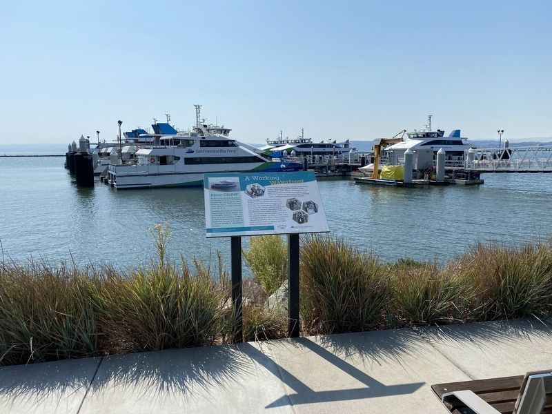
A Working Waterfront Marker - wide view, with ferries in the background
| 1 ► California, Alameda County, Alameda — A Working Waterfront — |
| Near Alameda Point Shoreline Trail. | |||
| 2 ► California, Alameda County, Alameda — 4 — Aircraft Carriers and Seaplane Tenders — At NAS Alameda — |
| On Ferry Point north of Oriskany Avenue, on the right when traveling south. | |||
| 3 ► California, Alameda County, Alameda — An Era of Dramatic Change — |
| Near Alameda Point Shoreline Trail. | |||
| 4 ► California, Alameda County, Alameda — 3 — Seaplanes and Flying Boats at NAS Alameda — |
| On Ferry Point north of West Oriskany Avenue, on the right when traveling south. | |||
| 5 ► California, Alameda County, Alameda, Former NAS Alameda — 2 — Seaplane Lagoon — Historic Development, Use, and Significance at the former NAS Alameda — |
| On Ferry Point north of West Oriskany Avenue, on the left when traveling north. | |||
| 6 ► California, Alameda County, Alameda, Leonardville — 1890 Seawall — |
| On Union Street south of Clinton Avenue. | |||
| 7 ► California, Alameda County, Berkeley, Berkeley Marina — Berkeley Municipal Pier — Berkeley History — 1926 |
| On Seawall Drive at University Avenue, on the right when traveling south on Seawall Drive. Reported missing. | |||
| 8 ► California, Alameda County, Berkeley, Northwest Berkeley — Delaware Street Historic District — Period of Significance, 1854-1910 — City of Berkeley Landmark - Designated 1979 — |
| On 5th Street at Delaware Street on 5th Street. | |||
| 9 ► California, Alameda County, Fremont, Niles — 46 — Vallejo Flour Mill — ← ½ Mile — |
| On Mission Boulevard (California Route 238) 0.5 miles west of Niles Canyon Road, on the left when traveling west. | |||
| 10 ► California, Alameda County, Hayward — A Salty Experiment in Habitat Management — Eden Landing Ecological Reserve — |
| On Eden Landing Road near Arden Road, on the left when traveling south. | |||
| 11 ► California, Alameda County, Hayward — Don Castro Regional Recreation Area — |
| Near Woodroe Avenue. | |||
| 12 ► California, Alameda County, Hayward — Search for Water — |
| On City Center Drive near 2nd Street, on the right when traveling east. | |||
| 13 ► California, Alameda County, Hayward — Snowy Plovers Find a Home — |
| On Eden Landing Trail near Eden Landing Road. | |||
| 14 ► California, Alameda County, Hayward — The Archimedes Screw Pump — From "The Oliver Salt Trail" by J. Herbert, M. Koslosky, and A. De Ponte — |
| Near Breakwater Avenue near Johnson Road. | |||
| 15 ► California, Alameda County, Hayward — Wetland to Salt Pond and Back Again — |
| Near Eden Landing Road near Eden Landing Road. | |||
| 16 ► California, Alameda County, Hayward — Who Needs This Habitat The Most? — |
| Near Eden Landing Trail near Eden Landing Road. | |||
| 17 ► California, Alameda County, Newark — Wind-Powered Archimedes Screw-Pump |
| Near Central Avenue near Morton Avenue. Reported missing. | |||
| 18 ► California, Alameda County, Oakland — USS Oakland Mast — |
| On Middle Harbor Road, on the left when traveling east. | |||
| 19 ► California, Alameda County, Oakland — Crossing the San Francisco Bay — |
| Near Burma Road. | |||
| 20 ► California, Alameda County, Oakland — Moving Shoreline — |
| On Mandela Parkway near Horton Street, on the right when traveling west. | |||
| 21 ► California, Alameda County, Oakland — 962 — Site of Blossom Rock Navigation Trees — |
| Near Skyline Boulevard, 0.5 miles north of Joaquin Miller Road. | |||
| 22 ► California, Alameda County, Oakland — Training Wall — |
| On Middle Harbor Road near 7th Street, on the right when traveling south. | |||
| 23 ► California, Alameda County, Oakland — USS Oakland CL-AA 95 — Commissioned: 17 July 1943 Decommissioned: 1 July 1949 — |
| On Middle Harbor Road, in the median. | |||
| 24 ► California, Alameda County, Oakland, Acorn Industrial — Food & Ships — |
| On 3rd Street near Linden Street, on the right. | |||
| 25 ► California, Alameda County, Oakland, Adams Point — USS Maine Memorial — |
| On Grand Avenue at Harrison Street, on the right when traveling west on Grand Avenue. | |||
| 26 ► California, Alameda County, Oakland, Downtown Oakland — 1920 Moving the World's Cargo — |
| Near 9th Avenue at Clinton Avenue, on the right when traveling east. | |||
| 27 ► California, Alameda County, Oakland, Downtown Oakland — 1930 Where the World Comes to Oakland — |
| On 9th Avenue east of Brooklyn Basin Way, on the right when traveling east. | |||
| 28 ► California, Alameda County, Oakland, Downtown Oakland — A Chinese Junk Boat for Oakland — |
| Near 10th Street east of Harrison Street. | |||
| 29 ► California, Alameda County, Oakland, Downtown Oakland — Masters of Navigation — |
| On 10th Street east of Harrison Street, on the right when traveling west. | |||
| 30 ► California, Alameda County, Oakland, East Peralta — Early Harbor |
| On Embarcadero, on the right when traveling south. Reported permanently removed. | |||
| 31 ► California, Alameda County, Oakland, East Peralta — Water & Rails / Brooklyn Basin — |
| On Embarcadero, on the right when traveling south. | |||
| 32 ► California, Alameda County, Oakland, Fruitvale — Cryer & Sons — |
| On Embarcadero near Dennison Street, on the right when traveling south. | |||
| 33 ► California, Alameda County, Oakland, Fruitvale — Tidal Canal — |
| On Alameda Avenue north of Tidal Way, on the right when traveling south. | |||
| 34 ► California, Alameda County, Oakland, Fruitvale — Union Point — |
| Near Embarcadero, on the right when traveling south. | |||
| 35 ► California, Alameda County, Oakland, Produce and Waterfront — Birthplace of Oakland — |
| On Broadway at Second Street, on the right when traveling north on Broadway. | |||
| 36 ► California, Alameda County, Oakland, Produce and Waterfront — Charles P. Howard Terminal — |
| Near Clay Street near Water Street. | |||
| 37 ► California, Alameda County, Oakland, Produce and Waterfront — Estuary Industry — |
| On 2nd Street at Clay Street, on the right when traveling south on 2nd Street. | |||
| 38 ► California, Alameda County, Oakland, Produce and Waterfront — Evolution of a Marine Terminal — |
| Near Clay Street near Water Street. | |||
| 39 ► California, Alameda County, Oakland, Produce and Waterfront — History of the Transbay Ferry — |
| Near Clay Street near Water Street. | |||
| 40 ► California, Alameda County, Oakland, Produce and Waterfront — Oakland's First Wharf — |
| Near Broadway near Water Street. | |||
| 41 ► California, Alameda County, Oakland, Produce and Waterfront — The Port of Oakland — |
| On Clay Street at Water Street, on the right when traveling south on Clay Street. | |||
| 42 ► California, Alameda County, Oakland, Produce and Waterfront — USS Potomac — |
| Near Clay Street at Water Street. | |||
| 43 ► California, Alameda County, Oakland, West Oakland — Seventh Street — |
| On Mandela Parkway at 7th Street, on the right when traveling south on Mandela Parkway. | |||
| 44 ► California, Alameda County, Piedmont — Sulphur Springs Grotto — The Healing Powers of Mineral Springs — |
| Near Wildwood Avenue, on the right when traveling west. | |||
| 45 ► California, Alameda County, San Leandro — A Zoo, a Monkey, and a Mansion Here Too! — Lake Chabot Historical Walk — |
| Near Estudillo Avenue. | |||
| 46 ► California, Alameda County, San Leandro — Chabot Dam — |
| Near Estudillo Avenue. | |||
| 47 ► California, Alameda County, San Leandro — Filtration Basins — Lake Chabot Historical Walk — |
| On Estudillo Avenue. | |||
| 48 ► California, Alameda County, San Leandro — Taming the Waters’ Flow — Lake Chabot Historical Walk — |
| Near Estudillo Avenue. | |||
| 49 ► California, Alameda County, San Leandro — To Build a Dam — Lake Chabot Historical Walk — |
| Near Estudillo Avenue. | |||
| 50 ► California, Alameda County, San Leandro — Transporting the Water — Lake Chabot Historical Walk — |
| Near Estudillo Avenue. | |||
| 51 ► California, Alameda County, San Leandro — Tunnel No. 1 Control Shaft — Lake Chabot Historical Walk — |
| Near Estudillo Avenue. | |||
| 52 ► California, Alameda County, San Leandro, Bay-O-Vista — Giant Water Filters — Lake Chabot Historical Walk — |
| Near Estudillo Avenue, on the right when traveling east. | |||
| 53 ► California, Alameda County, San Leandro, Bay-O-Vista — Lake Chabot Historical Walk — Welcome time travelers! — |
| Near Estudillo Avenue, on the right when traveling east. | |||
| 54 ► California, Alameda County, San Leandro, Chabot Park — Memorial to the Chinese Laborers — Lake Chabot Historical Walk — |
| Near Estudillo Avenue, on the right when traveling east. | |||
| 55 ► California, Alameda County, San Leandro, Mulford Gardens — Still on Patrol — |
| On Mulford Point Drive near Monarch Bay Drive, on the left when traveling south. | |||
| 56 ► California, Alameda County, Sunol — Alameda Creek Water System — Sunol Water Temple Restoration — |
| Near Paloma Way. | |||
| 57 ► California, Amador County, Sutter Creek — Robert Carlton Downs — 1828 – 1905 — |
| On Main Street (Old Highway 49) at Fiefield Street, on the left when traveling north on Main Street (Old Highway 49). | |||
| 58 ► California, Butte County, Oroville — Oroville Dam — |
| On Brad Freeman Trail, on the right when traveling south. | |||
| 59 ► California, Calaveras County, Angels Camp — 276 — Robinson's Ferry — |
| On State Highway 49, on the left when traveling south. | |||
| 60 ► California, Calaveras County, Dorrington — Dorrington Hotel — |
| 61 ► California, Calaveras County, Murphys — 275 — Murphys — |
| On Main Street at Jones Street on Main Street. | |||
| 62 ► California, Contra Costa County, Brentwood — Marsh-Kellogg Creek Watershed Project — Marsh Creek Floodwater Retarding Dam — |
| On Marsh Creek Road, 0.4 miles west of Vineyards Parkway, on the right when traveling west. | |||
| 63 ► California, Contra Costa County, Clayton — History of Marsh Creek Springs — |
| Near Marsh Creek Road near Aspara Drive. | |||
| 64 ► California, Contra Costa County, Concord — Port Chicago |
| On Kinney Boulevard, on the left when traveling east. Reported missing. | |||
| 65 ► California, Contra Costa County, El Cerrito — Cerrito Creek — |
| On San Pablo Avenue at Carlson Boulevard, on the left when traveling north on San Pablo Avenue. | |||
| 66 ► California, Contra Costa County, Martinez — Martinez-Benicia Ferry — "Gateway to the Gold Fields" — |
| On Joe DiMaggio Jr., Drive at Ferry Street, on the left when traveling east on Joe DiMaggio Jr., Drive. | |||
| 67 ► California, Contra Costa County, Martinez — Pony Express Ferry "Carquinez" — |
| On Ferry Street near Marina Vista Avenue, on the left when traveling north. | |||
| 68 ► California, Contra Costa County, Martinez — The Schooner Forester — |
| Near Pickleweed Trail. | |||
| 69 ► California, Contra Costa County, Oakley — Carquinez Strait — |
| Near Big Break Road. | |||
| 70 ► California, Contra Costa County, Oakley — Dredges — Digging in the Delta — |
| 71 ► California, Contra Costa County, Oakley — The San Joaquin: A River Runs Dry — |
| Near Big Break Road. | |||
| 72 ► California, Contra Costa County, Pinole — The Hay Schooner Carlotta — |
| On Tennent Avenue at Railroad Avenue, on the left when traveling west on Tennent Avenue. | |||
| 73 ► California, Contra Costa County, Pittsburg — Bristol Bay Sail Gill Netter — |
| On Marina Boulevard at East 3rd Street, on the right on Marina Boulevard. | |||
| 74 ► California, Contra Costa County, Richmond — "Victory ships were a bigger, complicated ship." — Reverend Ross Hidy, pastor — S.S. Red Oak Victory |
| On Canal Boulevard near Seacliff Drive, on the right when traveling south. Reported missing. | |||
| 75 ► California, Contra Costa County, Richmond — By Land and By Sea — |
| On Doran Drive near Western Drive, on the right when traveling south. | |||
| 76 ► California, Contra Costa County, Richmond — Dynamic Wartime Port — |
| Near Canal Boulevard near Seacliff Drive, on the right when traveling south. | |||
| 77 ► California, Contra Costa County, Richmond — East Brother Light Station — |
| Near Stenmark Drive. | |||
| 78 ► California, Contra Costa County, Richmond — El Toro — |
| On Cutting Boulevard east of Canal Boulevard, on the right when traveling east. | |||
| 79 ► California, Contra Costa County, Richmond — Ferries and Frieght on San Francisco Bay — |
| Near Dornan Drive at Brickyard Cove Road. | |||
| 80 ► California, Contra Costa County, Richmond — 1032 — Richmond Shipyards — |
| On Canal Boulevard, 1 mile south of Seacliff Drive, on the right when traveling south. | |||
| 81 ► California, Contra Costa County, Richmond — SS Red Oak Victory — |
| Near Canal Boulevard. | |||
| 82 ► California, Contra Costa County, Richmond — War Boomtown — Remnants of a Shipbuilding Past — |
| On Canal Boulevard near Seacliff Drive, on the right when traveling south. | |||
| 83 ► California, Del Norte County, Crescent City — 951 — Battery Point Lighthouse — |
| Near Lighthouse Way. | |||
| 84 ► California, Del Norte County, Crescent City — Dedication to Henry Sause, Jr. — |
| On Front Street at D Street, on the right when traveling east on Front Street. | |||
| 85 ► California, Del Norte County, Crescent City — 497 — S.S. Emidio — |
| On Front Street at Stamps Way, on the left when traveling south on Front Street. | |||
| 86 ► California, Del Norte County, Crescent City — St. George Reef Lighthouse — |
| On South Pebble Beach Drive south of West 9th Street, on the right when traveling south. | |||
| 87 ► California, Del Norte County, Crescent City — 541 — Brother Jonathan Cemetery — |
| On South Pebble Beach Drive, on the right when traveling north. | |||
| 88 ► California, El Dorado County, Coloma — “Gold Boys Gold” |
| Near Highway 49. Reported permanently removed. | |||
| 89 ► California, El Dorado County, Coloma — Cabin of James Marshall — |
| On Marshall Park Way, on the left when traveling north. | |||
| 90 ► California, El Dorado County, Coloma — Mining Ditches — |
| On Marshall Parkway, on the left when traveling north. | |||
| 91 ► California, El Dorado County, Coloma — Pleasant Flat — |
| On Mt Murphy Road at Levee Trail, on the left when traveling east on Mt Murphy Road. | |||
| 92 ► California, El Dorado County, Diamond Springs — 487 — Diamond Springs — |
| On Pleasant Valley Road (State Highway 49), on the right when traveling west. | |||
| 93 ► California, El Dorado County, Pollock Pines — Jenkinson Lake — |
| On Mormon Emigrant Trail east of Sly Park Road (County Route E16), on the right when traveling east. | |||
| 94 ► California, El Dorado County, South Lake Tahoe — "The Only Way to See Lake Tahoe" — |
| Near Heritage Way. | |||
| 95 ► California, El Dorado County, South Lake Tahoe — Enjoy the View from Inspiration Point — |
| Near Emerald Bay Rd (California Route 89). | |||
| 96 ► California, El Dorado County, South Lake Tahoe — The Hermit of Emerald Bay — An Eccentric Caretaker — |
| Near Emerald Bay Road (State Highway 89), on the right when traveling north. | |||
| 97 ► California, El Dorado County, Tahoma — Pine Lodge-Erhman Mansion — |
| On California State Park Road. | |||
| 98 ► California, Fresno County, Centerville — 23 — Kings River - Centerville — |
| On East Kings Canyon Road (State Highway 180) near South Rainbow Route, on the left when traveling east. | |||
| 99 ► California, Fresno County, Fresno — Fresno — |
| 100 ► California, Fresno County, Fresno — George M. Bowman — 1891 - 1984 — |
| On Fresno Street at O Street, on the right when traveling east on Fresno Street. | |||
644 entries matched your criteria. The first 100 are listed above. Next 100 ⊳