By Barry Swackhamer, May 16, 2018
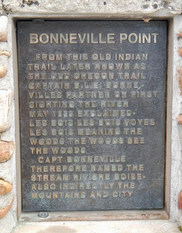
Bonneville Point Marker
GEOGRAPHIC SORT Title Sort Marker Number Sort Marker Number Sort N Marker Number Sort T Publication Order Sort Publication Order Sort A Erected Year Sort Most Viewed Sort Most Recent-Interest Sort Most Recently Changed Sort SEE FAQ #33 FOR DESCRIPTIONS
Near S. Upper Blacks Creek Road, 1.3 miles north of E. Blacks Creek Road.
On State Highway 21 at East Lake Forest Drive, on the right when traveling east on State Highway 21.
Near S. Upper Blacks Creek Road, 1.3 miles north of E. Blacks Creek Road.
On Julia Davis Drive, on the right when traveling west.
Near S. Upper Blacks Creek Road, 1.3 miles north of E. Blacks Creek Road.
Near S. Upper Blacks Creek Road, 1.3 miles north of E. Blacks Creek Road.
On South Capitol Boulevard near Julia Davis Drive, on the right when traveling north.
On U.S. 89 at milepost 2.2 near Loveland Lane, on the left when traveling south.
On Main Street (U.S. 30) near Stringtown Road, on the right when traveling north.
On State Highway 5, 0.1 miles west of North 23rd Street, on the right when traveling west.
On U.S. 20/26, on the right when traveling west.
On U.S. 26, on the right when traveling west.
On State Highway 75 at milepost 156 near Forest Road 406, on the left when traveling south. Reported permanently removed.
Near Banks Lowman Road (County Highway 17) near Station Creek Loop Road, on the left when traveling west.
On Wellington Place, 0.1 miles north of School Street, on the right when traveling south.
Paid Advertisement
On Hope Peninsula Road at 200, on the right when traveling south on Hope Peninsula Road.
On U.S. 95 at milepost 504 near Deep Creek Loop (State Highway 2), on the left when traveling north.
On U.S. 30 near South 3rd Street West, on the left when traveling west.
Near East 1st Street South near South Main Street.
On Soda Point Power Plant Road near Reservoir Road, on the right when traveling south.
On Wayan Loop Road (State Highway 34) near Wayan Loop Road, on the right when traveling west.
On U.S. 12, 1.5 miles south of State Highway 11, on the right when traveling west.
On U.S. 12, 0.6 miles west of Lenore Grade, on the right.
Near U.S. 12 at 140th Street, on the right when traveling west.
Near U.S. 12 at 140th Street, on the right when traveling west.
Near U.S. 12 at 140th Street, on the right when traveling west.
Near U.S. 12 at 140th Street, on the right when traveling west.
On U.S. 12, 3 miles south of Michigan Avenue, on the right when traveling west.
Near U.S. 12 near Bobbit Bench Grade, on the left when traveling east.
Near U.S. 12 at 140th Street, on the right when traveling west.
Near U.S. 12 at 140th Street, on the right when traveling west.
Paid Advertisement
On West Pierce Street (State Highway 11 at milepost 17) near West 7th Street, on the right when traveling east.
On Camas RoadCe near Cemetery Road.
On Camas Road near Cemetery Road, on the right when traveling east.
On Woods Street at West Pierce Street (State Highway 11), on the right when traveling east on Woods Street.
On West Pierce Street (State Highway 11) near West 7th Street.
On West Pierce Street (State Highway 11 at milepost 17) near West 7th Street, on the right when traveling east.
On U.S. 93 at milepost 245.3,, 0.9 miles north of Idaho 75 Scenic (Idaho Highway 75), on the right when traveling north.
On State Highway 75 at milepost 190 at Sawtooth Terra Tracts Road, on the right when traveling south on State Highway 75.
Near State Highway 75 near Yankee Fork Road, on the left when traveling west.
On Weston Canyon Road (State Highway 36) near West 300 South, on the left when traveling east.
On Weston Canyon Road (State Highway 36) near West 300 South, on the left when traveling west.
On Mesa Falls Scenic Byway (State Highway 47) near Forest Road 386, on the right when traveling north.
On South Bridge Street near East 3rd Street, on the right when traveling north.
Near River Road at U.S. 30.
On U.S. 95 at Airport Road, on the right when traveling north on U.S. 95.
On Lolo Motorway (Forest Road 500) near Weites Butte Lookout Road, on the left when traveling west.
Paid Advertisement
On Lolo Creek Road near Buckner Creek Road, on the right when traveling west.
On Forest Road 500 near unnamed road, on the left when traveling south.
On Forest Road 500 near Forest Road 514, on the left when traveling south.
On Lolo Motorway (Forest Road 500) at Smith Creek Road on Lolo Motorway.
Near Lake Road near Tolo Lake Road, on the left when traveling south.
On U.S. 12, 0.5 miles west of Dyche Road, on the left when traveling west.
On U.S. 12 at milepost 158 near Forest Road 1684, on the left when traveling west.
On U.S. 12 at milepost 158 near Forest Road 1684, on the left when traveling west.
On U.S. 12, 27.7 miles east of Mill Road, on the right when traveling east.
On U.S. 12 at State Highway 13, on the left when traveling east on U.S. 12.
Near Highway 12 near Elk Meadows Road, on the left when traveling east.
Near Powell Road (Forest Road 102) near U.S. 12.
On Elk Meadows Road (Forest Road 373) near Forest Road 5950, on the right when traveling east.
On U.S. 12, 27.7 miles east of Mill Road, on the right when traveling east.
On Highway 12, 3 miles west of Elk Meadows Road, on the left when traveling east.
On U.S. 12, 4.6 miles east of Doe Creek Road, on the left when traveling east.
Paid Advertisement
On Elk Meadows Road near U.S. 12.
On U.S. 95, 0.4 miles south of McKinley Mine Road, on the left when traveling north.
On Lolo Motorway (Forest Road 500) near Liz Butte Road, on the left when traveling west.
On Lolo Motorway (Forest Road 500) near Forest Road 566, on the right when traveling south.
On Lolo Motorway (Forest Road 500) near Gravey Creek Road (Forest Road 107), on the left when traveling west.
On Casey Road (U.S. 93) near Carmen Creek Road, on the left when traveling north.
On Tower Rock Road near Redtail Lane, on the left when traveling east.
On Casey Road (U.S. 93 at milepost 315) near Tower Rock Road when traveling north.
On Tower Rock Road near Redtail Lane, on the left when traveling east.
On Lewis and Clark Highway, Scenic (U.S. 93 at milepost 332), on the left when traveling north.
On U.S. 93 at milepost 345, on the right when traveling north.
On Casey Road (State Highway 93 at milepost 349) near State Highway 43, on the left when traveling north.
On U.S. 28 near Forest Road 188.
On Salmon River Highway (Scenic Route 30) 5 miles west of Lewis and Clark Highway (U.S. 93), on the left when traveling west.
On Lewis and Clark Highway (U.S. 93 at milepost 326.5) at Salmon River Road (Route NF 030), on the right when traveling south on Lewis and Clark Highway.
On Lewis and Clark Highway (U.S. 93 at milepost 326.1), 0.1 miles south of Salmon River Road (Route 30), on the left when traveling north.
Paid Advertisement
On Casey Road (U.S. 93) near Hughs Creek Road (Forest Road 091), on the left when traveling north.
On Salmon River Road (Forest Road 30) near Casey Road (U.S. 93), on the right when traveling west.
On State Highway 28 near Haynes Creek/17 Mile Road, on the right when traveling north.
On 17 Mile Road at Back Road (State Road 28), on the left when traveling east on 17 Mile Road.
On State Highway 28 near Haynes Creek/17 Mile Road, on the right when traveling north.
On State Highway 28, 1.5 miles east of U.S. 93, on the left when traveling east.
Near East Main Street (State Highway 28) 2 miles east of U.S. 93, on the left when traveling east.
Near Casey Road (U.S. 93) at Tower Creek Road, on the right when traveling north.
On Casey Road (U.S. 93) near Tower Rock Road, on the left when traveling north.
On State Highway 28 near Haynes Creek/17 Mile Road, on the right when traveling north.
On Casey Road (U.S. 93) near Tower Rock Road, on the left when traveling north.
Near Forest Road 158 at Warm Springs Road (Forest Road 185) when traveling south.
Near Warm Springs Road (Forest Road 185) near Forest Road 158 when traveling south.
On Warm Springs Road (Forest Road 158) near Lewis and Clark Highway (Forest Road 013), on the right when traveling south.
Near Lemhi Pass Road near Lewis and Clark Highway (Forest Road 013), on the right when traveling south.
On Lewis and Clark Highway (Forest Road 013) near Forest Road 068, on the right when traveling west.
Paid Advertisement
On State Highway 28 near Tendoy Lane.
On Warm Springs Road (Forest Road 158) near Lewis and Clark Highway (Forest Road 013), on the left when traveling south.
On Agency Creek Road near Forest Road 6238.
On State Highway 28 at Tendoy Lane, on the left when traveling north on State Highway 28.
On Agency Creek Road near Forest Road 6238, on the left when traveling west.
126 entries matched your criteria. The first 100 are listed above.
The final 26 ⊳