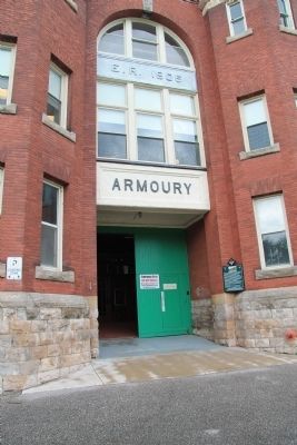
The Chatham Armoury was constructed in 1905 as a result of reform and expansion of the volunteer militia. The first unit to occupy the Armoury was the 24th Kent Regiment that was formed in 1901. It was the centre for local recruitment and training . . . — — Map (db m71382) HM
On this site a blockhouse was constructed in 1794 by order of Lieutenant-Governor John Graves Simcoe. He planned to establish here a small naval arsenal which would form a link in the defences of Upper Canada's western frontier and also draw the . . . — — Map (db m71313) HM
Boblo Island
For many centuries the island you see in front of you was used for hunting and fishing by First Nations people. Called Île aux Bois Blancs by the French, Boblo Island's key location made it a site for . . . — — Map (db m71185) HM
Brick Officers' Guard Room
and Staff Sergeant's Quarters
(1839)
Poste de garde des officiers en
briques et quartiers du sergent
de l'etat-major (1839) — — Map (db m71220) HM
Connection to Town
Fort Malden (originally called Fort Amherstburg) was the anchor of the town, which grew to the south. In this view, you are looking past the parade grounds of the fort (now a park) down Dalhousie Street . . . — — Map (db m71192) HM
The post was begun by the Royal Canadian Volunteers in 1796 to replace Detroit and to maintain British influence among the western Indians. As the principal defense of the Detroit frontier in 1812, it was here that Isaac Brock gathered his forces . . . — — Map (db m34353) HM
Fort Defences
In front of you is a recreated piece of the fort's palisade, a vertical wall of sharpened logs. This wall surrounded the fort, linking the four diamond-shaped corner projections, called bastions. Around each . . . — — Map (db m71173) HM
Fort Malden Points of Interest • Fort Malden Points d'intérêt
(1) Visitor Centre
1939
Centre d'accueil
1939
(2) Military Pensioner's Cottage
circa 1851 (Restoration) . . . — — Map (db m71278) HM
Pensioner's Cottage
This cottage was built in the early 1850s for a retired soldier and his family. About 85 of these homes were constructed just east of the Fort, and leased at a modest rate to veteran soldiers in return for light . . . — — Map (db m71167) HM
Privy
The foundations in front of you are from a communal privy (toilet) for enlisted men and their families that stood here in 1840. The women and children had a small room - the soldiers made do with an open structure offering . . . — — Map (db m71221) HM
Strategic Location
A deepwater channel between here and Boblo Island brings ships close to shore, a fact dramatically illustrated when a north-bound lake freighter passes by. This was why Fort Amerstburg was originally located . . . — — Map (db m71191) HM
The office for the Commissariat Department was built in 1831 near the government wharf and storehouse. Commissary officials purchased from local contractors the flour, beef, straw and firewood used by troops. They also managed Fort Malden's . . . — — Map (db m37356) HM
The Site Over Time
Today the site looks very different than it would have 170 years ago, when Fort Malden was at its height. Almost all the buildings from that period have been lost, and most of the ditch and wall that encircled . . . — — Map (db m71174) HM
English: This peninsula, headquarters of the Provincial Marine (c. 1790-1813), and of the Royal Navy (1813-1853), was the major British naval base on Lake Ontario during the War of 1812. Buildings surviving from this period include the Naval . . . — — Map (db m83618) HM
[English Text]:
Here in June, 1813, General John Vincent assembled troops that made the successful night attack on the invaders at Stoney Creek. From this point of vantage, in December, 1813, the force which retook Fort George and . . . — — Map (db m56725) HM
These ramparts were
erected by the British troops
during the War of 1812-15.
From this place on the night
of June 5th 1813,
700 men under the command
of Lieut. Colonel Harvey,
marched to Stoney Creek
where they surprised . . . — — Map (db m56756) HM
[text on left side]
BLOODY ASSIZE
In the spring of 1814, a court of assize (travelling circuit court) in Ancaster convicted fifteen men of high treason for aiding American forces during the War of 1812. In June 1814, the harshest of sentences . . . — — Map (db m222062) HM
English:
On 19 March 1813 Sir James Yeo, a brave and audacious commander earlier in the Napoleonic War, was appointed Commodore and senior officier on the Lakes of Canada. Having never commanded a Squadron before, he was instructed by the . . . — — Map (db m83570) HM
English:
With the outbreak of the War of 1812, a blockhouse was quickly constructed on Point Frederick complementary to and earlier one built on Point Henry. Both provided protection for the Kingston dockyard which was the pivotal point of . . . — — Map (db m83613) HM
The first Fort Henry was built during the War of 1812 to protect the British dockyards in Navy Bay. The present limestone citadel, constructed between 1832 and 1837, replaced the old fort as part of a larger plan for the defence of the recently . . . — — Map (db m39364) HM
English: The Navy Yard established in 1789 as a trans-shipment point for the Great Lakes and as the Provincial Marine's Lake Ontario base was administered by the Admiralty after 1813. During the War of 1812 Commodore James Yeo, R. N., . . . — — Map (db m83568) HM
One of the most influential and controversial figures in Canadian history, Frontenac was born at St-Germain-en-Laye, France. As a member of the noblesse d'epee he was able in 1672 to secure the appointment as Governor-General of New France. Devoted . . . — — Map (db m39978) HM
This tower was constructed in 1846 as part of the new naval defenses authorized for Kingston Harbour by the Imperial Government during the Oregon Crisis of 1845-1846. It was one of the last British works of defense commenced in the . . . — — Map (db m208941) HM
English: A strategic location for the defence of the Loyalist settlement at Cataraqui (Kingston), this point was reserved in 1788 and named after Sir Frederick Haldimand, Governor of Quebec (1778-86). In 1790-91 a guardhouse and storehouse . . . — — Map (db m83571) HM
In November 1812, guns of the original fort here were fired against American ships attacking Kingston. Perhaps this attack came as retaliation for the earlier Canadian one on Sackets (sic) Harbor, but more likely American commander Chauncey felt his . . . — — Map (db m83615) HM
English:
Early in his celebrated career the explorer La Salle played a principal role in the expansion of the French fur trade into the Lake Ontario region. In 1673 he arranged a meeting between Governor-General Frontenac, who . . . — — Map (db m141300) HM
Stood on this site from 1848 to 1875. With Shoal Tower opposite it defended Kingston Harbour and the Rideau Canal. From 1875 this was a public park. In 1885 the Kingston and Pembroke railway station was built. — — Map (db m39979) HM
English:
Once part of a large and active naval dockyard, this substantial stone building was erected as a warehouse for naval stores. Although initially planned in 1816, it was not completed until four years later when the need for storage . . . — — Map (db m83567) HM
Although technically no longer an island, this park peninsula has traditionally been known by a number of names in our local history. The original REFUGE ISLAND, a bare rock with some scrub growth, became HOSPITAL ISLAND during its tenure as an . . . — — Map (db m141826) HM
When Colonel Stone returned after the raid, he found the government storehouse in ashes, the bridge destroyed and his home ransacked. His wife, Abigail, had been seriously injured and took some time to recover. As a deterrent to any . . . — — Map (db m207630) HM
Last stand of France in Canada. Fort De Levis, on Isle Royale, (Chimney Island), was built by Captain Francois Pouchot in the spring and early summer of 1760. Its garrison surrendered after a gallant defense, on 25th August, 1760, to the British . . . — — Map (db m178522) HM WM
The Merrickville blockhouse is one of four blockhouses constructed on the Rideau Canal. Its architecture is a typical design utilized throughout British North America. The 3.5 foot (1.06 metres) walls were designed to be strong enough to . . . — — Map (db m142312) HM
This is one of four blockhouses which, with some twelve other "defensible buildings", were constructed along the Rideau Canal. The canal, built 1826-32 by Lieutenant-Colonel John By, Royal Engineers, was designed to serve as an alternative . . . — — Map (db m142181) HM
When construction of the Rideau Canal began, Merrickville was already an established village and was considered by the authorities to be a logical target for an invader. Consequently Colonel John By urged strong measures for the . . . — — Map (db m142194) HM
English: The first Fort Wellington was erected on this site during the War of 1812 to shelter British regular troops and Canadian militia defending the vital St. Lawrence River transportation route. In February 1813 those soldiers crossed . . . — — Map (db m209406) HM
English:
You are standing on a battlefield where men fought and died. This battle took place in November 1838, during the Canadian rebellions. One side fought to "liberate" Canada from British rule. The other side rallied to protect . . . — — Map (db m83497) HM
The construction of the Narrows blockhouse began in 1832 by William H. Tett,
a prominent Newboro merchant. This blockhouse is one of four constructed on the
Rideau Canal. Its architecture is a typical design utilized throughout . . . — — Map (db m207637) HM
Before the arrival of the Royal Engineers, Rideau Lake stretched unbroken
for 35 km (22 miles) between Newboro and the entrance to the Rideau
River, 29 km (18 miles) to the north. There was, and is, no reason for this
lock with its 1 . . . — — Map (db m207654) HM
The War of 1812 had shown that a successful defence of Canada against an American attack depended upon secure supply lines. The Rideau Canal was built as an alternate to the easily attacked St. Lawrence supply route. Blockhouses were . . . — — Map (db m207659) HM
In one of several concentrations of British troops in Upper Canada various infantry and artillery units were stationed on a military reserve here during the mid-19th century. The garrison, which contributed significantly to the economic growth of . . . — — Map (db m18918) HM
The fortifications which stood on this site were built in 1791 to protect the southern terminus of the Niagara portage road, and serve as a forwarding depot for government supplies. Known also as Fort Welland, the main structure consisted of a log . . . — — Map (db m49164) HM
Three fortifications occupied this site. The first (1764-1779) and second (c. 1783-1803), located at lower levels, were abandoned when ice and water inundated the works. The third Fort Erie, built between 1805 and 1808, was repaired in January 1814 . . . — — Map (db m48912) HM
[Text on the base of the Cairn];
Here are buried
150 British Officers and Men
Who fell in the attack on Fort Erie
On the 26th day of August, 1814, and three
of the defenders, men of the United States
Infantry, whose remains . . . — — Map (db m54139) HM
Thomas Baker McQuesten was born in Hespeler, Ontario June 30, 1882. In 1934 he was appointed Minister of Highways and Public Works for the Province of Ontario and Chairman of the Niagara Parks Commission. He served in both positions for ten years.
. . . — — Map (db m78489) HM
The Tower
By 1813, the British were planning to build "a tower in small redoubt to command the entrance of the River...at Mississauga Point." Begun in the Spring of 1814, this tower rests on the remains of the first Capital of . . . — — Map (db m52200) HM
A Strategic Location
You are standing at Mississauga Point where the Niagara River flows into Lake Ontario. Long ago the lakes and rivers were military supply and transportation routes and forts were built to protect them. . . . — — Map (db m52610) HM
Fort Niagara was only 1200 metres from Fort George, well within artillery range. In May, 1813, combined artillery fire from Fort Niagara, its detached batteries, and American warships at the river's mouth completely destroyed Fort George and forced . . . — — Map (db m53604) HM
The Niagara River was extremely important from a strategic perspective. It was part of the St. Lawrence – Great Lakes system, one of the main transportation routes on either side of the border. Those who controlled the waterways would . . . — — Map (db m140087) HM
Constructed by order of Lieutenant-Governor Simcoe 1796-99, Fort George served as the headquarters for Major-General Brock in 1812. In May, 1813, it was bombarded and captured by the Americans who constructed fortifications of their own on the site. . . . — — Map (db m48743) HM
This tower and earthwork are all that survive of the barracks, guardroom, and cells of Fort Mississauga. Built between 1814 and 1816 to replace Fort George as the counterpoise to the American Fort Niagara immediately opposite, it was garrisoned . . . — — Map (db m48745) HM
• Mississauga Point was the location of a Neutral First Nation fishing settlement by the 15th century.
• The area was under the control of the Seneca Nation during the late 17th century, and it became home to the Mississauga Nation by the . . . — — Map (db m52236) HM
Explore a part of our heritage - visit a fort almost 200 years old and discover part of the Lake Ontario shoreline.
Explorez un volet de notre patrimoine - visitez un fort qui a presque 200 ans d'histoire et decouvrez une partie du rivage du . . . — — Map (db m48632) HM
Across the Niagara River is the imposing American stronghold, Fort Niagara. Originally built by the French, then occupied by the British, and finally by the Americans, this fort for nearly 150 years stood guard over the traditional supply route to . . . — — Map (db m53630) HM
Only 1200 metres across the Niagara River is the imposing American stronghold, Fort Niagara. Originally built by the French, then occupied by the British, and finally the Americans, this fort for nearly 150 years stood guard over the traditional . . . — — Map (db m140089) HM
Brock's Monument and
Queenston Heights:
This striking commemoration and final resting place of Major General Brock marks the site of the Battle of Queenston Heights. Visitors can climb the 235 stairs to take in spectacular views, or . . . — — Map (db m54037) HM
The first lighthouse on the Great Lakes was built of stone at Point Mississauga in 1804 by John Symington, under orders from Lieutenant-Governor Peter Hunter. Demolished in 1814 to make room for this fort, its materials with debris from the ruined . . . — — Map (db m48746) HM
Field artillery was designed for mobility. Cannons mounted on carriages with large wheels could be moved quickly, even over rough terrain. This six pounder has a limber to carry ammunition and supplies and would be harnessed to a team of horses. . . . — — Map (db m54000) HM
In May of 1813, combined artillery fire from Fort Niagara and detached batteries destroyed Fort George paving the way for invasion. On May 27th, a large American force defeated a much smaller number of British regulars, militia and First Nations . . . — — Map (db m140092) HM
The St.Lawrence and Great Lakes system was the most efficient route to the interior of the continent of North America. Large waterways allowed for substantial sailing vessels to trade and maintain contact with Native allies from Montreal to the . . . — — Map (db m53624) HM
Everywhere
Artillery was vitally important to the defense of Upper Canada. Due to a shortage of heavy cannons available in the province, there were only five garrison guns mounted inside Fort George in May of 1813. . . . — — Map (db m53989) HM
Built in 1796, Fort George was the scene of fierce engagements during the War of 1812. It was captured and destroyed then refortified by the Americans in 1813. It was re-taken by the British later that same year. The fort was abandoned in the . . . — — Map (db m54038) HM
This smoothbore, muzzle-loading gun, along with six others (five shell guns and a 32-pounder), was mounted as part of an improved harbour defence battery at Fort York just west of here in 1862. An additional training battery of two 32-pounders was . . . — — Map (db m237590) HM
Originally a one-storey gunpowder magazine, this building's walls could not support the weight of the bombproof roof. The army replaced the roof and added a second floor in 1824 to store weapons and equipment. In 1838, the upper floor housed 5,000 . . . — — Map (db m237597) HM
This battery saw action during the Battle of York in 1813. It survived the American occupation and became part of the rebuilt fort of 1813-15. Today it reflects its 1816 appearance, when it held two artillery pieces. It was modified to hold five . . . — — Map (db m237599) HM
[English] Fort York constituted the primary defensive position in early York (Toronto). The present bildings, erected between 1813 and 1815 to replace those destroyed during the American occupations of York in 1813, are among the . . . — — Map (db m199282) HM
From 1800 to 1813, 'Government House' stood in the centre of today's Fort York. It was the home and office of Upper Canada's lieutenant-governor, head of the colony's civil government. In stressful times, the office was combined with that of the . . . — — Map (db m237595) HM
Like the No. 2 Blockhouse, this was one of the first buildings constructed during the refortification of Toronto in the second half of the War of 1812. The depression in the ground by the north wall is the approximate surface grade here in 1813; . . . — — Map (db m237598) HM
The first structures built at Fort York during the War of 1812 where blockhouses to house the soldiers. Thick, square-timbered walls (covered with ‘weather boards’) offered protection from bullets, exploding shells and small-calibre artillery. . . . — — Map (db m83745) HM
In 1815 each of these buildings housed 100 people: soldiers, their wives and their children. In the 1820s, the army halved the number of occupants to improve living conditions. By the 1860s, only three men and their families lived in each room. . . . — — Map (db m237593) HM
The Officers’ Blue Barracks housed junior officers: ensigns, lieutenants and some captains. Unlike the other structures in the fort, which are original to 1813-15, this building is largely a reconstruction. The army tore down the barracks' . . . — — Map (db m237596) HM
One section of this building housed senior officers while another met most of the dining needs of all of the garrison officers. Sometimes officers lived here with their families, but most married officers lived more comfortably in town. Money vaults . . . — — Map (db m237594) HM
The British Army constructed this building to house gunpowder and cartridges for artillery, muskets, rifles and other weapons. The magazine was bombproof in case of enemy attack. It also had features to prevent accidental explosions and to keep the . . . — — Map (db m237591) HM
English:
Loyal residents of York (Toronto) were encouraged by early British victories in the War of 1812, but in 1813, they experienced first-hand the hardships of war. On the morning of April 27th, an American fleet appeared offshore and . . . — — Map (db m83668) HM
This reconstruction shows a typical 19th century British army well house. The hand-dug well was sunk in 1802, soon after Government House was built. The well is over seven metres deep, has an outside diameter of three metres, and is lined with . . . — — Map (db m237592) HM