On 2nd Street at Main Street, on the right when traveling west on 2nd Street.
Army Captain Samuel Colville Vance was a surveyor for the United States government living in Cincinnati, Ohio. In 1802 he purchased all the land comprising the original town of "Lawrenceburgh." At that time the land was part of Hamilton County, . . . — — Map (db m66906) HM
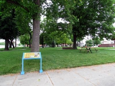
On East High Street at Elm Street, on the left when traveling south on East High Street.
c. 1820 Before the levee was built, Elm Row continued down the river to the city wharf — now under water.
1836 Indiana appropriates $1,400,000 to begin construction on Whitewater Canal linking the National Rd to Ohio River.
1837 . . . — — Map (db m187437) HM
On Walnut Street north of East Center Street, on the right when traveling north.
L. Kohlerman, a local undertaker built
this example of Italianate architecture
c. 1875. In the 1860's and 1870's,
the streets in Lawrenceburg were
raised because of flooding from the
Ohio River. The first floors of
buildings were covered and . . . — — Map (db m222708) HM
On Short Street south of East Williams Street, on the right when traveling south.
This Italianate building was originally
the First National Bank of
Lawrenceburg, one of three local
banks. It was built c. 1863 by Martin
Tittle, a local master brick mason.
Tittle built many of the city's
prominent buildings during . . . — — Map (db m222795) HM
On East High Street west of Short Street, on the right when traveling east.
The Ferris Drug Store was at this
location as early as 1830. This
building was built in 1853 after a fire
destroyed the original. In 1901, the
McCullough Drug Company
purchased the building. John C. and
his son John L. McCullough
established . . . — — Map (db m222738) HM
On Walnut Street south of West Williams Street, on the right when traveling south.
This Italianate building constructed
in 1885 was originally a buggy and
carriage factory for Helfer and
Woodward. The carriages were sold
mostly in the South. Lewis Adler
bought the building in 1861. Adler
remodeled the first floor to . . . — — Map (db m222729) HM
On Walnut Street south of East Tate Street, on the left when traveling south.
James B. Weddle built the
Walnut Theater in 1925. Weddle
and his son ran the theater until
they sold it in 1978. The interior
was remodeled after the 1937
flood to reflect the popular Art Deco
style of the time. The large
marquee was added in . . . — — Map (db m222712) HM
On East Washington Street, on the right when traveling west.
Built c. 1873 by Dr. William Bracken, this excellent Italianate commercial building displays decorative cornice work and unique rope trim on the upper window hoods. Dr. Bracken originally lived and worked in the west portion, which later housed a . . . — — Map (db m241665) HM
On East Main Street at South Broadway Street, on the right when traveling east on East Main Street.
The original federal style building on this location was built c.1850, with Italianate ironwork columns and lower level storefront windows added c. 1875, utilized as a hotel, the Citizen's National Bank, and the South Side Theatre, the structure was . . . — — Map (db m241662) HM
On South Franklin Street at East Main Street, on the right when traveling north on South Franklin Street.
Built c.1850, this Italianate commercial building was used to house the courthouse offices during the construction of the present courthouse from 1854 to 1860. It also housed a community center (Washington Hall) which doubled as the publishing site . . . — — Map (db m241663) HM
On North Broadway Street at Indiana Road 46, on the right when traveling south on North Broadway Street.
Constructed c. 1860 in Classical Revival style, it displays a unique parapet front gable roof with wood topped "steps.” At least four food distributors were located at this site, including Kammerling's Meats in 1908, the Model Grocery in 1914, . . . — — Map (db m187666) HM
On Gordon M. Buehrig Place just east of South Wayne Street, on the left when traveling east.
The Eckhart Carriage Company was established in 1874
in Auburn, Indiana. It was the direct ancestor of the Auburn Automobile Company as both were owned by the Eckhart family in the early days.
This is the last remaining building of the . . . — — Map (db m73297) HM
On Wayne Street at Gordon M Buehring Place, on the right when traveling north on Wayne Street.
Alan Leamy's everlasting gift to the automotive world is a legacy of
stunningly boautiful body styles that are the epitome of classic car design.
He was only 25 years old when he created the distinctive classic look
of the Cord L-29, America's . . . — — Map (db m185853) HM
On Wayne Street just north of Gordon M Buehring Place, on the left when traveling north.
Auburn. The Grand Trinity of classic automobiles—Auburn, Cord and Duesenberg—each played prominent roles in racing history. Established in 1900 by the Eckhart family, early models successfully competed in the popular speed and
reliability . . . — — Map (db m185849) HM
On Wayne Street at Gordon M. Buehrig Place, on the left when traveling south on Wayne Street.
Auburn Automobile Company (1900-1937) Art Deco Style Administration building, built 1929-1930. Housed departments of Cord Corporation, manufacturer of Auburn, Cord, and Duesenberg automobiles. Became Auburn-Cord-Duesenberg Museum, 1974; listed in . . . — — Map (db m53934) HM
On Wayne Street at Gordon M Buehring Place, on the right when traveling north on Wayne Street.
Auburn Cord Duesenberg Automobile Facility
has been designated a
National Historic Landmark
This industrial complex is a rare surviving example of an independent
specialty automobile company that manufactured . . . — — Map (db m185856) HM
On Wayne Street at Gordon M Buehring Place, on the left when traveling north on Wayne Street.
Augie was a tireless practical engineer who could turn mechanical
concepts into reality. The Duesenberg racecars upon which he labored
in the 1920s and 30s set top-speed and durability records, won the
French Grand Prix at Le Mans and were . . . — — Map (db m185846) HM
On Wayne Street at Gordon M Buehring Place, on the right when traveling north on Wayne Street.
In 1924, E. L. Cord was tochuited to manage the struggling
Auburn Automobile Company with the provision that he could secure
controlling interest if he were successful. He quickly assembled young.
talented engineers and designers that . . . — — Map (db m185855) HM
On Wayne Street at Gordon M Buehring Place, on the left when traveling north on Wayne Street.
Frank Eckhart was the oldest son of Charles Eckhart, founder of the
Eckhart Carriage Company. In 1902, Frank was inspired to build a
horseless carriage after being frustrated in his attempt to purchase one.
The result was the first Auburn . . . — — Map (db m185848) HM
On Wayne Street at Gordon M Buehring Place, on the left when traveling north on Wayne Street.
Inventor, engineer, and automotive pioneer Fred Duesenberg was responsible
for many technological innovations in the early twentieth century. As a
German immigrant, he shaped the automotive industry on both the race
track and public roads, . . . — — Map (db m185847) HM
On South Van Buren Street just north of Walnut Street, on the right when traveling north.
Gordon Buehrig was only 25 when he became the chief body designer
for Duesenberg, huilders of the most prestigious motor car in the
United StatCs. There he rendered some of the most stunning classic car
body designs ever penned. With his . . . — — Map (db m185850) HM
On South Van Buren Street at Walnut Street, on the left when traveling south on South Van Buren Street.
"No salesman can 'talk' quality into a car that has not been built into it,"
said E. L. Cord. Thus, the men empioyed by the Auburn Automobile Company
and Duesenberg inc., were charged with the demanding task of meeting
Cord's high expectations . . . — — Map (db m185843) HM
On Gordon M Buehrig Place just east of Wayne Street, on the left when traveling east.
Before the advent of the interstate highway system and modern hotel chains, travelers often had to sleep along the side of the road in their cars. Beginning just prior to 1920, travel courts and tourist camps began to appear and offered a warm, . . . — — Map (db m185860) HM
On Wayne Street north of Gordon M Buehring Place, on the left when traveling north.
Robert Wiley started his career at the Auburn Automobile Company in 1920
as a salesman. Prior to that, he served in the Philippines as a lieutenant
in the army. Upon his discharge, he obtained a job in the Auburn sales
department. When the . . . — — Map (db m185840) HM
On South Van Buren Street south of Walnut Street, on the left when traveling south.
The story of women workers at the Auburn Automobile Company is a
narrative of social change in Auburn and DeKalb County. Employment
at the auto company permitted women to become co-breadwinners in
their families during lean times. Although . . . — — Map (db m185844) HM
On South Broadway Street, on the right when traveling north.
In 1903, Walter and Eclecta Thompson constructed the original Opera House
building. The Opera House Grand Opening took place on November 26, 1903,
with a performance by a military band with a full orchestra performing "In
Sunny Tennessee."
. . . — — Map (db m193322) HM
On Keyser Street just east of Randolf Street, on the right when traveling east.
Side A In 1916, Henry Dills, Carl Heinzerling,and George Schulthess established the company, which became one of the country's leading manufacturers of artificial fishing lures. Crafted by a largely female workforce, the high quality lures . . . — — Map (db m107129) HM
On River Greenway, 0.2 miles south of County Road 60, on the left when traveling east.
This wooden statue is a tribute to Phil Carpenter, a local
leader in DeKalb Eastern School District who was instrumental
in the creation of the St. Joe River Greenway in 2001.
The project was crafted by our local artist, David Drake.
. . . — — Map (db m186257) HM
On County Route 56 at Indiana Route 1, on the right when traveling west on County Route 56.
Side One
Ralph and Anne Sechler established Sechler’s Pickles (first named St. Joe Valley) on their homestead here in the 1920s. Despite the Great Depression, they grew the business, selling many varieties of pickles to local restaurants . . . — — Map (db m241165) HM
On E. Harris St, 0.1 miles east of N. Meridian St, on the left when traveling east.
The first significant commercial gas well came in Sept. 15, 1886, near here south of the Mississinewa River and East of the railroad, ushering in the gas boom era. Almeron H. Crannell, a Civil War veteran and later resident of Hartford City, drilled . . . — — Map (db m63797) HM
On Indiana Route 28 at County Route 875, on the right when traveling west on State Route 28.
On June 12, 2021, this location was dedicated to Don
Talley, Citizen Driver. Don is a decorated veteran who
served in the U.S. Army from 1974 to 1994 and began his
trucking career while serving in Saudi Arabia.
Don is a natural born leader, . . . — — Map (db m180759) HM
On County Road 370 at County Road 1270, on the right when traveling north on County Road 370.
Joseph Wilson and Uriah Powers first operated a flour mill and a sawmill around which the village of Elizabethtown grew up in the 1830s. Wilson named the town after his daughter, Elizabeth, and had high hopes for the community as a prospective . . . — — Map (db m141424) HM
On County Road 650N, 0.1 miles east of County Line Rd, on the right when traveling east.
Site of production mill and three beehive kilns, first fueled by wood and then by natural gas, circa 1883-1910, owned & operated by Manassa Myers, Sr. family. Produced drainage tiles (hollow cylinder-shaped sections) from adjacent clay pit for local . . . — — Map (db m63796) HM
On East Elm Street (County Road 850N) at South Sycamore Street (County Road N600W), on the right when traveling east on East Elm Street.
The Barlett, Bryant, Vannata, and Veach families were the first settlers in 1837-1839.
In 1840-1850 the McCreery, Woodring and Maynard, Rowlett and Thompson families became property owners.
Snagtown ~ New Corner was platted by David L. . . . — — Map (db m141475) HM
On East Memorial Drive west of South Macedonia Avenue, on the left when traveling west. Reported missing.
Company incorporated in New York 1886 to manufacture glassware (particularly fruit jars). Brothers Edmund, Frank, George, William, and Lucius Ball all were trustees. Company - promised money, land, and free natural gas - came to Muncie; first . . . — — Map (db m31345) HM
On Macedonia Avenue, on the right when traveling north.
Side A
Founded as Gray & Hemingray in
Cincinnati, Ohio in 1848. Incorporated
1870 in Covington, Kentucky; company
produced glass bottles, jars, oil
lamps, light globes, tableware and
insulators. After discovery of natural
gas in . . . — — Map (db m65208) HM
Near Cardinal Greenway Trail at Wheeling Avenue, on the right when traveling south.
Several principal Indian and Pioneer Paths cut across Indiana and Delaware County
connecting trading and warrior routes of ancient times. First made by migrating large animals searching for salt, followed by Native Americans for food, trade and . . . — — Map (db m141410) HM
Near Minnetrista Parkway, on the right when traveling north.
The two blocks of granite placed here were salvaged from the W.A. McNaughton Building, which was demolished in 1989. They were design elements of the main entrance on Walnut Street. The building was constructed in 1901 at the south east corner of . . . — — Map (db m141269) HM
On West Charles Street west of South Walnut Street, on the right when traveling east.
The ground floor was modified several times to accommodate new tenants including Schuster Brothers, Men's Town, York Furs, and Murray's Jewelers. — — Map (db m222316) HM
On West Charles Street at South Walnut Street, on the right when traveling east on West Charles Street.
This building was purchased by William F. Freund and renamed the Freund Building. At this time the McNaughton Building (Ball Stores) and the Johnson Building also stood at the corners of Walnut and Charles Streets. — — Map (db m222315) HM
On West Charles Street west of South Walnut Street, on the right when traveling east.
This building was purchased by Steven and Todd Murray, the fourth generation of Murray Jewelers. At this time only the McNaughton Building (Ball Stores) and this building remained at the intersection of Walnut and Charles Streets. — — Map (db m222317) HM
On West Charles Street west of South Walnut Street, on the right when traveling east.
Steven and Todd Murray, Community Development, and the Urban Enterprise Association renovated the exterior of this building back to its original design character and renamed it the Murray Building. — — Map (db m222319) HM
On West Main Street (Indiana Route 32) at South Walnut Street, on the left when traveling west on West Main Street.
Downtown Muncie offers vibrant cultural experiences for all ages. Within a 30 block area major cultural venues anchor a lively district of galleries, performance spaces, restaurants, pubs and taverns featuring live entertainment.
Family . . . — — Map (db m222310) HM
On South Mulberry Street south of East Main Street (Indiana Route 32), on the left when traveling north.
This property
Boyce Block
has been placed on the
National Register
of Historic Places
by the United States
Department of the Interior — — Map (db m222323) HM
On North Walnut Street north of East North Street, on the right when traveling north.
Goldsmith C. Gilbert, New York trader and miller who came to Delaware County in the early 1820s and operated a trading post on the Mississinewa River, acquired the Hackley Reserve and erected a cabin on this square in which his daughter, Mary Jane, . . . — — Map (db m222292) HM
On South Walnut Street south of West Jackson Street (Indiana Route 32), on the right when traveling south.
Presented to the Muncie Urban Design Studio In recognition of its dedication to public education and citizen participation in historic preservation activities as a vital component of Muncie's central city revitalization efforts. MUDS operated . . . — — Map (db m222312) HM
On County Road 625 at County Road 1167, on the right when traveling south on County Road 625.
One of the oldest organized settlements in Delaware County, Smithfield was platted by David Stout and
William Duncan March 12, 1830. Its position on White River was considered advantageous as a trading point, and it thrived as such until the first . . . — — Map (db m141162) HM
On Main Street (Courthouse Square) at West 6th Street, on the right when traveling south on Main Street (Courthouse Square).
In 1860 the Alles Furniture Store was established here. This later became the Jasper Furniture Co., predecessor of the Jasper Desk Co., which was formally established in 1876 at another location. — — Map (db m195444) HM
On S. Main St at Harrison St, on the right when traveling south on S. Main St.
Bucklen Opera House
1884 - 1986
Main and Harrison Streets
Commissioned by: Herbert E. Bucklen
Architect: Unknown
General Contractor: Unknown
The Bucklen Opera House, built in 1884 on the northwest corner of Main and Harrison . . . — — Map (db m64642) HM
On East Jackson Boulevard at Elkhart Avenue, on the left when traveling east on East Jackson Boulevard.
Side One:
Charles Gerard Conn began the musical instrument industry in Elkhart; city has been called the Band Industry Capital of the World. By 1874 producing rubber mouthpiece; was granted patent 1875; began producing musical . . . — — Map (db m30747) HM
On W. Franklin Street at S. 4th Street, on the left when traveling west on W. Franklin Street.
Side one:
Born circa 1845 in Ohio. Graduated from Rush Medical College 1874. Moved medical practice from Chicago to Elkhart 1875. Began The Dr. Miles Medical Company 1885 to sell Dr. Miles' Nervine, Restorative Nerve and Liver pills, and . . . — — Map (db m44877) HM
Near South Elkhart Avenue south of Nibco Parkway, on the right when traveling north.
Dams have been used throughout the United States for a variety of reasons such as flood control and power generation. However, dams can greatly impact a river's ecology in three major ways: fish migration, habitat destruction, and water . . . — — Map (db m236150) HM
East from this point, along the "Elkheart" River were located the wharves where produce and merchandise to and from the village of "Elkheart", 1835 to 1851, was carried by Keel and Steamboat. — — Map (db m61185) HM
On W. Beardsley Avenue west of N. Riverside Drive, on the left when traveling west.
In Honor of
Havilah Beardsley.
1795 – 1856
First physician of this township who purchased Section five of the Indians in 1829, and in 1832 laid out the original plat of Elkhart. Built the first saw mill in 1831; the first flour . . . — — Map (db m73147) HM
Near Nibco Parkway just north of South Clark Street, on the right when traveling south.
Here in Elkhart, raceways along the St. Joseph and Elkhart Rivers powered a series of early mills and factories in the 1800's. The last water-powered mill ran until 1955.
🅐 The headrace, formerly located on this site, ran parallel . . . — — Map (db m236110) HM
Near Riverwalk Drive south of East Sycamore Street, on the right when traveling north.
Transporting Goods on the Rivers
Long before the railroad came to the area, the settlers relied on the rivers to transport their products to other markets. This area was fortunate to have two navigable rivers. The smaller Elkhart River flowed . . . — — Map (db m236112) HM
Near Pacific Street, 0.1 miles west of N. Elkhart Boulevard, on the right when traveling west.
The Hydraulics
Elkhart's early development as an industrial city can be attributed to its proximity to several waterways. Before the advent of electric power, the early industry pioneers harnessed the power of the river flow to provide the . . . — — Map (db m69752) HM
On U.S. 33 at County Road 28, on the right when traveling south on U.S. 33.
Amos E. Kunderd (1866 - 1965) owned and resided on a 100-acre farm on this site. Respected internationally for hybridization of varieties of gladioli which were exhibited, and grown in gardens, throughout the world. Originated the ruffled and . . . — — Map (db m30161) HM
Built as a source of hydraulic power for Goshen's industries, the Millrace Canal gave rise to a new form of energy in the late 1890's - electricity. In 1898 the energy of the canal was harnessed by the Hawks Electric Company's central generating . . . — — Map (db m64232) HM
Near W. Plymouth Avenue west of S. 3rd Street, on the right when traveling west.
Established in 1958, Shanklin Park was named after respected Goshen High School English teacher, Merle Shanklin. Formerly serving as the site of Goshen's landfill, the park has grown into the city's largest and most popular park. Located within . . . — — Map (db m68836) HM
Construction of the Goshen Dam and Millrace Canal began in March of 1867 and was completed on April 18, 1868, the same day Goshen was incorporated as a city. The project was built by a 40 man crew using horses and plows to excavate the canal bed. . . . — — Map (db m64230) HM
Near W. Jefferson St, 0.1 miles west of S. 3rd St.
Several bridges have been built across the Millrace Canal at various stages throughout its history. Most of these bridges were built for transportation purposes (first horse and carriage, then railroads and automobiles), although some were built . . . — — Map (db m64231) HM
Near Bristol Avenue at Krider Garden Lane, on the right when traveling west.
These gardens, displayed in the 1934 Chicago “A Century of Progress” World’s Fair, gave Krider Nurseries nationwide prominence. After showcasing an immaculately designed garden as a promotion at the fair, Krider Nurseries brought parts . . . — — Map (db m72768) HM
On Bristol Avenue at Railroad Street, on the right when traveling north on Bristol Avenue.
Side One:
Krider Nurseries constructed and exhibited Krider's Diversified Garden at Century of Progress International Exposition in Chicago 1933-1934. Some plants and structures were returned to Middlebury, and garden was reconstructed . . . — — Map (db m30745) HM
Near Bristol Avenue at Krider Garden Lane, on the right when traveling west.
In 1893 Vernon marched proudly off the rostrum with his high school sheepskin tucked under his arm. He was sure he was going away to school to become a physician. However, the country was in a depression, so his family could not afford to pay for . . . — — Map (db m72767) HM
On E. Market Street (U.S. 6) at S. Summit St, on the right when traveling east on E. Market Street.
Side one:
Nappanee platted 1874 on Baltimore & Ohio Railroad line. Sawmill opened 1873 produced ties for railroad construction. Coppes and Mutschler brothers were partners in lumber, milling, and furniture business, 1902-1913, becoming . . . — — Map (db m62666) HM
On West 6th Street at North Grand Avenue, on the left when traveling west on West 6th Street.
While attempting to improve their water wheel power efficiency in 1854 Philander H. and Francis M. Roots invented the Roots Rotary Positive Blower Principle, now known throughout the world and still manufactured in Connersville. — — Map (db m152034) HM
On East 4th Street east of North Central Avenue, on the right when traveling east.
1841 Built as Headquarters of
the Whitewater Valley Canal Co.
1854 Savings Bank of Indiana
Home of:
Dr. S. W. Vance 1857-1936
Congressman and Mrs. Finly H. Gray 1936-1947
1947 - 1971 V. F. W. Post 571
1971 - . . . — — Map (db m44760) HM
On East 5th Street at North Central Avenue, on the left when traveling east on East 5th Street.
Heineman Corner, Site of John Conner's 1820 Trading Post
Canal House - Built 1842
Alligator Drugs - 613 Central
Farmers & Merchants - 416 Central — — Map (db m222139) HM
On East 5th Street at North Eastern Avenue (Indiana Route 1), on the right when traveling east on East 5th Street.
1669 ~ Early "Indian Trail" Connecting Cincinnati to Northern Trading Posts
1812 ~ First Blockhouse
1813 ~ First Public Square
1828 ~ Parker, then Fayette County Seminary
1858 ~ First Public School
1874 ~ First High School Added
1904 ~ . . . — — Map (db m152029) HM
Near North Park Road, 0.1 miles north of East 28th Street.
The grinding wheels around Kiddie Land Playground in Roberts Park were originally part of the manufacturing equipment in the Ansted Spring and Axle Company, located on the east side of Columbia Avenue just north of Mount Street. The Ansted . . . — — Map (db m152023) HM
Near Park Road, 0.1 miles north of East 28th Street, on the right when traveling north.
Col. James E. Roberts was an industrial leader and prominent citizen of Fayette County. He moved to Connersville during the Civil War era and entered the retail hardware business. In 1874 he purchased interest in a local furniture factory and for . . . — — Map (db m152022) HM
On West 4th Street at Market Street, on the left when traveling east on West 4th Street.
1801 Licensed to trade with the Indians in pelts.
1808 Established here a fur trading post.
1812 Interpreter and guide for Gen. William Henry Harrison prior to and during The War of 1812.
1813 Founded . . . — — Map (db m152032) HM
On North Central Avenue at East 5th Street, on the left when traveling north on North Central Avenue.
John Conner laid out the town of Connersville on the north side of the west fork of the Whitewater River in March 1813 adjacent to his fur trading post. The original plat was for 62 lots bounded by what are today Central Ave to the west and Water . . . — — Map (db m152033) HM
On South Eastern Avenue east of East 5th Street, on the left when traveling east.
Built by John Conner in 1815
1815
Conner's Store & Trading Post
1820
Sample's Inn & Post Office
1854
Heineman's Grocery
1954
Heineman's Glass House
2002
Lemen's Glass House Antiques — — Map (db m222140) HM
Near Park Road (Indiana Route 1) just south of East 28th Street, on the right when traveling north.
The Kennedy Family
Emmett Loren Kennedy was born July 5, 1848. I 1870, he worked for his father, Archibald M. Kennedy, on the first bridge built by the Kennedy family. Upon completion of this bridge at Dunlapsville, in Union County, Indiana, . . . — — Map (db m152015) HM
On South Grand Avenue (State Road 121) at South Eastern Avenue, on the left when traveling south on South Grand Avenue.
In 1836 construction began on this fifty-six lock, one hundred one mile canal. Opened from Lawrenceburg to Brookville (1839), it was extended to Laurel and Cincinnati (1843), Connersville (1845), Cambridge City (1846), and Hagerstown (1847). — — Map (db m44741) HM
On Wissman Road south of the railroad tracks, on the right when traveling south.
Patrick & Mary Nantz Shields
Children James & Henry
1811
Aide to General Wm H Harrison
in Tippecanoe Campaign
1816
Delegate to the Indiana
Constitutional Convention
and signed the historical
document at Corydon's . . . — — Map (db m96067) HM
On East Main Street (Indiana Route 111) east of East 9th Street, on the right when traveling east.
French Second Empire Style structure. Construction began 1867 for William Stewart Culbertson (1814-1892), leading industrialist, financier, and philanthropist in New Albany area. Listed in National Register of Historic Places, 1974; accepted as . . . — — Map (db m180500) HM
On East 10th Street, 0.1 miles south of East Main Street (Indiana Road 111), on the right when traveling south.
South of this point, along the Ohio River, was located the Star Glass Company where John B. Ford produced the first successful American-made plate glass in 1870. The first glass sheets made were installed in a store window at 318 Pearl S., New . . . — — Map (db m207005) HM
Near East Main Street (Indiana Route 111) at State Street, on the right when traveling east.
As early as 1808, the area we know as New Albany was considered a good location for a settlement near the Ohio River and The Falls of The Ohio. The original 826 ½ acre tract of land — part of Clark’s grant — was between the Grant line and the foot . . . — — Map (db m194347) HM
On East Main Street (State Road 111) east of East 9th Street, on the right when traveling east.
When Joel, Abner and Nathaniel Scribner settled strategically below the Falls of the Ohio, they named New Albany for Albany, New York. The town became the county seat, and was a hub of steamboat activity. Mary industries thrived, including machine . . . — — Map (db m207008) HM
On West Market Street at West 1st Street, in the median on West Market Street.
Site of farmer's market before 1826. First stalls in market house were sold at public auction October 25th, 1826. Also used as community center, last market house torn down March, 1937. — — Map (db m207042) HM
On Eastbound I-64 exit ramp at West Spring Street, on the right when traveling south on Eastbound I-64 exit ramp.
Founded 1813 along Ohio River by Joel, Nathaniel, and Abner Scribner. During 1840s and 1850s, New Albany was largest city and leading commercial and industrial center in Indiana. Industries included shipbuilding; glass and ironworks; hosiery, . . . — — Map (db m207048) HM
On East Spring Street (Old Indiana Route 62) just east of Woodrow Avenue, on the right when traveling west.
Founded 1813 along Ohio River by Joel, Nathaniel, and Abner Scribner. During 1840s and 1850s, New Albany was largest city and leading commercial and industrial center in Indiana. Industries included shipbuilding; glass and ironworks; hosiery, . . . — — Map (db m180492) HM
On East Market Street at Pearl Street, on the right when traveling east on East Market Street.
[side 1] New Albany lots were advertised for sale 1813. It was designated county seat 1819, incorporated as town 1836, then as city 1839. Area within the district was part of early plat of New Albany. District boundaries are roughly West 1st . . . — — Map (db m180493) HM
On East Main Street (Indiana Route 111) close to Bank Street, on the right when traveling west.
Built in 1837 this building housed New Albany’s First Bank — a branch of the State Bank of Indiana. Of Greek Revival style, it was built of native limestone quarried from the hills of Floyd County. — — Map (db m193690) HM
On East Main Street (Ohio River Scenic Byway) (Indiana Route 111) just east of East 7th Street, on the right when traveling west.
Originally John R. Nunemacher, a contractor, built a “cottage with a basement”; however in 1876 Edward C. Hangary added the unique “New Orleans” façade and the top floor. The wrought iron fence was manufactured in New Albany and extended to 7th . . . — — Map (db m194195) HM
On East Market Street at State Street, on the right when traveling east on East Market Street.
In 1813 John Graham surveyed and platted a town which the Scribner brothers, founders of the town, named New Albany after Albany, New York. Within five years, the new community became the seat of the newly formed Floyd County. Boat building and . . . — — Map (db m194200) HM
On East Main Street (Indiana Route 111) at Bank Street, on the right when traveling west on East Main Street.
Second state bank was established in 1834 by General Assembly with ten branch banks; one of the most successful banks at the time in U.S. This Greek Revival Style structure, built 1837, housed New Albany branch, serving Floyd, Harrison, Washington, . . . — — Map (db m180504) HM
On West Main Street (Indiana Route 111) west of West 1st Street, on the right when traveling west.
During the 1840-1860 period this hotel and restaurant was the congregating place for men of commerce and industry. In addition to River Captains and their families notable visitors were: Gen. Winfield Scott, Daniel Webster, Andrew Jackson, Martin . . . — — Map (db m194196) HM
On East Main Street (State Road 111) at East 14th Street, on the right when traveling east on East Main Street.
formerly the
M. Fine & Sons shirt factory
has been placed on the
National Register
of Historic Places
by the United States
Department of the Interior — — Map (db m207001) HM
On West Main Street (Indiana Route 111) 0.1 miles west of West 10th Street, on the left when traveling west.
One of the most famous river boats, the Lee was built in 1866 at the riverfront shipyard of Humphrey & Dowerman near this spot. The Lee, racing against the Natchez in 1870, set the river record from New Orleans to St. Louis of 3 days, 18 hours and . . . — — Map (db m193710) HM
786 entries matched your criteria. Entries 101 through 200 are listed above. ⊲ Previous 100 — Next 100 ⊳