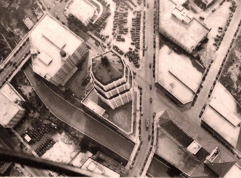
The narrow strip of land known to residents in the middle 1800s as Galveston Island was actually a peninsula surrounded on three sides by a bend in the San Antonio River. It was called an island because the fourth side was almost completely closed . . . — — Map (db m128527) HM
The administrative government of Bexar County, besides being the oldest in Texas, is distinguished by having served under nine governments. The community served under Spanish rule from May, 1718, until January, 1811, when it was taken over by . . . — — Map (db m53972) HM
At an elevation of 1340 feet, Comanche Hill is the fourth highest point in Bexar County. The hill lies on the southeastern edge of the Edwards Plateau and makes up the western edge of the Blackland Prairie. Throughout history this site has provided . . . — — Map (db m157297) HM
The origin of the name of Bandera Pass and its namesake city and county dates back to conflicts between the Spanish Army and native Lipan Apaches in the early 18th century. The history of the townsite began in the early 1840s, when Charles de Montel . . . — — Map (db m130359) HM
Ryall Luther White (1878-1962) was born in Jasper, Texas to John Luther Calvin White and Texanna Priscilla Ryall White. He married his wife, Ethel Gertrude Smyth, in 1907 and began working for his father-in-law as the manager of the Uvalde Rock . . . — — Map (db m163142) HM
Hendrick Arnold and Samuel McCulloch, Jr.
Hendrick Arnold and Samuel McCulloch, Jr. played important roles in the Texas Revolution and the formation of the Republic of Texas. After Texas became independent, both were considered free Blacks, . . . — — Map (db m256505) HM
De Witt County
Included in the colonial grant in 1825 to Green De Witt, Texas empesario ▲ Settled until 1840 largely by Anglo Americans ▲ Created a county of the state of Texas March 24, 1846, its area being taken from Gonzales, . . . — — Map (db m269140) HM
Alsbury, Young Perry (ca. 1814–1877)
Young Perry Alsbury, veteran of the battle of San Jacinto and the Mexican War, was born in Hopkinsville, Kentucky, around 1814, one of eleven children that included brother Horace Alsbury. He moved . . . — — Map (db m300917) HM
Born in Maine 1804. Died in Austin, Texas July 11, 1846. One of the founders of “The Telegraph and Texas Register” at San Felipe de Austin, October 10, 1835. A soldier at San Jacinto. First Chief Justice of Bexar County, 1836. Member of the . . . — — Map (db m25767) HM
Atascosa County was created from Bexar County in 1856 by the Sixth Legislature of Texas. The town was named after John Campbell who came to Texas from Ireland as a boy with his parents. John Campbell first came to Atascosa County around 1857 and . . . — — Map (db m261711) HM
A native of South Carolina; came to San Antonio in 1835; was guide for Ben Mailam and other leaders in first attack on San Antonio by Texas Army, Dec. 1835. As Bexar Delegate, Maverick signed Texas declaration of Independence at . . . — — Map (db m30608) HM
Ferdinand Ludwig Von Herff (1820-1912) was the son of Christian and Eleanora (Von Meusebach) Herff, prominent citizens of Darmstadt, Germany. The younger Von Herff studied in Giessen, Bonn and Berlin, graduating with a medical degree in 1843. He . . . — — Map (db m30554) HM
In 1899, John Lang Sinclair became a student at the University of Texas (UT) in Austin. The first UT band was formed in 1900 and Sinclair, possessing an aptitude for music, joined it as well as the Glee Club. The student head of the Glee Club, . . . — — Map (db m30131) HM
Anton F. Krause and Johanna Roesler emigrated from Austria to Texas in 1854. Like many new arrivals, they walked most of the way from the Texas coast to San Antonio where they were married in the San Fernando Church in May 1855. In 1875 they sold . . . — — Map (db m179926) HM
Teacher, historian and preservationist Adina Emilia de Zavala was born in Harris County, Texas, on November 28, 1861. She was the daughter of Augustine and Julia Tyrrell de Zavala, and the granddaughter of Lorenzo de Zavala, first Vice-President of . . . — — Map (db m163739) HM
Hendrick Arnold and Samuel McCulloch, Jr. played important roles in the Texas Revolution and the formation of the Republic of Texas. After Texas became independent, both were considered free Blacks, but they were placed under severe legal . . . — — Map (db m163014) HM
Freedman and soldier Hendrick Arnold (1804-1849) was awarded land following the Texas Revolution for his participation in the Siege of Bexar and the Battle of San Jacinto. He received six surveys in what was then Bexar county, including this . . . — — Map (db m201897) HM
This courthouse occupies the south side of Main Plaza, formerly called "La Plaza de las Islas", as originally laid out by the Canary Islanders in 1731. As it was then, this plaza is the administrative and judicial heart of Bexar County.
This . . . — — Map (db m287297) HM
Samuel McCulloch, Jr. (1810-1893), wounded at the Battle of Goliad October 9, 1835, was one of the first casualties of the Texas Revolution. This site is part of land he received in 1850 as a bounty for his service. The oldest marked grave is that . . . — — Map (db m179924) HM
In 1852, four brothers of Mary - three from France, one from Ohio - established the early beginnings of St. Mary's University and Central Catholic High School, at 112 College Street, San Antonio, Bexar County, Texas.
This sturdy stone rests . . . — — Map (db m238289) HM
Near this site once stood the community of Frazarville, founded in 1857 by Dr. Isaac James Frazar and his father, Col. James Watson Frazar. A locust infestation and Comanche raids forced them to move from Cibolo Creek in Bexar County to this site, . . . — — Map (db m96298) HM
Born near Little Cedar Lick, Wilson County, Tennessee. Lived in Mississippi, where he learned surveying. Joined Republic of Texas Army in May, 1836, and served 3 years in ranger/spy companies. Gained fame as an Indian fighter while surveyor for . . . — — Map (db m55204) HM
Hendrick Arnold, a free man of mixed race, emigrated from Mississippi in 1826, settling with his parents in Austin's Colony on the Brazos River. He played a key role in the Texas Revolution as a guide and spy for the Texian Army.
By 1835, . . . — — Map (db m232678) HM WM
The chronicle of encounters over decades and centuries tells the story of a city's beginnings and emergence.
Beginning In The 1680s, 160 years after the conquest of Mexico, several Spanish expeditions entered the still uncharted . . . — — Map (db m213498) HM
Sam McCulloch, Jr. was a hero who fought in many capacities for freedoms modern Texans take for granted. He was born in South Carolina and reared with three sisters, Jane, Harriet, and Mahaly, in Alabama by his father, Sam McCulloch, Sr., a white . . . — — Map (db m207413) HM
Swiss immigrants Abram Louis (1824-1921) and Anna Barbara (Kaderli) (1825-1905) Bueche, and family, settled in this area, known as Fratt, in 1854. Their infant granddaughter, Frieda A. Bueche, died in 1892 and is said to be the first buried at this . . . — — Map (db m247399) HM
SAN ANTONIO - M.P. 238
The SA&AP wood frame passenger depot was located at the corner of Aransas Street, later changed to S. Alamo Street. and S. Flores Street. During its operation the ground floor provided passenger services including . . . — — Map (db m174167) HM
Created Aug. 27, 1856. One of 128 counties formed from Bexar County that extended from the Rio Grande to the Panhandle, and as far west as El Paso. Named for Texas hero, Ben McCulloch, who fought in Texas Revolution, Indian, Mexican and Civil Wars. . . . — — Map (db m116316) HM
San Antonio, Texas, has a rich, but complex history. Part of this history is the number of nations that held sovereignty over the area, beginning with Spain and ending with the United States. Stell's mural includes symbols-buildings and . . . — — Map (db m188657) HM
The World Heritage Site Program was established by the United Nations Educational, Scientific, and Cultural Organization (UNESCO) in 1972 to identify and honor cultural, natural, or mixed sites of worldwide importance. Participating countries . . . — — Map (db m213396) HM
The World Heritage Site Program was established by the United Nations Educational, Scientific, and Cultural Organization (UNESCO) in 1972 to identify and honor cultural, natural, or mixed sites of worldwide importance. Participating countries . . . — — Map (db m216416) HM
Jumano and Apache Indians inhabited region when Spanish explorers traveled across it in the 17th and 18th centuries, and were displaced by the Comanche tribe by the mid-19th century. Area was under military jurisdiction of Forts Terrett . . . — — Map (db m239569) HM
Pattillo “Pat” Higgins was born in 1910 in Houston to Pattillo “Bud” Higgins, Sr. and Annie Jahn Higgins. Bud owned oil properties in Chambers and Bexar Counties and, in 1925, began to purchase land in Sutherland Springs. . . . — — Map (db m167547) HM
Background Information of Comanche Lookout Park
The Comanche Lookout is the forth highest point in the Bexar County of 1034 ft. In the earlier years the hill was probably used as a lookout to catch game that was watering around the Cibolo . . . — — Map (db m247393) HM
William Norwood (W.N.) Gates (1818-1903) was born in Madison County, Tennessee, and served in the Army of the Republic of Texas, participating in the Seige of Bexar in 1835. In 1854, he settled in what was then Bexar County, near present-day Poteet . . . — — Map (db m294024) HM
The footprints of Blacks in the sands of Bandera County's history are not easily found...but they can be seen with diligent searching. Carolyn Edwards, Chairperson, Bandera County Historical Commission, 1991
A Community Laid to Rest . . . — — Map (db m299184) HM
Land for this schoolhouse was given to Bexar County in 1919 by Albert F. Boldt. During that year this two-room building was constructed by local resident Fritz Gembler. From 1919 until 1960 it served as an educational facility for the children of . . . — — Map (db m205699) HM
From the 1840s-1880s Kingsbury Street near San Pedro Creek was affiliated with the family of John William (1792-1845) and María Jesusa Curbelo-Delgado (1815-1890 Smith. the couple married in 1830 when he was a 38-year-old Green DeWitt’s colony . . . — — Map (db m294942) HM
56 Canary Islanders founded a village, "San Fernando de Béjar", after arriving March 9, 1731.
They walked nearly 1,200 miles from Veracruz, with children, livestock and all their worldly possessions, for more than six months after a previous six . . . — — Map (db m179534) HM
Rural Land Surrounded Mission Concepción in the late 1800s providing a quiet retreat for city dwellers. The area began to change in 1888 when the San Antonio International Fair and Exposition opened at a nearby site along today's Roosevelt . . . — — Map (db m216287) HM
Named for James L. Gaines, a signer of the Texas Declaration of Independence, this county was formed out of Bexar County in 1876. Anglo settlement of the area began about 1895, and the county was formally organized in 1905. Seminole was established . . . — — Map (db m290379) HM
Teacher and inventor Jakob Brodbeck (1821-1910) conceived the idea of building an airship while sailing to the U.S. in 1846. Born and educated as a teacher in Plattenhardt, Germany, he began teaching in the Kingdom of Württemberg, where he worked on . . . — — Map (db m214271) HM
Welcome to Menard, Texas
This scenic Central Texas town of 1,600 souls was established in 1858 along the banks of the San Saba River and has thrived modestly through the decades as a center of farming and ranching industry. It is . . . — — Map (db m115712) HM
Created Aug. 21, 1876, from Bexar County. Named for Henderson Yoakum, who wrote a classic on early Texas history. Only Texas county named for an author.
Indian activity and frontier hazards made growth slow. Only itinerant buffalo hunters . . . — — Map (db m73468) HM
Erected
by the State of Texas
to the
memory of her defenders
Captain N. H. Dawson
and his command.
Who fell at the battle of Salado Texas
Sept. 18th, 1842. . . . — — Map (db m80829) HM WM
Located in far eastern Bexar County, Saint Hedwig was settled in 1855 by immigrants from Upper Silesia in Prussian Poland. Without land grants, funding or transportation provided by an empresario, establishing a community proved to be difficult . . . — — Map (db m304490) HM
Great early San Antonio leader, a native of North Carolina. Moved to Illinois, then to Missouri, where he was sheriff of Rawls County in 1824. Came to Texas with Green DeWitt in 1826 and settled at Gonzales.
Smith moved to San Antonio in 1828 . . . — — Map (db m82880) HM
The San Antonio River Provided Early Settlers with water for their homes and fields and power for small mills that ground corn and other grains. The first known mill was built at Mission San José in the 1790s, and by the late 1800s, many . . . — — Map (db m213417) HM
On May 4, 1917, a group of 17 doctors' wives met to discuss a proposal by Mrs. John O. McReynolds to form a woman's auxiliary to the Dallas County Medical Society - the first group of its kind in the country. With the nation's entry into WWI and . . . — — Map (db m151398) HM
"I embraced the cause of Texas at the report of the first cannon which foretold her liberty, filled an honorable situation in the ranks of the conquerors of San Jacinto, and was a member of the Legislative body of the Republic."
Personal . . . — — Map (db m232405) HM WM
During the 4 years, 4 months after secession, Texas sent 18 lawmakers to the Confederate capitols. Her delegates to the Provisional Congress, Feb. 1861 to Feb. 1862, were John R. Gregg, Freestone County; John Hemphill, Travis County; Wm. B. . . . — — Map (db m96899) HM
A native of North Carolina, Thomas Bailey Saunders (1816-1902) migrated to Texas in 1850 and started a cattle ranch near Gonzales. After the Civil War he completed cattle drives to markets in New Orleans and Kansas before settling in Bexar County. . . . — — Map (db m53413) HM
Atascosa County was created from Bexar County in 1856. The first county seat was at Navatasco, on land donated by Jose Antonio Navarro, and the county's first courthouse was a log cabin. The county seat was moved to Pleasanton in 1858, and a frame . . . — — Map (db m56584) HM
Suddenly, in the midst of an arid landscape of dire challenges, here was an unexpected oasis - brimming with life.
The First Spanish Explorers to arrive in the environs of San Pedro Creek and the nearby San Antonio River attested to a . . . — — Map (db m225326) HM
(top marker)
O. Henry House
Typical of the homes of early German settlers, this two-room dwelling was built by John Kush about 1855. It originally stood on south Presa Street. It was occupied in 1895-96 by William Sidney Porter, . . . — — Map (db m61240) HM
Formed from Bexar County
Created January 26, 1856
Organized March 22, 1856
Named in honor of
James Kerr, 1790-1850
the first American settler on
the Guadalupe River. General
manager of DeWitt's Colony
signer of the Texas . . . — — Map (db m111222) HM
Captain Heinrich Joseph Richarz established this cemetery in 1905. A native of Prussia, he and his family arrived in Texas in 1850. After a brief stay in Bexar County, the family moved to Fort Lincoln, residing for a time in quarters once occupied . . . — — Map (db m221512) HM
Following World War II, the Federal Communications Commission (FCC) lifted its freeze on new radio stations. In 1949 chiropractor, preacher and rancher Ben Parker and his wife, Mona Parker, each veteran broadcasters, helped form the Atascosa . . . — — Map (db m260127) HM
During the 1930s, San Antonio native Emma Tenayuca was a prominent leader of a movement that fought deplorable working conditions, discrimination and unfair wages on behalf of the city's working poor. As a child, Tenayuca had often visited the . . . — — Map (db m201905) HM
"We will transform an area ravaged by flood and make it Fruitful-Barren and Bring Blessings" Rev. Dr. E. Thurman Walker - 2007
Many homes were destroyed in the Salado Creek flood of 1998. In 2007, Bexar County Leadership . . . — — Map (db m304440) HM
Early Anglo settlers to Texas, the John Edens family arrived in Houston County in 1831. John's son Banister Edens, along with his wife Mary Walker Edens and their family, moved to Bexar County in 1855. By 1856 Banister Edens had acquired 350 acres . . . — — Map (db m197208) HM
Created August 21, 1876, from Bexar County. Named for a native of New Jersey, Robert Cochran, a private who died for Texas Independence in the siege of the Alamo.
Indian hostilities and the distance to market and supplies made settlement slow. . . . — — Map (db m76252) HM
An Ohio native who found gold in California in 1849, William A. Waugh settled near the Cibolo Creek Crossing on the Laredo-San Antonio Road in 1856, before La Salle County was created. Waugh served briefly as a Texas Ranger during the border raids . . . — — Map (db m202895) HM
These ancient waters also served as a resource for San Antonio's first entrepreneurs and aspiring industrialists.
San Pedro Creek was an invaluable source of water for residents who lived and farmed and grazed their livestock along its . . . — — Map (db m225336) HM
In 1892 Well Drillers Were Surprised when their well produced 103°F sulphur water instead of the clear artesian water they were hired to locate. Unable to use this water, the State of Texas which owned the well, leased it to Charles . . . — — Map (db m213224) HM
Spanish urban planners in the New World knew how to create a vibrant community: its two interconnected building blocks were a cathedral and a plaza.
This spatial structure compelled the citizens of New Spain to revolve around a civic center, . . . — — Map (db m118154) HM
Created in 1858 out of Bexar County, Kimble County was attached temporarily to Gillespie County for judicial purposes. It was named for Lt. George C Kimble slain March 6, 1836, in the siege of the Alamo. The county was organized in 1876 and the . . . — — Map (db m102796) HM
Human inhabitation of Kinney County began thousands of years ago. Spanish expeditions through the area began in 1535 and continued throughout subsequent centuries. An attempt at establishing a Franciscan mission in 1775 failed, as did settlement by . . . — — Map (db m56235) HM
Although Bexar County had three popular mineral water spas at one time, none of the others equaled Hot Wells Hotel's reputation for luxury.
Hot Wells guests could choose from a variety of facilities: 3 swimming pools, 45 private bathing . . . — — Map (db m213243) HM
Hot Sulphur Baths First Attracted health seekers to South Bexar County in 1892 when Charles Scheuermeyer used water from a nearby mineral well to fill an indoor pool at Southwestern Park. The property was later redeveloped by local brewery owner . . . — — Map (db m213225) HM
Hot Wells Was A Health Resort and an elegant hotel where visitors bathed and performed water gymnastics in hot mineral rich pools. When not bathing, guests strolled the 100-acre site along the San Antonio River and enjoyed golf, tennis, and . . . — — Map (db m213226) HM
The San Antonio River Is Formed By Springs that rise to the surface from the Edwards Aquifer north of downtown and by tributaries that flow into the river channel along its winding route. Most of these tributaries in Bexar County are on the west . . . — — Map (db m216273) HM
Formed from Bexar County
Created February 4, 1854
Organized February 27, 1854
Named in honor of
Henry Wax Karnes
1812-1840
Conspicuous for gallantry at
storming of Bexar
Commanded a company at
San Jacinto
Texas Ranger . . . — — Map (db m121656) HM
Built in 1878-1879 to serve as the first county-owned courthouse for Kinney County, this structure served that purpose for thirty-two years. In 1911 it became the headquarters of the Las Moras Masonic Lodge, which was chartered in 1876. While the . . . — — Map (db m248124) HM
Formed from Bexar County
Created February 1, 1858
Organized October 10, 1881
Named for
Josiah and Mathias Wilbarger
brothers who came to Texas
in 1829
Josiah, scalped by Indians
August, 1833,
survived 11 years . . . — — Map (db m96685) HM
Thin black lines indicate changes in relevance. Between each pair of lines entries are ordered geographically but all have the same relevance.
* Inflectional forms of words are their plurals, singulars, and possessives as well as gramatical tenses and similar variations.