2856 entries match your criteria. The first 100 are listed. ⊳
Anthropology & Archaeology Topic
By Mark Hilton, January 14, 2017
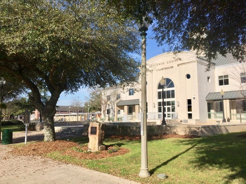
Bottle Creek Site Marker in front of Baldwin County Courthouse.
| 1 ► Alabama, Baldwin County, Bay Minette — Bottle Creek Site — |
| On Courthouse Square (U.S. 31) at Hand Avenue, on the left when traveling east on Courthouse Square. | |||
| 2 ► Alabama, Baldwin County, Blakeley — Site of Baldwin County's First Courthouse — |
| On Franklin Street north of Washington Avenue, on the right when traveling north. | |||
| 3 ► Alabama, Calhoun County, Oxford — Charcoal Production at Caver-Christian-Davis Farm — AD 1865 to AD 2000 — Choccolocco Park Interpretive Trail — |
| Near Leon Smith Parkway. | |||
| 4 ► Alabama, Calhoun County, Oxford — Paleoindian — 12,750 BC to 9,500 BC — Choccolocco Park Interpretive Trail — |
| Near Leon Smith Parkway. | |||
| 5 ► Alabama, Calhoun County, Oxford — Reconstructing the Cultural Landscape — Choccolocco Park Interpretive Trail — |
| Near Leon Smith Parkway. | |||
| 6 ► Alabama, Calhoun County, Oxford — The Choccolocco Creek Archaeological Complex — Alabama Indigenous Mound Trail — |
| Near Leon Smith Parkway. | |||
| 7 ► Alabama, Calhoun County, Oxford — Woodland — 1,250 BC to AD 1000 — Choccolocco Park Interpretive Trail — |
| Near Leon Smith Parkway. | |||
| 8 ► Alabama, Colbert County, Muscle Shoals — Natural and Cultural Preservation/Protecting Resources — |
| Near Reservation Road, 1 mile east of Alabama Route 133, on the left when traveling east. | |||
| 9 ► Alabama, Dallas County, Beloit — Cahawba |
| On State Road 22 at County Route 9, on the right when traveling west on State Road 22. Reported missing. | |||
| 10 ► Alabama, Dallas County, Cahaba — Civil War Prison — |
| Near Capitol Avenue near Vine Street. | |||
| 11 ► Alabama, Dallas County, Cahaba — Site of Alabama's Statehouse — 1820 - 1825 — |
| On Capitol Avenue, on the right when traveling east. | |||
| 12 ► Alabama, Dallas County, Cahaba — The Mound at Old Cahawba Archaeological Park — Alabama Indigenous Mound Trail — |
| On Vine Street at Capitol Avenue, on the right when traveling north on Vine Street. | |||
| 13 ► Alabama, Hale County, Moundville — A Perspective of Power — Moundville Archaeological Park — |
| Near Mound State Parkway, 1.5 miles west of Alabama Route 69. | |||
| 14 ► Alabama, Hale County, Moundville — Mound B — Moundville Archaeological Park — |
| Near River Bank Road, 0.3 miles west of Mound Parkway, on the right when traveling west. | |||
| 15 ► Alabama, Hale County, Moundville — Moundville — |
| On Mound Parkway at State Highway 69, on the right when traveling west on Mound Parkway. | |||
| 16 ► Alabama, Hale County, Moundville — Moundville Archaeological Park — Alabama Indigenous Mound Trail — |
| On Mound Parkway, 0.6 miles west of Alabama Route 69, on the right when traveling west. | |||
| 17 ► Alabama, Hale County, Moundville — Moundville Archaeological Park — Moundville Archaeological Park — |
| On Mound Parkway, 0.6 miles west of Alabama Route 69, on the right when traveling north. | |||
| 18 ► Alabama, Hale County, Moundville — Politics and Power — Moundville Archaeological Park — |
| On River Bank Road, 0.3 miles west of Mound Parkway, on the right when traveling west. | |||
| 19 ► Alabama, Hale County, Moundville — Protection and the Palisade — Moundville Archaeological Park — |
| Near River Bank Road, 0.9 miles west of Mound Parkway. | |||
| 20 ► Alabama, Hale County, Moundville — The CCC and Moundville — Moundville Archaeological Park — |
| Near River Bank Road, on the right when traveling south. | |||
| 21 ► Alabama, Jefferson County, Bessemer — The Bessemer Site — Alabama Indigenous Mound Trail — |
| On Alabama Avenue north of 19th Street N, on the right when traveling north. | |||
| 22 ► Alabama, Lauderdale County, Florence — Florence Indian Mound — Alabama Indigenous Mound Trail — |
| On South Court Street north of Canal Street, on the right when traveling south. | |||
| 23 ► Alabama, Lauderdale County, Florence — Prehistoric Mound — (Probably Built Between 100 B.C and 400 A.D.) — |
| On South Court Street. | |||
| 24 ► Alabama, Lawrence County, Oakville — Copena Burial Mound — |
| On County Route 187. | |||
| 25 ► Alabama, Marion County, Hamilton — The Hamilton Mounds Site — Alabama Indigenous Mound Trail — |
| On Old Indian Mound Road, 0.2 miles east of U.S. 278, on the left when traveling east. | |||
| 26 ► Alabama, Mobile County, Dauphin Island — Dauphin Island Indian Shell Mound Park — |
| On Iberville Drive north of Cadillac Avenue, on the left when traveling north. | |||
| 27 ► Alabama, Montgomery County, Montgomery — Alabama Bicentennial Park / Ancient Sea — |
| On North Bainbridge Street at Dexter Avenue, on the right when traveling south on North Bainbridge Street. | |||
| 28 ► Alaska, Anchorage — Ancient Traditions of the Athabascan People — |
| Near Heritage Center Drive. | |||
| 29 ► Alaska, Anchorage — Mobile Architecture — |
| 30 ► Alaska, Anchorage — Raven the Creator — Created by John Hoover in 1998 — |
| 31 ► Alaska, Anchorage — What is this “Rock Man”? — |
| On Juneau St. | |||
| 32 ► Alaska, Denali Borough, Denali National Park — Ice Age Hunters — The Deadliest Predators — |
| On Park Road. | |||
| 33 ► Alaska, Ketchikan Gateway Borough, Ketchikan — Chief Johnson Totem Pole — |
| On Dock Street at Mill Street, on the right when traveling west on Dock Street. | |||
| 34 ► Alaska, Ketchikan Gateway Borough, Ketchikan — Chief Kyan Totem Pole — |
| On Mission Street. | |||
| 35 ► Alaska, Sitka Borough, Sitka — Forgotten Workers of the Russian-American Company — |
| Near Harbor Road, 0.1 miles west of O'Connell Bridge (Route F-99), on the right when traveling west. | |||
| 36 ► Arizona, Apache County, Chinle — House Under Rock — |
| Near Mummy Cave Overlook Road, 1.5 miles east of North Rim Highway (Indian Route 64). | |||
| 37 ► Arizona, Apache County, Chinle — Sliding House Ruins — |
| Near Sliding House Overlook Road, 1.6 miles north of South Rim Highway (Indian Route 7). | |||
| 38 ► Arizona, Cochise County, Hereford — Lehner Mammoth Kill Site — |
| On Lehner Road, 2 miles north of Palominas Road & State Highway 92, on the left when traveling east. | |||
| 39 ► Arizona, Coconino County, Flagstaff — A Gathering Place — |
| On Loop Road, on the left when traveling north. | |||
| 40 ► Arizona, Coconino County, Flagstaff — A Legacy of the Past — |
| On Loop Road, on the right when traveling north. | |||
| 41 ► Arizona, Coconino County, Flagstaff — A Village/Abandonment — |
| On Loop Road, on the left when traveling north. | |||
| 42 ► Arizona, Coconino County, Flagstaff — Ancient Landscapes — |
| On Loop Road, on the right when traveling north. | |||
| 43 ► Arizona, Coconino County, Flagstaff — Box Canyon Ruins — |
| On Loop Road, on the right when traveling north. | |||
| 44 ► Arizona, Coconino County, Flagstaff — Daily Life — |
| On Loop Road, on the right when traveling north. | |||
| 45 ► Arizona, Coconino County, Flagstaff — Dry Land Farming — |
| On Loop Road, on the right when traveling north. | |||
| 46 ► Arizona, Coconino County, Flagstaff — Sunset Crater Volcano — |
| On Loop Road, on the right when traveling north. | |||
| 47 ► Arizona, Coconino County, Flagstaff — The Citadel / Natural Features — |
| On Loop Road, on the left when traveling north. | |||
| 48 ► Arizona, Coconino County, Flagstaff — Wukoki — |
| On Loop Road. | |||
| 49 ► Arizona, Coconino County, Grand Canyon National Park — Tusayan Museum and Ruin — |
| 50 ► Arizona, Coconino County, Grand Canyon National Park — Tusayan Ruin Trail — |
| 51 ► Arizona, Coconino County, North Rim — Summer Home — Grand Canyon National Park — |
| Near Grand Canyon Highway (Arizona Route 67) 43 miles south of U.S. 89A. | |||
| 52 ► Arizona, Coconino County, Sunset Crater Volcano National Monument — "The Peaks" — |
| 53 ► Arizona, Coconino County, Walnut Canyon National Monument — A Community Sharing the Land — |
| 54 ► Arizona, Coconino County, Walnut Canyon National Monument — A Days Work — |
| 55 ► Arizona, Coconino County, Walnut Canyon National Monument — An Efficient Design — |
| 56 ► Arizona, Coconino County, Walnut Canyon National Monument — Departure — |
| 57 ► Arizona, Coconino County, Walnut Canyon National Monument — Problem Solving — |
| 58 ► Arizona, Coconino County, Walnut Canyon National Monument — Room Functions — |
| 59 ► Arizona, Coconino County, Walnut Canyon National Monument — The Perfect Shelter — |
| 60 ► Arizona, Coconino County, Walnut Canyon National Monument — What Happened Here? — |
| 61 ► Arizona, Coconino County, Wupatki National Monument — Community — |
| 62 ► Arizona, Coconino County, Wupatki National Monument — Nalakihu — |
| 63 ► Arizona, Coconino County, Wupatki National Monument — The Ballcourt — A Mexican Idea at Wupatki — |
| 64 ► Arizona, Coconino County, Wupatki National Monument — The Blowhole — |
| 65 ► Arizona, Coconino County, Wupatki National Monument — Where Were The Fields? — |
| 66 ► Arizona, Maricopa County, Mesa — Prehistoric Irrigation in the Salt River Valley — |
| Near North Horne Avenue, 0.4 miles south of East McKellips Road. | |||
| 67 ► Arizona, Navajo County, Shonto — Big Sagebrush — Artemisia tridentata — |
| Near Arizona Route 564 at County Route 221. | |||
| 68 ► Arizona, Navajo County, Shonto — Broadleaf Yucca — Yucca baccata — |
| Near Arizona Route 564 at County Route 221. | |||
| 69 ► Arizona, Navajo County, Shonto — Douglas Fir — Pseudotsuga taxifolia — |
| Near State Highway 564 at County Route 221. | |||
| 70 ► Arizona, Navajo County, Shonto — Gambel Oak — Quercus gambelii — |
| Near State Highway 564 at County Route 221. | |||
| 71 ► Arizona, Navajo County, Shonto — Hogan — Navajo National Monument — |
| Near State Highway 564 at County Highway 221. | |||
| 72 ► Arizona, Navajo County, Shonto — Indian Rice Grass — Stipa hymenoides — |
| Near State Highway 564 at County Highway 221. | |||
| 73 ► Arizona, Navajo County, Shonto — Into The Memory — Navajo National Monument — |
| Near Arizona Route 564 at County Route 221. | |||
| 74 ► Arizona, Navajo County, Shonto — Pinyon Pine — Pinus edulis — |
| Near Arizona Route 564 at County Route 221. | |||
| 75 ► Arizona, Navajo County, Shonto — Prehistoric Pioneers — Navajo National Monument — |
| Near Arizona Route 564 at County Route 221. | |||
| 76 ► Arizona, Navajo County, Shonto — Rabbit Brush — Chrysothamnus nauseosus — |
| Near State Highway 564 at County Route 221. | |||
| 77 ► Arizona, Navajo County, Shonto — Sandal Trail — Navajo National Monument — |
| On Arizona Route 564. | |||
| 78 ► Arizona, Navajo County, Shonto — Serviceberry — Amelanchier utahensis — |
| Near State Highway 564 at County Route 221. | |||
| 79 ► Arizona, Navajo County, Shonto — Sweathouse — Navajo National Monument — |
| On Arizona Route 564. | |||
| 80 ► Arizona, Navajo County, Shonto — The Pygmy Conifer Forest - An Indian Store — |
| Near Arizona Route 564 at County Route 221. | |||
| 81 ► Arizona, Navajo County, Shonto — Upside-down Mountain — Navajo National Monument — |
| On Arizona Route 564. | |||
| 82 ► Arizona, Navajo County, Shonto — Utah Juniper — Juniperus osteosperma — |
| Near Arizona Route 564 at County Route 221. | |||
| 83 ► Arizona, Navajo County, Shonto — Voices in the Canyon — Navajo National Monument — |
| Near Arizona Route 564 at County Route 221. | |||
| 84 ► Arizona, Navajo County, Winslow — Central Plaza — Homol'ovi II Archaeological Site — |
| Near Homolovi State Park Entrance Road, 5.4 miles north of Arizona Route 87. | |||
| 85 ► Arizona, Navajo County, Winslow — East Plaza — Homol'ovi II Archaeological Site — |
| Near Homolovi State Park Entrance Road, 5.4 miles north of Arizona Route 87. | |||
| 86 ► Arizona, Navajo County, Winslow — Homol'ovi II — Homol'ovi II Archaeological Site — |
| Near Homolovi State Park Entrance Road, 5.4 miles north of Arizona Route 87. | |||
| 87 ► Arizona, Navajo County, Winslow — Illegal Digging — Homol'ovi II Archaeological Site — |
| Near Homolovi State Park Entrance Road, 5.4 miles north of Arizona Route 87. | |||
| 88 ► Arizona, Navajo County, Winslow — Kiva - Underground House — Homol'ovi II Archaeological Site — |
| Near Homolovi State Park Entrance Road, 5.4 miles north of Arizona Route 87. | |||
| 89 ► Arizona, Navajo County, Winslow — Let It Burn — We built these rooms just to burn them down — Homol'ovi's Experimental Archaeology — |
| Near Homolovi State Park Entrance Road, 2.1 miles west of Arizona Route 87. | |||
| 90 ► Arizona, Navajo County, Winslow — Nuvatukya'ovi — Homol'ovi II Archaeological Site — |
| Near Homolovi State Park Entrance Road, 5.4 miles north of Arizona Route 87. | |||
| 91 ► Arizona, Navajo County, Winslow — Paayu — Homol'ovi II Archaeological Site — |
| Near Homolovi State Park Entrance Road, 5.4 miles north of Arizona Route 87. | |||
| 92 ► Arizona, Navajo County, Winslow — Typical Room — Homol'ovi II Archaeological Site — |
| Near Homolovi State Park Entrance Road, 5.4 miles north of Arizona Route 87. | |||
| 93 ► Arizona, Navajo County, Winslow — Vandalized Kiva — Homol'ovi II Archaeological Site — |
| Near Homolovi State Park Entrance Road, 5.5 miles north of Arizona Route 87. | |||
| 94 ► Arizona, Yavapai County, Montezuma Castle National Monument — Lifeline / Prehistoric Produce — |
| 95 ► Arizona, Yavapai County, Montezuma Castle National Monument — Macaw Pen Stone? — |
| 96 ► Arizona, Yavapai County, Montezuma Castle National Monument — The Community — |
| 97 ► Arizona, Yavapai County, Montezuma Castle National Monument — The Neighborhood / Mysterious Departures — |
| 98 ► Arizona, Yavapai County, Montezuma Castle National Monument — The People Next Door — |
| 99 ► Arizona, Yavapai County, Montezuma Castle National Monument — The Way Up / Construction Sequence — |
| 100 ► Arizona, Yavapai County, Montezuma Castle National Monument — Welcome to The Castle — |
2856 entries matched your criteria. The first 100 are listed above. Next 100 ⊳