6723 entries match your criteria. Entries 401 through 500 are listed.⊲ Previous 100 — Next 100 ⊳
Historical Markers and War Memorials in North Carolina
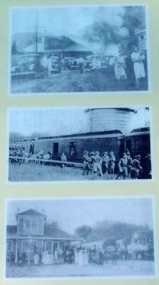
W&S Photos Reproduced on Marker
401 ► North Carolina, Brunswick County, Southport — Railroad & Religion on Rhett Street —  |
| On Rhett Street at Nash Street, on the right when traveling north on Rhett Street. | |||
| 402 ► North Carolina, Brunswick County, Southport — Robert C. Ruark — |
| On N. Lord Street at W. Nash Street, on the right when traveling south on N. Lord Street. | |||
| 403 ► North Carolina, Brunswick County, Southport — D 24 — Robert Howe — 1732-1786 — |
| On River Road Southeast (North Carolina Route 133) 0.2 miles north of George II Highway Southeast ( Route 87), on the left when traveling north. | |||
| 404 ► North Carolina, Brunswick County, Southport — D-93 — Robert Ruark — 1915 - 1965 — |
| On Howe Street (State Highway 211) at Nash Street, on the right when traveling south on Howe Street. | |||
| 405 ► North Carolina, Brunswick County, Southport — Smithville Burying Ground — |
| On Rhett Street north of Monroe Street, on the right when traveling north. | |||
| 406 ► North Carolina, Brunswick County, Southport — Southport’s First Fire Alarm — |
| On East Nash Street west of Howe Street ( Highway 211), on the right when traveling west. | |||
| 407 ► North Carolina, Brunswick County, Southport — D-110 — Stede Bonnet — 1688–1718 — |
| On Ferry Road (State Highway 211) at the Deep Point Marina exit road, on the left when traveling east on Ferry Road. | |||
| 408 ► North Carolina, Brunswick County, Sunset Beach — Honor America's Veterans — Sunset Beach, North Carolina — |
| On Sunset Boulevard N. | |||
| 409 ► North Carolina, Brunswick County, Winnabow — 32-Pounder Rifled Cannon — |
| Near St Phillips Road SE 0.6 miles east of Plantation Road, on the left when traveling east. | |||
| 410 ► North Carolina, Brunswick County, Winnabow — A Home at Brunswick: Hepburn-Reonolds Site — |
| Near St Phillips Road SE 0.6 miles east of Plantation Road, on the right when traveling south. | |||
| 411 ► North Carolina, Brunswick County, Winnabow — 12 — Brunswick Town — Revolutionary America 1775-1783 — |
| Near St Phillips Road SE 0.6 miles east of Plantation Road, on the left when traveling east. | |||
| 412 ► North Carolina, Brunswick County, Winnabow — Brunswick Town State Historic Site — |
| On St. Philips Road east of River Road ( Highway 133). | |||
| 413 ► North Carolina, Brunswick County, Winnabow — Capt. William Dry and the Spanish Attack — |
| Near St Phillips Road SE. | |||
| 414 ► North Carolina, Brunswick County, Winnabow — Colonel Maurice Moore — |
| Near St. Philips Road. | |||
| 415 ► North Carolina, Brunswick County, Winnabow — D-92 — Daniel L. Russell — 1845 – 1908 — |
| On Ocean Highway (Local Route 17) at Governors Road SE (Route 1521), on the right when traveling north on Ocean Highway. | |||
| 416 ► North Carolina, Brunswick County, Winnabow — Fort Anderson — |
| Near St. Philips Road east of Plantation Road. | |||
| 417 ► North Carolina, Brunswick County, Winnabow — Fort Anderson — One Shovelful at a Time — Confederate Lifeline — |
| Near St. Philips Road SE 0.6 miles east of Plantation Road when traveling east. | |||
| 418 ► North Carolina, Brunswick County, Winnabow — D-119 — Fort Anderson — |
| On River Road SE (State Highway 133) at Plantation Road (Local Road 1529), on the left when traveling south on River Road SE. | |||
| 419 ► North Carolina, Brunswick County, Winnabow — D-73 — John LaPierre — |
| On St. Philips Road at Plantation Road on St. Philips Road. | |||
| 420 ► North Carolina, Brunswick County, Winnabow — Margaret McCorkall: A Brunswick Woman — |
| Near St Phillips Road SE 0.6 miles east of Plantation Road, on the right when traveling east. | |||
| 421 ► North Carolina, Brunswick County, Winnabow — D-53 — Orton Plantation — |
| On Plantation Road 0.1 miles east of River Road (Route 133), on the left when traveling south. | |||
| 422 ► North Carolina, Brunswick County, Winnabow — D-55 — St. Philips Church — |
| On River Road (State Highway 133) at Plantation Road, on the left when traveling south on River Road. | |||
| 423 ► North Carolina, Brunswick County, Winnabow — St. Phillips Church Interior — |
| Near St Phillips Road SE 0.6 miles east of Plantation Road, on the right when traveling south. | |||
| 424 ► North Carolina, Brunswick County, Winnabow — The Big Guns Of Fort Anderson — |
| Near St Phillips Road SE 0.6 miles east of Plantation Road SE when traveling east. | |||
| 425 ► North Carolina, Brunswick County, Winnabow — Yankee Catchers & Infernal Machines — |
| Near St Phillips Road SE 0.6 miles east of Plantation Road SE, on the left when traveling east. | |||
| 426 ► North Carolina, Buncombe County, Asheville — Allen High School — 1887 - 1974 — |
| On College Place east of Town Mountain Road (State Highway 694), on the right when traveling east. | |||
| 427 ► North Carolina, Buncombe County, Asheville — America’s Favorite Drive — Blue Ridge Parkway — |
| Near Hemphill Knob Road. | |||
| 428 ► North Carolina, Buncombe County, Asheville — P-61 — Asheville Normal School — |
| On Victoria Road near Livingston Street, on the right when traveling north. | |||
| 429 ► North Carolina, Buncombe County, Asheville — Biltmore Dairy Bar — |
| Near Approach Road north of The Glen Road. | |||
| 430 ► North Carolina, Buncombe County, Asheville — P-68 — Biltmore House — |
| On McDowell St. (U.S. 25) at Biltmore Estate Drive on McDowell St.. | |||
| 431 ► North Carolina, Buncombe County, Asheville — Biltmore: A Collaboration — |
| On Approach Road, on the right when traveling south. | |||
| 432 ► North Carolina, Buncombe County, Asheville — Birthplace of American Forestry — |
| Near One Biltmore Plaza. | |||
| 433 ► North Carolina, Buncombe County, Asheville — Catholic Hill School / Stephen’s – Lee High School — |
| On South Market Street south of Sycamore Street, on the right when traveling south. | |||
| 434 ► North Carolina, Buncombe County, Asheville — P-5 — David L. Swain — |
| On Merrimon Avenue (U.S. 25) near Beaverdam Road ( Highway 2230). | |||
| 435 ► North Carolina, Buncombe County, Asheville — P-86 — Electric Streetcars — |
| On Haywood Road (State Highway 191) at Euclid Boulevard, on the right when traveling south on Haywood Road. | |||
| 436 ► North Carolina, Buncombe County, Asheville — First in Forestry — |
| On Approach Road, on the left when traveling south. | |||
| 437 ► North Carolina, Buncombe County, Asheville — P-95 — Flood of 1916 — |
| On Swannanoa River Road (State Highway 81) at Biltmore Avenue, on the right when traveling east on Swannanoa River Road. | |||
| 438 ► North Carolina, Buncombe County, Asheville — Frederick Law Olmsted — Biltmore Estate Landscape Architect — 1822 - 1903 — |
| Near One Biltmore Plaza. | |||
| 439 ► North Carolina, Buncombe County, Asheville — Frederick Law Olmsted & the Approach Road — |
| On Approach Road north of Glen Road, on the right when traveling north. | |||
| 440 ► North Carolina, Buncombe County, Asheville — Landsman Riley Powers — Mountain Sailor — |
| On Overlook Road south of Springside Road (County Route 3506), on the left when traveling south. | |||
| 441 ► North Carolina, Buncombe County, Asheville — P-29 — Lee's School — 1846-1879 — |
| On Tunnel Road (U.S. 70 / 74) at Chunn's Cove Road, on the right when traveling west on Tunnel Road. | |||
| 442 ► North Carolina, Buncombe County, Asheville — P-79 — Lillian Exum Clement Stafford — 1894 - 1925 — |
| On College Street (State Highway 74) at South Charlotte Street on College Street. | |||
| 443 ► North Carolina, Buncombe County, Asheville — Lynching in America / The Lynching of Bob Brackett — Community Remembrance Project — |
| On South Market Street at Sycamore Street, on the right when traveling south on South Market Street. | |||
| 444 ► North Carolina, Buncombe County, Asheville — P-36 — Richmond Pearson — 1852 - 1923 — |
| On Riverside Drive (State Highway 251) south of Pearson Bridge Road, on the right when traveling south. | |||
| 445 ► North Carolina, Buncombe County, Asheville — P-37 — Rutherford Trace — |
| On Hendersonville Road, on the right when traveling south. | |||
| 446 ► North Carolina, Buncombe County, Asheville — P-38 — Rutherford Trace — |
| On Brevard Road (State Highway 191) north of Biltmore Estates Drive, on the right when traveling north. | |||
| 447 ► North Carolina, Buncombe County, Asheville — Sassafras — Sassafras Albidum — |
| On Running Cedar Road 0.2 miles east of Frederick Law Olmsted Way, on the left when traveling east. | |||
| 448 ► North Carolina, Buncombe County, Asheville — Siting Biltmore House and Stables — |
| Near Approach Road 0.2 miles north of The Glen Road, on the right when traveling south. | |||
| 449 ► North Carolina, Buncombe County, Asheville — Smith-McDowell House — Our Businessman-Soldier — |
| Near Victoria Road 0.1 miles south of Oakland Road, on the right when traveling south. | |||
| 450 ► North Carolina, Buncombe County, Asheville — St. Genevieve ~ Of ~ The ~ Pines — |
| On Victoria Road south of McDowell Street (U.S. 25), on the right when traveling south. | |||
| 451 ► North Carolina, Buncombe County, Asheville — P-9 — Stoneman's Raid — |
| On Hendersonville Road (U.S. 25). | |||
| 452 ► North Carolina, Buncombe County, Asheville — P-53 — Sulphur Springs — |
| On Patton Avenue (U.S. 19/23) at Old Haywood Road ( Highway 1404) on Patton Avenue. | |||
| 453 ► North Carolina, Buncombe County, Asheville — The Quilt Garden — North Carolina Arboretum — |
| Near Frederick Law Olmsted Way 1.2 miles west of Brevard Road (State Highway 191). | |||
| 454 ► North Carolina, Buncombe County, Asheville, Bear Creek — P-78 — Olive Tilford Dargan — 1869-1968 — |
| On Haywood Road (Business U.S. 19/23) near Balsam Avenue, on the right when traveling west. | |||
| 455 ► North Carolina, Buncombe County, Asheville, Biltmore Village — The County of Buncombe — |
| On Biltmore Plaza at Kitchen Pl on Biltmore Plaza. | |||
| 456 ► North Carolina, Buncombe County, Asheville, Charlotte Street — 87 — Votes for Women — Road to the 19th Amendment — National Votes for Women Trail — |
| On Charlotte Street just south of East Chestnut Street, on the right when traveling north. | |||
| 457 ► North Carolina, Buncombe County, Asheville, Downtown — "The Block" — |
| Near South Market Street north of Eagle Street, on the right when traveling south. | |||
| 458 ► North Carolina, Buncombe County, Asheville, Downtown — P-101 — Allen School — |
| On College Street near Oak Street and Valley Street, on the right when traveling east. | |||
| 459 ► North Carolina, Buncombe County, Asheville, Downtown — P-97 — Anne Penland — 1885-1976 — |
| On Haywood Street south of Vanderbilt Place, on the left when traveling south. | |||
| 460 ► North Carolina, Buncombe County, Asheville, Downtown — Appalachian Stage — |
| On College Street (U.S. 74) near Coxe Avenue, on the right when traveling west. | |||
| 461 ► North Carolina, Buncombe County, Asheville, Downtown — Ashe Monument — |
| Near the Court Plaza east of S. Spruce St.. | |||
| 462 ► North Carolina, Buncombe County, Asheville, Downtown — Asheville — Building the Block / Crossroads of Culture |
| On Biltmore Avenue (U.S. 25) at Eagle Street, on the right when traveling north on Biltmore Avenue. Reported permanently removed. | |||
| 463 ► North Carolina, Buncombe County, Asheville, Downtown — Asheville's Enslaved People — Wartime Servitude — |
| Near Eagle Street at Davidson Drive, on the right when traveling east. | |||
| 464 ► North Carolina, Buncombe County, Asheville, Downtown — Battery Porter — Napoleons on Stony Hill |
| On O Henry Avenue at Battle Square, on the right when traveling north on O Henry Avenue. Reported missing. | |||
| 465 ► North Carolina, Buncombe County, Asheville, Downtown — Brick Artisan — |
| Near South Market Street north of Eagle Street, on the right when traveling south. | |||
| 466 ► North Carolina, Buncombe County, Asheville, Downtown — Buncombe County Court House — 1927 — |
| On Court Plaza. | |||
| 467 ► North Carolina, Buncombe County, Asheville, Downtown — Cat Walk — |
| On Wall Street, on the left when traveling west. | |||
| 468 ► North Carolina, Buncombe County, Asheville, Downtown — Children's Playhouse — |
| On North Market Street north of East Walnut Street, on the right when traveling north. | |||
| 469 ► North Carolina, Buncombe County, Asheville, Downtown — Civic Pride — |
| On Market Street at Collage Street on Market Street. | |||
| 470 ► North Carolina, Buncombe County, Asheville, Downtown — P-57 — Confederate Armory — |
| On College Street. | |||
| 471 ► North Carolina, Buncombe County, Asheville, Downtown — Cornerstone of Culture — |
| On Biltmore Avenue (U.S. 25) at Eagle Street, on the right when traveling north on Biltmore Avenue. | |||
| 472 ► North Carolina, Buncombe County, Asheville, Downtown — Crafting Our Culture — |
| On North Lexington Avenue at West Walnut Street, on the right when traveling north on North Lexington Avenue. | |||
| 473 ► North Carolina, Buncombe County, Asheville, Downtown — Crossroads of Commerce — |
| On South Pack Square at Biltmore Avenue ( Route 25), on the right when traveling east on South Pack Square. | |||
| 474 ► North Carolina, Buncombe County, Asheville, Downtown — Early Milestones in Buncombe County — |
| On Court Plaza at College Street (Alternate U.S. 74), on the right when traveling south on Court Plaza. | |||
| 475 ► North Carolina, Buncombe County, Asheville, Downtown — Ellington's Dream — |
| Near South Spruce Street south of College Street (Alternate U.S. 74), on the right when traveling north. | |||
| 476 ► North Carolina, Buncombe County, Asheville, Downtown — 8 — Flat Iron Architecture — |
| On Battery Park Avenue at Wall Street, on the right when traveling east on Battery Park Avenue. | |||
| 477 ► North Carolina, Buncombe County, Asheville, Downtown — Flora Sorrell Boarding Home — |
| On Biltmore Avenue (U.S. 25) north of South Market Street, on the right when traveling north. | |||
| 478 ► North Carolina, Buncombe County, Asheville, Downtown — Historic Hilltop — Asheville Urban Trail — |
| Near Page Avenue south of Battle Square Avenue. | |||
| 479 ► North Carolina, Buncombe County, Asheville, Downtown — D-3 — Historical Black Churches in Asheville — 1832-1898 — Black Cultural Heritage Trail — |
| On Eagle Street at South Spruce Street, on the right when traveling west on Eagle Street. | |||
| 480 ► North Carolina, Buncombe County, Asheville, Downtown — Hotel District — (of Asheville, N.C.) — |
| On Biltmore Avenue (U.S. 25) at Eagle Street, on the right when traveling north on Biltmore Avenue. | |||
| 481 ► North Carolina, Buncombe County, Asheville, Downtown — In Remembrance of Col. Robert K. Morgan — |
| On Court Plaza south of College Street, on the right when traveling south. | |||
| 482 ► North Carolina, Buncombe County, Asheville, Downtown — James Vester Miller — 1860-1940 — |
| On Court Plaza at South Spruce Street, on the left when traveling west on Court Plaza. | |||
| 483 ► North Carolina, Buncombe County, Asheville, Downtown — P-94 — Jimmie Rodgers — 1897-1933 — |
| On Haywood Street at Battery Park Avenue, on the left when traveling south on Haywood Street. | |||
| 484 ► North Carolina, Buncombe County, Asheville, Downtown — Legacy of Design — |
| On Broadway Street (U.S. 25) north of East Walnut Street, on the right when traveling north. | |||
| 485 ► North Carolina, Buncombe County, Asheville, Downtown — Lynching in America / The Lynching of John Humphries — Community Remembrance Project — |
| On College Street (Alternate U.S. 74) at South Spruce Street, on the right when traveling east on College Street. | |||
| 486 ► North Carolina, Buncombe County, Asheville, Downtown — Marketplace — Asheville Urban Trail — |
| On West Walnut Street east of North Lexington Avenue, on the right when traveling east. | |||
| 487 ► North Carolina, Buncombe County, Asheville, Downtown — Monument Corner — |
| Near North Pack Square (Alternate U.S. 74) at South Market Street, on the right when traveling east. | |||
| 488 ► North Carolina, Buncombe County, Asheville, Downtown — Mt. Zion Missionary Baptist Church — |
| On Eagle Street at South Spruce Street, on the right when traveling east on Eagle Street. | |||
| 489 ► North Carolina, Buncombe County, Asheville, Downtown — Oscar Wong — Founder Highland Brewing Company — Brewing at 12 Old Charlotte Hwy — |
| On Biltmore Avenue (U.S. 25) at Ashton Street, on the right when traveling north on Biltmore Avenue. | |||
| 490 ► North Carolina, Buncombe County, Asheville, Downtown — Past and Promise — |
| Near South Market Street (Alternate U.S. 74) at South Pack Square, on the right when traveling south. | |||
| 491 ► North Carolina, Buncombe County, Asheville, Downtown — 12 — Raphael Guastavino — Guastavino's Monument — Architect and builder, St. Lawrence Basilica — |
| On Haywood Street, on the right when traveling south. | |||
| 492 ► North Carolina, Buncombe County, Asheville, Downtown — Shifting Landscapes — |
| On Battery Park Avenue, on the right when traveling east. | |||
| 493 ► North Carolina, Buncombe County, Asheville, Downtown — Shindig on the Green — |
| Near College Street (Alternate U.S. 74) at Court Plaza. | |||
| 494 ► North Carolina, Buncombe County, Asheville, Downtown — Shopping Daze — |
| On Haywood Street at West Walnut Street, on the right when traveling south on Haywood Street. | |||
| 495 ► North Carolina, Buncombe County, Asheville, Downtown — D-2 — Stephens - Lee H.S. Educates Legends and Heroes — 1923-1965 — Black Cultural Heritage Trail — |
| On Court Plaza south of College Street, on the right when traveling south. | |||
| 496 ► North Carolina, Buncombe County, Asheville, Downtown — Sweet Harmonies — |
| On Haywood Street, on the left when traveling south. | |||
| 497 ► North Carolina, Buncombe County, Asheville, Downtown — D-1 — The Asheville Black Cultural Heritage Trail — Asheville Elects Freedman Newton Shepard/Graduates of the Allen School — |
| On Court Plaza at College Street, on the left when traveling north on Court Plaza. | |||
| 498 ► North Carolina, Buncombe County, Asheville, Downtown — D-1 — The Asheville Black Cultural Heritage Trail — Asheville Elects Freedman Newton Shepard/Graduates of the Allen School — |
| On Court Plaza at College Street, on the left when traveling north on Court Plaza. | |||
| 499 ► North Carolina, Buncombe County, Asheville, Downtown — The Bunkum Stone — |
| On Biltmore Avenue (U.S. 25) north of South Market Street, on the right when traveling north. | |||
| 500 ► North Carolina, Buncombe County, Asheville, Downtown — The Early Years In Asheville's Historic Central Square — |
| On South Pack Square (Alternate U.S. 74) east of Biltmore Avenue (U.S. 25), on the right when traveling east. | |||
6723 entries matched your criteria. Entries 401 through 500 are listed above. ⊲ Previous 100 — Next 100 ⊳