971 entries match your criteria. The first 100 are listed. ⊳
French and Indian War Topic
By Mark Hilton, April 6, 2019
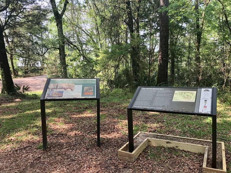
The Apalachee Village Marker on left.
| 1 ► Alabama, Baldwin County, Blakeley — The Apalachee Village — |
| On Franklin Street, 0.4 miles north of Washington Avenue, on the right when traveling west. | |||
| 2 ► Alabama, Montgomery County, Montgomery — Europeans Along the Alabama River — |
| Near Water Street. | |||
| 3 ► Connecticut, Fairfield County, New Fairfield — New Fairfield Veterans Memorial — |
| On Connecticut Route 37, 0.1 miles north of Brush Hill Road (Route 39), on the left when traveling north. | |||
| 4 ► Connecticut, Fairfield County, Wilton — Major Samuel Comstock — |
| Near Ridgefield Road (Connecticut Route 33) 0.2 miles north of Belden Hill Road, on the left when traveling north. | |||
| 5 ► Connecticut, Hartford County, Hartford, Downtown — Israel Putnam — John Q.A. Ward (1830-1910) — [Bushnell Park] — |
| On Trinity Street south of Jewell Street, on the left when traveling north. | |||
| 6 ► Connecticut, Hartford County, Hartford, Downtown — Israel Putnam — |
| On Trinity Street south of Jewell Street, on the right when traveling south. | |||
| 7 ► Connecticut, Litchfield County, Goshen — Goshen French and Indian War & Revolutionary War Memorial — |
| On North Street (Connecticut Route 63) at Elementary Drive, on the right when traveling north on North Street. | |||
| 8 ► Connecticut, Middlesex County, Clinton — A Walk Through Historic Clinton — |
| On East Main Street (U.S. 1) just east of Cemetery Road, on the right when traveling east. | |||
| 9 ► Connecticut, Middlesex County, East Haddam — Maj. Gen. Joseph Spencer — |
| On Millington Road (Connecticut Route 434) 0.1 miles Tater Hill Road, on the left when traveling west. | |||
| 10 ► Connecticut, New Haven County, Cheshire, Cheshire Village — Town of Cheshire Memorial Plaza — |
| On South Main Street (Connecticut Route 110) at Wallingford Road, on the right when traveling north on South Main Street. | |||
| 11 ► Connecticut, New Haven County, Madison — Thomas Chittenden — |
| On Boston Post Road (U.S. 1) at Britton Lane, on the left when traveling east on Boston Post Road. | |||
| 12 ► Connecticut, Windham County, Windham, Windham Center — The Battle of the Frogs — |
| On Windham Green Road at Plains Road, on the left when traveling south on Windham Green Road. | |||
| 13 ► Delaware, Kent County, Milford — KC-114 — Colonel John Haslet — |
| On Airport Road. | |||
| 14 ► Delaware, New Castle County, Christiana — NC-52 — Samuel Patterson — |
| On West Main Street just north of Flanders Way, on the right when traveling west. | |||
| 15 ► Delaware, Sussex County, Dagsboro — SC-59 — Dagsboro — |
| On Main Street, (Delaware Route 26), (Delaware Route 20) near Canal Street, on the right when traveling north. | |||
| 16 ► District of Columbia, Washington, Northwest Washington, Foggy Bottom — Braddock’s Rock — |
| On Constitution Avenue Northwest west of 23rd Street Northwest. | |||
| 17 ► District of Columbia, Washington, Northwest Washington, Massachusetts Heights — The Road to Fort Duquesne — [National Cathedral] — |
| Near Wisconsin Avenue Northwest, 0.1 miles north of Massachusetts Avenue Northwest, on the right when traveling north. | |||
| 18 ► Florida, Escambia County, Pensacola — D — Supremacy, Siege and the Sea — Pensacola Maritime Heritage Trail — |
| On Bayfront Parkway at South Alcaniz Street, on the right when traveling east on Bayfront Parkway. | |||
| 19 ► Florida, Jackson County, Bascom — 4 — Ekanachatte or "Red Ground" — Jackson County Spanish Heritage Trail, Stop #4 — |
| Near Florida Route 2, 1 mile east of Timberlake Road, on the right when traveling east. | |||
| 20 ► Georgia, Camden County, St. Marys — The Tragic Acadians — St. Marys History Walk — |
| Near Bartlett Street near St Marys Street West, on the left. | |||
| 21 ► Georgia, Seminole County, Donalsonville — Sabacola El Menor — |
| On State Park Drive, 0.1 miles south of Georgia Route 253, on the right when traveling east. | |||
| 22 ► Georgia, White County, Sautee Nacoochee — The Unicoi Road — Hardman Farm Historic Site — |
| Near Hardman Farm Road, 1 mile north of Unicoi Turnpike (Georgia Route 17). | |||
| 23 ► Illinois, Alexander County, McClure — Welcome to Illinois — |
| On Bunch Road west of Illinois Route 3, on the right when traveling south. | |||
| 24 ► Illinois, Edgar County, Chrisman — Pontiac Peace Treaty — |
| On U.S. 150, 0.3 miles north of County Route 2500N, on the right when traveling south. | |||
| 25 ► Illinois, Livingston County, Pontiac — Pontiac — The City of Pontiac is named for this Intrepid Warrior — |
| On West Washington Street at North Main Street, on the left when traveling east on West Washington Street. | |||
| 26 ► Illinois, Massac County, Metropolis — Four Flags Over Fort Massac — |
| Near 7th Street east of U.S. 45. | |||
| 27 ► Illinois, Pike County, Aladdin — Illinois — |
| On Highway 106, on the right when traveling east. | |||
| 28 ► Illinois, Randolph County, Chester — Chester-Kaskaskia, Illinois — |
| Near Illinois Route 150, 0.2 miles south of Briarhill Road. | |||
| 29 ► Illinois, Randolph County, Ellis Grove — Kaskaskia Village — |
| Near Park Road. | |||
| 30 ► Illinois, Randolph County, Ellis Grove — Site of Fort Kaskaskia — |
| On Park Road west of Shawneetown Trail (County Route 3), on the right when traveling east. | |||
| 31 ► Illinois, Randolph County, Prairie du Rocher — 1763 - Treaty of Paris Affects Prairie du Rocher — |
| On Market Street just north of Court Street, on the right when traveling north. | |||
| 32 ► Illinois, Randolph County, Prairie du Rocher — 1765 - Living under British Rule — |
| On Market Street at Court Street, on the right when traveling north on Market Street. | |||
| 33 ► Illinois, Randolph County, Prairie du Rocher — 1916 - Fort de Chartres Becomes a State Park — |
| On Market Street at Court Street, on the right when traveling north on Market Street. | |||
| 34 ► Illinois, Randolph County, Prairie du Rocher — Fort de Chartres — |
| Near Illinois Route 155. | |||
| 35 ► Illinois, Randolph County, Prairie du Rocher — Welcome to Fort de Chartres State Historic Site — |
| Near Illinois Route 155. | |||
| 36 ► Illinois, Vermilion County, Allerton — Croghan Treaty with Pontiac — July 1765 — |
| On 2700 N at 500E Edgar County Roads, on the left when traveling west on 2700 N. | |||
| 37 ► Illinois, Vermilion County, Sidell — Detroit - Kaskaskia Indian Trail — |
| On Road 100N at 740th St., on the left when traveling east on Road 100N. | |||
| 38 ► Illinois, Winnebago County, Rockford — Memorial Hall — |
| On North Main Street south of West Jefferson Street, on the right when traveling north. | |||
| 39 ► Indiana, Allen County, Fort Wayne, Northside — Site of Last French Fort — |
| On Northside Drive at St. Joseph Boulevard, on the right when traveling south on Northside Drive. | |||
| 40 ► Indiana, Allen County, Fort Wayne, West Central — The First French Fort / The First Playground in Fort Wayne — |
| On Van Buren Street at Michaels Avenue, on the right when traveling north on Van Buren Street. | |||
| 41 ► Indiana, Allen County, Hoagland — Hoagland, Indiana — Platted 1872 — Wayne Trace — |
| On Hoagland Road just east of Poplar Drive, on the right when traveling east. | |||
| 42 ► Indiana, Marion County, Indianapolis, Downtown — In Honor of Arthur St. Clair — Born in Scotland 1754 — Died in Pennsylvania 1818 — |
| On East Saint Clair Street east of North Meridian Street, on the right when traveling west. | |||
| 43 ► Kansas, Wyandotte County, Kansas City, Riverview — The History of the Wyandot Indian Nation — |
| On 7th Street Trafficway (U.S. 69) north of Ann Avenue, on the right when traveling north. | |||
| 44 ► Kentucky, Butler County, Morgantown — 2427 — Morgantown / Daniel Morgan — |
| On North Main Street north of W G L Smith Street, on the left when traveling north. | |||
| 45 ► Kentucky, Campbell County, Newport — 1386 — Dr. Thomas Hinde — |
| On Court Place at York Street (U.S. 27), on the right when traveling east on Court Place. | |||
| 46 ► Kentucky, Clark County, Winchester — 1047 — Capt. John Strode — |
| On West Lexington Avenue (U.S. 60) just east of Hospital Drive, on the right when traveling west. | |||
| 47 ► Kentucky, Garrard County, Paint Lick — 1526 — Fort Paint Lick — |
| On Richmond Road (Kentucky Route 52) south of Old Railroad Grade Road (County Route 1104), on the left when traveling south. | |||
| 48 ► Kentucky, Jefferson County, Lyndon — 974 — Fort William / Col. William Christian — |
| On Shelbyville Road (U.S. 60) at Whipps Mill Road, on the right when traveling west on Shelbyville Road. | |||
| 49 ► Kentucky, Madison County, Richmond — 1578 — Col. Richard Callaway / First Ferry in Kentucky — |
| On Boonesboro Road (Kentucky Route 388) south of Boonesborough Road (Kentucky Route 627), on the right when traveling north. | |||
| 50 ► Kentucky, Madison County, Richmond — 1685 — Grave of Hancock Taylor — |
| On Lancaster Road (KY52) south of Shale Drive (but North of Taylor Fork Creek), on the right when traveling south. | |||
| 51 ► Kentucky, Mercer County, Harrodsburg — 1258 — County Named / Mercer County — |
| On South Main Street, on the left when traveling north. | |||
| 52 ► Kentucky, Robertson County, Carlisle — William Jobe "Bill" Curtis — |
| Near Main Park Road (U.S. 68) 0.7 miles south of Old U.S. 68, on the right when traveling south. | |||
| 53 ► Kentucky, Shelby County, Shelbyville — 709 — Benj. Logan-Pioneer / James Knox-Pioneer — |
| On Taylorsville Road (Kentucky Route 55) at Brunerstown Road, on the left when traveling north on Taylorsville Road. | |||
| 54 ► Louisiana, Orleans Parish, New Orleans, Central Business District — Canal Street Under French and Spanish Rule (1718-1803) — |
| Near Canal Street at Carondolet Street, on the right when traveling east. | |||
| 55 ► Louisiana, Orleans Parish, New Orleans, French Quarter — Upper Pontabla Building — Pontabla Buildings National Historic Landmark — |
| On St. Peter Street south of Chartres Street, on the left when traveling north. | |||
| 56 ► Louisiana, Plaquemines Parish, Belle Chasse — Fort St. Leon — |
| On Main Street (Louisiana Route 996) 0.3 miles north of F. Edward Hebert Boulevard, on the right when traveling north. | |||
| 57 ► Louisiana, St. James Parish, St. James — Site of First Acadian Settlers in Louisiana — |
| On River Rd. (State Highway 18) 0.2 miles south of Dept. Of Energy Rd., on the left when traveling south. | |||
| 58 ► Louisiana, West Feliciana Parish, St. Francisville — British West Florida — |
| On Ferdinand Street (State Highway 1263) near Prosperity Street, on the right when traveling east. | |||
| 59 ► Maine, Cumberland County, Portland, East Bayside — The Site of Fort Loyal — |
| On Commercial Street / Thames Street at India Street, on the left when traveling north on Commercial Street / Thames Street. | |||
| 60 ► Maine, Cumberland County, South Portland — Early Settlement — |
| 61 ► Maine, Kennebec County, Winslow — Fort Halifax — Oldest Blockhouse in the United States — |
| Near Halifax Street (U.S. 201) 0.2 miles north of China Road (Maine Route 137), on the left when traveling north. | |||
| 62 ► Maine, Waldo County, Prospect — Pemtegwacook — |
| 63 ► Maine, Waldo County, Stockton Springs — Fort Pownall — |
| Near Lighthouse Road, 1 mile east of Cape Jellison Road. | |||
| 64 ► Maine, Waldo County, Stockton Springs — Fort Pownall, 1759-1775 — |
| Near State Park Road, 1 mile east of Cape Jellison Road. | |||
| 65 ► Maine, York County, Biddeford — A Stone Fort — |
| On Main Street (Maine Route 9) at Emery Street, on the right when traveling west on Main Street. | |||
| 66 ► Maine, York County, Biddeford — 4 — Fort Saco in 1693 / Le Fort Saco en 1693 — Biddeford, Maine — The Museum in the Streets® — |
| On Main Street (Maine Route 9) at Emery Street, on the right when traveling west on Main Street. | |||
| 67 ► Maryland, Allegany County, Cumberland — "Braddock's Road" — |
| On Braddock Road (Maryland Route 49) at Greene Street (U.S. 220), on the left when traveling west on Braddock Road. | |||
| 68 ► Maryland, Allegany County, Cumberland — Abandonment of Ft. Cumberland — Fort Cumberland Trail — |
| Near Prospect Square. | |||
| 69 ► Maryland, Allegany County, Cumberland — Baltimore Street Bridge — City of Cumberland, Maryland — Built 1916 — |
| On Greene Street at Baltimore Street, on the right when traveling north on Greene Street. | |||
| 70 ► Maryland, Allegany County, Cumberland — Col. Joshua Fry — |
| Near Greene St.. | |||
| 71 ► Maryland, Allegany County, Cumberland — Col. Thomas Cresap — |
| Near Greene St.. | |||
| 72 ► Maryland, Allegany County, Cumberland — Cumberland — |
| On Great Allegheny Passage, 0.1 miles north of Baltimore Street, on the left when traveling north. | |||
| 73 ► Maryland, Allegany County, Cumberland — Famous Personalities at Fort Cumberland — Fort Cumberland Trail — |
| On Prospect Square at Washington Street, on the left when traveling south on Prospect Square. | |||
| 74 ► Maryland, Allegany County, Cumberland — French and Indian War — Fort Cumberland Trail — |
| Near Prospect Square. | |||
| 75 ► Maryland, Allegany County, Cumberland — George Washington at Will’s Creek — Fort Cumberland Trail — |
| On Greene Street at Bridge Street on Greene Street. | |||
| 76 ► Maryland, Allegany County, Cumberland — Headquarters of George Washington — |
| Near Greene Street at Bridge Street. | |||
| 77 ► Maryland, Allegany County, Cumberland — Indians and Fort Cumberland — Fort Cumberland Trail — |
| On Washington Street just east of Prospect Square, on the right when traveling east. | |||
| 78 ► Maryland, Allegany County, Cumberland — Ohio Co. and Fort Cumberland — Fort Cumberland Trail — |
| On Greene Street at Baltimore Street, on the right when traveling north on Greene Street. | |||
| 79 ► Maryland, Allegany County, Cumberland — Palisado Fort or Stockade — Fort Cumberland Trail — |
| Near Greene St.. | |||
| 80 ► Maryland, Allegany County, Cumberland — Perimeter of the Fort — Fort Cumberland Trail — |
| On Washington St., on the left when traveling west. | |||
| 81 ► Maryland, Allegany County, Cumberland — President Washington's Last Visit - 1794 — |
| On Washington Street at Prospect Square, on the left when traveling west on Washington Street. | |||
| 82 ► Maryland, Allegany County, Cumberland — Site of Fort Cumberland — |
| On Greene St. at Washington Street on Greene St.. | |||
| 83 ► Maryland, Allegany County, Cumberland — The Fort Bastions — Fort Cumberland Trail — |
| On Washington Street just east of Prospect Square, on the right when traveling east. | |||
| 84 ► Maryland, Allegany County, Cumberland — The Fort Proper — Fort Cumberland Trail — |
| On Washington Street at Prospect Square, on the right when traveling west on Washington Street. | |||
| 85 ► Maryland, Allegany County, Cumberland — The Parade Ground of Fort Cumberland — Occupied this site 1755 — |
| On Washington St. at Prospect Square, on the left when traveling west on Washington St.. | |||
| 86 ► Maryland, Allegany County, Cumberland — This Tablet Marks the Site of Old Fort Cumberland — |
| On Greene St. at Washington Street on Greene St.. | |||
| 87 ► Maryland, Allegany County, Dickens — Washington’s Road — |
| On U.S. 220, on the right when traveling north. | |||
| 88 ► Maryland, Allegany County, Frostburg — Blazing Braddock's Road |
| On Historic National Road (Alternate U.S. 40), on the left when traveling west. Reported missing. | |||
| 89 ► Maryland, Allegany County, Frostburg — Braddock Stone — |
| On East Main Street, on the right. | |||
| 90 ► Maryland, Allegany County, Frostburg — George's Creek Valley — |
| On New Georges Creek Road (Maryland Route 36) at Hoffman Hollow Road, on the right when traveling north on New Georges Creek Road. | |||
| 91 ► Maryland, Allegany County, Frostburg — Historic Braddock Road — 1755 — |
| Near St. John's Rock Road, 0.5 miles south of Beall School Road. | |||
| 92 ► Maryland, Allegany County, Frostburg — Martin’s Plantation — |
| On National Highway (U.S. 40) at Maryland Route 36, on the right when traveling east on National Highway. | |||
| 93 ► Maryland, Allegany County, La Vale — “Spendelow Camp” — Also Called “Camp at the Grove” — |
| On Vocke Road (Maryland Route 53(658)) south of Exit 40 (Interstate 68). | |||
| 94 ► Maryland, Allegany County, Lonaconing — Daniel Cresap — |
| On Recreation Area Road Southwest, 0.6 miles south of Water Station Run Road, on the right when traveling south. | |||
| 95 ► Maryland, Allegany County, Oldtown — Michael Cresap — (1742–1775) — |
| On Opessa Street at Green Spring Road, on the left when traveling east on Opessa Street. | |||
| 96 ► Maryland, Allegany County, Oldtown — Old Town — (King Opessa’s Town) — |
| On Oldtown Road (Maryland Route 51) at Opessa Street, on the right when traveling east on Oldtown Road. | |||
| 97 ► Maryland, Baltimore, University of Maryland — The McDonoghs of Baltimore — |
| Near West Fayette Street at North Greene Street. | |||
| 98 ► Maryland, Baltimore County, Dundalk — Battle of North Point — 1814 — |
| On North Point Road (Maryland Route 20) at Kimberly Road, on the right when traveling south on North Point Road. | |||
| 99 ► Maryland, Frederick County, Braddock Heights — The Braddock-Washington Monument — |
| On The Old National Pike (U.S. 40-Alt), on the right when traveling east. | |||
| 100 ► Maryland, Frederick County, Braddock Heights — This Boulder Marks the National Trail — General Braddock Monument — |
| On Old National Pike (Alternate U.S. 40) 0.1 miles west of Ridge Road, on the left when traveling west. | |||
971 entries matched your criteria. The first 100 are listed above. Next 100 ⊳