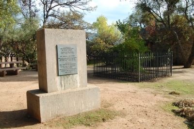
To commemorate The Mother Orange Tree of Butte County planted at this spot by Judge Joseph Lewis in 1856.
The Bidwell Bar Bridge, first suspension bridge of California, transported from New York via Cape Horn 1853. Completed 1856. . . . — — Map (db m100596) HM
Fashioned as either small ornaments or large enough to be heard for miles, bells have long been a part of human history and culture. First appearing around 2000 B.C. as simple percussion instruments, they continue to celebrate special events to this . . . — — Map (db m101587) HM
Josephine Felix arrived from France in 1852, one of the first settlers in Salt Spring Valley. Soon widowed, she established a waystation at the junction of the Angels and Central Ferry Roads. She wed neighbor Alban Hettick and the couple developed a . . . — — Map (db m58929) HM
In 1859 Tacitus Ryland Arbuckle located a homestead in the Sacramento Valley, and in 1875 had the land plotted for a town site. The legendary Arbuckle founded the town, deeded the lots, furnished the nails, and helped build the first houses in what . . . — — Map (db m54548) HM
Spurs and Branding Irons
California Cowhides are Big Business
After Spain's rule in the New World ended in 1821, the newly
established government of Mexico began the process of distributing
the mission lands. The area where you . . . — — Map (db m185763) HM
In the early 19th century many canneries operated throughout California. The rich agricultural and fishing areas of east Contra Costa County hosted a number of canneries and packing sheds. The picturesque Antioch waterfront was home to two canneries . . . — — Map (db m18292) HM
This little house built by the McCoy's in 1861, at their ranch on the side of Kirker Pass, served as their first home. As time passed and the ranch became established, a much larger farmhouse was built for the family. It was then that the 2 room . . . — — Map (db m93574) HM
This house, which serves as the museum for the East Contra Costa Historical Society, was originally built by Johnson and Elizabeth Fancher in 1878. In the early 1880's the Fanchers sold the house and surrounding acreage to John and Letitia Byer. In . . . — — Map (db m94652) HM
Drainage Area 33,000 Acres
Total Capacity 4,800 Acre Ft.
Water Surface Area 375 Acres
Height of Dam 58 Feet
Length of Dam 1,500 Feet
Volume of Fill 440,000 Cu.Yds.
Built under the Watershed Protection and . . . — — Map (db m198002) HM
Miwok Indians inhabited this valley at the base of Mt. Diablo when Spanish explorers came in the 1770’s. Scouts, trappers, prospectors and settlers followed.
In 1857 Clayton was founded by Joel Clayton, a miner, farmer, and wagonmaster from . . . — — Map (db m59954) HM
Paul De Martini built Clayton Vineyards Winery in 1885 on land formerly owned by Joel Clayton, the area’s first vintner. An Austrian stone mason directed construction, using stone quarried on Mount Diablo and hauled here by wagon teams. This was . . . — — Map (db m312022) HM
Pioneers, miners & cowboys along with ranching and farming have
all been important parts of Clayton's history. Founded by Joel
Clayton in 1857, he laid out the downtown, established his cattle
ranch and planted 28 acres of vineyards.
When . . . — — Map (db m190219) HM
As early as 2000 BC, this area was home to the Volvon Miwok Native Americans. Many artifacts of their lifestyle were found when American settlers arrived in the 1800s.
Under the Homestead Act between 1862 and 1872, Clayton's founder, Joel Clayton . . . — — Map (db m150414) HM
Don Salvio Pacheco was born on July 15, 1793 in Monterey, Alta California. After serving in the Monterey Militia for many years, he petitioned the Territorial Deputation Council of the Mexican government for a Land Grant in 1834. With the possession . . . — — Map (db m206217) HM
Crockett Ranch Staging Area is the gateway to 1,300 acres of scenic and secluded parkland that make up Crockett Hills Regional Park. Long held as private ranchland, the area has always offered a quiet counterpoint to the hustle and bustle of the . . . — — Map (db m190311) HM
Ranching has long been a way of life in these
hills. With steep terrain, and water in scarce
supply, the area has always favored cattle grazing
over cultivation of water-intensive crops.
The region once formed part of the vast . . . — — Map (db m190310) HM
Settling in Danville from Virginia, early pioneers Robert B. Love and Amelia Harvey Love owned most of the land that is now “West Danville.” Once surrounded by orchards and a bee farm, this is one of the oldest remaining original farmhouses in . . . — — Map (db m202119) HM
(front or street side:)
"My parents were given much help
(from the Adachis and Nabetas)
digging a well by hand and building
their house. Much help was given on
how to grow the flowers as well as
how to build the greenhouses. . . . — — Map (db m145945) HM
(front or street side:)
"At four in the morning they would
start preparing the flowers for market.
Grandfather would carefully put the
flowers in a basket and sling it over
his shoulder. Grandmother, carrying
a lantern, would lead him . . . — — Map (db m156299) HM
In front of you is the last remaining structure of El Cerrito's once vibrant Japanese American flower growing industry: the former storefront of Contra Costa Florist which was owned by the Mabuchi Family.
Hikojiro and Tomi Mabuchi, aided . . . — — Map (db m145944) HM
El Cerrito was once a town of farms and dairies. The mild weather, lush fields, and many creeks coming down from the hills made for excellent dairy farming. Over the years, there have been about 25 dairies located in El Cerrito. . . . — — Map (db m94131) HM
El Sobrante never attracted heavy industry. Probably the largest commercial enterprise in the town was the S.P. Skow & Sons Dairy, which supplied milk in Richmond and surrounding towns. For most of that time, the dairy was located on Clark Road, . . . — — Map (db m94273) HM
El Sobrante gets its name from Rancho El Sobrante, "surplus" land situated between existing ranchos that in 1841 was granted by the government of Mexico to brothers Juan Jose and Victor Castro. Curiously, El Sobrante's downtown is actually within . . . — — Map (db m94305) HM
In the city, from 1879 to 1932, the 70 acre parcel of land extending in a triangle from what is now Bush Street to Pacheco Boulevard to Brown Street to Alhambra Creek was owned by The Christian Brothers Religious Teaching Order, Founded by Saint . . . — — Map (db m112828) HM
Vicente Martínez was born in Santa Barbara on August 18, 1818, the second son of Don Ygnacio and Martina de Arellano Martínez who were married in the Presidio Chapel at Santa Barbara 1802. Don Ygnacio Martínez was a Spanish officer at San Diego and . . . — — Map (db m50827) HM
In 1919, Colonel Robert Bradford Marshall
of the United States Geological Survey
proposed an unprecedented project
of dams, canals, and pumps to
move Delta-bound water from
California's wet north and snowy
Sierra Nevada mountains to its
arid . . . — — Map (db m190979) HM
Fifty Years
That's all it took for the clamshell dredge to change the
Delta from a vast wetland into the agricultural, water
delivery, and shipping hub we know today. In the late
1880s, these dredges reshaped the waterways to ease . . . — — Map (db m190314) HM
Picture a river running through a desert.
Now picture a desert running through a river.
The San Joaquin River once flowed
uninterrupted from high mountains,
through the arid valley bearing its name,
to the Delta. Floods enriched . . . — — Map (db m190726) HM
Patrick Rodgers left Ireland for America C. 1843 at the age of 10, without his family. In 1855, he arrived in California for the Gold Rush. In 1868, he and his wife, Mary Ann, bought this 149-acre site to grow wheat. The Rodgers, along with eight . . . — — Map (db m99625) HM
At Forest Home Farms, much of the food was home grown. The Boones grew vegetables for their own use and raised cattle on a leased ranch in Livermore which they brought to the meat house, in front of you, for processing. This structure was . . . — — Map (db m202114) HM
Take a walk down the path and imagine what life might have been like here 200 years ago. Oak Creek would have provided fresh water and an abundance of plant material and wildlife for food and shelter. Houses would have been built with willow . . . — — Map (db m202104) HM
Welcome!
Forest Home Farms was one of many ranches in the San Ramon Valley in the early 1900s. Originally part of a Mexican land grant, the property was farmed, built upon, and subdivided over the years. In 1899, 163 acres were purchased by . . . — — Map (db m202115) HM
Man power or animal power – that was the choice for most farmers up until the 1930s to till, sow and reap their crops. Gas engines existed from the early 19th century but were only able to do stationary farm and household chores like grinding grain, . . . — — Map (db m202111) HM
Getting a drink of water in the early 20th century was not as easy as it is today. You couldn’t just turn on a tap. You had to use a windmill to extract groundwater which was then fed into a holding tank. The water flowed by gravity to a cast iron . . . — — Map (db m202059) HM
San Ramon's Pioneers
American pioneers first came to San Ramon in 1850 when Leo and Mary Jane Norris
purchased 4,450 acres of land from Jose Amador's Rancho San Ramon. Other early
landowners were William and Mary Lynch, James and . . . — — Map (db m155606) HM
There was always work to be done on the ranch. Each year the Boones ran a walnut processing operation which included washing, hulling, and drying for local walnut farmers. Travis Boone owned one of the few hay harvesters in the valley. At the end . . . — — Map (db m202113) HM
Minnie Boone purchased Forest Home Farms in 1899. The Boone House was built in 1900 and is a Dutch Colonial style home with 5375 square feet and 22 rooms. The older north wing of the home is Gothic style and pre-dates the Boone’s ownership to the . . . — — Map (db m202102) HM
A farm is a complicated endeavor to run. Equipment must be maintained, repaired and stored; crops must be planted, harvested, and kept dry until needed; and farm animals must be fed and sheltered. Specialized buildings are needed, serving many . . . — — Map (db m202106) HM
Animals were an essential part of the ranches and farms of the last century. Horse were especially important to farm life, for they provided transportation, pulled plows, and other farm equipment, hauled cargo, and even powered machines that did . . . — — Map (db m202108) HM
Used for sowing seeds in the fields. Most early farm machinery were Rube Goldberg-like contraptions. When the wagon wheels turned, the gears fastened to them turned other gears. — — Map (db m93982) HM
First model built by International Harvester in 1924. Designed to cultivate or weed between rows. Instead of the traditional side-mounted flywheel to which a belt was attached to run machinery, the Farmall had what was known as a "power take-off," a . . . — — Map (db m93979) HM
Originally located at the Cereghino Ranch of Walnut Creek
Relocated to Shadelands in 1995
Restoration of the buildings was made possible by the efforts of:
Walnut Creek Historical Society
Joseph Bologna, Project Architect
Primo E. . . . — — Map (db m209652) HM
After mining started to decline in the mid-1850s, the local people turned to agriculture. Among them was Henry Mahler, who had over 1,500 fruit trees on this site in the 1860s. Henry Mahler Sr. died in 1867, and Henry Jr. took over the farm. Most of . . . — — Map (db m215741) HM
Mining ditches were dug by ditch companies to carry vast amounts of water needed for placer mining. Thousands of miles of ditches and flumes were built in the gold country; some brought immense profits to their owners. As mining declined in the . . . — — Map (db m17484) HM
The home of the pioneer Monroe family stood here for more than a century. The family matriarch, Nancy Gooch, came across the plains from Missouri as a slave in 1849. She gained her freedom in 1850 when California joined the Union as a . . . — — Map (db m17455) HM
Pearly Monroe was a grandson of Peter and Nancy Gooch, who were freed from slavery here when California became a state in 1850. The Monroe family became successful fruit farmers and prominent property holders in Coloma. This house was built by . . . — — Map (db m17205) HM
This area held a number of important homes and stores during the gold rush. The first large building in Coloma was built here in 1849 by John T. Little. It contained a store, hotel, restaurant and post office. Little also operated a ferry to cross . . . — — Map (db m215742) HM
Most of Coloma's buildings were wooden, but some were were made of brick or stone to resist fire. This one, known as "Bells Brick Store," was a general merchandise store that also sold feed and grain. The U.S. Post Office was located in this . . . — — Map (db m12207) HM
This town, settled in 1848, derived its name from its crystal clear springs. Among the richest in this vicinity its diggings produced a 25 pound nugget, one of the largest in El Dorado County. Its most thriving period was in 1851. Later it became a . . . — — Map (db m10936) HM
Site of the only tea and silk farm established in California. First agricultural settlement of pioneer Japanese immigrants who arrived at Gold Hill on June 8, 1869. Despite the initial success, it failed to prosper. It marked the beginning of . . . — — Map (db m76181) HM
This fieldstone building was built by Giovanni N. Lombardo in 1872 from stones cleared to plant vineyards on the property. The lower cellar was used to produce wine for the local community. The grapes were crushed in the upper story living room and . . . — — Map (db m101534) HM
Whose deep concern for the conservation and improvement of our forests led him to establish the Eddy Tree Breeding Station on this site in 1925. His own effort and funds created this oldest forest genetics research institution in the Western . . . — — Map (db m105854) HM
Jacob Zwang was born in Sennefeld, Baden Germany and migrated to the United States in 1896 at the age of 16 years. He arrived at 2:00 o’clock in the morning and was met by his uncle Moses Levy, and cousin Albert Levy. This was the start of a . . . — — Map (db m64061) HM
[Side A:]
Easton
In 1878, O.W. Easton and J.P. Whitney, San Francisco entrepreneurs, bought a total of 12 sections of land in this area (7680 acres), formed the Washington Irrigated Colony and began selling 20-acre farms. Allen T. . . . — — Map (db m229962) HM
"Fresno" is the Spanish word for "Ash Tree." The first settlement to which the name was applied was "Fresno City," a station on the old Butterfield Stage Route located on Fresno Slough about one and one-half miles northwesterly from the present . . . — — Map (db m41007) HM
During and after World War II, nearly 5,000,000
contracted braceros came to work in agriculture
and on the railroads, the majority in California and
the San Joaquin Valley, under U.S. and Mexican Treaty,
demonstrating their patriotism . . . — — Map (db m41067) HM
The Father of Fresno Irrigation. He was born in New York State in 1819, became a blacksmith and emigrated to California in 1852. He came to Fresno County in 1868 and employed by A. Y. Easterby, built the first irrigation system for lush fields of . . . — — Map (db m127909) HM
Its waters made possible the irrigation of a million fertile acres, despite a 39 year battle over water rights. From 1882 forward, 150 lawsuits were filed and early irrigators often used armed force to open headgates to water their crops. L. A. . . . — — Map (db m27996) HM
"Yank" Hazelton, son of Joseph, a blacksmith, and Sophia Cleveland, was born in Coeyman, N.Y., in 1824. He emigrated to California through San Diego in 1853. He settled on this site and homesteaded this land in November, 1857, with his wife of 2 . . . — — Map (db m28069) HM
[Marker Front:]
Groundwater Irrigation Beginnings
The San Joaquin Valley's groundwater reservoir was first tapped with a practical pumping plant 4 miles northeast of here on Dec. 12, 1894. William De La Grange of Selma, tired of . . . — — Map (db m28594) HM
On this 6 1/4 acre site, Libby, McNeill and Libby opened the San Joaquin Valley's largest cannery on July 18, 1911, less than four hectic months after the site was acquired and construction plans were announced. The initial construction cost was . . . — — Map (db m52240) HM
Arrived via Panama route, San Francisco Oct. 10, 1849
Arrived Colusi County, July 6, 1850
Ferry boat captain, mail carrier, surveyor, editor, writer, legislator, Surveyor General of the United States, California State Treasurer, irrigationist, . . . — — Map (db m143420) HM
This pioneer agricultural community, settled in 1852, helped feed the booming population of mid-century San Francisco. Long known as “Cream City,” Ferndale made innovative and lasting contributions to the dairy industry. Local creameries, and the . . . — — Map (db m1557) HM
This site, originally R.A. Simpson's Ferndale Mechanical Shop, and shared by A. Monroe Cider and Vinegar Company, was chosen in 1904 by Aage Jensen as the founding location of the Central Creamery with first production of butter in September, . . . — — Map (db m65235) HM
These historic images represent an earlier time when the low-lying wetlands and salt marshes around Humboldt Bay and the lower Eel River valley were largely drained and converted to agricultural uses.
Under the congressional Swamp and . . . — — Map (db m139531) HM
Hard work and perseverance created a family business that lasted generations
In 1850, Joseph and Zipporah Russ moved to Humboldt County from Maine to start a cattle and sheep ranch. The main buildings were built between 1915 and 1925 and . . . — — Map (db m139548) HM
At this historic spot the first irrigation water from the Colorado River reached Imperial Valley in 1901, coming from Mexico. This waterway was replaced in 1942 by the All-American Canal. Water has made this once arid area into an agricultural . . . — — Map (db m314306) HM
In 1908 Hardy McConnell and son, Leslie, (A Native Son) left Temescal Canyon, near Corona, enroute to settle in Imperial Valley, driving two teams of horses pulling wagons, hauling farm implements, chickens and leading a cow.
Fourteen days later . . . — — Map (db m81635) HM
Emil Schaffner arrived from Rufenach, Switzerland, through Ellis Island, in 1914, bound for Imperial Valley. He began working in Calexico for Judge Towland, insisting on being paid in cattle. In 1921, Emil established "Schaffner Dairy" and it has . . . — — Map (db m314305) HM
The largest gravity fed irrigation district in the western hemisphere, established in 1911. They later assumed control of several water companies and were instrumental in getting the Hoover Dam and the All American Canal built.
They commenced . . . — — Map (db m62035) HM
Mining has played a vital role in the local economies of
the Eastern Sierra beginning in the 1860s. Historically
significant mines include:
The Mine in the Sky
Twenty miles west of here lies the Pine Creek Tungsten . . . — — Map (db m288225) HM
"It was in 1863 that my parents set out on a great adventure.
They packed their goods in a wagon, hitched up their teams,
and made the long, rough trip to Owens Valley. The drama
of our frontier community began to unfold..."
- Eva Lee . . . — — Map (db m288409) HM
Before you is a survivor, a remnant orchard from a
time when hundreds of apple, pear, and peach
orchards occupied the Manzanar landscape. Since
farmer Romeo Wilder planted these pear trees
about 1918, they have thrived in years of . . . — — Map (db m299796) HM
"A wonderful community atmosphere - picnics in the cottonwood grove, Christmas
programs, and ice cream socials - brought everyone together in kindred spirit."
— Gladys Graham Branson, former Manzanar town resident.
Step back in . . . — — Map (db m288408) HM
The Alabama Gates and gate house were constructed in 1913 when the Los Angeles Aqueduct was built to dewater the aqueduct when maintenance is necessary. On November 16, 1924, seventy or more local citizens seized the aqueduct at the Alabama Gates . . . — — Map (db m93252) HM
Named for the Diaz family who established a ranch
here when brothers Rafael and Eleuterio Diaz
emigrated from Chile in the 1860's. They owned and
operated a successful cattle ranch until the land
was sold to the City of Los Angeles Dept of . . . — — Map (db m221367) HM
This English Pedunculate Oak tree
originated in Sherwood Forest England.
Around the turn of the century a small
sprout was sent to Lone Pine. A member
of the Fred French family planted the
sprout on this original site, a part of the
old Harvey . . . — — Map (db m221404) HM
In the 1890's a Chinese man named Ah Foo came to this canyon from the Borax Works in Death Valley. He developed a successful ranch, raising livestock, hay, fruits and vegetables to help feed the local silver miners and their draft animals. The . . . — — Map (db m72929) HM
Basque immigrants from the Pyrenees mountains of France and Spain were drawn to California by the Gold Rush. They found providing the miners with lamb and wool more profitable than digging for gold.
Young Basque men would follow their sheep . . . — — Map (db m237371) HM
In the 1930’s, more than half of a million Americans fled the Southwestern part of the United States due to the prolonged drought called the “Dust Bowl.”
Traveling in old cars with just basic necessities, the migrants came primarily from . . . — — Map (db m167100) HM
This area was originally a portion of the Jewett Brothers’ Ranches. In 1859 Solomon and Philo Jewett walked 2000 miles to present day Kern County. They built the first store in Bakersfield in 1865 and the same year raised the first commercial cotton . . . — — Map (db m24989) HM
The Chinese community was an early and significant element of the population of Kern County.
Chinese immigrants contributed to the social, economic and industrial growth of Kern County by mining, farming, building railroads, and owning . . . — — Map (db m25318) HM
When European explorers first came to what is now Kern County, it was inhabited predominantly by indigenous peoples known as the Chumash, Kawaiisu, Kitanemuk, Serrano, Tubatulabal and Yokuts.
The Kern County area was first claimed by the . . . — — Map (db m167101) HM
In 1871 Horatio P. Livermore and William Muehe built the Kern River Flour Mills on the Kern Island Canal. Muehe sold his interest to Fordyce Roper in 1874 and Livermore to James B. Haggin in 1879, who also acquired Roper's interest in 1884. The . . . — — Map (db m53243) HM
Large scale farming and ranching was needed to supply the restaurants and grocery stores in fast-growing cities like San Francisco and Los Angeles in the late 1800s.
Henry Miller and Charles Lux purchased large areas of land throughout . . . — — Map (db m25309) HM
This barn, used to feed and harness teams of horses, was originally located at 1606 “R” Street in Bakersfield.
Four horses could be fed and harnessed inside this barn. Chopped hay, stored in the barn’s loft, was lowered . . . — — Map (db m25642) HM
This parlor was built by John Bugni in the 1940’s for his home in Pumpkin Center. John and Antonia Fachin Bugni were proud of their Italian heritage and their extended family. The caretta is a Sicilian wine cart donated by George and Maria Giumarra . . . — — Map (db m297338) HM
Kern County had a surge of Italian immigrants in the 19th century engaged in farming, ranching, and working on the railroad.
Kern’s Italians prospered in the Mediterranean climate making their own wine, olive oil, sausage and cheese. They . . . — — Map (db m297324) HM
Developers beckoned hopeful settlers with the dream of owning land to land offices where workers drew property lines and assigned private rights.
When the Kern County Land Company was organized in 1890, much of the county was undeveloped. The . . . — — Map (db m297330) HM
Historical buildings,
Arvin Farm Labor
Supply Center,
Sunset Government Camp.
From the people of
Oklahoma — the Okies —
who found a home here
and helped build California.
-Gov Frank Keating, 2002. — — Map (db m309817) HM
Back From the Brink of Extinction
Half a million tule elk once roamed
the marshes and grasslands of
California. The Gold Rush began an
era of commercial hunting and
agricultural practices that decimated
the elk and their . . . — — Map (db m184928) HM
A fifth generation native of Kern River Valley, Bob is best remembered for the 9 history books he wrote. Without him much of what happened in our valley’s past would have been lost. He was a cowboy, cattleman, ranger, family man and historian. . . . — — Map (db m25238) HM
The Shafter Cotton Research Station, established here in 1922 by the U.S. Department of Agriculture, developed the "Acala" varieties which were exceptionally well suited to the San Joaquin Valley. The quality of the acala cottons and the marketing . . . — — Map (db m52055) HM
In 1872, the fifteen families residing in what is now Bear Valley Springs joined together to
build a schoolhouse in order to provide an education and source of community structure for
their children. The original schoolhouse was erected near . . . — — Map (db m209103) HM
In 1947 the Tehachapi Soil Conservation District was organized to advise the farm industry. It was apparent by the early 1960s that if agriculture were to continue as economic force in the District, additional water had to be found. In the early . . . — — Map (db m135047) HM
Tehachapi’s early settlers grazed cattle on the abundant grass of the open range until the great droughts of the 1860s & 70s reduced the herds. Herds increased again in the 1880s and large ranches began such as the Hill Ranch, the Tehachapi Cattle . . . — — Map (db m134558) HM
The "T-Hacha-P" logo was taken from an early fruit crate label. The steam powered combine shown is followed by a horse drawn water wagon, with Tehachapi Peak in the background. Jake Jacobsen, a former mayor and civic leader, along with his brother . . . — — Map (db m53115) HM
Avelino Martinez was of Mexican, Indian and Chinese descent, four feet-four inches tall and thirteen years of age when he came with a group of drovers to the United States from Sonora, Mexico, searching for his father. He worked as a groom for . . . — — Map (db m52918) HM
8545 entries matched your criteria. Entries 301 through 400 are listed above. ⊲ Previous 100 — Next 100 ⊳