By Rev. Ronald Irick, October 15, 2019
Old Indian Trail / Wheeling Pike Marker
| Near Cardinal Greenway Trail at Wheeling Avenue, on the right when traveling south. |
| Near West Minnestrista Boulevard south of North Minnetrista Parkway, on the left when traveling south. |
| On North Walnut Street north of East North Street, on the right when traveling north. |
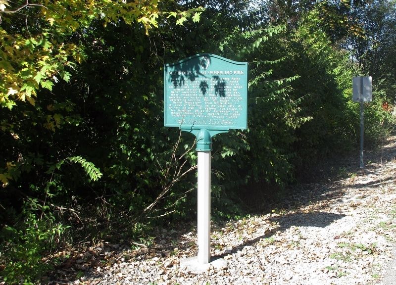
| On East Wysor Street at West Walnut Street, on the right when traveling east on East Wysor Street. |
| On County Road 625 at County Road 1167, on the right when traveling south on County Road 625. |
| On County Road 44, 1 mile west of U.S. 33, on the left when traveling west. |
| Near W. Vistula Street at Chestnut Street. |
| On South 2nd Street at West High Street, on the left when traveling north on South 2nd Street. |
| Near Nibco Parkway just south of East Lexington Avenue, on the right when traveling south. |
| On W. Beardsley Avenue west of N. Riverside Drive, on the left when traveling west. |
| Near Pacific Street west of N. Elkhart Avenue. |
| On Prairie Street at Chapman Avenue, on the right when traveling north on Prairie Street. |
| Near Nibco Parkway just north of South Clark Street, on the right when traveling south. |
| Near Pacific Street west of N. Elkhart Avenue. |
| Near Riverwalk Drive south of East Sycamore Street, on the right when traveling north. |
| Near Pacific Street west of N. Elkhart Avenue. Reported unreadable. |
| On E. Beardsley Avenue east of Montessori Drive, on the right when traveling east. |
| Near S. Main Street (State Road 15) at River Vista Drive, on the right when traveling north. |
| On Lincolnway East (U.S. 33) at Reynolds Street, on the right when traveling south on Lincolnway East. |
| Near N. Arnott Street (County Road 3) at W. Market Street (U.S. 6), on the right when traveling north. |
| On County Road 142, 0 miles east of County Road 29, on the left when traveling east. |
| Near County Road 42 at County Road 29, on the left when traveling north. |
| On South Grand Avenue (State Road 121) south of South Eastern Avenue, on the right when traveling south. |
| On East 5th Street at North Central Avenue, on the left when traveling east on East 5th Street. |
| On North Central Avenue at West Court Street, on the left when traveling north on North Central Avenue. |
| On West 4th Street at Market Street, on the left when traveling east on West 4th Street. |
| On North Central Avenue at East 5th Street, on the left when traveling north on North Central Avenue. |
| On North Eastern Avenue (Indiana Route 131) at Charles Street, on the left when traveling south on North Eastern Avenue. |
| On South Grand Avenue (State Road 121) at South Eastern Avenue, on the left when traveling south on South Grand Avenue. |
| On State Road 44 at South Gabbard Road, on the right when traveling east on State Road 44. |
| On Wissman Road south of the railroad tracks, on the right when traveling south. |
| On Main Street (State Road 54) at Gilstrap Way, on the right when traveling west on Main Street. |
| On Wissman Road south of the railroad tracks, on the right when traveling south. |
| Near East Main Street (Indiana Route 111) at State Street, on the right when traveling east. |
| On Eastbound I-64 exit ramp at West Spring Street, on the right when traveling south on Eastbound I-64 exit ramp. |
| On East Spring Street (Old Indiana Route 62) just east of Woodrow Avenue, on the right when traveling west. |
| On East Market Street at Pearl Street, on the right when traveling east on East Market Street. |
| On East Market Street at State Street, on the right when traveling east on East Market Street. |
| On East Main Street (Indiana Route 111) at State Street, on the right when traveling east on East Main Street. |
| On East Main Street (Ohio River Scenic Byway) (Indiana Route 111) just west of East 9th Street, on the right when traveling west. |
| On West Washington Street, on the right when traveling west. Reported permanently removed. |
| On East River Road (County Road 1400) 1 mile east of North Riverside Road (State Road 500), on the left when traveling east. |
| On Ravine Park Boulevard near East Jackson Street, on the right when traveling north. |
| On East Main Street west of South 2nd Street, on the right when traveling west. |
| On South Coffing Brothers Road north of State Road 234, on the right when traveling south. |
| On U.S. 136 at South Layton Station Road, on the left when traveling west on U.S. 136. |
| On Cades Hollow Road east of South Jenks Road, on the right when traveling east. |
| On Main Street (U.S. 52) south of East 5th Street, on the left when traveling south. |
| On St Marys Road, on the left when traveling west. |
| On St. Mary's Road at Castle Road, on the left when traveling west on St. Mary's Road. |
| On East 10th Street, on the right when traveling east. |
| On East 10th Street at John Street, on the right when traveling east on East 10th Street. |
| On U.S. 52 at Blue Creek Road, on the right when traveling north on U.S. 52. |
| On Toner Street (State Road 121) at Main Street, on the left when traveling north on Toner Street. |
| On Columbia Street north of Lovers Lane, on the right when traveling north. |
| On US Rt 52 (U.S. 52), on the left when traveling west. |
| On Pennington Road (Main Street) west of Bridge Street, on the left when traveling west. |
| On 75 Main Street (Pennington Road) just west of Walnut Street, on the left when traveling west. |
| On Main Street (a.k.a. Pennington Road) at Bridge Street, on the left when traveling west on Main Street (a.k.a. Pennington Road). |
| On Main Street (a.k.a. Pennington Road) east of Bridge Street, on the right when traveling east. |
| On Main Street (a.k.a. Pennington Road) west of Banes Street, on the right when traveling west. |
| On Main Street (a.k.a. Pennington Road) at Bridge Street, on the right when traveling north on Main Street (a.k.a. Pennington Road). |
| On Main Street (a.k.a. Pennington Road) east of Bridge Street, on the right when traveling east. |
| On U.S. 52 east of McGuire Ridge Road, on the right when traveling east. |
| On U.S. 52, 0.1 miles north of North Street, on the right when traveling north. |
| On Pearl Street south of Main Street, on the right when traveling south. |
| On Main Street north of East 9th Street, on the right when traveling north. |
| On North Old US Highway 31 north of County Road E 350 N, on the right when traveling north. |
| On State Road 25 south of County Road E 400 S, on the right when traveling south. |
| On U.S. 31 south of County Road W 375 N, on the right when traveling south. |
| On Old U.S. 31 north of County Road 350N, on the right when traveling north. |
| On State Road 25 at milepost 105,, 0.1 miles south of County Road E 700 N, on the left when traveling south. |
| On County Road 550E at County Road 175S, on the left when traveling south on County Road 550E. |
| On South Clay Street at West Oak Street, on the left when traveling north on South Clay Street. |
| On West Broadway Street (Indiana Route 65) at North West Street, on the left when traveling east on West Broadway Street. |
| On West Broadway Street (Indiana Route 65) at North West Street, on the left when traveling east on West Broadway Street. |
| On North Hart Street just south of West State Street, on the right when traveling south. |
| On West Broadway Street (Indiana Route 65) at North West Street, on the left when traveling east on West Broadway Street. |
| On West Broadway Street (Indiana Route 65) at North West Street, on the left when traveling east on West Broadway Street. |
| On West Broadway Street (State Road 64) at North Hart Street, on the right when traveling west on West Broadway Street. |
| On West Broadway Street (Indiana Route 65) at North West Street, on the left when traveling east on West Broadway Street. |
| On County Road 500W south of Road 100N, on the right when traveling south. |
| On West Broadway Street (Indiana Route 65) at North West Street, on the left when traveling east on West Broadway Street. |
| On West Broadway Street (Indiana Route 65) at North West Street, on the left when traveling east on West Broadway Street. |
| On Harrison Street just north of 1st Street, on the right when traveling north. |
| On W. North A St at N. Grant St, on the right when traveling west on W. North A St. |
| On County Road 380 West, 0.8 miles south of County Road W600N, on the left when traveling south. |
| On South Adams Street north of East 4th Street, on the left when traveling north. |
| On South Washington Street south of West 3rd Street, on the left when traveling south. |
| On South Washington Street at East 3rd Street (State Road 18), on the left when traveling south on South Washington Street. |
| On West 600 South (County Route 600 S) at County Route 350 W, on the right when traveling west on West 600 South. |
| On State Road 26 at S. Wheeling Pike, on the left when traveling east on State Road 26. |
| On South Main Street (Indiana Route 22) south of Railroad Street, on the left when traveling north. |
| On Railroad Street, on the right when traveling east. |
| On South Main Street (Indiana Route 22) south of Railroad STreet, on the left when traveling north. |
| On E. 276th Street, 0.8 miles east of U.S. 31, on the left when traveling east. |
| On Conner Street (Indiana Route 32), on the right when traveling west. |
| On Logan Street east of North 10th Street, on the right when traveling east. |
| On 9th Street at Maple Avenue, on the left when traveling south on 9th Street. |
| Near West 1st Street at South Main Street, on the right when traveling west. |
578 entries matched your criteria. Entries 101 through 200 are listed above.
⊲ Previous 100 —
Next 100 ⊳