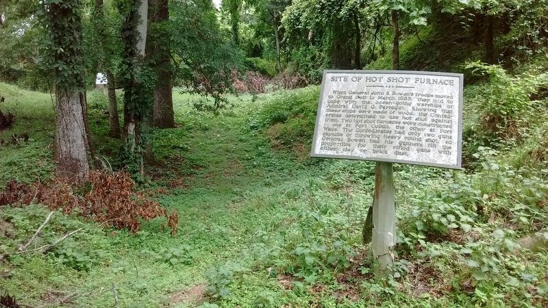
When General John S. Bowen’s troops moved to Grand Gulf in March 1863, they had to cope with the ocean-going warships of Admiral David G. Farragut. Knowing that these ships were made of wood, the Confederates determined to use hot shot against them. . . . — — Map (db m105781) HM
By the use of flying batteries, the Confederates were so mobile that the Union troops had much difficulty in stopping fortification of bluffs behind Grand Gulf. Harassment forced Commodore David Farragut to convoy the unarmed ships. In March, 1863, . . . — — Map (db m103925) HM
This house was built in the late 1790's of cypress, poplar and heart pine and put together with wooden pegs instead of nails. The Spanish built structure represents one of several homesteads erected by five different groups of "Conquerors" who . . . — — Map (db m103935) HM
This XIII-inch Mortar
was probably used by the Union
in the fight for Vicksburg.
In the early 1900's it was seen
partially buried in the levee
on Davis Island. These mortars
were mounted on schooners
or box-like boats. . . . — — Map (db m104294) HM
The town of Grand Gulf began in the 18th century as a small British settlement. By 1828 it had grown to a village of three stores, one tavern, and several houses. There was a stage line to Port Gibson and steamboats stopped at its wharves. . . . — — Map (db m105720) HM
Despite the estimated more than 2,500 heavy projectiles fired into the Confederate forts, there was little damage. The Confederates suffered three dead, including Colonel Wade, and eighteen wounded. Union losses totaled nineteen dead and fifty-seven . . . — — Map (db m103929) HM
No town in Mississippi felt the sting of the Civil War worse than did Grand Gulf. In the spring of 1862, Commodore David Farragut sent his powerful ocean-going squadron up the Mississippi River. Baton Rouge and Natchez fell, but Vicksburg refused to . . . — — Map (db m103928) HM
Grand Gulf was named for the large whirlpool or gulf formed by the current of the Mississippi River being diverted to the left by the rocky headland called Point of Rock. At the time of the Civil War, the Big Black discharged into the Mississippi at . . . — — Map (db m105782) HM
After U.S. Grant had planned much of his campaign at Mrs. Bagnell’s, four miles west, he arrived at Rocky Springs on May 7. He remained until May 10, allowing the XV Corps to cross the Mississippi and rejoin the army. McClernand’s XIII Corps arrived . . . — — Map (db m87358) HM
At the end of this trail is evidence of a once thriving rural community. First settled in the late 1790's, the town grew from a watering place along the Natchez Trace, and took its name from the source of that water -- the Rocky Spring. In 1860, a . . . — — Map (db m80147) HM
1830 - Oakland College was founded by Dr. Jeremiah Chamberlain.
Chamberlain envisioned Oakland as serving the 300,000 inhabitants
of Mississippi. Louisiana, and Arkansas. Representatives of three
Louisiana parishes and eight Mississippi counties . . . — — Map (db m119854) HM
About 14 miles west at the mouth of Bayou Pierre is the old river port settled by Peter Bryan Bruin in 1788. It was visited by Aaron Burr in 1807. Grant landed there in Vicksburg Campaign of 1863. — — Map (db m103797) HM
Built by Samuel and Jacob, prominent Jewish businessmen, this complex forms an unusual group of consecutively constructed buildings of various architectural styles. This house, built in 1901, replaced an earlier one used by Gen. U.S. Grant as his . . . — — Map (db m103796) HM
On the afternoon of April 30, 1863, Confederate General Martin E. Green posted his brigade near Magnolia Church to defend this route to Port Gibson. Just after midnight, Green's pickets, stationed here at the Shaifer House, fired on the sixteen-man . . . — — Map (db m143709) HM
At daybreak, the Union soldiers who camped here found themselves in the midst of a rugged landscape of ridges and ravines. As it happened, they were also at the center of what would become the battlefield. From this knoll, Generals Grant and . . . — — Map (db m143854) HM
On May 1, 1863, Confederate forces under Brig. Gen. John Bowen clashed with elements of two Union corps commanded by Maj. Gen. U.S. Grant. The battle began around midnight near the Shaifer House four miles west of town. At dawn, the Federals . . . — — Map (db m35542) HM
Confederate Gen. Martin E. Green on the afternoon of April 30, 1863, posted his brigade near Magnolia Church, with an outpost here. Shortly after midnight. Green rode forward to check on his pickets. Reaching this point, the general found Mrs. A. . . . — — Map (db m143319) HM
A night attack by Iowa and Wisconsin soldiers of Gen. E. A. Carr's division on Gen. M. E. Green's Confederates at this point was repulsed. At daybreak May 1, the Federals readied a new thrust. Gen. J. A. McClernand sent Gen. P. J. Osterhaus up the . . . — — Map (db m143571) HM
Gen. W. E. Baldwin's brigade reached Willow Creek about the time
Gen. M. E. Green's troops were driven from Magnolia Church. Confederate Gen. J. S. Bowen had Baldwin form his troops in this undergrowth-filled
bottom. Rebel cannoneers emplaced . . . — — Map (db m143845) HM
When the Union Navy was repulsed by General Bowen at Grand Gulf, Grant's army was forced to land in Louisiana and march down river. Conducting the largest amphibious landing prior to World War II, the Union Army crossed the river and landed without . . . — — Map (db m146559) HM
Following the arrival of Presbyterian missionaries in 1801, Joseph Bullen and James Smylie organized the Bayou Pierre Church at this site in 1807. After part of the congregation formed the Bethel Church southwest of here in 1824, the remaining . . . — — Map (db m70394) HM
The Union Army under command of Maj. Gen. U.S. Grant was composed of the 13th Corps and Logan's Division of the 17th Corps. The Confederate Army, under command of Brig. Gen. John S. Bowen, was composed of Tracy's, Cockrell's, Green's, and Baldwin's . . . — — Map (db m104412) HM
The Caucasian habitation of Claiborne County began as a settlement on the banks of Bayou Pierre, a venture which perished in 1729. Pioneers again attempted to settle Grand Gulf in 1775. In 1802 the County officially established and named for the . . . — — Map (db m139493) HM
During the battle, and for weeks afterward, the Shaifer home
served as a field hospital where amputations took place on
benches and tables on the porches around the house. It was
here that Charles Dana, a former journalist who was observing
the . . . — — Map (db m143999) HM
As Logan's division marched west toward Grand Gulf on May 3, 1863, M. M. Crocker's division moved toward Hankinson's Ferry. At Kennison Creek, one mile north, the road was blocked by two Confederate brigades. After a spirited skirmish, the . . . — — Map (db m103822) HM
From This Site Was Fired The First Shot In The Battle Of Port GibsonTop of Monument In Memory Of The Confederate Soldiers Who Fought And Fell In The Battle Of Port Gibson May 1, 1863. — — Map (db m143320) HM WM
After occupying Willow Springs on May 5. 1863,. Gen. U. S. Grant divided his force. The XVII Corps advanced on Hankinson s Ferry 5 miles north of here in two columns. Gen. M. M. Crocker's division driving up this road encountered a Confederate . . . — — Map (db m103849) HM
703 Church. Ca. 1840 Greek Revival/Italianate. Italianate long windows and protruding bay windows are typical of many houses built just before the Civil War. The interesting and unusual etched glass panel in the front door depicts a pelican. — — Map (db m104344) HM
After firing the nighttime opening shots of the Battle of Port Gibson, Confederate skirmishers retreated to the ridge behind you to join the battle line that General Green formed in the dark. A volley from this line stopped the advancing Union' . . . — — Map (db m143740) HM
Magnolia Church was in the middle of some of the heaviest fighting of the battle, with the center of Brig. Gen. Martin Green's Confederate brigade being posted here. Union troops under command of Brig. Gens. Carr, Benton and Hovey and Col. Stone . . . — — Map (db m143705) HM
After the war this house became a symbol of reconciliation between North and South. Although Confederate veteran A.K. "Kell" Shaifer Jr. lost his wife and two sons during the war and had his home and farm ravaged, he later made friends with several . . . — — Map (db m143901) HM
W. 2 mi. Built about 1800 by George W. Humphreys, Birthplace of Benjamin Grubb Humphreys (1808-82). Brigadier General, C.S.A. Governor of Mississippi from 1865 to 1868. — — Map (db m103800) HM
When Union Gen. J. B. McPherson's XVII Corps reached Grindstone Ford, 2 miles south of here at dusk on May 2, 1863, the troops found the bridge across Big Bayou Pierre burning. Col. J. H. Wilson and a detachment put out the fire. During the night . . . — — Map (db m103855) HM
About dark on May 1, 1863, Gen. W. E. Baldwin's Confederates retreated through Port Gibson. After crossing the suspension bridge over Little Bayou Pierre, the Confederates set it afire. On the morning of the 2d. the Union army entered the beautiful . . . — — Map (db m103808) HM
After Grant's army came ashore at Bruinsburg, each enslaved person in this area was faced with a decision: whether or not to flee to freedom.
Directly in the path of the Union army, the slaves who lived and worked on the Shaifer farm certainly . . . — — Map (db m144111) HM
On the afternoon of May 3, 1863, Union Gen. U.S. Grant rode west past this intersection to Grand Gulf while Gen. John A. Logan's division turned north toward Vicksburg. Logan was in pursuit of the Confederate force that had abandoned Grand Gulf . . . — — Map (db m173365) HM
From here you see where the nineteenth century path intersects with the auxiliary "plantation road." During the battle, this road provided the Union command a direct link with their left flank engaged along the Bruinsburg Road to the north. . . . — — Map (db m143713) HM
In April of 1861, rumors of Civil War became a reality at Charleston harbor when Fort Sumter was fired upon by Southern forces. Many leaders, both North and South, believed that a dash to capture the opposing side's capital city would bring a quick . . . — — Map (db m139494) HM WM
Smith Coffee Daniell II, a successful cotton planter, completed construction of Windsor in 1861. Daniell owned 21,000 acres of plantation land in Louisiana and Mississippi. Ironically, he died in April 1861, only weeks after completing his . . . — — Map (db m70541) HM
Center of early trade on Chickasawhay River with Gulf Coast. Served during Civil War as location of hospital and prison camp and temporary refuge of the State Government. — — Map (db m84213) HM
To the Confederate
Soldiers
Though Your Ranks
Now Fast are Melting
and the Stars and
Bars are Furled,
Yet the South
Will Live Forever
In the Glory
Of Your World.
Clarke County’s
Tribute to
The Noble Men
Who Marched . . . — — Map (db m84239) WM
Front
In memory of
those who fought to
liberate West Point
Feb. 21, 1864
Their actions resulted
in victory against
a vastly superior
Federal army. Their
bravery will always
be remembered.
Rear . . . — — Map (db m107823) HM WM
E. 10 mi. Plantation home built c. 1852 by Geo. H. Young. Octagonal cupola. Gen. N.B. Forrest visited here during the Civil War. National Fox Hunters Assn. organized here. — — Map (db m50160) HM
On February 3, 1863, Union forces blasted the Mississippi River levee to enable flotilla to use Moon Lake and the Yazoo Pass in a futile effort to reach Vicksburg by way of the Coldwater, Tallahatchie, and Yazoo rivers. Federal forces were stopped . . . — — Map (db m170401) HM
Originally facing the river, the Robinson/Marinelli house bears the mark of shelling from the Union Navy. Built ca. 1850 by Mr. and Mrs. James Dardis Robinson, it is the oldest structure in Friars Point. According to local historians, the house . . . — — Map (db m170392) HM
The Friars Point Methodist Church congregation was organized in 1836 under a nearby brush arbor. The original log church, on this site, was burned by Union troops during the Civil War. A second structure was destroyed by a tornado. The present . . . — — Map (db m170394) HM
Named for chief engineer of first Jackson - New Orleans railway. Last spike driven here on March 31, 1858. Town was raided by Grierson in 1863. Shipping point for cattle, truck crops, and lumber. — — Map (db m50893) HM
East ¼ mile. Founded in 1846 as a coeducational boarding school by A.R. Graves, NY Presbyterian clergyman. Gave pre-law, pre-medical and fine arts training. Destroyed in the Civil War. — — Map (db m170485) HM
A native of Tennessee, Sam Powel
(1821-1902), a Mexican War veteran,
was Colonel or the 29th Tennessee
Infantry. After the Civil War, he
moved to Hernando, where he served
as a circuit judge. Mississippi
representative and senator . . . — — Map (db m170276) HM
[Northeast Inscription]:
C.S.A.
To the Men and Women of
the Confederacy
1861-1865
[Southwest Inscription]:
When their county called
they held back nothing.
They cheerfully gave their
property and their lives.
. . . — — Map (db m39867) HM
In November 1864, Union Brig. Gen. John
Davidson led an expedition from Baton
Rouge toward the Mobile & Ohio R.R. On
December 10, part of his force crossed
the Chickasawhay River and met two
Confederate cavalry regiments at McLeods
Mill. . . . — — Map (db m122344) HM
This monument is dedicated to a large group of
men that was formed here. These men were
common men with an uncommon valor in war
they fought for their homes, families and a
constitutional government most were early
settlers of Greene . . . — — Map (db m122702) WM
Main defensive position on Yalobusha River line held by Gen. Pemberton in fall of 1862 to repel Gen. Grant, whose army of 25,000 was moving to attack Vicksburg. — — Map (db m89894) HM
Lawyer, soldier statesman.
Maj. Gen. in Confederate
Army. U. S. Senator from
1885 to 1898. Made home
here from 1871 to death.
House built shortly before
outbreak of Civil War. — — Map (db m173961) HM
Established July 4, 1836
by union of the towns of
Pittsburg and Tullahoma.
Federal plans to attack
Confederates here stopped
by Gen. Van Dorn's raid on
Holly Springs, Dec., 1862. — — Map (db m173958) HM
Front
To the noble men
who marched neath
the flag of the
Stars and Bars,
and were faithful
to the end.
Glorious
in life,
death sublime.
Back
Jefferson Davis,
June 3, 1808,
Dec. 6, 1889. . . . — — Map (db m90264) WM
The Grenada Depot was jointly constructed
by the MS Central and TN MS Railroads in
1870. Two previous depots were burned during
the Civil War in 1863 and 1865. The second
story and sheds were added by Illinois
Central in 1926.
Due to the . . . — — Map (db m173966) HM
In 1862 the Confederate army built
forts throughout Grenada in response to
General Ulysses S. Grant's Mississippi
Central Railroad Campaign to capture
Vicksburg. This small fort was placed
to guard the approach to Grenada from
the south, along . . . — — Map (db m173975) HM
Established circa 1840. this is
Grenada's oldest cemetery. Buried
here are many prominent, early
citizens, including Rev. Abraham
Lucas, who performed the "marriage
of Pittsburg & Tullahoma" on
July 4, 1836, forming Grenada.
Also buried here . . . — — Map (db m173957) HM
In 1860, John Deason, a Mexican War Veteran, organized a militia company here. The "Gainesville Volunteers" entered Confederate service in 1861 as Co. G. of the Third Mississippi Infantry. During the Civil War the unit served in the Gulf Coast . . . — — Map (db m8755) HM
The home of Andrew Jackson, Jr., a nephew and the adopted son of President Jackson, was located here. Jackson and his wife Sarah, who named the plantation, lived here just before the Civil War. The Jacksons sold the property in 1861. The house, . . . — — Map (db m108577) HM
Built 1852-4. Last home of Jefferson Davis, U.S. Senator, Congressman, Secretary of War, and only President of Confederacy. Beauvoir served as a Confederate Veterans' home from 1903 until 1956. — — Map (db m92604) HM
In 1848, the United States Lighthouse Service erected the South's first cast-iron lighthouse, in
Biloxi on a low sandy bluff overlooking the Mississippi Sound. The tower was fabricated by the
Murray and Hazelhurst Vulcan Works of Baltimore, . . . — — Map (db m102221) HM
Known as the Father Ryan House, the Greek Revival house once located here was built ca. 1840 by Judge W.C. Wade of Natchez. Among the area's first vacation villas, it was sold to New Orleans architect T.W. Carter in 1885, and was altered. It may be . . . — — Map (db m115365) HM
Site granted by Spanish to Jean Baptiste Carquote in 1790. Residence in Civil War of Mayor John L. Henley, who led defense against Union fleet, Sept., 1861. Restoration by Biloxi Garden Clubs. — — Map (db m42855) HM
During the early 19th Century, the Biloxi peninsula was sparsely populated
with a few French speaking families. The 1827 establishment of steamboat
service between New Orleans and Mobile, via Lake Pontchartrain, served
as a catalyst for the . . . — — Map (db m102223) HM
The Louisiana Native Guards, composed largely of former slaves and free men of color from Louisiana, were organized by Union Maj. Gen. Benjamin Butler in 1862. On April 9, 1863, 180 men from companies B and G of the 2nd Regiment, landed at . . . — — Map (db m102161) HM
On site of old Harrison County Court House
where at age 80 he made this famed speech
— To the —
young men of Mississippi which stands
out as this great American's crowning service
to the United States through its . . . — — Map (db m81014) HM
12 miles south of the mainland lies emerald waters and sugar white sand. Site of economic and military conquest by the Spanish in the 1500s and the French in 1699, the British in the 1700s, and the Union Army in 1861. Site of Civil War Fort . . . — — Map (db m102170) HM
Located 4.4 mi. S.W., is site of crucial battle in the Vicksburg defense, May 16, 1863. Grant, cutting off Johnston's relief, drove Pemberton from this hill across Big Black River. — — Map (db m89736) HM
Grant established his headquarters here on May 10, remaining two days. On May 11, Tuttle's and Steele's divisions of the XV Corps passed through Cayuga and the XIII Corps camps at Fivemile Creek to Auburn, three and a half miles northeast. Lacking . . . — — Map (db m103887) HM
The Battle on Champion Hill raged back and forth for hours,
earning the site a reputation as "the hill of death." As more Union
reinforcements arrived, Pemberton gave the order to retreat. With
Pemberton's army in danger of being trapped, a . . . — — Map (db m109561) HM
As the Civil War moved into the Deep South, many people
fled the shifting war front. Two coinciding events encouraged
Henry Coker to become a refugee: the death of his wife and the
approach of the Union navy, steaming up the Mississippi . . . — — Map (db m109563) HM
On the morning of May 16, 1863, Gen. Pemberton placed his three
Confederate divisions along a two-mile front extending from the
Raymond Road on the south to the Middle Road on the north - Loring
on the right, Bowen in the center and Stevenson on . . . — — Map (db m109210) HM
Champion Hill Battlefield
has been designated a
National
Historic Landmark
This site possesses national significance
in commemorating the history of the
United States of America . . . — — Map (db m109300) HM
Artillery used the crest of this ridge throughout the battle.
From here Confederate guns commanded the Raymond Road,
preventing a Union advance from the right. Late in the afternoon,
the Confederates deployed closer to Bakers Creek, and . . . — — Map (db m109565) HM
"I found General Hovey's command drawn up in line
of battle, his right resting on the left of the main road, the
enemy, as I learned, having been discovered in force
strongly posted on a high ridge known as Champion's
Hill, and apparently well . . . — — Map (db m109310) HM
The Crossroads is a junction formed by the Middle Road from the east, the Ratliff plantation road from the south and the Jackson Road from the north as it descends from the crest of Champion Hill and turns west. At 1:30 p.m. on May 16, 1863, Federal . . . — — Map (db m109298) HM
General Lloyd Tilghman, a graduate of West Point Military Academy,
settled in Kentucky after the Mexican War. In October, 1861, Tilghman
was commissioned Brigadier General in the Confederate Army.
At Champion Hill he led a brigade whose . . . — — Map (db m109556) HM
"I cannot think of this bloody hill without
sadness and pride. Sadness for the great loss of
my true and gallant men; pride for the heroic
bravery they displayed. No prouder division
ever met as vastly superior foe and fought with
more . . . — — Map (db m109305) HM
This boulder is erected by the Mississippi
College Rifles Chapter U. D. C.
in grateful memory of the 104 men who went
out from this college as Company E; 18th
Mississippi Regiment, April 23, 1861.
J. W. Welborn, Capt., Cuddie . . . — — Map (db m90391) HM
Walter Hillman was President of the Central Female Institute from 1855 to 1887 and of Mississippi College from 1867 to 1873. During the Civil War he saved many Clintonians from starvation by requesting rations from General Sherman. When Charles . . . — — Map (db m103744) HM
Built ca. 1835, this Greek Revival house is one of the oldest in Hinds Co. U.S. Grant passed by enroute to Civil War siege of V'burg, 1863. This structure is listed on the National Register of Historic Places. — — Map (db m115290) HM
For more than a year, Union forces struggled with difficult
terrain and the seemingly impregnable Confederate defenses
guarding the fortress city of Vicksburg. By the end of April,
1863, Major General Ulysses S. Grant's army of more than
30,000 . . . — — Map (db m244407) HM
What you see here is a reconstruction of the 1852
house built by the Cokers. Efforts to fully restore
the original house were not successful. In order to
save the structure, the house was dismantled and
the salvaged materials were used in the . . . — — Map (db m110131) HM
On the morning of May 16, 1863, Confederate cannon positioned on this ridge engaged Union artillery located nearly a mile east on the Raymond-Edwards Road (to your right). By late afternoon, Confederate positions north of this location were forced . . . — — Map (db m244405) HM
After the defeat at Champion Hill, Confederate forces retreated to the Big Black River on the night of May 16, 1863. Here, Generals John Bowen and John Vaughn defended the east bank of the river and the bridge. On May 17, Federal forces under Gen. . . . — — Map (db m80679) HM
On May 17, 1863, Pemberton's 4th
Brigade, commanded by Col.
Reynolds, and portions of Grant's
15th Corps, commanded by Gen.
Sherman, fought here as Confederate
forces retreated from Champion Hill.
Subsequent skirmishing took place near
here . . . — — Map (db m244398) HM
In 1853, the land now known as Champion Hill was given to Sid and Matilda Champion as a wedding present from her father, Eli Montgomery. They erected a two-story white-frame house along the Jackson Road that overlooked the railroad. In 1862, Sid . . . — — Map (db m86780) HM
On May 12, 1863, Grant made his headquarters here at Dillon's Farm with Sherman's XV Corps. At Raymond, five and a half miles east along Fourteenmile Creek, McPherson's XVII Corps, with 12,000 men, defeated 3,000 Confederates under John Gregg. Grant . . . — — Map (db m80242) HM
On the morning of May 12, 1863, Grant and
Sherman arrived here with two divisions
of the XV Corps and found the bridge
across Fourteenmile Creek ablaze. A brisk
firefight ensued between a detachment
of Wirt Adams' Mississippi cavalry,
posted . . . — — Map (db m178365) HM
May 14
Dissension Among Pemberton's Generals – On his way to take command of the forces around Edwards Station, John C. Pemberton is handed a message from his commanding officer, Joseph E. Johnston, suggesting a move to destroy a federal force . . . — — Map (db m244415) HM
Lloyd Tilgham
Brigadier General C.S.A.
Commanding First Brigade
Loring's Division
Killed here the afternoon of May 16, 1863, near
the close of the Battle of Champion's Hill. — — Map (db m86785) HM
Located 3.5 miles south of Edwards,
Mt. Moriah crossroads was occupied by
Union Gen. John McClernand's XIII Corps
on May 12, 1863. McClernand's object
was to move north and cut the Mississippi
Southern R.R. However. Confederate Lt.
Gen. John . . . — — Map (db m244404) HM
On May 12, 1863, after Grant and two divisions of the XV Corps marched past, three divisions of the XIII Corps turned here onto the Telegraph Road. Four miles north, they met a portion of the 1st Missouri (Dismounted) Cavalry at Whitaker's Ford. . . . — — Map (db m80290) HM
The Coker House is the only remaining structure on grounds
where the pivotal Battle of Champion Hill was fought on May
16, 1863. Located on the southern margin of the battlefield,
the house sustained fire from both Union and . . . — — Map (db m110129) HM
"Vicksburg is the key," said President Abraham
Lincoln. "The war can never be brought to a
close until that key is in our pocket."
The United States government had to control
the lower Mississippi River in order to move
agricultural . . . — — Map (db m110132) HM
906 entries matched your criteria. Entries 101 through 200 are listed above. ⊲ Previous 100 — Next 100 ⊳