Near East Broad Street east of First Street, on the right when traveling east.
Many kinds of people were important threads in the weave of Athens' historical industrial fabric.
The first mill workers were white men and women, and seasonally leased African-American male slaves. During the Civil War, skilled slaves, . . . — — Map (db m206385) HM
On East Broad Street at College Avenue, in the median on East Broad Street. Reported permanently removed.
Erected
by the
Ladies’
Memorial
Association.
1871.
True to the Soil
That gave them Birth and reared them Men:
True to their Ancestors, of High Renown
And Hallowed Worth:
Cherishing the Sentiments of Home and Country
And the . . . — — Map (db m230567) WM
Near East Broad Street east of First Street, on the right when traveling east.
• 1862 Cook & Brother purchases property at the junction of Trail Creek and the North Oconee River, builds the Armory and produces Enfield-model rifles for the Confederate Army.
• 1865 Cook & Brother Armory closes at the end of the Civil . . . — — Map (db m60603) HM
On East Broad Street east of First Street, on the left when traveling east.
To this building in 1862 was brought the machinery of the armory established in New Orleans at the outbreak of the War by Ferdinand W.C. and Francis L. Cook, recent English immigrants, the former a skilled engineer for the manufacture of Enfield . . . — — Map (db m11288) HM
Near Cemetery Street, 0.2 miles east of East Campus Road.
Lt. Col. Jefferson Mirabeau Lamar commanded Cobb’s Legion Infantry at Crampton’s Gap. Lamar graduated from the University of Mississippi before opening a law practice in Covington, GA. A month after his July 1861 marriage to his cousin, Mary Ann . . . — — Map (db m108759) HM
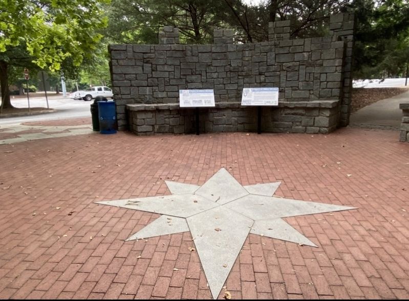
Near East Broad Street east of First Street, on the right when traveling east.
Water provided the power to saw, bore, mill, forge, cast and polish high quality rifles, carbines and bayonets at the Cook & Brother Armory during the Civil War.
Gun parts needed to be interchangeable so that a broken gun could be repaired on . . . — — Map (db m195770) HM
Near East Broad Street east of First Street, on the right when traveling east.
The Cook brothers came to Athens to manufacture guns for the Confederate Army. Weapons produced in the water-powered Armory were heralded as some of the finest in the South.
Francis and Ferdinand Cook bought William Carr's grist and sawmill . . . — — Map (db m206375) HM
Near East Broad Street east of First Street, on the right when traveling east.
During 145 years of operation the riverside textile mills produced a diversity of fabrics. Materials ranged from sturdy wool and cotton cloth for Confederate uniforms to lightweight gauze for modern bandages.
The Athens Manufacturing . . . — — Map (db m206378) HM
Near East Broad Street east of Wilkerson Street, on the right when traveling east.
Mills were located at shoals in the river where water dropped quickly, providing power for manufacturing. Clarke County had 19 mills, and many were located on the Athens riverfront.
A dam constructed in the 1830s on the rocky shoals downstream. . . . — — Map (db m207644) HM
Near East Broad Street (State Road 10 / 78) at Herty Street, on the left when traveling south.
A majestic oak tree once stood on this spot and one of the University's most endearing legends also flourished here. Robert Toombs (1810-1885) was young, and boisterous when he was dismissed from Franklin College in 1828. Five decades later it . . . — — Map (db m11966) HM
On East Hancock Avenue at College Avenue, on the right when traveling east on East Hancock Avenue.
This cannon, the only known one of its kind, was designed by Mr. John Gilleland, a private in the “Mitchell Thunderbolts,” an elite “home guard” unit of business and professional men ineligible because of age or disability . . . — — Map (db m19549) HM
On West Broad Street (U.S. 78) at South Lumpkin Street, on the right when traveling east on West Broad Street.
Closing in on Atlanta in July, 1864, Maj. Gen. W.T. Sherman found it "too strong to assault and too extensive to invest". To force its evacuation, he sent Maj. Gen. Geo. Stoneman’s cavalry [US] to cut the Macon railway by which Atlanta’s defenders . . . — — Map (db m19661) HM
On Dixon Street (State Highway 4) at East 12th Street, on the right when traveling south on Dixon Street.
This County, created by Act of the Legislature July 27, 1914, is named for Augustus O. Bacon, four times U.S. Senator, who died in office Feb. 15, 1914. An expert on Mexican affairs, his death was a great loss coming at a time of critical relations . . . — — Map (db m24292) HM
On West Hancock Street (Georgia Route 49) at Jackson Street, on the right when traveling west on West Hancock Street.
This Milledgeville Federal-style house was built c. 1825 on North Wilkinson Street for George T. Brown by English-born builder-architect John Marlor. It was operated as the U.S. Hotel and then the Beecher-Brown Hotel to serve visitors and . . . — — Map (db m13141) HM
On Georgia Route 22/24 at Old River Bridge Road, on the right when traveling east on State Route 22/24.
The Union Army of 65,000 men under the command of General Wm. T. Sherman left Atlanta on November 15, 1864. Only the left wing of 30,000 men entered Milledgeville. The advance units arrived here on the 22nd. The right wing marched via Clinton and . . . — — Map (db m35995) HM
On Old Monticello Road NW at Nelson Road, on the right when traveling west on Old Monticello Road NW.
Marching toward Milledgeville via Covington, Shady Dale and Eatonton Factory, the Union Army's 14th Corps reached this crossroad on the night of November 22, 1864. General Sherman camped at the Howell Cobb place, a few yards north of this point. . . . — — Map (db m13136) HM
On West Hancock Street (Georgia Route 49) west of North Wilkinson Street, on the right when traveling west.
On this 20-acre square stood the first Georgia State Penitentiary. Completed in 1816, the walled compound occupied 2-1/2 acres in the center of the square. The penitentiary housed approximately 245 prisoners in a brick and granite main cell . . . — — Map (db m127158) HM
On East Green Street near South Jefferson Street, on the right when traveling east.
On January 16, 1861, the Georgia Secession Convention met here to consider seceding from the United States. Secession began in response to Abraham Lincoln's election as president the previous November and the belief that his Republican party was . . . — — Map (db m42603) HM
On North Wilkinson Street at West Hancock Street (Georgia Route 49), on the left when traveling north on North Wilkinson Street.
In commemoration of the safeguarding
of the
Great Seal of Georgia
and the
unfinished acts of the
legislature, 1864
Within five hundred feet east of here lived Georgia's wartime Secretary of State, Nathan C. Barnett. At midnight . . . — — Map (db m197768) HM
On Old Monticello Road NW at Nelson Road, on the right when traveling west on Old Monticello Road NW.
Site of the large Baldwin County plantation of Howell Cobb, one of the 'Great Georgia Triumvirate' of Stephens, Toombs and Cobb, and his wife, the former
Mary Ann Lamar. Born at Cherry Hill in Jefferson County, Georgia Sept. 7, 1815, he graduated . . . — — Map (db m13137) HM
On Kinderhook Road (Georgia Route 212) at Glynn Street (Georgia Route 22), on the right when traveling south on Kinderhook Road.
With the right wing of his army in the vicinity of Clinton and Macon, General Sherman, with the left wing, appeared at this point on November 23, 1864. The left wing, consisting of the 20th and 14th corps, was comprised of 30,000 men, 12,000 horses . . . — — Map (db m35832) HM
On South Jefferson Street near East Greene Street, in the median.
South (Front)
CSA
This tribute to the
memory of the
Confederate Soldier,
unveiled April 26, 1912.
West
His heroism, in the
presence of the
conquering foe was
equaled only by
his . . . — — Map (db m103412) WM
On South Clark Street (U.S. 441) 0 miles north of West Greene Street, on the right when traveling north.
Completed in 1838, The Executive Mansion was the fifth and last residence occupied by Georgia governors when Milledgeville was the capital of Georgia. The Palladian-inspired structure is considered one of the most perfect examples of Georgian . . . — — Map (db m36124) HM
On Allen Memorial Drive at Ivey Drive, on the right when traveling west on Allen Memorial Drive.
This is the site of the antebellum college established in the community of Midway by the Hopewell Presbytery in 1833. Its first president, Carlisle P. Beman, was succeded by Samuel K. Talmage. In 1861, students and faculty entered Confederate . . . — — Map (db m10803) HM
On South Jefferson Street at East Hancock Street (Georgia Route 22/24), in the median on South Jefferson Street.
A reproduction of Georgia’s State Capitol 1807-1867 stands on the original site. Wings to the main building were added in 1828 and 1837. Here the Secession Convention met Jan. 16, 1861 and after three days of bitter debate passed the secession act. . . . — — Map (db m36405) HM
On East Greene Street at North Jefferson Street, on the right when traveling east on East Greene Street. Reported missing.
The 3rd Wisconsin and the 107th New York Regiments, having been detailed for provost duty, encamped on this square, November 22-25, 1864. The State Arsenal on the north side of the square was burned. The magazine, which stood on the opposite side, . . . — — Map (db m208063) HM
On West Greene Street at South Jackson Street, on the left when traveling east on West Greene Street.
On the morning of Nov. 23, 1864, the main body of the 20th Corps of the Union Army, commanded by Gen. A. S. Williams, reached Milledgeville from Eatonton. The Corps marched down Jackson Street to this point where companies were formed into line. . . . — — Map (db m35712) HM
On South Wayne Street at West Washington Street, on the right when traveling north on South Wayne Street.
This Church was organized in 1841 through the efforts of Bishop Stephen Elliott. The church building was completed in 1843 and consecrated Dec. 10. The vestibule, annex and Gothic roof were added later. The handmade chancel furniture was given by . . . — — Map (db m36104) HM
On North Clark Street (Business U.S. 441) 0 miles West Hancock Street (Georgia Route 49), on the right when traveling north.
Largely through the efforts of William Y. Atkinson the Georgia Normal and Industrial College was founded in 1889 with J. Harris Chappell as the first president. It became a degree-granting institution in 1917 and included a liberal arts program. The . . . — — Map (db m36361) HM
On East Greene Street at South Jefferson Street, on the right when traveling east on East Greene Street.
This 20-acre square as the center of Georgia's state government and location of its capitol building from 1807 until 1868. The "State House," imposing Gothic edifice that dominates the square contained the offices of the governor and the chambers of . . . — — Map (db m103227) HM
On South Wayne Street at East Greene Street, on the right when traveling north on South Wayne Street.
On this tract of twenty acres was built the Statehouse, the original wing of which was completed in 1811. Later additions were made until 1835 when it was finished in its present form. Near the Statehouse stood the Arsenal and the Magazine, brick . . . — — Map (db m36404) HM
On North Wilkinson Street at West Hancock Street (Georgia Route 49), on the right when traveling south on North Wilkinson Street.
When Federal troops entered Milledgeville in November, 1864, Georgia Secretary of State Nathan C. Barnett hid the Great Seal under a house and the legislative minutes in a pig pen 30 yards east of this point. Later they were returned to the . . . — — Map (db m36358) HM
On Clark Street (Georgia Route 243) 0 miles south of West Montgomery Street (U.S. 441), on the right when traveling south. Reported missing.
On Nov. 15, 1864, after destroying Atlanta and cutting his communications with the North, Maj. Gen. W.T. Sherman, USA, began his destructive campaign for Savannah -- the March to the Sea. He divided his army [US] into two wings. The Right Wing (15th . . . — — Map (db m208062) HM
On South Clarke Street (Business U.S. 441) south of East Hancock Street, on the left when traveling south.
Construction of this Executive Mansion was authorized in 1835 and completed in 1839. The governor's earlier residence, Government House, just to the south on the corner of Clarke and Greene Streets, had fallen into disrepair. The Mansion is . . . — — Map (db m103230) HM
These Confederate soldiers, all serving in the Georgia Militia, died at Brown Hospital in Milledgeville and were buried at this location. Their names soon became lost, and they were considered Unknown Soldiers until 2003 when their identities were . . . — — Map (db m91851) HM
On Irwinton Road (Ga 29) (U.S. 441) at Georgia Route 243, on the right when traveling north on Irwinton Road (Ga 29).
Gen. Sherman’s Cavalry Corps, commanded by Gen. Judson Kilpatrick, consisted of 5,000 men, 8,000 animals, and 300 wagons. It rode from Gordon to Milledgeville on Nov. 24 to join the left wing of the Union Army. On the 25th, Gen. Kilpatrick moved . . . — — Map (db m42314) HM
On Homer Road (U.S. 441) 0.1 miles north of Womack Drive, on the right when traveling north.
This battle was fought Oct. 12, 1864 between Confederate troops and Union cavalry in the nearby mountain pass.
A Confederate victory saved Habersham county from pillaging by Union troops and camp followers and also saved grain fields for . . . — — Map (db m40640) HM
On Georgia Route 105 at Carnes Circle, on the right when traveling east on State Route 105.
This marker is a memorial to the Middle River Volunteers, March 4, 1862, who drilled on this road for service before entering Civil War.
Donated by descendants of these soldiers.
Dedicated 1980
Company Roster
Orig Capt Wm P Brown + . . . — — Map (db m41943) HM
Near Christmas Avenue (Georgia Route 11) at Manger Avenue, on the right when traveling south.
Oldest Methodist Church in Barrow County, organized in the 1780’s. Services first held two miles N.E. in log house. In 1790 a church was built nearby. The present site was originally a camp ground with an arbor, tents & cottages for camp meetings. . . . — — Map (db m46843) HM
On Broad Street at Wise Court, on the right when traveling east on Broad Street.
Built circa 1850. Owned by M. John C. Statham. He provided homes for widows of Civil War Veterans; donated land for right-of-way of railroad; streets for town, and a lot for a Methodist Church -- now the city cemetery. Statham, incorporated Dec. 20, . . . — — Map (db m17348) HM
On Thompson Mill Road (Georgia Route 211) 0.1 miles north of Will Maynard Road, on the right when traveling north.
On July 31, 1864, at the Battle of Sunshine Church (19 miles NE of Macon), Maj. Gen. Geo. Stoneman [US] surrendered with 600 men to Brig. Gen. Alfred Iverson, Jr., [CS], after covering the escape of Adams’ and Capron’s brigades of his cavalry . . . — — Map (db m23454) HM
On West Athens Street (Georgia Route 211) 0 miles east of Church Street, on the left when traveling east.
In 1836 Byrd Betts, Pioneer Steward of the Concord Methodist Church, later to become the First Methodist Church of Winder, gave 10 acres land for the church and cemetery. Those known buried here.
On Gainesville Highway (Georgia Route 53) at Rockwell Church Road, on the right when traveling north on Gainesville Highway.
Organized 1839 — second oldest Universalist Church in Georgia. Located here near original site of Rockwell School, oldest school in this section, and Rockwell Masonic Lodge. Confederate Soldiers enlisted and drilled here 1861-1865. Church . . . — — Map (db m19548) HM
On North Broad Street (Georgia Route 11) at Laura Street, on the right when traveling south on North Broad Street.
Closing in on Atlanta in July, 1864, Maj. Gen. W.T. Sherman found it "too strong to assault and too extensive to invest." To force its evacuation, he sent Maj. Gen. Geo. Stoneman's cavalry [US] to cut the Macon railway by which its defenders were . . . — — Map (db m17307) HM
On Main Street North at Cherry Street, on the left when traveling north on Main Street North.
Adairsville had its beginning in Oothcaloga Valley, two miles north of the present site. It was named for Cherokee Indian Chief John Adair, the son of a Scottish trader and a Cherokee Princess.
Adairsville moved in 1848 to Adair Station . . . — — Map (db m227027) HM
On Barnsley Gardens Road, 0.1 miles east of Rock Fence Road, on the right when traveling east.
A unique, ante-bellum plantation, established by Godfrey Barnsley in the 1850’s.
Maj. Gen. J. B. McPherson’s H’dq’rs. [US], May 18, 1864.
K. Garrard’s cav. [US], via Hermitage, arrived at noon. A detachment (Minty’s brigade) sent S. . . . — — Map (db m40812) HM
On Poplar Springs Road at South Cass Street, on the right when traveling east on Poplar Springs Road.
May 18, 1864, The 4th, 14th & 20th Corps (Army of the Cumberland) [US] together with the 15th &16th corps (Army of the Tennessee) [US] reached Adairsville from Resaca, at noon. Sherman convinced that all of Johnston's forces had gone to Kingston & . . . — — Map (db m13235) HM
On Adairsville Highway (Georgia Route 140) at Poplar Springs Road, on the right when traveling east on Adairsville Highway.
About 2 miles N. is the plantation home of Augustus Crawford Trimble, pioneer settler, member of the Home Guard, and businessman of Adairsville. A son, serving in the 1st Georgia Cavalry under Gen. Joe Wheeler, engaged the enemy on the plantation. . . . — — Map (db m12419) HM
On Poplar Springs Road at South Cass Street, on the right when traveling east on Poplar Springs Road.
May 18, 1864. The three corps of the Confederate Army, on reaching Adairsville from Resaca, moved by two roads to Cassville. Hood's & Polk's corps marched S. on old U.S.41 Highway: Hardee's corps took direct road to Kingston W. & parallel to the . . . — — Map (db m13233) HM
On Hall Station Road at Rock Fence Road, on the right when traveling south on Hall Station Road.
May 18th, 1864. Logan’s 15th A.C. of the Army of the Tennessee [US] left Adairsville in afternoon, following the 4th & 14th A.C. [US] as far as this point, where it turned S.W. to Barnsley Gardens, where it joined K. Garrard’s Cavalry [US]. . . . — — Map (db m40466) HM
On Poplar Springs Road at South Cass Street, on the right when traveling east on Poplar Springs Road.
Five miles NE on State Highway 140 - a notable plantation and manufacturing center of the 1860's. The Federal 23rd Corps, left wing of Sherman's forces [US] marching southward from Resaca, having crossed at Field's Mill, Coosawattee River, enroute . . . — — Map (db m13231) HM
On Joe Frank Harris Parkway (U.S. 41 at milepost 0), 0 miles south of Miller Ferry Road, on the right when traveling south.
May 17, 1864, Johnston’s forces (CSA) retreated S. From Resaca and paused here on an E. - W. line, the intention being to make a stand against the Federals in close pursuit. Finding the position untenable due to width of Oothcaloga Valley, Johnston . . . — — Map (db m87049) HM
On Public Square south of Wood Street, on the right when traveling south.
April 12, 1862: James J. Andrews led Union spies in an espionage scheme to destroy the Western & Atlantic Railroad and thus disrupt a vital supply line for the Confederacy. Andrews' Raiders stole a train, The General, 50 miles south of . . . — — Map (db m87053) HM
Near Old Alltatoona Road SE, 0.4 miles north of Allatoona Landing Road SE, on the right when traveling north.
On this site stood a wood frame "dog-trot" style house that served as the regimental headquarters for the 4th Minnesota Regiment, the permanent Federal garrison at Allatoona under the command of Lieutenant Colonel John E. Tourtellotte.
Here . . . — — Map (db m87376) HM
Near Old Allatoona Road SE, 0.4 miles Allatoona Landing Road SE, on the right when traveling north.
On the morning of October 5, 1864, following a two hour bombardment from Major John D. Myrick's Confederate artillery on Moore's Hill located 1,200 yards to the south, Confederate Major General Samuel G. French sent his adjutant, Major David W. . . . — — Map (db m193681) HM
On Old Allatoona Road SE, 2.9 miles east of Interstate 75.
The Western & Atlantic Railroad, running from
Chattanooga to Atlanta, “winds Southeasterly among
the hills, and...penetrates a minor ridge and emerges
from a cut” recalled a Federal officer. The ruggedness of
Allatoona Pass . . . — — Map (db m142914) HM
Near Old Alltatoona Road SE, 0.4 miles north of Allatoona Landing Road SE, on the right when traveling north.
By 11:00 a.m., after overrunning Rowett's Redoubt, the Confederate attack swept up this hill from the west and the north, forcing the Federals to retreat inside the Star Fort. As the last of the fleeing Federals entered the fort, a three-inch . . . — — Map (db m87383) HM
On Old Allatoona Road, 0.2 miles north of Allatoona Landing Road, on the left when traveling east.
After artillery firing and repeated assaults by French's troops, [CS] the Federals made a final stand in the star fort W. of rock cut. Failing to dislodge
the defenders, French retreated to New Hope Church in Paulding County. French's division . . . — — Map (db m13936) HM
Near Old Alltatoona Road SE, 0.4 miles north of Allatoona Landing Road SE when traveling north.
"A shout of triumph rolled over those fields … Men grasped hands and shouted … and embraced each other. The wounded joined in the delirium of rejoicing. The dying looked to the Flag, still proudly floating above these hills…" History of . . . — — Map (db m87386) HM
Near Old Alltatoona Road SE, 0.4 miles north of Allatoona Landing Road SE, on the right when traveling north.
During the night of October 4, Federal troops anxiously awaited in their defenses for the attack they knew would come.
Harvey M. Trimble at the 93rd Illinois Regiment recalled:
"That night the command slept under arms. All knew that . . . — — Map (db m87379) HM
Near Old Alltatoona Road SE, 0.4 miles north of Allatoona Landing Road SE, on the right when traveling north.
Local families once recalled that a few days after the battle, a wooden box addressed "Allatoona, Georgia" arrived at the station with no information as to its origin. Six local women found a deceased Confederate soldier in the box and buried . . . — — Map (db m87382) HM
Near Old Allatoona Road, 0.2 miles north of Allatoona Landing Road.
They Died so that our Nation Might Live 39th Iowa Volunteer Infantry Brigadier General John Corse of Iowa commanded victorious Federal forces at Allatoona Pass October 5, 1864 Reverse: 39th Iowa Volunteer Infantry Fallen soldiers at . . . — — Map (db m240086) HM WM
Near Old Alltatoona Road SE, 0.4 miles north of Allatoona Landing Road SE, on the right when traveling north.
The Federal defenses at Allatoona included a military service road that crossed the Tennessee Wagon Road at this point. The military road connected the fortified positions at the Eastern Redoubt on the right side with positions closer to the . . . — — Map (db m87373) HM
Near Old Allatoona Road SE, 2.9 miles east of Interstate 75.
The Federal defense at Allatoona included a military
service road that crossed the Tennessee Wagon
Road-noted by a star on the map. The Military Service
Road connected the fortified positions of the Eastern
Redoubt to the headquarters of the 4th . . . — — Map (db m142956) HM
Near Old Alltatoona Road SE, 0.4 miles north of Allatoona Landing Road SE, on the right when traveling north.
The Allatoona Mountain range is the southernmost spur of the Appalachian Mountains. Years before the war, Lieutenant William T. Sherman spent time surveying this area for the U.S. Army; therefore, he understood the formidable military defense . . . — — Map (db m87374) HM
Near Old Allatoona Road SE, 0.4 miles Allatoona Landing Road SE, on the right when traveling north.
Allatoona Pass is the site of a significant and bloody Civil War battle that took place after the fall of Atlanta in September 1864. With no city to defend, the Confederate Army retreated from Atlanta and began a new tactic of attacking Federal . . . — — Map (db m87341) HM
Near Old Alltatoona Road SE, 0.4 miles north of Allatoona Landing Road SE, on the right when traveling north.
At this approximate location stood the Crow's Nest, a sixty-foot tall Georgia Pine surmounted by a signal platform. Before and after the battle, information to General Sherman was sent by signal flag communication from this platform to signal . . . — — Map (db m87378) HM
Near Old Alltatoona Road SE, 0.4 miles north of Allatoona Landing Road SE, on the right when traveling north.
The immediate level, directly below the top, is a berm or shoulder excavated to prevent earth from falling into the cut and blocking the tracks and corresponds to the top of the rock strata. Beyond this berm, the Western and Atlantic Railroad . . . — — Map (db m87372) HM
Near Old Alltatoona Road SE, 0.4 miles north of Allatoona Landing Road SE, on the right when traveling north.
The eastern redoubt was constructed with six-foot tall earth parapets and a six-foot deep ditch surrounding the fort on all sides. Gun embrasures allowed cannon to be fired at the enemy from this defensive position. Under the command of . . . — — Map (db m87377) HM
On Old Alltatoona Road SE, 0.4 miles north of Allatoona Landing Road SE, on the right when traveling north.
At this point, a crude wooden bridge spanned the cut about 90 feet above the railroad tracks. It was constructed by felling two pine trees across the cut, planking over them and adding a handrail. During the battle, Private Edwin R. Fullington . . . — — Map (db m87380) HM
Near Old Allatoona Road SE, 0.4 miles north of Allatoona Landing Road SE, on the right when traveling north.
This battlefield, along with its memorial ground, is dedicated to the Union and Confederate forces that fought here on October 5, 1864. During the battle, units representing five Union states and six Confederate states were present. Most of the . . . — — Map (db m87346) HM
Near Old Allatoona Road SE, 0.4 miles north of Allatoona Landing Road SE, on the right when traveling north.
Chartered by the State of Georgia in 1837, workmen completed the Western & Atlantic Railroad in 1850 over a winding 137-mile route from Atlanta, Georgia, to Chattanooga, Tennessee. At Allatoona, massive quantities of earth and stone were removed . . . — — Map (db m87344) HM
Near Old Allatoona Road SE, 0.4 miles north of Allatoona Landing Road SE, on the right.
In 1866, George N. Barnard photographed Allatoona looking north from approximately the same location as this marker. The Western & Atlantic Railroad from Atlanta to Chattanooga penetrated the Allatoona Mountain range at this point through a 175 . . . — — Map (db m87338) HM
Near Old Allatoona Road SE, 0.4 miles Allatoona Landing Road SE, on the right when traveling north.
The Georgia State Parks and Historic Sites, Redtop Mountain State Park, the U.S. Army Corps of Engineers, the Friends of Georgia State Parks and Historic Sites, and the Etowah Valley Historical Society welcome you to Allatoona Pass Battlefield. . . . — — Map (db m87340) HM
On Cassville Road (Georgia Route 293) 0.1 miles south of Goodyear Avenue, on the right when traveling south.
Johnston’s forces [CS] retreated southward from Cassville along this road, to Allatoona Mountains, south of the Etowah, May 20, 1864. They were immediately followed by Schofield’s 23d Corps, [US] which encamped in this vicinity. While here, troops . . . — — Map (db m21679) HM
Near Old Allatoona Road Southeast, 1.5 miles east of Interstate 75, on the left when traveling east.
“For the noble dead the army mourns. A nation mourns for the living. Honor and respect will await them wherever they shall be known as faithful soldiers who have for their dearest rights so often gone through the fires of battle and the baptism . . . — — Map (db m240090) HM WM
On South Tennessee Street (Georgia Route 293) 0 miles north of Brook Drive, on the right when traveling north.
Lawyer, U.S. Attorney for District of Georgia, 1869-70; U.S. Attorney General, 1870-71. Born Portsmouth, N.H., February 23, 1821; died in Cartersville, Georgia, December 21, 1880; buried Oak Hill Cemetery. Served as Confederate soldier in Georgia . . . — — Map (db m60385) HM
On West Cherokee Avenue at North Erwin Street, on the right when traveling west on West Cherokee Avenue.
Originally Cass, Bartow County was created by Act of Dec. 3, 1832 from Cherokee County. The name was changed Dec. 6, 1861 to honor Gen. Francis S. Bartow (1816-1861), Confederate political leader and soldier, who fell mortally wounded at the First . . . — — Map (db m40585) HM
Near Unnamed road, 1 mile south of Georgia Route 20 Spur.
After the fall of Atlanta, hoping Sherman would follow, Hood moved his Confederate army north, sending French’s Division to fill the railroad cut at Allatoona, and burn the railroad bridge over the Etowah River, to hamper Sherman’s movement. . . . — — Map (db m21843) HM
On Georgia Route 293 at Old River Road, on the right when traveling north on State Route 293.
Four miles east, in the gorge of the Etowah River, are the picturesque ruins of the once flourishing town of Etowah, developed by Mark Cooper around his iron furnace and rolling mill. The furnace was built in 1844, following one built in 1837 on . . . — — Map (db m56315) HM
The Confederacy sought iron and munitions eagerly, which quickly brought prosperity to Etowah. Patriotic key workers, though exempt from army duty, enlisted, and loss of their skill hampered production.
Mark Cooper sold the works in 1862. In the . . . — — Map (db m56318) HM
On Rockmart Highway (Georgia Route 113) 0.4 miles east of Dallas Highway SW (Georgia Route 61), on the right when traveling west.
On this site from 1844-1879 stood the plantation of Maj. John Sharpe Rowland and Frances Lewis Rowland. The plantation comprised some 2,500 acres. Rowland’s Ferry was located just northeast of here at the mouth of Pettit’s Creek. The Rowlands also . . . — — Map (db m68747) HM
On Joe Frank Harris Parkway (U.S. 41) at Old River Road, on the right when traveling north on Joe Frank Harris Parkway.
Atop the hill to the east was a fort that protected the river bridge, part of the rail line which enabled Sherman to supply his army during the Atlanta Campaign. The rail line has been moved downstream, but piers in the river mark the site of the . . . — — Map (db m10894) HM
Near West Main Street (Georgia Route 113) west of South Public Square, on the right when traveling west.
Lawyer, legislator, soldier. Born Savannah, Georgia, September 6, 1816; died Manassas Battlefield, Virginia, July 21, 1861; buried Laurel Grove Cemetery, Savannah, Georgia.
Served two terms in State Legislature and one term in State Senate, from . . . — — Map (db m190659) HM
Near West Main Street (Georgia Route 113) west of South Public Square, on the right when traveling west.
Lawyer, politician, soldier, planter, humanitarian. Born Habersham County, Georgia, June 28, 1824; died Cass Station, Georgia, May 22, 1884. Captain in Mexican War. Georgia Legislator, 1849. Delegate to Georgia Secession Convention, 1861. Voted not . . . — — Map (db m190698) HM
Near Old Allatoona Road Southeast, 1.5 miles east of Interstate 75, on the left when traveling east.
Here loyal men fell defending the United States and Freedom
October 5, 1864
The price of victory was 86 killed, 243 wounded, 48 missing
Illinois Volunteer Infantry Regiments 7th 9th 12th 50th 57th 93rd — — Map (db m240084) HM WM
Near Old Allatoona Road SE, 2 miles east of Interstate 75, on the left when traveling east.
The "Star Fort" was constructed of 6-foot high earthworks or parapets, with a 6-foot deep trench completely surrounding the fort. The earthen walls were topped with interlacing railroad ties forming a multi-pointed star, giving the fort its . . . — — Map (db m77959) HM
Near West Main Street (Georgia Route 113) west of South Public Square, on the right when traveling west.
Soldier, politician. Born Spartanburg, South Carolina, November 15, 1836; died New York City, July 6, 1896; buried Oak Hill Cemetery. Resigned from West Point, Class of 1861 to join Confederate Army, roommate of General George Armstrong Custer. Was . . . — — Map (db m190703) HM
On Old River Road, 2.5 miles east of Joe Frank Harris Parkway (U.S. 41), on the left when traveling north.
These ruins of an old iron furnace built by Moses Stroup are all that remain of Cooper's Iron Works, developed by Mark Anthony Cooper, pioneer industrialist, politician, and farmer. Cooper was born in 1800 near Powelton, Ga. Graduating from S.C. . . . — — Map (db m56319) HM
On Euharlee Road at Milam Bridge Road, on the right when traveling east on Euharlee Road.
The covered structure over the Etowah here, was burned by Jackson's [CS] Cav. May 21, 1864, the day after Johnston´s [CS] passage of the river at State R.R. Bridge. May 23rd, the 2 pontoon bridges intended for the passage of Schofield's 23d A.C. . . . — — Map (db m13840) HM
Near Old Allatoona Road Southeast, 1.5 miles east of Interstate 75, on the left when traveling east.
In tribute to the officers and men of the Fourth Regiment Minnesota Volunteer Infantry, Lt. Col. John E. Tourtellotte, commanding. Who held their ground on October 5, 1864. 11 killed. 33 wounded. — — Map (db m240083) HM WM
Near Old Allatoona Road Southeast, 1.5 miles east of Interstate 75, on the left when traveling east.
Honor to those men who fought here on Oct. 5 1864.
4th Reg. Col. Thomas N. Adaire
7th Reg. Capt. J.D. Harris
35th Reg. Col. William S. Barry
36th Reg. Col. William Witherspoon
39th Reg. Col. P.J. Durr
46th Reg. Col. William H. . . . — — Map (db m240088) HM WM
Near Old Allatoona Road Southeast, 1.5 miles east of Interstate 75, on the left when traveling east.
On this field of honor Missouri soldiers of Cockrell's elite brigade fought and died for southern independence. October 5, 1864. 91 killed. C.S.A. — — Map (db m240087) HM WM
Near Old Allatoona Road Southeast, 1.5 miles east of Interstate 75, on the left when traveling east.
In honor of the brave men of the North Carolina 29th and 39th Infantry Regiments who fought and died here in defense of their families, homes, country and for southern independence. — — Map (db m240089) HM WM
Near Old Allatoona Road Southeast, 1.5 miles Interstate 75, on the left when traveling east.
The 5th Ohio Cavalry served throughout the Atlanta Campaign. Acting as the eyes of the Union forces, elements of the 5th Ohio were posted to Allatoona on picket and communication duty where they fought in the Battle of Allatoona Pass on October . . . — — Map (db m240081) HM WM
Near North Erwin Street, 0.1 miles east of Cassville Road (Georgia Route 293).
PMB Young was born in Spartanburg, S.C., on November 15, 1836. His parents were Dr. Robert Maxwell and Elizabeth Caroline (Jones) Young. The Young family came to Georgia in 1839. He graduated from Georgia Military Institute at Marietta in 1856; . . . — — Map (db m21680) HM
On Rockmart Highway (Georgia Route 113) 0.1 miles west of Kincannon Road SW, on the right when traveling west.
Geary's (2d) Div., 20th A.C. [US], having crossed the Etowah, May 23, drove Ross' cavalry [CS] beyond the creek, May 24, 1864. This covered the march of
the rest of the corps S. to Burnt Hickory P.O., in which Geary's troops joined - being relieved . . . — — Map (db m13946) HM
2771 entries matched your criteria. The first 100 are listed above. Next 100 ⊳