By Tom Bosse, July 2, 2017
Site of Hot Shot Furnace Marker
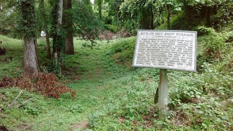
| Near Grand Gulf Road, 1.8 miles north of Frazier Road when traveling north. |
| Near Grand Gulf Road south of River Road. |
| Near Grand Gulf Road at River Road. |
| Near Grand Gulf Road, 0.1 miles River Road. |
| On Grand Gulf Road, 1.1 miles north of Frazier Road, on the left when traveling north. |
| Near Grand Gulf Road, 0.1 miles north of River Road. |
| Near Grand Gulf Road at River Road. |
| Near Grand Gulf Road, 1.8 miles north of Frazier Road when traveling north. |
| On Old Port Gibson Road (State Highway 462) 0.5 miles south of Moulder Road, on the right when traveling north. |
| Near Natchez Trace Parkway (at milepost 54.8). |
| On ASU Drive east of Alcorn Avenue, on the right when traveling east. |
| On Church Street (U.S. 61) south of Carroll Street, on the right when traveling south. |
| On Walnut Street at Farmer Street, on the right when traveling east on Walnut Street. |
| On Shaifer Road, 1.5 miles west of Bessie Weathers Road, on the right when traveling west. |
| Near Shaifer Road, 1.5 miles west of Bessie Weathers Road, on the right when traveling west. |
| On Main/Market Street at Carroll Street/Rodney Road, on the right when traveling south on Main/Market Street. |
| On Shaifer Road, 1.5 miles west of Bessie Weathers Road, on the left when traveling west. |
| On Shaifer Road, 0.5 miles west of Bessie Weathers Road, on the left when traveling west. |
| On Bessie Weathers Road, 0.3 miles west of Rodney Road, on the left when traveling west. |
| On Rodney Road west of Carroll Street, on the right when traveling west. |
| On Rodney Road, 4.2 miles west of Church Street (U.S. 61), on the right when traveling west. |
| On Cemetery Drive east of East Greenwood Street when traveling east. |
| Near Church Street south of Horton Drive, on the right when traveling north. |
| Near Shaifer Road, 1.5 miles west of Bessie Weathers Road, on the right when traveling west. |
| On Old Port Gibson Road (Mississippi Route 462) at Old U.S. 61, on the left when traveling north on Old Port Gibson Road. |
| Near Shaifer Road, 1.5 miles west of Bessie Weathers Road, on the right when traveling west. |
| On Old Port Gibson Road at Old U.S. 61, on the left when traveling north on Old Port Gibson Road. |
| On Church Street (U.S. 61) north of Carroll Street, on the right when traveling north. |
| On Shaifer Road, 0.5 miles west of Bessie Weathers Road, on the left when traveling west. |
| On Shaifer Road, 0.5 miles west of Bessie Weathers Road, on the left when traveling west. |
| Near Shaifer Road, 1.5 miles west of Bessie Weathers Road, on the right when traveling west. |
| On Grand Gulf Road at U.S. 61, on the right when traveling east on Grand Gulf Road. |
| On Old Port Gibson Road at Willow Road, on the right when traveling north on Old Port Gibson Road. |
| On Rodney Road west of Flower Street, on the right when traveling west. |
| Near Shaifer Road, 1.5 miles west of Bessie Weathers Road, on the right when traveling west. |
| On Ingleside Karnac Ferry Road at Shiloh Road, on the right when traveling west on Ingleside Karnac Ferry Road. |
| Near Shaifer Road, 1.5 miles west of Bessie Weathers Road, on the right when traveling west. |
| On Church Street (U.S. 61) south of Horton Drive, on the right when traveling north. |
| Near Rodney Road (State Highway 552) 1.3 miles north of Rodney Westside Road, on the right when traveling north. |
| On Gunn Drive (U.S. 11) at Old Mill Creek Road, on the right when traveling north on Gunn Drive. |
| On S. Archusa Avenue (State Highway 145) at Church Street, on the right when traveling north on S. Archusa Avenue. |
| On Mississippi Route 50 west of Hillside Drive, on the right when traveling west. |
| On State Highway 45, on the right when traveling north. |
| On U.S. 61, 0.3 miles south of Old Pumping Station Road, on the right when traveling north. |
| On 2nd Street at Church Street, on the left when traveling north on 2nd Street. |
| On 2nd Street at Church Street, on the left when traveling north on 2nd Street. |
| On Caldwell Drive (U.S. 51) at West Gallatin Street, in the median on Caldwell Drive. |
| On U.S. 49 at State Route 590, in the median on U.S. 49. |
| On North Main Street at Eaton Street, on the right when traveling south on North Main Street. |
| Near River Street, 0.1 miles east of McLeod Avenue, on the right. |
| On Main Street (Mississippi Route 63/57) at Lafayette Avenue, on the right when traveling west on Main Street. |
| On Loop State Highway 333 at E J Henry Road, on the right when traveling north on State Highway 333. |
| On College Boulevard east of South Line Street, on the right when traveling east. |
| On Dr Martin Luther King Jr Boulevard at Sunset Drive (State Route 8), on the right when traveling north on Dr Martin Luther King Jr Boulevard. |
| On South Main Street at 1st Street, on the right when traveling south on South Main Street. |
| On 2nd Street north of Kershaw Street, on the left when traveling north. |
| On Springhill Road, 0.2 miles east of Sunset Drive (State Route 8), on the right when traveling east. |
| On Cemetery Street west of Dr Martin Luther King Jr Boulevard, on the right when traveling west. |
| On Interstate 10 at milepost 2,, 1 mile west of 607 (Mississippi Highway 607), on the right when traveling east. |
| On South Beach Boulevard south of Brown Road. |
| Near Beach Boulevard, 0.2 miles west of Brady Drive, on the right when traveling west. |
| On Beach Boulevard (U.S. 90) at Porter Avenue, on the right when traveling east on Beach Boulevard. |
| On Beach Boulevard (U.S. 90) at Caldwell Avenue, on the right when traveling west on Beach Boulevard. |
| On Bayview Avenue, 0.5 miles Interstate 110, on the right when traveling west. |
| Near Beach Boulevard (U.S. 90) at Porter Avenue. |
| On Jones Park Drive, 0.2 miles east of 25th Avenue, on the right when traveling east. |
| On 23rd Avenue at 19th Street, on the right when traveling south on 23rd Avenue. |
| On Courthouse Road at 16th Street, on the right when traveling south on Courthouse Road. |
| On Jones Park Drive, 0.2 miles east of 25th Avenue. |
| On Bolton-Raymond Road at East Madison Street (Old U.S. 80), on the left when traveling south on Bolton-Raymond Road. |
| On Old Port Gibson Road (Mississippi Route 462) at Cayuga Road, on the right when traveling north on Old Port Gibson Road. |
| On Adams Lane south of State Route 467, on the left when traveling south. |
| On Adams Lane near State Route 467, on the left when traveling south. |
| On Billy Fields Road at D J Johnson Road, on the left when traveling east on Billy Fields Road. |
| On Billy Fields Road at D J Johnson Road, on the left when traveling east on Billy Fields Road. |
| On Adams Lane south of State Route 467, on the left when traveling south. |
| On Champion Hill Road, 0.7 miles west of South Farr Road, on the right when traveling west. |
| On Billy Fields Road at D J Johnson Road, on the left when traveling east on Billy Fields Road. |
| On Adams Lane south of State Route 467, on the left when traveling south. |
| Near West College Street at Jefferson Street. |
| On East Leake Street east of East Street, on the right when traveling east. |
| On East College Street east of Landrum Street, on the left when traveling east. |
| On Adams Lane south of Mississippi Route 467, on the left when traveling south. |
| On Adams Lane near State Route 467, on the left when traveling south. |
| On Adams Lane at Mississippi Route 467, on the left when traveling south on Adams Lane. |
| On Old U.S. 80, 0.5 miles west of Smith Station Road, on the right when traveling east. Reported missing. |
| On Askew Landing Road, 0.5 miles north of Askew Ferry Road when traveling north. |
| Near Champion Hill Road, 0.2 miles west of South Farr Road. |
| On Old Port Gibson Road, 0.2 miles west of Mt. Moriah Road, on the right when traveling east. |
| On Old Port Gibson Road, 0.2 miles north of Learned Road, on the right when traveling north. |
| On Adams Lane south of Mississippi Route 467, on the left when traveling south. |
| On State Highway 467, 0.1 miles west of Hackler Road, on the right when traveling west. |
| On Mount Moriah Road at Smith Station Road on Mount Moriah Road. |
| On Old Port Gibson Road at Middle Road, on the right when traveling north on Old Port Gibson Road. |
| On Adams Lane south of State Route 467, on the left when traveling south. |
| On Adams Lane near State Route 467, on the left when traveling south. |
906 entries matched your criteria. Entries 101 through 200 are listed above.
⊲ Previous 100 —
Next 100 ⊳