In the background of this sign are the huge tailing piles of The Baltic Mine.
This area is part of the old Stringer District and was discovered in 1896 (a year after the famous Yellow Aster Mine in
Randsburg was happened upon) by William . . . — — Map (db m153090) HM
Few local miners still burrow underground, lured by the rich yellow gleam of gold. Most gold now recovered from California’s Rand Mining District is microscopic in size, and so finely dispersed that it is invisible to the naked eye. Rock containing . . . — — Map (db m153105) HM
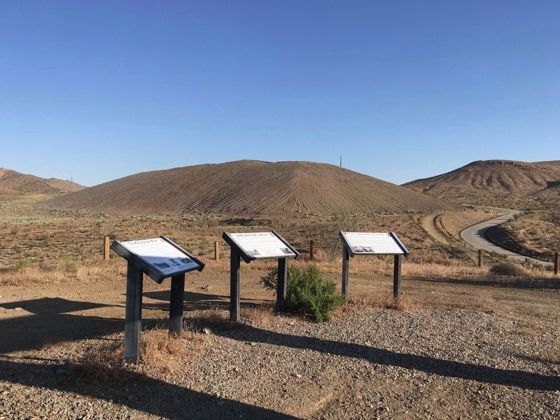
South of this sign (in Red Mountain) is The Kelly Silver Mine. Discovered around 1919, it was the richest Silver Mine in the United States
at the time! Its total output was around $13 Million Dollars (more in today's prices!) When first . . . — — Map (db m153132) HM
North of this sign is the famous Yellow Aster Gold Mine in Randsburg. Three friends, Fredrick Mooers, John Singleton
and Charles Burcham discovered the Yellow Aster Gold Mine in 1895 and so was the beginning of the famous Rand
Mining District! . . . — — Map (db m153138) HM
As Taft’s first 100 years is being celebrated in 2010, let’s look back to see from where we came. Taft got its start when the railroad laid tracks to Taft and beyond. Siding Number Two was where it all started along the tracks in the vicinity of 2nd . . . — — Map (db m54388) HM
The Jameson # 17 oil derrick, which was drilled in 1917 and produced until
the 1980’s, was scheduled to be torn down. In 1974 the local American
Association of University Women and several dedicated people convinced
Jameson Oil Company to donate . . . — — Map (db m88603) HM
This sulphur mine also produced quicksilver and
became one of most noted producers in world.
First worked for sulphur in 1865 and in four
years produced total of 2,000,000 pounds.
Reopened and developed for quicksilver in 1873
and credited with . . . — — Map (db m240310) HM
Located about 10 miles south of here between Lake Pyramid and Castaic Lake lies the Castaic Powerplant. This facility, unlike others along the West Branch, is a pumping-generating plant owned and operated by Los Angeles Department of Water and . . . — — Map (db m196318) HM
On this site, bubbling springs once flowed from their source in a deep water basin which has existed continuously since the Pleistocene Era. Prehistoric animals, Indians, and early Inglewood settlers were attracted here by the pure artesian water. . . . — — Map (db m126337) HM
Water Wagon ca. 1908-1913
This water wagon
was used by George W. Lane
during the construction of
the Los Angeles Aqueduct
through the Antelope Valley.
George moved to the
Antelope Valley in 1908 and
was a mule skinner by . . . — — Map (db m245924) HM
1910 - City of Los Angeles water system purchases land for reservoir in Ascot Hills.
El sistema de agua de la ciudad de Los Ángeles compra terrenos para embalses en Ascot Hills.
1915 - City of Los Angeles water . . . — — Map (db m229925) HM
Built by United States Work Projects Administration, 1940.
second marker:
Exact Center - City of Los Angeles
Point of balance of the plane of the City of Los Angeles, Lat. 34°07'31"N, Long. 118°23'57"W, Alt. 920 ft, . . . — — Map (db m199910) HM
A penniless Irish immigrant boy who rose by the force of his industry, intelligence, integrity and intrepidity to be a sturdy American citizen, a self-educated engineering genius, a whole-hearted humanitarian, the father of the city's water system, . . . — — Map (db m164804) HM
Designer - Walter S. Claberg. Built 1940. Declared 1976, Historic-Cultural Monument No. 162, City of Los Angeles, Cultural Heritage Commission, Cultural Affairs Department. — — Map (db m164812) HM
Presented to the citizens of Los Angeles County in December 1916 by Captain Allan Hancock with a request that the scientific
features be preserved.
First historic reference to the tar pools recorded in the diary of Gaspar de Portolá on August . . . — — Map (db m126874) HM
A replica of one in Cordoba, Spain; was built around 1812-1814 and was part of the water system in San Fernando Mission garden.
100 years later this garden was the property of Mr. Leslie C. Brand, who donated a part of it to Los Angeles for a . . . — — Map (db m130560) HM
The varied habitats of Guashna, which includes the Ballona Wetlands, nurtures the Gabrielino-Tongva people
of the past, present, and future. Discover how this biodiversity contributes to their rich culture and survival.
Ti'at (Plank . . . — — Map (db m216623) HM
Charles and Lotte Melhorn
More than fifty-year residents of the Santa Monica Mountains, Charles and Lotte Mel horn fought for the recognition of the natural areas and viewshed along Mulholland Drive as a precious public resource. . . . — — Map (db m164714) HM
Where Does Your Water Come From?
Discover the history of water in Los Angeles and learn how the future of water is our future.
The Los Angeles River
About 15,000 years ago, people began moving into the Los Angeles Basin . . . — — Map (db m188162) HM
Silver Lake & Ivanhoe Reservoirs.
Engineer - William Mulholland.
Built 1906. Declared 1989,
Historic-Cultural
Monument No. 422,
City of Los Angeles,
Cultural Heritage Commission,
Cultural Affairs Department.
Donated by
the Silver . . . — — Map (db m231685) HM
The Native Americans who inhabited
the Big Tujunga Wash were called the
Tongva. They used many local native
plants for food, shelter, medicine,
and in their ceremonies.
Can you find these plants in the garden?
Many of these plants . . . — — Map (db m207433) HM
The Verdugo Hills and Tujunga Wash
hold a surprising wealth of biodiversity.
When you look out at these areas, what do you see?
You might be looking at plants that grow in
the San Gabriel Mountains but not in the Santa Monica
Mountains — and . . . — — Map (db m198564) HM
This is the terminus of the Los Angeles-Owens River Aqueduct, which brings water 338 miles from the eastern slopes of the Sierra Nevada to the City of Los Angeles. Begun in 1905, the great aqueduct was completed November 5, 1913. The Mono Craters . . . — — Map (db m164815) HM
Settling Basin built by San Fernando Mission Indians about 1800. Mission water supply came from these wells.
panel 2:
Original water supply system, San Fernando Mission, circa 1800. Declared Historic Cultural Monument No. 50 . . . — — Map (db m111907) HM
On November 5, 1913, 40,000 people gathered here to witness the dedication of the Los Angeles - Owens River Aqueduct. The terminus of a 233-mile long engineering marvel, the Cascades were the site of William Mulholland‘s famous speech: “There it is, . . . — — Map (db m165409) HM
Malibu Potteries was located on the beach about a
half mile beyond the pier and used clay from the ranch.
Mrs. Rindge, trying to supplement her income following a disastrous
legal battle, was looking for oil on her property but found . . . — — Map (db m206576) HM
This marker locates the site near which the Indians and early California settlers came to obtain their salt, which at many times was more valuable than gold. — — Map (db m50973) HM
In 1839, the Mexican Government granted to
Antonio del Valle some 48,000 acres of
The Santa Clarita Valley known as the Del Valle Rancho.
On March 9, 1842, Francisco Lopez y Arbello, the brother-in-law of Antonio del Valle, visited the . . . — — Map (db m20112) HM
In Placeritas Canyon, March 1842, Francisco Lopez y Arballo, while gathering wild onions from around an old oak, discovered gold particles clinging to the roots of the bulbs. It is estimated that $80,000 in gold was discovered as a result of this . . . — — Map (db m154258) HM
In Placeritas Canyon, March 1842, Francisco Lopez y Arballo, while gathering wild onions from around an old oak, discovered gold particles clinging to the roots of the bulbs. It is estimated that $80,000 in gold was discovered as a result of this . . . — — Map (db m154260) HM
Francisco Lopez made California’s first authenticated gold discovery on March 9, 1842. While gathering wild onions near an oak tree in Placerita Canyon he found gold particles clinging to the roots of the bulbs. The San Fernando placers and nearby . . . — — Map (db m154261) HM
The Southern California oil industry began in the Newhall area in the late nineteenth century. Remnants of the industry on display include an oil pump, oil production packer, rotary rock drill bit, and tool rack which were all manufactured in . . . — — Map (db m180432) HM
In 1875 the Star Oil Company, one of the predecessors of the Standard Oil Company of California, drilled its first Pico Canyon well, which yielded about one hundred barrels per day. The discovery resulted in the erection of the first commercial oil . . . — — Map (db m145418) HM
California's first oil refinery operated on a commercial scale, erected 1876. Restored by the Standard Oil Company of California in 1930 as a memorial to D. G. Scofield and his pioneer associates of the California Star Oil Works company, a . . . — — Map (db m165742) HM
Walker Ranch is located at the eastern end of Placerita Canyon Natural Area and was purchased by the California Parks Department in the late 1950's. It was the home of Frank Walker and his family beginning in the mid 1920's. The Walker's . . . — — Map (db m180445) HM
What you are smelling is a pool of bubbling white oil. This very rare geologic feature of translucent petroleum has been filtered by nature. This special resource originates from deep within the earth in the Placerita Schist basement complex . . . — — Map (db m243727) HM
Mentryville, named after Charles Alexander Mentry, who drilled California's first successful commercial oil well in 1876, was one of the first oil towns in the state. Mentry's restored home, barn and Felton School remain on the site where the . . . — — Map (db m165661) HM
In Placeritas Canyon, March 1842, Francisco Lopez y Arballo, while gathering wild onions from around an old oak, discovered gold particles clinging to the roots of the bulbs. It is estimated that $80,000 in gold was discovered as a result of this . . . — — Map (db m154259) HM
In 1920, Signal Hill was a grassy dome dotted with seasonal farms. Though there was interest, opinions among oil company geologists about the prospects for oil here were mixed. A well near the corner of Wardlow and Atlantic Streets, drilled to 3,449 . . . — — Map (db m100450) HM
This eight-ton, short-wheel base, wood burning locomotive, built by the H. K. Porter Co. of Pittsburg, Pennsylvania, was delivered to the Merced Mining Company of Coulterville in 1897. All of "Billy’s" active life was spent hauling gold-bearing . . . — — Map (db m5956) HM
The California State Geological Society started collecting mineral specimens in 1865. In 1880, the California State Mining Bureau was founded. This plaque is dedicated to the miners and founders for their foresight. Todays collection displays . . . — — Map (db m46845) HM
This site is part of the 44,000 arce [sic] Las Mariposa Land Grant purchased in 1847 by Colonel John C. Fremont for $3,000. In 1850 La Mineta, a mining camp, was established here by Sonoran miners. La Mineta was changed to Princeton in 1854 for the . . . — — Map (db m46407) HM
The Mount Ophir Mine is one of the most successful and conspicuous of the Mother Lode mines in Mariposa County. It includes the Mount Ophir Mint which was the first of such mints to turn gold into coins. The Mint was built by John Moffitt, who had . . . — — Map (db m46381) HM
Through the collective recognition of the Community of Nations
expressed within the Principles of the
Convention concerning Protection of the World
Cultural and Natural Heritage, Yosemite National Park
has been designated a
World Heritage . . . — — Map (db m235569) HM
Native Americans used these springs for thousands of years before Frank Marble "discovered" them in 1848. William Day established the resort here in 1854. Ukiah Vichy represents one of the oldest continuously operating mineral springs resorts in . . . — — Map (db m78163) HM
In October of 1863, rich silver discoveries led to the formation of Montgomery Mining District and Montgomery City which, although short lived, supported a newspaper, The Pioneer. There were no continuous veins found and mining operations . . . — — Map (db m3492) HM
The mine was discovered in 1903 and was owned and operated by various owners until 1939 when it ceased operations.
The total amount of bullion taken from this site is unknown. However, one owner did ship $12,000.00 in 1912. The gold vein was . . . — — Map (db m50083) HM
Near this site was located June Lake’s first and only commercial mining venture organized in 1924. The district was composed of ten mines or claims, which produced high-grade ore of zinc, lead and silver.
During its heyday, the mines employed . . . — — Map (db m50033) HM
One mile west is the site of Bennettville. Originally located as the Sheepherder Mine in 1874 by William Bruskey and relocated by Thomas Bennett, President of the Great Sierra Consolidated Silver Mining Company as the Tioga Mines. The claim and . . . — — Map (db m49968) HM
To meet the ever increasing demand for lumber and cord wood the Bodie Railway and Lumber Company was formed in February 1881. Timber was harvested from various tracts to the south. It was milled at this site and then shipped to Bodie on the railroad . . . — — Map (db m49977) HM
Home of the May Lundy Mine. Site of W. J. Lundy sawmill supplying lumber to Bodie in 1878. Organized as the Homer Mining District in 1879 by Wasson, Nye and Homer. Plagued by snowslides and partially destroyed by fire in 1886, Lundy's page of Mono . . . — — Map (db m37583) HM
On this site, opposite colorful Mineral Hill (now known as Red Mountain) where the Mammoth mines are located, stood the town of Mammoth City. In this gulch during 1878-79 sprouted a mining camp of perhaps a thousand people. Mammoth City – the . . . — — Map (db m50043) HM
Mammoth’s famous gold mining boom began in 1877 and ended abruptly in 1881 when the Mammoth Mining Company’s property was sold at a sheriff’s sale. Miners have continued to prospect and mine Red Mountain on a small scale to this day. In 1927 the . . . — — Map (db m59473) HM
Named for Arthur R. Wilson, who founded Granite Rock Company on February 14, 1900, this quarry has been the heart of Granite Rock's business since the beginning. In more than a century of continuous operation, the quarry has seen destruction from . . . — — Map (db m149110) HM
Around you are the remains of a portion of the U.S. Army’s Fort Ord. In fact, you are standing on what’s left of the parking lot for Stilwell Hall, once an elegant Soldier’s Club.
The Army base, closed in 1994, and surrounding land was eventually . . . — — Map (db m68880) HM
This Chestnut tree, form the lawn of the White House, was originally planted in front of Colton Hall on September 20, 1966 by First Lady, Lady Bird Johnson. It was later replanted in Friendly Plaza. — — Map (db m63327) HM
This small but mighty steam well was built back in the 1930s. It served a variety of purposes, but was especially useful when it came to cooking. Cooking with steam is a practice that goes back thousands of years. This particular steam well was used . . . — — Map (db m121732) HM
This intersection of the Phoenix Mining claim, patented November 15, 1861 and the Washington Mining claim, patented December 20, 1862 once was inhabited by a community of several hundred people and gave the appearance of a small town.
The . . . — — Map (db m200310) HM
This plaque marks the site of
the Empire Mine,
noted for its continuous operation
1850-1957,
producing over $120,000,000 in gold. — — Map (db m239874) HM
This stamp mill was manufactured at the Miners Foundry and Supply Co., Nevada City, California in the late 1800’s. After a circuitous journey, it has returned to its place of crushing hard rock at the English Mine and then the New Salmon Mine, owned . . . — — Map (db m12862) HM
This monitor was used at the now closed La Grange Mine near Weaverville in Trinity County and is similar in size to those used at the Malakoff to wash down the gravel hillsides.
It was obtained through a joint effort of E Clampus Vitus, . . . — — Map (db m861) HM
This original brick building in continuous usage as a foundry for over 110 years. Famous Pelton Waterwheel developed and manufactured here in 1878. Ingenious double-cupped bucket designed by Lester A. Pelton of Camptonville and Nevada City. It . . . — — Map (db m12863) HM
The 7874 foot tunnel, engineered by Hamilton Smith Jr. from the Malakoff Diggings, has its outlet in Humbug Creek 1 mile up stream. In the late 1870’s, tailings from the Malakoff Diggings filled the river channel to a depth of 60 feet. Remnants of . . . — — Map (db m45946) HM
Boca's Railroad Roots
From 1866-68, the Central Pacific Railroad was laying tracks over the Sierra Nevada working to complete its portion of the nation's first transcontinental railroad. The railroad's Construction Camp 17, here, at the . . . — — Map (db m62048) HM
A natural glacier formation, or the work of an unknown tribe as a form of altar. It’s exact origin will never be known. The perfectly balanced stone until recently would rock at the touch of a finger.
C.F. McGlashan built the original tower in . . . — — Map (db m23527) HM
One mile north of here were the towns of Alpha and Omega, named by gold miners in the early 1850’s. The tremendous hydraulic diggings, visible from near this point, engulfed most of the original townsites. Alpha was the birthplace of famed opera . . . — — Map (db m45152) HM
The course of oil production was changed in 1899 when the Olinda area became the first site in California to use the technique of drilling with the hole full of water. Having been developed as a source of fuel oil for for the Santa Fe Railroad, . . . — — Map (db m50337) HM
On this site, Edward L. Doheny drilled the first oil well in the Olinda field in 1897. Olinda #1, drilled to 806 feet, pumped about 50 barrels per day (bpd). By 1898, ten wells were drilled, some producing up to 100 bpd. In 1899, the Santa Fe . . . — — Map (db m238742) HM
William Pereira's Master Plan envisioned for Irvine an entirely
different approach to living a series of self-contained villages
providing a wide diversity of housing types along with parks,
trails, schools and retail centers. The City's . . . — — Map (db m244148) HM
This site is on the northern edge of the West Coyote oil field, one of the largest fields in the Los Angeles Basin. This field produced about 250 million barrels of oil from sandstone at a depth of about 3,000'. West Coyote was active from 1903 to . . . — — Map (db m58909) HM
This lined section of the Cajon Canal (Circa 1923) helped bring water from the Santa Ana River to Rancho Santa Ana and several northern Orange County communities during the early development of the county. Construction of the original, unlined . . . — — Map (db m164929) HM
The Cajon Canal is one of the oldest and most significant historical resources in the city of Yorba Linda. During the late 19th and early 20th centuries, the canal was instrumental in facilitating the early growth and development of north Orange . . . — — Map (db m164926) HM
The Gold Bug stamp mill was built in the 1880s in the Tahoe National Forest. The Gold Bug Mine, one of many smaller hardrock mines located throughout the Mother Lode, was established to protect the ownership of the main quartz vein of the Eagle Bird . . . — — Map (db m94180) HM
The quartz rock on site here at the Auburn depot came from “The Marquerite (sic) Mine” of Auburn Donated by Don Robinson Don Robinson Sand & Gravel — — Map (db m81625) HM
History
At one time canals laced the Sierra foothills and the mountains above. Many still exist as do the reservoirs the canals linked. Originally the canals were used to funnel water to hydraulic and pacer mining. The system was well in . . . — — Map (db m129768) HM
With prospects so cheering, located in a section of country abounding in timber and water, with a climate so healthy, who can foretell the future of Meadow Lake? Here the puff of the iron locomotive will soon be heard as it speeds onward to . . . — — Map (db m129472) HM
Hydraulic mining shaped the reddish cliffs along this highway corridor. From the 1850’s until 1885 jets of water were used to break down gold-laden gravel and to wash the material through gold separating devises called sluices. This practice was . . . — — Map (db m23666) HM
(Original marker, which was stolen in 2012. See Photo #1)
Founded in 1849 as 'The Spanish Corral,' Area proved so rich that Biblical name of Ophir adopted in 1850. Most populous town in Placer County in 1852, polling 500 votes. Almost . . . — — Map (db m11922) HM
Founded June 1851 - Commonly called 'Virginia.' Over 2,000 miners worked rich deposits. Captain John Brislow built California's first railroad, 1852, to carry pay to Auburn Ravine, a distance of one mile. Site of Philip Armour's and George Aldrich's . . . — — Map (db m10973) HM
Business and tourists
Outlet point is the location where the waters of Lake Tahoe find their only release from the lake basin along the Lower Truckee River at Tahoe City
The sheltered inlet of the Truckee River mouth provided safe harbor . . . — — Map (db m34932) HM
In the early 1930’s Clinton C. Clarke offered to the world his vision of a continuous trail stretching from Canada through 3 states to Mexico. “Along the summit divide of the mountain ranges traversing the best scenic areas and maintaining an . . . — — Map (db m66157) HM
Along the Pioneer Trail lies Jamison City and Mine. Large producer, famous for its 52-pound nugget; Eureka Mill and Mine yielding $17 millions to Cornish miners and others. Johnstown, now Johnsville, well preserved '49 town. — — Map (db m154371) HM
These soda springs were used by the Maidu Indians since time immemorial. Gold mines were discovered here in 1850. Andrew Miller first saw the valley in 1849 and returned in 1850 to homestead, raise a family, build a store and hotel. Many homes and . . . — — Map (db m66117) HM
Waters from this spring have been used for generations by the Mountain Maidu and local ranchers. The ground water here flows naturally through calcium carbonate rocks, creating a characteristic fizz or soda taste. Such waters have long been . . . — — Map (db m66118) HM
John Vardanega, first owner of Mt. Tomba Inn, (1933-1944) designed and built this cement tank with the help of the CCC on or about 1938 for water supply in the immediate vicinity. — — Map (db m56612) HM
Henry A. Engels settled at the Superior Mine in 1880. Discovered the Engels Mine in 1883. The first all flotation copper mill in the U.S. was completed in 1914. The Indian Valley Railroad began in 1917 and company town Engelmine was established. The . . . — — Map (db m66078) HM
Gold was found in 1851 and a wild mining town was born with a dance hall, feed store, livery, blacksmith, post office, grocery, rooming houses and a hotel with solar heated showers. The canyon’s mines included the Sunnyside, Lucky Chance, White . . . — — Map (db m56684) HM
Port Wine had its beginning in early 1850. By 1851 surface mining had declined, but hydraulic mining instilled new life into the area. Port Wine was described as a religious and sober town in 1863. There was a post office and Wells Fargo Express . . . — — Map (db m56652) HM
Millions in gold were taken from the Spanish Creek Mines between 1851 and 1905. To supply the miners the small town of New Boston sprang up at the mouth of Wahponsey Creek. Complete with a toll gate, apple orchard and gardens, in the 1870’s it was . . . — — Map (db m56530) HM
It seems to me that the strangest and wonder of existence are emphasized here, in the desert, by the comparative sparcity of the flora and fauna: life not crowded upon life…with a generous gift of space for each herb and bush and tree, each stem . . . — — Map (db m92513) HM
The Iron Chief, Black Eagle and other mines produced gold at Eagle Mountain between 1881 and 1900 from ores containing as much as 54 per cent iron. L.S. Barnes secured options and sold the mines to Southern Pacific Railroad in 1909. Kaiser Steel . . . — — Map (db m124247) HM
Early in 1848 W. Sidney S. Willis (ES) and Wilford Hudson, members of the Mormon Battalion, set out from Sutter’s Fort to hunt deer. Stopping on the South Fork of the American River, they found gold. They told their story on returning to the Fort . . . — — Map (db m17637) HM
When rain falls on a vernal pool grassland, some water sinks into the ground and the rest flows into streams or into depressions in the landscape. The water cannot move deeper into the ground in a vernal pool grassland because a hardpan blocks its . . . — — Map (db m52708) HM
(left panel)
Michigan Bar
Gold was discovered on the Cosumnes River in 1849 by two men from Michigan in the vicinity of the historic Nisenan settlement of Palamul. In the 1850s the town of Michigan Bar was the largest in Cosumnes . . . — — Map (db m2037) HM
Though they comprise less than 9 percent of the 270 million acres of public lands administered by the U.S. Bureau of Land Management, riparian and wetland areas, such as Salt Creek, are considered the most productive resources found on public lands. . . . — — Map (db m72926) HM
This area was the focus of both prehistoric...American activities and historic...mining. The rich environment provides...for numerous species.
Please...protect these natural and c... This ACEC is open for hiking and non...d vehicle use. . . . — — Map (db m72928) HM
The stamp mill was an early machine
used to crush gold bearing ore.
Many miners were employed at the
large scale mines and Big Bear
was one of the many mining towns.
Gold Mountain and Rose mines were
the largest, having 40 stamps each
on . . . — — Map (db m197824) HM
Southern California's largest gold rush followed the discovery of rich placer deposits by William F. Holcomb and Ben Choteau on May 4, 1860. Miners rushed to the valley and established boom towns. Belleville, the largest, rivaled San Bernardino in . . . — — Map (db m50702) HM
Named for William Francis "Bill" Holcomb, pioneer prospector who, in this valley discovered Southern California's richest gold field - May 5, 1860. — — Map (db m50610) HM
1558 entries matched your criteria. Entries 201 through 300 are listed above. ⊲ Previous 100 — Next 100 ⊳