9535 entries match your criteria. Entries 101 through 200 are listed.⊲ Previous 100 — Next 100 ⊳
Roads & Vehicles Topic
By Mark Hilton
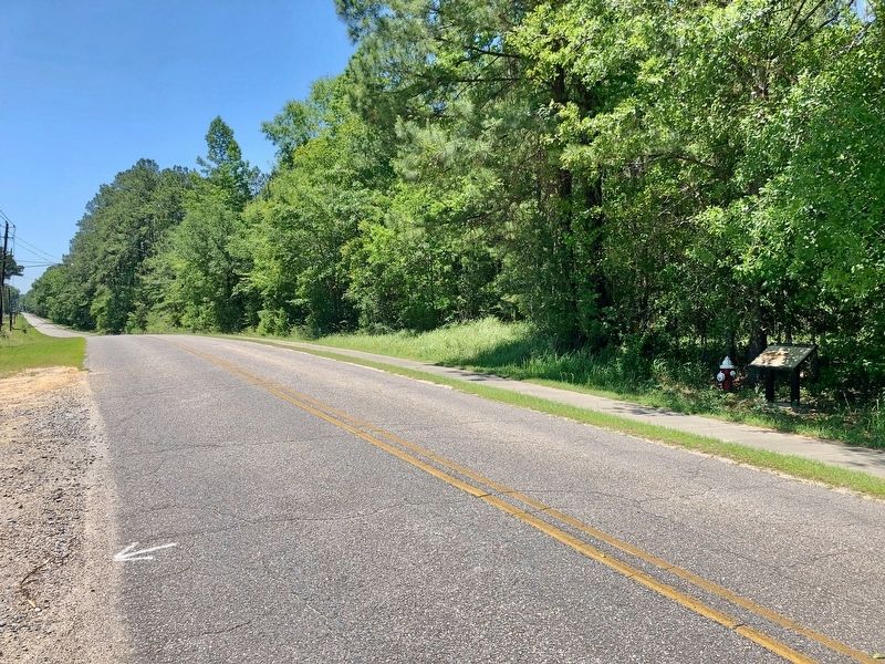
Looking west on Old Military Road with the marker on right.
| 101 ► Alabama, Mobile County, Mt. Vernon — 4 — Old Military Road and Old Federal Road — Mount Vernon History Trail — |
| On Old Military Road, 0.1 miles west of Shepard Lake Road East, on the right when traveling west. | |||
| 102 ► Alabama, Monroe County, Burnt Corn — Old Federal Road — Burnt Corn — |
| On Old Federal Road (County Road 5) at County Road 15, on the right when traveling south on Old Federal Road. | |||
| 103 ► Alabama, Monroe County, Perdue Hill — Claiborne — |
| On U.S. 84 at Old Fort Claiborne Road, on the right when traveling west on U.S. 84. | |||
| 104 ► Alabama, Monroe County, Shackleville — Old Federal Road — |
| On Wright Street (County Road 38) 2.6 miles west of South Butler Springs Road (County Road 7), on the right when traveling west. | |||
| 105 ► Alabama, Montgomery County, Maxwell Air Force Base Gunter Annex — Freightliner M-915a3 Tractor Truck — |
| On Avenue D, on the right when traveling south. | |||
| 106 ► Alabama, Montgomery County, Montgomery — Dexter Avenue King Memorial Baptist Church — Organized 1877 — |
| On Dexter Avenue at S Decatur Street, on the left when traveling west on Dexter Avenue. | |||
| 107 ► Alabama, Montgomery County, Montgomery — 5 — Highway Construction Destroys Historic Black Neighborhoods — The Cloverleaf beneath Interstates 65 and 85 — Selma to Montgomery National Historic Trail — |
| On West Jeff Davis Avenue at South Holt Street, on the right when traveling east on West Jeff Davis Avenue. | |||
| 108 ► Alabama, Montgomery County, Montgomery — Montgomery Racial Segregation on Buses — |
| Near Caroline Street south of Clayton Street, on the left when traveling south. | |||
| 109 ► Alabama, Montgomery County, Montgomery — Teague Road — |
| On Hyundai Boulevard (County Route 42) at Mobile Highway (U.S. 31), on the right when traveling east on Hyundai Boulevard. | |||
| 110 ► Alabama, Montgomery County, Montgomery — Teague Road — |
| On Hyundai Boulevard (County Road 42) west of Norman Bridge Road (U.S. 331), on the right when traveling west. | |||
| 111 ► Alabama, Montgomery County, Montgomery, Washington Park — The Smiths: A Civil Rights Family — |
| On Second Street west of Tulane Street, on the right when traveling west. | |||
| 112 ► Alabama, Montgomery County, Pintlala — 5 — Federal Road, 1805, — |
| On Mobile Highway (U.S. 31) at Federal Road / West Old Hayneville Road (County Road 24), on the left when traveling north on Mobile Highway. | |||
| 113 ► Alabama, Montgomery County, Pintlala — The Federal Road / Manac's Tavern — |
| On Federal Road at Cloverfield Road (County Route 24), on the right when traveling south on Federal Road. | |||
| 114 ► Alabama, Morgan County, Decatur — 7 — Two Bridges Across The Tennessee River — “A Hard Nut To Crack” — The Battle For Decatur — |
| On Wilson Street Northwest (U.S. 72) at Raiload Street, on the right when traveling west on Wilson Street Northwest. | |||
| 115 ► Alabama, Morgan County, Hartselle — Bethel Road Historical District — |
| On Bethel Road Northeast at Indian Hills Road Northeast, on the right when traveling south on Bethel Road Northeast. | |||
| 116 ► Alabama, Pickens County, Gordo — History of Gordo, Alabama — |
| On North Main Street (Alabama Route 159) at 2nd Avenue Northwest, on the right when traveling north on North Main Street. | |||
| 117 ► Alabama, Pike County, Troy — The Great Pensacola Trading Path — |
| On U.S. 231, 0.3 miles north of Monticello Drive, on the left when traveling north. | |||
| 118 ► Alabama, Pike County, Troy — Three Notch Road — |
| On South 3 Notch Street (U.S. 29) at East Church Street, on the right when traveling north on South 3 Notch Street. | |||
| 119 ► Alabama, Russell County, Seale — Indian Trail — |
| On Old Seale Road/Magnolia Greene Hwy (County Road 137 at milepost 102), 0.2 miles west of U.S. 431, on the right when traveling south. | |||
| 120 ► Alabama, Russell County, Seale — The Old Federal Road — Russell County — |
| On Alabama Route 169 just west of U.S. 431, on the right when traveling west. | |||
| 121 ► Alabama, Shelby County, Vandiver — Sidney Word Lee — (1864-1944) — |
| On Alabama Route 25 north of Lake View Circle, on the right when traveling north. | |||
| 122 ► Alabama, Talladega County, Talladega — Jackson Trace — 1813 – 1918 — |
| On Alabama Route 21 north of Mardisville Road (County Road 241), on the right when traveling north. | |||
| 123 ► Alabama, Tuscaloosa County, Tuscaloosa — Willys Jeep — |
| On McFarland Boulevard East (U.S. 82), on the right when traveling north. | |||
| 124 ► Alabama, Wilcox County, Catherine — Postal Routes of 1820 — |
| On State Highway 28 at State Highway 162, on the right when traveling west on State Highway 28. | |||
| 125 ► Alabama, Winston County, Haleyville — The Byler Road — |
| On 20th Street west of 10th Avenue, on the left when traveling west. | |||
| 126 ► Alabama, Winston County, Natural Bridge — Byler Road / History of Natural Bridge — |
| On County Road 9 north of U.S. 278, on the right when traveling north. | |||
| 127 ► Alaska, Fairbanks North Star Borough, Fairbanks — Cushman Street — |
| On Cushman Street near 4th Avenue. | |||
| 128 ► Alaska, Ketchikan Gateway Borough, Ketchikan — From Planks to Pavement — North Front Street's Early Views — |
| On Front Street at Water Street, on the right when traveling south on Front Street. | |||
| 129 ► Alaska, Ketchikan Gateway Borough, Ketchikan — Keeping the Catch! — |
| On Front Street at Water Street, on the right when traveling south on Front Street. | |||
| 130 ► Alaska, Matanuska-Susitna Borough, Wasilla — Balto — Iditarod Trail Sled Dog Race — |
| On South Knik-Goose Bay Rd, on the right when traveling north. | |||
| 131 ► Alaska, Matanuska-Susitna Borough, Wasilla — Father of the Iditarod — Joe Redington, Sr. — Iditarod Trail Race Headquarters — |
| On Knik-Goose Bay Road, on the right when traveling north. | |||
| 132 ► Alaska, Matanuska-Susitna Borough, Wasilla — Iditarod Cabin — In loving memory of Dean H. Christopherson — |
| 133 ► Alaska, Southeast Fairbanks Census Area, Delta Junction — Delta Junction, Alaska — Northern Terminus of the "Alcan" Highway — |
| On Alaska Highway (at milepost 1,422) at Richardson Highway, on the left when traveling north on Alaska Highway. | |||
| 134 ► Alaska, Southeast Fairbanks Census Area, Tok — Taylor Highway — |
| On Taylor Highway (Alaska Route 6) at Alaska Highway (Alaska Highway 2) on Taylor Highway. | |||
| 135 ► Alaska, Valdez-Cordova Census Area, Valdez — Goat Trail — |
| On Richardson Highway (Alaska Route 4 at milepost 13.9). | |||
| 136 ► Alaska, Valdez-Cordova Census Area, Valdez — Horse and Sled Trail — |
| On Richardson Highway (Alaska Route 4 at milepost 15.3). | |||
| 137 ► Arizona, Apache County, Adamana — Santa Fe Railroad — Petrified Forest National Park — National Park Service, U.S. Department of the Interior — |
| Near Petrified Forest Road, on the right when traveling north. | |||
| 138 ► Arizona, Apache County, Lupton — Arizona Highways — Sunset Point Rest Area — |
| Near Interstate 40 at milepost 359. | |||
| 139 ► Arizona, Apache County, Petrified Forest National Park — Highway of Dreams — |
| On Petrified Forest Road at Old U.S. Route 66, on the right when traveling south on Petrified Forest Road. | |||
| 140 ► Arizona, Apache County, Petrified Forest National Park — Route 66 |
| On Petrified Forest Road, on the left when traveling north. Reported missing. | |||
| 141 ► Arizona, Apache County, Springerville — 28 — Madonna of the Trail — |
| On East Main Street, on the left when traveling west. | |||
| 142 ► Arizona, Cochise County, Bisbee — Mule Pass — |
| On North Old Divide Road, 0.5 miles east of Arizona Route 80, on the right when traveling east. | |||
| 143 ► Arizona, Cochise County, Bowie — Apache Pass — |
| On Apache Pass Road, 6 miles east of Arizona Route 181, on the left when traveling east. | |||
| 144 ► Arizona, Cochise County, Bowie — The Butterfield Overland Mail — |
| Near Fort Bowie Trail, 0.6 miles south of Apache Pass Road. | |||
| 145 ► Arizona, Cochise County, Bowie — The Stage Station Ruin — |
| Near Fort Bowie Trail, 0.6 miles south of Apache Pass Road. | |||
| 146 ► Arizona, Cochise County, San Simon — The San Simon Rest Area - Percy Jones, Jr. — |
| Near Interstate 10 at milepost 388. | |||
| 147 ► Arizona, Cochise County, San Simon — The San Simon Rest Area - Percy Jones, Jr. — |
| 148 ► Arizona, Cochise County, Tombstone — 37 — Million Dollar Stope — |
| On Toughnut Street east of 5th Street, on the left when traveling west. | |||
| 149 ► Arizona, Cochise County, Willcox — Railroad Avenue — |
| On East Maley Street (Arizona Route 186) at South Railroad Avenue, on the left when traveling east on East Maley Street. | |||
| 150 ► Arizona, Coconino County, Flagstaff — Beale Road — Historic Site — |
| On U.S. 180, on the right when traveling north. | |||
| 151 ► Arizona, Coconino County, Flagstaff — Beale Wagon Road — 1857 - 1882 — |
| On North Gemini Drive, on the right when traveling north. | |||
| 152 ► Arizona, Coconino County, Flagstaff — Museum Club — Route 66 Roadside Attraction — Flagstaff, Arizona — |
| On East Route 66 (U.S. 180) west of Fanning Drive, on the right when traveling west. | |||
| 153 ► Arizona, Coconino County, Flagstaff — The Old Tractor |
| On South Milton Road (Business Interstate 40) at West Tucson Avenue, on the right when traveling north on South Milton Road. Reported missing. | |||
| 154 ► Arizona, Coconino County, Grand Canyon National Park — A Trail, a Camp, and a "Hermit" — |
| Near Hermit Road at West Rim Trail. | |||
| 155 ► Arizona, Coconino County, Grand Canyon National Park — Bright Angel Trail — |
| 156 ► Arizona, Coconino County, Grand Canyon National Park — Down Memory Lane — Grand Canyon — National Park Service, U.S. Department of the Interior — |
| Near Hermit Road at West Rim Trail. | |||
| 157 ► Arizona, Coconino County, Grand Canyon National Park — Grandview, 1898 — |
| 158 ► Arizona, Coconino County, Grand Canyon National Park — Hermit Camp — Grand Canyon — National Park Service, U.S. Department of the Interior — |
| Near Hermit Road at West Rim Trail. | |||
| 159 ► Arizona, Coconino County, Grand Canyon National Park — Hermit Road — Grand Canyon — National Park Service, U.S. Department of the Interior — |
| Near Hermit Road at Village Loop Drive, on the right when traveling west. | |||
| 160 ► Arizona, Coconino County, Grand Canyon National Park — Kaibab Trail Suspension Bridge — National Historic Civil Engineering Landmark — |
| On Rim Trail north of Yavapai Point, on the right when traveling west. | |||
| 161 ► Arizona, Coconino County, Grand Canyon National Park — Mules and the Canyon — |
| 162 ► Arizona, Coconino County, Grand Canyon National Park — Tusayan Ruin Trail — |
| 163 ► Arizona, Coconino County, Happy Jack — General Crook Trail — |
| On Rim Road (Forest Road 300), 1.2 miles east of Arizona Route 87, on the left when traveling east. | |||
| 164 ► Arizona, Coconino County, Happy Jack — General Crook Trail — |
| On Rim Road (Forest Road 300), 8.4 miles east of Arizona Route 87, on the left when traveling east. | |||
| 165 ► Arizona, Coconino County, Kaibab — 119 — The Historic Dixie-Long Valley, Utah Pioneer Trail — |
| On Arizona Route 389 at Cane Beds road, on the right when traveling north on State Route 389. | |||
| 166 ► Arizona, Coconino County, Marble Canyon — 350 — Lee's Ferry — |
| Near U.S. 89A at milepost 539. | |||
| 167 ► Arizona, Coconino County, Marble Canyon — Navajo Bridge — |
| Near U.S. 89A at milepost 537. | |||
| 168 ► Arizona, Coconino County, Marble Canyon — Navajo Bridge — |
| Near U.S. 89A at milepost 538. | |||
| 169 ► Arizona, Coconino County, Marble Canyon — Navajo Bridge Erection Toggle Screw / Navajo Bridge — State of Arizona — 1927 / 1928 — |
| Near U.S. 89A at milepost 537. | |||
| 170 ► Arizona, Coconino County, Sedona — Carl Richards' Garage — |
| Near Alternate Arizona Route 89, 0.1 miles north of Jordan Road. | |||
| 171 ► Arizona, Coconino County, Williams — Last Town Bypassed By I-40 — |
| On West Route 66 (Route 66), on the left when traveling east. | |||
| 172 ► Arizona, Coconino County, Williams — Route 66 — Gateway to the Grand Canyon — |
| On East Bill Williams Avenue (Old U.S. 66) west of North Pine Street, on the right when traveling west. | |||
| 173 ► Arizona, Coconino County, Winslow — Meteor City Trading Post, Winslow, Arizona — Route 66 Roadside Attraction |
| On Interstate 40 Frontage Road west of Dennison T I, on the left when traveling west. Reported missing. | |||
| 174 ► Arizona, Gila County, Globe — Becker Butte Lookout — |
| On U.S. 60 at milepost 297, on the right when traveling east. | |||
| 175 ► Arizona, Gila County, Globe — El Capitan Pass — |
| On Arizona Route 77 at milepost 162, on the right when traveling north. | |||
| 176 ► Arizona, Gila County, Pine — Camp Verde Arizona to Payson Arizona Mail Trail — |
| On Arizona Route 87, 0.1 miles north of Hardscrabble Mesa Road, on the left when traveling north. | |||
| 177 ► Arizona, Gila County, Roosevelt — Al Sieber — |
| On The Apache Trail (Arizona Route 188 at milepost 245), on the right when traveling north. | |||
| 178 ► Arizona, Graham County, Safford — Army of the West — |
| On U.S. 70 at milepost 347, on the left when traveling east. | |||
| 179 ► Arizona, Greenlee County, Clifton — Black Hills National Back Country Byway — |
| On Black Hills Back Country Byway at San Francisco River Road, on the right when traveling south on Black Hills Back Country Byway. | |||
| 180 ► Arizona, La Paz County, Quartzsite — 060-019 — Tyson's Well — Old Stage Station — |
| On West Main Street (Arizona Route 95), on the right when traveling east. | |||
| 181 ► Arizona, Maricopa County, Apache Junction — Welcome to the Apache Trail Historic Road — |
| On Apache Trail (Route 88 at milepost 241), on the left when traveling east. | |||
| 182 ► Arizona, Mohave County, Kingman — The Powerhouse, Kingman, Arizona — Route 66 Roadside Attraction — |
| On West Andy Devine Avenue (Old U.S. 66) west of North 1st Street, on the left when traveling west. | |||
| 183 ► Arizona, Mohave County, Kingman — Wagon Route — |
| Near Andy Devine Road (Business Interstate 40) near Grandview Avenue. | |||
| 184 ► Arizona, Mohave County, Littlefield — 121 — The Old Spanish Trail — 1829 - 1848 — |
| On County Highway 91 at Old Pioneer Road on County Highway 91. | |||
| 185 ► Arizona, Mohave County, Oatman — Gold Mining Ghost Town, Oatman, Arizona — Route 66 Roadside Attraction — |
| On Oatman Highway (Old U.S. 66) at Rock Hound Hill Road on Oatman Highway. | |||
| 186 ► Arizona, Navajo County, Holbrook — Historic Wagon Road — |
| On Joy Nevin Avenue west of 2nd Street, on the right when traveling west. | |||
| 187 ► Arizona, Navajo County, Joseph City — Jack Rabbit Trading Post, Joseph City, AZ — Route 66 Roadside Attraction — |
| On Old U.S. 66, on the right when traveling west. | |||
| 188 ► Arizona, Navajo County, Winslow — 6 — A City in Motion: Modern Modes — Journeys to Winslow — |
| On East 2nd Street, 0.1 miles east of North Kinsley Ave. | |||
| 189 ► Arizona, Navajo County, Winslow — 2 — Early Trails Across the Little Colorado River Valley — Journeys to Winslow — |
| Near East 2nd Street, 0.1 miles east of North Kinsley Avenue. | |||
| 190 ► Arizona, Navajo County, Winslow — Historic Wagon Road — |
| On East 2nd Street (Old Highway 66) at North Williamson Avenue (State Road 87), on the right when traveling east on East 2nd Street. | |||
| 191 ► Arizona, Navajo County, Winslow — La Posada Hotel, Winslow, Arizona — Route 66 Roadside Attraction — |
| On East 2nd Street (Business Interstate 40) east of Arizona Route 87, on the right when traveling east. | |||
| 192 ► Arizona, Navajo County, Winslow — Standin’ on the Corner Park, Winslow, Arizona — Route 66 Roadside Attraction — |
| On North Kinsley Avenue at West 2nd Street (Business Interstate 40), on the right when traveling south on North Kinsley Avenue. | |||
| 193 ► Arizona, Navajo County, Winslow — Winslow – Toreva Highway — |
| On Arizona Route 87 at milepost 360 at Painted Desert Rim Drive, on the left when traveling north on State Route 87. | |||
| 194 ► Arizona, Navajo County, Winslow — 8 — Winslow Today: Downtown Renaissance and Tourism — Journeys to Winslow — |
| On East 2nd Street, 0.1 miles east of North Kinsley Ave. | |||
| 195 ► Arizona, Pima County, Oro Valley — Cañada Del Oro |
| On Arizona Route 77 at milepost 80, on the right when traveling south. Reported missing. | |||
| 196 ► Arizona, Pima County, Tucson, Armory Park — Broadway Boulevard — Camp Street — |
| On East Broadway Boulevard at South 5th Avenue, on the right when traveling east on East Broadway Boulevard. | |||
| 197 ► Arizona, Pima County, Tucson, Armory Park — Corral Street — |
| On South Stone Avenue at West Corral Street, on the right when traveling south on South Stone Avenue. | |||
| 198 ► Arizona, Pima County, Tucson, Armory Park — Scott Avenue — |
| On South Scott Avenue at East 14th Street, on the right when traveling south on South Scott Avenue. | |||
| 199 ► Arizona, Pima County, Tucson, Armory Park — Scott Avenue — |
| On South Scott Avenue at East Broadway Boulevard, on the right when traveling north on South Scott Avenue. | |||
| 200 ► Arizona, Pima County, Tucson, Armory Park — Stone Avenue — |
| On South Stone Avenue at West Cushing Street, on the right when traveling south on South Stone Avenue. | |||
9535 entries matched your criteria. Entries 101 through 200 are listed above. ⊲ Previous 100 — Next 100 ⊳