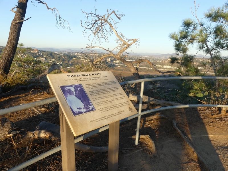
“the heart of a nurse, the courage of an astronaut and a capacity to give both generously and wisely” – Thomas O. Scripps
The philanthropist Ellen Browning Scripps (1836—1932) holds a special and endearing place . . . — — Map (db m142943) HM
Since 1933, offshore from this beach access, the seafloor bears memorial markers to name and honor San Diego’s most heralded underwater pioneers. The San Diego Bottom Scratchers Dive Club.
The Bottom Scratchers dedicated every dive to . . . — — Map (db m280308) HM
The San Diego-La Jolla Underwater Park is a continuing community project to preserve the natural ecology, reestablish the underwater sea life and maintain the natural beauty of the shoreline. The San Diego-La Jolla Underwater Park was created in . . . — — Map (db m280673) HM
One of the world’s finest natural harbors plays host above and below the surface
Homeport to America’s Finest City
One of the most beautiful and exemplary natural harbors in the world, San Diego Bay is steeped in rich maritime heritage . . . — — Map (db m73905) HM
Piece by piece through many years he acquired these acres, the site of the first Spanish settlement in California. He erected this building. He planted the trees and shrubs and nurtured their growth with tireless devotion, and when the barren . . . — — Map (db m84997) HM
For thousands of years, the Kumeyaay had called today's Mission Valley home. With the contact of Spanish explorers and establishment of the Mission San Diego de Alcalá by Father Junípero Serra on July 16, 1769, the course of history was . . . — — Map (db m223892) HM
He laid the foundation of the National Park Service defining and establishing the policies under which its areas shall be developed and conserved unimpaired for future generations. There will never come and end to the good that he has done. — — Map (db m84892) HM
Transformed from an army parade ground to a playground for the children of federal prison guards, the expanse of concrete straight ahead is now a nesting ground for Alcatraz's vast colony of western gulls. Each winter, up to 1,100 pairs of . . . — — Map (db m133765) HM
Historically, the underlying soil of the North Shore
Watershed was primarily sand with serpentine
outcroppings. The basin's shoreline and soil composition
changed when large sections of Yerba Buena Cove
(now the Financial District), Fisherman's . . . — — Map (db m175164) HM
The natural landscape of San Francisco has changed remarkably in the past two hundred years. Streams are now channeled underground, the shoreline is radically altered; native species have been pushed out or become extinct, while alien species from . . . — — Map (db m251036) HM
In 1870, the newly established Golden
Gate Park was mostly sand dunes.
When some barley grain spilled from
a horse's feedbag and took root, it gave
park engineers an idea. They planted
barley in abundance, stabilizing the
dunes with a root . . . — — Map (db m176651) HM
Panel One:
A Human-Shaped Landscape
Lands End looks nothing like it did when the Yelamu lived here. The Yelamu were an independent tribe of the Ramaytush Ohlone peoples. After Europeans arrived, the land was grazed over, built upon, . . . — — Map (db m210899) HM
The Channel Watershed was originally comprised of
sand dunes, marshes, and a large bay called Mission
Bay. The waterfront edges of Mission Bay were marked
by Potrero Point, near Pier 70, and Steamboat Point,
which today is the launch point for . . . — — Map (db m191949) HM
This site has changed dramatically over the years. Before the Army arrived, a creek ran below your feet supplying fresh water to an extensive salt marsh where Crissy Field is today. In the 1870s, soldiers grew vegetables on the creek's banks and . . . — — Map (db m242328) HM
Within the ocean swells, beyond the Golden Gate, is an underwater world of astoundingly rich and diverse marine life. Few regions on earth host the multitude of marine species found in the sanctuary’s open waters an estuaries, within its sea floor, . . . — — Map (db m63424) HM
San Francisco Bay was once ringed by extensive
wetlands. The northern edge of the Presidio consisted
of a beach backed by sparsely vegetated dunes. Inland
from the beach and dunes was a meandering slough
that paralleled the shore. The lake in . . . — — Map (db m284493) HM
Only rarely must the Golden Gate Bridge withstand earthquakes or strong wind, but everyday it must fight another threat: corrosion of the steel which creates a byproduct called rust.
Steel is an alloy comprised principally of iron along with . . . — — Map (db m176579) HM
Original "Wasteland" Filled
This recreated tidal marsh and lagoon recoup a fragment of a luxuriant 130-acre marsh system that once stretched along this shoreline. Abounding in life, the marsh offered the native Yelamu people an ideal . . . — — Map (db m132412) HM
Twin Peaks is the last San Francisco Habitat for the Mission Blue Butterfly (icaricia Icariodes Missionensis), an endangered species that was once commonly found throughout the City. On sunny spring days a few small iridescent blue butterflies may . . . — — Map (db m210552) HM
The Creekside Reserve Native Plant Gardens
(first planted in 2022)
These gardens showcase how California Native Plants can be used to create beautiful, water-conserving landscapes while promoting California's extraordinary plant . . . — — Map (db m298143) HM
Nitt Witt Ridge, one of California's remarkable Twentieth Century Folk Art Environments, is the creation of Arthur Harold Beal (Der Tinkerpaw or Capt. Nitt Witt), a Cambria Pines pioneer who sculpted the land using hand tools and indigenous . . . — — Map (db m50545) HM
Santa Rosa Creek originates in the Santa Lucia mountain range.
Restoration of its 47-square mile watershed is an on-going Greenspace priority, including restoration plans, stream bank replanting and repair, removal of barriers to . . . — — Map (db m297839) HM
Solar History
1958 - Solar in space! NASA launches the Vanguard I satellite with solar pv technology to power hs radios.
1963 - Sharp Corporation begins production of photovoltaic modules.
1977 - U.S. Department of Energy launches the . . . — — Map (db m298386) HM
A Fishing Village
Some Americans eat about 20 pounds of seafood a year. Throughout the 1900s, more fishing boats took to the sea and fishing technology grew ever more lethal to keep up with growing demand.
In some places, so much was . . . — — Map (db m298392) HM
From 1850-1900, over 5,000 gray and humpback whales were taken by California whaling stations. By 1892, the capture of whales decreased from 22 to 5 in San Simeon Bay. The continued take and improvements in hunting technology contributed to the . . . — — Map (db m297763) HM
This family ranch began in 1865, when George Hearst bought nearly 50,000 acres of the Piedra Blanca Rancho (named by Spanish explorers for its “white rocks”) from Jose de Jesus Pico, who was granted the land in 1840 by Mexican Governor Juan . . . — — Map (db m159600) HM
Almost Lost Forever
In the late 1800s whalers discovered elephant seal blubber yielded extremely high quality oil. Hunted by the thousands for several decades, these animals were thought to be extinct until a small group was found on . . . — — Map (db m81694) HM
Slowly But Surely
Miles below your feet, two huge chunks of the Earth's crust - tectonic plates - are grinding slowly past each other, moving at different rates along the San Andreas Rift Zone. Just east of Cholame the highway crosses the . . . — — Map (db m249387) HM
The beginning
In 1969, James V. Fitzgerald and the San Mateo County Board of Supervisors passed a bill officially designating Fitzgerald Marine Reserve. That same year, Bob Breen was hired as its first Ranger. Within one year of parks . . . — — Map (db m229654) HM
As coastside population growth began displacing agriculture in the 1960s and 70s, an environmental movement inspired voters to pass a protection act in 1972 that resulted in the California Coastal Commission. With increased environmental awareness, . . . — — Map (db m229568) HM
Arroyo Hondo creek has the best habitat on the south coast of Santa Barbara County for the endangered Southern California Steelhead (Oncorhynchus mykiss). This native fish spends part of its life in freshwater streams like this one, and part . . . — — Map (db m71951)
Alviso’s marina today starkly contrasts with its past as a bustling seaport. In the mid-19th century, Alviso was a transportation hub through which crops, goods and people circulated, fueling the economic growth of the South Bay. Port activity in . . . — — Map (db m24408) HM
Beginning with the Ohlone people, who harvested salt for local use and regional trade, small scale salt production on San Francisco Bay expanded into one of the largest industrial solar evaporation complexes in the world. Salt production transformed . . . — — Map (db m24444) HM
Water in Alviso is a complex issue that touches on the environment, economics, and life safety. Already susceptible to flooding, Alviso’s situation was worsened by regional development. Hard paving, which prevented water absorption into the ground, . . . — — Map (db m24414) HM
Spanish colonization in the 1700s destroyed traditional Ohlone tribal life and threatened fragile ecosystems. In 1834, Mexico enacted a plan to reduce the areas under control of the missions. As part of this plan, the native people were . . . — — Map (db m198352) HM
In the rapidly urbanizing Silicon Valley, open space is precious. Your voice and your vote help protect the regional greenbelt that provides us all with clean air and water, climate change resilience, and nearby opportunities to unplug and connect . . . — — Map (db m203020) HM
Explore layers of history
The land along this ridgeline has been deeply admired and repeatedly altered-by wealthy estate owners beginning in the 1850s, then by the Jesuits of Alma College from 1934 until the 1950s. Midpen invites you to form . . . — — Map (db m239758) HM
Andrew Putnum Hill was an artist and photographer who used political advocacy to create a conservation legacy for future generations. His paintings and photographs exemplify his appreciation for both the natural and man-made environments but it was . . . — — Map (db m226875) HM
Here, on the 1,939-acre Rancho Potrero de Santa Clara, Christopher A. Shelton in early March 1853 introduced the honeybee to California. In Aspinwall, Panama, Shelton purchased 12 beehives from a New Yorker and transported them by rail, . . . — — Map (db m3627) HM
This ancient native Blue Oak (Quercus douglasii) is unique in its size. Its numbers are now greatly diminished as settlers cut them for firewood and fencing. It is found in the rolling foothills of Santa Clara Valley and the western foothills of the . . . — — Map (db m195466) HM
In the Fall of 1992 this Sugar Pine (Pinus lambertiana) was cut at the Dinkney Creek Campground in the Sierra National Forest. When stressed by several years of drought, the tree died after it became infected by the disease "Blister Rust." After the . . . — — Map (db m195468) HM
A group of conservationists led by Andrew P. Hill camped at the base of Slippery Rock on May 15, 1900 and formed the Sempervirens Club to preserve the redwoods of Big Basin. Their efforts resulted in deeding 3,500 acres of primeval forest to the . . . — — Map (db m2350) HM
This area, popularly known as Twin Lakes, was named after twin lagoons that once reached the sea.
Schwan Lagoon and its twin, Woods Lagoon, changed as the town developed. Woods Lagoon became the yacht harbor. Schwan Lagoon lost its connection to . . . — — Map (db m209199) HM
Less than a year after fire destroyed the original Casino and Plunge, construction began on new buildings to include an indoor natatorium. The original ceiling arches can be seen today. The main pool measured 144 feet by 64 feet and featured a . . . — — Map (db m62792) HM
When the “new” Casino was built in 1907, the Boardwalk was owned by the Santa Cruz Beach Company. Local businesses experienced an economic downturn from 1912-1914, and the Beach Company went bankrupt. In 1915 the Santa Cruz Seaside . . . — — Map (db m64253) HM
On a chilling night in 1931, Soquel heard the haunting cry, “River, stay away from my door,” as Soquel Creek overflowed. A monstrous flood, 600 feet wide, surged toward Capitola, destroying everything in its path. This was just one chapter in . . . — — Map (db m264319) HM
This facility is dedicated to the men and women,
who battled the 1992 Fountain Fire,
and those who have worked and are working
to restore this forest to a healthy and productive part
of the local ecosystem.
During the dangerous salvage . . . — — Map (db m13741) HM
He laid the foundation of the National Park Service, defining and establishing the policies under which its areas shall be developed and conserved unimpaired for future generations. There will never come an end to the good that he has done. — — Map (db m71149) HM
This basaltic andesite boulder was created about 350 years ago, during the formation of Cinder Cone Volcano. Cinder cones form when blobs of gas-charged lava explode from a volcano’s vent, then fall back to earth as cooled fragments of rock. . . . — — Map (db m63318) HM
Our guide [Mr. K.V. Bumpass,] after cautioning us to be careful where we stepped, that the surface was treacherous, suddenly concluded with Virgil that the “descent to Hell was easy” for stepping upon a slight inequality in the ground . . . — — Map (db m237974) HM
California Indians have lived here for thousands of years. One local tribe is the Wintu who lived off the abundant natural resources in the area. Their way of life changed dramatically in 1848 when gold was discovered. Miners and settlers . . . — — Map (db m174574) HM
The mountains of Lassen Volcanic National Park have been a sacred place of healing and strength to American Indians for more than a thousand years. The Atsugewi, Maidu, Yana, and Yahi tribes settled in the mountain foothills and spent their summers . . . — — Map (db m63301) HM
If we think of volcanoes as mountain builders, then glaciers are mountain remodelers. This lone rock pays tribute to the rearranging forces of glaciers. Glaciers carve, grind, and excavate mountains in ways that geologists easily recognize. This . . . — — Map (db m63310) HM
Whiskeytown Lake is part of a system of dams, reservoirs, canals, and power plants that make up the Central Valley Project (CVP). Created to control floods, supply water, and generate power, the CVP serves millions of Californians from Redding to . . . — — Map (db m63353) HM
Whiskeytown Dam is protected from flooding by the circular structure located a short distance from shore. Named the Glory Hole because it resembles the trumpet-shaped morning glory flower, this structure allows overflow lake waters to drain. . . . — — Map (db m63357)
Preserved for its caves and volcanic features since 1925, Lava Beds serves as an outdoor school for professional and amateur geologists alike. While the monument covers only ten percent of the surface area of the massive Medicine Lake shield volcano . . . — — Map (db m63272) HM
Imagine watching hot lava flowing toward you at this spot over twelve thousand years ago. Like treads rolling on a tank, the clinker, cooling front of the flow fell off and was run over by the hot molten core. The Devils Homestead flow, which . . . — — Map (db m63258) HM
At some time within the last several thousand years, an eruption of magna from the bottom of the earth crust sent a broad stream of hot liquid rock across this land. The flow started to your right, 3.2 kilometers (2 miles) south of here at the site . . . — — Map (db m63253) HM
The “chimneys” before you built up as hot gasses propelled globs of lava high into the air like lumpy oatmeal boiling over a pot. This lava quickly formed dramatic, hollow spatter cones as it fell back to the ground. Later, less . . . — — Map (db m113375) HM
The petrified forest, dating from the Eocene Period, is the only known example of a petrified forest in California. Its size, scope and variety of petrification is unique in the world. Opalized wood, obsidian, quartz crystal, petrified coral and . . . — — Map (db m175865) HM
London's workers graded the steeper fields before you into stair-steps to prevent erosion. Traveling to Japan and Korea as a war correspondent in 1904, London had seen how well terracing worked.
"What I never been able to understand was why they . . . — — Map (db m102538) HM
Alta Irrigation District was formed in August 1888 by means of a general election
after the Wright Act, which became law on March 7, 1887. It was the first such district to become operational. The Alta District incorporated the holdings of the "76" . . . — — Map (db m141675) HM
In 1894 John Jolly (J.J.) Cairns planted rows of olive trees as a windbreak on the north side of his newly planted orange orchard. His daughters Laura and Ethel, stated that Cairns truly loved the beauty of the trees. He planted three rows on the . . . — — Map (db m155668) HM
Try to imagine yourself standing here in the 1950’s. You would have been surrounded by cars. Engine noise and exhaust would have overridden your impressions of the giant trees. Almost 100 cabins and motel units would have faced you from across the . . . — — Map (db m44311) HM
He laid the foundation of the National Park Service defining and establishing the policies under which its areas shall be developed and conserved unimpaired for future generations. There will never come to an end to the good that he has done. — — Map (db m52661) HM
This cabin was built by cattlemen who had acquired much of the Giant Forest land for grazing purposes prior to the establishment of Sequoia National Park in 1890. After the park’s establishment, the land was leased to men who supplied meat and milk . . . — — Map (db m44338) HM
United Nations Educational Scientific and Cultural Organization Program on Man and the Biosphere
By decision of the Bureau of the International Coordinating Council of the Program on Man and the Biosphere, duly authorized to that effect by . . . — — Map (db m2978) HM
Shaping a Park
The Naturalists
Moro Rock is one of the places in Sequoia National Park where, in 1922, naturalists began “translating” the landscape for early park visitors. Naturalists offered walks, talks, and campfire programs . . . — — Map (db m103434) HM
Fred Leighton first entered this emigrant wilderness basin in 1895 to tend cattle with his uncle Alvah Shaw. Thanks to his vision to build check dams, first one in 1920, on the stream flows in the area. The water was reserved for fish propagation . . . — — Map (db m49886) HM
Discovered 1851, by Chileans, they took out a substantial amount of free gold.
Early 1870's acquired by James Divoll, Charles Clark, and Joseph Bray, sinking a shaft 1500 ft. in 1877. Big strike came in 1879, 990 lbs. of gold was removed in one . . . — — Map (db m7565) HM
The Chumash Garden at the Oxnard Historic Farm Park was established in 2015 to highlight plants which were used by the Chumash people of Southern California for a wide variety of uses. The garden also provides the public with examples of plants . . . — — Map (db m301380) HM
W. B. Moranda Park was constructed over the former Hueneme Slough, or lagoon. High tides created this 8-acre body of water surrounded by cattails (tules) making it a haven for water fowl. The Ventura County Railroad crossed the slough on a trestle . . . — — Map (db m136194) HM
We can help reverse the trend of decreasing wildlife populations by restoring habitat: the food, water and shelter needed by all living creatures.
The vast wetlands once found in the Yolo Basin were “reclaimed” (drained and converted to farmland) . . . — — Map (db m200823) HM
Lake Spafford occupies a segment of the
original main channel of Putah Creek. The creek,
named after a settlement of the local Patwin
Indians, was once part of an extensive network of
streams and rivers in California's Central Valley.
The rich . . . — — Map (db m187040) HM
Hydraulic gold mining was introduced in the 1850’s. Men with hoses blasted hillsides with powerful jets of water, which reduced the hills to mounds of gravel 20 times faster than with pick and shovel. Massive quantities of gravel and silt from . . . — — Map (db m15713) HM
Influences on the River West Sacramento River Walk The Sacramento River originates in Siskiyou County near Mt. Shasta. Standing between that point and Sacramento is Shasta Dam, which controls the flow of water downstream. Hundreds of miles of . . . — — Map (db m137484) HM
Rocky Mountain Arsenal National Wildlife Refuge
Located just eleven miles northeast of downtown Denver, the Refuge is the largest contiguous open space in the Denver metropolitan area. A major environmental restoration program will be . . . — — Map (db m119390) HM
This Headquarters area is dedicated in honor of all the Rocky Mountain Arsenal employees who accomplished the production, demilitarization, and environmental restoration at the Arsenal from 1942 until 2012 — — Map (db m162066) HM WM
As the focus changed to environmental cleanup, Building 111 became the headquarters of this new mission-and of a public-private partnership among the U.S. Army, Shell Oil Co. and U.S. Fish and Wildlife Service. Years of
Partnership Called . . . — — Map (db m163885) HM
Arsenal Beginnings
Building 111, also known as the “White House, "was located north of the flagpole area. The building was the U.S. Army's headquarters
from the time the Arsenal was established in 1942 until the building was . . . — — Map (db m163883) HM
In 1942, women and men of the U.S. Army built this Arsenal that helped achieve victory in WWII and the Cold War. With thanks to our partners, the U.S. Army, Shell Oil Company and their contractors, we dedicate this flagpole to the employees of . . . — — Map (db m119380) HM
The Fourteeners
There are 58 peaks in the Colorado Rocky Mountains that are above 14,000 feet in height. While 54 are generally acknowledged to be "14ers", most people who want to climb them want to climb all 58. They are contained in six . . . — — Map (db m119395) HM
Commerce City
Commerce City was incorporated as Commerce Town in 1952 and became Commerce City in 1970. In 2004 the Prairie Gateway, a 917-acre parcel of land located along the western edge of the Rocky Mountain Arsenal National Wildlife . . . — — Map (db m119381) HM
According to Outdoor Life (April, 2004), Old Mose was the most famous grizzly ever to appear in their publication. This one bear was responsible for a myriad of depredations. Known for his distinctive footprint (he was missing two toes on . . . — — Map (db m160761) HM
The first U.S. citizen known to have seen the site of present-day Alamosa, Lt. Zebulon M. Pike, was arrested nearby in 1807 for trespassing on Spanish soil. But the Spanish were trespassers themselves—the Utes occupied the land. The conflicting . . . — — Map (db m160914) HM
[Map captions, clockwise from top right, read]
• Penitente Canyon [informational]
• Great Sand Dunes National Park [informational]
• Stations of the Cross Shrine [informational]
• The Fort Garland Museum is a . . . — — Map (db m160927) HM
Colorado's first home railroad was begun in 1871. William J. Palmer, Civil War veteran and founder of the Denver and Rio Grande, felt that transportation was the key to success in this new, undeveloped land.
"Narrow gauge" railroad was a new . . . — — Map (db m160929) HM
Travel the route of these explorers and read Lt. Pike’s own words from his journal.
U.S. Army Expedition to explore the United States new southwest boundary with New Spain.
The men:
Lt. Zebulon M. Pike Dr. John H. Robinson Sgt. . . . — — Map (db m71882) HM
“We can see the Dunes and the Crestone Needles from all over our ranch. When we are lost, that’s what we navigate by.”
--local rancher
Whether traveling on foot, by horseback, Model A, or the . . . — — Map (db m71051) HM
"Totally Unique and Unexpected!"
—park visitor
Welcome to the high elevation desert that is Great Sand Dunes! Does this landscape strike you as amazing, bizarre or totally out of place. If so, you’re not . . . — — Map (db m71050) HM
Pioneer conservationist
and founding member
of the Moffat - Hooper - Mosca
Service League for his many years
of dedicated service to the
preservation of the natural beauty
of the San Luis Valley — — Map (db m160692) HM
Travel the route of these explorers and read Lt. Pike’s own words from his journal.
U.S. Army Expedition to explore the United States new southwest boundary with New Spain.
The men:
Lt. Zebulon M. Pike Dr. John H. Robinson Sgt. . . . — — Map (db m160680) HM
Different Life Zones Exist in the Mountains
Imagine climbing the mountain in front of you. You might notice it gets cooler as you ascend. As the temperature drops, moisture in the air condenses, precipitation increases, and creates different . . . — — Map (db m71056) HM
You are about to step into the Great Sand Dunes Wilderness. Its mood changes with the seasons, from the spacious solitude of winter, to spring and summer fun and play. Whatever the season of your visit, this unexpected wilderness offers . . . — — Map (db m71057) HM
Mountains and passes were important in the formation
of the sand dunes.
You are looking at the Sangre de Cristo Mountains. Prevailing southwesterly winds carrying sand across the San Luis Valley were blocked by the mountains.
As the . . . — — Map (db m71055) HM
As you travel through these sandy grasslands, notice the bright white surface deposits visible along the highway to the west. The sabkha forms where sand is seasonally saturated by rising ground water. When the water evaporates away in late . . . — — Map (db m160687) HM
(Left Panel)
Climbing -- A Longtime Boulder Passion
Scrambling, tramping, hiking, climbing, mountaineering...No matter the name, early Colorado Chautauquans reveled in their outings into the adjacent foothills. In 1908, . . . — — Map (db m88253) HM
Dominating the view to the west, the peaks of the Sawatch Range define the Continental Divide. Fifteen of the peaks in the Upper Arkansas River Valley are "fourteeners," boasting summits exceeding 14,000 feet.
Between the peaks, creeks flow . . . — — Map (db m158531) HM
Agriculture in the Upper Arkansas Valley was initially developed to meet the demand of area mining camps. The flood of fortune-seekers created a market for meat, flour, vegetables, and other foods.
French immigrant Frank Mayol, credited . . . — — Map (db m158536) HM
As trappers, miners, and settlers migrated west they encountered an arid environment. Early explorers referred to the West as the Great American Desert and many believed it could not be settled. Unlike the wetter eastern United States, . . . — — Map (db m158541) HM
5388 entries matched your criteria. Entries 401 through 500 are listed above. ⊲ Previous 100 — Next 100 ⊳