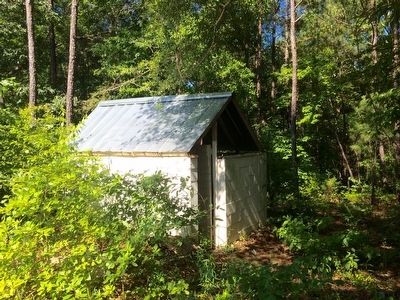
This series is for markers related to the history of toilets, WCs, bathrooms, loos, washrooms, potties, outhouses, privies, latrines, comfort stations, bogs, cans, and other similar places.
The Church Privies are located behind the church. There are mens and womens, each with three toilets. The toilets are original, and are made of solid metal, with attached closable lids. According to the wording on the lids, they were . . . — — Map (db m95115) HM
This was not you everyday outhouse. It had ten seats that connected by way of a culvert to the Bay. The tide would come in and out once a day and "flush" the toilets. This was necessary being that over 400 men used these latrines daily. It was . . . — — Map (db m260079) HM
The Bath House is typical of the 1930s construction used in outbuildings throughout Irvine Ranch. Constructed in 1931, it replaced the restroom facilities within the Bunkhouse when it was converted from an open dormitory to individual rooms. . . . — — Map (db m203552) HM
Think about the people who made Tahoe City what it is today. They were frontiersman and adventurers, hunters and fishermen, lumberjacks and miners, school teachers, newspapermen, and ladies of the night. They ranged from Washoe Indians, who called . . . — — Map (db m34899) HM
The toilets for ordinary sailors were usually located in the front or "head" of the ship and consisted of a series of holes in a plank which allowed for a direct drop into the ocean. From this location came the name "head," which remains a common . . . — — Map (db m101849) HM
Everyday needs such as eating, bathing, and going to the bathroom were much more difficult in prison. This foundation is thought to be a latrine for the prison guards and officials. As for the prisoners, one of the overseer's reports states that a . . . — — Map (db m248848) HM
This simple shed served as the toilet for shipwrights at the shipyard established by Herbert Newbert and Leroy Wallace in 1942. the yard specialized in building fishing vessels, including the eastern-rig dragger ROANN, which is . . . — — Map (db m226974) HM
Outhouse
This outhouse or privy is typical of those built by the Works Progress Administration during the 1930s to improve health and living conditions in rural areas of the United States. Between 1933 and 1945, the WPA built 2,309,239 . . . — — Map (db m283034) HM
Before indoor toilets became common, most Americans used outhouses. An outhouse (also known as a privy) is a small structure covering a pit toilet or removable waste receptacle. The replica privy in front of you is made of 90% reclaimed lumber that . . . — — Map (db m252825) HM
Tidal Toilet (English)
This colonial restroom had a twice-daily, natural flushing system. Incoming tides filled the pit with seawater, and outgoing tides flushed waste out into the bay.
Limpiado por las mareas . . . — — Map (db m127743) HM
These bricks are the remains of the south privy (outhouse), built for use primarily by tourists rather than the keepers’ families. At some point during its history this outhouse was converted into a toilet.
The smaller brick square just to the . . . — — Map (db m126954) HM
When using a creek or river to power a mill, water is channeled along a man-made headrace to direct it to the waterwheel. After spinning the wheel, the water is returned to the river through the tailrace.
This is the site of the . . . — — Map (db m195760) HM
Construction of this schoolhouse in 1909 was supervised by Ira Ethridge who had been a teacher before he married Susan Ella Shields. Alex and Emory Shields, grandsons of James Shields, donated two acres of land and the school was named Bachelors' . . . — — Map (db m201048) HM
In 1864, the Confederate States of America built a prisoner of war camp here. Named Camp Lawton, the stockade, designed to hold 40,000 prisoners, enclosed 42 acres. The first prisoners arrived from Andersonville in late September of 1864. Due to . . . — — Map (db m114315) HM
This downstream end of Stockade Branch was the site of the camp "sinks" or latrines. According to the Confederates' original plan, prisoners would get drinking water upstream and use latrines downstream, where the current would flush sewage out . . . — — Map (db m89243) HM
This comfort station, commonly known as the Carlson Cottage, exemplifies Victorian-era picturesque architecture and reflects a commitment to constructing high quality buildings in the park even for the most mundane functions. Trained at MIT and . . . — — Map (db m293430) HM
Why would an archeologist excavate an outhouse pit? In the years before indoor plumbing, outhouse toilets often doubled as garbage dumps. Sometimes things fell in accidentally. Other times material was tossed in as part of the fill when a privy was . . . — — Map (db m259784) HM
Five brick shower houses with latrines were built in the 1920s as part of the Civilian Military Training Camp (CMTC).
The restrooms included flush toilets. Coming on the heels of World War I, flush toilets were a new modern convenience in . . . — — Map (db m280269) HM
The latrine was the outhouse for the camp. It was at four different locations during the lifespan of the camp. Can you find the four different depressions in the ground?
Latrine in background. Background image is CCC sewer . . . — — Map (db m238394) HM
Outhouses were used before modern bathrooms existed. Every homestead had one located some distance from the house. Most were designed for one individual, although some could accommodate two. Toilet tissue was often a luxury, so substitutes such . . . — — Map (db m276241) HM
"Bathing is promotive both of comfort and health; and where convenience for it are to be had, the men should be made to bathe at least once a week. The feet are to be washed at least twice a week."
1841 Army Regulations
This foundation, . . . — — Map (db m36168) HM
One of the surviving original coal camp outhouses in Southeast Kansas, this structure was relocated and preserved to help tell the story of everyday life in the mining communities.
Typical of outdoor facilities used in the early part of the . . . — — Map (db m314770) HM
Outhouses vary in design and construction. An outhouse was typically a structure separate from the main dwelling, close enough to allow easy access, but far enough to minimize smell.
Old newspapers and catalogs from retailers specializing in . . . — — Map (db m314766) HM
These reproduction outhouses are non-functioning and are based on a design from Fort Laramie, a contemporary of Fort Hays, since no clear, unmistakable images exist of the Fort Hays outhouses. These facilities were for the use of officers and so had . . . — — Map (db m200816) HM
Originally located in the community of Prairie Rhonde,
next to the Emar Andrepont home, this 19th century
cabinette was donated by the family of Dewey Ledoux
and moved to the village in 1992.
While outhouses typically featured two seats, one . . . — — Map (db m127819) HM
Restrooms for the crew were located forward through the passage at the bow. The ship's crew and officers relieved themselves here while exposed to the elements. Only the captain had private facilities.
The heads had two cabinets, one on . . . — — Map (db m219675) HM
Built in the Neo-Colonial Style with doric columns and large squared corner stones for a sense of banking stability. Elegant interior was especially known for its attractive room for ladies, complete with fireplace, desks " and adjoining toilet . . . — — Map (db m87347) HM
Prior to the introduction of indoor plumbing, the privy was the farm family's toilet. It was built over a 6- to 8-foot deep pit. When the pit was full, the privy was moved to a new location. It would commonly be located a short distance behind . . . — — Map (db m168882) HM
The outhouse, or privy, meaning "place of privacy," was the outdoor toilet for the farm family. Often it was utilized long after there was running water piped inside the house. The privy was placed over a 3-to-6 foot deep hole and would be moved to . . . — — Map (db m197875) HM
The wooden water tank inside this building was placed on the highest point so that gravity would push water through underground pipes to the house and barn. There would then be running water in the house for toilets, tubs and sinks. Underground . . . — — Map (db m197864) HM
During the 1840s improvements were made to this wall, defensively the weakest part of the fort. The parapet was raised and an outer work, called a caponiere, was added. The protected passageway on your left will lead you to the outerwork that . . . — — Map (db m8075) HM
People have always needed places while they are out in public to find relief. Over the past century, the accommodations people have used and systems for removing waste have changed dramatically.
Throughout the 1800s, there were two kinds of . . . — — Map (db m258459) HM
School Privy
The bathrooms in early schools were outside, away from the building, but not too far. Typical of the day, it seated more than one person simultaneously. The odor was often masked with fragrant plants, like lilacs or hollyhocks, . . . — — Map (db m274030) HM
The Farmstead
Meridian Township was primarily settled by German families. The Grettenbergers, Unruhs, Brays, and Proctors came to an area covered in forests and wetlands. The tree needed to be cut down in order to get seed in the ground. . . . — — Map (db m174993) HM
Follow this map and step into Iron County's past. Can you imagine your family living in one of these cabins? Dates of construction and original locations of buildings are listed below: 1. The Soderquist Barn and Sheds, 1890, Bates Township . . . — — Map (db m213415) HM
Outhouses with pit toilets were common in early Northville. If properly constructed, normal bacterial action would eventually make waste harmless. If properly vented, odors would be controlled. Outhouses, also called privies, were often used to . . . — — Map (db m174305) HM
In 1972 Minnesota Historical Society archaeologists excavated a row of latrines that stood behind the officers' quarters, in order to retrieve household articles disposed of during the post's active years. This excavation revealed that the . . . — — Map (db m72670) HM
After the selection of Camp Shelby as the permanent home of the Mississippi National Guard's training activities, construction began in 1935 on the cantonment's first structures. This brick structure was the first of four identical latrines along . . . — — Map (db m291416) HM
This is a replica of an outhouse that was typical in a poor, Southern neighborhood.
Oftentimes, a single privy was shared by several residents. The original outhouse located behind the row of rental houses along Saltillo Road was also shared by . . . — — Map (db m102842) HM
Archaeologist Tom Rust, PhD of Montana State University Billings, carried out a detailed archaeological study of the proposed site. Using Modern tools and technology, he made convincing discoveries.
Where Clark's camp symbol was mapped, a . . . — — Map (db m165718) HM
Although this tiny school house was uncluttered with even the most basic of modern conveniences, it provided a quality education.
The original school house for Hunterdon County District 31, often referred to as the Old Church School, was a . . . — — Map (db m140752) HM
Trenton burst forth as the premier pottery-producing center of the Eastern United States in the second half of the 19th century, the city skyline soon being dominated by the smokestacks of pottery kilns. Trenton’s location as a transportation hub . . . — — Map (db m166109) HM
Two latrines were built within the parados for soldiers assigned to the gun batterys. The bathrooms each had several toilets for enlisted men, a private stall for officers and a large cast-iron urinal. Toilets were similar to our modern . . . — — Map (db m22021) HM
Throughout the 19th century, military sanitation was far ahead of most civilian practice in the West. The “sinks,” “privies,” “necessaries,” and latrines of the military kept contagious disease at a minimum and even by modern standards were not . . . — — Map (db m149184) HM
Prospect Park Alliance waters this garden with water already used in hand sinks or in cleaning the floors in the Wellhouse comfort station, called greywater. This greywater garden, together with the composting toilets in the Wellhouse, will save . . . — — Map (db m203870) HM
The East River Park runs alongside the Franklin Delano Roosevelt (FDR) Drive and the East River from Montgomery Street to East 12th Street. It was conceived in the early 1930s when Robert Moses (1888-1981) was designing the FDR (also known as the . . . — — Map (db m135673) HM
No Gold? No Dinosaurs? No Long-Forgotten Tombs?
Instead, our backyard archaeological
dig found 97 Orchard Street's original toilet: an outdoor privy with multiple seats. Rather than a privy pit, this backyard outhouse had an underground 'vault' . . . — — Map (db m142886) HM
Perched on a knoll overlooking the East River, and framed by the monumental RFK (Triboro) and Hell Gate bridges, this little municipal comfort station is an echo of the first efforts to transform the island-landscape into a park. Its slate roof . . . — — Map (db m274919) HM
What looks like a small amphitheater from where you are now standing was the site of the H.H. Stickles Sash and Blind Factory. Here, water power was harnessed to run machines for planing, cutting, shaping, mortising, and finishing wood, and for . . . — — Map (db m88734) HM
Built in 1822, the Bay View School originally stood on the triangle of land in Great Hog Neck. The Hallock family leased the land to School District No. 6 for one peppercorn a year. The school closed in 1926.
Children were taught reading, . . . — — Map (db m175331) HM
The corn crib (located on your left) was a special building used for storing corn and other grains. The corn would be picked from the fields and put in there to dry. Once the corn dried, the farmer would separate the kernels from the cob using a . . . — — Map (db m222803) HM
The little wooden outhouse as we know it has been an architectural fixture of America since the 1700s, when it began to replace chamber pots. In the 1800s, outhouses were built discreetly behind homes, as the old joke goes: "too close in the . . . — — Map (db m240034) HM
Welcome
This public facility was built by the Friends of Chrisholm and MetroParks of Butler County to provide needed amenities for visitors to this historic site, AND to demonstrate an innovative way to conserve our water. We have abundant, . . . — — Map (db m275804) HM
This is an example of an outside toilet used before more hygienic methods of wastewater disposal such as sanitary sewers were available. This outhouse, donated by the Baumgartner family, was moved to Century Village from Big Run South Road. . . . — — Map (db m298369) HM
This outdoor toilet, often referred to as outhouse or privy, was originally behind the Bright Day Lodge on Main Street. In earlier days this was an essential structure for every business and home. On Halloween night in Arcadia these buildings were . . . — — Map (db m83067) HM
Toilets were not inside the house in the first few decades of the 1900s. Families used "outhouses" in the backyard as the toilet. These small structures covered a hole in the ground and could be moved to a new location in the yard when needed. . . . — — Map (db m292438) HM
Keeping the CCC Boys clean...
Here, on the southern edge of Camp S-67, was the Bath House and Latrine. Most of their days consisted of doing hard, dirty, physical labor, so the nearly 200 young men of Company 1475 required plenty of room to . . . — — Map (db m276792) HM
The Ladies Rest Room was erected in 1924 by the Marshall County Court as a place for women and young children to rest, use a toilet, or eat a packed lunch during a visit to town. The building was designed with a large sitting room, a two-stall . . . — — Map (db m196541) HM
Archaeological work located 3 privies. A privy is a military name for a soldier’s toilet building. Holes were dug to a depth of 10 to 14 ft. The ground walls were either lined with small logs or brick and stone. Wall alignment would help prevent . . . — — Map (db m164349) HM
Archaeological work located 3 privies. A privy is a military name for a soldier’s toilet building. Holes were dug to a depth of 10 to 14 ft. The ground walls were either lined with small logs or brick and stone. Wall alignment would help prevent . . . — — Map (db m164398) HM
Archaeological work located 3 privies. A privy is a military name for a soldier’s toilet building. Holes were dug to a depth of 10 to 14 ft. The ground walls were either lined with small logs or brick and stone. Wall alignment would help prevent . . . — — Map (db m164381) HM
Smokehouse
Historically, farms in the 19th century included a small building called the smokehouse where meats could be smoked and stored. It was generally separated from other buildings to keep smoke away from the main house and lower . . . — — Map (db m69121) HM
Prior to modern indoor plumbing, people in homes and public spaces utilized a small structure that contained an outdoor toilet. Outhouses were generally made of wood and located fifty to one hundred yards away from the house. They usually contained . . . — — Map (db m288952) HM
Soldiers lived a rough life on the Texas frontier. Even though rank had its privileges, Fort Martin Scott offered few amenities. Private quarters and privies were the only noticeable luxuries officers enjoyed at the fort.
There were six . . . — — Map (db m118454) HM
In 1937 the State of Texas and Hardeman County worked with President Franklin Roosevelt's Works Progress Administration in an attempt to provide much-needed employment to indigent citizens and replace unsanitary privies with improved facilities. The . . . — — Map (db m104919) HM
The original American outdoor toilet was called a "Privy" or the "Necessary'" and later the "Jonny House". They came in all sizes, shapes and construction types. In most cases, they were constructed of wood, although in rare instances a few were . . . — — Map (db m299536) HM
A necessary was an outdoor privy, or toilet. Not only did it provide convenience, but the necessary also encouraged the centralized collection of human waste. The waste fell into large wooden drawers below the seats, which could easily be removed . . . — — Map (db m282183) HM
Washtucna Sheriff's Office/Jail
Est. 1880's
Outhouse
Deluxe model, 2 holer seater and used well during the days
Donated by: Unknown — — Map (db m303174) HM
Donor: Leonard Peterson
This outhouse was located behind one of the old cottages at Wagon Trail Resort (now Rowley's Bay Resort). It dates back to the early 1900s.
A two-holer, it still has the original seats. — — Map (db m254214) HM
In the 1880’s the Surgeon General determined that the privy vault - - “That most objectionable and dangerous nuisance” - - was a threat to the soldier’s health. His concern had been prompted by the accumulated reports from disgusted . . . — — Map (db m86996) HM
Although paved highways have existed in the U.S. since the 1920s, rest areas are a more recent feature of highway travel. In the 1960s, President Lyndon Johnson and First Lady, Lady Bird Johnson promoted a nationwide effort to beautify highways . . . — — Map (db m98300) HM
Privy
The foundations in front of you are from a communal privy (toilet) for enlisted men and their families that stood here in 1840. The women and children had a small room - the soldiers made do with an open structure offering . . . — — Map (db m71221) HM
Dr. Jones House, Original Building
Built: c. 1880, Perth County
Con. 14, Lots 22 & 23, Downie Township
This house, formerly known as Miller House, was originally built by Keith Lee around 1880. Brothers Robert and Dorrington James . . . — — Map (db m285201) HM
Designed by architect Alan Crossley and structural engineer Laurence Cazaly, this Space Age comfort station is a local landmark and a rare example of the Googie architectural style in Toronto. Also known as the Oculus, the South Humber Park Pavilion . . . — — Map (db m310537) HM
Javni zahod za potrebe posjetitelja u Vrtu je postavljen kod ulaza vec
1892., no zamijenjen je novim objektom 1905. Tada je iz Beca mladi
arhitekt Milan Lenuci (danas dobro poznat po urbanistickom
ostvarenju Zelene potkove) donio ideju . . . — — Map (db m270083) HM
Visitors to the bathhouse and the theater enjoyed a life of social grace and culture.
But what did they do when nature called?
Like a true Roman-Byzantine city, Bet-She'an had public latrines. Users entered an open courtyard paved with a mosaic . . . — — Map (db m221169) HM
Questa latrina, tra le meglio conservate di Ostia, fu ricavata all'interno di due botteghe di età adrianea (117-138 d.C.). L'aspetto attuale risale al IV secolo d.C., come emerge dalla presenza di lastre marmoree di reimpiego, alcune delle quali . . . — — Map (db m281488) HM
Italian:
I resti dell'imponente basamento, realizzato in grossi blocchi di tufo e ancora visibile alle spalle dei templi B e C, appartengono alla Curia di Pompeo, una grande aula rettangolare dove si riuniva sporadicamente il . . . — — Map (db m266667) HM
Italian:
Le Latrine. II Circo Massimo era un monumento con una affluenza di pubblico eccezionale e quindi era dotato di un sistema di servizi igienici (fontanelle, latrine) in grado di sopperire velocemente alle esigenze delle . . . — — Map (db m265904) HM
Museum De Noord en Vogeldorp
Architect Berend Tobia Boeyinga (1886-1969)
Opdrachtgever Gemeentelijke Woningdienst
Bouwjaren 1918-1919
In het Museum De Noord - het oude Gemeente Badhuis - kwamen vorige eeuw . . . — — Map (db m268667) HM
English: The public Latrine could be reached from the covered `Academy Street'. The free public toilet served the citizens as well as
the visitors of the adjacent Varius Bath. The seats of the Latrine were arranged round three sides of the . . . — — Map (db m84542) HM
Today the ground in front of you drops away. before gradually rising again towards the chapter house wall. The ground was dug out in the 1640s, during the Civil War, and was later landscaped in Victorian times, to create a performance space within . . . — — Map (db m253786) HM
The East Range
These buildings contained the dormitory and the monastic latrines.
The first floor of the east range in front of you was a single large dormitory or dorter where originally the abbot and all the monks slept. To the left of it, . . . — — Map (db m128797) HM
The Water Tower once stood at this location. It was so called because it stood by the river, with a clear view of the Town Bridge. The river joined the flooded moat at this tower. When the river was high, the two water levels were the same. When the . . . — — Map (db m272072) HM
The King's Tower was a strongly fortified but comfortable residence. Accounts show that the present tower was built around 1300 and King Edward II took a keen interest in the building work. The Constable of the Castle, appointed to run the Castle . . . — — Map (db m277632) HM
A military community Villages like Vindolanda were a vital part of the military occupation of Hadrian's Wall, and were planned extensions of the forts themselves. They provided extra space for facilities such as shops, workshops, additional . . . — — Map (db m126419) HM
Castle Ditch You are overlooking the site of a dry ditch that protected the Castle. This ditch prevented invaders from tunnelling beneath the curtain walls, and was therefore important to the Castle defences. Latrines (outdoor toilets) might . . . — — Map (db m248646) HM
This ruinous building was long thought to have been a chapel. It has stood isolated in the corner of the churchyard since the 1850s when Church Path was laid out by breaking through the east wall next to the southeast entry. In 1899 the path was . . . — — Map (db m273193) HM
The dungeon was first carved out of solid rock by hand around 950 years ago and has been extended over the years. It was originally a secure store for the Norman Lords' valuables, but during the 1640s it was used as a secure store- for prisoners! . . . — — Map (db m277785) HM
In the castle's medieval heyday up to one thousand people had to be fed. Only the king spent more money on his household than the Lord of Pontefract Castle!
Even on a quiet day around 200 gallons of ale were drunk, most of which was brewed on . . . — — Map (db m277786) HM
This was the Constable Tower, a large, square tower with thick walls projecting six metres beyond the curtain wall. The garderobe (toilet) shaft within the left hand wall emptied straight into the outer ditch - an extra deterrent for would-be . . . — — Map (db m279464) HM
Introduction
Standing high above Kendal, these ruins are the remains of the magnificent fortified manor of the Barons of Kendal. For almost 500 years, the families of Lancaster, Brus, Roos, and Parr dominated Westmorland life, administering a . . . — — Map (db m274780) HM
You are standing in one of the towers that overlooked medieval Kendal. Originally, it had three storeys but the uppermost level has been destroyed.
The lower storey is a rough stone vault, maybe used as a store room. The upper room would have . . . — — Map (db m274781) HM