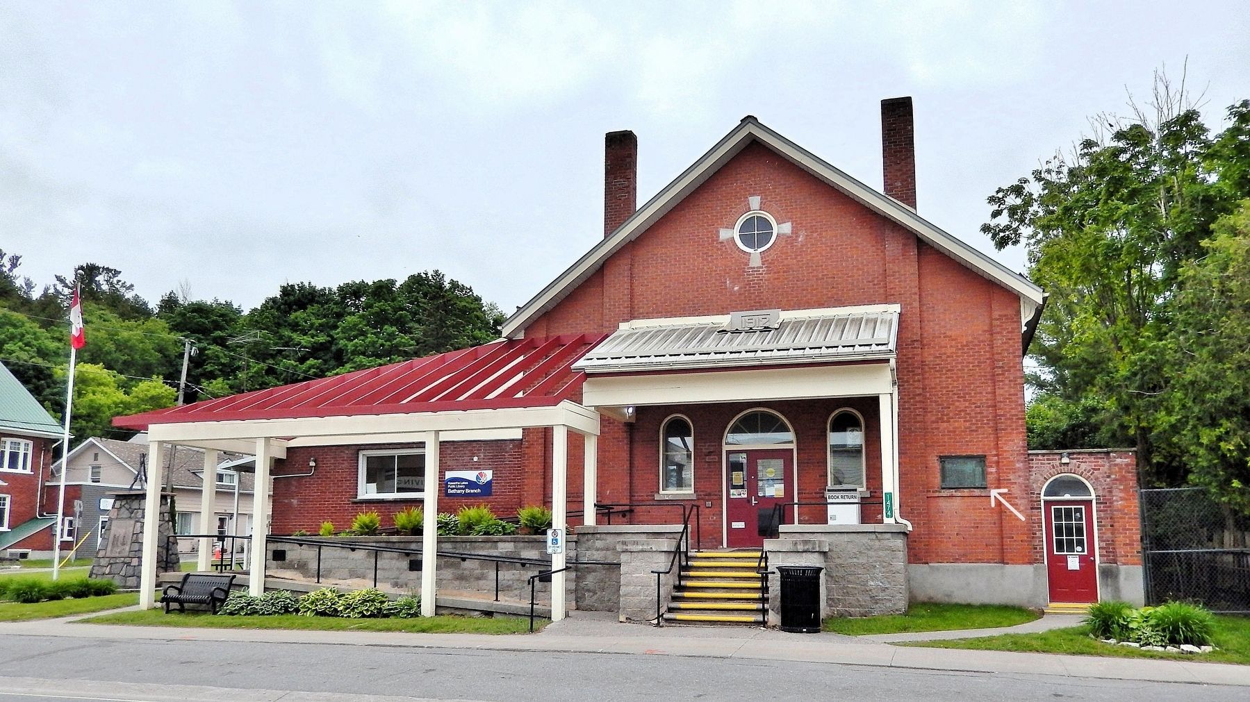
On Provincial Highway 7A just east of Wilson Street, on the right when traveling east.
Erected by the People of Bethany and district in memory ofCapt. Percy Wilmot Chambers Douai Aug. 13, 1917 Lt. James Thos. Hutchinson Nasmyth St. Julien April 22, 1915 Cpl. Saml Elmer Hutchinson . . . — — Map (db m274278) WM
On Provincial Highway 7A just east of Wilson Street, on the right when traveling east.
In memory of the men from Manvers Township who died defending freedom in two World Wars 1914 — 1918Cairns Frank • Coulter Henry • Chambers P., Capt. • Delong Cecil • Edwards Albert • Fowler Wesley • Graham Edgar • Hutchinson E., Cpl. • . . . — — Map (db m274297) WM
On 2nd Line Road at County Road 45, on the left when traveling east on 2nd Line Road.
The cenotaph was constructed in 1927 by Alf McKeel and Son of Campbellford who supplied the design and donated the materials for the project while the hard physical labour was supplied by many volunteers. The Native Indian men of Alderville used . . . — — Map (db m275533) HM WM
On 2nd Line Road at County Road 45, on the left when traveling east on 2nd Line Road.
To the honour and glory of those from
the Alderville Reserve who served
in World War I 1914-1918
Killed in action
Wm. Blaker ·
Jos. Blaker ·
Vic Blaker ·
Aus. Beaver ·
S. Comego ·
Wm. Hagar ·
W. Franklin ·
A. Simpson . . . — — Map (db m275992) HM
On 2nd Line Road 0.2 kilometers east of County Road 45, on the left when traveling east.
Alderville Manual Labour School
One of several technical training institutes operating in
Upper Canada during the first half of the 19th century,
the Alderville Manual Labour School was established here
by 1839 by Wesleyan . . . — — Map (db m275299) HM
On Hardwood Road (Regional Road 15) 0.5 kilometers north of Cookery Road, on the left when traveling north.
In 1854, fourteen German immigrants who had been employed on the construction of the Cobourg and Peterborough Railway, died of cholera on this property (lot 6, concession 8, Hamilton Township). They were buried in unmarked graves beside the nearby . . . — — Map (db m274975) HM
On Regional Road 15 0.4 kilometers west of King Road, on the right when traveling south.
In May 1847, Catharine Parr Traill (1802-1899), one of Canadas distinguished early writers, moved with her husband, Thomas, and family from Wolf Tower to this farm which they damed Mount Ararat, "the highest elevation on the Rice Lake Plains.” This . . . — — Map (db m274972) HM
On Pinnacle Street South at Elizabeth Street (Provincial Highway 2), on the right when traveling south on Pinnacle Street South.
To honour the
Pioneers of the Community
and all those who
during the past 100 years
have served the cause of agriculture
in Brighton District — — Map (db m262502) HM
On Elizabeth Street (Provincial Highway 2) just west of Terry Fox Drive/Pinnacle Street South, on the right when traveling west.
The original school on this site was officially opened as the Union High and Public School on September 4, 1915. The construction of such an imposing building at a cost of over $52,000 during the First World War was a remarkable act of faith in . . . — — Map (db m262531) HM
On Main Street (Provincial Highway 2) at Veterans Way, on the right when traveling west on Main Street.
Memorial Park is the heart of Downtown Brighton. Used in all seasons, residents and visitors alike gather in this space for concerts, movies, special events, parades, and many community celebrations.
During World War I, before it was 'Memorial . . . — — Map (db m262529) HM
On County Road 64 at Boes Road, on the right when traveling west on County Road 64.
Van Sicklen families emigrated from Holland to America before New Amsterdam became New York City.
In 1805, a branch of one of those families, Cornelius and his wife Hannah van Sicklen together with their children Mary, Ferdinand, Sarah and . . . — — Map (db m275537) HM
On Kingsley Avenue just north of Main Street (Provincial Highway 2), on the right when traveling north.
In the service of Canada in war and peace
Au service du canada en temps de guerre et de paix
World War I • Premier guerre mondiale
1914 - 1918
John Baxter · Sidney Betts · William . . . — — Map (db m262549) WM
On Cavan Road 0.2 kilometers east of Little Road North, on the right when traveling east.
An early twentieth century Canadian female
explorer of Labrador and writer, Mina Benson
was born on this property, Lot 28, Concession
7, Township of Hamilton, County of
Northumberland. From June 27 to August 27,
1905, Benson completed the . . . — — Map (db m274969) HM
On Queen Street 0.1 kilometers north of Bridge Street West, on the right when traveling north.
In 1831 two Scottish-born brothers, Lieut.-Col. Robert Campbell and Major David Campbell, were granted 2200 acres of land in Seymour township, which had been surveyed in 1819. Robert, who had achieved an outstanding record in the Napoleonic Wars, . . . — — Map (db m284037) HM
On Grand Road 0.1 kilometers north of Canrobert Street South, on the right when traveling north.
Original five-storey building was erected in the late 1870's and opened in 1882.
Built by Gault Bros. of Montreal and built of brick kilned at West Brickyards of West's Corners.
Operated as Trent Valley Woollens and used own power generated . . . — — Map (db m275335) HM
On Grand Road at Bridge Street West, on the right when traveling north on Grand Road.
Trent-Severn Waterway National Historic Site of Canada
Built in stages between 1833-1920, the Trent-Severn Waterway provides a link between Georgian Bay and Lake Ontario. Originally designed to promote local development and
aid . . . — — Map (db m275364) HM
On King Street East (Provincial Highway 2) at Church Street, on the left when traveling east on King Street East.
This Anglican church was begun in 1851 to replace a frame building erected in 1820. Distinguished by the stepped battlements of its façade, the new building was designed in early Gothic Revival style by the noted architect Kivas Tully, who was . . . — — Map (db m90045) HM
On 3rd Street 0.2 kilometers south of Albert Street, on the left when traveling south.
Largely financed by the citizens and town, Cobourg's railway to Peterborough was chartered 1852 and opened 1854. Like many others of this period, it suffered from excessive optimism, land speculation and faulty engineering. Ice made the . . . — — Map (db m90087) HM
On McClellan Road 0.2 kilometers north of Bell Hill Road East, on the right when traveling north.
Boltus Harris, a United Empire Loyalist from New York, was granted this property (Lot 32 Concession 4 of Hamilton Township) in 1797. Known as the township's "first settler". Boltus and members of his family (plus others) are buried here. The . . . — — Map (db m274968) HM
On King Street west (Provincial Highway 2) at Matthew Street, on the right when traveling west on King Street west.
Leila Maria Koerber, a talented actress and singer known internationally as Marie Dressler, was born in Cobourg. About 1883 she joined a touring stock company, later gaining recognition on Broadway in a series of successful comedy productions, . . . — — Map (db m90090) HM
On King Street East (Provincial Highway 2) near College Street, on the right when traveling east.
This walk, sponsored by the Cobourg branch of the Architectural Conservancy of Ontario, honors Egerton Ryerson, one of the founders of Upper Canada Academy in 1832 and its second principal. The Academy, which later became Victoria College and . . . — — Map (db m90054) HM
On 3rd Street 0.2 kilometers south of Albert Street, on the left when traveling south.
Saw and grist mills erected in this area during the first decade of the 19th century fostered the development here of a small settlement. The completion of the Kingston Road by 1817 facilitated its growth and within a decade it had a population of . . . — — Map (db m90089) HM
On University Avenue East at College Street, on the left when traveling east on University Avenue East.
The cornerstone of this building was laid June 7, 1832, and teaching began in 1836. First operated under a royal charter by the Weslayan Methodists as Upper Canada Academy, in 1841 it obtained a provincial charter under the name of Victoria . . . — — Map (db m90042) HM
On King Street West (Provincial Highway 2) west of 2nd Street, on the left when traveling west.
One of the finest public buildings in Canada, this imposing structure was built as an expression of civic pride and confidence in the future. It was begun in 1856 and opened by the Prince of Wales four years later. Designed by the renowned . . . — — Map (db m90084) HM
On King Street West (Provincial Highway 2) east of 3rd Street, on the right when traveling east.
This building, designed by the architect Kivas Tully in a Victorian version of the Palladian style, is representative of the finer public buildings of mid-nineteenth century Canada. One of the most impressive town halls in Ontario, it reflects the . . . — — Map (db m90086) HM
On King Street East (Provincial Highway 2) east of McGill Street, on the right when traveling east.
This resident of Cobourg was the province's leading stage-coach proprietor from about 1830 to 1856. His Royal Mail Line ran from Hamilton to Montréal, with links to other centres. In February, 1840, Weller drove the Governor-General, Charles . . . — — Map (db m90082) HM
On King Street West at Toronto Street, on the right when traveling west on King Street West.
In memory
of our Colborne boys
who lost their lives
in the Great War
1914-1918
Killed in action
Lt. Lorne Campbell.M.C. ·
W. A. Smith ·
Pte. L. D. Cox ·
G. Chatterson ·
W. R. Frazier ·
F. L. Griffis ·
A. E. Peters ·
J. . . . — — Map (db m276221) WM
On Toronto Street at King Street West, on the right when traveling north on Toronto Street.
To the Glory of God
and to perpetually honour our men
who made the supreme sacrifice
1939-1945
Cpl. Brooks Victor E.
P/O. Farrell Douglas
W/O. Grant W. K.
Capt. McCutcheon Harold
Pte. McMurray Clarke
F/O. Peters Arthur H. . . . — — Map (db m275884) HM
On King Street East at Victory Street, on the right when traveling west on King Street East.
This church, built from local stone, was begun in 1830 on land acquired by the Presbyterian congregation from Joseph A. Keeler, a prominent local merchant. It was designed by Archibald Fraser, a Scottish architect-builder, in a plain and classically . . . — — Map (db m275411) HM
On Toronto Street 0.1 kilometers north of King Street, on the right when traveling north.
A store established here about 1819 by Joseph Abbott Keeler, a prominent early settler, provided the nucleus around which a small community began to develop. Within ten years a distillery and a blacksmith's shop had been erected. The . . . — — Map (db m275429) HM
On Plank Road 0.2 kilometers north of Rice Lake Scenic Drive, on the left when traveling north.
Named after Thomas S. Gore, an Irishman who settled in this vicinity in 1845, the village of Gore's Landing prospered for a time as the terminal point of a plank road constructed from Cobourg to Rice Lake 1847-48. Among the well known residents of . . . — — Map (db m275199) HM
On Plank Road 0.3 kilometers north of Rice Lake Scenic Drive, on the left when traveling north.
The wharf you are standing on is more than a landmark; in fact, it is the reason Gore's Landing exists at all, for the village became an important link in the local transportation network. Steamboats began to ply Rice Lake in 1832 and by the 1860s . . . — — Map (db m275178) HM
On County Road 2 at Barnum house Road, on the right when traveling west on County Road 2.
Built ca. 1820 for Colonel Eliakim Barnum, an American emigrant, this timber-framed home is recognized as an outstanding example of Neoclassic domestic architecture in Canada. While retaining a Palladian composition of centre block and . . . — — Map (db m275433) HM
On County Road 2 at Barnham House Road, on the right when traveling west on County Road 2.
Barnum
A superb example of a prosperous Upper Canada home, this elegant classical building was erected about 1819. Though its interior has been modified several times since, the façade remains essentially unaltered. In the first . . . — — Map (db m284038) HM
On Front Street 0.3 kilometers north of Rice Lake Scenic Drive, on the right when traveling north.
This area, purchased in 1828 by Robert Harwood, a Montreal merchant, did not begin to develop rapidly until the arrival of the Cobourg and Peterborough Railway in 1854, Harwood was surveyed in 1855, and the line, which transported passengers, lumber . . . — — Map (db m275203) HM
On King Street at Dorset Street East, on the right when traveling north on King Street.
This fine limestone house, originally painted blue, was completed in 1834 by John David Smith. Born in New York City in 1786, he came here in 1797 with his father, Elias Smith, who had played a leading role in the founding of this community. The . . . — — Map (db m275125) HM
On Queen Street near Dorset Street West, on the right when traveling south.
This 77mm German field gun was captured by
Canadian soldiers on the Western front during
the Great War, 1914-1918 and was presented as
a memorial to the Town of Port Hope in 1919.
During the service of dedication on the 15th day
of June, 1925, . . . — — Map (db m274961) HM WM
On Walton Street at Mill Street North, on the right when traveling west on Walton Street.
Ganaraské, Pemetescoutiang, Fat Fire Creek, Toronto, Smith's Creek. From the early 1600's to 1819 these French, Indian, and English names referred to a village on the banks of a swift river filled with trout and salmon, that met Lake Ontario. . . . — — Map (db m275065) HM
On Queen Street at Augusta Street, on the right when traveling south on Queen Street.
To commemorate
the devoted patriotism and heroic bravery of
Lieutenant Colonel
Arthur T. H. Williams M P.
commanding the
Midland Battalion of volunteer militia who
after gallantly leading the victorious and
decisive charge at the Battle of . . . — — Map (db m275003) HM WM
On Queen Street at Augusta Street, on the right when traveling south on Queen Street.
The Port Hope Cenotaph was originally erected in 1926, funded by the efforts of the Port Hope Chapter of the Imperial Order of the Daughters of the Empire, a women's service organization founded to foster understanding between British women and . . . — — Map (db m275119) HM
On Mill Street South 0.1 kilometers south of Walton Street, on the right.
Born Farley McGill Mowat, in Belleville Ontario, recognized as one of Canada's literary lions and a fervent champion of environmental issues. A graduate of the University of Toronto, Farley is remembered not only as an author and environmentalist . . . — — Map (db m275124) HM
On Queen Street at Dorset Street West, on the right when traveling south on Queen Street.
Peter Smith, a fur trader, occupied a house here at “Smith's Creek" by 1788. The first permanent settlers were Loyalists brought to the township in 1793 by a group of associates headed by Jonathan Walton of Schenectady, N.Y. and Elias Smith, . . . — — Map (db m274963) HM
On Mill Street South 0.1 kilometers south of Walton Street, on the right when traveling south.
The Ganaraska River watershed shaped thousands of years ago by glacial activity, flows through the Municipality of Clarington, the Municipality of Port Hope, and the Township of Hamilton. Its uppermost headwaters are found in the City of Kawartha . . . — — Map (db m275122) HM
On King Street 0.2 kilometers north of Dorset Street East, on the right when traveling north.
Born in Poughkeepsie, Dutchess Co., N.Y., USA of English and Dutch descent. When the thirteen colonies declared war on England, he remained loyal to King George III and served during the Revolution in the Quarter Master Department at New York. When . . . — — Map (db m275171) HM
On Queen Street 0.1 kilometers south of Walton Street, on the right when traveling south.
Port Hope Capitol Theatre
Constructed in 1930 and designed by Canadian architect Murray Brown, this theatre was one of the first cinemas in Canada to be created specifically for the presentation of "talkies." Its twilight sky . . . — — Map (db m275007) HM
On Queen Street at Augusta Street, on the right when traveling south on Queen Street.
[west side]
1914 - 1918
“The Unforgotten Dead”
Capt. Gilbert Edwards M.C. ·
Lieut. Harry D. Mason ·
Lieut. Thomas M. Walsh ·
Lieut. Charles H. White ·
Albert N. Gloyne ·
Grant T. Carmichael ·
Chester J. Ham ·
Louis S. . . . — — Map (db m276291) WM
On Walton Street at Mill Street North, on the right when traveling west on Walton Street.
Archaeologists have confirmed that people of the First Nations lived here for over 1,000 years. From 1650 on, Dutch from Albany traded furs with the Iroquois and later French and English traded with the Mississaugas. By 1788 fur trader Peter Smith . . . — — Map (db m275058) HM
On Queen Street at Augusta Street, on the right when traveling north on Queen Street.
This Rotary Foot Bridge was erected
and given to the Town of Port Hope
by the Rotary Club in 1927.
Rotary Park, where this plaque
stands, was created by the club
to enhance the area in 1926,
bordered to the south by
Centennial Park, a project . . . — — Map (db m275531) HM
On Walton Street at Mill Street North, on the right when traveling west on Walton Street.
In October, 1859, Signor Farini made his debut here, on a
high wire strung across the river between two four-
storey buildings. His second performance drew a crowd
twice the population of the town; among his feats was a
headstand at mid-wire. . . . — — Map (db m275036) HM
On King Street 0.2 kilometers north of Dorset Street East, on the right when traveling north.
Built in 1822 this Anglican Church was consecrated in 1828 and dedicated to St. John the Evangelist. With an enlargement in 1842 and alterations to windows and tower in 1851 the church approached its present size, form and Gothic appearance.
A new . . . — — Map (db m275141) HM
On Eldorado Place 0.1 kilometers south of Marsh Street, on the left when traveling south.
The Eldorado Refinery
A pioneering operation in the development of nuclear energy, the Eldorado refinery was established in 1933 by Gilbert LaBine, a veteran prospector, and his brother Charles. It extracted radium, used in the . . . — — Map (db m274959) HM
On Walton Street at Mill Street North, on the right when traveling west on Walton Street.
"The Great Farini" or "Signor Farini" was born William Leonard Hunt to Thomas Hunt and Hannah Soper on June 10, 1838. He was one of six children. The family lived in Bomanville when Willie was an infant, but then his father bought a farm and moved . . . — — Map (db m275039) HM
On John Street 0.1 kilometers north of Augusta Street, on the right when traveling north.
It is estimated that the Little Station may have been the first railway station in Port Hope, on the Grand Trunk Railway. It was built in the mid 1850's as a stop on the way to Lindsay and Beaverton. Because of its low gable roof and three foot . . . — — Map (db m275117) HM
On Elias Street 0.1 kilometers Augusta Street, on the left when traveling north.
"The world of today differs from that of Napoleon Bonaparte more than his world differed from that of Julius Caesar; and this change has chiefly been made by engineering." These were the words of civil engineer Thomas Clarke, a New . . . — — Map (db m275084) HM
On Lakeshore Road 2.5 kilometers east of Wesleyville Road, on the right when traveling west.
Likely built by Thomas and Selinda Oughtred in 1858, this dwelling is known as the "Y" house due to its unusual architectural style. The main doorcase is centred at the convergence of angled east and west walls, with the bulk of the dwelling . . . — — Map (db m308251) HM
On Lakeshore Road 2.5 kilometers east of Wesleyville Road, on the right when traveling west.
Along with the nearby Wesleyan Methodist Church this one-room school was the centre of village life. For over a century, students walked back and forth daily to attend school here from farms and homes up to 5 or 6 kilometres away.
The first . . . — — Map (db m308253) HM
On 4th Line 0.4 kilometers east of County Road 10, on the left when traveling east.
As early as 1820, a log building on the property of one of the early settlers, James Hawkins, was used as a school and a place of worship.
In 1832, on the same site, the men and women of Canton built a modest wooden structure - Hope Chapel. It . . . — — Map (db m274956) HM
On 4th Line 0.3 kilometers east of County Road 10, on the right when traveling east.
Resident of Hope Township, he was a volunteer
Union soldier with the 21st. New York Cavalry.
He received the Congressional Medal of Honour for
bravery at Ashby's Gap Virginia, USA on July 19, 1864
for rescuing his wounded captain from . . . — — Map (db m274958) HM
On Lakeshore Road 2.5 kilometers west of Wesleyville Road, on the right when traveling west.
The 1860 Wesley Church has been restored to its role as the cultural heart of Port Hope's Lakeshore Road community thanks to Friends of Wesleyville Village volunteers and co-operation from the United Church of Canada. Gatherings and celebrations . . . — — Map (db m308249) HM
On 2nd Line Road 0.1 kilometers east of County Road 45, on the left when traveling east.
The Mississaugas of the Ojbway (Objebwa) nation collected on Grape
Island in the Bay of Quinte in the year 1826 to establish a Wesleyan
Methodist Mission. Elder Case with the assistance of Peter Jones
converted 102 native peoples and taught them . . . — — Map (db m275255) HM
On Bridge Street North at Front Street West, on the right when traveling south on Bridge Street North.
1914 - 1918
Erected by the
Hastings and the Darontal chapters of
the Imperial Order Daughters of the Empire.
In proud and loving memory of those
who died in defence of their country
Armour, S. ·
Hicks, B. ·
Logan, J.L. ·
Parker, T. . . . — — Map (db m275781) WM
On Front Street West 0.3 kilometers west of Bridge Street North, on the left when traveling west.
By 1825 James Crooks, a prominent entrepreneur and land speculator of West Flamborough, had acquired over 1,000 acres here at the rapids on the Trent River. He soon erected a small grist-mill but made no further improvements until the government . . . — — Map (db m275314) HM
On Old Hastings Road at Mill Street, on the left when traveling north on Old Hastings Road.
John David Kelly, a gifted painter and illustrator, is best-known for his meticulously researched paintings depicting important events in Canadas history. Many of Kelly's paintings and sketches were commissioned for reproduction and were widely . . . — — Map (db m275395) HM
On Old Hastings Road at Mill Street, on the left when traveling north on Old Hastings Road.
These rolling hills are an ideal farming area for
cheese production. In the late 1800's cheese factories were two to three miles apart, located by creeks and open from May to October. With horses and wagons farmers brought cans of milk to each . . . — — Map (db m275401) HM
On McDonnel Street just west of George Street North, on the left when traveling west.
The West Riding Peterborough Agricultural Society Fair had been searching for many years for a larger location to hold the fair, and the closure of the Burial Grounds provided a perfect opportunity for much needed open space. The “Agricultural . . . — — Map (db m260799) HM
On McDonnel Street just west of George Street North, on the left when traveling west.
A tribute to the Canadian volunteers and to the memory of Capt. Edward T. Brown, of Boulton’s Scouts, a native of this county who fell at Batoche on May 12th, 1885 — — Map (db m260797) HM
On George Street North at Murray Street, on the right when traveling south on George Street North.
The transformation of the agricultural fair site and old burial grounds into a formal park was important to the citizens of Peterborough who protested the Town Council's first plan to subdivide the area into building lots. In 1884 Council agreed . . . — — Map (db m260796) HM
Near Hunter Street East 0.1 kilometers west of Ashburnham Drive, on the left when traveling south.
[English] D-Day and the Battle of Normandy 6 June-21 August 1944 After months of elaborate planning, the largest seaborne invasion in modern history commenced on 6 June 1944 (D-Day) to liberate northwestern . . . — — Map (db m260998) HM
On Water Street at Simcoe Street, on the right when traveling north on Water Street.
On this site stood in 1825 Government House Log dwelling and office of Peter Robinson. In that year, 2,204 Irish immigrants were assisted in settling here by the British Government. From that time the settlement was known as . . . — — Map (db m260794) HM
On Murray Street just west of George Street North, on the right when traveling west.
Central Park was an ideal site for a military training area with its expansive grounds and location — accessible by foot, horse and wagon. A drill shed was built in 1867 and used for band practices, dances and military activities. Drill sheds were . . . — — Map (db m260795) HM
On George Street North at McDonnel Street, on the right when traveling south on George Street North.
Peterborough's first burial ground was laid out in 1825 on the land bounded by Aylmer, George, Murray and McDonnel Streets. At the time, this was the northern edge of the town. It was multidenominational with areas for Roman Catholics, Anglicans, . . . — — Map (db m260918) HM
Near Hunter Street East 0.1 kilometers west of Ashburnham Drive, on the left when traveling south.
Louis Riel 1844-1885 [English] Louis Riel led the Red River Métis in opposing Canadian expansion into their region in 1869. Only 25 years old at the time, Riel was chosen to head the provisional . . . — — Map (db m260999) HM
On Brock Street just west of Bethune Street, on the right when traveling west.
Sandford Fleming arrived at this house from Scotland on June 7, 1845. He resided here with his cousin, Dr. John Hutchison, for nearly two years. During this time he surveyed and made a map of the townsite of Peterborough. Here he met his future . . . — — Map (db m260698) HM
On Rubidge Street just north of Hall Street, on the left when traveling north.
An outstanding example of Greek revival architecture, modified in the Palladian manner, it was begun about 1847 by P.M. Grover, a well-to-do local merchant. A type of building rare in Ontario, it was probably inspired by a "design for a villa" . . . — — Map (db m260694) HM
On Brock Street just west of Chambers Street, on the right when traveling west.
Here on December 6, 1960, the skeletal remains of a man who lived in this area about 2,000 years ago were discovered by Douglas Yaxley of Peterborough. Buried with the man were twenty-nine artifacts attributed to the Point Peninsula Culture, which . . . — — Map (db m260778) HM
On Hunter Street West just east of Reid Street, on the left when traveling east.
[English] The parish of St. Peter-in-Chains was established in 1826 to serve the large Irish Catholic population of the surrounding Robinson Settlement. This building, erected in 1837-38 of stone from nearby . . . — — Map (db m260697) HM
On George Street North just south of McDonnel Street, on the right when traveling south.
The Citizens' War Memorial, in memory of those who fell in three wars, was designed by Toronto architect and sculptor Walter Seymour Allward (1876-1955), with the help of the English sculptor Gilbert Bayes (1872-1953). It was commissioned in 1921 . . . — — Map (db m260798) HM
On Brock Street just west of Bethune Street, on the right when traveling west.
This stone house, completed by February 1837, was first occupied by Dr. John Hutchison, Peterborough's first permanently established physician. A native of Kirkcaldy, Scotland, Hutchison had come to Upper Canada by 1818 and practiced in the Rice . . . — — Map (db m260696) HM
On Murray Street just east of George Street North, on the right when traveling east.
Riding a wave of national pride and military enthusiasm following the South African War (1899-1902), the Canadian government embarked on a major reform of the nation's defence system. The new programme included an expanded and upgraded . . . — — Map (db m260700) HM
On Simcoe Street at Water Street, on the left when traveling west on Simcoe Street.
During the years 1873 to 1991, 123 Simcoe Street was the site of The Peterborough Club. Originally modelled as an English gentlemen’s club, it developed at this location as a place for business and professional people to meet and as a community . . . — — Map (db m260788) HM
Near Hunter Street East 0.1 kilometers west of Ashburnham Drive, on the left when traveling south.
[English] Opened in 1904, with a lift of 19.8 metres, this is the highest hydraulic lift lock in the world and the first of two built in North America, both on the Trent-Severn Waterway. It operates on a balance principle. A . . . — — Map (db m247847) HM
On Hunter Street West just west of Water Street, on the right when traveling west.
The old Post Office, located at the north-west corner of Hunter and Water Streets, opened in 1888 and was demolished in 1955 soon after the new Post Office on Charlotte St. was opened. The building was designed in Ottawa by Dominion architect . . . — — Map (db m260785) HM
On Water Street just north of Brock Street, on the right when traveling north.
In an effort to alleviate poverty and unemployment in Ireland, the British government in 1825 sponsored a settlement of Irish emigrants in the Newcastle District of Upper Canada. Peter Robinson, later that province's Commissioner of Crown Lands, . . . — — Map (db m260695) HM
Near Ashburnham Drive at Marsdale Drive, on the left when traveling north.
The Tollington Bridge was constructed in 1998 to access the Rotary Greenway Trail along the north shore of Little Lake. Funds for this project were provided by the Tollington Park Endowment Fund. Impressed by the beauty of the parks and the . . . — — Map (db m260981) HM
Near Hunter Street East 0.1 kilometers west of Ashburnham Drive, on the right when traveling west.
[English] Did you know that…
• The Peterborough Lift Lock was inaugurated on July 9, 1904. It took eight years to build. • With a height of 19.8 metres, it is the highest hydraulic lift . . . — — Map (db m260800) HM
Near Hunter Street East 0.1 kilometers west of Ashburnham Drive, on the left when traveling south.
[English] Women in Canada and Newfoundland significantly contributed to Allied victory. Whereas women were military nurses during the First World War, more than 50,000 were now serving in uniform as non-combatants in . . . — — Map (db m260987) HM