808 entries match your criteria. Entries 101 through 200 are listed.⊲ Previous 100 — Next 100 ⊳
Native Sons/Daughters of the Golden West Historical Markers
The NSGW was formed by Albert Maver Winn in 1875 to preserve the California historic buildings and sites of the Gold Rush and prior. The only requirement to be a member is to have been born in California. The sister organization, NDGW, followed soon thereafter.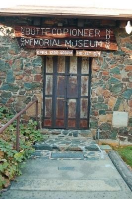
By Barry Swackhamer, November 14, 2012
Site of 1st Sawmill Marker
| 101 ► California, Butte County, Oroville — Site of 1st Sawmill — |
| Near Montgomery Street, on the left when traveling east. | |||
| 102 ► California, Butte County, Oroville — Site of the First Flour Mill — |
| On Montgomery Street (Business California Route 70), on the right when traveling west. | |||
| 103 ► California, Butte County, Oroville — 809 — The Last Yahi Indian — |
| On Oroville-Quincy Highway at Oak Avenue, on the left when traveling east on Oroville-Quincy Highway. | |||
| 104 ► California, Butte County, Oroville — 314 — The Mother Orange Tree of Butte County — Bidwell Bar Bridge — |
| On Bidwell Canyon Road. | |||
| 105 ► California, Butte County, Paradise — Old Paradise — |
| On Clark Road at Elliott Road, on the right when traveling north on Clark Road. | |||
| 106 ► California, Butte County, Paradise — Butte 011 — Old Paradise Depot — |
| On Black Olive Drive north of Pearson Road, on the right when traveling north. | |||
| 107 ► California, Butte County, Thermalito — Hamilton — 1851 – 1853 — |
| Near Larkin Road at East Hamilton Road, on the left when traveling south. | |||
| 108 ► California, Butte County, Wyandotte — 141-04 — Dunstone Memorial Hall — |
| On Foothill Boulevard, 0.2 miles Dunstone Drive, on the right when traveling south. | |||
| 109 ► California, Calaveras County, Altaville — 288 — Altaville Foundry & Machine Works — Founded by J.M. Wooster — Est. 1854 — |
| Near State Highway 49. | |||
| 110 ► California, Calaveras County, Altaville — 499 — Altaville Grammar School — |
| Near Main Street (State Highway 49). | |||
| 111 ► California, Calaveras County, Altaville — 735 — Prince-Garibardi Building — |
| On South Main Street (State Highway 49) near Demarest Street, on the right when traveling south. | |||
| 112 ► California, Calaveras County, Angels Camp — Camp 9 Powerhouse Pelton Wheel — |
| Near South Main Street (California Route 49). | |||
| 113 ► California, Calaveras County, Angels Camp — GPY-135-2 — Hogarth Stamp Mill — |
| Near South Main Street/Golden Chain Highway (State Highway 49), on the right when traveling north. | |||
| 114 ► California, Calaveras County, Angels Camp — Just Jenny — |
| On South Main Street (California Route 49). | |||
| 115 ► California, Calaveras County, Angels Camp — Ol' Beth — |
| On South Main Street (California Route 49), on the left when traveling south. | |||
| 116 ► California, Calaveras County, Angels Camp — Serpentine Drill Core Section — |
| Near South Main Street (California Route 49). | |||
| 117 ► California, Calaveras County, Angels Camp — Stalactite/Stalagmite — |
| On South Main Street (California Route 49), on the left when traveling south. | |||
| 118 ► California, Calaveras County, Angels Camp — 146-11 — Utica Mansion — |
| On Utica Lane, on the left when traveling north. | |||
| 119 ► California, Calaveras County, Angels Camp — Utica Mine North Shaft — |
| On Utica Lane north of Sam's Way, on the right when traveling north. | |||
| 120 ► California, Calaveras County, Avery — Avery Hotel — Formerly Half-Way House — |
| On Moran Road at Avery Hotel Road, on the left when traveling east on Moran Road. | |||
| 121 ► California, Calaveras County, Calaveritas — The Costa Store — Constructed by Mr. Luigi Costa in 1852 — |
| Near Costa Road at Calaveritas Road. | |||
| 122 ► California, Calaveras County, Copperopolis — Copperopolis Armory — |
| On Main Street, on the left when traveling south. | |||
| 123 ► California, Calaveras County, Jenny Lind — 266 — Jenny Lind — |
| On Milton Road, on the right when traveling east. | |||
| 124 ► California, Calaveras County, Mokelumne Hill — 269 — Mokelumne Hill — |
| On Main Street at Center Street, on the left when traveling south on Main Street. | |||
| 125 ► California, Calaveras County, Murphys — 142-9 — Batten-Davies Store — |
| On Big Trees Road at Main Street, on the right when traveling north on Big Trees Road. | |||
| 126 ► California, Calaveras County, Murphys — GPY 136-10 — Buena Vista Cemetery — |
| On Jones Street, 0.1 miles west of Hwy 4 (California Route 4), on the left when traveling west. | |||
| 127 ► California, Calaveras County, Murphys — Independent Order of Odd Fellows Hall — |
| On Main Street east of Intersection of Murphys Grade and French Gulch Rds, on the right when traveling east. | |||
| 128 ► California, Calaveras County, Murphys — Jones Apothecary – Cheap Cash Store — |
| On Main Street at Algiers, on the right when traveling north on Main Street. | |||
| 129 ► California, Calaveras County, Murphys — 275 — Murphys — |
| On Main Street at Jones Street on Main Street. | |||
| 130 ► California, Calaveras County, Murphys — Murphys' Oldest Wooden Home — |
| On Jones Street, on the right when traveling east. | |||
| 131 ► California, Calaveras County, Murphys — Native Sons of the Golden West — |
| On Main Street east of North Algiers Street, on the right when traveling east. | |||
| 132 ► California, Calaveras County, Murphys — Old Segale Building — |
| On Main Street east of South Algiers Street, on the right when traveling east. | |||
| 133 ► California, Calaveras County, Murphys — 267 — Old Sperry Hotel — The Mitchler Hotel — |
| On Main Street west of South Algiers Street, on the right when traveling east. | |||
| 134 ► California, Calaveras County, Murphys — 466 — Peter L. Traver Building — |
| On Main Street. | |||
| 135 ► California, Calaveras County, Murphys — 465 — Site of Brownsville — |
| On Pennsyvania Gulch Road, on the right when traveling south. | |||
| 136 ► California, Calaveras County, Murphys — Stangetti – Solari – Cademartori Store — |
| On Main Street at Church Street, on the right when traveling east on Main Street. | |||
| 137 ► California, Calaveras County, Murphys — The Heinsdorff Bakery — |
| On Main Street near Algiers Street, on the right when traveling north. | |||
| 138 ► California, Calaveras County, Murphys — The Old Fisk Building — |
| On Main Street, on the right when traveling east. | |||
| 139 ► California, Calaveras County, Vallecito — 370 — Vallecito — |
| On Church Street at Cemetary Lane, on the left when traveling north on Church Street. | |||
| 140 ► California, Calaveras County, West Point — 253 — Sandy Gulch — |
| On State Highway 26, on the left when traveling east. | |||
| 141 ► California, Contra Costa County, Antioch — Birthplace of Antioch — |
| On F Street north of West 2nd Street. | |||
| 142 ► California, Contra Costa County, Brentwood — John and Abby Marsh — In Memory of — |
| On Marsh Creek Road near Vineyards Parkway. | |||
| 143 ► California, Contra Costa County, El Cerrito — 356 — The Adobe Houses of Victor Castro — Late 1830's to 1956 — |
| On Carson Boulevard east of San Pablo Avenue, on the right when traveling east. | |||
| 144 ► California, Contra Costa County, Lafayette — Nathaniel Jones — Dedicated to the Memory of — |
| Near Mount Diablo Boulevard west of Mt Diablo Court when traveling south. | |||
| 145 ► California, Contra Costa County, Martinez — Capt. Joseph R. Walker — |
| Near Carquinez Scenic Drive near Talbart Street, on the right when traveling west. | |||
| 146 ► California, Contra Costa County, Pittsburg — Rose Hill Cemetery — |
| Near Nortonville Road, 0.6 miles west of Somervilla Road. | |||
| 147 ► California, Contra Costa County, Pleasant Hill — Contra Costa County World War I Memorial — |
| On Contra Costa Boulevard at Boyd Road, on the right when traveling south on Contra Costa Boulevard. | |||
| 148 ► California, Contra Costa County, Port Costa — McNear Warehouse — |
| On Canyon Lake Drive near Erskine Street, on the right when traveling north. | |||
| 149 ► California, Contra Costa County, Richmond — East Brother Light Station — |
| Near Stenmark Drive. | |||
| 150 ► California, Contra Costa County, Richmond — Richmond Native Sons/Daughters of the Golden West Veterans Memorial — |
| Near Barrett Avenue near 27th Street. | |||
| 151 ► California, El Dorado County, Cameron Park — GPY 137-01 — James Skinner Winery & Distillery — |
| Near Starbuck Road at Cameron Park Drive. | |||
| 152 ► California, El Dorado County, Coloma — 2010-03 — 200th Anniversary of James W. Marshall's Birth — |
| Near Marshall Park Way (California Route 153). | |||
| 153 ► California, El Dorado County, Coloma — Capt. William E. Shannon — |
| Near Highway 49. | |||
| 154 ► California, El Dorado County, Coloma — 143 — James W. Marshall — 1810 - 1885 — |
| Near Marshall Park Way (State Highway 153). | |||
| 155 ► California, El Dorado County, Coloma — James Wilson Marshall — And the Coloma Valley — |
| Near State Highway 49. | |||
| 156 ► California, El Dorado County, Coloma — Sutter Mill Cemetery – 1848 — |
| On Cold Springs Road, on the right when traveling north. | |||
| 157 ► California, El Dorado County, Coloma — 530 — Sutter’s Mill Site — |
| Near Coloma Road (California Route 49) north of Mt Murply Road, on the right when traveling north. | |||
| 158 ► California, El Dorado County, Coloma — 748 — The Coloma Road — |
| Near State Highway 49. | |||
| 159 ► California, El Dorado County, Diamond Springs — Diamond Springs I.O.O.F. No. 09 Lodge Hall — |
| Near Odd Fellows Road at North Street. | |||
| 160 ► California, El Dorado County, Diamond Springs — Odd Fellows Hall — |
| Near Odd Fellows Road near North Street. | |||
| 161 ► California, El Dorado County, El Dorado — Hiram No.43 Masonic Building — |
| On Pleasant Valley Road, on the right when traveling south. | |||
| 162 ► California, El Dorado County, El Dorado Hills — 569 — Mormon Island, Negro Hill, Salmon Falls, and Condemned Bar — |
| On Green Valley Road at Shadowfax Lane, on the left when traveling east on Green Valley Road. | |||
| 163 ► California, El Dorado County, El Dorado Hills — 699 — Mormon Tavern — Overland Pony Express Route - California — |
| On PG&E-Clarksville Sub-Station Road, on the right when traveling west. | |||
| 164 ► California, El Dorado County, Georgetown — 17 — Balsar House / I.O.O.F Hall — |
| On Lower Main Street (aka Wentworth Springs Road), on the right when traveling north. | |||
| 165 ► California, El Dorado County, Georgetown — Georgetown Community United Methodist Church — |
| Near Church Street north of School Street, on the right when traveling north. | |||
| 166 ► California, El Dorado County, Georgetown — 2010-04 — Georgetown School — |
| Near Wentworth Springs Road. | |||
| 167 ► California, El Dorado County, Georgetown — Georgia Slide — |
| On Wentworth Springs Road at School Street, on the right when traveling south on Wentworth Springs Road. | |||
| 168 ► California, El Dorado County, Georgetown — 141-14 — Growlersburg Veterans of Foreign Wars Post 9241 — |
| On Main Street, on the left when traveling east. | |||
| 169 ► California, El Dorado County, Georgetown — The American Hotel — Built in 1863 — |
| On Orleans Street at Main Street, on the right when traveling west on Orleans Street. | |||
| 170 ► California, El Dorado County, Georgetown — GPY 141-02 — The Rubicon — |
| On The Rubicon Trail, on the right when traveling east. | |||
| 171 ► California, El Dorado County, Greenwood — GPY 139-11 — The Greenwood School House — |
| Near Greenwood Road, 0.2 miles south of Georgetown Road (California Route 193). | |||
| 172 ► California, El Dorado County, Pilot Hill — 551 — California’s First Grange Hall — |
| On State Highway 49, on the left when traveling north. | |||
| 173 ► California, El Dorado County, Placerville — Bee-Bennett House — |
| On Bee Street west of Coloma Road (California Highway 49), on the right when traveling north. | |||
| 174 ► California, El Dorado County, Placerville — Boeger Winery — |
| Near Carson Road, 0.3 miles north of Schnell School Road. | |||
| 175 ► California, El Dorado County, Placerville — Confidence Hall — |
| On Main Street west of Bedford Street, on the right when traveling west. | |||
| 176 ► California, El Dorado County, Placerville — Emigrant Jane — |
| On Main Street, on the right when traveling west. | |||
| 177 ► California, El Dorado County, Placerville — Fountain and Tallman Soda Works — |
| On Main Street, on the right when traveling east. | |||
| 178 ► California, El Dorado County, Placerville — 141 — Hangmans Tree — |
| On Main Street at Center Street on Main Street. | |||
| 179 ► California, El Dorado County, Placerville — James G. Eddy — April 7, 1881 - June 5, 1964 — |
| Near Carson Road, 0.3 miles east of Union Ridge Road. | |||
| 180 ► California, El Dorado County, Placerville — Morning Star #20 I.O.O.F Lodge Building — |
| On Main Street west of Bedford Avenue, on the right when traveling west. | |||
| 181 ► California, El Dorado County, Placerville — Placerville Hardware — |
| 182 ► California, El Dorado County, Placerville — Randolph Jewelers — |
| On Main Street, on the right when traveling west. | |||
| 183 ► California, El Dorado County, Placerville — The Old Vet’s Building — |
| On Main Street, on the right when traveling east. | |||
| 184 ► California, El Dorado County, Placerville — Upper Central House — |
| On Main Street at Clay Street, on the right when traveling west on Main Street. | |||
| 185 ► California, El Dorado County, Pollack Pines — In Memory of the Bravery of Our Pioneer Officers — |
| On Pony Express Trail, on the left when traveling east. | |||
| 186 ► California, El Dorado County, Rescue — 747 — The Coloma Road — |
| On Green Valley Road at Deer Valley Road, on the right when traveling east on Green Valley Road. | |||
| 187 ► California, El Dorado County, Skinners — 703 — Pleasant Grove House — |
| On Green Valley Road, on the left when traveling east. | |||
| 188 ► California, El Dorado County, Volcanoville — 137-03 — The Josephine Mine Cemetery — |
| Near Paymaster Mine Road, 0.7 miles south of Volcanoville Road. | |||
| 189 ► California, Fresno County, Coalinga — Coaling Station A — |
| On West Elm Street just east of 7th Street, on the left when traveling west. | |||
| 190 ► California, Fresno County, Fresno — "100th Anniversary of the Arrival of the Railroad to the San Joaquin Valley" — 1872 - 1972 — Z.S. Leymel Park Mayor - City of Fresno 1929-37 1941-47 |
| On Divisadero Street at Broadway, on the right when traveling east on Divisadero Street. Reported missing. | |||
| 191 ► California, Fresno County, Fresno — 873 — Site of the Fresno Free Speech Fight — |
| Near Mariposa Street at Fulton Street. | |||
| 192 ► California, Glenn County, Willows — Kanawha — |
| On California Route 162 near Road B, on the left when traveling west. | |||
| 193 ► California, Humboldt County, Arcata — 135-8 — Jacoby's Storehouse — |
| On 7th Street at H Street, on the right when traveling west on 7th Street. | |||
| 194 ► California, Humboldt County, Arcata — The Gregg-Wood Party and the Union Company — |
| On 9th Street east of G Street, on the left when traveling west. | |||
| 195 ► California, Humboldt County, Eureka — Arkley Center for the Performing Arts — The State Theater — |
| On G Street at Laura Lane, on the right when traveling south on G Street. | |||
| 196 ► California, Humboldt County, Eureka — Clarke Memorial Museum — |
| On E Street at 3rd Street, on the left when traveling north on E Street. | |||
| 197 ► California, Humboldt County, Eureka — Hose Company Number 4 — |
| On 3rd Street at O Street, on the left when traveling east on 3rd Street. | |||
| 198 ► California, Humboldt County, Eureka — N.S.G.W. Hall — |
| On 3rd Street, on the right when traveling west. | |||
| 199 ► California, Humboldt County, Eureka — 140-6 — Sequoia Hose Company No. 6 — Organized June 30, 1904 — |
| On J Street, 0.8 miles south of Redwood Highway (U.S. 101), on the left when traveling north. | |||
| 200 ► California, Humboldt County, Eureka — 2008-9 — Sequoia Park Zoo — |
| On W Street, on the right when traveling south. | |||
808 entries matched your criteria. Entries 101 through 200 are listed above. ⊲ Previous 100 — Next 100 ⊳