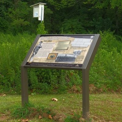
By Allen C. Browne, July 26, 2015
African American Soldiers from Montgomery County Marker
GEOGRAPHIC SORT Title Sort Marker Number Sort Marker Number Sort for Trails Publication Order Sort Publication Order Sort A Erected Year Sort Most Viewed Sort Most Recent-Interest Sort Most Recently Changed Sort SEE FAQ #33 FOR DESCRIPTIONS
Near Darnestown Road (Maryland Route 28) 1 mile north of Beallsville Road (Route 109), on the right when traveling north.
On Beallsville Road (Maryland Route 109) north of Darnestown Road ( Route 28), on the right when traveling south.
On Beallsville Road (Maryland Route 109) north of Darnestown Road ( Route 28), on the right when traveling south.
On Beallsville Road (Maryland Route 109) just north of Darnestown Road ( Route 28), on the right when traveling south.
Near Elliott Road 0.4 miles west of Ashfield Road, on the right when traveling west.
On Elliott Road 0.4 miles west of Ashfield Road, on the right when traveling west.
On Arlington Road at Elm Street, on the left when traveling north on Arlington Road.
On Elliott Road 0.4 miles west of Ashfield Road, on the right when traveling west.
Near Elliott Road 0.4 miles west of Ashfield Road, on the right when traveling west.
On Capital Crescent Trail 0.4 miles south of River Road ( Route 190), on the left when traveling south.
On Capital Crescent Trail 0.4 miles south of River Road ( Route 190), on the left when traveling south.
On Rock Creek Trail west of Cedar Lane, on the right when traveling west.
On Capital Crescent Trail 1.7 miles south of River Road ( Route 190), on the right when traveling south.
On Western Avenue east of Park Avenue, on the right when traveling west.
Near River Road (Maryland Route 190) west of Willard Avenue, on the right when traveling west.
Paid Advertisement
On Capital Crescent Trail south of Bethesda Avenue, on the right when traveling east.
On Bethesda Avenue just west of Woodmont Avenue, on the left when traveling west.
Near Elliott Road 0.4 miles west of Ashfield Road, on the right when traveling west.
On Grosvenor Lane at Rockville Pike ( Road 355), on the right when traveling north on Grosvenor Lane.
Near Lake Ridge Drive 0.1 miles north of Lake Ridge Drive, on the left when traveling north.
On White Ground Road west of Hoyles Mill Road when traveling west.
On Lake Ridge Drive just north of Lake Ridge Drive, on the left when traveling north.
On Lake Ridge Drive 0.7 miles south of Black Hills Road, on the right when traveling south.
Near Zion Road south of Sundown Road, on the right when traveling north.
On Georgia Avenue (Maryland Route 97) at Brookeville Road, on the right when traveling south on Georgia Avenue.
On Brookeville Road 0.3 miles east of Grayhaven Manor Road, on the right when traveling east.
Near Zion Road south of Sundown Road, on the right when traveling north.
Near Zion Road south of Sundown Road, on the right when traveling north.
On Meadowbrook Lane 0.2 miles south of East-West Highway ( Route 410), on the right when traveling south.
On Jones Mill Road at East-West Highway ( Route 410), on the right when traveling north on Jones Mill Road.
Near Western Piedmont Trail 4.9 miles west of Clarksburg Road, on the left when traveling west.
Paid Advertisement
Near North Frederick Road (Maryland Route 355) just south of Stringtown Road.
On North Frederick Road (Maryland Route 355) south of Stringtown Road, on the right when traveling south.
On North Frederick Road (Maryland Route 355) just south of Stringtown Road, on the right when traveling south.
Near Hyattstown Mill Road 0.2 miles east of Frederick Road ( Route 355), on the right when traveling east.
On North Frederick Road (Maryland Route 355) near Stringtown Road.
On North Frederick Road (Maryland Route 355) 0.1 miles north of Prescott Road, on the right when traveling north.
Near Piping Rock Drive at Eastway Drive, on the right when traveling east.
Near Darnestown Road (Maryland Route 28) just east of Seneca Road ( Route 112), on the left when traveling east.
Near Darnestown Road (Maryland Route 28) east of Seneca Road ( Route 112), on the left when traveling east.
Near Darnestown Road close to Seneca Road.
Near Darnestown Road (Maryland Route 28) at Seneca Road (Route 112), on the right when traveling west.
Near Darnestown Road (Maryland Route 28) east of Seneca Road ( Route 112), on the left when traveling east.
Near River Road (Maryland Route 190) 0.4 miles east of Petit Way, on the right when traveling east.
Near Darnestown Road (Maryland Route 28) at Seneca Road ( Route 112), on the left when traveling east.
Paid Advertisement
Near Darnestown Road (Maryland Route 28) 0.4 miles west of Seneca Road ( Route 112), on the right when traveling west.
Near Darnestown Road (Route 28) just east of Seneca Road (Route 112), on the left when traveling east.
Near Darnestown Road (Maryland Route 28) east of Seneca Road ( Route 112), on the left when traveling east.
On Rock Creek Park Road 0.3 miles north of Muncaster Road, on the right when traveling north.
Near Rock Creek Park Road north of Muncaster Road, on the right when traveling north.
Near Needwood Road 0.1 miles north of Jousting Terrace, on the right when traveling east.
On Rock Creek Park Road 0.6 miles north of Muncaster Road, on the left when traveling north.
On Rock Creek Park Road 0.6 miles north of Muncaster Road, on the left when traveling north.
On Darnestown Road (Maryland Route 28) 1.1 miles north of Beallsville Road ( Route 109), on the right when traveling north.
Near Darnestown Road (Maryland Route 28) 1.1 miles north of Beallsville Road ( Route 109), on the right when traveling north.
Near Wasche Road 0.3 miles north of Farm Road Trail, on the right when traveling north.
On Rock Creek Park Road 0.5 miles north of Muncaster Mill Road, on the right when traveling north.
On Brink Road 0.1 miles east of Goshen Road, on the right when traveling west.
Near Snouffer School Road 0.1 miles south of Calypso Lane, on the left when traveling south.
Paid Advertisement
Near Beach Drive 0.3 miles north of Knowles Avenue ( Route 547), on the right when traveling north.
On Hampden Street at Vaughn Street, on the right when traveling west on Hampden Street.
On Kensington Parkway, on the right when traveling south.
Near Rock Creek Trail south of Ken-Gar Palisades Park, on the left when traveling south.
Near North Frederick Avenue (Maryland Route 355) north of Game Preserve Road, on the right when traveling north.
On Watkins Mill Road north of Apple Ridge Road, on the right when traveling north.
Near Old Georgetown Road (Maryland Route 187) 0.1 miles south of Tilden Lane, on the right when traveling south.
Near Old Georgetown Road (Maryland Route 187) 0.1 miles south of Tilden Lane, on the right when traveling south.
Near Old Georgetown Road (Maryland Route 187) 0.1 miles south of Tilden Lane, on the right when traveling south.
Near Old Georgetown Road (Maryland Route 187) 0.1 miles south of Tilden Lane, on the right when traveling south.
Near Nicholson Lane at Old Georgetown Road ( Route 187), on the right when traveling west.
On Old Georgetown Road (Maryland Route 187) 0.1 miles south of Tilden Lane, on the right when traveling south.
Near Old Georgetown Road (Maryland Route 187) 0.1 miles south of Tilden Lane, on the right when traveling south.
Near Nicholson Lane at Old Georgetown Road ( Route 187), on the right when traveling west.
Near Old Georgetown Road (Maryland Route 187) 0.1 miles south of Tilden Lane, on the right when traveling south.
On Old Georgetown Road (Maryland Route 187) 0.1 miles south of Tilden Lane, on the right when traveling south.
Paid Advertisement
Near Old Georgetown Road (Maryland Route 187) 0.1 miles south of Tilden Lane, on the right when traveling south.
Near Old Georgetown Road (Maryland Route 187) 0.1 miles south of Tilden Lane, on the right when traveling south.
On Nicholson Lane at Old Georgetown Road ( Route 187), on the right when traveling west on Nicholson Lane.
On Old Georgetown Road (Maryland Route 187) 0.1 miles south of Tilden Lane, on the right when traveling south.
On Brookeville Road 0.2 miles east of Grayheaven Manor Road, on the right when traveling east.
Near River Road (Maryland Route 190) 1.6 miles east of Seneca Road ( Route 112), on the right when traveling east.
Near Rock Creek Park Road 0.3 miles north of Muncaster Road, on the right when traveling north.
Near Rock Creek Park Road 0.5 miles north of Muncaster Road, on the right when traveling north.
On Washington Grove Lane south of Mineral Springs Drive, on the left when traveling north.
On Washington Grove Lane at Mineral Springs Drive, on the left when traveling north on Washington Grove Lane.
Near Rock Creek Park Road 0.5 miles north of Muncaster Road, on the right when traveling north.
Near Rock Creek Park Road 0.5 miles north of Muncaster Road, on the right when traveling north.
On Washington Grove Lane south of Mineral Springs Drive, on the right when traveling south.
On Viers Mill Road (Maryland Route 586) near Twinbrook Parkway, on the right when traveling west.
Near Muncaster Mill Road (Maryland Route 115) west of Norbeck Road, on the right when traveling west.
Paid Advertisement
Near Norwood Road (Maryland Route 182) 0.1 miles north of Ednor Road, on the right when traveling north.
Near Norwood Road (Maryland Route 182) 0.1 miles north of Ednor Road, on the right when traveling north.
On Park Police Drive near Ednor Road, on the left when traveling east.
On Park Police / Woodlawn Drive, on the right when traveling north.
︽
156 entries matched your criteria. The first 100 are listed above.
The final 56 ⊳