176 entries match your criteria. The first 100 are listed. ⊳
Historical Markers and War Memorials
in Coast & Mountains Region
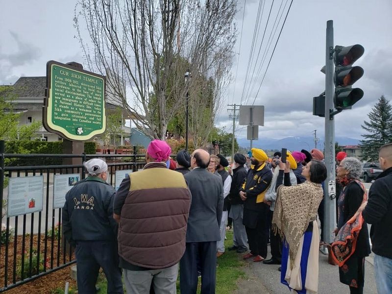
By B.C. Ministry of Transportation and Infrastructure via Flickr (CC BY-NC-ND 2.0)
Gur Sikh Temple Marker
1 ► British Columbia, Fraser Valley, Abbotsford, Clearbrook — Gur Sikh Temple —  |
| On South Fraser Way at Fairlane Street, on the right when traveling west on South Fraser Way. | |||
| 2 ► British Columbia, Fraser Valley, Abbotsford, Sumas Prairie — Sumas Lake Reclamation — |
| Near Cole Road just south of South Parallel Road, on the right when traveling south. | |||
| 3 ► British Columbia, Fraser Valley, Chilliwack, Chilliwack Proper Village West — Chilliwack City Hall / Hotel de Ville de Chilliwack — |
| On Spadina Avenue, on the left when traveling west. | |||
| 4 ► British Columbia, Fraser Valley, Hope — Christ Church — |
| On Fraser Avenue north of Park Avenue, on the right when traveling north. | |||
| 5 ► British Columbia, Fraser Valley, Hope — Tashme — |
| On Sumallo River Road 0.05 kilometers south of Crowsnest Highway (Provincial Highway 3), on the right when traveling south. | |||
| 6 ► British Columbia, Fraser Valley, Hope — The Hope Slide — |
| Near Crowsnest Highway, on the right when traveling west. | |||
| 7 ► British Columbia, Fraser Valley, Manning Park — The Dewdney Trail — |
| Near Crowsnest Highway (Provincial Highway 3) 12.7 kilometers east of E.C. Manning Provincial Park's west entrance gate, on the left when traveling east. | |||
| 8 ► British Columbia, Fraser Valley, Squeah — Early Chinese — |
| On Emory Creek Park Road 0.8 kilometers south of Trans-Canada Highway (Provincial Highway 1), on the left when traveling south. | |||
| 9 ► British Columbia, Fraser Valley, Yale — Historic Yale — |
| Near Douglas Street east of Victoria Street, on the left when traveling east. | |||
| 10 ► British Columbia, Fraser Valley, Yale — J.W. Trutch — 1826-1904 |
| Near Trans-Canada Highway (Provincial Highway 1) south of Anderson River Mainline Road, on the right when traveling south. Reported missing. | |||
| 11 ► British Columbia, Fraser Valley, Yale — The Yale Convention — |
| Near Douglas Street east of Victoria Street, on the left when traveling east. | |||
| 12 ► British Columbia, Metro Vancouver, Burnaby, Maywood — Bright Waters — |
| On Beresford Street east of Silver Avenue, on the right when traveling south. | |||
| 13 ► British Columbia, Metro Vancouver, Burnaby, Maywood — Central Park — City of Burnaby Heritage Site — |
| Near Kingsway (British Columbia Route 1A) east of Boundary Road, on the right when traveling east. | |||
| 14 ► British Columbia, Metro Vancouver, Burnaby, Maywood — Central Park Bandstand — City of Burnaby Heritage Site — |
| Near Kingsway (Provincial Highway 1A) east of Boundary Road, on the right when traveling east. | |||
| 15 ► British Columbia, Metro Vancouver, Burnaby, Maywood — Jubilee Grove — City of Burnaby Heritage Site — |
| On Kingsway (Provincial Highway 1A) at Patterson Avenue, on the right when traveling east on Kingsway. | |||
| 16 ► British Columbia, Metro Vancouver, Burnaby, Maywood — Korean War Memorial — |
| On Boundary Road just north of East 46th Avenue, on the right when traveling north. | |||
| 17 ► British Columbia, Metro Vancouver, Burnaby, Maywood — South Burnaby Cenotaph — |
| On Imperial Street at Nelson Avenue, on the left when traveling east on Imperial Street. | |||
| 18 ► British Columbia, Metro Vancouver, Burnaby, Maywood — Variety Park Playground — |
| Near Kingsway (Provincial Highway 1A) east of Boundary Road, on the right when traveling east. | |||
| 19 ► British Columbia, Metro Vancouver, Delta — Salmon! — |
| On Gunderson Road just south of Elevator Road, on the right when traveling south. | |||
| 20 ► British Columbia, Metro Vancouver, Langley Twp — Fort Langley — |
| On Mavis Ave. | |||
| 21 ► British Columbia, Metro Vancouver, New Westminster — Carnegie Library — 1905 - 1958 — |
| On Carnavon Street at McKenzie Street, on the left when traveling east on Carnavon Street. | |||
| 22 ► British Columbia, Metro Vancouver, New Westminster — Irving House — |
| On Royal Avenue at Merivale Street, on the right when traveling east on Royal Avenue. | |||
| 23 ► British Columbia, Metro Vancouver, New Westminster — The Great Fire — New Westminster — |
| On Columbia Street at 4th Street on Columbia Street. | |||
| 24 ► British Columbia, Metro Vancouver, New Westminster — The New Westminster Court House and Land Registry Office — |
| Near Carnavon Street at McKenzie Street. | |||
| 25 ► British Columbia, Metro Vancouver, North Vancouver — Pacific Great Eastern Railway Station — Protected Heritage Building - 1913 — |
| Near Lonsdale Avenue at Carrie Cates Court. | |||
| 26 ► British Columbia, Metro Vancouver, North Vancouver — St. Paul's Church — L'église Saint-Paul — |
| On Esplanade West 0.1 kilometers south of Mission Road, on the left when traveling south. | |||
| 27 ► British Columbia, Metro Vancouver, Port Moody — Port Moody |
| On Esplanade Avenue 0.4 kilometers north of Murray Street, on the right when traveling north. Reported missing. | |||
| 28 ► British Columbia, Metro Vancouver, Richmond — B.C. Hydro Helped The YVR Expansion Take Flight — |
| On Grant McConachie Way, on the right when traveling west. | |||
| 29 ► British Columbia, Metro Vancouver, Richmond — New International Terminal and Third Runway — |
| On Grant McConachie Way, on the right when traveling west. | |||
| 30 ► British Columbia, Metro Vancouver, Richmond — Thanks and Remembrance — |
| On Grant McConachie Way. | |||
| 31 ► British Columbia, Metro Vancouver, Richmond — Vancouver Control Tower / La tour de contrôle de Vancouver — |
| On Grant McConachie Way, on the right when traveling west. | |||
| 32 ► British Columbia, Metro Vancouver, Richmond, Steveston — Japanese Fisherman Monument — |
| Near Railway Avenue at Westwater Drive, on the right when traveling south. | |||
| 33 ► British Columbia, Metro Vancouver, Richmond, Steveston — West Coast Fishery / La Pêche Sur La Côte Ouest — |
| On Fourth Avenue at Moncton Street, on the right when traveling south on Fourth Avenue. | |||
| 34 ► British Columbia, Metro Vancouver, Surrey — Farming History — Part of Surrey’s Cultural Heritage — |
| Near Crescent Road. | |||
| 35 ► British Columbia, Metro Vancouver, Surrey — Historic Elgin — Part of Surrey’s Heritage Resources — |
| On Crescent Road at 142a Street on Crescent Road. | |||
| 36 ► British Columbia, Metro Vancouver, Surrey — Historic Port Elgin — Transportation & Communication — Part of Surrey’s Built Heritage — |
| Near Elgin Road. | |||
| 37 ► British Columbia, Metro Vancouver, Surrey — Historic Stewart Farmhouse — Part of Surrey’s Built Heritage — |
| Near Crescent Road. | |||
| 38 ► British Columbia, Metro Vancouver, Surrey — Peace Arch — The Signing of the Columbia River Treaty — |
| On 0 Avenue (Interstate 5), on the left when traveling south. | |||
| 39 ► British Columbia, Metro Vancouver, Surrey — The Semiahmoo Trail — |
| On Elgin Road, on the right when traveling south. | |||
| 40 ► British Columbia, Metro Vancouver, Surrey, Crescent Beach — Historic McMillan Expedition — Part of Surrey’s Heritage — |
| On Sullivan Street. | |||
| 41 ► British Columbia, Metro Vancouver, Vancouver, Central Vancouver — "Gassy Jack" — 1830-1875 — The Founding Father of Gastown — |
| On Powell Street at Carrall Street on Powell Street. | |||
| 42 ► British Columbia, Metro Vancouver, Vancouver, Central Vancouver — "O Canada" House — Built 1897 — |
| On Barclay Street, on the left when traveling north. | |||
| 43 ► British Columbia, Metro Vancouver, Vancouver, Central Vancouver — 326 West Pender Street — City of Vancouver Heritage Building — Architect: J.S.D. Taylor — |
| On West Pender Street close to Hamilton Street, on the right when traveling east. | |||
| 44 ► British Columbia, Metro Vancouver, Vancouver, Central Vancouver — 3rd Malkin Warehouse — A Glimpse of Gastown’s Past — |
| On Water Street, on the right when traveling west. | |||
| 45 ► British Columbia, Metro Vancouver, Vancouver, Central Vancouver — A Position of Honour — |
| On Stanley Park Drive, on the left when traveling west. | |||
| 46 ► British Columbia, Metro Vancouver, Vancouver, Central Vancouver — Abrams Block — City of Vancouver Heritage Building — |
| On Carrall Street, on the left when traveling south. | |||
| 47 ► British Columbia, Metro Vancouver, Vancouver, Central Vancouver — Angel of Victory, CPR Station Bronze War Memorial — |
| On West Cordova Street, on the right when traveling west. | |||
| 48 ► British Columbia, Metro Vancouver, Vancouver, Central Vancouver — B.C. Electric Building — City of Vancouver Heritage Building — Architects: Sharp and Thompson Berwick Pratt — |
| On Burrard Street at Nelson Street, on the right when traveling north on Burrard Street. | |||
| 49 ► British Columbia, Metro Vancouver, Vancouver, Central Vancouver — BC & Yukon Chamber of Mines — City of Vancouver Heritage Building — |
| On West Hastings Street, on the right when traveling north. | |||
| 50 ► British Columbia, Metro Vancouver, Vancouver, Central Vancouver — Beacon of Maritime Safety — |
| Near Stanley Park Drive, on the right when traveling west. | |||
| 51 ► British Columbia, Metro Vancouver, Vancouver, Central Vancouver — Beaver — First Steamship in the Pacific Northwest — 1836~1888 — |
| On Stanley Park Drive. | |||
| 52 ► British Columbia, Metro Vancouver, Vancouver, Central Vancouver — Beaver Crest Pole — |
| On Brockton Point Trail. | |||
| 53 ► British Columbia, Metro Vancouver, Vancouver, Central Vancouver — Before the Lagoon Was Lost — |
| On Lost Lagoon Path. | |||
| 54 ► British Columbia, Metro Vancouver, Vancouver, Central Vancouver — Byrnes Block — A Glimpse at Gastown’s Past — |
| On Carrall Street, on the left when traveling north. | |||
| 55 ► British Columbia, Metro Vancouver, Vancouver, Central Vancouver — Canada Pacific Railway Station — City of Vancouver Heritage Building — |
| On Seymour Street. | |||
| 56 ► British Columbia, Metro Vancouver, Vancouver, Central Vancouver — Canada Pavillion — |
| On Canada Place. | |||
| 57 ► British Columbia, Metro Vancouver, Vancouver, Central Vancouver — Canada Place — |
| On Canada Place. | |||
| 58 ► British Columbia, Metro Vancouver, Vancouver, Central Vancouver — Canadian Bank of Commerce Building — Architects: Darling and Pearson — City of Vancouver Heritage Building — |
| On Granville Street close to West Hastings Street. | |||
| 59 ► British Columbia, Metro Vancouver, Vancouver, Central Vancouver — Carnegie Library — City of Vancouver Heritage Building — Architect: George William Grant — |
| Near Main Street at East Hastings Street. | |||
| 60 ► British Columbia, Metro Vancouver, Vancouver, Central Vancouver — Ceperley Rounsefell Building — City of Vancouver Heritage Building — |
| On West Hastings Street, on the right when traveling east. | |||
| 61 ► British Columbia, Metro Vancouver, Vancouver, Central Vancouver — Chehalis Cross — |
| On Stanley Park Drive. | |||
| 62 ► British Columbia, Metro Vancouver, Vancouver, Central Vancouver — Chief Skedans Mortuary Pole — |
| On Brockton Point Trail. | |||
| 63 ► British Columbia, Metro Vancouver, Vancouver, Central Vancouver — Chief Wakas Pole — |
| On Brockton Point Trail. | |||
| 64 ► British Columbia, Metro Vancouver, Vancouver, Central Vancouver — Cordage Building — City of Vancouver Heritage Building — |
| On Water Street, on the left when traveling west. | |||
| 65 ► British Columbia, Metro Vancouver, Vancouver, Central Vancouver — Creating a Vancouver Icon: the Lions Gate Bridge |
| Near Stanley Park Drive when traveling north. Reported missing. | |||
| 66 ► British Columbia, Metro Vancouver, Vancouver, Central Vancouver — Deutschesland Café — City of Vancouver Heritage Building — Architect: Max B. Downing — |
| On Seymour Street just south of Dunsmuir Street, on the left when traveling north. | |||
| 67 ► British Columbia, Metro Vancouver, Vancouver, Central Vancouver — Disasters and Narrow Escapes — |
| Near Stanley Park Drive, on the right when traveling west. | |||
| 68 ► British Columbia, Metro Vancouver, Vancouver, Central Vancouver — Downtown Skyline — |
| On Stanley Park Seawall Path. | |||
| 69 ► British Columbia, Metro Vancouver, Vancouver, Central Vancouver — Drill Hall — City of Vancouver Heritage Building — Architect: Department of Public Works — |
| On Beatty Street at Dunsmuir Street, on the right when traveling north on Beatty Street. | |||
| 70 ► British Columbia, Metro Vancouver, Vancouver, Central Vancouver — Drs. James Till & Ernest McCulloch — |
| On Quebec Street. | |||
| 71 ► British Columbia, Metro Vancouver, Vancouver, Central Vancouver — Edward Hotel — |
| On Water Street at Cambie Street, on the left when traveling west on Water Street. | |||
| 72 ► British Columbia, Metro Vancouver, Vancouver, Central Vancouver — Ferguson Point — |
| On Stanley Park Drive, on the right when traveling south. | |||
| 73 ► British Columbia, Metro Vancouver, Vancouver, Central Vancouver — Financial District — |
| On West Hastings Street at Granville Street, on the left when traveling north on West Hastings Street. | |||
| 74 ► British Columbia, Metro Vancouver, Vancouver, Central Vancouver — First Known AIDS Memorial — |
| On Denman Street. | |||
| 75 ► British Columbia, Metro Vancouver, Vancouver, Central Vancouver — First West Vancouver Ferry — |
| On Denman Street. | |||
| 76 ► British Columbia, Metro Vancouver, Vancouver, Central Vancouver — Flack Block — City of Vancouver Heritage Building — Architect: William Blackmore — |
| On West Hastings Street at Cambie Street, on the right when traveling west on West Hastings Street. | |||
| 77 ► British Columbia, Metro Vancouver, Vancouver, Central Vancouver — From Coal Seams to Park — |
| On Gilford Street. | |||
| 78 ► British Columbia, Metro Vancouver, Vancouver, Central Vancouver — Ga'akstalas — |
| On Brockton Point Trail. | |||
| 79 ► British Columbia, Metro Vancouver, Vancouver, Central Vancouver — Gastown — |
| On Water Street. | |||
| 80 ► British Columbia, Metro Vancouver, Vancouver, Central Vancouver — George Leslie's Lane Cottage — City of Vancouver Heritage Building — |
| On Pendrell Street. | |||
| 81 ► British Columbia, Metro Vancouver, Vancouver, Central Vancouver — Greenshields Building — City of Vancouver Heritage Building — |
| On Water Street, on the right when traveling west. | |||
| 82 ► British Columbia, Metro Vancouver, Vancouver, Central Vancouver — Hallelujah Point — 1887 - 1967 — |
| On Stanley Park Drive. | |||
| 83 ► British Columbia, Metro Vancouver, Vancouver, Central Vancouver — Harry Winston Jerome — |
| On Stanley Park Drive. | |||
| 84 ► British Columbia, Metro Vancouver, Vancouver, Central Vancouver — Her Majesty's Canadian Ship Discovery — |
| On Stanley Park Seawall Path. | |||
| 85 ► British Columbia, Metro Vancouver, Vancouver, Central Vancouver — Here Stood Hamilton — |
| On West Hastings Street close to Hamilton Street. | |||
| 86 ► British Columbia, Metro Vancouver, Vancouver, Central Vancouver — Hotel Georgia — |
| On West Georgia Street at Howe Street, on the right when traveling north on West Georgia Street. | |||
| 87 ► British Columbia, Metro Vancouver, Vancouver, Central Vancouver — Hotel Vancouver — City of Vancouver Heritage Building — |
| On Hornby Street, on the left when traveling north. | |||
| 88 ► British Columbia, Metro Vancouver, Vancouver, Central Vancouver — Indian Totem Poles — |
| On Brockton Point Trail. | |||
| 89 ► British Columbia, Metro Vancouver, Vancouver, Central Vancouver — Inukshuk — |
| On Beach Avenue. | |||
| 90 ► British Columbia, Metro Vancouver, Vancouver, Central Vancouver — Jack Poole Plaza — |
| On Canada Place. | |||
| 91 ► British Columbia, Metro Vancouver, Vancouver, Central Vancouver — Japanese Canadian War Memorial — |
| On Pipeline Road. | |||
| 92 ► British Columbia, Metro Vancouver, Vancouver, Central Vancouver — Kakaso'las — People Come From Far Away to Seek Her Advice — |
| On Brockton Point Trail. | |||
| 93 ► British Columbia, Metro Vancouver, Vancouver, Central Vancouver — Komagata Maru — |
| On West Waterfront Road. | |||
| 94 ► British Columbia, Metro Vancouver, Vancouver, Central Vancouver — Lions Gate Bridge — |
| On Stanley Park Drive. | |||
| 95 ► British Columbia, Metro Vancouver, Vancouver, Central Vancouver — Meet You Under the Clock — |
| On Granville Street at West Hastings Street, on the right when traveling north on Granville Street. | |||
| 96 ► British Columbia, Metro Vancouver, Vancouver, Central Vancouver — Nagle Bros. Garage — Architects: McCarter & Nairne — |
| On Water Street, on the left when traveling west. | |||
| 97 ► British Columbia, Metro Vancouver, Vancouver, Central Vancouver — Nine O'Clock Gun — |
| Near Stanley Park Drive 1 kilometer east of West Georgia Street. | |||
| 98 ► British Columbia, Metro Vancouver, Vancouver, Central Vancouver — Orpheum Theatre — |
| On Granville Street, on the right when traveling north. | |||
| 99 ► British Columbia, Metro Vancouver, Vancouver, Central Vancouver — Oscar Maltipi Pole — |
| On Brockton Point Trail. | |||
| 100 ► British Columbia, Metro Vancouver, Vancouver, Central Vancouver — Percy Williams Statue — Percy Williams (1908 - 1982) — |
| On Expo Boulevard, on the left when traveling west. | |||
176 entries matched your criteria. The first 100 are listed above. The final 76 ⊳