213 entries match your criteria. The first 100 are listed. ⊳
Historical Markers and War Memorials
in the Platte River Valley Region
By Larry Lee, September 7, 2026
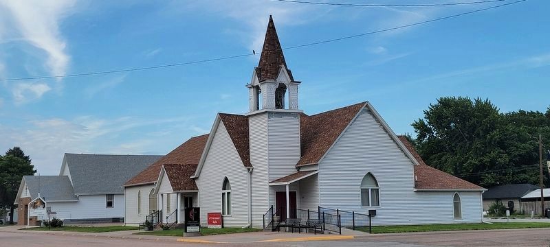
United Methodist Church
1 ► Nebraska, Buffalo County, Elm Creek — Elm Creek —  |
| On North Tyler Street, on the right when traveling south. | |||
| 2 ► Nebraska, Buffalo County, Gibbon — First Buffalo County Court House — |
| On Court Street (State Highway 10C) at 2nd Street, on the left when traveling south on Court Street. | |||
| 3 ► Nebraska, Buffalo County, Gibbon — 115 — Gibbon — 1871 - 1971 — |
| On Windmill St Recreation Road east of Lowell Road (Nebraska Route 10C), on the right when traveling east. | |||
| 4 ► Nebraska, Buffalo County, Gibbon — 201 — Gibbon — |
| On 2nd Street near Court Street (Nebraska Highway 10C), on the left when traveling west. | |||
| 5 ► Nebraska, Buffalo County, Gibbon — In Honor of D. E. "Mac" McGregor — |
| On Windmill State Recreation Road just west of Lowell Road (Nebraska Route 10C), on the right when traveling east. | |||
| 6 ► Nebraska, Buffalo County, Gibbon — Memorial Tree — |
| On 2nd Street east of Court Street (Nebraska Highway 10C), on the right when traveling east. | |||
| 7 ► Nebraska, Buffalo County, Gibbon — 359 — Nebraska Centre - Boyd Ranche — |
| On U.S. 30 0.1 miles east of Navaho Road. | |||
| 8 ► Nebraska, Buffalo County, Gibbon — The Soldiers Free Homestead Colony — In Memory Of — April 7, 1871 — |
| On LaBarre Street at 1st Street, on the left when traveling south on LaBarre Street. | |||
| 9 ► Nebraska, Buffalo County, Kearney — Baldwin Engine 481 — |
| Near West 11th Street. | |||
| 10 ► Nebraska, Buffalo County, Kearney — Boyd House — |
| On West 11th Street. | |||
| 11 ► Nebraska, Buffalo County, Kearney — 488 — Buffalo County’s Lincoln Highway Seedling Mile — |
| On U.S. 30, on the right when traveling west. | |||
| 12 ► Nebraska, Buffalo County, Kearney — Dr. Paul Ambrose — |
| On 31st Street at Central Avenue, on the right when traveling west on 31st Street. | |||
| 13 ► Nebraska, Buffalo County, Kearney — Empress Theatre — 1914 — |
| On Central Avenue near 22nd Street, on the right when traveling north. | |||
| 14 ► Nebraska, Buffalo County, Kearney — Frontier Forts in Nebraska — |
| Near Interstate 80. | |||
| 15 ► Nebraska, Buffalo County, Kearney — German Baptist Church of the Brethren — |
| On W. 11th Street. | |||
| 16 ► Nebraska, Buffalo County, Kearney — Good Samaritan Air Crew — |
| On 31st Street at Central Avenue, on the right when traveling west on 31st Street. | |||
| 17 ► Nebraska, Buffalo County, Kearney — 153 — Historic Kearney — |
| On West 11th Street at 6th Avenue, on the right when traveling west on West 11th Street. | |||
| 18 ► Nebraska, Buffalo County, Kearney — Hostetler Amphitheatre — |
| Near Interstate 80 Alternate. | |||
| 19 ► Nebraska, Buffalo County, Kearney — Kearney — From the Beginning — |
| On Central Avenue at 19th Street, on the left when traveling north on Central Avenue. | |||
| 20 ► Nebraska, Buffalo County, Kearney — Kearney Civil War and Spanish-American War Memorial — |
| On Central Avenue at East 25th Street (U.S. 30), on the left when traveling south on Central Avenue. | |||
| 21 ► Nebraska, Buffalo County, Kearney — 148 — Kearney Cotton Mill — |
| On U.S. 30 0.2 miles east of 46th Avenue, on the right when traveling east. | |||
| 22 ► Nebraska, Buffalo County, Kearney — Kearney State College Memorial Carillon Tower — |
| Near Interstate 80 Alternate. | |||
| 23 ► Nebraska, Buffalo County, Kearney — Kearney-Fort Kearny — |
| On Interstate 80 close to Alternate Interstate 80, on the right when traveling east. | |||
| 24 ► Nebraska, Buffalo County, Kearney — Loup River Freighter Hotel — |
| Near West 11th Street. | |||
| 25 ► Nebraska, Buffalo County, Kearney — Old Oregon Trail — |
| On Central Avenue at Railroad Street, on the right when traveling north on Central Avenue. | |||
| 26 ► Nebraska, Buffalo County, Kearney — Shelton Union Pacific Depot — |
| On West 11th Street. | |||
| 27 ► Nebraska, Buffalo County, Kearney — Site of Bauer Drug — November 1, 1946 - December 1958 — Proprietor, George J. Bauer — |
| On Central Avenue near 19th Street, on the left when traveling north. | |||
| 28 ► Nebraska, Buffalo County, Kearney — The Frank House — |
| Near University Drive 0.2 miles east of Lincoln Highway (U.S. 30), on the right when traveling east. | |||
| 29 ► Nebraska, Buffalo County, Kearney — 202 — The Great Plains — |
| On Interstate 80 at milepost 271, on the right when traveling west. | |||
| 30 ► Nebraska, Buffalo County, Kearney — The Mormon Pioneer Trail / Frontier Mail Carriers — Mormon Pioneer National Historic Trail — |
| On the Kearny Eastbound Rest Area (Interstate 80 at milepost 269), 16.5 miles east of the Odessa Road interchange (Nebraska Route 108), on the right when traveling east. | |||
| 31 ► Nebraska, Buffalo County, Kearney — 178 — The Watson Ranch — |
| On U.S. 30 at 1733 Road, on the right when traveling east on U.S. 30. | |||
| 32 ► Nebraska, Buffalo County, Kearney — 125 — University of Nebraska at Kearney — |
| On 9th Avenue at U.S. 30, on the right when traveling south on 9th Avenue. | |||
| 33 ► Nebraska, Buffalo County, Ravenna — 370 — Civilian Conservation Corps — Ravenna, Nebraska — |
| On State Highway 2 1 mile east of Ravenna Road (State Highway 68), on the right when traveling east. | |||
| 34 ► Nebraska, Buffalo County, Ravenna — John Pesek — World Champion Wrestler — |
| On Grand Avenue (State Highway 68) at East Syracuse Street, on the right when traveling north on Grand Avenue. | |||
| 35 ► Nebraska, Buffalo County, Ravenna — Pleasanton Branch Union Pacific Railroad — |
| On State Highway 2 1 mile east of Ravenna Road (State Highway 68), on the right when traveling east. | |||
| 36 ► Nebraska, Buffalo County, Ravenna — 361 — Post South Loup Fork — "Fort Banishment" — |
| On State Highway 2 1 mile east of Ravenna Road (State Highway 68), on the right when traveling east. | |||
| 37 ► Nebraska, Buffalo County, Shelton — Early Shelton Pioneers — |
| On U.S. 30 at South C Street, on the left when traveling west on U.S. 30. | |||
| 38 ► Nebraska, Buffalo County, Shelton — 407 — Joseph E. Johnson and the Huntsman’s Echo — |
| On U.S. 30 at South D Street, on the right when traveling west on U.S. 30. | |||
| 39 ► Nebraska, Buffalo County, Shelton — Meisner Bank Building — |
| On Lincoln Highway (U.S. 30) at C Street, on the right when traveling west on Lincoln Highway. | |||
| 40 ► Nebraska, Dawson County, Cozad — 73 — Central Platte Valley — |
| Near Interstate 80 at milepost 226, on the right when traveling east. | |||
| 41 ► Nebraska, Dawson County, Cozad — 74 — Central Platte Valley — |
| On Interstate 80 at milepost 227, on the right when traveling west. | |||
| 42 ► Nebraska, Dawson County, Cozad — 17 — The 100th Meridian — |
| On U.S. 30 at North Meridian Avenue, on the right when traveling east on U.S. 30. | |||
| 43 ► Nebraska, Dawson County, Cozad — Willow Express Station — |
| On East 9th Street, on the right when traveling west. | |||
| 44 ► Nebraska, Dawson County, Cozad — Willow Island Pony Express Station — |
| On East 9th Street, on the right when traveling west. | |||
| 45 ► Nebraska, Dawson County, Gothenburg — Dedicated to Sod House Settlers — |
| On Platte River Road east of Route 47, in the median. | |||
| 46 ► Nebraska, Dawson County, Gothenburg — Dissected Loess Plains — |
| On 15th Street, on the left when traveling east. | |||
| 47 ► Nebraska, Dawson County, Gothenburg — Gothenburg — |
| On 16th Street, on the right when traveling west. | |||
| 48 ► Nebraska, Dawson County, Gothenburg — Original Pony Express Station — 1854 — |
| On 16th Street, on the left when traveling east. | |||
| 49 ► Nebraska, Dawson County, Gothenburg — 350 — Swedish Crosses Cemetery — |
| On Local Route 769 at Local Route 409 on Local Route 769. | |||
| 50 ► Nebraska, Dawson County, Gothenburg — The Pony Express — |
| On 15th Street, on the left when traveling east. | |||
| 51 ► Nebraska, Dawson County, Gothenburg — The Road to Zion — |
| On 15th Street, on the left when traveling east. | |||
| 52 ► Nebraska, Dawson County, Lexington — M2 Bradley Fighting Vehicle — Heartland Museum of Military Vehicles — |
| On Heartland Road. | |||
| 53 ► Nebraska, Dawson County, Lexington — M60A1 Main Battle Tank — Heartland Museum of Military Vehicles — |
| On Heartland Road. | |||
| 54 ► Nebraska, Dawson County, Lexington — Plum Creek Railroad Attack — |
| On U.S. 30 0.1 miles west of Road 430, on the right when traveling east. | |||
| 55 ► Nebraska, Dawson County, Overton — 222 — The Tobin Indian Raid — |
| On U.S. 30 at Road 446, on the right when traveling east on U.S. 30. | |||
| 56 ► Nebraska, Hall County, Cairo — 519 — Solon H. Borglum — "Sculptor of the Prairie" — |
| On State Highway 2 5.6 miles west of State Highway 11, on the right when traveling west. | |||
| 57 ► Nebraska, Hall County, Doniphan — Martin Brothers Historic Memorial — Erected to commemorate the Martin Brothers Incident of August 1864 — |
| On South Alda Road at West Platte River Drive (County Route 9), on the left when traveling north on South Alda Road. | |||
| 58 ► Nebraska, Hall County, Doniphan, South Platte Township — Warren Historical Marker — |
| On West Platte River Drive / West Pine Street (County Route 11) 0.2 miles west of South Hilltop Road (County Route 16), on the left when traveling west. | |||
| 59 ► Nebraska, Hall County, Grand Island — 6th Bomb Group — 24 Bomb Sqd. • 39 Bomb Sqd. • 40 Bomb Sqd. — 1944 • B-29 C.B.I.-Guam-Saipan-Tinian • 1945 — |
| Near West Capital Avenue. | |||
| 60 ► Nebraska, Hall County, Grand Island — Amiel Whipple W.R.C. Civil War Memorial — |
| On Capital Avenue near Webb Road, on the right when traveling west. | |||
| 61 ► Nebraska, Hall County, Grand Island — Arrasmith Field — |
| Near Sky Park Road 0.6 miles north of East Airport Road, on the right when traveling north. | |||
| 62 ► Nebraska, Hall County, Grand Island — 163 — B-17 Bomber Crash, 1944 — |
| On Saint Paul Road 0.5 miles north of East White Cloud Road (County Road 41), on the right when traveling north. | |||
| 63 ► Nebraska, Hall County, Grand Island — B-29 Superfortress / 6th Bomb Group / Tinian Island — |
| Near Sky Park Road 0.6 miles north of East Airport Road, on the right when traveling north. | |||
| 64 ► Nebraska, Hall County, Grand Island — 464 — Central Nebraska Regional Airport — |
| Near Sky Park Road 0.6 miles north of East Airport Road, on the right when traveling north. | |||
| 65 ► Nebraska, Hall County, Grand Island — Civil War and Spanish-American War Memorial — |
| On Locust Street near 1st Street (U.S. 30), on the left when traveling south. | |||
| 66 ► Nebraska, Hall County, Grand Island — Earth Lodge Design and Construction — |
| On Tech Ave. at U.S. 34 on Tech Ave.. | |||
| 67 ► Nebraska, Hall County, Grand Island — Federal Building — |
| On 2nd Street (U.S. 30) at Locust Street, on the left when traveling west on 2nd Street. | |||
| 68 ► Nebraska, Hall County, Grand Island — Fort O. K. Cannon — |
| On Locust Street near 1st Street (U.S. 30), on the left when traveling south. | |||
| 69 ► Nebraska, Hall County, Grand Island — Grand Island — |
| On Interstate 80 near the Grand Island Eastbound Rest Area, on the right when traveling east. | |||
| 70 ► Nebraska, Hall County, Grand Island — Grand Island — |
| Near West Stolley Park Road at Park Drive, on the right when traveling east. | |||
| 71 ► Nebraska, Hall County, Grand Island — 172 — Grand Island — |
| On Interstate 80 at milepost 316.5, on the right when traveling west. | |||
| 72 ► Nebraska, Hall County, Grand Island — Grand Island Public School Bell — |
| On 1st Street (U.S. 30) at Cleburn Street, on the left when traveling east on 1st Street. | |||
| 73 ► Nebraska, Hall County, Grand Island — 560 — Grand Island Veterans Home — |
| Near West Capital Avenue just west of Taylor Avenue, on the right when traveling west. | |||
| 74 ► Nebraska, Hall County, Grand Island — 480 — Hall County Courthouse — |
| On 1st Street (U.S. 30) at Locust Street, on the left when traveling west on 1st Street. | |||
| 75 ► Nebraska, Hall County, Grand Island — 506 — Hall County Poor Farm Cemetery — |
| Near American Legion Memorial Highway (U.S. 281) at West Abbott Road (County Road 39), on the right when traveling south. | |||
| 76 ► Nebraska, Hall County, Grand Island — Hall County Veterans Memorial Park — |
| Near West Capital Avenue. | |||
| 77 ► Nebraska, Hall County, Grand Island — 55 — La Grande Isle — |
| Near West Stolley Park Road. | |||
| 78 ► Nebraska, Hall County, Grand Island — Martin Building — |
| On Walnut Street at 3rd Street, on the right when traveling north on Walnut Street. | |||
| 79 ► Nebraska, Hall County, Grand Island — 157 — Mormon Trail — |
| On Tech Drive at U.S. 34 on Tech Drive. | |||
| 80 ► Nebraska, Hall County, Grand Island — Old California Overland Trail — |
| On Tech Drive at U.S. 34 on Tech Drive. | |||
| 81 ► Nebraska, Hall County, Grand Island — 490 — Old Dodge School — World War II POW Branch Camp — |
| On 1st Street (U.S. 30) at Walnut Street, on the right when traveling east on 1st Street. | |||
| 82 ► Nebraska, Hall County, Grand Island — Oldest Remaining School House — |
| Near West Stolley Park Road. | |||
| 83 ► Nebraska, Hall County, Grand Island — Original Home of the Stolley Family — Stolley State Park — |
| Near West Stolley Park Road. | |||
| 84 ► Nebraska, Hall County, Grand Island — 141 — Pioneer Park — |
| On West 2nd Street at Cleburn St. on West 2nd Street. | |||
| 85 ► Nebraska, Hall County, Grand Island — Sinclair Tank Wagon, 1917 — |
| On Bosselman Avenue at Wood River Road, on the right when traveling south on Bosselman Avenue. | |||
| 86 ► Nebraska, Hall County, Grand Island — Site of the Original Settlement in Hall County, Nebraska — July 4, 1857 — |
| Near East Swift Road 0.2 miles west of Museum Drive, on the right when traveling west. | |||
| 87 ► Nebraska, Hall County, Grand Island — 255 — The Lincoln Memorial Highway — |
| On West 2nd Street near West 2nd Street and West Elm Street. | |||
| 88 ► Nebraska, Hall County, Grand Island — The Mormon Trail — |
| On Interstate 80 at milepost 316.5, on the right when traveling west. | |||
| 89 ► Nebraska, Hall County, Grand Island — The Pawnee: Prairie Town Builders, Pawnee History — |
| On Tech Ave. at U.S. 34 on Tech Ave.. | |||
| 90 ► Nebraska, Hall County, Grand Island — The Purple Heart — |
| On Interstate 80 at milepost 316.5, on the right when traveling west. | |||
| 91 ► Nebraska, Hall County, Grand Island — 482 — The Seedling Mile — |
| On Seedling Road, in the median. | |||
| 92 ► Nebraska, Hall County, Grand Island — The Yancey — |
| On Locust Street at 2nd Street (U.S. 30), on the right when traveling north on Locust Street. | |||
| 93 ► Nebraska, Hall County, Grand Island — Vietnam War Memorial — All Gave Some - Some Gave All — |
| Near West Capital Avenue. | |||
| 94 ► Nebraska, Hall County, Wood River — 435 — B-17 Crash, 1943 — |
| On West Husker Highway 0.9 miles west of State Highway 11, on the left when traveling west. | |||
| 95 ► Nebraska, Hall County, Wood River — 553 — Cornhusker Army Ammunition Plant — |
| On West Old Potash Highway 0.2 miles west of North 90th Road, on the right when traveling west. | |||
| 96 ► Nebraska, Hall County, Wood River — 336 — Original Townsite of Wood River — |
| On U.S. 30, on the right when traveling west on U.S. 30. | |||
| 97 ► Nebraska, Hall County, Wood River — Wood River Veterans Memorial — Connor-Benson Post #314 American Legion - Wood River, NE — |
| On West 9th Street, on the right when traveling west. | |||
| 98 ► Nebraska, Howard County, Saint Paul — 559 — Howard County Courthouse — |
| On Indian Street at 6th Street, on the left when traveling west on Indian Street. | |||
| 99 ► Nebraska, Howard County, Saint Paul — 402 — St. Wenceslaus Catholic Cemetery, Warsaw — |
| On 12th Avenue 0.7 miles west of State Highway 11, on the left when traveling west. | |||
| 100 ► Nebraska, Howard County, St. Paul — Ed Fleming — |
| On Howard Street 0.1 miles 5th Street, on the left when traveling west. | |||
213 entries matched your criteria. The first 100 are listed above. Next 100 ⊳