THE HISTORICAL
MARKER DATABASE
“Bite-Size Bits of Local, National, and Global History”


156 entries match your criteria. The first 100 are listed.                                               The final 56 ⊳


Maryland, Montgomery Parks Historical Markers

These markers are erected by Montgomery Parks, the Parks and Recreation Department for Maryland's most populous county in the DC suburbs - Montgomery County.
 
By Allen C. Browne, July 26, 2015
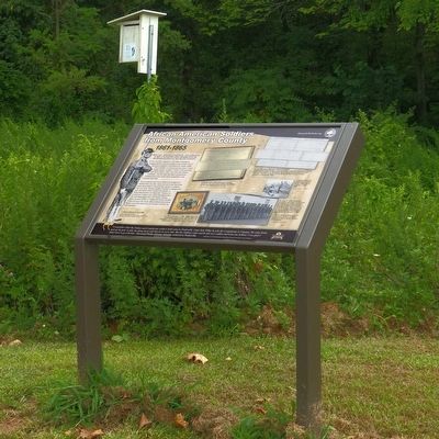
African American Soldiers from Montgomery County Marker
1 ► Maryland, Montgomery County, Beallsville — African American Soldiers from Montgomery County — 1861-1865 —
Near Darnestown Road (Maryland Route 28) 1 mile north of Beallsville Road (Route 109), on the right when traveling north.
2 ► Maryland, Montgomery County, Beallsville — The Country Store —
On Beallsville Road (Maryland Route 109) north of Darnestown Road ( Route 28), on the right when traveling south.
3 ► Maryland, Montgomery County, Beallsville — The Darby Family —
On Beallsville Road (Maryland Route 109) north of Darnestown Road ( Route 28), on the right when traveling south.
4 ► Maryland, Montgomery County, Beallsville — The Darby Store —
On Beallsville Road (Maryland Route 109) just north of Darnestown Road ( Route 28), on the right when traveling south.
5 ► Maryland, Montgomery County, Bethesda — Artist's Conception of Battery Bailey, Circa 1862 —
Near Elliott Road 0.4 miles west of Ashfield Road, on the right when traveling west.
6 ► Maryland, Montgomery County, Bethesda — Battery Bailey —
On Elliott Road 0.4 miles west of Ashfield Road, on the right when traveling west.
7 ► Maryland, Montgomery County, Bethesda — Caroline Freeland — Remarkable Montgomery: Untold Stories / Montgomery Extraordinario: Historias sin contrar —
On Arlington Road at Elm Street, on the left when traveling north on Arlington Road.
8 ► Maryland, Montgomery County, Bethesda — Col. Guilford Dudley Bailey — The Fallen Union Officer for Whom the Battery Was Named —
On Elliott Road 0.4 miles west of Ashfield Road, on the right when traveling west.
9 ► Maryland, Montgomery County, Bethesda — Defending the City of Washington —
Near Elliott Road 0.4 miles west of Ashfield Road, on the right when traveling west.
10 ► Maryland, Montgomery County, Bethesda — Loughborough Mill —
On Capital Crescent Trail 0.4 miles south of River Road ( Route 190), on the left when traveling south.
11 ► Maryland, Montgomery County, Bethesda — Loughborough Mill —
On Capital Crescent Trail 0.4 miles south of River Road ( Route 190), on the left when traveling south.
12 ► Maryland, Montgomery County, Bethesda — Native American Veterans / Veteranos indígenas americanos — Remarkable Montgomery: Untold Stories / Montgomery Extraordinario: Historias Sin Contrar —
On Rock Creek Trail west of Cedar Lane, on the right when traveling west.
13 ► Maryland, Montgomery County, Bethesda — The Dalecarlia Tunnel —
On Capital Crescent Trail 1.7 miles south of River Road ( Route 190), on the right when traveling south.
14 ► Maryland, Montgomery County, Bethesda — The District of Columbia Boundary Stones — [Original Federal Boundary Stone, District of Columbia, Northwest 6] —
On Western Avenue east of Park Avenue, on the right when traveling west.
15 ► Maryland, Montgomery County, Bethesda — The Washington and Glen Echo Railroad —
Near River Road (Maryland Route 190) west of Willard Avenue, on the right when traveling west.
Paid Advertisement
16 ► Maryland, Montgomery County, Bethesda — We Are Still Here / Seguimos aquí — Remarkable Montgomery: Untold Stories / Montgomery Extraordinario: Historias Sin Contrar —
On Capital Crescent Trail south of Bethesda Avenue, on the right when traveling east.
17 ► Maryland, Montgomery County, Bethesda — We Drivers! —
On Bethesda Avenue just west of Woodmont Avenue, on the left when traveling west.
18 ► Maryland, Montgomery County, Bethesda — What is a Battery? —
Near Elliott Road 0.4 miles west of Ashfield Road, on the right when traveling west.
19 ► Maryland, Montgomery County, Bethesda — "The Linden Oak" — - 1976 - —
On Grosvenor Lane at Rockville Pike ( Road 355), on the right when traveling north on Grosvenor Lane.
20 ► Maryland, Montgomery County, Boyds — Black Hill Gold Mine —
Near Lake Ridge Drive 0.1 miles north of Lake Ridge Drive, on the left when traveling north.
21 ► Maryland, Montgomery County, Boyds — Edward U. Taylor School — Remarkable Montgomery: Untold Stories —
On White Ground Road west of Hoyles Mill Road when traveling west.
22 ► Maryland, Montgomery County, Boyds — To Honor the Memory of George A, (Jay) Chadwick Jr. — November 20, 1911 - July 20, 2001 —
On Lake Ridge Drive just north of Lake Ridge Drive, on the left when traveling north.
23 ► Maryland, Montgomery County, Boyds — Welcome to our Earthbench —
On Lake Ridge Drive 0.7 miles south of Black Hills Road, on the right when traveling south.
24 ► Maryland, Montgomery County, Brookeville — Mills in the Upcounty —
Near Zion Road south of Sundown Road, on the right when traveling north.
25 ► Maryland, Montgomery County, Brookeville — Newlin’s Mill —
On Georgia Avenue (Maryland Route 97) at Brookeville Road, on the right when traveling south on Georgia Avenue.
26 ► Maryland, Montgomery County, Brookeville — Oakley Cabin —
On Brookeville Road 0.3 miles east of Grayhaven Manor Road, on the right when traveling east.
27 ► Maryland, Montgomery County, Brookeville — Our Agricultural Heritage —
Near Zion Road south of Sundown Road, on the right when traveling north.
28 ► Maryland, Montgomery County, Brookeville — The Rachel Carson Greenway —
Near Zion Road south of Sundown Road, on the right when traveling north.
29 ► Maryland, Montgomery County, Chevy Chase — Meadowbrook Stables —
On Meadowbrook Lane 0.2 miles south of East-West Highway ( Route 410), on the right when traveling south.
30 ► Maryland, Montgomery County, Chevy Chase — Reforestation — Trees For Our Future —
On Jones Mill Road at East-West Highway ( Route 410), on the right when traveling north on Jones Mill Road.
31 ► Maryland, Montgomery County, Clarksburg — A Real Field of Dreams —
Near Western Piedmont Trail 4.9 miles west of Clarksburg Road, on the left when traveling west.
Paid Advertisement
32 ► Maryland, Montgomery County, Clarksburg — Archaeology at Dowden's Ordinary —
Near North Frederick Road (Maryland Route 355) just south of Stringtown Road.
33 ► Maryland, Montgomery County, Clarksburg — Dowden's Ordinary: A French & Indian War Site —
On North Frederick Road (Maryland Route 355) south of Stringtown Road, on the right when traveling south.
34 ► Maryland, Montgomery County, Clarksburg — Dowden's Ordinary: The Elephant Comes to Clarksburg —
On North Frederick Road (Maryland Route 355) just south of Stringtown Road, on the right when traveling south.
35 ► Maryland, Montgomery County, Clarksburg — Our Daily Bread — The Hyattstown Mill —
Near Hyattstown Mill Road 0.2 miles east of Frederick Road ( Route 355), on the right when traveling east.
36 ► Maryland, Montgomery County, Clarksburg — Tavern Life at Dowden's Ordinary —
On North Frederick Road (Maryland Route 355) near Stringtown Road.
37 ► Maryland, Montgomery County, Clarksburg — Welcome to Froggy Hollow —
Near Kingsley Road.
38 ► Maryland, Montgomery County, Clarksburg — Women on the Homefront in Montgomery County — 1861 – 1865 —
On North Frederick Road (Maryland Route 355) 0.1 miles north of Prescott Road, on the right when traveling north.
39 ► Maryland, Montgomery County, Colesville — The Commonwealth Farm — "Everything We Put Our Hand To Prospered" — Remarkable Montgomery: Untold Stories —
Near Piping Rock Drive at Eastway Drive, on the right when traveling east.
40 ► Maryland, Montgomery County, Darnestown — A 19th Century Crossroads — Darnestown —
Near Darnestown Road (Maryland Route 28) just east of Seneca Road ( Route 112), on the left when traveling east.
41 ► Maryland, Montgomery County, Darnestown — Andrew Small Academy — Darnestown —
Near Darnestown Road.
42 ► Maryland, Montgomery County, Darnestown — Civil War Troops & Darnestown Residents — The Civil War —
Near Darnestown Road (Maryland Route 28) east of Seneca Road ( Route 112), on the left when traveling east.
43 ► Maryland, Montgomery County, Darnestown — Clues to the Past: Oral History and Archaeology — The Graveyard — Darnestown —
Near Darnestown Road close to Seneca Road.
44 ► Maryland, Montgomery County, Darnestown — Darnestown: A Strategic Point of Defense — The Civil War —
Near Darnestown Road (Maryland Route 28) at Seneca Road (Route 112), on the right when traveling west.
45 ► Maryland, Montgomery County, Darnestown — Disease, Death, and Medical Discoveries During the Civil War — The Graveyard — Darnestown —
Near Darnestown Road (Maryland Route 28) east of Seneca Road ( Route 112), on the left when traveling east.
46 ► Maryland, Montgomery County, Darnestown — Life During Encampment in Montgomery County — 1861 - 1865 —
Near River Road (Maryland Route 190) 0.4 miles east of Petit Way, on the right when traveling east.
47 ► Maryland, Montgomery County, Darnestown — The Civil War in Darnestown — The Civil War —
Near Darnestown Road (Maryland Route 28) at Seneca Road ( Route 112), on the left when traveling east.
Paid Advertisement
48 ► Maryland, Montgomery County, Darnestown — The Cliff Bland Recreation Area — Dedicated May 19, 1991 —
Near Darnestown Road (Maryland Route 28) 0.4 miles west of Seneca Road ( Route 112), on the right when traveling west.
49 ► Maryland, Montgomery County, Darnestown — The Origins of Darnestown — Darnestown —
Near Darnestown Road (Route 28) just east of Seneca Road (Route 112), on the left when traveling east.
50 ► Maryland, Montgomery County, Darnestown — The Signal Corps and Wartime Communications — The Civil War —
Near Darnestown Road (Maryland Route 28) east of Seneca Road ( Route 112), on the left when traveling east.
51 ► Maryland, Montgomery County, Derwood — Agricultural History Farm Park —
On Rock Creek Park Road 0.3 miles north of Muncaster Road, on the right when traveling north.
52 ► Maryland, Montgomery County, Derwood — Native Farming / Agricultura nativa — Remarkable Montgomery: Untold Stories / Montgomery Extraordinario: Historias sin contrar —
Near Rock Creek Park Road north of Muncaster Road, on the right when traveling north.
53 ► Maryland, Montgomery County, Derwood — Needwood —
Near Needwood Road 0.1 miles north of Jousting Terrace, on the right when traveling east.
54 ► Maryland, Montgomery County, Derwood — Newmantown —
On Rock Creek Park Road 0.6 miles north of Muncaster Road, on the left when traveling north.
55 ► Maryland, Montgomery County, Derwood — Sustaining a Family —
On Rock Creek Park Road 0.6 miles north of Muncaster Road, on the left when traveling north.
56 ► Maryland, Montgomery County, Dickerson, Beallsville — Brewer Farmstead —
On Darnestown Road (Maryland Route 28) 1.1 miles north of Beallsville Road ( Route 109), on the right when traveling north.
57 ► Maryland, Montgomery County, Dickerson, Beallsville — Equestrian Heritage —
Near Darnestown Road (Maryland Route 28) 1.1 miles north of Beallsville Road ( Route 109), on the right when traveling north.
58 ► Maryland, Montgomery County, Dickerson, Beallsville — Seneca Stone Barn —
Near Wasche Road 0.3 miles north of Farm Road Trail, on the right when traveling north.
59 ► Maryland, Montgomery County, Gaithersburg — Childhood and Slavery in Maryland —
On Rock Creek Park Road 0.5 miles north of Muncaster Mill Road, on the right when traveling north.
60 ► Maryland, Montgomery County, Gaithersburg — Goshen Mills —
On Brink Road 0.1 miles east of Goshen Road, on the right when traveling west.
61 ► Maryland, Montgomery County, Gaithersburg — Nike Missile Local Park —
Near Snouffer School Road 0.1 miles south of Calypso Lane, on the left when traveling south.
62 ► Maryland, Montgomery County, Germantown — Waters' Mill —
Near Lake Ridge Drive.
63 ► Maryland, Montgomery County, Hyattstown — Hyattstown Mill —
On Hyattstown Mill Road.
Paid Advertisement
64 ► Maryland, Montgomery County, Kensington — Baltimore and Ohio Railroad Bridge Abutment —
Near Beach Drive 0.3 miles north of Knowles Avenue ( Route 547), on the right when traveling north.
65 ► Maryland, Montgomery County, Kensington — Edith Throckmorton — (1901-1982) —
On Hampden Street at Vaughn Street, on the right when traveling west on Hampden Street.
66 ► Maryland, Montgomery County, Kensington — Kensington Cabin — It Takes a Community — …The oldest Commission-constructed park activity in Montgomery County. —
On Kensington Parkway, on the right when traveling south.
67 ► Maryland, Montgomery County, Kensington — Newport Mills —
Near Rock Creek Trail south of Ken-Gar Palisades Park, on the left when traveling south.
68 ► Maryland, Montgomery County, Montgomery Village — Middlebrook Mills —
Near North Frederick Avenue (Maryland Route 355) north of Game Preserve Road, on the right when traveling north.
69 ► Maryland, Montgomery County, Montgomery Village — Watkins Mill —
On Watkins Mill Road north of Apple Ridge Road, on the right when traveling north.
70 ► Maryland, Montgomery County, North Bethesda — A Royal Audience — President Obama and Henson's Legacy —
Near Old Georgetown Road (Maryland Route 187) 0.1 miles south of Tilden Lane, on the right when traveling south.
71 ► Maryland, Montgomery County, North Bethesda — Agriculture on the Riley Plantation —
Near Old Georgetown Road (Maryland Route 187) 0.1 miles south of Tilden Lane, on the right when traveling south.
72 ► Maryland, Montgomery County, North Bethesda — Archaeology at Josiah Henson Park —
Near Old Georgetown Road (Maryland Route 187) 0.1 miles south of Tilden Lane, on the right when traveling south.
73 ► Maryland, Montgomery County, North Bethesda — Farm Road Bed —
Near Old Georgetown Road (Maryland Route 187) 0.1 miles south of Tilden Lane, on the right when traveling south.
74 ► Maryland, Montgomery County, North Bethesda — How Did Josiah Henson Help Free Enslaved People? —
Near Nicholson Lane at Old Georgetown Road ( Route 187), on the right when traveling west.
75 ► Maryland, Montgomery County, North Bethesda — Josiah Henson —
On Old Georgetown Road (Maryland Route 187) 0.1 miles south of Tilden Lane, on the right when traveling south.
76 ► Maryland, Montgomery County, North Bethesda — Life in the Slave Quarters —
Near Old Georgetown Road (Maryland Route 187) 0.1 miles south of Tilden Lane, on the right when traveling south.
77 ► Maryland, Montgomery County, North Bethesda — Maryland: Confederate or Union State? —
Near Nicholson Lane at Old Georgetown Road ( Route 187), on the right when traveling west.
78 ► Maryland, Montgomery County, North Bethesda — Preserving the Riley-Bolten House —
Near Old Georgetown Road (Maryland Route 187) 0.1 miles south of Tilden Lane, on the right when traveling south.
79 ► Maryland, Montgomery County, North Bethesda — Return to the Riley Farm —
On Old Georgetown Road (Maryland Route 187) 0.1 miles south of Tilden Lane, on the right when traveling south.
Paid Advertisement
80 ► Maryland, Montgomery County, North Bethesda — The Meathouse: A Food Vault —
Near Old Georgetown Road (Maryland Route 187) 0.1 miles south of Tilden Lane, on the right when traveling south.
81 ► Maryland, Montgomery County, North Bethesda — The Riley Plantation —
Near Old Georgetown Road (Maryland Route 187) 0.1 miles south of Tilden Lane, on the right when traveling south.
82 ► Maryland, Montgomery County, North Bethesda — Who Was Josiah Henson? —
On Nicholson Lane at Old Georgetown Road ( Route 187), on the right when traveling west on Nicholson Lane.
83 ► Maryland, Montgomery County, North Bethesda — Whose House Was This? —
On Old Georgetown Road (Maryland Route 187) 0.1 miles south of Tilden Lane, on the right when traveling south.
84 ► Maryland, Montgomery County, Olney — Freedmen during Reconstruction in Montgomery County — post-1865 —
On Brookeville Road 0.2 miles east of Grayheaven Manor Road, on the right when traveling east.
85 ► Maryland, Montgomery County, Potomac — Traveler's Impressions of Montgomery County — 1861 - 1865 —
Near River Road (Maryland Route 190) 1.6 miles east of Seneca Road ( Route 112), on the right when traveling east.
86 ► Maryland, Montgomery County, Redland — Agricultural Crops and Labor —
Near Rock Creek Park Road 0.3 miles north of Muncaster Road, on the right when traveling north.
87 ► Maryland, Montgomery County, Redland — Bussard Family —
Near Rock Creek Park Road 0.5 miles north of Muncaster Road, on the right when traveling north.
88 ► Maryland, Montgomery County, Redland — Camp Meeting / Encuentro religioso al aire libre — Remarkable Montgomery: Untold Stories / Montgomery Extraordinario: Historias sin contrar —
On Washington Grove Lane south of Mineral Springs Drive, on the left when traveling north.
89 ► Maryland, Montgomery County, Redland — Education and Excellence / Educatión y excelencia — Remarkable Montgomery: Untold Stories / Montgomery Extraordinario: Historias sin contrar —
On Washington Grove Lane at Mineral Springs Drive, on the left when traveling north on Washington Grove Lane.
90 ► Maryland, Montgomery County, Redland — Evolution of a House —
Near Rock Creek Park Road 0.5 miles north of Muncaster Road, on the right when traveling north.
91 ► Maryland, Montgomery County, Redland — Farming and Labor in Montgomery County — 1861-1865 —
Near Rock Creek Park Road 0.5 miles north of Muncaster Road, on the right when traveling north.
92 ► Maryland, Montgomery County, Redland — Johnson's Park / Un parque adorado — Remarkable Montgomery: Untold Stories / Montgomery Extraordinario: Historias sin contrar — ⚾ —
On Washington Grove Lane south of Mineral Springs Drive, on the right when traveling south.
93 ► Maryland, Montgomery County, Rockville, Aspen Hill — Veirs Mill —
On Viers Mill Road (Maryland Route 586) near Twinbrook Parkway, on the right when traveling west.
94 ► Maryland, Montgomery County, Rockville, Norbeck — Norbeck Rosenwald School —
Near Muncaster Mill Road (Maryland Route 115) west of Norbeck Road, on the right when traveling west.
95 ► Maryland, Montgomery County, Sandy Spring — Quakers Practicing their Faith in Montgomery County — 1861-1865 —
Near Norwood Road.
Paid Advertisement
96 ► Maryland, Montgomery County, Sandy Spring — The Rachel Carson Greenway —
Near Norwood Road (Maryland Route 182) 0.1 miles north of Ednor Road, on the right when traveling north.
97 ► Maryland, Montgomery County, Sandy Spring — Welcome to the Woodlawn Stone Barn Visitor Center —
Near Norwood Road (Maryland Route 182) 0.1 miles north of Ednor Road, on the right when traveling north.
98 ► Maryland, Montgomery County, Sandy Spring, Norwood — African Americans and Quakers in Sandy Spring —
On Park Police Drive near Ednor Road, on the left when traveling east.
99 ► Maryland, Montgomery County, Sandy Spring — Woodlawn —
On Park Police / Woodlawn Drive, on the right when traveling north.
100 ► Maryland, Montgomery County, Seneca — A Veteran’s Life in Montgomery County — post-1865 —
Near Old River Road.

156 entries matched your criteria. The first 100 are listed above. The final 56 ⊳
 
 
CeraNet Cloud Computing sponsors the Historical Marker Database.
This website earns income from purchases you make after using our links to Amazon.com. We appreciate your support.
Paid Advertisement
Nov. 13, 2026
