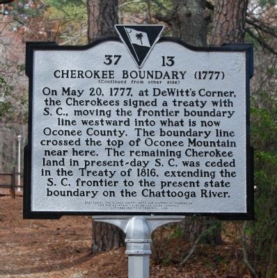
[Front Side]:
The Cherokee sided with the British during the American Revolution, and in 1776 Maj. Andrew Williamson's S.C. militia destroyed their "Lower Towns" in what is now S.C. He then cooperated with the N.C. militia in expeditions . . . — — Map (db m14351) HM
"The promptness with which you seized the opportunity to engage in honest work, the willingness with which you have performed your daily tasks, and the fine spirit you have shown in winning the respect of the communities in which your camps have . . . — — Map (db m14329) HM
On Verner Mill Road 0.1 miles west of Highlands Highway (State Highway 28), on the left when traveling west.
(front) Mountain Rest School
The building across the road was constructed in 1948 to house the Mountain Rest School. Initially staffed by four teachers, the school served local white children in grades 1-6. In 1964, the Oconee . . . — — Map (db m198061) HM
Russell House
This was a busy Appalachian farmstead in the late 1800's and early 1900's. You could hear the laughter of children playing in the creek, lowing cattle and clucking chickens as they searched for food. Ganaway Russell built a . . . — — Map (db m20978) HM
The Civilian Conservation Corps (CCC) was established by President Franklin D. Roosevelt in 1933 as part of the comprehensive relief effort during the grim depression years. Three million men were involved in the CCC during its ten-year . . . — — Map (db m14350) HM
Establishment of the Park
Oconee State Park was developed in the 1930's as one of the earliest State Parks in South Carolina was built by members of the Civilian Conservation Corp. The CCC was a program created as part of President Franklin . . . — — Map (db m14353) HM
The historic buildings below are products of the great Depression-era Works Progress Administration (WPA) and the Civilian Conservation Corps (CCC). The WPA, the CCC, and President Franklin D. Roosevelt's other New deal programs provided jobs to . . . — — Map (db m14217) HM
On Broadway Street (State Highway 37-203) at Palmetto Avenue, on the left when traveling west on Broadway Street.
1918
Worldwide Flu Epidemic
Marker Erected
in Loving Memory of
Ella Nunley & Eli Whitney Stanton by
Their Daughter Marcie S. Simmons — — Map (db m63321) HM
On Broadway Street (State Highway s37-203) at Palmetto Avenue, on the left when traveling east on Broadway Street.
To the Men and
Women of the Armed
Forces Whose
Unselfish Service
Preserving the Peace
of this Nation - This
Memorial is Humbly Dedicated — — Map (db m55158) HM
On Broadway Street (State Highway 37-203) at Palmetto Avenue, on the left when traveling east on Broadway Street.
The citizens of Newry had been having church service in the hall over the company store for a good while after the village was built. They petitioned the company to allow them to start a building fund, which was agreed to. However, the management . . . — — Map (db m56561) HM
On West Oak Highway (State Highway 24), on the right when traveling north.
Before the building was constructed, the Pickens Circuit of the Methodist conference used the grounds for their camp meetings. Throughout the years the church changed circuits from Pickens to Townville to Westminster and back to Townville. Being in . . . — — Map (db m53690) HM
On Buckeye Drive, on the right when traveling north.
Jocassee was one of several Cherokee “Lower Towns” in what is now S.C. It was located about 2 mi. E on the Jocassee River and in the Vale of Jocassee, near the modern Jocassee Dam. The town, like other Cherokee Lower Towns, was abandoned . . . — — Map (db m27338) HM
On Nimmons Bridge Road (State Highway S37-128) at Keowee Town Landing Road (State Highway S 37-98) on Nimmons Bridge Road.
[Marker Front] Keowee Town, which means “mulberry grove place,” was the largest and most important of the Cherokee “Lower Towns” in what is now S.C. It was 1 mi. E on the Keowee River, and was already considered a . . . — — Map (db m27335) HM
On West Main Street, on the left when traveling south.
With greatest respect and honor for the Confederate Soldiers from this area, we salute you, with the dedication of this monument. Special recognition goes to Sgt. John W. Cannon, an officer of the Confederacy and highly respected citizen of the . . . — — Map (db m14385) HM
On Cherokee Foothills Scenic Highway (SC Highway 11).
[Front Side]:
The main trading path to the Cherokee Nation paralleled the route of Highway 11 for several miles at this point. This section of the path was used by travelers going from Keowee, the main Lower Town of the Cherokees, across . . . — — Map (db m14383) HM
On Cherokee Foothills Scenic Highway (State Highway 11).
In recognition of Distinguished Public Service promoting water resources, highways, conservation, national defense, veterans affairs, textiles, Appalachia et cetera
State Representative
State Senator
Soldier World War II
U.S. Congressman . . . — — Map (db m21053) HM
Andrew Pickens
The county and its county seat are both named in honor of General Andrew Pickens, hero of the American Revolution, state legislator and Congressman. The Pickens family arrived in the Carolina backcountry in the mid-18th . . . — — Map (db m13205) HM
Near Old Pickens Church Road near East Pickens Highway (State Highway 183).
Andrew Pickens (1739-1817) Pickens County and its county seat are both named in honor of General Andrew Pickens, hero of the American Revolution, state legislator, and U.S. Congressman. The Pickens family arrived in the Carolina backcountry . . . — — Map (db m185616) HM
On SC Highway 59, on the left when traveling south.
[Front]:
Capt. Samuel Earle (1760-1833), an officer during the American Revolution, state representative, and U.S. representative, lived at nearby Beaverdam Plantation. He also furnished land for the town of Andersonville, once 12 mi. . . . — — Map (db m34563) HM
On West South 4th Street, on the left when traveling south.
On February 4, 1938, Mrs. Ploma M. Adams, owner of this farm, assisted by the Upper Savannah Soil Conservation District, initiated the first Farm-Conservation Plan of any district in America. — — Map (db m26287) HM
Henry Craig was the body servant of John Craig and served with him during the War Between the States. John was a member of Company A, First South Carolina Rifles, Orr's Regiment, from 1861 until he was wounded at Gravely Hill, Virginia on August . . . — — Map (db m55172) HM
On North Fairplay Street, on the left when traveling north.
Memorial
Gateway
1860-1865
Dedicated to the
men of the Confederacy
who gallantly
defended the southland
during the
War Between the States. — — Map (db m13957) HM
On East South 2nd Street, on the right when traveling east.
[Front]:
Oconee County Training School, which educated the African American children of this county from 1925 to 1955, was the successor of the Seneca Colored Graded School. This school, also known as OCTS, was founded in 1925 with Rev. . . . — — Map (db m13979) HM
Old Pickens Church
A Presbyterian congregation was probably organized in the 1840s. It is impossible to fix an exact date because the church records were destroyed in a fire around the turn of the 20th century. Construction on the church . . . — — Map (db m13179) HM
Near Old Pickens Church Road near East Pickens Highway (State Highway 183).
Old Pickens Presbyterian Church A Presbyterian congregation was probably organized in the 1840's. It is impossible to fix the exact date because the church records were destroyed in a fire around the turn of the 20th century. Construction on . . . — — Map (db m185418) HM
Near Old Pickens Church Road at East Pickens Highway (State Highway 183) when traveling north.
Built in 1850
A church/meeting house for early immigrants
of Scotch-Irish and English descent
who settled in the area.
Presented by
Col. John Robins Chapter
National Society Colonial Dames 17th Century
in honor of . . . — — Map (db m185419) HM
A church/meeting house for early immigrants
of Scotch-Irish and English descent
who settled in the area.
Presented by
Col. John Robins Chapter
National Society Colonial Dames 17th Century
In Honor of
Mrs. Kay Patricia Hunt Alford . . . — — Map (db m121930) HM
Founded August 14, 1873, as
"Seneca City," and chartered on
March 14, 1874, the town of
Seneca was named for an Indian
village on the Seneca River.
Its location was determined by
the junction of the Blue Ridge
Railroad and the . . . — — Map (db m13969) HM
On North Fairplay Street at Ram Cat Alley on North Fairplay Street.
This site, lot No. 126, was the first sold at auction by J.J. Norton and A.W. Thompson, August 14, 1873 when 14 lots sold and Seneca City was founded. Purchased by John M. Dumas, who was named the first Postmaster on April 15, 1873.
Site of: . . . — — Map (db m46925) HM
On South Poplar Street at West South 3rd Street on South Poplar Street.
Marker Front:
Seneca Institute
The Seneca Institute (later Seneca Junior College) educated African American children of this region from 1899 to 1939. It was founded and sponsored by the Seneca River Baptist Association, which in 1898 . . . — — Map (db m27333) HM
Near South Cove Road (County Route 37-608) 1.8 miles east of Keowee School Road (South Carolina Route 188).
This section of Oconee County was
Cherokee land until 1777. Located
north of here on the banks of Cane
Creek was a small Cherokee Lower
Town often referred to as Cane Creek
Town. One 19th century account states
its original Cherokee name . . . — — Map (db m276392) HM
On Robin Way 0.1 miles west of Cherokee Lake Road, on the left when traveling west.
(front)
Cheowee Town, sometimes spelled “Chehohee,” and meaning “otter place,” was one of several Cherokee “Lower Towns” in what is now S.C. Located on the headwaters of Little River, it predated European contact and was considered a . . . — — Map (db m198165) HM
Near Rogers Drive just west of Bumgardner Drive, on the right when traveling west.
In memory of Josephine Clark Peters Kanawha Valley Chapter Dedicated October 16, 1993 by the West Virginia State Society, NSDAR Mrs. Joel Morris Wagoner, State Regent — — Map (db m239347) HM
Near Bumgardner Drive at California Drive, on the right when traveling south.
Dedicated on October 15, 2019, this plaque celebrates and commemorates 100 years of devoted service to children and families. Founded by the South Carolina Daughters of the American Revolution to educate mountain children, Tamassee DAR School . . . — — Map (db m241194) HM
On State Highway 11, on the left when traveling north.
[Marker Front] Tamassee DAR School, founded by the S.C. Society of the Daughters of the American Revolution (DAR) in 1919, was established in an area described as “remote but accessible where the need was greatest.” It has long . . . — — Map (db m27441) HM
On Tamassee Knob Road (State Highway S-37-95) at Cheohee Valley Road (State Highway S37-375), on the right when traveling east on Tamassee Knob Road.
Near this site once stood the Cherokee "lower town" of Tamassee. On August 12, 1776 a Revolutionary War battle known as the "Ring Fight" was fought here between the Cherokee and the South Carolina Militia under Captain Andrew Pickens. The Cherokee . . . — — Map (db m152185) HM
On Bethel Church Road (State Road S37-198) just north of Lecroy Road (State Road S37-449), on the left when traveling north.
Bethel Presbyterian Church, the oldest church in continuous existence in Oconee County, was founded in 1805 by General Andrew Pickens, one of South Carolina’s most notable Revolutionary War heroes. General Andrew Pickens, along with others found . . . — — Map (db m183264) HM
On Short Street west of South Tugaloo Street, on the left when traveling west.
The Cherokee Path was the only unencumbered route of travel for the
two hundred mile journey from the mountains of South Carolina to the
coast without crossing a major river or other obstacle.
Trails were originally created by migratory . . . — — Map (db m276468) HM
On Short Street, on the right when traveling east.
This building, constructed in 1905, was the law office of "Colonel" Robert Thompson Jaynes from 1905 until he retired in 1950.
"Colonel Bob" began his practice of law in 1885. His most notable case was Hopkins vs. Clemson College, a case . . . — — Map (db m64789) HM
On West Main Street (State Highway 28) at South Tugaloo Street, on the right when traveling east on West Main Street.
To Honor All Combat
Infantrymen
We were boys and we were young
We became men on that hill we overrun
Some of us lived, many of us died
For a moment with us abide
And join in prayer with me
To honor those of the combat infantry. . . . — — Map (db m64807) HM
On West Main Street, on the left when traveling west.
The Sacrifices of few ensured the freedom of many.
A grateful community remembers those who served in the Armed Forces of the United States during times of war and peace, whose courage and personal sacrifices defended and preserved our freedom.
. . . — — Map (db m14031) HM
On South Church Street at Short Street, on the right when traveling north on South Church Street.
Front
Founder of Walhalla. Born in Sievern, Kingdom of Hannover. Germany July 21, 1816. He emigrated to Charleston, SC where her became a leader in the German emigrant community. Elected Mayor of Charleston. Organized the German . . . — — Map (db m20966) HM
The Legend
Local stories about thus site involve variations from the poem, "Cateechee of Keowee,' a story of love and adversity penned by J.W. Daniels, A.M., in 1898. The following is a summary of Rev. Daniels' poem, which thrust Issaqueena . . . — — Map (db m14193) HM
Near Stumphouse Tunnel Road east of State Highway 28, on the right when traveling north.
The Legend
Tradition relates that the waterfall is named for Issaqueena, a Creek maiden captured by the Cherokee. Of the many legends, the most popular, based on Rev. J.W. Daniels' 1898 poem, “Cateechee of Keowee,” told how Issaqueena was . . . — — Map (db m185423) HM
On West Main Street, on the left when traveling west.
[East Side]:
Erected
to the Memory of
Gen. Jno. A. Wagener
Founder of Walhalla
and to His Co-laborers
of the German
Colonization Society
August 23-24, 1900. — — Map (db m17491) HM
Near Stumphouse Tunnel Road 0.4 miles east of South Carolina Route 28, on the right when traveling north.
The salient map shows why such a small tunnel was necessary. At the 450 foot level, where the railroad was to be built, on the Eastern side of the Stumphouse Mountain, a projection of rock and earth [a salient], was blocking the construction of the . . . — — Map (db m291508) HM
On East North Broad Street, on the right when traveling north.
[Front]:
Newberry College, founded in 1856, moved here from Newberry in 1868 and remained in Walhalla until 1877, returning to Newberry for the opening of the 1877-78 academic year. The Lutheran college struggled during the Civil War and . . . — — Map (db m13991) HM
On West Main Street, on the left when traveling west.
[East Side]:
This monument is dedicated to the memory of the Confederate Soldiers by the women of Oconee County. These gallant soldiers gave their lives for the principle of states rights, for the protection of their homes, and in . . . — — Map (db m14163) HM
On West Main Street, on the left when traveling west.
In appreciation of
the Oconee County Veterans Committee
for establishing this park in honor
Oconee County soldiers who served
so that we could be free. — — Map (db m14456) HM
Located along the edge of the Blue Ridge Mountains, the history of Oconee County dates back to when the area was predominately inhabited by the Cherokee.
Following the American Revolution, and after settlement increased in South Carolina's . . . — — Map (db m64805) HM
On Short Street west of South Tugaloo Street, on the left when traveling west.
Oconee Mountain would have been the first mountain encountered when moving east to
west along the Cherokee Trading Path. It appears in European journals as early as the
1700s. In 1761, Captain Christopher French wrote: “We march’d about five, & at . . . — — Map (db m276462) HM
Oconee State Park was built by the Civilian Conservation Corps in the 1930s during the Great Depression and continues to serve as a destination itself and as a gateway to the nearby Chattooga and Chauga rivers and to the blue Ridge and Smoky . . . — — Map (db m14324) HM
Oconee Station
The South Carolina Frontier Experience
Oconee station & the William Richards House
This site was a frontier outpost and a meeting place between European American and Cherokees of this region during the late . . . — — Map (db m14372) HM
Oconee, also spelled "Aconnee," was one of the Cherokee "Lower Towns" in what is now S.C. at the base of Oconee Mountain and on the main trading path between the British and Cherokees, it was abandoned in 1752. Oconee Station was built in 1792 as an . . . — — Map (db m132065) HM
On Short Street east of South Church Street, on the left when traveling east.
Built in 1933 by the Civilian Conservation Corps, the “Old Rock Building” was constructed from rock found at nearby historic Stumphouse Tunnel. The building is owned by Oconee County. Before becoming the home to the Oconee Veteran's . . . — — Map (db m46853) HM
Near Stumphouse Tunnel Road near State Highway 28, on the right when traveling west.
[Listed from north to south]
Oconee Located on the edge of the Blue Ridge Mountains, Oconee County is known for nature-based activities such as boating, birding, backpacking, and camping
Pickens Pickens County has many beautiful . . . — — Map (db m185421) HM
On West Main Street, on the left when traveling west.
On November 20, 1853, St. John's was organized by members of the German Colonization Society of Charleston, S.C. who founded the town of Walhalla in 1850. Services were originally held in a house on West Union which was purchased from Col. Joseph . . . — — Map (db m14160) HM
Near Stumphouse Tunnel Road 0.4 miles east of South Carolina Route 28, on the right when traveling north.
You are facing the west entrance to the Middle Tunnel, which now lies within the Stumphouse Mountain Heritage Preserve (established in August 2008). This 385-foot tunnel was drilled by the Blue Ridge Railroad in 1856-1858 as part of their plan to . . . — — Map (db m291507) HM
The history of Stumphouse Tunnel is as rich as the surrounding land and carries with it stories of dreams, failures, hardships, and opportunities. The dream was to develop a railroad line from Charleston, South Carolina to Cincinnati, Ohio. The . . . — — Map (db m15041) HM
Near Stumphouse Tunnel Road 0.5 miles east of Highlands Highway (South Carolina Highway 28).
(Front)
The unfinished railroad tunnel cut into the SE face of Stumphouse Mtn. is the largest of three begun before the Civil War by the Blue Ridge Rail Road, for a line from Anderson, S.C., to Knoxville, Tenn. Work began in late 1853. . . . — — Map (db m74218) HM
Near Stumphouse Tunnel Road 0.4 miles east of South Carolina Route 28, on the right when traveling north.
This is the S.W. approach and portal to Middle Tunnel. It is interesting to note that in the 1850's, the engineering standards stated that if the obstacle encountered was sixty feet or greater in height, a tunnel as opposed to a cut was cheaper to . . . — — Map (db m291506) HM
Near Stumphouse Tunnel Road 0.4 miles east of South Carolina Route 28, on the right when traveling north.
This map shows the Stumphouse Mountain range in the upper northwest portion of the picture and the somewhat parallel portion of the Turnip Top Mountain range in the southeastern quadrant of the picture. In between the two ranges is a small valley on . . . — — Map (db m291509) HM
On South Church Street north of Short Street, on the left when traveling north.
Front
Walhalla, in what was Pickens District until Oconee County was created in 1868, was founded by the German Colonization Society of Charleston in 1850 and boasted as many as 500 German settlers by 1855. The first school offering . . . — — Map (db m20964) HM
On Short Street at South Tugaloo Street, on the right when traveling west on Short Street.
In 1930, over 100 white men
and boys broke into Oconee
County Jail to lynch Allen
Green, a prominent local
African American. Born in
1879, Green lived a few
blocks east of here with
his wife, Corrie Green.
On April 20, he was arrested
on . . . — — Map (db m276684) HM
On West Main Street, on the left when traveling west.
The price of a silver rose is not free
"They gave their tomorrow for your toadys."
In memory of the men and women
who served in the Vietman War
and later died as a result
of Agent Orange dioxins
we honor and remember
their . . . — — Map (db m14029) WM
On West Main Street, on the left when traveling west.
Dedicated to the brave and gallant Confederate soldiers and their families of Western Pickens District (Oconee County) who despite great hardships gave their blood and earthly possessions in defense of states rights and their beloved south land.
. . . — — Map (db m14162) HM
On Cherokee Foothills Scenic Highway (State Highway 11) north of Sangamo Drive.
West Union Grammar School
West Union Graded School, also known as West Union Grammar School or West Union Elementary School, was built here in 1923-24. In 1922, trustees purchased 4 acres from Marvin Phinney for a new school to replace an . . . — — Map (db m64783) HM
On Dales Drive at Dr Johns Road, on the right when traveling north on Dales Drive. Reported missing.
(front) Cross Roads Baptist Church
This church was founded between 1860 and 1880 by Forch Allen (1823-1911) and members of the Allen and Oglesby families, including other descendants of Cherokees who lived in early Lower Towns . . . — — Map (db m198118) HM
[Front]:
This school, often called Retreat Colored School, was built in 1923 for the African-American students in and near Westminster. A two-room, two-teacher, elementary school, it was built by local builder William Walker Bearden of . . . — — Map (db m53235) HM
On East Main Street at Alley Street, on the right when traveling west on East Main Street.
The original Westminster Freight Depot was built in 1885. The railroad contributed to rapid growth and development in the Westminster area. Following incorporation and continued growth, in 1911 the passenger depot was constructed. However, as . . . — — Map (db m46848) HM
Near Werner Street north of Stewart Street, on the left when traveling east.
As the midpoint between the major population centers of Atlanta, Georgia and Charlotte, North Carolina, 133 miles from each city, the community of Central found itself the focus of a railroad boom in the early 1870s. The Keowee Courier . . . — — Map (db m185440) HM
This rose garden was created to honor Bertha Evans Morgan, wife of J. Robert Morgan, who was a nephew of Jeptha and Minnie Morgan.
Bertha Morgan was a teacher, wife, mother, Clemson University employee and dedicated Christian. Throughout her . . . — — Map (db m16528) HM
On Broad Street at Gaines Street, on the left when traveling west on Broad Street.
Upon the death of Nina “Bird” Garvin Montgomery in 2000 there were two items in her possession that stirred the emotions of her surviving kin. One was a little paring knife, its handles worn thin by close to a century of peeling potatoes and apples . . . — — Map (db m185436) HM
On Cateechee Trail at Norris Highway (South Carolina Route 137), on the right when traveling west on Cateechee Trail.
Cateechee Mill Village originally
housed employees of Norris Cotton
Mills, built on Twelve Mile River in
1895-97 as the first modern textile
mill in Pickens County. Upon opening,
the 4-story masonry plant had 5,000
spindles and 150 looms, . . . — — Map (db m276332) HM
On West Main Street (State Highway 93) at Bank Street, on the right when traveling west on West Main Street.
[Front]:
The town of Central, chartered in 1875, grew up along what is now Gaines Street. The post office was called Five Mile from 1851 to 1871. In the 1870s the Atlanta & Richmond Airline Railway built its depot, hotel, offices, and . . . — — Map (db m29834) HM
On West Main Street (South Carolina Route 93) at Hamilton Street, on the right when traveling south on West Main Street.
This frame building was
constructed c. 1925 as a
school for African American
residents of Central. Known
as Central Colored School,
it replaced a privately
owned one room school
building believed to have
been located nearby. The
school . . . — — Map (db m276358) HM
On West Main Street (State Highway 93) at Werner Street, on the right when traveling east on West Main Street.
The car that traditionally signals the end of the train is fittingly displayed as a memorial to Central's railroad heritage. The Norfolk & Western caboose was donated by Norfolk Southern Railroad in 1988 thanks to then Mayor Al Cumbie and Norfolk . . . — — Map (db m185434) HM
On Church Street south of West Main Street, on the right when traveling south.
This Classical Revival
structure, built 1908-09 by
B.E. Grandy, was originally
a school for residents of
the town of Central. It was
designed by Christopher
Gadsden Sayre, a regionally
prominent architect from
Mount Pleasant, S.C. . . . — — Map (db m276334) HM
On West Main Street (State Highway 93) at Bank Street, on the right when traveling west on West Main Street.
The “Peach Queen,” along with the “Crescent,” was one of Southern Railway's premier passenger trains that ran through Central. Southern Railway operated these streamlined inter-city passenger trains from the late 1940's until dropping passenger . . . — — Map (db m185437) HM
On Furman L. Smith Memorial Highway at South Main Street (SC 133) on Furman L. Smith Memorial Highway.
In memory of Furman L. Smith Veteran of World War II killed in Italy June 1, 1944 for heroic action beyond the call of duty. He was awarded the Congressional Medal of Honor 1925-1944. — — Map (db m111315) WM
On 6 Mile Highway (U.S. 133) near Old 6 Mile Road when traveling north.
During World War II the U.S. Army Air
Force (USAAF) used Lake Issaqueena
and surrounding land as a bombing
range. The lake was built in 1938 as
part of the New Deal-era Clemson
Land Use Project. The War Department
acquired most of the range . . . — — Map (db m276364) HM
On West Main Street (South Carolina Route 93) at Hamilton Street, on the right when traveling south on West Main Street.
In 1949, the building was a white, four-room wooden
structure with a ceiled interior painted light green and
brown. The building had two classrooms, a dining room
and a kitchen. The two classrooms could be converted into
an auditorium by . . . — — Map (db m276360) HM
On Church Street, on the right when traveling south. Reported unreadable.
The Central Heritage Society purchased the Morgan House in 1995 as headquarters for the Central History Museum. Several of the rooms are almost exactly as Jessie and Jennie Morgan left them, while others focus on Central, South Carolina history. . . . — — Map (db m15559) HM
Railroads and Farming
In 1873, the town of Central was established as a train headquarters where engines were changed. The town was named for its central location between Atlanta and Charlotte. Central rapidly filled with dispatchers, . . . — — Map (db m15578) HM
On Broad Street at Gaines Street, on the left when traveling west on Broad Street.
Across the railroad tracks from the present Red Caboose once stood a long rambling hotel among a grove of trees built by the railroad company in the late nineteenth century, known as the Central Railroad Hotel. The hotel was famous up and down the . . . — — Map (db m185435) HM
355 entries matched your criteria. Entries 101 through 200 are listed above. ⊲ Previous 100 — Next 100 ⊳