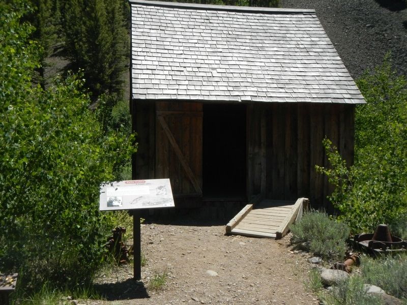
This building was one of the smaller homes in Custer and was built using prefabricated "panels" for walls. It housed a small family and many a bachelor miner. One such miner was Francis Tully, who played his fiddle for many dances in and around . . . — — Map (db m109896) HM
There are no records from explorers’ journals or pioneers’ memories of earthquakes occurring in this area. Scientists have not detected activity in recent time. But, old fault scars indicate that earthquakes occurred before. Geologists recognized . . . — — Map (db m109708) HM
• The scarp before you extends for 21 miles, paralleling the mountain front. In some places, multiple scarps formed.
• Ground motion, or “ground roll,” did $15,000,000 damage to roads and buildings in the Challis and Mackay areas. . . . — — Map (db m109709) HM
Idaho is part of the world’s longest mountain chain above sea level. This chain extends from the tip of South America to Alaska’s north coast. The widest section is in the western United States - from the Sierra Nevada to the Rocky Mountains. The . . . — — Map (db m109706) HM
On October 28, 1983, a major earthquake fracture, 26 miles long and 7 miles deep, surfaced as Lost River Valley slid away from Mount Borah.
During that rock shift, Mount Borah’s ridge front rose about 6 inches, while this valley . . . — — Map (db m109704) HM
Cliff City and White Knob were bustling mining towns established west of Mackay in the late 1800s.
After copper was discovered in the White Knob Mountains in 1879, Cliff City and White Knob sprang up to support the mines. The boomtowns . . . — — Map (db m140071) HM
Known as Goddin's River in the days of the fur trade. This stream originally was named for the trapper who discovered it.
Thyery Goddin, a prominent Iroquois who explored this river in 1819 or 1820, had come here with Donald Mackenzies fur . . . — — Map (db m109705) HM
Idaho’s highest peak, 12,662 feet, is named for William E. Borah, who served in the United States Senate from 1907 until his death in 1940.
Ten or a dozen large but shallow inland seas have covered this area in the past billion years. They . . . — — Map (db m109703) HM
Mt. McCaleb, named for the Civil War veteran and local merchant, Jesse McCaleb, is the prominent 11,683 ft. peak visible north of MacKay.
In 1878, while helping escort supply wagons and arms to Challis, McCaleb and 13 others were attacked by . . . — — Map (db m140070) HM
Long before miners and ranchers settled Stanley Basin, bears dominated this area.
When Alexander Ross and his Hudson’s Bay Company trappers stopped here, September 20, 1824, they “observed at some distance the appearance of a ploughed . . . — — Map (db m110042) HM
Prospectors panned for gold in the Yankee Fork-Salmon River area from the late 1860's to 1879.
Then in 1880 the Yankee Fork Consolidated Gravel Mining Company built a ditch to bring water here for their new hydraulic gold mining operations. . . . — — Map (db m110013) HM
In memory of Charley J. Langer, District Forest Ranger, Challis National Forest, Pilot Captain Bill Kelly and Co-Pilot Arthur A. Crofts of the U.S. Army killed in an airplane crash April 5, 1943 near this point while searching for survivors of an . . . — — Map (db m117661) HM
Foundations along the trail reflect earlier times when hot springs attracted travelers, settlers, and businessmen. Tales are told of early hot pools, cabins, and chicken raising operations.
An attempt to raise chickens here was made by the . . . — — Map (db m110039) HM
River rafters and kayakers now find whitewater excitement on this stretch of the Salmon River. Early photographs help us discover that these rapids were once replaced by a lake.
Whitewater was missing after the completion of Sunbeam Dam. . . . — — Map (db m110011) HM
When Challis National Forest was established in 1908, this site became an administrative center. Early log Ranger Stations stood here from 1909 to 1932.
Expanding Forest Service responsibilities led to construction of a larger ranger . . . — — Map (db m182177) HM
This 1937 stonework building remains as a tribute to Civilian Conservation Corps (CCC) craftsmanship. CCC workers from Camp Clayton built the structure. It was originally used as a bathhouse and is now a historic site.
The National Forest System . . . — — Map (db m110038) HM
The Sunbeam Dam was constructed by the Sunbeam Consolidated Gold Mines Company to provide power for their mill located 13 miles up Yankee Fork on Jordan Creek.
Construction of the dam and power plant began in June, 1909, and was completed . . . — — Map (db m110010) HM
Alexander Ross and his Hudsons Bay Company fur trappers were the first white men to visit these hot springs. His dairy describes camping "at the boiling fountain" when they came here on October 1, 1824.
Hot springs result when hot water reached . . . — — Map (db m110040) HM
This cabin was built by Erle Embley. Erle was born in 1885 and raised in Michigan. He came to the Tower Creek (originally "Boyle Creek") in 1906 and worked as a ranch hand. Erle met and married his wife Lula Thornburg and eventually purchased a . . . — — Map (db m123686) HM
In a grove of cottonwoods across the river, Capt. B.L.E. Bonneville established a winter fur trade post. Sept. 26, 1832.
His fort, described by a rival trapper as "a miserable establishment" - - -"consisted of several log cabins, low, . . . — — Map (db m59848) HM
1866 - Gold discovered at Leesburg by Elijah Mulkey, Wm. Smith, F.B. Sharkey, Jos. Rapp, & Ward Girton.
Mining has continued in Lemhi Co. with production of $30 Mil. in gold & nearly $35 Mil. in copper, lead, tungsten, silver, etc. 63 . . . — — Map (db m109670) HM
Leading packhorses, the Lewis and Clark Expedition followed their Shoshone guide Toby up Tower Creek on August 31, 1805. The Indian road went northwest from here across the foothills to the North Fork of the Salmon.
Behind the Corps of . . . — — Map (db m123682) HM
"On August 21, 1805, Captain Clark and party camped near this spot. Clark wrote "crossed the river and went over a point of high land and struck it again near a bluff on the right side...those two men joined me at my camp on the right side below the . . . — — Map (db m123673) HM
Clark's "Pirimids" are lessons in erosion and deposition. Looks closely at the columns to see layers of sediment: sandstone, gravel, and larger rocks that were eroded from ancient hills and deposited in valleys millions of years ago. Time and . . . — — Map (db m123683) HM
Sept. 2, 1805 Lewis and Clark proceeded with much difficulty up the North Fork, they camped on the west side of the river in this vicinity. Clark wrote "…we were obliged to cut a road, over rocky hill Slides where our horses were in peteal . . . — — Map (db m59864) HM
British investment in a large Gibbonsville mine after 1880 made this an important gold camp until 1899.
Discovery of a major lode here in 1877 and construction of a good wagon road to a Utah and Northern Railway terminal in Montana brought . . . — — Map (db m109623) HM
Original construction of the wagon road was relatively simple. With a little luck and a lot of sweat, the ten foot wide path only needed the removal of a few large rocks and trees. By the turn of the twentieth century the road was improved to haul . . . — — Map (db m109638) HM
On their way north searching for a route over Idaho's mountain barrier, Lewis and Clark left this canyon and ascended a high ridge to reach Bitterroot Valley, September 3-4, 1805. No Indian trail came this way, but Tobe, their experienced Shoshoni . . . — — Map (db m59798) HM
Two adjacent markers which complement each other are treated as one marker.
Lost Trail Pass
“hills high & rockey on each Side, in the after part of the day the high mountains closed the Creek on each Side and . . . — — Map (db m109641) HM
This traditional Indian route provided access from Montana's buffalo country to Snake and Salmon river fishing streams.
Hudson's Bay Company trapping expeditions came this way after 1822 and prosectors followed searching for mines. Then . . . — — Map (db m109408) HM
This marker consists of three panels: one map and two historical. Before the Roads
Shoshone Homeland
Native Americans were the first to travel over this rugged country. Most of the year they spent traveling from place . . . — — Map (db m109403) HM
Bricks for the kilns were made from a very light clay and lime, which probably came from deposits in Jump Creek. The lime was burned in nearby kilns and mixed with clay to produce a tough lightweight brick. Though wages were only $1.50-$2.00 a day, . . . — — Map (db m109075) HM
Charcoal is the carbonized residue to wood that has been heated in the absence of air. It was used in smelting because it required less blast than other fuels, was more convenient to obtain, and reacted well with the ore. Wood, cut in four foot . . . — — Map (db m109071) HM
Charcoal for a smelter, active from 1885-1889 across the valley at Nicholia, was produced in 16 kilns 6 miles west of here.
Discover in 1881, the Viola mine became an important source for lead and silver from 1886-1888. Ore also was hauled . . . — — Map (db m109034) HM
A French Canadian who came to southern Idaho in 1818, Joseph Cote found this valley while trapping beaver.
Though he was thousands of miles from his Canadian base in Montreal, he had years of experience in Pacific Northwest exploration. . . . — — Map (db m109032) HM
Lack of a good transportation system delayed serious lead and silver mining at Gilmore from 1880 to 1910.
Construction of a branch railroad from Montana to serve this mining area resulted in a production of $11,520,852 before a power plant . . . — — Map (db m109391) HM
These are three of the four charcoal kilns that remain of the original sixteen that were once located here. These beehive shaped kilns were constructed of brick and designed to stand 20 feet in both height and diameter. The walls were plastered . . . — — Map (db m109070) HM
Four panels in the Birch Creek Campground kiosk deal with the history of Birch Creek Valley
A Prehistory and History of
Lower Birch Creek Valley
a natural travel route between the Salmon River & the Snake River Plain . . . — — Map (db m109050) HM
Sixteen charcoal kilns were built on this site in 1886 by J.W. and W.C. King of Butte, Montana.
The kilns produced charcoal for the smelter at Nicholia for about two years. When the smelter closed suddenly in 1888, operations at the kilns . . . — — Map (db m109038) HM
Archaeological research as traced human occupation to this valley back more than ten thousand years.
The first men here found the valley forested. As the climate became drier, other mountain dwellers -- known to archaeologists as people of . . . — — Map (db m109031) HM
These kilns are the only remaining evidence of important historic events, and efforts have been made to preserve them. Steel pipes support on roof that was bout to collapse and gates have been erected to keep out stock.
These structures are a . . . — — Map (db m109069) HM
Once wood was stacked as high as possible from the front door, loading continued through an opening in the back of the kiln. Wooden ramps that once led up to these doors disappeared long ago. — — Map (db m109072) HM
A side road from Highway 28 leads to Nicholia Townsite and the Viola Mine. Parts of these sites are on private land. Please be especially respectful of private owners rights and wishes.
The Nicholia Ranch is on the site of Nicholia, once home to . . . — — Map (db m109073) HM
During the two years the 16 kilns were in operation, 150,000 cords of wood (about 15,000 loads of today’s logging trucks) were made into charcoal. A supply of 6,000 cords of wood was kept on hand at all times. Some can still be seen lying on the . . . — — Map (db m109077) HM
The historic Lewis and Clark Expedition travelled along this river in 1805. As the first white men to document this region, their maps, diaries, and encounters with different cultures forever changed the western landscape.
Cold, wet and hungry, . . . — — Map (db m59754) HM
In commemoration of
Old Toby
the Shoshone Indian
who guided the Lewis & Clark expedition from the Salmon to the Bitterroot Valley after he had shown Captain Clark that the Salmon River Canyon was impassable. Old Toby served this famous . . . — — Map (db m59632) HM
In memory of
Jeff Allen and Shane Heath,
Indianola Helitack Crew members,
lost in the Cramer Fire near here on July 22, 2003.
This will be a lasting place of remembrance and gratitude for their lives and service, a place for . . . — — Map (db m59865) HM
Clark explored the first few miles of the rugged canyon of the Salmon below here late in August 1805. His small advance party camped here with poor but friendly Indians. Clark reported that the Salmon "is almost one continued rapid," and that . . . — — Map (db m59847) HM
Following high ridges, buffalo hunters cut an old Indian trail along a direct route from Lewiston past here to Lemhi Valley.
This trail was not available to Lewis and Clark in 1805, but an early missionary -- Samuel Parker -- crossed it with . . . — — Map (db m109621) HM
Three panels make up this marker.
Salmon River Encounter
... a Small river at the mouth of Which Several families of Indians were encamped and had Several Scaffolds of fish & buries drying we allarmed (sic) them verry . . . — — Map (db m109645) HM
Living for more than 60 years in hand-built "dugouts" across the Salmon River from this site, Richard "Dugout Dick" Zimmerman (1916-2010) came to symbolize the Idaho hermit.
With colorful names like Buckskin Bill and Hank the Hermit, . . . — — Map (db m109678) HM
After crossing the Continental Divide southeast of here, Aug. 12, 1805, Lewis camped with a Shoshoni band near here, Aug. 13-14.
Lewis had to obtain Indian horses so his men could get from the upper Missouri to a navigable stream flowing to . . . — — Map (db m109599) HM
Whooping and yelling, Blackfeet Indians and white trappers "fought like deamons" in the defile before you in 1823.
After the Hudson's Bay Company trappers burned the Indians out of a strong position by starting a large brush fire, the . . . — — Map (db m109598) HM
Born in the Lemhi River Valley around 1788, Sacajawea, an Agaidika Shoshone, was the only female member of the Lewis and Clark "Corps of Discovery". She joined the expedition at the Knife River Mandan Village in North Dakota and traveled to the . . . — — Map (db m109671) HM
Returned to her homeland in this valley in 1805 as an interpreter for Lewis and Clark when they explored these mountains.
When she was only about 14 years old, she had been captured by Indians in Montana, where her people were out hunting . . . — — Map (db m109600) HM
[This marker also serves as a site map for historical and natural resource sites. The text is entered in the order of their numbers.]
1. Mud Lake Wildlife Management Area
Mud Lake Wildlife Management Area was established in 1940 by . . . — — Map (db m59922) HM
Inscribed on his collar:
"The greatest traveler of my species. My name is Seaman, the dog of Captain Meriwether Lewis, whom I accompanied to Pacifick Ocean through the interior of the continent of North America."
This statue is . . . — — Map (db m59654) HM
The McNutt Building, constructed of local Pollard brick, was
completed in 1901. It is decorated with corbel slanted brick work,
corbelling along the top with corbelled eyebrow pattern above the
windows. The sills are of local stone, and the heavy . . . — — Map (db m306374) HM
Captain Clark, after viewing the Continental Divide on August 22, 1805, remarked, “… we set out early passed a small creek on the right at 1 mile and the points of four mountains verry steep, high, and rockey. The assent of three was so steep . . . — — Map (db m109666) HM
Sixty million years ago, you wouldn't have recognized this place. There were no high mountains, no deep canyons. Streams meandered through a landscape of broad valleys and low hills that may have resembled Kentucky's Cumberland Valley.
The rocks, . . . — — Map (db m109669) HM
Near this site, on August 20, 1805, the Lewis and Clark Expedition first contacted waters flowing to the Pacific assuring the success of their efforts and guaranteeing title to the Northwest for the United States of America. They camped here, . . . — — Map (db m109587) HM
William Clark's reconnaissance party camped here on their way down the Salmon River on August 21. They returned on the 25th, convinced that the canyon was impassable. Clark's hunters saw deer and elk, but not close enough to chance a shot.
"Old . . . — — Map (db m109668) HM
Filling in the Blanks
The maps of North America carried by Lewis and Clark showed only a vast, uncharted space between the Mandan villages of the Missouri Rier and the Pacific Coast. The mountains separating the Missouri and Columbia river . . . — — Map (db m109507) HM
Two days before reaching the Continental Divide, Meriwether Lewis speculated that the Columbia River would not have the same moderate character as the Missouri.
“I do not beleive (sic) that the world can furnish an example of a . . . — — Map (db m109542) HM
First Taste of the Columbia
"we proceeded on to the top of the dividing ridge from which I discovered immence ranges of high mountains still to the West of us with their tops partially covered with snow. I now decended the mountain about . . . — — Map (db m109543) HM
High Point of the Journey
"thus far I had accomplished one of those great objects on which my mind has been unalterably fixed for many years.," wrote Meriwether Lewis, 456 days after setting out from St. Louis.
Lewis, George . . . — — Map (db m109504) HM
On Monday August 12, 1805, Lewis,with three men as an advance party, crossed the Lemhi Pass and spent their first night in Idaho near this spot. Lewis wrote, "...after a short halt of a few minutes we continued our march along the Indian road which . . . — — Map (db m109545) HM
Arriving at the headwaters of Lemhi River, a company of Latter-Day Saint men who had been called to establish a mission among the Indians proceeded approximately 30 miles downstream, selected a site for a fort and a tract of farming land, On June . . . — — Map (db m123675) HM
In 1855 a group of Mormon missionaries came north from Utah to found a remote colony just below the bench east of here.
A religious settlement rather than a military fort. Salmon River Mission grew to more than 100 settlers before Indian . . . — — Map (db m109585) HM
This marker is made up of two panels.
Moving over the Mountains
The Shoshone Indians call this pass " Wee-yah-vee." For thousands of years, the Aqui-dika, or Salmoneater people of the Shoshone, and other tribes, . . . — — Map (db m109503) HM
The salmon runs that fed the Lemhi Shoshone in summer had almost ended: it was time to leave for the fall buffalo hunt on the Missouri River. Cameaghwait and his people would hunt with their allies, the Montana Salish, for mutual defense against . . . — — Map (db m109440) HM
Who passed this way?
In August of 1805 members of the Lewis and Clark Expedition and Shoshone Indians crossed Lemhi Pass six times in 15 days.
• Monday, the 12th --- Lewis, McNeal, Drouillard & Shields --- headed west
• . . . — — Map (db m110838) HM
Cameahwait's band of 400 Lemhi Shoshone dried berries, seeds, roots, and salmon in summer, but it was not enough. To survive the long winter, they would need about fifteen tons of bison jerky. The fall bison hunt in Montana was risky because enemies . . . — — Map (db m109582) HM
After crossing through Lemhi Pass, 12 miles east of here, Lewis unfurled the American flag for the first time west of the Rockies.
Meriwether Lewis met with 3 Shoshoni Indians near here on August 13, 1805. "....leaving my pack and . . . — — Map (db m109409) HM
Captain Meriwether, interpreter George Drouillard, and privates Hugh McNeal and John Shields crossed Lemhi Pass on the afternoon of August 12, 1805. The Indian road they were traveling climbed north out of the narrow Agency Creek Canyon at the foot . . . — — Map (db m109581) HM
When Lewis learned that Clark had found the Salmon River un-navigable, buying more horses became a top priority. He'd already bought fifteen, but he needed twice that many to carry the Expedition's baggage.
But enemy raiders had stolen many Lemhi . . . — — Map (db m109441) HM
The Corps of Discovery were the first U.S. citizens to reach the Northwest by land, strengthening the American claim established in 1792 when mariner Robert Gray discovered the Columbia River.
When Lewis unfurled the Stars and Stripes, he . . . — — Map (db m109463) HM
Lewis and Clark fans love the sturdy the overland portion of the Trail in Montana and Idaho. There's little question about the route on the Missouri or Columbia rivers, but the mountains present challenges to explorers then and now.
The evidence . . . — — Map (db m109478) HM
At the Lemhi Shoshone camp Lewis learned of the danger and hunger that threatened the tribe. He asked the chief about routes west, but Cameahwait's descriptions were discouraging: rocky rivers, deep canyons, terrible mountains.
Lewis proposed an . . . — — Map (db m109459) HM
Lewis's advance party entered the valley below in search of the Lemhi Shoshone, whose horses the Expedition would need to cross the mountains. The first Indians Lewis saw fled before he could reach them, but he soon came upon three women. When Lewis . . . — — Map (db m213343) HM
(Two panels share a common support.)
Meriwether Lewis identified, described and collected plants that were new to science and observed how the Shoshone used local plants. These species can be found in this area:
• Syringa or Mock . . . — — Map (db m109584) HM
Pioneer miner and rancher Frank B. Sharkey, who settled near this site in the 1870s, praised this sprig as he soaked in its soothing waters. Around 1890 Eleihu Barnes erected as shanty over the springs to keep the cows out.
In the late . . . — — Map (db m109462) HM
There are many stories about the young Indian woman who accompanied the Lewis and Clark Expedition.
As time goes on, Sacajawea continues to inspire our admiration and curiosity. People delight in the stories of Sacajawea. These stories continue . . . — — Map (db m109480) HM
Lewis and Clark gave Sacajawea a miracle: a return home for the first time since her kidnapping several years earlier. She gave them as much: a Lemhi Shoshone interpreter and an advocate for the Expedition in buying Lemhi horses.
It was a . . . — — Map (db m109445) HM
There were many heroes in this band of intrepid explorers, there was but one heroine. Denied in life and after that recognition which was due her, it is fitting that we meet here today to dedicate this spot in honor of that heroine." R.F. . . . — — Map (db m109482) HM
On April 7, 1855, at the conference of the Church of Jesus Christ of Latter-Day Saints, Pres. Brigham Young called 27 elders to found a mission among the Indians of the Salmon River Country, Oregon Territory, with Thomas S. Smith in charge. . . . — — Map (db m123676) HM
This community is named for a great man: Tendoy, chief of the Lemhi Shoshone from 1863 to 1907. During the Nez Perce, Bannock and Sheepeater troubles of the 1870s, Tendoy preserved the peace in Lemhi County. In gratitude, prominent local settlers . . . — — Map (db m172862) HM
The Red Rock Stage travelled this route between Salmon, ID, and Red Rock, MT from 1866 to 1910. It ran 125 miles daily, year-round, involving 90 horses, 14 Concord Coaches, and 12 wagons. Several holdups occurred near here, and it was not unusual . . . — — Map (db m109554) HM
[There are four plaques, one on each side, of this monument.]
The Indian Mission Call: Issued by Brigham Young to 27 elders of the Church of Jesus Christ of Latter-Day Saints (Mormon) at Salt Lake City, April 6 1855. . . . — — Map (db m123678) HM
About 50 million years ago, this was one of the most violent landscapes on Earth. A sub-surface mass of molten rock rose and subsided in cycles, spewing gas, mineral fragments and ash in explosions hundreds of times more powerful that an atomic . . . — — Map (db m109446) HM
Was the Salmon River as treacherous as Cameahwait, the Lemhi Shoshone chief, had said? Clark and eleven men had come to find out. Finding a navigable, westward-flowing river was the major objective of the Expedition at this time.
Clark . . . — — Map (db m231270) HM
While hunting stolen horses on Aug. 20, 1878, Wm. Monday, Jake Groseclose, Tom Healy, & "Three Finger" Smith were ambushed in a rocky basin 9/10 mile by road from here.
Monday and Groseclose were killed immediately, and Healy wounded; . . . — — Map (db m23231) HM
Historic Meadows Valley
The town of New Meadows is located in a small valley that is filled with memories when logging and ranching was a way of life in the mountains of Central Idaho.
Payette Lake
This glacial lake was . . . — — Map (db m109707) HM
The McCall City Jail was built for $650 in June, 1930, directly behind the City Hall located on the corner of Lenora and Third Streets.
The City Hall building was later moved 12 miles to Roseberry, ID, leaving the jail as a sole reminder of . . . — — Map (db m109934) HM
Sloan's Point Lookout was a prefabricated lookout tower built by the Aeromotor (sic) Company. One of 200 such structures in the Northwest, the Aeromotor — — Map (db m119491) HM
Dedicated to the young men
who served in the
Civilian Conservation Corps
from 1933 – 1942.
Their work in the forests and parks in
Idaho remain for all to enjoy
Dedicated August 5, 2006
NACCCA Chapter 28
city of McCall
. . . — — Map (db m110416) HM
A Rich Tradition Of Land Use
Gathering, Hunting, Trapping, Mining, Logging, Ranching, Farming, Recreation
Around 15 thousand years ago, groups of Native Americans started the long history of land use in this area. Today, the Nez . . . — — Map (db m119494) HM
Prior to the arrival of the railroad in 1912, the North Fork of the Payette River provided an avenue for logs destined to downstream mills in Horseshoe Bend and Emmett.
In 1903, $100,000 was spent to dynamite open a clear channel in the . . . — — Map (db m23233) HM
200 entries matched your criteria. Entries 101 through 200 are listed above. ⊲ Previous 100