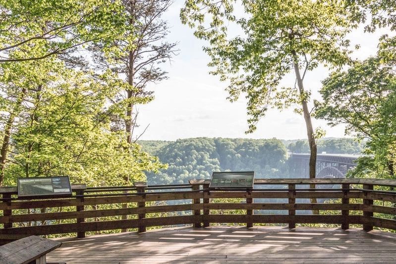
When the New River Gorge Bridge
was completed on October 22, 1977,
a travel challenge was solved. The
bridge reduced a 45-minute drive
down narrow mountain roads and
across one of North America's
oldest rivers to less than a minute
drive. . . . — — Map (db m223789) HM
Notice the tree-covered slopes of the Gorge—they are not as they appear.
From here the solid forest cover from riverbottom to ridgetop all looks pretty much the same, but, a close look reveals great differences. The forest varies with slope, . . . — — Map (db m99980) HM
This walkway leads to views of the New River Bridge. An easily-accessible upper overlook provides a scenic view framed by trees. From there the walkway descends 200 feet down a steep stairway to a broad view of the bridge, gorge, and New River 600 . . . — — Map (db m99993) HM
What is so special here? Why did the United States Congress in 1978 add New River Gorge to America’s system of National Parks? Because at New River Gorge National River there is:
(Inscriptions under the images-left to right, top to bottom) *An . . . — — Map (db m99975) HM
Site of largest mine disaster in Fayette County history. On 2 March 1915, coal dust in Layland #3 ignited, killing 112 men; 42 of 53 survivors were rescued 6 March, one mile inside 10th left section behind barricade they built. — — Map (db m140484) HM
Sandstone formation at 2510 feet is landmark known for view of Sewell Mt. range to SE. Known as "Rock of Eyes" by Native Americans and dubbed "Spy Rock" by Civil War soldiers. Sept. 1861, Gen. J.D. Cox and 5,000 Union soldiers camped here to oppose . . . — — Map (db m34430) HM
Born in slavery in Monroe Co., Sept. 7, 1848, he worked as servant in the Confederate army. Served as teacher and ordained Baptist minister; estab. West Virginia Enterprise, Pioneer, & Mountain Eagle papers; later a lawyer. First . . . — — Map (db m252544) HM
Fayette County
Formed in 1831 from Nicholas, Greenbrier, Kanawha, Logan. Named for General Lafayette. On New River, 1671, Batts and Fallam officially claimed Mississippi Valley for Great Britain in opposition to the claim of France. . . . — — Map (db m76931) HM
Settled before the Revolution by Levi Morris, whose father, William Morris, made the first permanent settlement in the Great Kanawha Valley. Named Coal Valley in 1879. Renamed when incorporated in 1891 for James C. Montgomery. — — Map (db m138010) HM
Settled before the Revolution by Levi Morris, whose father, William Morris, made the first permanent settlement in the Great Kanawha Valley. Named Coal Valley in 1879. Renamed when incorporated in 1891 for James C. Montgomery. — — Map (db m138013) HM
State institution established in 1895 as Preparatory Branch of West Virginia University. In 1931, name was changed to New River State College. Became a multipurpose college in 1941, known as West Virginia Institute of Technology. — — Map (db m76933) HM
With railroads came thousands of workers looking to make a new life in the coalfields. In the late 1800’s and well into the mid-1900’s, many Appalachian miners lived in company towns called “Coal Camps”.
Mine operators built . . . — — Map (db m34443) HM
1913-Union organizer Mary "Mother" Jones imprisoned in Pratt.
1913-Approximate location of the striking miners tent colony that was fired on by mine guards wielding a machine gun mounted on the "Bull Moose" special train
1919-7 miners are . . . — — Map (db m34438) HM
Soon after settlers arrived in Paint Creek, the landscape and population changed forever with the discovery of coal. Within just a few years, mines began operating at Paint Creek under the ownership of New York businessman William Henry Greene. . . . — — Map (db m34436) HM
As the community of Mount Hope developed with the coal interests during the early 20th century, it emerged as one of the premier commercial and industrial centers of the New River coalfields, serving a steady customer base of both workers and . . . — — Map (db m179359) HM
Unlike nearby Kilsyth, most of the housing within Mount Hope was constructed without formal company planning. One Exception, however, was a cluster of 14 identical houses developed by the Mount Hope Coal Company on the outskirts of the community . . . — — Map (db m179365) HM
Secondary to only the mines themselves, the railroads were the most significant driver of development in the Dunloup Creek watershed at the outset of the 20th century. A fiercely competitive business, access to the railroad determined the success . . . — — Map (db m242619) HM
An African American high school
formed in 1917, it educated black
Fayette County children until 1956.
Students were taught in community
buildings and churches, 1950-1954,
after the school was destroyed by
fire. The second DuBois High . . . — — Map (db m140445) HM
In 1906 a levy was passed in Fayette County to establish the county's first high schools, one for white children and one for black children. The original school for African American children was constructed at Turkey Knob, but was later replaced . . . — — Map (db m242569) HM
A cadre of excellent teachers sharing and imparting values produced students with interests and community endeavors, fundraising, and contributions to projects throughout the world.
Leadership – Principals
see photo
. . . — — Map (db m161345) HM
Fayette County. Formed, 1831, from Nicholas, Greenbrier, Kanawha, Logan. Named for General Lafayette. On New River, 1671, Batts and Fallam officially claimed Mississippi Valley for Great Britain in opposition to the claim of France. . . . — — Map (db m228751) HM
Welcome to the Mount Hope Historic Walking Trail. Walk along the sidewalks of Mount Hope and take a step back in time as you make your way through the heart of downtown. Hear stories of how the New River Company not only shaped the town but the . . . — — Map (db m242620) HM
The New River Company was a leader in the safety-first movement which swept through the state's mining communities during the 1920s and 1930s. The company established first aid teams at each of its operations, and each year they competed in a . . . — — Map (db m242625) HM
With the birth of the Coal Industry, Mount Hope would play a very important role.
During Mount Hope's early history, settlers began removing coal from a seam on the side of a mountain. Commercial mining of coal had been in effect since the . . . — — Map (db m161343) HM
Native Americans used the area of Sugar. Dunloup, and Mill Creeks for hunting until Virginia's Governor purchased land south of the Kanawha River in 1770. Raids continued until General Anthony Waynes won a decisive victory in Ohio in 1794 securing . . . — — Map (db m161340) HM
Many structures built during the coal boom remain throughout the town of Mount Hope showing the business and industrial center that Mount Hope once was.
The stone bank building that survived the fire of 1910 and the New River Coal Company office . . . — — Map (db m161338) HM
By 1872 there were only three families, that of C.C. Brown, the Warner's and the McGinnis’ living in the area now known as Mount Hope. They built a one room wooden schoolhouse replacing the first school held in the Blake Ian kitchen and in a tenant . . . — — Map (db m161276) HM
The New River field is one of the smokeless coal producing regions of southern West Virginia. It takes its name from the New River that generally bisects the field from north to south. Coal that produced little smoke when burned was very desirable . . . — — Map (db m242623) HM
Located within the New River coalfield, Mt. Hope was an important service center for the oldest of southern West Virginia's three "smokeless" coalfields. Unlike the Pocahontas field, where town- building followed railroad and coal development, . . . — — Map (db m242624) HM
On the morning of July 23. 1966, an explosion tore through an area of the Mount Hope Siltix Mine that was being operated by the New River Company. The blast, caused by the ignition of built-up methane gas, killed seven men and wounded two others who . . . — — Map (db m228744) HM
The arrival of the coal industry in the 1890s dramatically transformed the landscape of the New River coalfield. Guided by managers of the newly-founded companies, company towns emerged almost overnight along the coal seam, introducing . . . — — Map (db m242618) HM
The turn of the 20th century brought the birth of two of the most important coal companies in the New River field: the McKell Coal & Coke Company and the New River Company. Thomas McKell's company was organized in 1893 to lease coal lands to . . . — — Map (db m242626) HM
As Mt. Hope emerged, there occurred one of the most important events in the state's history: the Chesapeake & Ohio Railroad, routed through the New River Gorge, was completed in 1873. The C&O was the first railroad to enter southern West Virginia . . . — — Map (db m242622) HM
Occupying an area of land in a bend on the west side of the New River, much of what became the New River coalfields was once known simply as "the Loop" to early-19th century Virginians on the frontier. Bound by the river, the area was fed by two . . . — — Map (db m228745) HM
Located on the edge of Mount Hope, a mining operation was first established at Kilsyth in 1893 by the McKell Coal and Coke Company. Operating until the 1940s under the New River Coal Company, the mine's production peaked in 1911. The mine was . . . — — Map (db m228747) HM
Located in the New River basin and bisecting portions of Raleigh and Fayette counties, Dunloup Creek historically has been the subject of many efforts to establish crossings, whether for pedestrian, railroad, or automobile. Foot bridges, wooden . . . — — Map (db m228748) HM
In memory of our local loyal defenders who offered their lives in the cuase of world democracy, 1914–1918.
White Roy Arnold • Wm. M. Armentrout • Robert Archer •Edward Brock •Albert S. Bradley • Clarence Bailey • Lonard Boggess • Lake . . . — — Map (db m179276) WM
Nallen. Wilderness Lumber Co. camp, named for John I. Nallen, manager, circa 1916. John Bayes family settled in 1825, later by James Miller, who had ferry across Meadow R. Served by Sewell Valley, later NF&G connection to C&O RR. . . . — — Map (db m238234) HM
You are at the site of the coal-mining town of Nuttallburg. Mine owner John Nuttall arrived here in 1870 and quickly opened two mines. He built Nuttallburg to serve the mines and his workers.
Nuttallburg evolved with the mining industry, Mine . . . — — Map (db m242436) HM
The small building that once stood on this foundation was probably a mine workers' house. Many workers and their families would have called this home over the 85-year life of Nuttallburg. Try to picture yourself living and raising a family here a . . . — — Map (db m242437) HM
Nuttallburg was built around this picturesque stream, called Short Creek. The creek played a major role in the life of residents. It provided water for residents, water for Nuttalburg industry, and it divided the community socially. . . . — — Map (db m242431) HM
You are standing in the heart of Nuttallburg's African-American community. The school for black children once stood on the foundation in front of you. The church for blacks stood on the foundation behind you. When coal companies designed their . . . — — Map (db m242430) HM
This trail, the former Keeney Creek Branch Railroad, leads to the site of Nuttallburg, a coal mining town that existed from 1870 until 1958. Today you can visit the site and learn about life in a New River Gorge mining town. Several structures and . . . — — Map (db m242427) HM
This large foundation supported what was probably the most imposing residential building in Nuttallburg. It illustrates the quality of homes in which more-prominent families lived, and also demonstrates the evolution of Nuttallburg over time. . . . — — Map (db m242434) HM
The scene around you recently changed-again. The landscape here has undergone several transitions in the past 150 years. Native Americans and settlers in the early 1800s saw solid forest, but in the late 1800s mining companies cut much of the . . . — — Map (db m242435) HM
This long, low, masonry structure is a bank of coke ovens. It is the only structure that survives from Nuttallburg's earliest days. Workers used these ovens to convert coal into a hot-burning fuel called coke.
One of the first things John Nuttall . . . — — Map (db m242463) HM
You are at the site of the coal-mining town of Nuttallburg. Mine owner John Nuttall arrived here in 1870 and quickly opened two mines. He built Nuttallburg to serve the mines and his workers.
Nuttallburg evolved with the mining industry, Mine . . . — — Map (db m242428) HM
The large structures that dominate this site (the tipple behind you and the conveyor that climbs the slope in front of you) were built during a unique period in Nuttallburg's 85-year history. In the 1920s Henry Ford, of Ford Motor Company fame, was . . . — — Map (db m242459) HM
It was the belief of [my grandfather] that the safest and most profitable investment that a man could make was the purchase of wild lands which had natural resources on or under them. Such lands should increase in value... [and] no trusted . . . — — Map (db m242462) HM
The large structure that climbs the slope in front of you was a conveyor that carried coal from the mine entrance high up the gorge wall to the tipple behind you. It was an innovative-and expensive-device for moving coal downhill. At 1,385 feet . . . — — Map (db m242458) HM
The railroad track in front of you is the C&O Railway's main line. Without the railroad, there would have been no Nuttallburg. By carrying coal to market, the railroad made coal mining in New River Gorge possible. John Nuttall came here in 1870 to. . . . — — Map (db m242438) HM
This foundation marks the site of Nuttallburg's company store. Archeologists believe that it dates to the town's earliest days. Though few details are known about it, this store was probably similar to company stores throughout the coal fields. . . . — — Map (db m242466) HM
The large, metal structure in front of you was Nuttallburg's tipple, where coal was sorted, stored, loaded into rail cars, or transferred to the site's coke ovens. The name tipple comes from the practice in some mines of tipping ore cars to unload . . . — — Map (db m242457) HM
Sounds frightening doesn't it? It sounds like if you take this trail you might not be seen again. Fear not. Seldom Seen was the name of a community that once existed about 4 mile from here. Visiting the site of Seldom Seen takes about 30 minutes. It . . . — — Map (db m242465) HM
The legendary Hank Williams recorded 30 hit singles,
including seven number-one hits, on the Billboard Top Ten
country-western charts in six years. However, his erratic
behavior caused by a mixture of alcohol and narcotics
caused WSM’s Grand . . . — — Map (db m179221) HM
On 1 January 1953 in Oak Hill, West Virginia, Hank Williams Sr. made his last stop on his last tour. This memorial is dedicated by his fans who wish to keep his memory and music alive forever. — — Map (db m179255) HM
Marian McQuade from Fayette County was an elder rights activist and founder of National Grandparents Day. Marian's efforts led Governor Arch Moore to declare WV's first Grandparents Day in 1973. She went on to campaign for a national day. In 1978, . . . — — Map (db m292756) HM
Built in 1903 by the White Oak Railway Company, the depot is one of the oldest surviving structures in the community. It was leased by the Virginian Railway Company in 1912, then purchased in 1922, and is the only extant Virginian depot in West . . . — — Map (db m143111) HM
White Oak Fuel Company built the Oakwood Mine Complex in 1902. In 1915, 21 miners died when gas in the mine exploded. A year later, the original wooden tipple was upgraded to a multi-story steel structure. New River Company ran the mine after . . . — — Map (db m76691) HM
In 1844, Joseph Lively (father of Elias and Rufus) came to Paint Creek and made a deal with Town Creek settler, Archibald Van Waters, for the 791 acre tract on which the Van Waters cabin was located, whereby Lively paid the sale price and received a . . . — — Map (db m264728) HM
New River Gorge National River is one of over 400 National Park areas that protect our natural and cultural treasures and tell our nation's stories. Whenever you pass by the National Park Service arrowhead symbol you have entered a special place . . . — — Map (db m242572) HM
Camp Prince, or Army Camp as it was known locally, was a site operated by the 1428th Engineer Float Bridge Company. It opened around 1950 as a training and testing ground for the quick assembly of temporary floating bridges. These bridges were . . . — — Map (db m242575) HM
Are you wondering, "Why don't they mow this area?" Rare species of plants are found here - one of the few places in West Virginia that these plants grow. Limiting the cutting of vegetation to once a year ensures the long-term health of these . . . — — Map (db m242574) HM
Fayette County. Formed in 1831 from Nicholas,
Greenbrier, Kanawha, Logan.
Named for General Lafayette.
On New River, 1671, Batts
and Fallam officially claimed
Mississippi Valley for Great
Britain in opposition to the
claim of France.
. . . — — Map (db m140483) HM
In the summer of 2015, the National Park Service rebuilt the Turkey Spur boardwalk and stairway in order to provide a safer and more enjoyable experience while visiting this outstanding overlook. This project required four months of labor from a . . . — — Map (db m292849) HM
In 1870 the Quinnimont Charter Oak and Iron Company built an iron furnace on Laurel Creek, which operated for three
years. The main line of the Chesapeake and Ohio Railway was completed through the gorge in the spring of 1873, and by
fall the . . . — — Map (db m165223) HM
This tablet marks the site of the "Lee Tree" under which General Robert E. Lee pitched his tent during the Autumn of 1861
Placed by the West Virginia Division of the United Daughters of the Confederacy
1934 — — Map (db m271682) HM
Near here, at highest point on
the Midland Trail, Gen. Robert
E. Lee had headquarters during
his campaign in West Virginia
in 1861. His famous war horse
“Traveler,” was brought to him
here from the Andrew Johnston
farm in . . . — — Map (db m164702) HM
From August to October 1861, about 17,000 Union and Confederate troops operated near the Sewell Mountain area. Waiting for a major battle that never came, many soldiers died of disease caused by foul weather. Excessive rainfall hampered the long . . . — — Map (db m138110) HM
Southwest is the Old Stone
House, built, 1824, by Richard
Tyree on the James River and
Kanawha Turnpike. It was visited by Jackson, Clay, Webster,
Benton, and other notables.
Here Matthew Fontaine Maury
wrote his book on navigation. — — Map (db m138108) HM
In 1909 the Big Sandy Coal and Coke Co. whose name was later changed to Solvay Collieries Co. began the consideration of that property which was to become Kingston. In 1910 a temporary store and office building together with a six room house and a . . . — — Map (db m264734) HM