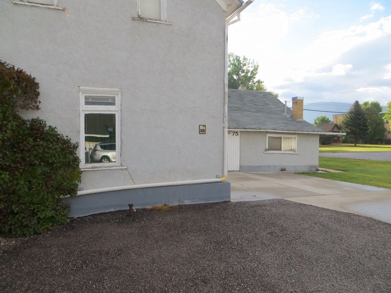
Built by
Hans Hansen, 1862
Registered by
Mrs. Gladys Sparks
June 3, 1971
Construction notes
Original oolite limestone
covered with stucco
— — Map (db m150181) HM
Near this spot on Tuesday, October 17, 1865, Black Hawk, a Ute chief, led his warriors out of Cottonwood Canyon foraging for cattle. They stole the entire Ephraim herd. Settlers who were working in the fields were massacred and lie buried in one . . . — — Map (db m74951) HM
This fine Queen Anne style house was constructed in 1897 for John Dorius, Jr., a prominent local businessman. The son of a Danish immigrant farmer, John Dorius pieced together a successful career in farming, freighting, and merchandising in Ephraim . . . — — Map (db m75000) HM
Constructed between 1889 and 1908, this building was the first permanent home of Snow Academy which in 1923 became Snow College. The school was founded in 1888 as the Sanpete Stake Academy and was one of the eleven academies established by the . . . — — Map (db m75024) HM
Near this spot February 7, 1854, twenty-five men organized in military order, began the construction of a small fort for protection from the Indians. The walls, made of rock were seven feet high, almost two feet thick, and formed the outer wall of . . . — — Map (db m74998) HM
"After traveling 1,400 miles from Illinois either by wagon or by pulling a handcart, the pioneer came to the Great Salt Lake Valley. Along the way, the pioneers experienced many hardships. Many people died during their journey. The Mormon . . . — — Map (db m255715) HM
This sacred plot, laid out by Joseph Gaston Garlick, was first used in 1860. Three small children, Maria Terry, Henry Weeks Sanderson, Jr., and Lucy Jones were the first buried here. Later, John Givens, his wife, Eliza, and their son and three small . . . — — Map (db m75061) HM
“These are the Mill Stones from the first grist mill in this area”.
It was built in 1868 by Elam Cheney Sr., a pioneer of 1847. At the request of President Brigham Young he quarried & shaped the stones & moved them & his family to . . . — — Map (db m75062) HM
The Niels P. Hjort house is architecturally significant as an example of a
modified temple-form, gable-façade cross-wing type, which was one of the basic residential building types implemented by early Utah settlers. The vernacular classical . . . — — Map (db m255716) HM
In 1859, a small group from Mt. Pleasant laid out a townsite here called North Bend. Later the name was changed to Fairview. During the winter rock was quarried and hauled to build a fort, and in 1860 walls of three sides were finished; the other . . . — — Map (db m235293) HM
In 1861 Joseph Bartholomew, James Mellor and others settled here and diverted the warm creek for irrigation purposes. A branch of the Church of Jesus Christ of Latter-day Saints was organized in 1862 with Branch Young as President. The name of the . . . — — Map (db m74909) HM
Official outlet of ZCMI (Zion's Co-operative Mercantile Institution), "America's First Department Store". This building housed the Fayette Merc. from circa 1890s to 1986. Until 1960 it was part of the ZCMI co-operative system which served more than . . . — — Map (db m74910) HM
After Albert Petty surveyed this site in 1859, pioneers came, built homes, erected a meeting house of logs cut by William Gibson and Asbury Parks. In 1861, Bishop Robert L. Johnson opened first store and hotel. Polly Johnson was first Relief Society . . . — — Map (db m75193) HM
This monument replaces one previously erected north of town near the site of this historical event. Over the years the original marker was weather-eroded and vandalized.
Lewis Lund an eighteen year-old herdsman, along with Jasper Robertson, Swen . . . — — Map (db m75191) HM
This location, later called Fountain Green, was a favorite camping place for travelers. Sept. 30, 1853, James Nelson, Wm. Luke, Wm. Reed and Thos. Clark, while camping here with their ox teams, were killed by Indians. Under direction of Brigham . . . — — Map (db m75228) HM
From the beginning of the Common Era and into the nineteenth century, European Jews were prohibited from owning land. By necessity, Jews abandoned an agrarian existence and turned to a more urban way of life, becoming instead shopkeepers, peddlers, . . . — — Map (db m134344) HM
The Casino Theatre, constructed in 1912, is historically significant as the best example of “high style” architecture in Gunnison and as the first and only theatre constructed in the town. A two-story rectangular building with its narrow . . . — — Map (db m74906) HM
Gunnison was settled in 1859. As a precinct it was granted weekly U.S. Mail service in 1862. The Black Hawk War began in 1865. In 1867 a bastion was erected 362 feet southeast of here. It was used by Colonel Byron Pace and 1500 militia men to . . . — — Map (db m74907) HM
Captain John. W. Gunnison
Captain John. W. Gunnison (1812-53), an army officer and explorer, was commissioned in 1853 to lead a mapping expedition to find a route for the Southern Pacific Railroad. After mapping the Grand River in Colorado . . . — — Map (db m260678) HM
Gunnison Sugar Factory
The sugar industry in Gunnison Valley began in 1901 when Bishop C.A. Madsen offered a prize for beet-growing. Farmers planted the new crop and shipped them for processing to Lehi and later to Elsinore. In 1904, Madsen . . . — — Map (db m260679) HM
In 1911, the Jewish Agricultural and Colonial Association of Philadelphia purchased 6,085 acres of land and water rights from the Utah State Land board for the agricultural experiment that they would name Clarion. Members of the association tasked . . . — — Map (db m134341) HM
For the Jewish settlers who came to Utah, Clarion was not just a theoretical experiment; it was a real opportunity to escape the poverty and stress of life in the ghettos of the eastern cities, for themselves as well as their families. As the . . . — — Map (db m134343) HM
The pioneers of Sanpete were committed to fostering their relationship with God and desired to build a temple where they could worship and increase their spiritual understanding of God's principles. Twenty-eight years after the first pioneers . . . — — Map (db m243325) HM
In the 1840s settlers in the west were typically separated by miles of open fields, leaving individuals and families isolated and unprotected. The pioneers, however, did not follow this settlement pattern when they gathered together in Utah. . . . — — Map (db m243332) HM
In June 1849 Chief Wakara (or Walker), a Ute Indian, journeyed to Salt Lake City from the Sanpitch (Sanpete) valley to invite a group of Mormon settlers to come and live in the area. Chief Wakara wanted the settlers to teach his tribe how to . . . — — Map (db m243319) HM
Third fort built in Manti
Location: 9 blocks in center of city
Marker Location
Construction: Rock, adobe, and
mud-filled wood frame
Walls: 12' high, 3' wide at base,
2' wide at top
Protection of settlers livestock
From Indian . . . — — Map (db m74944) HM
Bridging the Past, Present, Future
It was late November 1849, when a vanguard of pioneers arrived with their songs of praise, their Bibles and Books of Mormon. Within their hearts was a burning desire to help build Zion near the designated . . . — — Map (db m243386) HM
This house, built about 1858, is a significant example of one of the traditional building designs found in early Utah vernacular architecture. Three of Manti's most prominent families lived here. Orville Southerland Cox, the builder, was a leading . . . — — Map (db m74946) HM
Daniel Buckley Funk was an industrious and innovative citizen of
early Sanpete. He owned a mill, a farm made shoes and drums from animal hides and served in the military. Daniel had an entrepreneurial spirit. Throughout his life, he ventured . . . — — Map (db m243389) HM
The Pioneers were a culturally diverse group, gathered together from many nations. Yankees, Southerners, British, and Scandinavians made up the majority of the people. Though their backgrounds varied, a universal value held by the early . . . — — Map (db m243323) HM
Mormon pioneer Joseph Taylor’s journal contains an account of a miracle he witnessed while building the temple: Joseph Taylor served as the timekeeper during construction of the Manti Temple. As timekeeper, he would walk the temple grounds, . . . — — Map (db m243324) HM
The Mormon Pioneers had an all-encompassing purpose in leaving their
homelands and gathering to Utah. The pioneers sought a place where they could help build Zion, a community organized and based on religious ideals.
(caption) The . . . — — Map (db m243388) HM
Visit the historic Manti City Cemetery
The adjoining cemetery marks the final resting place of many Central Utah settlers who died beginning in November 1849 and into the early 1850s. Death was very much a part of the pioneer experience. . . . — — Map (db m243326) HM
This house has two markers
John Patten House
The John Patten House was constructed c.1854 of limestone. John Patten came to Utah in 1850 and settled in Manti. He was active in community affairs serving as a representative to the . . . — — Map (db m74950) HM
This Victorian Eclectic and Queen Anne style house remains as one of the most distinctive architectural landmarks of Manti. The house, which initially consisted of only two rooms, was begun in 1896 by Lewis R. (L.R.) Anderson. After he returned . . . — — Map (db m74921) HM
*Marker Location
Little Stone Fort Erected 1852 By Mormon Pioneers
First Fort Built in Manti
Location: NW quarter Block 64
Foundation: 3' wide, stone
Walls: 12' high, 2' thick
Provided protection from Hostile Ute . . . — — Map (db m243321) HM
Manti's Old Red Schoolhouse was located at 65 South, First West 1894-1936. Its Schoolhouse bell was forged in 1892 and was originally used in the one-room rock, North Ward Schoolhouse. Bell tower erected 1989. — — Map (db m243318) HM
Built in 1910-11, the Manti Carnegie Library is one of 23 Carnegie Libraries in Utah and one of over 1650 library buildings in the United States that were built by millionaire/philanthropist Andrew Carnegie. Carnegie donated the entire cost of the . . . — — Map (db m74945) HM
November 3, 1873, the Manti City Council under Mayor A. W. Bessey, "Motioned and carried that work on the City Hall be commenced without delay," and May 1, 1882, "The council tendered a vote of thanks to the building committees for their energetic . . . — — Map (db m74947) HM
In 1849, at Chief Wakara’s invitation, President Brigham Young sent about 225 Mormon pioneers to settle in the Sanpete valley. Initially, relations between the Mormon settlers and the local Ute Indians were helpful and cooperative, but tensions . . . — — Map (db m243327) HM
Pioneer children faced the challenges and hardships as their parents. We learn how they also stood for the values of faith, education, cooperation, and industry in their lives. Read the stories below to learn about Elizabeth Wilcox Hurst and . . . — — Map (db m243322) HM
This pioneer cabin, one of the first erected in Manti, was built inside the log fort, about 1853 by Nathaniel S. Beach. He later moved it to 104 West 2nd North where it was purchased by William and Johannah Richey, as a home for their family. At one . . . — — Map (db m74949) HM
Pioneer Values
Cooperation
Mormons converts migrated to the west seeking a place to gather as a people and find refuge from religious persecution. They faced many challenges as they established settlements in Central Utah.
The . . . — — Map (db m243335) HM
Pioneer Values
Faith
Leaving from states such as Illinois and Iowa the early pioneers over 1,200 miles to reach their destination in Central Utah. These early settlers abandoned their homes and livelihoods to cross the treacherous and . . . — — Map (db m243390) HM
Pioneer Values
Industry
Determined pioneers walked across the Great Plains and then settled in a dry-desert with conditions that seemed unrelenting. The life they had chosen was not an easy one. Each day the pioneers had to commit . . . — — Map (db m243391) HM
This monument and replica pioneer dugout honor the founders of Manti City and Sanpete County.
At the invitation of Wakara, Chief of the Ute Indian Nation, the Prophet Brigham Young sent Isaac Morley with 224 pioneers to make the Sanpitch Valley . . . — — Map (db m74952) HM
This mission church and school constructed in 1881 of native oolite limestone in the Greek Revival style was designed by architect Peter Van Houghton of Salt Lake City. The church was constructed under the supervision of Reverend G.W. Martin who . . . — — Map (db m74922) HM
Under direction of Bishop Isaac Morley 224 pioneers arrived in this vicinity Nov. 22, 1849. In response to an invitation from Indian Chief Walker to President Brigham Young. Their first homes were dugouts in the south side of Temple Hill. That . . . — — Map (db m44489) HM
On April 25 1877, the pioneer colonizers of Manti -- the fourth community established in Utah -- began taking form the south side of this hill the oolite stone from which to build their temple. The third of these sacred edifices erected in Utah, it . . . — — Map (db m44485) HM
This location marks the final resting place of hundreds of men, women, and children of diverse backgrounds and life experiences. It is believed that most if not all burials of white settlers in Sanpete Valley between November 1849 and the early . . . — — Map (db m243334) HM
Mayfield was first considered a settlement in 1873 when our pioneers brought their families from Gunnison to occupy the log cabins they had erected on the north side of Twelve-Mile Creek. In 1875 a townsite New London, on the south side, provided . . . — — Map (db m150182) HM
Erected in 1865 on order of General D.H. Wells to protect the settlers during the Black Hawk War. The fort covered the present City Hall Block and westward with 12 ft. rock walls supporting cabins along the inside. The bastion stood on the Lincoln . . . — — Map (db m75190) HM
Official outlet of ZCMI (Zion's Co-operative Mercantile Institution), "America's First Department Store". This building housed the "Consolidated Mercantile" from 1902 to 1932. It was part of the ZCMI co-operative system servicing more than 150 . . . — — Map (db m75189) HM
On Sept. 7, 1872, the final peace treaty of the Utah Black Hawk Indian War was signed at the home of Bishop Seeley by General Henry A. Morrow, Orson Hyde, Amasa Tucker, Fredrick Olson, Reddick Allred and William S. Seeley. Representing the Indians . . . — — Map (db m75172) HM
Mt. Pleasant, a small town nestled at the foot of the mountains in Sanpete County near the geographic center of Utah, was settled early in 1859. During June the men kept busy tending their crops and building a fort, twenty-six rods by twenty-six . . . — — Map (db m75169) HM
This monument has markers on four sidesFront Plate: Erected in Honor of the Pioneers of 1859 by the descedants of the Pioneers, whose names are inscribed upon this Monument. Unveiled July 6, 1909.
Right Plate: . . . — — Map (db m75170) HM
The Mount Pleasant "Liberal" Club was an organization whose members were usually former Mormons. They built this hall in 1875 as a meeting place and social center. It was here that the Presbyterian minister and educator, the Reverend Dr. Duncan J. . . . — — Map (db m75171) HM
Built c, 1861, this house is significant as the reported site of the signing, in September 1872, of the final peace treaty that ended the Black Hawk War between Mormon settlers and Indians in the area. William S. Seeley was prominent in the . . . — — Map (db m75173) HM
This elegant stone house was built in 1883 for Isaac Behunin, one of the first settlers in Sanpete County. Mixing Gothic style inspired dormers with Greek cornice detailing, the house exemplifies the decorative eclecticism found in Mormon domestic . . . — — Map (db m150179) HM
Local carpenters and stonemasons constructed this building in 1893 to serve as a civic meeting hall. It was also used as a schoolhouse until the big school was opened in 1900. the simple forms, symmetrical facade, and Greek revival style cornice are . . . — — Map (db m75056) HM
The Lyceum Theater, later known as Victory Hall, was constructed in 1915 by John Baxter. The theater was used for school productions, plays, and convocations through the 1940s. Later the theater served as an LDS cultural and recreation center. — — Map (db m75053) HM
This one-and-one-half-story brick cross-wing house was built in 1909, replacing a two-room adobe cabin belonging to Louis Lund. It was built for Mary Ann Allred, one of three wives of James Anderson Allred. Mary came to Utah in 1855 at the age of . . . — — Map (db m75045) HM
The Niels H. Borresen House, one of the oldest stone houses in Spring City, was constructed about 1864. The stone walls of this hall-parlor house are two feet thick. Born in Denmark, Niels converted to the LDS church in in his native country in . . . — — Map (db m75043) HM
This wood frame, false front commercial building was built at the turn of the twentieth century. "Drummers," or traveling salesmen, used the building to display their goods to local merchants. Later it served the town as the firehouse and may have . . . — — Map (db m75055) HM
Rasmus Justesen was a sheepman and polygamist who built this 1-1/2 story stucco-over-adobe house for his first wife, Sarah Shepherd and her family. In addition to his sheep business, Rasmus fought in the Black Hawk Indian War, sat on the Spring City . . . — — Map (db m75048) HM
William Sandstrom built this two-story frame and adobe commercial building in 1911. The first floor operated as a pool hall with a dance hall above. Later in the century, it was operated as a grocery store. It also served as the post office and, . . . — — Map (db m75054) HM
This spring was long used by Indians and early scouts as a camp site. James Allred, directed by Brigham Young on March 22, 1852 led his sons and their families here to build their homes. In 1853 a large colony of Scandinavian emigrants joined them. . . . — — Map (db m75059) HM
This small, brick one-part commercial block was built by John R. Baxter in 1915 and at first operated as a confectionery in conjunction with the theater. It served as a confectionery for over 63 years, selling penny candy and operating as an ice . . . — — Map (db m75052) HM
The pioneers of Spring City established a cemetery at this location in 1857. It is in the shape of the State of Utah. The earliest known burial was that of Newton Devine Allred in 1857. Three men who were casualties of the Black Hawk War, James . . . — — Map (db m150177) HM
In 1859, this area was resettled permanently by families of James Allred, Wm. Black, James Ellis, a large Danish colony of gifted craftsmen and stonemasons, and others. They surveyed the land, raised abundant crops, and became known as the . . . — — Map (db m75044) HM
William A. Ford, a blacksmith, built this frame and adobe house with clapboard siding about 1880. The house is a hall-parlor plan with a rear addition. Ford's blacksmith shop was located west of the house. The house was sold to Edward Sahlberg about . . . — — Map (db m75050) HM
In 1873, Daniel B. Funk purchased the winter camp grounds of the Sanpitch Indians situated in Arropeen Valley, one mile east of Sterling, Utah. With the help of President Brigham Young, he obtained from Chief Arropeen a deed to the valley. Here he . . . — — Map (db m74917) HM
In this cemetery are the remains of many of the settlers of the town of Pettyville. In 1873, George Petty led fifteen families from the town of Manti to an area located two miles west of Sterling. They built a settlement and named it after Mr. . . . — — Map (db m74920) HM
First Walker War casualty, Peter Ludvigson, was killed by Indians in 1865, three miles south of Sterling. Wm. D. and Daniel B. Funk located on Six-Mile Creek in 1872; dug irrigation ditches for farming. Families came later. A Manti branch of Church . . . — — Map (db m74919) HM
In 1854, at Fort Ephraim, an Indian Tabiona, gave Pres. Brigham Young a black rock, saying “Heap burn.” Two Welsh coal miners, John Rees and John Price, were sent with the Indian to located the coal vein, which was found in Coal Canyon . . . — — Map (db m150180) HM
In the spring of 1871, Harry Dalton, James Powell, and their families traveled across Sevier Valley to Omni Point at the base of Cove Mountain. In early fall that same year, the Edward Killick Roberts and John Gleave families moved from Glenwood . . . — — Map (db m307634) HM
While riding through the Aurora valley, George T. Holdaway, J. Alma Holdaway and Elliott Newell of Provo, Utah, noticed fertile soil and an abundance of water and decided to begin a settlement here. They traveled home and encouraged others to join . . . — — Map (db m74856) HM
June 15, 1873 Brigham Young called Albert K. Thurber and George W. Bean, Indian interpreters, WM. B. Pace, William Jex and others to explore Grass Valley for settlement and make peace with the Indians. Chief Tabioonah accompanied the party and acted . . . — — Map (db m142661) HM
In the fall of 1873 the pioneer families of William A, Stewart and Joseph Evans decided to make this area their home. As they drove onto the site nothing greeted them but a wilderness of giant greasewoods towering above their heads. In the spring of . . . — — Map (db m147710) HM
The Old Spanish Trail, supposedly the “longest, crookedest, mot arduous pack mule route in the history of America,” passed through this valley. Launched in the late 18th century the trail was used by caravans from New Mexico carrying . . . — — Map (db m147708) HM
Elsinore, named for a town in Denmark, was settled in 1874-75 by families of James C. Jensen, Charles H. Nielson, Lars Hansen, Niels Erickson, Hans Nielsen, William and Vigo Smith; Thomas C. Jensen and sons: (Jens Ivor, Christian J., Niels Peter), . . . — — Map (db m74807) HM
On October 2, 1874, the Latter-day Saints living in this locality organized a modern order of Enoch called the United Order, established under counsel and instruction of Brigham Young. Families placed their land, cattle, sheep, machinery and all . . . — — Map (db m74844) HM
This building has two markers on the east wall of the building.
ZCMI Co-Op Building
1878-1930
Official outlet of ZCMI (Zion's Co-operative Mercantile Institution), "America's First Department Store". This building housed the . . . — — Map (db m74846) HM
Jericho settlement was begun in 1864. That spring, Charles Green, John Pine, Daniel Brown, and a Mr. Hill arrived from Sanpete. The valley had fertile soil and water from the Sevier River, but the site was abandoned in 1865 because of Indian . . . — — Map (db m74801) HM
Constructed in 1914 by the community. The wood frame hall contains a gymnasium, stage, kitchen and basement. As a community recreation center, the hall was used for dances, plays, basketball games, programs, and movies. It served as the annual . . . — — Map (db m137024) HM
Near this spot in 1875, the first house in Grass Valley was erected. The garage to the west is constructed of those very logs. F.P. Peterson managed the first store & post office on this lot. In that house the mother of Grass Valley, Ingar Kjarstena . . . — — Map (db m137025) HM
During the winter of 1866-1867, William Cordingly built a small log cabin in the settlement of Alma, and by early spring the house was ready for his family. Indian troubles forced some of the original settlers to abandon their homes and leave this . . . — — Map (db m74804) HM
Pioneers and Families who lived in
Fort Alma (later Monroe) 1864-1867
Major Allred, Parley Allred, Wiley Allred, Andrew Anderson, Israel Bale, Benjamin Barney, Walter Barney, Joseph Besswick, George Blacket, John W. Bohman, Thomas Broadbent, . . . — — Map (db m74806) HM
The town of Redmond established in 1875 with John Johnson as the first Bishop and Mayor, received its name from the three red mounds that form part of the grey hills to the west of town. The Redmond Town Hall has been a landmark in Redmond for many . . . — — Map (db m74861) HM
On this spot of ground, in 1873, an adobe building, the first recreation center in Richfield, was erected by Pioneers Austin M., Alonzo L. and Albert Farnsworth. Accepted into the United Order in 1874. Acquired by the LDS Church in 1877 for all . . . — — Map (db m74819) HM
The first county jail was built in 1879, and was located on Third North and Main Street. It joined the county court house on the east. The jail consisted of two cells built by spiking 2 x 4's and nailing them together. The cells were plastered. The . . . — — Map (db m147712) HM
Near this spot in 1865 a rock fort was built as a protection from Indians. It was a cooperative project. Each man who owned a city lot built one rod of the wall which was 3 l/2 feet at base, 12 feet high, 1 foot at top. There were portholes at . . . — — Map (db m74820) HM
This facility is dedicated to the men and women of the United States Military-past, present and future for their sacrifice and service to our great Nation. Richfield City honors those
heroes, who secured and continue to safeguard our Freedom. — — Map (db m279589) WM
This old lime kiln is the best preserved of seven kilns constructed north of Richfield during the late 1880′s. It was built by John Kyhl for Jens Larsen Jenson, a Swedish immigrant. The lime was used in the construction of homes, churches and . . . — — Map (db m74841) HM
Was Made Here
June 14, 1873
This treaty led up to the final treaty at Cedar Grove in Grass Valley July 1, 1873, ending the Black Hawk Indian War in Southern Utah.
Present at the treaty council were:
Gen. Wm. B. Pace · George Evans · Byron . . . — — Map (db m138058) HM
Built in 1913-14, the Richfield Carnegie Library is one of 23 Carnegie Libraries in Utah and one of over 1650 library buildings in the United States that were built by millionaire/philanthropist Andrew Carnegie. Carnegie donated the entire cost of . . . — — Map (db m74821) HM
The first ten pioneers who arrived here January 6, 1864, were Capt. Albert Lewis, Robert W. Glenn, Christian O. Hansen, Hans O. Hansen, Nelson Higgins, August Nelson, George Oglevie, Eskild C. Peterson, Andrew Poulson, and Jorgen Smith. Followed by . . . — — Map (db m74840) HM
This mission chapel was erected in 1880 as part of the efforts of Reverend Duncan McMillan to evangelize central Utah. Originally located on Main Street, the building was torn down and rebuilt at this location in 1937/38. The church also symbolizes . . . — — Map (db m74818) HM
An Historic Trade Route Passed This Way
In the early 1800s, thousands of men, mules, and horses plodded along a well-travelled trail that paralleled Fish Lake. Can you imagine the dust, noise, and smells of a trading caravan on the move?
. . . — — Map (db m137030) HM