204 entries match your criteria. Entries 101 through 200 are listed.⊲ Previous 100 — The final 4 ⊳
Trail of Tears Historical Markers
The Indian Removal Act of 1830 opened a dark chapter in American history. Thousands of Native Americans died during forced removal from their eastern homelands to the Great Plains, along what is now know as the Trail of Tears for many different tribes and nations.
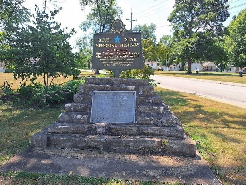
This park commemorates the overland movement of more than three hundred Cherokee Indians from Georgia and Tennessee into Oklahoma Territory. In November 1837 they crossed the Mississippi above Cape Girardeau, proceeding through Jackson and . . . — — Map (db m282502) HM
In the winter of 1838-1839, ten groups of the Cherokee Nation utilized the valuable water resources from this park's fourteen springs. Hidden Waters Nature Park is a verified trail segment of the Trail of Tears.
About Hidden Waters Nature . . . — — Map (db m271502) HM
A marker, 200 feet to the south, recalls the death of White Buffalo Girl of the Ponca tribe. The death of this child, daughter of Black Elk and Moon Hawk, symbolizes the tragic 1877 removal of the Ponca from their homeland on the Niobrara River to . . . — — Map (db m182053) HM
Fort Delaney, the U.S. Army’s post for the 1838 forced removal of Cherokee citizens from the upper Valley River Valley, was located due south of here in present-day Andrews. East Tennessee Mounted Volunteers built the fort in October 1837, . . . — — Map (db m156070) HM
Welcome to Konehete, the Long Valley Place that white’s shortened to Valleytown, the first name of Andrews. For centuries, the Long Valley was home to Cherokee communities such as Little Tellico, Tomatla, Conostee, Quotoconechito, Nehowee, Dasetsi, . . . — — Map (db m156076) HM
(preface)
In 1838, the United States government deported more than 16,000 Cherokee Indian people from their homelands in Tennessee, Alabama, North Carolina, and Georgia, and sent them to Indian Territory (now Oklahoma). Thousands of . . . — — Map (db m156080) HM
(preface)
In 1838, the United States government deported more than 16,000 Cherokee Indian people from their homelands in Tennessee, Alabama, North Carolina, and Georgia, and sent them to Indian Territory (now Oklahoma). Thousands of . . . — — Map (db m156081) HM
Commanded by
Genl. Winfield Scott
during the round up
of the Cherokee
Indians for removal
to Oklahoma in 1837-1838
— — — — — — —
Donated to Town of Murphy
by Tar Heel . . . — — Map (db m99008) HM
In 1838, the United States government deported more than 16,000 Cherokee Indian people from their homeland in Tennessee, Alabama, North Carolina, and Georgia, and sent them to Indian Territory (now Oklahoma). Thousands of Cherokee perished during . . . — — Map (db m120337) HM
In 1838, the United States government deported more than 16,000 Cherokee Indian people from their homeland in Tennessee, Alabama, North Carolina, and Georgia, and sent them to Indian Territory (now Oklahoma). Thousands of Cherokee perished during . . . — — Map (db m120343) HM
One of the forts where General Winfield Scott's United States Forces gathered the Cherokee before moving them west, stood 3/4 mi. N. W. — — Map (db m41936) HM
The rugged terrain of the Smoky Mountains determined patterns of human settlement. Residents of the Smokies - be they native Cherokees or European emigrants and their descendants - gravitated to valleys or coves. Settlement was confined to areas far . . . — — Map (db m20054) HM
In 1838, the United States government deported more than 16,000 Cherokee Indian people from their homelands in Tennessee, Alabama, North Carolina and Georgia, and sent them to Indian Territory (now Oklahoma). Thousands of Cherokees perished during . . . — — Map (db m73923) HM
(preface)
In 1838, the United States government deported more than 16,000 Cherokee Indian people from the homelands in Tennessee, Alabama, North Carolina, and Georgia, and sent them to Indian Territory (now Oklahoma). Thousands of Cherokees . . . — — Map (db m190503) HM
The End of the Journey
Between June 1838 and March 1839, more than 15,000 Cherokee trekked west from
their traditional eastern homeland to Indian Territory (present-day Oklahoma) over the “Trail of Tears.” More than 1,000 died during the . . . — — Map (db m304920) HM
Home in the West
George Woodall's farm was a busy scene as groups of Cherokee Nation citizens arrived here after their 800-mile trek west from their southern Appalachian homelands. As detachments arrived, they ended their journey at a . . . — — Map (db m304748) HM
The End of the Journey
Between June 1838 and March 1839, more than 16,000 Cherokee Nation citizens trekked west from their traditional eastern homeland to Indian Territory (present-day Oklahoma) over the "Trail of Tears." More than . . . — — Map (db m304751) HM
The Choctaw people traveled the “Long Walk” Trail of Tears from their eastern homes to settle in new Choctaw Nation in Indian Territory. The first home in Durant belonged to Fisher Durant and was located on the site of Northside or Dixon Durant . . . — — Map (db m286674) HM
(front)
The United States Government, unable to conclude an agreement with the duly authorized leaders of the Cherokee Nation, signed a treaty with a minority faction willing to cede the last remaining portion of the original Cherokee . . . — — Map (db m77932) HM
Principal Chief of the Cherokee 1828-1866 Born October 3, 1790 in Turkeytown, Alabama. The son of a one-quarter Cherokee maiden and a Scotsman, John Ross was elected as the first Principal Chief of the Cherokee Indians in 1828 and . . . — — Map (db m259375) HM
The signing of the Treaty of Dancing Rabbit Creek on Sept. 27, 1830, was the final negotiation to remove the Choctaws from their ancestral homelands in Mississippi and Alabama to Indian Territory. The trip covered 600 miles. Many small groups had . . . — — Map (db m165637) HM
Cut from Washington, Ark., to Fort Towson in 1831 for removal of Choctaws from Miss., became known as Choctaw Trail of Tears after thousands of suffering Indians used it to reach new lands. Road served as major east-west artery for Choctaw Nation . . . — — Map (db m24398) HM
The Choctaw homelands were originally located in the southeastern United States, within present-day Mississippi, Alabama, and the Florida panhandle. Choctaw heritage includes some of the mound-building communities that thrived in complex social . . . — — Map (db m286682) HM
After the death of Choctaw leader Pushmataha in 1824 and the signing of the Dancing Rabbit Creek Treaty in 1830, the US government forcibly removed the Choctaw Nation from Mississippi. Removal occurred in three stages along multiple routes and . . . — — Map (db m173135) HM
When she went shortly after to her American woman friend, she told her, "They are going to take you Indian people somewhere pretty soon now." She told her, "Do not leave anything. Take along all your things with you. Put your canoe . . . — — Map (db m114762) HM
It affords me sincere pleasure to apprise the Congress of the entire removal of the Cherokee Nation of Indians to their new homes west of the Mississippi. The measures authorized by Congress at its last session, with a view to the . . . — — Map (db m177976) HM
I have often wished to enjoy your company once more but it is very uncertain whether I shall ever again have that pleasure. If we Cherokees are to be driven to the west by the cruel hand of oppression to seek a new home in the west, . . . — — Map (db m177983) HM
The full moon of May is already on the wane; and before another shall have passed way, every Cherokee man, woman and child in those states [North Carolina, Georgia, Alabama, and Tennessee] must be in motion to join their brethren in . . . — — Map (db m177955) HM
We are overwhelmed! Our hearts are sickened, our utterance is paralyzed, when we reflect on the condition in which we are placed, by the audacious practices of unprincipled men...
— Principal Chief John Ross to the . . . — — Map (db m177958) HM
I have all necessary preparations made, having upwards of 600,000 rations on hand, and boats and wagons sufficient to my command to carry [the Cherokee] off comfortably.
— General Nathaniel Smith to C.A. Harris, . . . — — Map (db m177965) HM
Our situation is truly a critical one. Our whole country is full of troops and fortifications and should it be determined by the Govmt, to remove the Cherokees by force under the fraudulent Treaty by the kind of Soldiers which are . . . — — Map (db m177967) HM
My troops already occupy many positions in the country that you are to abandon, and thousands and thousands are approaching from every quarter, to render resistance and escape alike hopeless. All those troops, regular and militia, are . . . — — Map (db m177970) HM
The Cherokees are nearly all prisoners. They have been dragged from their houses, and encamped at the forts and military posts, all over the nation … Our brother [Jesse] Bushyhead and his family, Rev. Stephen Foreman, native . . . — — Map (db m177972) HM
[A]s a very natural result of collecting and marching … men, women and children of all ages and conditions, changing suddenly, and very materially all their habits of life … We should feel little astonishment at finding a high grade . . . — — Map (db m177973) HM
On last Friday two Cherokee men came into our camps … for the purpose of ascertaining whether any thing could be done for their relief. … They said they left their families sick and one of them said he had lost one of his children … . . . — — Map (db m177975) HM
In truth, our cause is your own; it is the cause of liberty and of justice, it is based upon your own principles … Spare our people! Spare the wreck of our prosperity! Let not our deserted homes become the monuments of our . . . — — Map (db m177961) HM
In December 1835, a small faction of Cherokee, led by Major Ridge, John Ridge, Elias Boudinot, and others, acting on their own and without the consent of Principal Chief John Ross, signed the Treaty of New Echota, setting the conditions for the . . . — — Map (db m177914) HM
In December 1835, a small faction of Cherokee, led by Major Ridge, John Ridge, Elias Boudinot, and others, acting on their own and without the consent of Principal Chief John Ross, signed the Treaty of New Echota, setting the conditions for the . . . — — Map (db m177984) HM
In 1873, Bennet Cooper (1797-1886) gave one-quarter of an acre of land for a family burying ground. His first wife, Lydia, was buried there along with several other family members. The cemetery is located on a ridge behind the Cooper Homeplace . . . — — Map (db m81367) HM
"Long time we travel on way to new land...Womens cry... Children cry and men cry... but they say nothing and just put heads down and keep go towards West. Many days pass and people die very much."
-Recollection of a survivor of the . . . — — Map (db m29815) HM
This sculpture is a small piece of theater, a tableau to engage the spectator in the heartbreak of the Cherokee walking west on the two routes of the Trail of Tears that crossed in Pulaski. Fear, suffering, survival, and resolve are expressed within . . . — — Map (db m81562) HM
Bell's Route of the Cherokee Trail of Tears in Tennessee, Arkansas, and Oklahoma, 1838-1839 Overview
The detachment headed by John Bell differed from the parties under Cherokee Chief John Ross's supervision. Bell's detachment was composed of . . . — — Map (db m29811) HM
John Benge's Route of the Cherokee Trail of Tears in Alabama, Tennessee, Kentucky, Missouri, Arkansas and Oklahoma, 1838-1839
John Benge led one detachment of approximately 1100 Cherokee with 60 wagons and 600 horses that left from Alabama on . . . — — Map (db m29812) HM
The Trail of Tears Interpretive Center Popularly known as the Rock Church, this beautiful chapel of Gothic architectural design was constructed by native limestone and was dedicated as the Immaculate Conception Catholic Church on August 10, 1941. A . . . — — Map (db m29810) HM
The 1830 Indian Removal Act mandated the removal of all American Indian Tribes East of the Mississippi River to lands in the West. Pulaski, Tennessee is where the Bell and Benge routes crossed in 1838. Benge's route left Fort Payne, AL on September . . . — — Map (db m81601) HM
On October 11, 1838, the last group of 650-700 treaty party Cherokees (so-called), led by conductor John A. Bell, also Cherokee, left Ft. Cass in Charleston, TN, headed for their new homes in the West. With them was U.S. Army LT. Edward Deas, . . . — — Map (db m167640) HM
The Cherokees refused to emigrate and on May 26, 1838 the Army and civilian volunteers began the brutal roundup of the Cherokees. They captured men and women in their homes, farmers working in fields, and children at play. The captives were often . . . — — Map (db m165896) HM
Indian and United States government relations were defined by treaties between sovereign nations and recognized as law by our Constitution. In exchange for land that became Alabama and Mississippi, President Thomas Jefferson made an agreement in . . . — — Map (db m165866) HM
Witnessed a young Sam Houston, who gained favor with Chief Jolly on Hiwassee Island nearby, witnessed the Indian removal and countless events that shaped Meigs County, the State of Tennessee and points westward.
Commemorated in 2016 to . . . — — Map (db m165865) HM
Trail of Tears
In 1838, nearly 2,000 Cherokee, their enslaved Africans, and others stopped at Brown's Ferry (a few yards to your left) and gazed across the Tennessee River toward the landing on the opposite bank. They must . . . — — Map (db m84250) HM
In May 1836, the United States Senate ratified the Treaty of New Echota by the margin of a single vote and set in motion the forcible removal of the Cherokee nation to the west. In 1838, the U.S. Government removed more than 16,000 Cherokee and . . . — — Map (db m69239) HM
John Ross was the grandson of John McDonald and the son of Daniel Ross natives of Scotland and partners in a trading post established at Ross’s Landing. He dedicated himself to the education of the Cherokee Nation. JOHN ROSS is called the greatest . . . — — Map (db m238572) HM
In May 1838 soldiers, under the command of Gen. Winfield Scott, began rounding up Cherokee Indians in this area who had refused to move to Indian Territory (Oklahoma). About 15,000 Cherokees were placed in stockades in Tennessee and Alabama until . . . — — Map (db m81675) HM
The old Savannah-Bolivar Road, aligned with present-day US Hwy 64. was the route taken by approximately 660 Cherokees led by John Bell and military escort US Army Lieutenant Edward Deas. John Bell was a signer of the Treaty of New Echota which set . . . — — Map (db m164129) HM
Savannah stands at the junction of two major corridors- the north-south Tennessee River and the east-west road of Memphis. Savannah's secure, high ground and deep water made it an important port. For decades pioneers and area farmers found the water . . . — — Map (db m103113) HM
The Bell Route
On October 11, 1838, 660 Cherokee led by John Adair Bell left from Fort Cass (present day Charleston, Tennessee) to begin an arduous 700-mile journey. Weak and miserable from being held in removal camps, the people in the Bell . . . — — Map (db m108202) HM
Long time we travel on way to new land… Womens cry…Children cry and men cry…but they say nothing and just put heads down and keep on go towards West. Many days pass and people die very much.
Recollection of a survivor of the Trail of . . . — — Map (db m108204) HM
The Indian Removal Act of 1830 mandated the removal of all American Indian tribes east of the Mississippi River to lands in the west.
The Trail of Tears National Historic Trail commemorates the removal of the Cherokee and the paths that 17 . . . — — Map (db m63079) HM
During 1837 and 1838, a forced removal plan of the native people was implemented consisting of the removal of the tribal people of Cherokee, Chickasaw, Choctaw, Creek, and Seminole. Lieutenant Edward Deas, escorted one of the last groups to be . . . — — Map (db m75213) HM
A group of approximately 660 Cherokees traveled through McNairy County in late fall of 1838. Also called Bell's Treaty Party, it was the only detachment to be accompanied by the military. Escorted by U.S. Army Lt. Edward Deas and Cherokee leader . . . — — Map (db m19311) HM
In 1830, President Andrew Jackson signed the Indian Removal Act. It ended the century long treaty relation that had defined Anglo-American, Cherokee relations. The debates that preceded the removal legislation set off fierce debates.
Public . . . — — Map (db m39497) HM
As they trudged westward, the parties that left Blythe's Ferry in the early fall of 1838 endured lingering health problems from diseases, such as diarrhea, dysentery, measles, and whooping cough, which began during their long stay in stockades. . . . — — Map (db m39538) HM
The Cherokee people made their homes in the river valleys that spread out of the southern Appalachian Mountains. They claimed a domain that stretched across present-day North and South Carolina, Georgia, Tennessee, Alabama. They also claimed hunting . . . — — Map (db m39494) HM
In addition to losing their land to the American government, many Cherokees fell prey to robbers and thieves who operated near the camps and along the roads leading west.
"We are now about to take our final leave and kind . . . — — Map (db m39532) HM
In hopes of avoiding bloodshed, American military leaders made one final appeal to the Cherokee people. It contained both promises of protection and threats of doom. The President, as well as Congress, have decreed that you should remove from . . . — — Map (db m39499) HM
During the 18th century, Cherokees worked hard to defend their homeland from invasion by Anglo-Americans. The nature of Cherokee politics - dispersed and locally defined - often hampered unified resistance to the invaders. In 1809, the Cherokee . . . — — Map (db m39495) HM
Although American legislation declared an end to Cherokee sovereignty, most of those remaining in the Nation continued to resist. In December 1835, however, a small party of Cherokee signed the Treaty of New Echota. The agreement promised that the . . . — — Map (db m39498) HM
Cherokees! The President of the United States has sent me with a powerful army, to cause you, in obedience to the treaty of 1835, to join that part of your people who have already established in prosperity on the other side of the Mississippi. . . . — — Map (db m39491) HM
Moving the thousand's of people and about 5,000 horses and 500 wagons across the Tennessee River at Blythe's Ferry proved slow. Some crossings took as long as three days. "I reached Blythe's ferry on Sunday evening last, and found the great body . . . — — Map (db m39536) HM
Beginning on May 26, 1838, soldiers began rounding up Cherokee women, men, and children. They showed little concern or respect for families or their property. In the first days, confusion abounded as soldiers and militiamen gathered individuals . . . — — Map (db m39530) HM
In the spring of 1838, American military forces evicted the Cherokee Nation from its homeland. Nearly 16,000 women, men, and children - including nearly five hundred Muskogee Creek Indians, and slaves belonging to Cherokee owners -- were forced from . . . — — Map (db m39492) HM
"The Trail of Tears was a tragedy for a progressive and independent people whose population was markedly decreased as a result of the hardships associated with lengthy confinements and a lengthy arduous journey. The forced Removal left an . . . — — Map (db m39540) HM
The detachments approached Walden's Ridge within days of leaving Blythe's Ferry. The climb up the mountain proved difficult. Supplying food to both people and animals became a major problem. Particular hardship accompanied the climb up Walden's . . . — — Map (db m39537) HM
Both the Indian Removal Act of 1830 and the Treaty of New Echota aimed to accomplish removal through voluntary emigration. Such efforts largely failed and by 1838 only about 2,000 Cherokee affected by the treaty had moved west. For those remaining, . . . — — Map (db m39493) HM
Both the Indian Removal Act of 1830 and the Treaty of New Echota aimed to accomplish removal through voluntary emigration. Such efforts largely failed and by 1838 only about 2,000 Cherokee affected by the treaty had moved west. For those remaining, . . . — — Map (db m39529) HM
One of the worst acts of "man's inhumanity" took place when an entire race of peoples were driven from their lands in 1838. It was here at Blythe Ferry that approx. 9000 Cherokees and Creeks camped while waiting to cross the Tennessee River on their . . . — — Map (db m39469) HM
Around 1809, William Blythe, a Cherokee, established a ferry at this site to provide transportation for the settlers to the west and the Cherokees to the east. During the 1838 Trail of Tears, it was an important crossing, and it played a military . . . — — Map (db m62612) HM
Around 1809, William Blythe, a Cherokee, established a ferry at this site to provide transportation for the settlers to the west and the Cherokees to the east. During the 1838 Trail of Tears, it was an important crossing, and it played a military . . . — — Map (db m39468) HM
Nine detachments ranging in size from 729 to 1,766 individuals began crossing the Tennessee River at Blythe's Ferry in October, 1838. Cherokee leaders, called conductors, Hair Conrad, Elijah Hicks, Reverend Jesse Bushyhead, Situwakee, Captain Old . . . — — Map (db m82269) HM
Throughout the spring and summer of 1838 Principal Chief John Ross and a group of Cherokee delegates negotiated with the United States War Department to take control of conducting the parties west. Just as the first groups departed under United . . . — — Map (db m82270) HM
By the beginning of the 19th century, many Cherokee had adopted many white ways of living. They built American type farms, wore American style clothes, developed American style systems of government and began buying African slaves to work on . . . — — Map (db m82271) HM
General Winfield Scott followed John Wool (1836-1837) and William Lindsay (1837-1838) as commander of Federal troops in the Cherokee nation. Scott arrived at New Echota, Cherokee Nation on April 16, 1838 and assumed command of the "Army of the . . . — — Map (db m39454) HM
Sir The several detachments of Emigrating Cherokees under the charge of Messrs. Hair Conrad, Elijah Hicks, John Benge, Jesse Bushyhead, Sitewakee, James D. Wofford, Stephen Foreman, & Moses Daniel having signified their readiness for the road will . . . — — Map (db m39535) HM
Upon arrival in the western territory, the Cherokee emigrants settled among several thousand Cherokee Old Settlers. Relations proved rocky and a generation of conflict followed. Despite the tensions the Cherokee began to rebuild their lives and . . . — — Map (db m39539) HM
This old road bed echoes back to 1838 for a nation of peoples that walked here, not by choice, but by force. Each agonizing step by thousands of people, horses and wagons etched a trench between August and November in 1838. No turning back, their . . . — — Map (db m178070) HM
The path now known as the Unicoi Turnpike Trail has existed for over 1,000 year. The earliest European maps of the area note the trail as a connector between Cherokee Territories and the coastal ports of Charleston and Savannah. In 1756 British . . . — — Map (db m82299) HM WM
Cherokee Heritage Trails (Tsalagi Usdi Nvnohi) wind through the mountains of North Carolina, Tennessee, and Georgia, in the heart of Cherokee homelands that once encompassed more than 140,000 square miles. Here, where Cherokee people have lived for . . . — — Map (db m75440) HM
The path now known as the Unicoi Turnpike Trail has existed for over 1,000 years. The earliest European maps of the area note the trail as a connector between Cherokee Territories and the coastal ports of Charleston and Savannah. In 1756 British . . . — — Map (db m82302) HM WM
The path now known as the Unicoi Turnpike Trail has existed for over 1,000 years. The earliest European maps of the area note the trail as a connector between Cherokee Territories and the coastal ports of Charleston and Savannah. In 1756 British . . . — — Map (db m82303) HM
“…the people are very loathe to go on and unusually slow in preparing for starting each morning…because they are moving not from choice to an unknown region not desired by them…” Elijah Hicks, detachment leader, 1838. . . . — — Map (db m315528) HM
Retracing the Trail of Tears
You are invited to walk along the same path the Cherokee traveled in 1838-1839.
During the harsh winter, 11 detachments containing more than 10,000 Cherokee passed through this area, not even halfway to . . . — — Map (db m315529) HM
The Tennessee General Assembly established Port Royal on October 24th, 1797. They established the town at the request of settlers to provide them with commerce, community, and access to trade via shipping on the Red River. The dark-fired tobacco . . . — — Map (db m315490) HM
Named for pioneer settler William Smith, a New England teacher and merchant, who settled here in 1820, it was the junction of the Kiuka War Trace (later Black Fox Trail) to the Cumberland and the main north-south Indian trail to the Great Lakes. . . . — — Map (db m4053) HM
1/2 mi. east were the hunting grounds of Cherokee Chief Black Fox, Inali. On Sept. 7, 1794, Ore's Expedition overpowered Black Fox at the spring. According to legend, to avoid capture Black Fox leaped into the spring and emerged from Murfree . . . — — Map (db m82337) HM